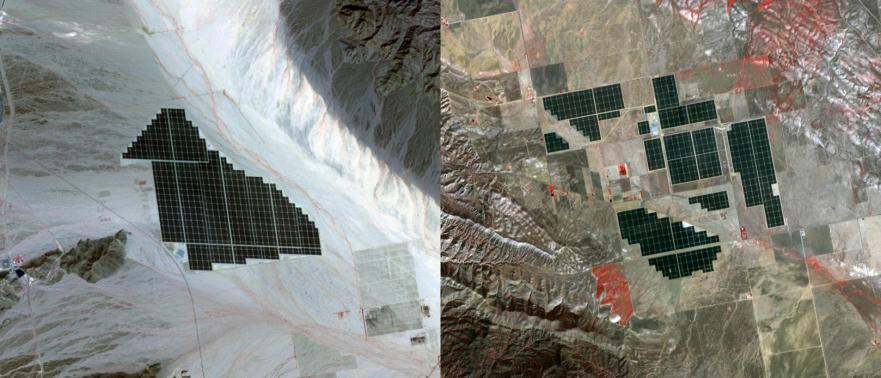
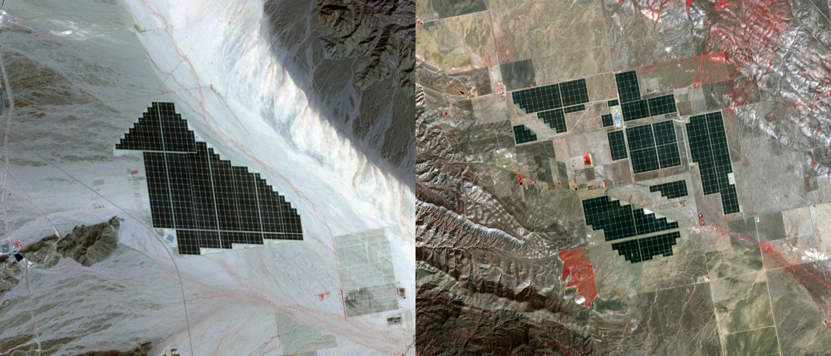
On February 15, 2015 the Desert Sunlight solar project in California's Mojave Desert became operational. The 550-megawatt plant generates enough electricity to power 160,000 average homes. Covering an area of 16 km2, the 8.8 million cadmium telluride photovoltaic modules take advantage of the more than 300 days of sunshine. Desert Sunlight joins the similar-sized Topaz Solar Farm in San Luis Obispo County, CA, that became operational in June, 2014. The Desert Sunlight image (left) was acquired March 12, 2015 and is located at 33.8 degrees north, 115.4 degrees west; the Topaz image (right) was acquired September 11, 2014 and is located at 35.4 degrees north, 120.1 degrees west. Each image covers an area of 10.5 x 12 km.
With its 14 spectral bands from the visible to the thermal infrared wavelength region and its high spatial resolution of 15 to 90 meters (about 50 to 300 feet), ASTER images Earth to map and monitor the changing surface of our planet. ASTER is one of five Earth-observing instruments launched Dec. 18, 1999, on Terra. The instrument was built by Japan's Ministry of Economy, Trade and Industry. A joint U.S./Japan science team is responsible for validation and calibration of the instrument and data products.
The broad spectral coverage and high spectral resolution of ASTER provides scientists in numerous disciplines with critical information for surface mapping and monitoring of dynamic conditions and temporal change. Example applications are: monitoring glacial advances and retreats; monitoring potentially active volcanoes; identifying crop stress; determining cloud morphology and physical properties; wetlands evaluation; thermal pollution monitoring; coral reef degradation; surface temperature mapping of soils and geology; and measuring surface heat balance.
The U.S. science team is located at NASA's Jet Propulsion Laboratory, Pasadena, Calif. The Terra mission is part of NASA's Science Mission Directorate, Washington, D.C.
More information about ASTER is available at http://asterweb.jpl.nasa.gov/.
 Planetary Data System


