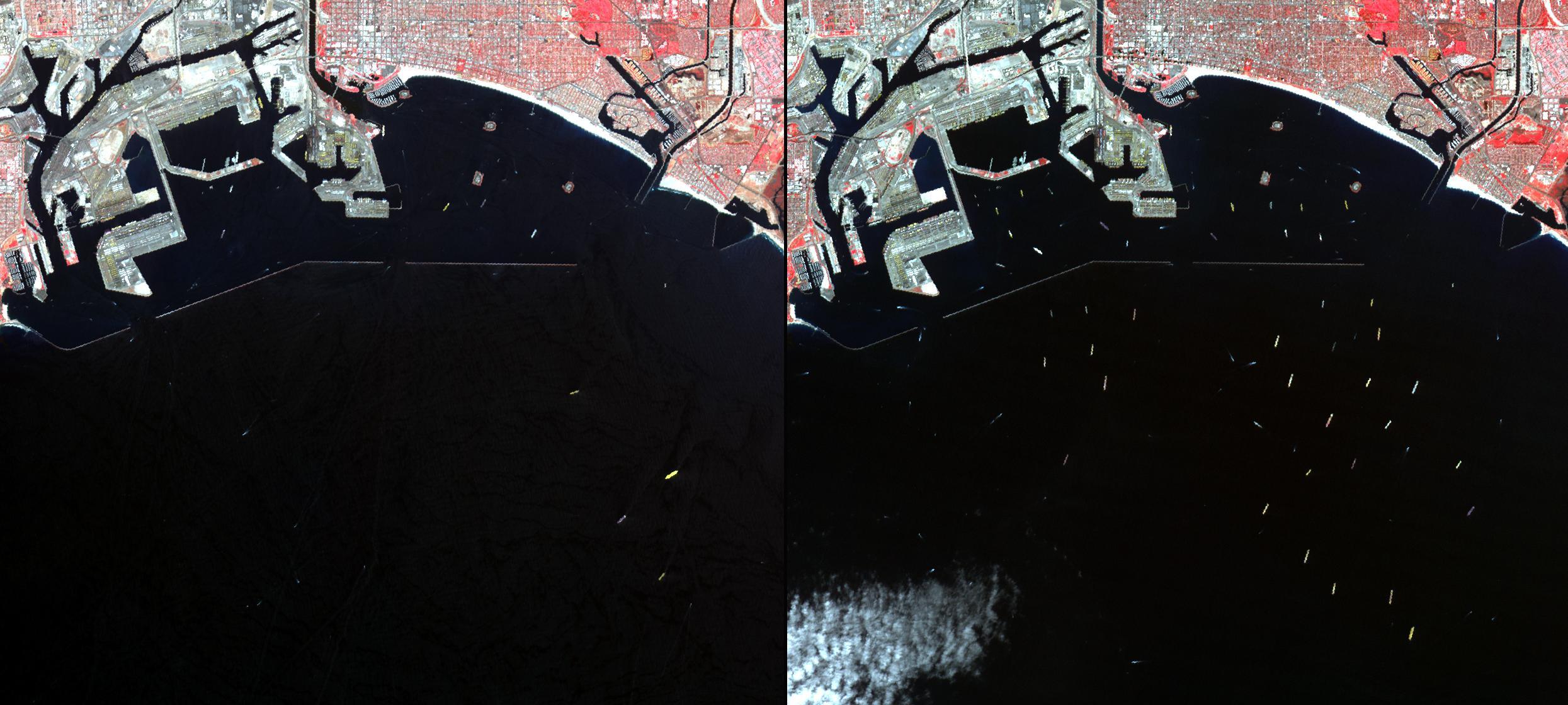
In southern California, the combined ports of Los Angeles and Long Beach account for 33% of the nation's containerized imports. In early March, a long-lasting labor dispute between the longshoremen's union and shipowners came to an end, and the large backlog of waiting cargo ships was being slowly unloaded. The left image was acquired July 4, 2014 during normal operations: 14 ships are being unloaded, while 7 wait their turns near the facilities. The right image was acquired on March 8, 2015: 19 ships are moored at unloading docks, while 47 ships wait their turns. The images cover an area of 16.7 x 18.6 km, and are located at 33.7 degrees north, 118.2 degrees west.
With its 14 spectral bands from the visible to the thermal infrared wavelength region and its high spatial resolution of 15 to 90 meters (about 50 to 300 feet), ASTER images Earth to map and monitor the changing surface of our planet. ASTER is one of five Earth-observing instruments launched Dec. 18, 1999, on Terra. The instrument was built by Japan's Ministry of Economy, Trade and Industry. A joint U.S./Japan science team is responsible for validation and calibration of the instrument and data products.
The broad spectral coverage and high spectral resolution of ASTER provides scientists in numerous disciplines with critical information for surface mapping and monitoring of dynamic conditions and temporal change. Example applications are: monitoring glacial advances and retreats; monitoring potentially active volcanoes; identifying crop stress; determining cloud morphology and physical properties; wetlands evaluation; thermal pollution monitoring; coral reef degradation; surface temperature mapping of soils and geology; and measuring surface heat balance.
The U.S. science team is located at NASA's Jet Propulsion Laboratory, Pasadena, Calif. The Terra mission is part of NASA's Science Mission Directorate, Washington, D.C.
More information about ASTER is available at http://asterweb.jpl.nasa.gov/.
 Planetary Data System


