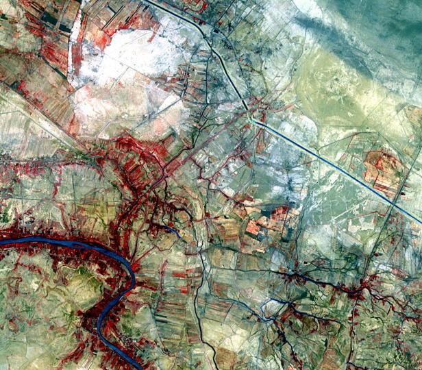
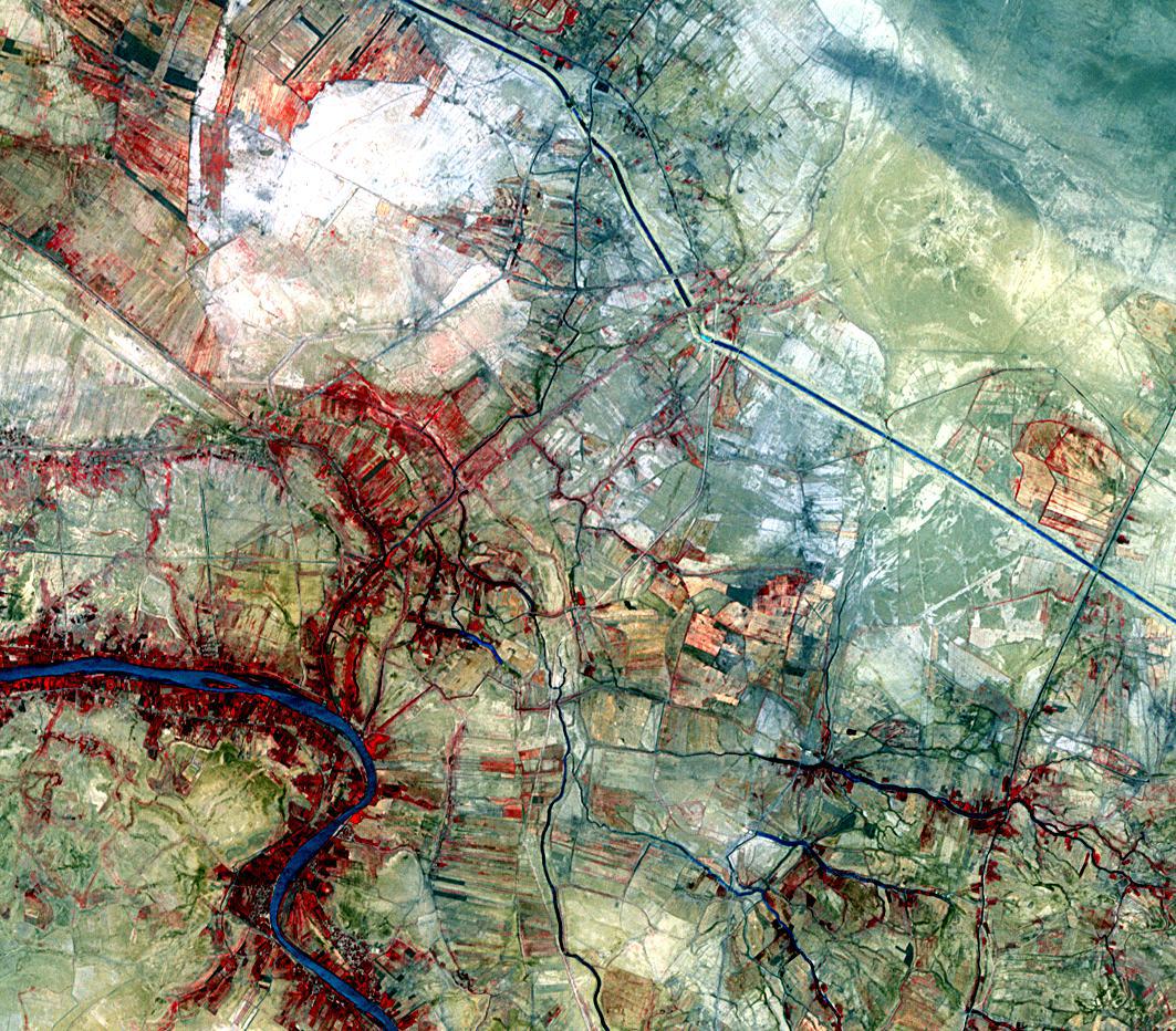
The ancient city of Uruk is located in present-day Iraq, on an abandoned channel of the Euphrates River. Uruk gave its name to the Uruk period, spanning circa 4000 to 3100 BCE. At its height around 2900 BCE, Uruk had more than 50,000 residents, making it the largest city in the world. The semi-mythical king Gilgamesh ruled Uruk in the 27th century BCE. The city was occupied until around 500 AD, and was re-discovered in 1849. On the image, Uruk is the round yellowish area in the upper right. The image was acquired July 18, 2007, covers an area of 14.4 x 15.9 km, and is located at 31.3 degrees north latitude, 45.6 degrees east longitude.
With its 14 spectral bands from the visible to the thermal infrared wavelength region and its high spatial resolution of 15 to 90 meters (about 50 to 300 feet), ASTER images Earth to map and monitor the changing surface of our planet. ASTER is one of five Earth-observing instruments launched Dec. 18, 1999, on Terra. The instrument was built by Japan's Ministry of Economy, Trade and Industry. A joint U.S./Japan science team is responsible for validation and calibration of the instrument and data products.
The broad spectral coverage and high spectral resolution of ASTER provides scientists in numerous disciplines with critical information for surface mapping and monitoring of dynamic conditions and temporal change. Example applications are: monitoring glacial advances and retreats; monitoring potentially active volcanoes; identifying crop stress; determining cloud morphology and physical properties; wetlands evaluation; thermal pollution monitoring; coral reef degradation; surface temperature mapping of soils and geology; and measuring surface heat balance.
The U.S. science team is located at NASA's Jet Propulsion Laboratory, Pasadena, Calif. The Terra mission is part of NASA's Science Mission Directorate, Washington, D.C.
More information about ASTER is available at http://asterweb.jpl.nasa.gov/.
 Planetary Data System


