Your search criteria found 2625 images
Target is Earth (and available satellites)
Go to PIAxxxxx:
Refine this list of images by:
Target:
Mission:
Spacecraft:
Instrument:
Click on an image for detailed information
Click on a column heading to sort in ascending or descending order
My
List
Addition Date Target MissionSort Descending Instrument Size
Add Image to Favorite List 2006-08-17 Earth Aqua
AIRS
900x695x3
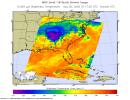
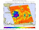
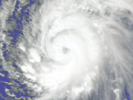
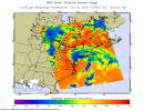
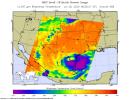
Infrared image of Hurricane Hector in the eastern Pacific were created with data from the Atmospheric Infrared Sounder (AIRS) on NASA's Aqua satellite on August 17, 2006.
PIA00507:
Hurricane Hector in the Eastern Pacific
Full Resolution:     TIFF (1.879 MB)     JPEG (104.8 kB)
Add Image to Favorite List 2006-08-22 Earth Aqua
AIRS
900x695x3
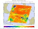
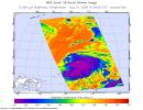
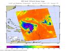
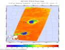
This infrared image show Tropical Depression Debbie in the Atlantic, from the Atmospheric Infrared Sounder (AIRS) on NASA's Aqua satellite on August 22, 2006.
PIA00508:
Tropical Depression Debbie in the Atlantic
Full Resolution:     TIFF (1.879 MB)     JPEG (98.1 kB)
Add Image to Favorite List 2006-08-22 Earth Aqua
AIRS
900x695x3
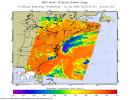
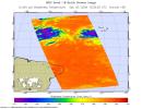
This is an infrared image of Hurricane Ileana in the Eastern Pacific, from the Atmospheric Infrared Sounder (AIRS) on NASA's Aqua satellite on August 22, 2006.
PIA00509:
Hurricane Ileana in the Eastern Pacific
Full Resolution:     TIFF (1.879 MB)     JPEG (124.2 kB)
Add Image to Favorite List 2006-08-28 Earth Aqua
AIRS
900x695x3
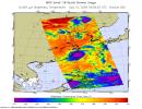
This infrared image shows Tropical Storm Ernesto over Cuba, from the Atmospheric Infrared Sounder (AIRS) on NASA's Aqua satellite in August, 2006.
PIA00510:
Tropical Storm Ernesto over Cuba
Full Resolution:     TIFF (1.879 MB)     JPEG (114.8 kB)
Add Image to Favorite List 2006-08-29 Earth Aqua
AIRS
900x695x3
This infrared image shows Typhoon Ioke in the Western Pacific, from the Atmospheric Infrared Sounder (AIRS) on NASA's Aqua satellite in August, 2006.
PIA00511:
Typhoon Ioke in the Western Pacific
Full Resolution:     TIFF (1.879 MB)     JPEG (111.4 kB)
Add Image to Favorite List 2006-09-03 Earth Aqua
AIRS
900x695x3
This infrared image shows Tropical Depression 6 (Florence) in the Atlantic, from the Atmospheric Infrared Sounder (AIRS) on NASA's Aqua satellite in September, 2006.
PIA00512:
Tropical Depression 6 (Florence) in the Atlantic
Full Resolution:     TIFF (1.879 MB)     JPEG (102.3 kB)
Add Image to Favorite List 2002-09-08 Earth Aqua
AIRS
641x469x3
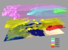
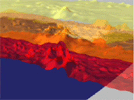
AIRS Retrieved Temperature Isotherms over Southern Europe viewed from the west, September 8, 2002. The isotherms in this map made from AIRS onboard NASA's Aqua satellite data show regions of the same temperature in the atmosphere.
PIA00513:
AIRS Retrieved Temperature Isotherms over Southern Europe
Full Resolution:     TIFF (903.1 kB)     JPEG (28.96 kB)
Add Image to Favorite List 2005-07-15 Earth Aqua
AIRS
480x187x3
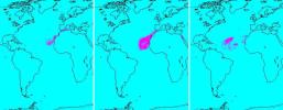
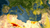
In July of 2005, a continent-sized cloud of hot air and dust originating from the Sahara Desert crossed the Atlantic Ocean and headed towards Florida and the Caribbean, captured by the Atmospheric Infrared Sounder onboard NASA's Aqua satellite.
PIA00448:
Sahara Dust Cloud
Full Resolution:     TIFF (269.8 kB)     JPEG (18.24 kB)
Add Image to Favorite List 2005-09-22 Earth Aqua
AIRS
900x695x3
In September, 2005, Rita was a category 5 hurricane with sustained winds of 150 mph and a central pressure of 897 millibar when positioned approximately 470 southeast of Galveston, Texas.
PIA00449:
Hurricane Rita as Observed by NASA's Spaceborne Atmospheric Infrared Sounder (AIRS)
Full Resolution:     TIFF (1.879 MB)     JPEG (126.2 kB)
Add Image to Favorite List 2007-05-18 Earth Aqua
AIRS
1200x900x3
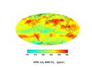
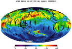
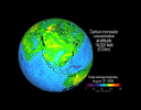
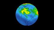
The Atmospheric Infrared Sounder (AIRS) instrument onboard NASA's Aqua spacecraft is also being used by scientists to observe atmospheric carbon dioxide.
PIA09269:
AIRS Global Map of Carbon Dioxide from Space
Full Resolution:     TIFF (3.244 MB)     JPEG (100.5 kB)
Add Image to Favorite List 2007-07-24 Earth Aqua
AIRS
6444x5172x3
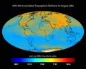
Global tropospheric methane for August 2005 retrieved from the Atmospheric Infrared Sounder (AIRS) instrument onboard NASA's Aqua satellite.
PIA09941:
AIRS-Retrieved Global Tropospheric Methane for August 2005
Full Resolution:     TIFF (99.99 MB)     JPEG (1.271 MB)
Add Image to Favorite List 2007-07-24 Earth Aqua
AIRS
1980x1524x3
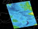
Sulfur dioxide plume from the Mt. Etna Eruption 2002 as seen by the Atmospheric Infrared Sounder (AIRS) instrument onboard NASA's Aqua satellite.
PIA09937:
Sulfur Dioxide Plume from Mt. Etna Eruption 2002 as Detected with AIRS Data
Full Resolution:     TIFF (9.065 MB)     JPEG (274.5 kB)
Add Image to Favorite List 2007-07-24 Earth Aqua
AIRS
2500x1875x3
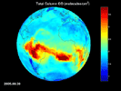
Map of carbon monoxide draped on globe: time Series from 8/1/2005 to 9/30/2005 from the Atmospheric Infrared Sounder (AIRS) on NASA's Aqua satellite.
PIA09936:
AIRS Map of Carbon Monoxide Draped on Globe: Time Series from 8/1/2005 to 9/30/2005 Animation Icon
Full Resolution:     TIFF (14.08 MB)     JPEG (289.4 kB)
Add Image to Favorite List 2007-07-24 Earth Aqua
AIRS
2931x2223x3
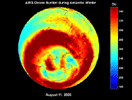
Ozone burden during Antarctic winter: time series from 8/1/2005 to 9/30/2005 from the Atmospheric Infrared Sounder (AIRS) on NASA's Aqua satellite.
PIA09938:
AIRS Ozone Burden During Antarctic Winter: Time Series from 8/1/2005 to 9/30/2005 Animation Icon
Full Resolution:     TIFF (19.55 MB)     JPEG (358.8 kB)
Add Image to Favorite List 2007-07-24 Earth Aqua
AIRS
2102x1276x3
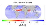
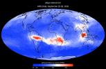
Detection of dust: global map for July 2003 from the Atmospheric Infrared Sounder (AIRS) instrument onboard NASA's Aqua satellite.
PIA09940:
AIRS Detection of Dust: Global Map for July 2003
Full Resolution:     TIFF (8.057 MB)     JPEG (214.1 kB)
Add Image to Favorite List 2007-09-11 Earth Aqua
AIRS
1280x720x3
A series of fires across Greece in August of 2007 burned 469,000 acres, visualized here by the Atmospheric Infrared Sounder (AIRS) on NASA's Aqua satellite.
PIA09923:
Visualization of Fires in Greece as seen by the Atmospheric Infrared Sounder Animation Icon
Full Resolution:     TIFF (2.768 MB)     JPEG (115.7 kB)
Add Image to Favorite List 2007-10-23 Earth Aqua
AIRS
1000x1000x3
Smoke from multiple wildfires burning in Southern California in October, 2007, can be seen in this false-color image from the Atmospheric Infrared Sounder (AIRS) instrument onboard NASA's Aqua satellite.
PIA10088:
Swirls of Smoke and Dust Blow Out to Sea
Full Resolution:     TIFF (3.004 MB)     JPEG (103.4 kB)
Add Image to Favorite List 2008-03-12 Earth Aqua
AIRS
4196x2747x3
The Atmospheric Infrared Sounder instrument onboard NASA's Aqua satellite shows mean carbon monoxide at 500 millibar, September 22-29, 2002 AIRS Mean Carbon Monoxide at 500 Millibar, September 22-29, 2002.
PIA10241:
AIRS Mean Carbon Monoxide at 500 Millibar, September 22-29, 2002
Full Resolution:     TIFF (34.58 MB)     JPEG (798.8 kB)
Add Image to Favorite List 2008-03-17 Earth Aqua
AIRS
1428x1836x3
Water vapor is the dominant greenhouse gas in our atmosphere. Mean clear air precipitable water, 500mb to top of atmosphere from the Atmospheric Infrared Sounder (AIRS) instrument onboard NASA's Aqua satellite.
PIA10242:
Mean Clear Air Precipitable Water, 500mb to TOA from AIRS data
Full Resolution:     TIFF (7.88 MB)     JPEG (295.5 kB)
Add Image to Favorite List 2007-05-16 Earth Aqua
AIRS
720x486x3
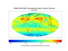
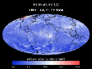
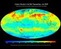
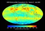
AIRS mid-tropospheric CO2, Version 5, July 2003 from the Atmospheric Infrared Sounder (AIRS) instrument onboard NASA's Aqua satellite.
PIA10645:
AIRS Mid-Tropospheric CO2, Version 5, July 2003
Full Resolution:     TIFF (1.051 MB)     JPEG (53.1 kB)
Add Image to Favorite List 2007-08-15 Earth Aqua
AIRS
1000x1000x3
Visible image of Hurricane Dean, at the coast of Mexico from Manzanillo to Mazatlan in August, 2007, from Atmospheric Infrared Sounder (AIRS) insturment onboard NASA's Aqua satellite.
PIA10646:
Hurricane Dean
Full Resolution:     TIFF (3.004 MB)     JPEG (130.4 kB)
Add Image to Favorite List 2007-08-15 Earth Aqua
AIRS
1000x1000x3
Visible image of Tropical Storm Erin, the Atlantic Ocean 210 miles south of Galveston, Texas, August, 2007, from the Atmospheric Infrared Sounder (AIRS) instrument onboard NASA's Aqua satellite.
PIA10647:
Tropical Storm Erin
Full Resolution:     TIFF (3.004 MB)     JPEG (123.6 kB)
Add Image to Favorite List 2007-08-18 Earth Aqua
AIRS
1000x1000x3
Visible image of Typhoon Sepat, western Pacific Ocean, southeast coast of China, August, 2007, from the Atmospheric Infrared Sounder (AIRS) instrument onboard NASA's Aqua satellite.
PIA10648:
Typhoon Sepat
Full Resolution:     TIFF (3.004 MB)     JPEG (130.3 kB)
Add Image to Favorite List 2007-09-03 Earth Aqua
AIRS
900x695x3
These infrared and microwave images were created with data retrieved by the Atmospheric Infrared Sounder (AIRS) on NASA's Aqua satellite, and show the remnants of the former Hurricane Felix over Central America, September, 2007.
PIA10649:
Hurricane Felix
Full Resolution:     TIFF (1.879 MB)     JPEG (124.9 kB)
Add Image to Favorite List 2008-07-22 Earth Aqua
AIRS
1026x577x3
Carbon monoxide from California's wildfire, a visualization created using data from the Atmospheric Infrared Sounder (AIRS) on NASA's Aqua satellite, June-July, 2008.
PIA10973:
Carbon Monoxide from California's Wildfire - a Visualization Created Using Data from NASA's Atmospheric Infrared Sounder Animation Icon
Full Resolution:     TIFF (1.779 MB)     JPEG (61.13 kB)
Add Image to Favorite List 2008-08-06 Earth Aqua
AIRS
727x329x3
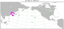
Transport of dust from China Dust Storm of April 2006, from the Atmospheric Infrared Sounder (AIRS) on NASA's Aqua satellite.
PIA11009:
Transport of Dust from China Dust Storm of April 2006 Animation Icon
Full Resolution:     TIFF (718.7 kB)     JPEG (30.38 kB)
Add Image to Favorite List 2008-08-13 Earth Aqua
AIRS
321x239x3
Hurricane Isabel isotherms as the storm moved across the Atlantic Ocean in September, 2003, from the Atmospheric Infrared Sounder (AIRS) on NASA's Aqua satellite.
PIA11032:
Hurricane Isabel Isotherms Animation Icon
Full Resolution:     TIFF (230.6 kB)     JPEG (8.968 kB)
Add Image to Favorite List 2008-08-13 Earth Aqua
AIRS
319x240x3
Supertyphoon Pongsona isotherms as it hit the island of Guam, December of 2002, from the Atmospheric Infrared Sounder (AIRS) on NASA's Aqua satellite.
PIA11033:
Supertyphoon Pongsona Isotherms Animation Icon
Full Resolution:     TIFF (230.2 kB)     JPEG (9.715 kB)
Add Image to Favorite List 2008-08-14 Earth Aqua
AIRS
640x480x3
A series of maps of the transport of carbon monoxide generated by Alaska Fires, July 2004, created by data from the Atmospheric Infrared Sounder (AIRS) on NASA's Aqua satellite.
PIA11034:
Transport of Carbon Monoxide Generated by Alaska Fires, July 2004 Animation Icon
Full Resolution:     TIFF (922.8 kB)     JPEG (44.52 kB)
Add Image to Favorite List 2008-09-17 Earth Aqua
AIRS
638x478x3
The Atmospheric Infrared Sounder (AIRS) onboard NASA's Aqua satellite collects data and creates a temperature profile, September, 2008, represented by a blue beam as it sweeps back and forth through the atmosphere down to the surface of the Earth.
PIA11171:
AIRS Collects Data and Creates a Temperature Profile Animation Icon
Full Resolution:     TIFF (916.1 kB)     JPEG (39.04 kB)
Add Image to Favorite List 2008-09-22 Earth Aqua
AIRS
1777x948x3
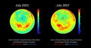
AIRS global distribution of mid-tropospheric carbon dioxide at 8-13 km altitudes between July 2003 and 2007, from the Atmospheric Infrared Sounder (AIRS) insturment onboard NASA's Aqua satellite.
PIA11186:
AIRS Global Distribution of Mid-Tropospheric Carbon Dioxide at 8-13 km Altitudes
Full Resolution:     TIFF (5.062 MB)     JPEG (146.6 kB)
Add Image to Favorite List 2008-09-24 Earth Aqua
AIRS
5000x3750x3
This image, created with data acquired by the Atmospheric Infrared Sounder instrument during July 2008, shows large scale patterns of carbon dioxide concentrations that are transported around the Earth by the general circulation of the atmosphere.
PIA11194:
Global Carbon Dioxide Transport from AIRS Data, July 2008
Full Resolution:     TIFF (56.25 MB)     JPEG (715.3 kB)
Add Image to Favorite List 2008-11-03 Earth Aqua
AIRS
3840x2160x3
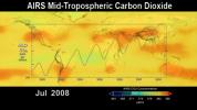
This image shows the distribution and amount of carbon dioxide in Earth's mid-troposphere in July 2008 as measured by the Atmospheric Infrared Sounder (AIRS) instrument onboard NASA's Aqua satellite.
PIA11395:
AIRS Carbon Dioxide with Mauna Loa Carbon Dioxide Overlaid
Full Resolution:     TIFF (24.88 MB)     JPEG (534 kB)
Add Image to Favorite List 2008-11-18 Earth Aqua
AIRS
1024x576x3
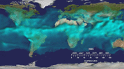
This visualization from the Atmospheric Infrared Sounder (AIRS) on NASA's Aqua satellite shows variations in the three dimensional distribution of water vapor in the atmosphere during the summer and fall of 2005.
PIA11424:
Water Vapor Transport, June through November 2005 (Movie) Animation Icon
Full Resolution:     TIFF (1.772 MB)     JPEG (54.12 kB)
Add Image to Favorite List 2009-02-19 Earth Aqua
AIRS
764x522x3
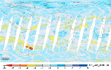
Carbon monoxide from the Australian fires of February, 2009, as seen by the Atmospheric Infrared Sounder (AIRS) on NASA's Aqua satellite.
PIA11807:
Carbon Monoxide from the Australian Fires of Feb 2009 as seen by AIRS Animation Icon
Full Resolution:     TIFF (1.198 MB)     JPEG (92.37 kB)
Add Image to Favorite List 2009-06-30 Earth Aqua
AIRS
1600x1025x3
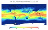
This image represents the total precipitable water vapor for May 2009 as observed by JPL's Atmospheric Infrared Sounder on NASA's Aqua satellite.
PIA12096:
Global Total Precipitable Water Vapor for May 2009
Full Resolution:     TIFF (4.928 MB)     JPEG (173.4 kB)
Add Image to Favorite List 2009-06-30 Earth Aqua
AIRS
1600x1025x3
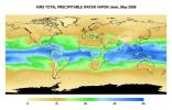
This image represents the total precipitable water vapor for May, 2009 as observed by JPL's Atmospheric Infrared Sounder on NASA's Aqua satellite.
PIA12097:
Global Total Precipitable Water Vapor for May 2009
Full Resolution:     TIFF (4.928 MB)     JPEG (187.7 kB)
Add Image to Favorite List 2009-06-30 Earth Aqua
AIRS
1600x1025x3
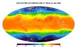
This image shows average daytime temperatures in May, 2009, as observed by JPL's Atmospheric Infrared Sounder on NASA's Aqua satellite.
PIA12098:
Global Daytime Air Temperature for May 2009
Full Resolution:     TIFF (4.928 MB)     JPEG (198.8 kB)
Add Image to Favorite List 2009-09-04 Earth Aqua
AIRS
640x500x3
Carbon monoxide in the smoke from the Station fire was lofted high into the atmosphere, where it was observed by JPL's Atmospheric Infrared Sounder instrument onboard NASA's Aqua satellite. Animation available at the Photojournal.
PIA12195:
Concentration and Transport of Carbon Monoxide from the California Wildfires Animation Icon
Full Resolution:     TIFF (961.2 kB)     JPEG (32.29 kB)
Add Image to Favorite List 2009-09-24 Earth Aqua
AIRS
1000x1000x3
A major dust storm moved across the eastern and northeastern regions of Australia on Sept. 23, 2009, out towards the Pacific as seen the by Atmospheric Infrared Sounder (AIRS) instrument onboard NASA's Aqua satellite.
PIA12239:
Australia's Red Dawn
Full Resolution:     TIFF (3.004 MB)     JPEG (138.4 kB)
Add Image to Favorite List 2009-11-09 Earth Aqua
AIRS
1460x1179x3
Created with data acquired by JPL's Atmospheric Infrared Sounder instrument during July 2009 this image shows large-scale patterns of carbon dioxide concentrations that are transported around Earth by the general circulation of the atmosphere.
PIA12339:
Global Carbon Dioxide Transport from AIRS Data, July 2009
Full Resolution:     TIFF (5.174 MB)     JPEG (184.8 kB)
Add Image to Favorite List 2010-04-15 Earth Aqua
AIRS
900x695x3
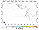
NASA's Aqua satellite flew over the volcano on April 15, capturing this image of the ash plume. The image shows the ash cloud being carried over the Shetland Islands and onward to Europe.
PIA13041:
NASA's AIRS Instrument Captures Ash Cloud from Icelandic Volcano
Full Resolution:     TIFF (1.879 MB)     JPEG (102.3 kB)
Add Image to Favorite List 2010-05-17 Earth Aqua
AIRS
2417x1887x3
Images made with data from the Atmospheric Infrared Sounder on NASA's Aqua satellite, show sulfur dioxide released from the volcanic eruption of Eyjafjallajökull.
PIA13142:
Sulfur Dioxide in Iceland's Eyjafjallajökull Volcanic Cloud as seen by AIRS
Full Resolution:     TIFF (13.7 MB)     JPEG (322.9 kB)
Add Image to Favorite List 2010-08-19 Earth Aqua
AIRS
1200x901x3
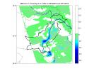
This image from NASA's Aqua spacecraft shows how surface emissivity -- how efficiently Earth's surface radiates heat -- changed in several regions of Pakistan over a 32-day period between July 11 (pre-flood) and August 12 (post-flood).
PIA13342:
NASA's AIRS Detects Extent of Pakistan Flooding
Full Resolution:     TIFF (1.084 MB)     JPEG (109.2 kB)
Add Image to Favorite List 2011-02-03 Earth Aqua
AIRS
882x630x3
Powerful Tropical Cyclone Yasi's fury rakes Northeastern Australia in February, 2011, as seen by the Atmospheric Infrared Sounder (AIRS) instrument onboard NASA's Aqua satellite.
PIA13836:
Yasi's Fury Rakes Northeastern Australia
Full Resolution:     TIFF (1.669 MB)     JPEG (105.4 kB)
Add Image to Favorite List 2011-02-02 Earth Aqua
AIRS
1800x1150x3
This visible image from NASA's Aqua satellite Jan. 31 shows thickening clouds along a developing intense front in the plains and Midwestern states that will produce excessive snow, freezing rain, sleet, and wind in those areas.
PIA13831:
NASA's AIRS Instrument Captures Data on Monster Winter Storm Affecting 30 States
Full Resolution:     TIFF (6.219 MB)     JPEG (286.1 kB)
Add Image to Favorite List 2011-02-02 Earth Aqua
AIRS
900x695x3
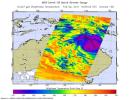
Shown here is the latest infrared image of Yasi from NASA's Aqua satellite, taken on Feb. 1, 2011. A distinct eye is visible, and the outer bands of the storm can be seen nearing the Australian coast.
PIA13834:
Monster Cyclone Yasi Eyes Australia in NASA Image
Full Resolution:     TIFF (1.879 MB)     JPEG (128.3 kB)
Add Image to Favorite List 2011-02-04 Earth Aqua
AIRS
814x630x3
The Atmospheric Infrared Sounder (AIRS) instrument onboard NASA's Aqua spacecraft captured this infrared image of Tropical Cyclone Yasi on Feb. 2, 2011 as the storm passed over Australia's Great Dividing Range.
PIA13838:
Tropical Cyclone Yasi Spins Through Australia's Interior
Full Resolution:     TIFF (1.54 MB)     JPEG (103.9 kB)
Add Image to Favorite List 2011-04-18 Earth Aqua
AIRS
1200x860x3
NASA's Aqua satellite captured an infrared image of the storms on April 16, 2011 showing very cold, high cloud tops of the strong thunderstorms that spawned tornadoes in North Carolina and Virginia.
PIA14042:
NASA's AIRS Instrument Images April 16, 2011 Severe Storm/Tornado Outbreak
Full Resolution:     TIFF (3.1 MB)     JPEG (130.1 kB)
Add Image to Favorite List 2011-05-28 Earth Aqua
AIRS
780x797x3
The Atmospheric Infrared Sounder (AIRS) on NASA's Aqua satellite sees sulfur dioxide plume from Iceland's Grímsvötn Volcano when it erupted May, 2011.
PIA14173:
NASA's AIRS Sees Sulfur Dioxide Plume from Iceland's Grímsvötn Volcano Animation Icon
Full Resolution:     TIFF (1.867 MB)     JPEG (215.3 kB)
Add Image to Favorite List 2011-07-26 Earth Aqua
AIRS
1276x744x3
NASA's Aqua spacecraft has illustrated surface air and skin temperature for the period from July 16-24, showing movement of a dome of heat across the eastern two-thirds of the country. See More Details for the movies.
PIA14480:
NASA AIRS Movies Show Evolution of U.S. 2011 Heat Wave Animation Icon
Full Resolution:     TIFF (2.851 MB)     JPEG (114.3 kB)
Add Image to Favorite List 2011-07-28 Earth Aqua
AIRS
1200x900x3
Surface relative humidity anomalies in percent, during July 2011 compared to the average surface relative humidity over the previous eight years, as measured by NASA's Aqua instrument AIRS. The driest areas are shown in oranges and reds.
PIA14488:
NASA Satellite Tracks Severity of African Drought
Full Resolution:     TIFF (3.244 MB)     JPEG (119.7 kB)
Add Image to Favorite List 2011-07-29 Earth Aqua
AIRS
927x1000x3
NASA's Aqua spacecraft passed over Tropical Storm Don at 8:17 UTC (1:17 a.m. EDT) on July 29, 2011. Texas is experiencing exceptional drought conditions; Tropical Storm Don may bring relief.
PIA14499:
NASA Satellite Tracks Texas-Bound Tropical Storm Don
Full Resolution:     TIFF (2.785 MB)     JPEG (105.6 kB)
Add Image to Favorite List 2011-08-02 Earth Aqua
AIRS
1000x1000x3
NASA's Aqua spacecraft continues to track the gradual organization of Tropical Storm Emily, as seen in this image taken Aug. 2, 2011 at 1:05 p.m. EDT. At that time, the storm was located about 270 miles southeast of San Juan, Puerto Rico.
PIA14515:
NASA Image Shows a Slightly Stronger Emily
Full Resolution:     TIFF (3.004 MB)     JPEG (135.7 kB)
Add Image to Favorite List 2011-08-03 Earth Aqua
AIRS
900x695x3
Tropical Storm Emily continues its march toward Hispaniola, which it is expected to reach later on Aug. 3. NASA's Aqua spacecraft captured this infrared image 1:53 p.m. EDT on Aug. 3, with the storm located south of Santo Domingo, Dominican Republic.
PIA14516:
NASA Image Captures Emily's Trek Toward Hispaniola
Full Resolution:     TIFF (1.879 MB)     JPEG (116.6 kB)
Add Image to Favorite List 2011-08-28 Earth Aqua
AIRS
900x695x3
This infrared image of Hurricane Irene from the AIRS instrument on NASA's Aqua spacecraft, was taken at 2:47 a.m. EDT on Aug. 28. The storm's coldest cloud top temperatures and intense rains are shown in purples and blues.
PIA14743:
NASA Satellite Shows a Mean Irene's Fury
Full Resolution:     TIFF (1.879 MB)     JPEG (123.8 kB)
Add Image to Favorite List 2012-06-29 Earth Aqua
AIRS
MODIS
1920x1070x3
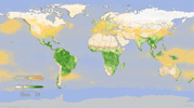
In this frame from an animation, NASA instruments show the seasonal cycle of vegetation and the concentration of carbon dioxide in the atmosphere.
PIA15838:
Effect of Seasonal Vegetation Cycle on Global Atmospheric Carbon Dioxide Animation Icon
Full Resolution:     TIFF (6.166 MB)     JPEG (200.6 kB)
Add Image to Favorite List 2012-08-30 Earth Aqua
AIRS
1200x1012x3
Strong tropical storm Isaac continues to create havoc across the Gulf Coast, from eastern Texas to Florida. This infrared image from NASA's Aqua spacecraft, was acquired at 2:41 p.m. CDT on Aug. 29, 2012.
PIA16113:
A Slow-moving Isaac Brings Flooding to Gulf States
Full Resolution:     TIFF (3.645 MB)     JPEG (201.4 kB)
Add Image to Favorite List 2012-10-30 Earth Aqua
AIRS
900x695x3
Early Tuesday, Oct. 30, 2012, Hurricane Sandy continued inland, moving to the northwest over Pennsylvania. Swaths of infrared measurements taken over two orbits of NASA's Aqua satellite by the Atmospheric Infrared Sounder are displayed here.
PIA16434:
Hurricane Sandy Moving Northwest
Full Resolution:     TIFF (1.877 MB)     JPEG (135.4 kB)
Add Image to Favorite List 2012-11-29 Earth Aqua
AIRS
900x695x3
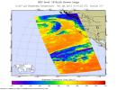
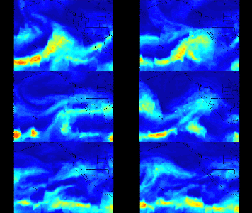
NASA's Aqua spacecraft captured this infrared image of the first of a series of storms approaching the Pacific Northwest at 2141 UTC (1:41 p.m. PST) on Nov. 28, 2012, marking the beginning of an 'atmospheric river' event.
PIA16534:
NASA's Aqua Spacecraft Captures Start of West Coast Atmospheric River Event
Full Resolution:     TIFF (1.877 MB)     JPEG (118 kB)
Add Image to Favorite List 2013-05-13 Earth Aqua
MODIS
1500x1686x3
The quick dry-out of vegetation in Southern California this year is depicted in this pair of images from the Moderate Resolution Imaging Spectroradiometer (MODIS) sensor on NASA's Aqua spacecraft.
PIA17053:
MODIS Satellite See Double Jeopardy for Socal Fire Season
Full Resolution:     TIFF (7.59 MB)     JPEG (220.7 kB)
Add Image to Favorite List 2013-05-22 Earth Aqua
AIRS
1976x1900x3
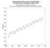
This graph made with data from the AIRS instrument on NASA's Aqua satellite shows the concentration of carbon dioxide in Earth's mid-troposphere, located roughly between 3 to 6 miles (5 to 9 kilometers) in altitude.
PIA14435:
Concentration of Atmospheric Carbon Dioxide from Earth's Mid-Troposphere, 2002 to 2013
Full Resolution:     TIFF (11.27 MB)     JPEG (185.8 kB)
Add Image to Favorite List 2013-05-22 Earth Aqua
AIRS
2084x1946x3
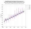
This plot shows the concentration of carbon dioxide in Earth's mid-troposphere at various latitudes as measured by NASA's Aqua satellite. The colored lines represent different latitude bands that circle Earth, called 'zones'.
PIA14436:
Zonally Averaged Carbon Dioxide Concentration from Earth's Mid-Troposphere at Different Latitudes, 2002 to 2013
Full Resolution:     TIFF (12.17 MB)     JPEG (346.7 kB)
Add Image to Favorite List 2013-05-22 Earth Aqua
AIRS
1960x1482x3
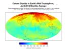
This map created with data from the AIRS on NASA's Aqua satellite shows the concentration of carbon dioxide in Earth's mid-troposphere, located roughly between 3 to 6 miles (5 to 9 kilometers) in altitude.
PIA14437:
Carbon Dioxide in Earth's Mid-Troposphere, April 2013 Monthly Average
Full Resolution:     TIFF (2.909 MB)     JPEG (260.8 kB)
Add Image to Favorite List 2013-08-27 Earth Aqua
AIRS
879x600x3
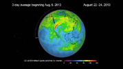
The plume of carbon monoxide pollution from the Rim Fire burning in and near Yosemite National Park, Calif., shows a three-day running average of daily measurements from NASA's Aqua spacecraft.
PIA17427:
NASA's Aqua Spacecraft Images Pollution from California's Rim Fire
Full Resolution:     TIFF (1.583 MB)     JPEG (101.7 kB)
Add Image to Favorite List 2013-08-27 Earth Aqua
AIRS
1279x713x3
This frame from a movie was produced with data from NASA's Aqua spacecraft showing the spread of carbon monoxide pollution across North America from fires in the Western U.S., including the Beaver Creek Fire in Idaho and the Rim Fire in California.
PIA17433:
NASA's AIRS Instrument Sees Spread of Pollution from Western Wildfires Animation Icon
Full Resolution:     TIFF (2.737 MB)     JPEG (60.04 kB)
Add Image to Favorite List 2014-04-29 Earth Aqua
AIRS
900x695x3
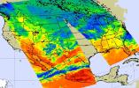
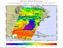
NASA's Aqua spacecraft passed over central and southern United States on April 27-29, 2014 capturing this false-color infrared image of the slow-moving low-pressure system that spawned the strong supercell thunderstorms.
PIA18047:
NASA Satellite Spots Severe Weather Outbreak in South
Full Resolution:     TIFF (1.877 MB)     JPEG (142 kB)
Add Image to Favorite List 2014-05-29 Earth Aqua
MODIS
7091x5556x1
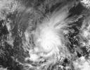
Amanda, the first named storm of the 2014 hurricane season in the Americas, is seen off the west coast of Mexico in an image acquired on May 25 by the Moderate Resolution Imaging Spectrometer (MODIS) on NASA's Aqua satellite.
PIA18097:
Hurricane Amanda
Full Resolution:     TIFF (39.44 MB)     JPEG (4.125 MB)
Add Image to Favorite List 2014-09-02 Earth Aqua
MODIS
6843x3890x3
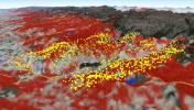
In this image from NASA's Aqua satellite, the red areas seen by the MODIS instrument revealed that live fuel moisture had excessively dried up by more than 50 percent prior to the Rim Fire in August 2013.
PIA18795:
2013 Yosemite Fire Assessed by NASA Satellite Data
Full Resolution:     TIFF (79.89 MB)     JPEG (2.397 MB)
Add Image to Favorite List 2015-05-07 Earth Aqua
AIRS
737x467x3
This frame from a movie shows alternating day and nighttime views of the plume of sulfur dioxide gas emitted by Calbuco, as observed by NASA's AIRS instrument onbpard NASA's Aqua spacecraft, from April 22 to May 4, 2015.
PIA19385:
NASA's AIRS Instrument Tracks Transport of Sulfur Dioxide from Chilean Volcanic Eruption (Animation) Animation Icon
Full Resolution:     TIFF (1.033 MB)     JPEG (69.56 kB)
Add Image to Favorite List 2016-05-11 Earth Aqua
AIRS
914x569x3
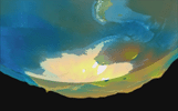
Visualization of the formation and evolution of the Antarctic Vortex (ozone hole) over the South Pole from Sept. 1 to Dec. 4, 2014, created using data from NASA's Aqua spacecraft.
PIA20664:
Ozone Hole Formation Over South Pole Observed by NASA's AIRS Animation Icon
Full Resolution:     TIFF (1.122 MB)     JPEG (31.32 kB)
Add Image to Favorite List 2016-10-06 Earth Aqua
AIRS
876x960x3
NASA's Aqua spacecraft spied Hurricane Matthew, currently an extremely dangerous Category 4 storm on the Saffir-Simpson Hurricane Wind Scale, continues to bear down on the southeastern United States.
PIA21092:
A Look at Hurricane Matthew from NASA's AIRS
Full Resolution:     TIFF (1.696 MB)     JPEG (107.9 kB)
Add Image to Favorite List 2016-10-14 Earth Aqua
MODIS
VIIRS
1000x1000x3
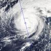
NASA's CloudSat satellite completed an eye overpass of Hurricane Nicole on Oct. 12, 2016, at 10:55 a.m. PDT (17:55 UTC) as the storm was moving toward Bermuda.
PIA21098:
NASA's CloudSat Looks Hurricane Nicole in the Eye
Full Resolution:     TIFF (2.794 MB)     JPEG (195.4 kB)
Add Image to Favorite List 2017-01-13 Earth Aqua
AIRS
649x464x3
A series of atmospheric rivers that brought drought-relieving rains, heavy snowfall and flooding to California this week is highlighted in this movie frame created with satellite data from the AIRS instrument on NASA's Aqua satellite.
PIA21209:
Series of Storms Battering California Tracked by NASA's AIRS Instrument Animation Icon
Full Resolution:     TIFF (312.2 kB)     JPEG (346.4 kB)
Add Image to Favorite List 2017-08-28 Earth Aqua
AIRS
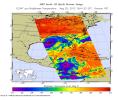
900x695x3
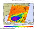
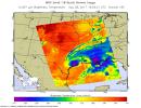
In the false-color image, acquired at 2:29 p.m. on Aug. 28, 2017, NASA's Aqua satellite shows a large area of dark blue and purple centered along the southeastern Texas coast denotes the coldest cloud top temperatures and strongest thunderstorms.
PIA21885:
Tropical Storm Harvey Parked Over Southeast Texas Shown by Latest NASA AIRS Image
Full Resolution:     TIFF (723.4 kB)     JPEG (126.7 kB)
Add Image to Favorite List 2017-09-05 Earth Aqua
AIRS
900x1405x3
NASA's Aqua satellite shows what Hurricane Irma looked like when Aqua passed overhead just before 1 p.m. local time on Sept. 5, 2017.
PIA21941:
New NASA Infrared Image of Irma Shows an Angry Eye
Full Resolution:     TIFF (1.323 MB)     JPEG (230.3 kB)
Add Image to Favorite List 2017-09-08 Earth Aqua
AIRS
1920x1080x3
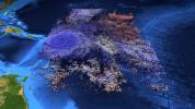
The large-scale structure of clouds in and around Hurricane Irma is seen in this image created with data AIRS instrument on NASA's Aqua satellite. The clouds are typical of tropical areas both nearby and away from tropical cyclones.
PIA21950:
Hurricane Irma's Cloud Structure as Seen by NASA's AIRS
Full Resolution:     TIFF (6.223 MB)     JPEG (323.8 kB)
Add Image to Favorite List 2018-03-19 Earth Aqua
AIRS
2400x1800x3
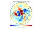
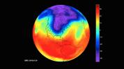
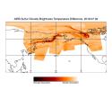
When the polar vortex dips south it often makes headlines. This map created by the Atmospheric Infrared Sounder instrument onboard NASA's Aqua satellite shows warmer-than-normal temperatures colored in red and below average temperatures colored in blue.
PIA22344:
The Other Side of the Vortex
Full Resolution:     TIFF (496.1 kB)     JPEG (1.489 MB)
Add Image to Favorite List 2018-08-14 Earth Aqua
AIRS
950x534x3
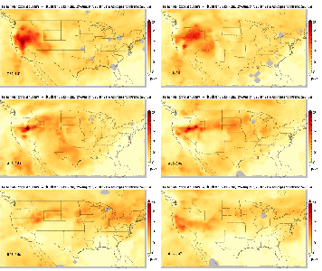
This image is one of a series showing carbon monoxide (in orange/red) from California's massive wildfires drifting east across the U.S. between July 30 and August 7, 2018.
PIA22492:
Carbon Monoxide Transport from California Wildfires, July 30-August 7, 2018 Animation Icon
Full Resolution:     TIFF (452.9 kB)     JPEG (421.9 kB)
Add Image to Favorite List 2018-08-24 Earth Aqua
AIRS
900x695x3
This image shows Hurricane Lane as observed by NASA's Aqua satellite Friday, August 24, 2018. Purple shows very cold clouds high in the atmosphere, blue and green show the warmer temperatures of lower;orange and red areas have almost no clouds.
PIA22493:
Hurricane Lane as Viewed by NASA's AIRS Instrument
Full Resolution:     TIFF (676.9 kB)     JPEG (104.3 kB)
Add Image to Favorite List 2018-09-12 Earth Aqua
AIRS
900x695x3
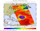
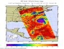
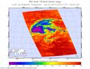
This image, taken on Sept. 11, 2018 by NASA's Aqua satellite shows Hurricane Florence whose strong winds are expected to reach the Carolina coast late Thursday. Florence intensified from a Category 2 to a Category 4 storm in a matter of hours.
PIA22697:
Hurricane Florence Captured on Tuesday by NASA's AIRS Instrument
Full Resolution:     TIFF (752.6 kB)     JPEG (132.1 kB)
Add Image to Favorite List 2018-09-12 Earth Aqua
AIRS
900x695x3
This image shows Hurricane Florence in infrared light, and was taken at 1:35 p.m. local time on Wednesday, September 12, 2018 by the Atmospheric Infrared Sounder (AIRS) on board NASA's Aqua satellite.
PIA22698:
Hurricane Florence as seen by NASA's AIRS Instrument
Full Resolution:     TIFF (791 kB)     JPEG (140 kB)
Add Image to Favorite List 2018-10-10 Earth Aqua
AIRS
900x695x3
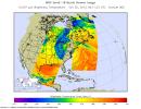
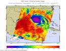
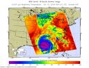
This image, taken on Oct. 10, 2018 by NASA's Aqua satellite shows the temperature of clouds or the surface in and around Hurricane Michael as it approaches northwestern Florida.
PIA22749:
NASA's AIRS captures Hurricane Michael off Florida coast
Full Resolution:     TIFF (747.2 kB)     JPEG (123.4 kB)
Add Image to Favorite List 2018-10-10 Earth Aqua
AIRS
900x695x3
This image, taken on Oct. 10, 2018 by NASA's Aqua satellite shows the temperature of clouds or the surface in and around Hurricane Michael as the storm made landfall in the Florida panhandle.
PIA22752:
NASA's AIRS captures Hurricane Michael's Landfall
Full Resolution:     TIFF (810.2 kB)     JPEG (132.6 kB)
Add Image to Favorite List 2019-01-31 Earth Aqua
AIRS
1395x783x3
NASA's Atmospheric Infrared Sounder (AIRS) instrument captures a polar vortex moving from Central Canada into the U.S. Midwest from January 20 through January 29, 2019.
PIA22823:
AIRS Captures Polar Vortex
Full Resolution:     TIFF (1.034 MB)     JPEG (81.95 kB)
Add Image to Favorite List 2019-04-25 Earth Aqua
AIRS
900x695x3
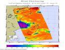
NASA's AIRS instrument shows the temperature of clouds or the surface in and around Tropical Cyclone Kenneth as it was about to make landfall in northern Mozambique on Thursday, April 25.
PIA23144:
NASA's AIRS Images Cyclone Kenneth over Mozambique
Full Resolution:     TIFF (986.1 kB)     JPEG (113.3 kB)
Add Image to Favorite List 2019-05-02 Earth Aqua
AIRS
900x695x3
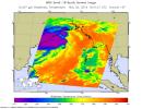
NASA's Atmospheric Infrared Sounder (AIRS) instrument shows Tropical Cyclone Fani just off the east coast of India in the Bay of Bengal on May 2, 2019.
PIA22838:
NASA's AIRS Images Cyclone Fani Before Landfall
Full Resolution:     TIFF (821.5 kB)     JPEG (110.5 kB)
Add Image to Favorite List 2019-07-12 Earth Aqua
AIRS
900x695x3
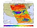
NASA's AIRS instrument imaged Tropical Storm Barry on the afternoon of July 12, 2019, a day before the storm is expected to make landfall on the Louisiana Coast.
PIA23355:
NASA's AIRS Images Tropical Storm Barry Before Landfall
Full Resolution:     TIFF (1.069 MB)     JPEG (134.4 kB)
Add Image to Favorite List 2020-07-10 Earth Aqua
AIRS
900x695x3
NASA's AIRS instrument captured this image of Tropical Storm Fay around 2 p.m. local time on July 10, 2020, as the storm swept through New England.
PIA23783:
Tropical Storm Fay 2020
Full Resolution:     TIFF (831.9 kB)     JPEG (140.7 kB)
Add Image to Favorite List 2019-08-23 Earth Aqua
AIRS
1400x787x3
This time series shows carbon monoxide associated with fires from the Amazon region in Brazil from Aug. 8-22, 2019.
PIA23356:
NASA's AIRS Maps Carbon Monoxide from Brazil Fires
Full Resolution:     TIFF (879.2 kB)     JPEG (63.62 kB)
Add Image to Favorite List 2019-08-29 Earth Aqua
AIRS
900x695x3
An infrared image of Hurricane Dorian, as seen by the AIRS instrument aboard NASA's Aqua satellite at 1:30 p.m. EDT (10:30 a.m. PDT) on Aug. 29, 2019.
PIA23358:
AIRS Measures the Clouds in Hurricane Dorian
Full Resolution:     TIFF (746.3 kB)     JPEG (105.8 kB)
Add Image to Favorite List 2019-09-05 Earth Aqua
AIRS
3994x3194x3
In this image from NASA's Aqua satellite, sulfur dioxide (SO2) in the volcanic plume is observed over several overpasses on July 2, 2019, days after the Raikoke volcanic eruption.
PIA23421:
NASA's AIRS Displays Sulfur Dioxide Plumes After Raikoke Eruption, June 2019
Full Resolution:     TIFF (8.331 MB)     JPEG (713.6 kB)
Add Image to Favorite List 2020-07-27 Earth Aqua
AIRS
900x695x3
NASA's AIRS instrument captured this image of Tropical Storm Hanna at 1:35 a.m. local time on July 26, 2020, as the storm swept over southern Texas and northeastern Mexico.
PIA23784:
AIRS Captures Tropical Storm Hanna
Full Resolution:     TIFF (790.4 kB)     JPEG (121.2 kB)
Add Image to Favorite List 2020-07-27 Earth Aqua
AIRS
900x695x3
NASA's AIRS instrument captured this image of Hurricane Douglas at 1:53 a.m. local time on July 26, 2020, as the storm swept towards the Hawaiian Islands.
PIA23785:
AIRS Captures Hurricane Douglas
Full Resolution:     TIFF (640.7 kB)     JPEG (100.5 kB)
Add Image to Favorite List 2020-09-14 Earth Aqua
AIRS
1600x900x3
This visualization shows a three-day average of carbon monoxide concentrations, from Sept. 6 to14, in the atmosphere over California due to wildfires. Higher concentrations of the gas appear as red and orange regions.
PIA23789:
NASA's AIRS Instrument Monitors Carbon Monoxide From California Wildfires
Full Resolution:     TIFF (1.769 MB)     JPEG (106.9 kB)
Add Image to Favorite List 2021-07-08 Earth Aqua
AIRS
1210x1266x3
The AIRS instrument aboard NASA's Aqua satellite collected temperature readings in the atmosphere and at the surface during an unprecedented heat wave in the Pacific Northwest and western Canada that started around June 26.
PIA24537:
Heat Wave Surface Temperature
Full Resolution:     TIFF (2.168 MB)     JPEG (155.4 kB)
Add Image to Favorite List 2021-07-15 Earth Aqua
AIRS
1210x1266x3
The AIRS instrument aboard NASA's Aqua satellite collected temperature readings in the atmosphere and at the surface during an unprecedented heat wave in the southwestern U.S. from July 1 to July 12, 2021.
PIA23693:
July 2021 Heat Wave Surface Temperature
Full Resolution:     TIFF (2.603 MB)     JPEG (116.2 kB)
Add Image to Favorite List 2021-08-31 Earth Aqua
AIRS
900x695x3
The AIRS instrument aboard NASA's Aqua satellite caught views of Hurricane Ida as the high-end Category 4 storm swept ashore around noon local time on August 29, 2021, near Port Fourchon, Louisiana.
PIA24538:
Hurricane Ida Before Landfall
Full Resolution:     TIFF (817.2 kB)     JPEG (122.8 kB)
Add Image to Favorite List 2021-09-16 Earth Aqua
AIRS
900x695x3
The AIRS instrument aboard NASA's Aqua satellite captured views of Hurricane Nicholas before and after it made landfall about 10 miles west-southwest of Sargent Beach, Texas, on Tuesday, September 14, 2021.
PIA24532:
Hurricane Nicholas Before and After Landfall
Full Resolution:     TIFF (814 kB)     JPEG (120 kB)
Add Image to Favorite List 2022-01-04 Earth Aqua
AIRS
1664x1740x3
This animation, derived from AIRS instrument data aboard NASA's Aqua satellite, shows a nearly 20-year record of temperature anomalies for two layers in Earth's atmosphere.
PIA24139:
AIRS Temperature Anomalies
Full Resolution:     TIFF (3.235 MB)     JPEG (343.9 kB)
Retrieve Previous Set  Jump to a Previous Set   Jump to a Previous Set   Current Set   Jump to a Following Set   Jump to a Following Set   Jump to a Following Set   Jump to a Following Set   Jump to a Following Set   Jump to a Following Set   Jump to a Following Set   Retrieve Next Set 
 1-100   101-200   201-300   301-400   401-500   501-600   601-700   701-800   801-900   901-1000 
Currently displaying images: 201 - 300 of 2625