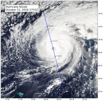
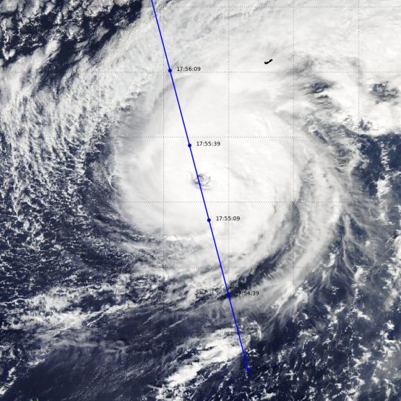
Figure 1
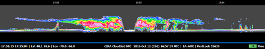
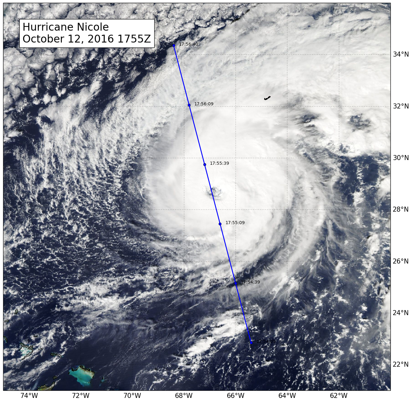
Figure 2
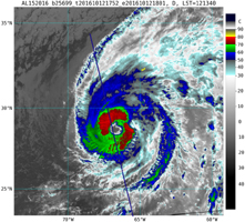
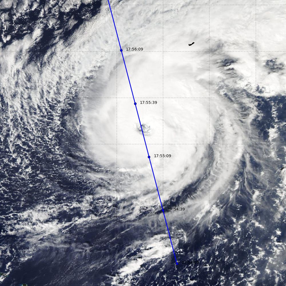
Figure 3
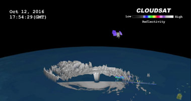
Animation
NASA's CloudSat satellite completed an eye overpass of Hurricane Nicole on Oct. 12, 2016, at 10:55 a.m. PDT (17:55 UTC) as the storm was moving toward Bermuda. At the time the system had sustained winds of 109 miles per hour (95 knots), with a minimum pressure of 962 millibars. CloudSat viewed the system just as it was going through a period of intensification (from 98 miles per hour, or 85 knots, to 121 miles per hour (105 knots) during a 12-hour period.
CloudSat overpassed directly through the eye of the storm (Figure 1). The CloudSat overpass (Figure 2) reveals the curved outward appearance from Earth's surface to the cloud top height of the eyewall. Bands of cirrus clouds extend outward and heavy precipitation can be seen in the rain bands surrounding the eyewall.
The Visible Infrared Imaging Radiometer Suite (VIIRS) overpassed CloudSat during the same time period (Figure 3). The Enhanced Infrared Imagery (11 µm brightness temperature) depicts the cloud tops (less than minus 70 degrees Celsuis) at cloud top height. Direct intersections of a storm center by CloudSat occur infrequently, but when they do happen they provide an exceptional, one-of-a-kind view of the internal structure of tropical cyclones.
The Moderate Resolution Imaging Spectroradiometer (MODIS) instrument on NASA's Aqua satellite captured the infrared image, which was taken a few minutes before the CloudSat overpass (the blue line on Figure 1). Figure 2 depicts the CloudSat 1B-CPR imagery of the overpass. Figure 3 is the VIIRS enhanced infrared imagery with the CloudSat track (blue line) courtesy of CIRA RAMMB.
CloudSat is a satellite mission designed to measure the vertical structure of clouds from space. The radar data produces detailed images of cloud structures which will contribute to a better understanding of clouds and climate. Quicklook Images can viewed at the CloudSat Data Processing Center.

