When the polar vortex dips south it often makes headlines. Frigid air, usually confined to the arctic, spills into lower parts of the continent making it a chilly challenge for people going about their day.
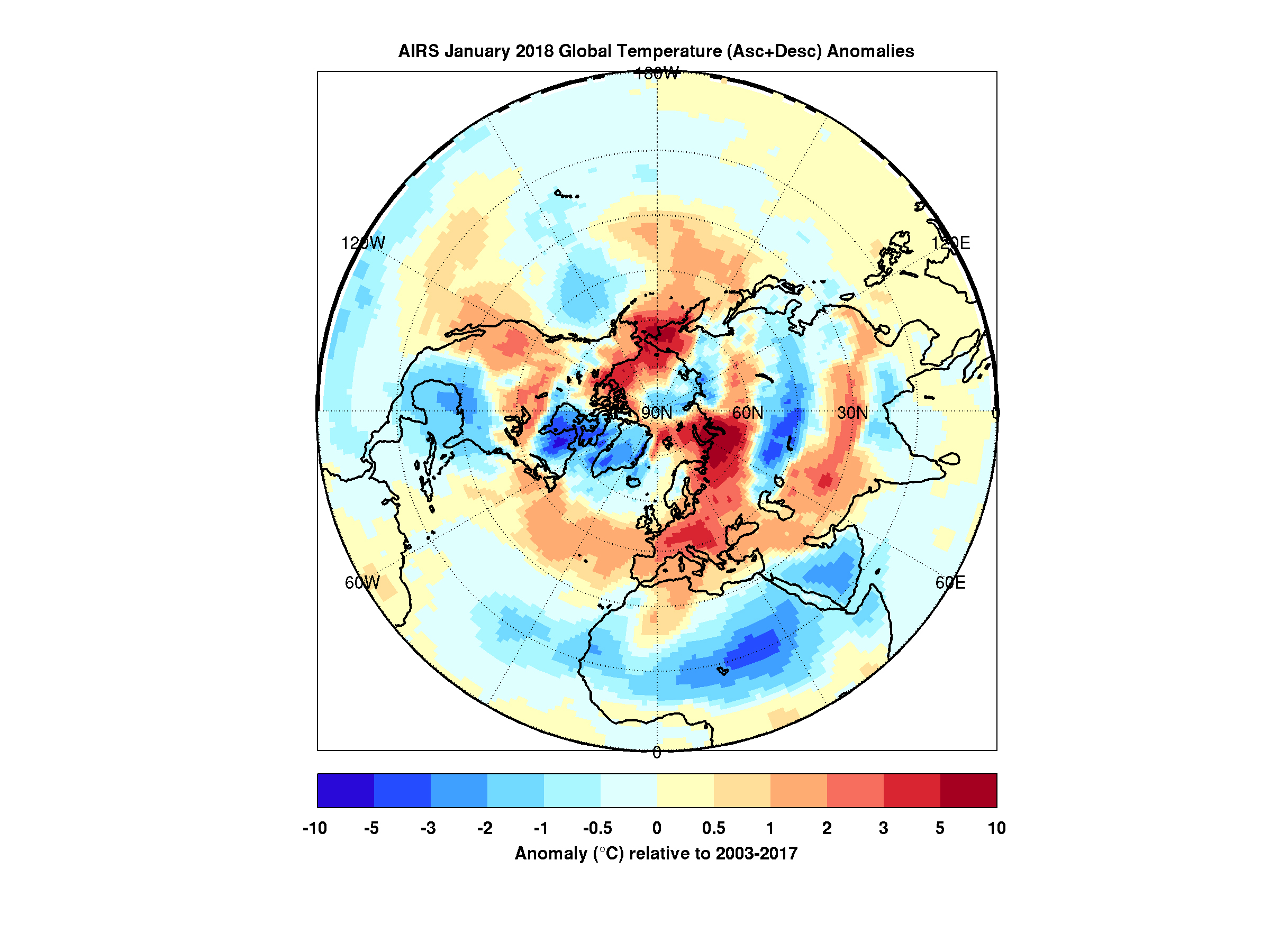
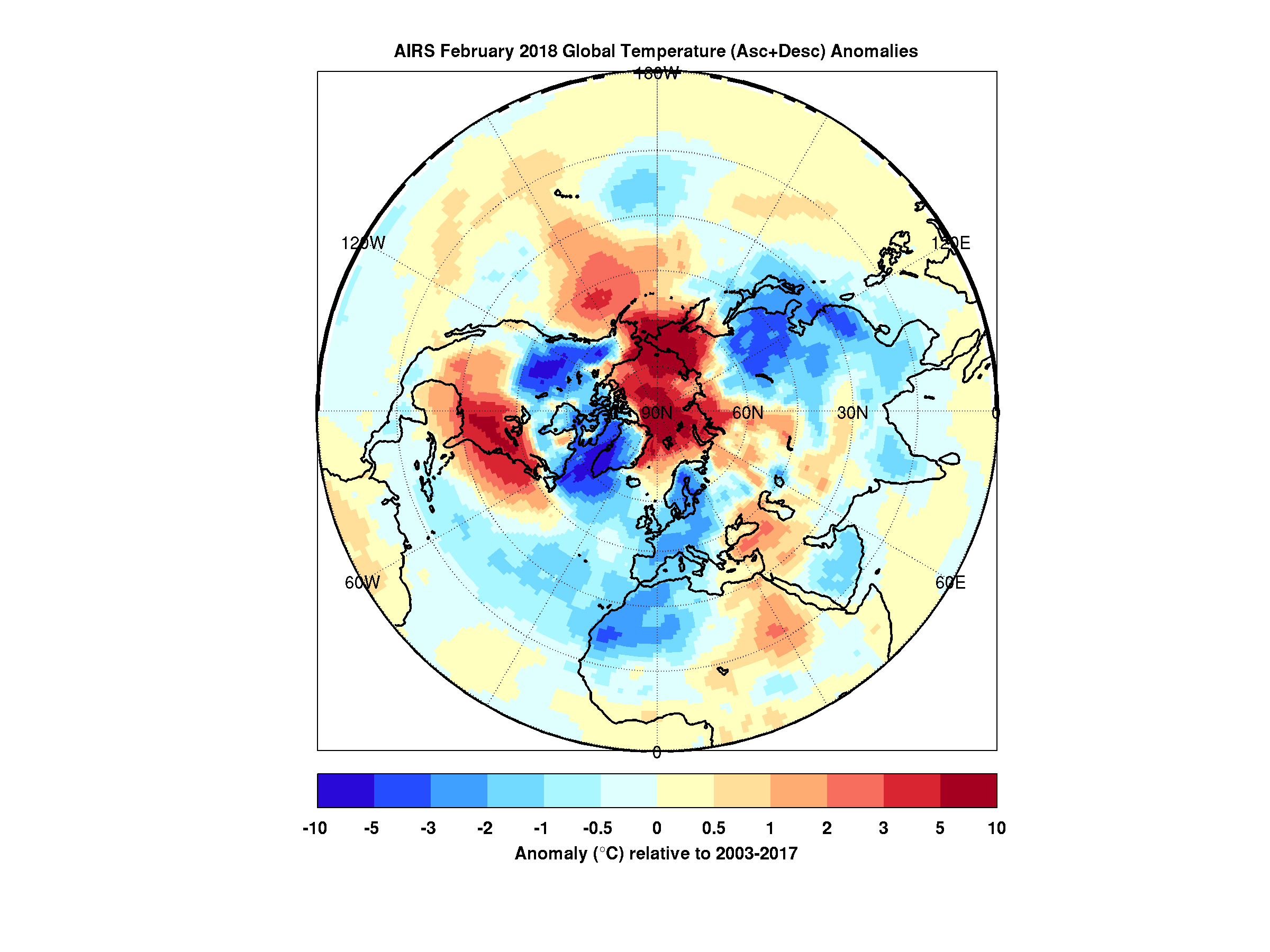
But there's a warm part to the story as well. While the eastern and southern United States were shivering in January the arctic was experiencing above average temperatures. In maps created with data by the Atmospheric Infrared Sounder (AIRS) on NASA's Aqua satellite, warmer-than-normal temperatures are colored in red and below average temperatures are colored in blue.
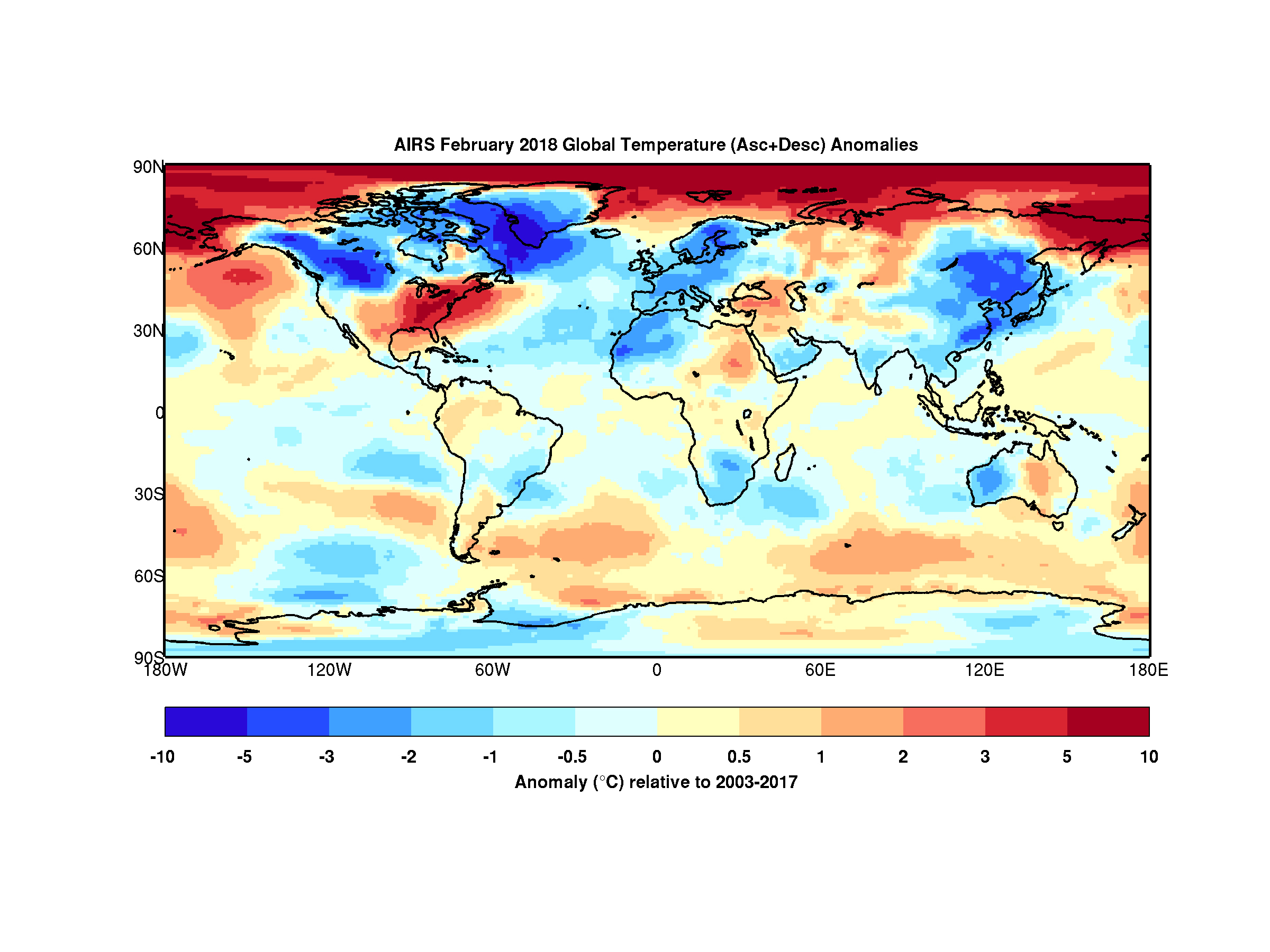
Provided in geographic and polar projections, the maps show regions of unusually cold air hovering over the eastern and southern U.S., eastern Canada and Greenland in January. February shows colder-than-normal air blanketing the northwest U.S., Canada, Western Europe, northwest Africa and East Asia. In both cases, the arctic remains exceptionally warm.
During most winters the polar vortex is like a giant counterclockwise whirlpool spinning around the north pole with cold air at its center. Occasionally the vortex splits and its parts move south, usually over the continents. At the same time, warm air from the south moves in to fill the gap, and that northward movement usually occurs over the oceans. The cold air movement gets the most attention because it typically affects many millions of people. However, that cooling is very often accompanied by warming somewhere over the Arctic -- an equally important part of the polar vortex story that usually goes unnoticed but is very apparent in the images shown here.

Figure 1
Click on image for larger version
High Resolution TIFF
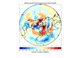
Figure 2
Click on image for larger version
High Resolution TIFF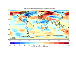
Figure 3
Click on image for larger version
High Resolution TIFF
About AIRS
The Atmospheric Infrared Sounder, AIRS, in conjunction with the Advanced Microwave Sounding Unit, AMSU, senses emitted infrared and microwave radiation from Earth to provide a three-dimensional look at Earth's weather and climate. Working in tandem, the two instruments make simultaneous observations all the way down to Earth's surface, even in the presence of heavy clouds. With more than 2,000 channels sensing different regions of the atmosphere, the system creates a global, three-dimensional map of atmospheric temperature and humidity, cloud amounts and heights, greenhouse gas concentrations, and many other atmospheric phenomena. Launched into Earth orbit in 2002, the AIRS and AMSU instruments fly onboard NASA's Aqua spacecraft and are managed by NASA's Jet Propulsion Laboratory in Pasadena, California, under contract to NASA. JPL is a division of the California Institute of Technology in Pasadena.
More information about AIRS can be found at https://airs.jpl.nasa.gov.
 Planetary Data System


