Your search criteria found 2311 images
Target is Earth
Go to PIAxxxxx:
Refine this list of images by:
Target:
Mission:
Spacecraft:
Instrument:
Click on an image for detailed information
Click on a column heading to sort in ascending or descending order
My
List
Addition DateSort Ascending Target Mission Instrument Size
Add Image to Favorite List 2004-03-11 Earth Mars Exploration Rover (MER)
Navigation Camera
Panoramic Camera
1194x1007x1
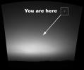
This is the first image ever taken of Earth from the surface of a planet beyond the Moon. It was taken by the Mars Exploration Rover Spirit one hour before sunrise on the 63rd martian day, or sol, of its mission.
PIA05547:
You are here: Earth as seen from Mars
Full Resolution:     TIFF (711 kB)     JPEG (55.18 kB)
Add Image to Favorite List 2004-03-04 Earth Shuttle Radar Topography Mission (SRTM)
C-Band Radar
X-Band Radar
250x380x3
The area known as the Afar Triangle is located at the northern end of the East Africa Rift, where it approaches the southeastern end of the Red Sea and the southwestern end of the Gulf of Aden as seen by NASA's Shuttle Radar Topography Mission.
PIA04953:
Nabro and Mallahle Volcanoes, Eritrea and Ethiopia, SRTM Colored Height and Shaded Relief
Full Resolution:     TIFF (285.5 kB)     JPEG (23.34 kB)
Add Image to Favorite List 2004-03-03 Earth Terra
MISR
3020x1941x3
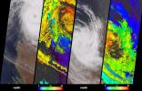
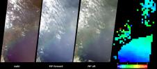
NASA's Terra spacecraft acquired these natural color images and cloud top height measurements for Monty before and after the storm made landfall over the remote Pilbara region of Western Australia, on February 29 and March 2, 2004.
PIA04353:
Tropical Cyclone Monty Strikes Western Australia
Full Resolution:     TIFF (9.508 MB)     JPEG (1.217 MB)
Add Image to Favorite List 2004-02-18 Earth Terra
MISR
2384x2675x3
After a 19 month rainfall deficiency, heavy rainfall during January 2004 brought drought relief to much of northern Queensland; these images were acquired by NASA's Terra spacecraft.
PIA04352:
Greener Pastures in Northern Queensland, Australia
Full Resolution:     TIFF (9.4 MB)     JPEG (1.25 MB)
Add Image to Favorite List 2004-02-13 Earth Landsat
Shuttle Radar Topography Mission (SRTM)
C-Band Interferometric Radar
4300x1212x3
This image from NASA's Landsat shows the Danube River flows east as it enters this west-looking scene (upper right) and forms the border between Slovakia and Hungary.
PIA04952:
Budapest, Hungary, Perspective View, SRTM Elevation Model with Landsat Overlay
Full Resolution:     TIFF (15.64 MB)     JPEG (1.094 MB)
Add Image to Favorite List 2004-02-04 Earth Terra
MISR
1352x1548x3
The Pampas of Argentina is shown in this MISR Mystery Quiz #17 captured by NASA's Terra spacecraft.
PIA04351:
Where on Earth...? MISR Mystery Image Quiz #17:
The Pampas of Argentina

Full Resolution:     TIFF (5.684 MB)     JPEG (378.5 kB)
Add Image to Favorite List 2004-01-30 Earth Jason-1
Altimeter
640x640x3
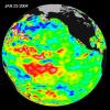
The image from NASA's Jason satellite show that the equatorial Pacific sea surface levels are higher, indicating warmer sea surface temperatures in the central and west Pacific Ocean on Jan. 23, 2004.
PIA05071:
Pacific Dictates Droughts and Drenchings
Full Resolution:     TIFF (904.6 kB)     JPEG (59.93 kB)
Add Image to Favorite List 2004-01-22 Earth Shuttle Radar Topography Mission (SRTM)
C-Band Radar
X-Band Radar
3020x1700x3
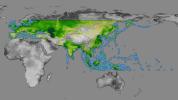
The colored regions of this map show the extent of digital elevation data released by NASA's Shuttle Radar Topography Mission (SRTM). This release includes data for most of Europe and Asia plus numerous islands in the Indian and Pacific Oceans.
PIA03398:
SRTM Data Release for Eurasia, Index Map and Colored Height
Full Resolution:     TIFF (4.646 MB)     JPEG (509.4 kB)
Add Image to Favorite List 2004-01-22 Earth Shuttle Radar Topography Mission (SRTM)
C-Band Radar
X-Band Radar
1876x423x3
This perspective view shows Mount Ararat in easternmost Turkey, which has been the site of several searches for the remains of Noah's Ark as seen by NASA's Shuttle Radar Topography Mission.
PIA03399:
Mount Ararat, Turkey, Perspective with Landsat Image Overlay
Full Resolution:     TIFF (1.243 MB)     JPEG (128.5 kB)
Add Image to Favorite List 2004-01-22 Earth Shuttle Radar Topography Mission (SRTM)
C-Band Radar
X-Band Radar
1669x1217x3
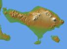
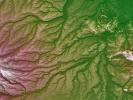
The volcanic nature of the island of Bali is evident in this shaded relief image generated with data from NASA's Shuttle Radar Topography Mission.
PIA04950:
Bali, Shaded Relief and Colored Height
Full Resolution:     TIFF (2.888 MB)     JPEG (213.7 kB)
Add Image to Favorite List 2004-01-22 Earth Shuttle Radar Topography Mission (SRTM)
C-Band Radar
X-Band Radar
1400x704x3
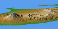
This perspective view shows the major volcanic group of Bali, one 13,000 islands comprising the nation of Indonesia as seen by NASA's Shuttle Radar Topography Mission.
PIA04951:
Mts. Agung and Batur, Bali, Shaded Relief and Colored Height
Full Resolution:     TIFF (1.996 MB)     JPEG (108.6 kB)
Add Image to Favorite List 2004-01-21 Earth Terra
MISR
2574x2766x3
NASA's Terra spacecraft saw a pall of smoke and dust largely obscured the nations of Cote d'Ivoire, Ghana, Burkina Faso and southern Mali on January 12, 2004.
PIA04350:
Hazy and Dusty Skies over Western Africa
Full Resolution:     TIFF (13.18 MB)     JPEG (658.8 kB)
Add Image to Favorite List 2004-01-07 Earth Terra
MISR
1374x889x3
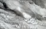
In this natural-color image from NASA's Terra spacecraft, a fingerprint-like gravity wave feature occurs over a deck of marine stratocumulus clouds.
PIA04349:
Gravity Waves Ripple over Marine Stratocumulus Clouds
Full Resolution:     TIFF (3.482 MB)     JPEG (191.8 kB)
Add Image to Favorite List 2003-12-23 Earth Terra
MISR
924x764x3
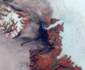
Vibrant reds, emerald greens, brilliant whites, and pastel blues adorn this view of the area surrounding the Jakobshavn Glacier on the western coast of Greenland captured by NASA's Terra spacecraft on June 18, 2003.
PIA05070:
Greenland's Coast in Holiday Colors
Full Resolution:     TIFF (2.121 MB)     JPEG (118.1 kB)
Add Image to Favorite List 2003-12-10 Earth Terra
MISR
1062x860x3
This anaglyph from the MISR instrument aboard NASA's Terra spacecraft shows Santa Ana winds swept large amounts of dust and ash across the skies of San Diego and over the Pacific Ocean. 3D glasses are necessary to view this image.
PIA04348:
Airborne Dust and Ash over Southern California
Full Resolution:     TIFF (2.744 MB)     JPEG (148.8 kB)
Add Image to Favorite List 2003-12-04 Earth Terra
MISR
2895x3200x3
Within that narrow window during a solar eclipse where one on Earth can watch the Moon's shadow obscure more than 90% of the Sun, NASA's Terra spacecraft captured these views of the Antarctic surface during the total solar eclipse of November 23, 2003.
PIA04347:
Capturing the Motion of an Eclipse Shadow
Full Resolution:     TIFF (15.8 MB)     JPEG (452.3 kB)
Add Image to Favorite List 2003-11-26 Earth Terra
MISR
877x1185x3
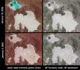
Brush fires consumed nearly 750,000 acres across Southern California between October 21 and November 18, 2003. Burn scars and vegetation changes wrought by the fires are illustrated in these false-color images from NASA's Terra spacecraft.
PIA04346:
Burn Scars Across Southern California
Full Resolution:     TIFF (3.121 MB)     JPEG (253.8 kB)
Add Image to Favorite List 2003-11-19 Earth Terra
ASTER
4038x3056x3
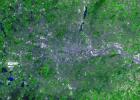
On November 18, 2003, NASA's Terra satellite acquired this image of the Old Fire/Grand Prix fire east of Los Angeles.
PIA04879:
Old Fire/Grand Prix Fire, California
Full Resolution:     TIFF (37.02 MB)     JPEG (3.971 MB)
Add Image to Favorite List 2003-11-19 Earth Terra
MISR
1200x1128x3
Maldives in the Indian Ocean and Tuamotu, French Polynesia is shown in this MISR Mystery Quiz #16 captured by NASA's Terra spacecraft.
PIA04345:
Where on Earth...? MISR Mystery Image Quiz 16:
Maldives in the Indian Ocean and Tuamotu, French Polynesia

Full Resolution:     TIFF (4.066 MB)     JPEG (207 kB)
Add Image to Favorite List 2003-11-18 Earth Jason-1
Altimeter
900x900x3
This image from NASA's Jason-1 is a global map of sea surface height of the equatorial Pacific Ocean. The image represents data collected and composited over a 10-day period, ending on Nov. 3, 2003.
PIA04878:
A Mostly Quiet Pacific
Full Resolution:     TIFF (1.523 MB)     JPEG (113.4 kB)
Add Image to Favorite List 2003-11-12 Earth Terra
MISR
945x805x3
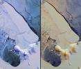
NASA's Terra spacecraft imaged Iceberg B-15A, the largest iceberg in the world (measuring about 11,000 square kilometers) when it broke away from Western Antarctica's Ross Ice Shelf in March 2000.
PIA04344:
Breakup of the World's Largest Iceberg
Full Resolution:     TIFF (2.286 MB)     JPEG (151 kB)
Add Image to Favorite List 2003-10-29 Earth Terra
MISR
2464x2300x3
Large plumes of smoke rising from devastating wildfires burning near Los Angeles and San Diego on Sunday, October 26, 2003, are highlighted in this set of images from NASA's Terra spacecraft.
PIA04343:
Wildfires Rage in Southern California
Full Resolution:     TIFF (9.506 MB)     JPEG (846.2 kB)
Add Image to Favorite List 2003-10-24 Earth Shuttle Radar Topography Mission (SRTM)
C-Band Interferometric Radar
X-Band Radar
1528x917x3
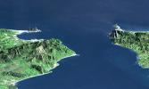
This perspective view shows the Strait of Gibraltar, which is the entrance to the Mediterranean Sea from the Atlantic Ocean. Europe (Spain) is on the left. Africa (Morocco) is on the right. The Rock of Gibraltar is the peninsula in the back left.
PIA03397:
Strait of Gibraltar, Perspective with Landsat Image Overlay
Full Resolution:     TIFF (3.227 MB)     JPEG (185.6 kB)
Add Image to Favorite List 2003-10-22 Earth Terra
MISR
1539x2131x3
Austral winter and spring in Queensland's Brigalow Belt as seen by NASA's Terra spacecraft.
PIA04342:
Austral Winter and Spring in Queensland's Brigalow Belt
Full Resolution:     TIFF (9.856 MB)     JPEG (730.1 kB)
Add Image to Favorite List 2003-10-08 Earth Terra
MISR
1270x1468x3
During the 2003 fire season, blazes in the taiga forests of Eastern Siberia were part of a vast network of fires across Siberia and the Russian Far East, northeast China and northern Mongolia seen here by NASA's Terra spacecraft.
PIA04341:
Smoke from Siberian Taiga Fires
Full Resolution:     TIFF (3.225 MB)     JPEG (357.2 kB)
Add Image to Favorite List 2003-09-24 Earth Terra
MISR
1291x1683x3
Kamchatka Peninsula, Russia is shown in this MISR Mystery Quiz #15 captured by NASA's Terra spacecraft.
PIA04340:
Where on Earth...? MISR Mystery Image Quiz #15: Kamchatka Peninsula, Russia
Full Resolution:     TIFF (6.525 MB)     JPEG (394.6 kB)
Add Image to Favorite List 2003-09-20 Earth Aqua
AIRS
500x500x3
a Category 5 storm.
PIA00430:
Hurricane Isabel, Amount of Atmospheric Water Vapor Observed By AIRS
Full Resolution:     TIFF (482.7 kB)     JPEG (37.55 kB)
Add Image to Favorite List 2003-09-20 Earth Aqua
AIRS
Scatterometer (SeaWinds)
500x500x3
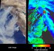
These two images show Hurricane Isabel as viewed by AIRS and SeaWinds scatterometers on NASA's ADEOS-2 and QuikScat satellites in September, 2003.
PIA00429:
Hurricane Isabel, AIRS Infrared and SeaWinds Scatterometer Data Combined
Full Resolution:     TIFF (252 kB)     JPEG (521 kB)
Add Image to Favorite List 2003-09-18 Earth Terra
MISR
1011x1115x3
Cloud-top radiance and height characteristics of Hurricane Isabel are depicted in these data products and animations from NASA's Terra spacecraft on September 7, 2003.
PIA04339:
Aspects of Hurricane Isabel
Full Resolution:     TIFF (3.386 MB)     JPEG (348.3 kB)
Add Image to Favorite List 2003-09-18 Earth Aqua
AIRS
489x471x3
This false-color image shows Hurricane Isabel viewed by the AIRS and AMSU-A instruments at 1:30 EDT in the morning of Thursday September 18, 2003.
PIA00428:
Hurricane Isabel
Full Resolution:     TIFF (393.3 kB)     JPEG (50.8 kB)
Add Image to Favorite List 2003-09-10 Earth Terra
MISR
1280x866x3
The extent, height, and amount of smoke originating from the B&B Complex Fires in central Oregon are captured in these September 4, 2003 views from NASA's Terra spacecraft.
PIA04338:
Smoke Plumes from the B&B Complex Fires, Oregon
Full Resolution:     TIFF (2.02 MB)     JPEG (215.1 kB)
Add Image to Favorite List 2003-08-21 Earth Shuttle Radar Topography Mission (SRTM)
C-Band Interferometric Radar
14850x8000x3
These images of the world were generated with data from the Shuttle Radar Topography Mission (SRTM). Two visualization methods were combined to produce the image: shading and color coding of topographic height.
PIA03394:
World Globes, Shaded Relief and Colored Height
Full Resolution:     TIFF (109.4 MB)     JPEG (35.2 MB)
Add Image to Favorite List 2003-08-21 Earth Shuttle Radar Topography Mission (SRTM)
C-Band Interferometric Radar
21600x9049x3
This image of the world was generated with data from NASA's Shuttle Radar Topography Mission.
PIA03395:
World in Mercator Projection, Shaded Relief and Colored Height
Full Resolution:     TIFF (127.8 MB)     JPEG (17.15 MB)
Add Image to Favorite List 2003-08-21 Earth Shuttle Radar Topography Mission (SRTM)
C-Band Interferometric Radar
1900x1070x3
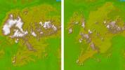
These two images show the area in South America, the Guiana Highlands straddling the borders of Venezuela, Guyana and Brazil as seen by NASA's Shuttle Radar Topography Mission.
PIA03396:
Guiana Highlands, Shaded Relief and Colored Height
Full Resolution:     TIFF (5.185 MB)     JPEG (269.5 kB)
Add Image to Favorite List 2003-08-13 Earth Terra
MISR
1798x920x3
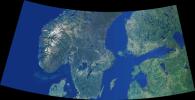
Data from NASA's Terra spacecraft were combined to create this cloud-free natural-color mosaic of Scandinavia and the Baltic region.
PIA04337:
Scandinavia and the Baltic Region
Full Resolution:     TIFF (2.677 MB)     JPEG (234.7 kB)
Add Image to Favorite List 2003-07-25 Earth Shuttle Radar Topography Mission (SRTM)
C-Band Interferometric Radar
8688x8296x3
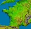
This image of France was generated with data from NASA's Shuttle Radar Topography Mission.
PIA03393:
France, Shaded Relief and Colored Height
Full Resolution:     TIFF (134.9 MB)     JPEG (22.27 MB)
Add Image to Favorite List 2003-07-21 Earth GRACE
K-Band Ranging System
2037x1645x3
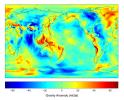
Gravity is the force that is responsible for the weight of an object and is determined by how the material that makes up the Earth is distributed throughout the Earth. Data is from NASA's Grace satellite.
PIA04652:
New Views of Earth's Gravity Field from GRACE
Full Resolution:     TIFF (6.062 MB)     JPEG (295.6 kB)
Add Image to Favorite List 2003-07-16 Earth Terra
MISR
1174x970x3
Strong synoptic winds disperse pollutants over the skies of Greece and the Aegean Sea during winter months as sen in this image from NASA's Terra spacecraft captured in 2002.
PIA04336:
Summer Aerosols over Greece
Full Resolution:     TIFF (1.67 MB)     JPEG (123 kB)
Add Image to Favorite List 2003-07-14 Earth Jason-1
Altimeter
900x900x3
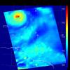
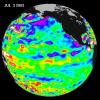
NASA's Jason oceanography satellite took a 10-day data collection in 2003, indicating that near-equatorial ocean had been very quiet, although sea levels and sea-surface temperatures were near normal or slightly warmer.
PIA04622:
Where is La Niņa?
Full Resolution:     TIFF (1.557 MB)     JPEG (123.3 kB)
Add Image to Favorite List 2003-07-03 Earth Landsat
Shuttle Radar Topography Mission (SRTM)
C-Band Interferometric Radar
2805x1705x3
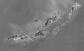
St. Thomas, St. John, Tortola, and Virgin Gorda are the four main islands (lower left to upper right) of this map-view anaglyph of the U.S. Virgin Islands and British Virgin Islands from NASA's Shuttle Radar Topography Mission. 3D glasses are necessary.
PIA03392:
Anaglyph with Landsat Virgin Islands, Caribbean
Full Resolution:     TIFF (7.529 MB)     JPEG (737 kB)
Add Image to Favorite List 2003-07-03 Earth Landsat
Shuttle Radar Topography Mission (SRTM)
C-Band Interferometric Radar
1025x577x3
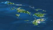
St. Thomas, St. John, Tortola, and Virgin Gorda are the four main islands in this view of the U.S. Virgin Islands and British Virgin Islands, along the perimeter of the Caribbean Sea. This image is from NASA's Shuttle Radar Topography Mission.
PIA03391:
SRTM Perspective with Landsat Virgin Islands, Caribbean
Full Resolution:     TIFF (1.777 MB)     JPEG (89.61 kB)
Add Image to Favorite List 2003-07-01 Earth Terra
ASTER
2748x3156x3
On June 26, NASA's Terra satellite acquired this image of the Aspen fire burning out of control north of Tucson, AZ.
PIA04602:
Aspen Fire, Arizona
Full Resolution:     TIFF (26.02 MB)     JPEG (2.055 MB)
Add Image to Favorite List 2003-06-25 Earth Terra
MISR
1438x620x3
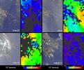
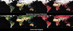
These images from NASA's Terra spacecraft provide global, seasonal summaries of a quantity called the Directional Hemispherical Reflectance (DHR), also sometimes referred to as the 'black-sky' albedo.
PIA04335:
Global and Seasonal Surface Albedos from MISR
Full Resolution:     TIFF (1.217 MB)     JPEG (140.9 kB)
Add Image to Favorite List 2003-06-19 Earth Shuttle Radar Topography Mission (SRTM)
C-Band Interferometric Radar
960x725x3
Pando Province, Bolivia, and adjacent parts of Brazil and Peru are seen in this visualization of NASA's Shuttle Radar Topography Mission elevation data covering part of the Amazon Basin.
PIA03390:
Pando Province, Northern Bolivia, Shaded Relief and Colored Height
Full Resolution:     TIFF (2.091 MB)     JPEG (172.2 kB)
Add Image to Favorite List 2003-06-19 Earth Shuttle Radar Topography Mission (SRTM)
C-Band Interferometric Radar
7200x10886x3
This anaglyph, from NASA's Shuttle Radar Topography Mission, in South America is dominated by the Andes Mountains, which extend all along the Pacific Coast. 3D glasses are necessary to view this image.
PIA03389:
Anaglyph, South America
Full Resolution:     TIFF (50.13 MB)     JPEG (6.633 MB)
Add Image to Favorite List 2003-06-19 Earth Shuttle Radar Topography Mission (SRTM)
C-Band Interferometric Radar
7200x10886x3
This image of South America was generated with data from NASA's Shuttle Radar Topography Mission.
PIA03388:
South America, Shaded Relief and Colored Height
Full Resolution:     TIFF (69.52 MB)     JPEG (8.202 MB)
Add Image to Favorite List 2003-06-11 Earth Terra
MISR
1797x2300x3
During Spring 2003, students, teachers, and scientists worked side-by-side, measuring the properties of aerosols (fine particulate matter suspended in the air) over Baltimore, Maryland using hand-held instruments shown here by NASA's Terra spacecraft.
PIA04334:
Students and NASA Study Aerosols over Baltimore
Full Resolution:     TIFF (7.608 MB)     JPEG (720 kB)
Add Image to Favorite List 2003-06-04 Earth Terra
MISR
1466x896x3
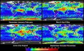
Global summaries of aerosol optical thickness from NASA's Terra spacecraft.
PIA04333:
Global and Seasonal Aerosol Distributions from MISR
Full Resolution:     TIFF (3.079 MB)     JPEG (530.4 kB)
Add Image to Favorite List 2003-06-03 Earth Terra
MISR
400x309x3
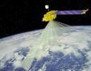
This artist concept is of NASA's MISR spacecraft which views the sunlit Earth simultaneously at nine widely spaced angles.
PIA04498:
Artist's Concept of Terra Satellite with MISR Onboard
Full Resolution:     TIFF (297 kB)     JPEG (22.06 kB)
Add Image to Favorite List 2003-06-02 Earth Aqua
AIRS
1437x921x3
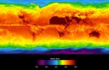
This image shows average temperatures in April, 2003, observed by AIRS at an infrared wavelength that senses either the Earth's surface or any intervening cloud.
PIA00427:
Global Average Brightness Temperature for April 2003
Full Resolution:     TIFF (2.867 MB)     JPEG (158.1 kB)
Add Image to Favorite List 2003-05-28 Mars Mars Global Surveyor (MGS)
Mars Orbiter Camera (MOC)
388x583x3
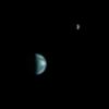
Taken on May 22, 2003, this image from NASA's Mars Global Surveyor is the first image of Earth ever taken from another planet that actually shows our home as a planetary disk when Jupiter, Earth, and the Moon aligned.
PIA04529:
Earth, Moon, and Jupiter, as seen from Mars
Full Resolution:     TIFF (102 kB)     JPEG (8.933 kB)
Add Image to Favorite List 2003-05-28 Earth Terra
MISR
1078x1282x3
Anatahan Island is shown in this MISR Mystery Quiz #14 captured by NASA's Terra spacecraft.
PIA04332:
Where on Earth...? MISR Mystery Image Quiz #14:
Anatahan Island

Full Resolution:     TIFF (3.775 MB)     JPEG (186.6 kB)
Add Image to Favorite List 2003-05-22 Earth Mars Global Surveyor (MGS)
Mars Orbiter Camera (MOC)
961x961x3
This is the first image of Earth ever taken from another planet that actually shows our home as a planetary disk. This image is from NASA's Mars Global Surveyor.
PIA04531:
Earth and Moon as viewed from Mars
Full Resolution:     TIFF (197.6 kB)     JPEG (17.52 kB)
Add Image to Favorite List 2003-05-22 Earth Mars Global Surveyor (MGS)
Mars Orbiter Camera (MOC)
1068x3151x3
What does Earth look like when viewed from Mars? At 13:00 GMT on 8 May 2003, NASA's Mars Global Surveyor (MGS) Mars Orbiter Camera (MOC) captured this tiny image of Mars from 86 million miles away.
PIA04530:
Earth and Jupiter as viewed from Mars
Full Resolution:     TIFF (325.7 kB)     JPEG (53.78 kB)
Add Image to Favorite List 2003-05-21 Earth Terra
MISR
794x858x3
Several oil slicks occurred on Lake Maracaibo in northwestern Venezuela between December 2002 and January 2003, and were observed by NASA's Terra spacecraft on December 26, 2002.
PIA04331:
Oil Slicks on Lake Maracaibo, Venezuela
Full Resolution:     TIFF (1.895 MB)     JPEG (115.7 kB)
Add Image to Favorite List 2003-05-15 Earth Terra
MISR
2400x2400x3
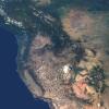
This natural-color image from NASA's Terra spacecraft captures the beauty of the western United States and Canada.
PIA04330:
Western United States and Southwestern Canada
Full Resolution:     TIFF (14.96 MB)     JPEG (980 kB)
Add Image to Favorite List 2003-05-07 Earth Terra
MISR
2476x2291x3
The complex structure and beauty of polar clouds are highlighted by these images acquired by NASA's Terra spacecraft on April 23, 2003. These clouds occur at multiple altitudes and exhibit a noticeable cyclonic circulation over the Southern Indian Ocean,
PIA04329:
Multi-layer Clouds Over the South Indian Ocean
Full Resolution:     TIFF (17.04 MB)     JPEG (975 kB)
Add Image to Favorite List 2003-05-01 Earth Landsat
Shuttle Radar Topography Mission (SRTM)
C-Band Interferometric Radar
Thematic Mapper
3262x3162x3
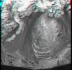
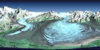
This anaglyph, from NASA's Shuttle Radar Topography Mission, is of Malaspina Glacier in southeastern Alaska. 3D glasses are necessary to view this image.
PIA03387:
Malaspina Glacier, Alaska, Anaglyph with Landsat Overlay
Full Resolution:     TIFF (26.8 MB)     JPEG (2.079 MB)
Add Image to Favorite List 2003-05-01 Earth Landsat
Shuttle Radar Topography Mission (SRTM)
C-Band Interferometric Radar
Thematic Mapper
3162x1581x3
Malaspina Glacier in southeastern Alaska is considered the classic example of a piedmont glacier. Piedmont glaciers occur where valley glaciers exit a mountain range onto broad lowlands, are no longer laterally confined, and spread to become wide lobes.
PIA03386:
Malaspina Glacier, Alaska
Full Resolution:     TIFF (12.59 MB)     JPEG (950.8 kB)
Add Image to Favorite List 2003-04-30 Earth Terra
MISR
2156x3424x3
The height and motion of the ash and gas plume from the April 22, 2003, eruption of the Chikurachki volcano is portrayed in these views NASA's Terra spacecraft.
PIA04328:
Height and Motion of the Chikurachki Eruption Plume
Full Resolution:     TIFF (9.229 MB)     JPEG (473.8 kB)
Add Image to Favorite List 2003-04-23 Earth Terra
MISR
1314x1756x3
During the first two weeks of April, 2003, numerous fires occurred in eastern Russia and northeast China, and produced a large amount of smoke that rose to form a thick layer of tiny atmospheric particles, or aerosols seen here by NASA's Terra spacecraft.
PIA04276:
Smoke from Asian Fires Traverses the Pacific
Full Resolution:     TIFF (2.465 MB)     JPEG (234.7 kB)
Add Image to Favorite List 2003-04-11 Earth Terra
ASTER
3782x2037x3
An Earth-monitoring instrument aboard NASA's Terra satellite kept a close eye on a potential glacial disaster in the making in Peru's spectacular, snow-capped Cordillera Blanca (White Mountains), the highest range of the Peruvian Andes.
PIA03899:
NASA Keeps Watch on a Potential Disaster in the Icy Andes
Full Resolution:     TIFF (23.11 MB)     JPEG (1.499 MB)
Add Image to Favorite List 2003-04-09 Earth Terra
MISR
1362x1824x3
Dark smoke from oil fires extend for about 60 kilometers south of Iraq's capital city of Baghdad in this anaglyph acquired by the MISR instrument aboard NASA's Terra spacecraft on April 2, 2003. 3D glasses are necessary to view this image.
PIA04326:
Oil Fire Plumes Over Baghdad
Full Resolution:     TIFF (7.24 MB)     JPEG (331.6 kB)
Add Image to Favorite List 2003-04-02 Earth Terra
MISR
2366x1722x3
During the last weeks of March 2003, unusually high and widespread aerosol pollution was detected over Europe by several satellite-borne instruments aboard NASA's Terra satellite.
PIA04325:
Aerosols over Central and Eastern Europe
Full Resolution:     TIFF (7.249 MB)     JPEG (538.7 kB)
Add Image to Favorite List 2003-04-02 Earth Terra
ASTER
2115x2139x3
This image acquired by NASA's Terra spacecraft on November 5, 2001, shows a chunk of glacier was threatening to fall into an Andean lake and cause major flooding in Huraez, a Peruvian city of 60,000.
PIA03898:
Huaraz, Peru
Full Resolution:     TIFF (13.59 MB)     JPEG (963.6 kB)
Add Image to Favorite List 2003-03-27 Earth Shuttle Radar Topography Mission (SRTM)
C-Band Interferometric Radar
1573x2401x3
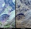
Manicouagan Crater is one of the world's largest and oldest known impact craters and perhaps the one most readily apparent to astronauts in orbit. This anaglyph is from the instrument onboard NASA's Shuttle Radar Topography Mission. 3D glasses needed.
PIA03385:
Anaglyph, Manicouagan Crater, Quebec, Canada
Full Resolution:     TIFF (9.691 MB)     JPEG (826 kB)
Add Image to Favorite List 2003-03-27 Earth Shuttle Radar Topography Mission (SRTM)
C-Band Interferometric Radar
3200x3400x3
NASA's Shuttle Radar Topography Mission shows Manicouagan Crater, one of the world's largest and oldest known impact craters and perhaps the one most readily apparent to astronauts in orbit.
PIA03384:
Stereo Pair, with Topographic Height as Color, Manicouagan Crater, Quebec, Canada
Full Resolution:     TIFF (23.78 MB)     JPEG (2.177 MB)
Add Image to Favorite List 2003-03-26 Earth Terra
MISR
1344x2219x3
This anaglyph from the MISR instrument aboard NASA's Terra spacecraft portrays the Little Aral and the eastern Large Aral at the onset of winter. 3D glasses are necessary to view this image.
PIA04324:
Windswept Shores of the Aral Sea
Full Resolution:     TIFF (8.956 MB)     JPEG (470.1 kB)
Add Image to Favorite List 2003-03-25 Earth Airborne Synthetic Aperture Radar (AIRSAR)
AirSAR
783x1192x3
This sequence of three images in northern Colorado, taken by NASA's Airborne Synthetic Aperture Radar in 2002, shows Fraser, Colorado, before snowfall, the morning after snow, and after the snow melted.
PIA04266:
Fraser, Colorado
Full Resolution:     TIFF (2.803 MB)     JPEG (339 kB)
Add Image to Favorite List 2003-03-19 Earth Terra
MISR
1060x1344x3
Acquired by the Multi-angle Imaging SpectroRadiometer instrument aboard NASA's Terra spacecraft, this image is from the MISR Where on Earth...? Mystery Quiz #13. The location is Western Uzbekistan and Northeastern Turkmenistan
PIA04323:
Where on Earth...? MISR Mystery Image Quiz #13: Western Uzbekistan and Northeastern Turkmenistan
Full Resolution:     TIFF (4.28 MB)     JPEG (247.6 kB)
Add Image to Favorite List 2003-03-13 Earth Shuttle Radar Topography Mission (SRTM)
C-Band Interferometric Radar
628x801x3
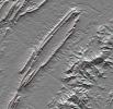
Shenandoah National Park lies astride part of the Blue Ridge Mountains, which form the southeastern range of the greater Appalachian Mountains in Virginia as seen by NASA's Shuttle Radar Topography Mission.
PIA03383:
Shenandoah National Park, Virginia, Shaded Relief with Height as Color
Full Resolution:     TIFF (1.511 MB)     JPEG (152.9 kB)
Add Image to Favorite List 2003-03-13 Earth Shuttle Radar Topography Mission (SRTM)
C-Band Interferometric Radar
1587x1536x3
This anaglyph, from NASA's Shuttle Radar Topography Mission, is of Massanutten Mountain in the Shenandoah Valley of northern Virginia. 3D glasses are necessary to view this image.
PIA03382:
Massanutten Mountain, Virginia, USA (Anaglyph)
Full Resolution:     TIFF (6.914 MB)     JPEG (527.2 kB)
Add Image to Favorite List 2003-03-12 Earth Terra
MISR
1134x1885x3
On March 2, 2003, NASA's Terra spacecraft saw near-surface winds carrying a large amount of Saharan dust aloft and transported the material westward over the Atlantic Ocean.
PIA04322:
Casting Light and Shadows on a Saharan Dust Storm
Full Resolution:     TIFF (3.043 MB)     JPEG (250.3 kB)
Add Image to Favorite List 2003-03-11 Earth Aqua
AIRS
1003x946x3
Visible image of a California storm in March, 2003, as seen by the Atmospheric Infrared Sounder (AIRS) on NASA's Aqua satellite.
PIA00402:
Viewing a California Storm
Full Resolution:     TIFF (1.767 MB)     JPEG (140.5 kB)
Add Image to Favorite List 2003-03-06 Earth Shuttle Radar Topography Mission (SRTM)
C-Band Interferometric Radar
3010x3416x3
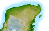
The top picture is a shaded relief image of the northwest corner of Mexico's Yucatan Peninsula generated from NASA's Shuttle Radar Topography Mission data, and shows a subtle, but unmistakable, indication of the Chicxulub impact crater.
PIA03381:
Shaded Relief with Height as Color and Landsat, Yucatan Peninsula, Mexico
Full Resolution:     TIFF (30.85 MB)     JPEG (2.545 MB)
Add Image to Favorite List 2003-03-06 Earth Shuttle Radar Topography Mission (SRTM)
C-Band Interferometric Radar
1600x1080x3
This anaglyph of Mexico's Yucatan Peninsula was generated from NASA's Shuttle Radar Topography Mission data, and shows a subtle but distinctive indication of the Chicxulub impact crater. 3D glasses are necessary to view this image.
PIA03380:
Anaglyph, Yucatan Peninsula, Mexico
Full Resolution:     TIFF (2.651 MB)     JPEG (362 kB)
Add Image to Favorite List 2003-03-06 Earth Shuttle Radar Topography Mission (SRTM)
C-Band Interferometric Radar
18001x11438x3
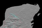
This shaded relief image of Mexico's Yucatan Peninsula show a subtle, but unmistakable, indication of the Chicxulub impact crater as seen by NASA's Shuttle Radar Topography Mission.
PIA03379:
Shaded Relief with Height as Color, Yucatan Peninsula, Mexico
Full Resolution:     TIFF (395.4 MB)     JPEG (50.01 MB)
Add Image to Favorite List 2003-03-06 Earth Shuttle Radar Topography Mission (SRTM)
C-Band Interferometric Radar
9600x7240x3
This anaglyph, from NASA's Shuttle Radar Topography Mission, is of the Iturralde Structure, Bolivia, a possible impact crater. 3D glasses are necessary to view this image.
PIA03378:
Anaglyph, North America
Full Resolution:     TIFF (94.73 MB)     JPEG (9.055 MB)
Add Image to Favorite List 2003-03-06 Earth Shuttle Radar Topography Mission (SRTM)
C-Band Interferometric Radar
9600x7240x3
This image of North America was generated with data from NASA's Shuttle Radar Topography Mission.
PIA03377:
Shaded Relief with Height as Color, North America
Full Resolution:     TIFF (130.7 MB)     JPEG (56.09 MB)
Add Image to Favorite List 2003-03-05 Earth Terra
MISR
1521x1041x3
More than 2 million acres were consumed by hundreds of fires between December 2002 and February 2003 in southeastern Australia's national parks, forests, foothills and city suburbs as seen by NASA's Terra spacecraft.
PIA04321:
Drought and Burn Scars in Southeastern Australia
Full Resolution:     TIFF (4.759 MB)     JPEG (334.3 kB)
Add Image to Favorite List 2003-02-26 Earth Terra
MISR
691x1200x3
Brightness variations in the terrain along a portion of southwestern Africa are displayed in these views from NASA's Terra spacecraft.
PIA04320:
Seasonal Surface Changes in Namibia and Central Angola
Full Resolution:     TIFF (2.107 MB)     JPEG (111.5 kB)
Add Image to Favorite List 2003-02-24 Earth SeaWinds
SeaWinds Scatterometer
3956x1978x3
One of NASA's Earth-observing instruments, the SeaWinds scatterometer aboard Japan's Advanced Earth Observing Satellite (Adeos) 2--now renamed Midori 2--has successfully transmitted its first radar data to our home planet.
PIA03896:
NASA's Newest SeaWinds Instrument Breezes Into Operation
Full Resolution:     TIFF (9.364 MB)     JPEG (1.724 MB)
Add Image to Favorite List 2003-02-19 Earth Terra
MISR
1218x1896x3
These views from NASA's Terra spacecraft portray the Lutzow-Holm Bay region of Queen Maud Land, East Antarctica, on September 5, 2002.
PIA04319:
Lutzow-Holm Bay and the Shirase Glacier, Antarctica
Full Resolution:     TIFF (6.023 MB)     JPEG (290.1 kB)
Add Image to Favorite List 2003-02-12 Earth Terra
MISR
2070x2288x3
These images and data products from NASA's Terra spacecraft documented extensive smoke from fires burning throughout Nigeria and north central Africa on January 31, 2003.
PIA03897:
Smoke over Nigeria and the Gulf of Guinea
Full Resolution:     TIFF (5.98 MB)     JPEG (681.2 kB)
Add Image to Favorite List 2003-02-05 Earth Terra
MISR
782x1146x3
On January 26, 2001, when India's Republic Day is normally celebrated, a devastating earthquake hit the state of Gujarat. These two false-color images were acquired by NASA's Terra spacecraft before and after the event, on January 15 and 31.
PIA03895:
Dewatering Effects from the Gujarat earthquake
Full Resolution:     TIFF (2.692 MB)     JPEG (143.6 kB)
Add Image to Favorite List 2003-01-29 Earth Terra
MISR
3200x1420x3
These views from NASA's Terra spacecraft portray Houston and Galveston Bay on September 12, 2002, and display data from three of MISR's nine cameras along with a map of retrieved aerosol optical thickness.
PIA04303:
Aerosols over Houston and Galveston Bay
Full Resolution:     TIFF (7.279 MB)     JPEG (305 kB)
Add Image to Favorite List 2003-01-22 Earth Terra
MISR
1632x1869x3
The height and extent of billowing smoke plumes from bushfires near Canberra, the Australian capital, are illustrated by these views from NASA's Terra spacecraft acquired on January 18, 2003.
PIA04302:
Fires in the Australian Capital Territory
Full Resolution:     TIFF (4.485 MB)     JPEG (560.5 kB)
Add Image to Favorite List 2003-01-18 Earth Terra
ASTER
3685x2635x3
For almost 2,000 years, the River Thames has served as the life force of London, capital of the United Kingdom and one of the world's most famous cities. NASA's Terra satellite acquired this image on October 12, 2001.
PIA04301:
London, England
Full Resolution:     TIFF (23.03 MB)     JPEG (2.731 MB)
Add Image to Favorite List 2003-01-15 Earth Terra
MISR
940x738x3
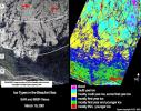
Sea ice in the Beaufort Sea off the north coast of Alaska was classified and mapped in these concurrent images acquired March 19, 2001 by NASA's Terra spacecraft.
PIA04300:
Ice Types in the Beaufort Sea, Alaska
Full Resolution:     TIFF (971.8 kB)     JPEG (215.5 kB)
Add Image to Favorite List 2003-01-13 Earth QuikScat
SeaWinds Scatterometer
2490x1050x3
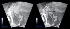
The SeaWinds instrument on NASA's Quick Scatterometer (QuikScat) spacecraft captured these near-real-time backscatter images of melting on the Larsen C ice shelf in Antarctica's Weddell Sea between October 27 (left) and October 29 (right).
PIA03894:
QuikScat Captures an Early Melt
Full Resolution:     TIFF (2.168 MB)     JPEG (289.1 kB)
Add Image to Favorite List 2003-01-08 Earth Terra
MISR
1559x1368x3
In the high plateau of southwestern Bolivia, two large salt deserts, or playas, are located between the eastern and western Andes. NASA's Terra spacecraft depicted the playas on January 16, 2002 and January 3, 2003.
PIA03749:
Salt Playas of the Bolivian Altiplano
Full Resolution:     TIFF (5.821 MB)     JPEG (270.9 kB)
Add Image to Favorite List 2003-01-08 Earth Terra
ASTER
1914x1960x3
The Anti-Atlas Mountains of Morocco formed as a result of the collision of the African and Eurasian tectonic plates about 80 million years ago.
PIA03893:
Anti-Atlas Mountains, Morocco
Full Resolution:     TIFF (11.27 MB)     JPEG (1.133 MB)
Add Image to Favorite List 2003-01-08 Earth QuikScat
SeaWinds Scatterometer
800x667x3
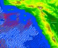
High-resolution ocean surface wind data from NASA's Quick Scatterometer (QuikScat) illustrate the strength of Santa Ana winds that pounded Southern California in 2003.
PIA03892:
Santa Ana Winds Over Los Angeles
Full Resolution:     TIFF (1.608 MB)     JPEG (154.9 kB)
Add Image to Favorite List 2003-01-02 Earth Terra
MISR
1522x1789x3
Stratus clouds are common in the Arctic during the summer months, and are important modulators of the arctic climate as seen in this anaglyph from the MISR instrument aboard NASA's Terra spacecraft. 3D glasses are necessary to view this image.
PIA03748:
Stratified Arctic Clouds
Full Resolution:     TIFF (8.183 MB)     JPEG (436.8 kB)
Add Image to Favorite List 2002-12-23 Earth Landsat
Shuttle Radar Topography Mission (SRTM)
C-Band Interferometric Radar
Thematic Mapper
4475x1896x3
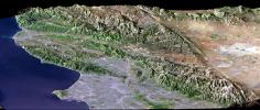
Los Angeles, CA., is one of the world's largest metropolitan areas with a population of about 15 million people. The urban areas mostly cover the coastal plains and lie within the inland valleys. This image is from NASA's Shuttle Radar Topography Mission.
PIA03376:
Perspective View, SRTM / Landsat, Los Angeles, Calif
Full Resolution:     TIFF (25.45 MB)     JPEG (1.906 MB)
Add Image to Favorite List 2002-12-23 Earth Terra
ASTER
700x910x3
The towns of Santa Claus, Ga., (top) and Santa Claus, Ind. (bottom), are shown in these two images from the Advanced Spaceborne Thermal Emission and Reflection Radiometer (ASTER) instrument on NASA's Terra satellite.
PIA03891:
Santa Claus, Ga./Ind.
Full Resolution:     TIFF (1.914 MB)     JPEG (205.6 kB)
Add Image to Favorite List 2002-12-19 Earth Aqua
AIRS
1280x1280x3
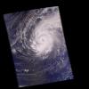
This image was made from data acquired by the Atmospheric Infrared Sounding System (AIRS) instrument suite aboard NASA's Aqua spacecraft in December, 2002, just as the eye of Supertyphoon Pongsona was about to pass over Guam.
PIA00367:
Supertyphoon Pongsona
Full Resolution:     TIFF (2.6 MB)     JPEG (132.5 kB)
Add Image to Favorite List 2002-12-18 Earth Terra
MISR
889x906x3
The border between Russia and Finland is shown in this MISR Mystery Quiz #12 captured by NASA's Terra spacecraft.
PIA03747:
Where on Earth...? MISR Mystery Image Quiz #12:
Border between Russia and Finland

Full Resolution:     TIFF (2.419 MB)     JPEG (204.7 kB)
Add Image to Favorite List 2002-12-13 Earth Terra
ASTER
3441x1982x3
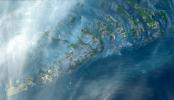
The Florida Keys are a chain of islands, islets and reefs extending from Virginia Key to the Dry Tortugas. This image was acquired by NASA's Terra satellite on October 28, 2001.
PIA03890:
Florida Keys
Full Resolution:     TIFF (20.46 MB)     JPEG (724 kB)
Add Image to Favorite List 2002-12-12 Earth Jason-1
Altimeter
900x900x3
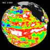
The latest image from NASA's Jason oceanography satellite, taken during a 10-day collection cycle ending December 2, 2002, shows the Pacific dominated by two significant areas of higher-than-normal sea level (warmer ocean temperatures).
PIA03889:
El Niņo Continues to Grow
Full Resolution:     TIFF (2.439 MB)     JPEG (136.2 kB)
Retrieve Previous Set  Jump to a Previous Set   Jump to a Previous Set   Jump to a Previous Set   Jump to a Previous Set   Jump to a Previous Set   Jump to a Previous Set   Jump to a Previous Set   Jump to a Previous Set   Jump to a Previous Set   Jump to a Previous Set   Retrieve Next Set 
 1-100   101-200   201-300   301-400   401-500   501-600   601-700   701-800   801-900   901-1000 
Currently displaying images: 1501 - 1600 of 2311