My
List |
Addition Date
|
Target
|
Mission
|
Instrument
|
Size
|

|
2016-12-01 |
Earth
|
Terra
|
ASTER
|
395x655x3 |
|
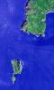
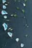
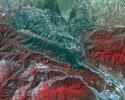
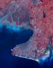
-
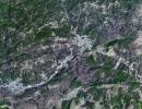
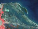
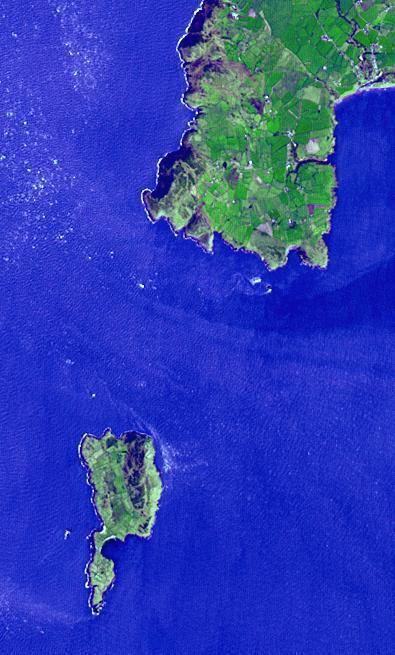
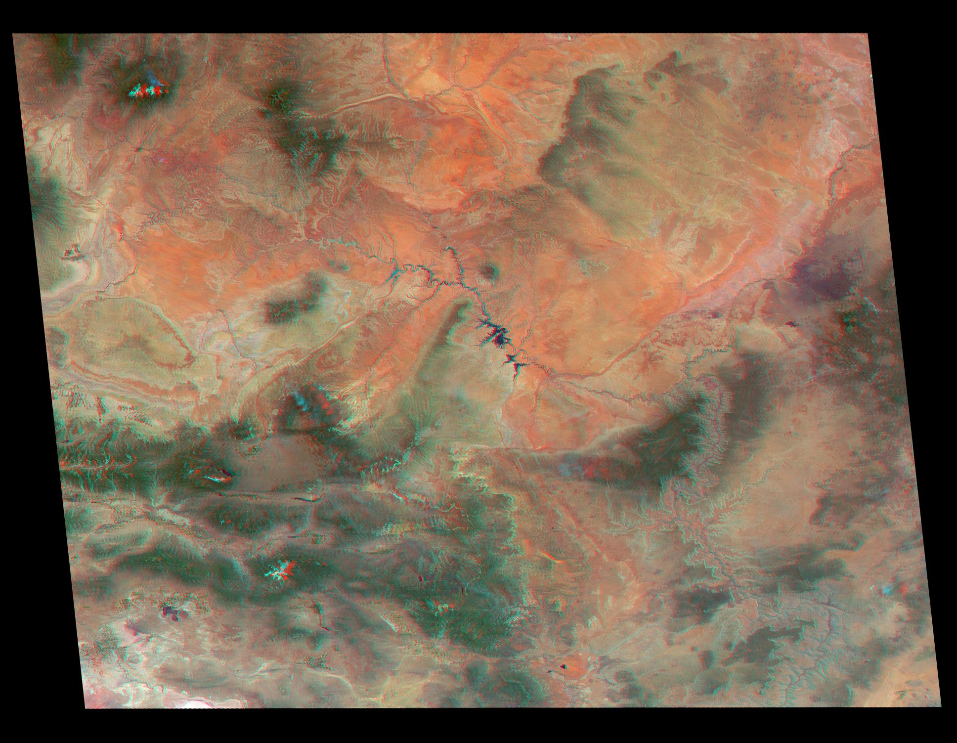
PIA21182:
-
Bardsey Island, Wales
Full Resolution:
TIFF
(776.7 kB)
JPEG
(54.91 kB)
|
|
|
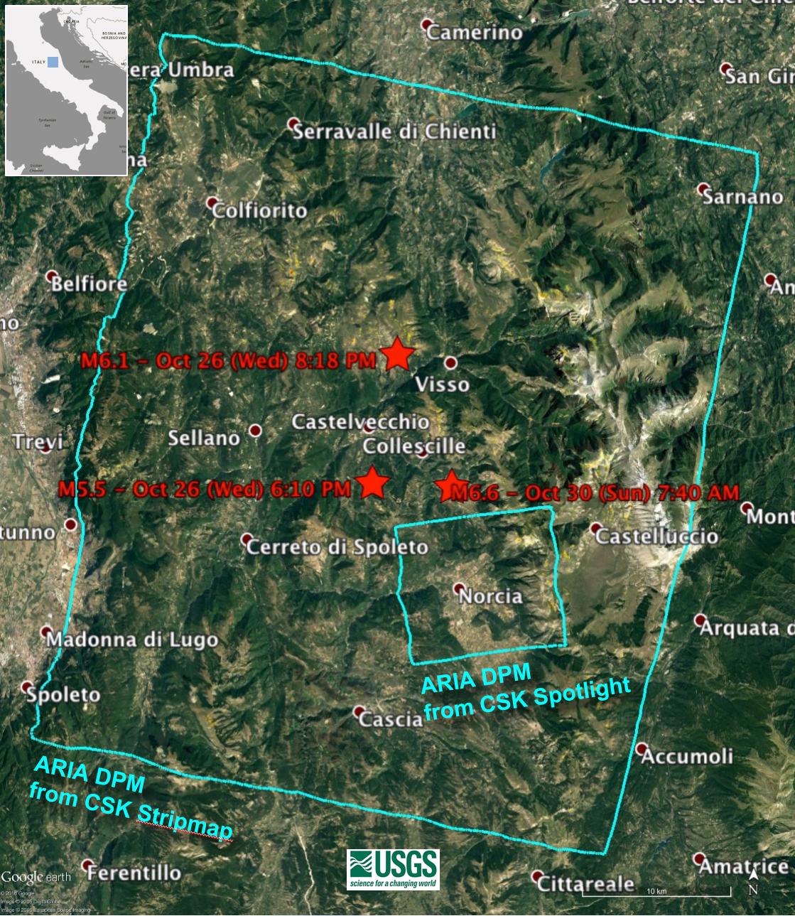
2016-11-16 |
Earth
|
ARIA
|
|
1119x1289x3 |

|
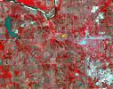
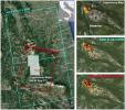
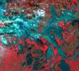
-
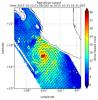
PIA15374:
-
NASA’s Damage Proxy Map to Assist with Italy Earthquake Disaster Response
Full Resolution:
TIFF
(4.329 MB)
JPEG
(322.2 kB)
|
|
|
2016-11-16 |
Earth
|
Terra
|
MISR
|
4200x3300x3 |
|
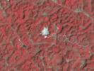
-
PIA15375:
-
MISR Where on Earth...? MISR Mystery Image Quiz #28
Full Resolution:
TIFF
(38.53 MB)
JPEG
(1.409 MB)
|
|
|
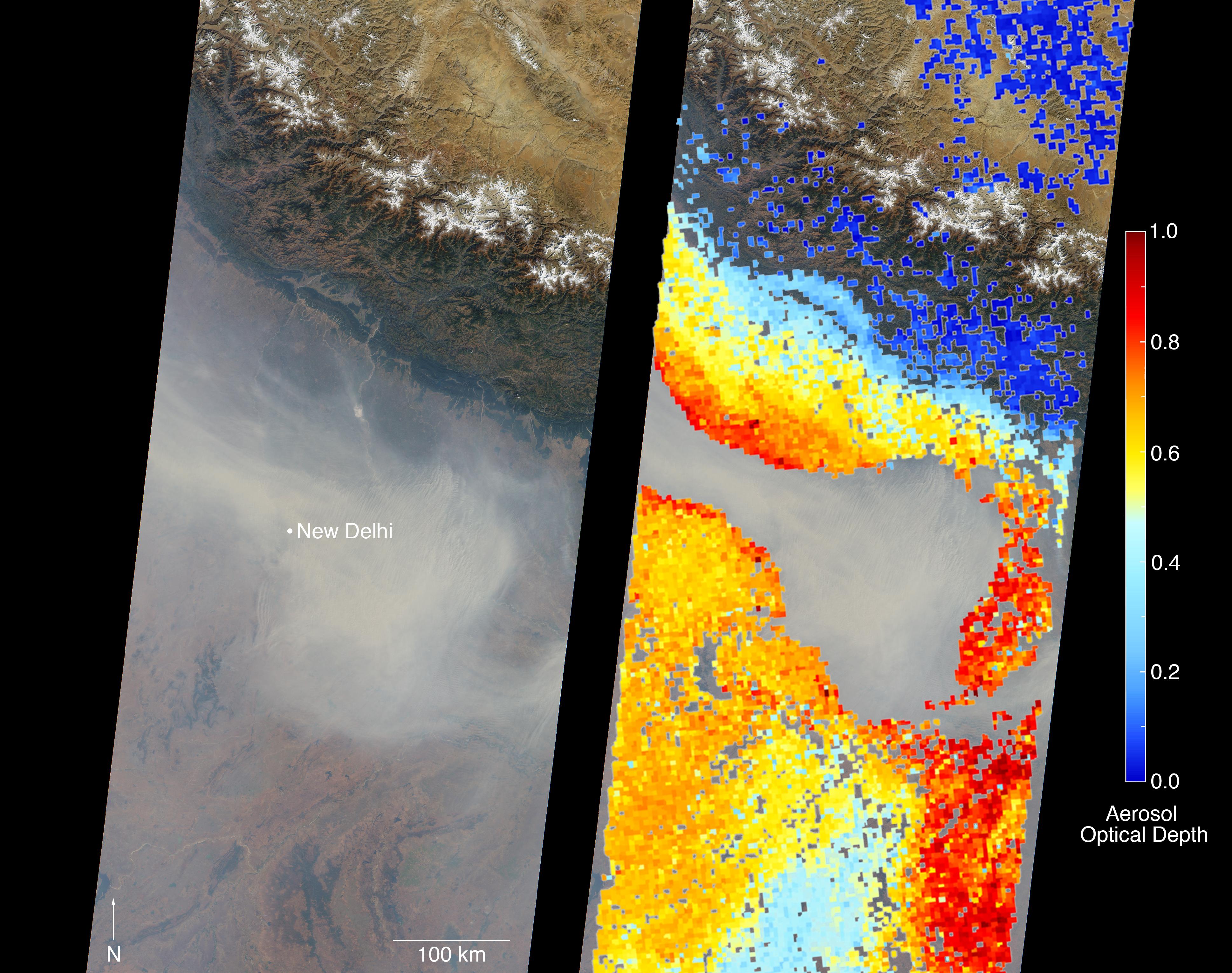
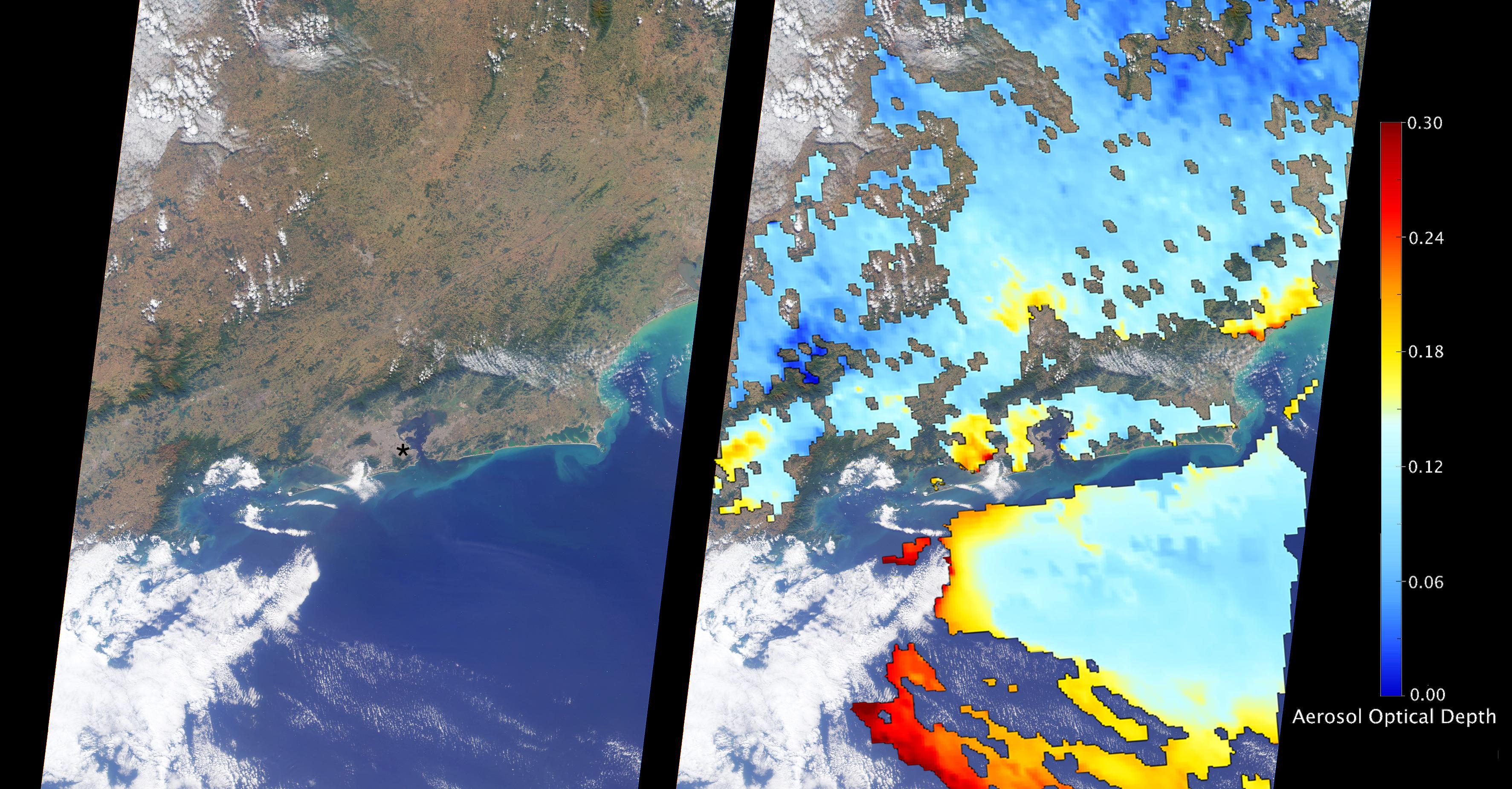
2016-11-16 |
Earth
|
Terra
|
MISR
|
3876x3062x3 |
|
-
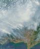
PIA21100:
-
Severe Air Pollution in New Delhi View by NASA's MISR
Full Resolution:
TIFF
(24.14 MB)
JPEG
(1.287 MB)
|
|
|
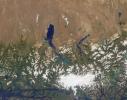
2016-11-15 |
Earth
|
Terra
|
ASTER
|
3684x2704x3 |
|
-
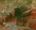
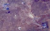
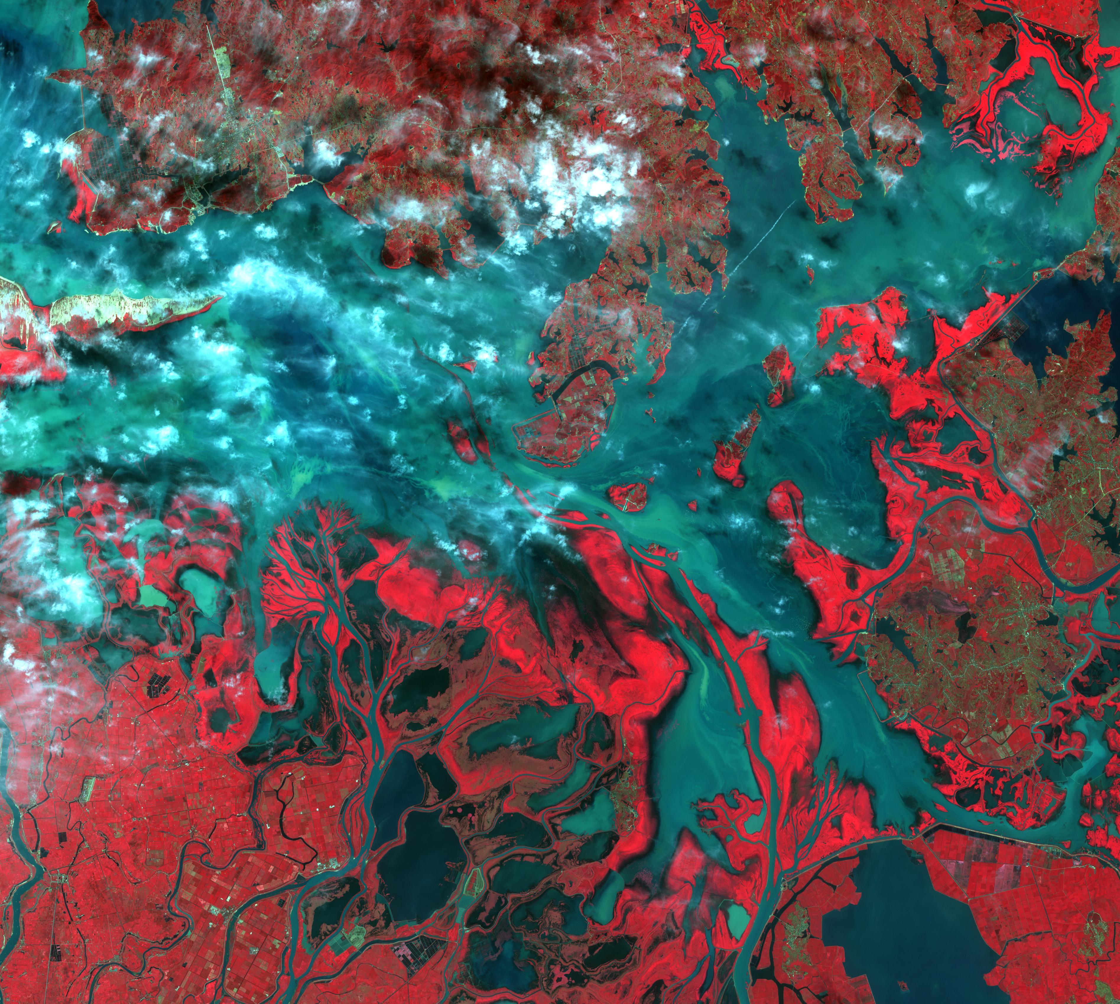
PIA21170:
-
Shadegan, Iran
Full Resolution:
TIFF
(29.9 MB)
JPEG
(1.611 MB)
|
|
|
2016-11-09 |
Earth
|
Terra
|
ASTER
|
2022x3012x3 |
|
-
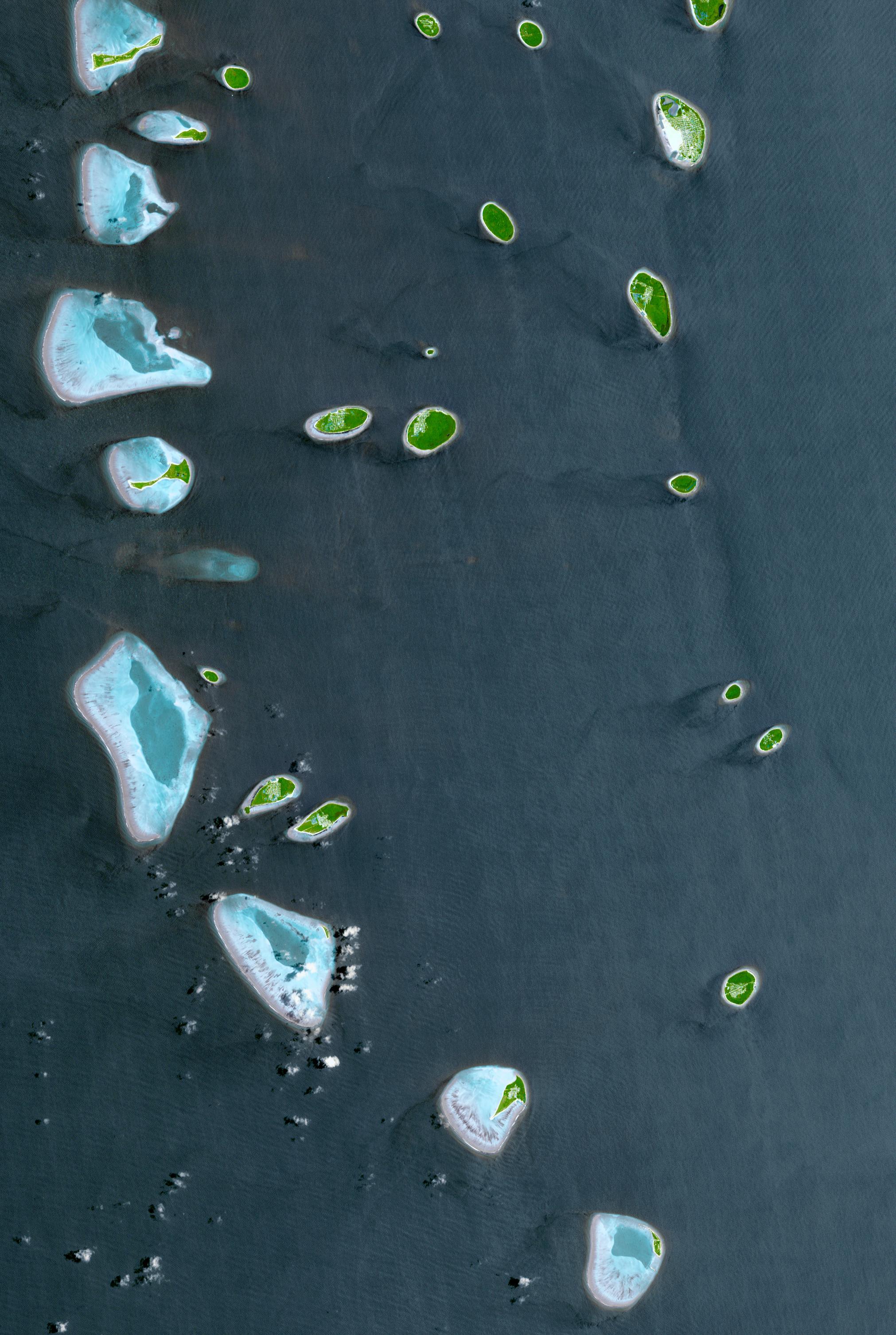
PIA21166:
-
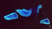
Republic of Maldives
Full Resolution:
TIFF
(14.07 MB)
JPEG
(887.6 kB)
|
|
|
2016-11-08 |
Earth
|
Terra
|
ASTER
|
965x757x3 |
|
-
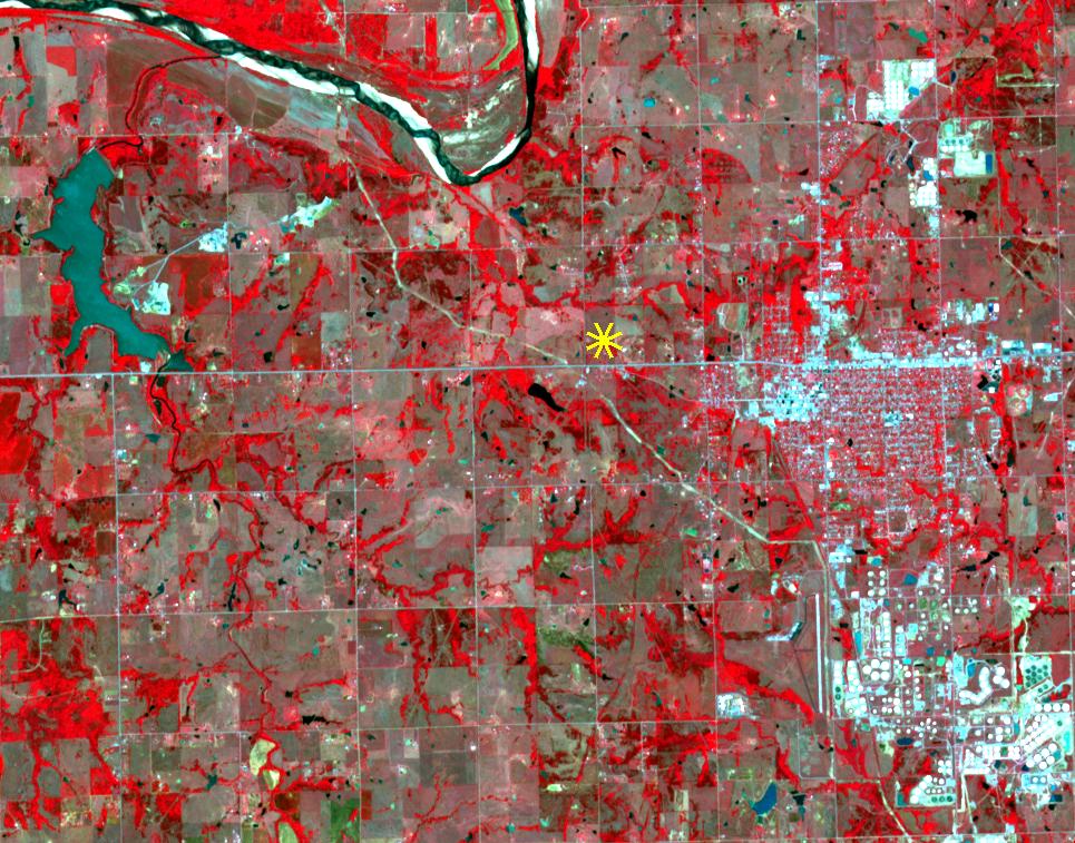
PIA21099:
-
Oklahoma Area Struck By Magnitude 5.0 Earthquake Imaged by NASA Satellite
Full Resolution:
TIFF
(2.185 MB)
JPEG
(191.1 kB)
|
|
|
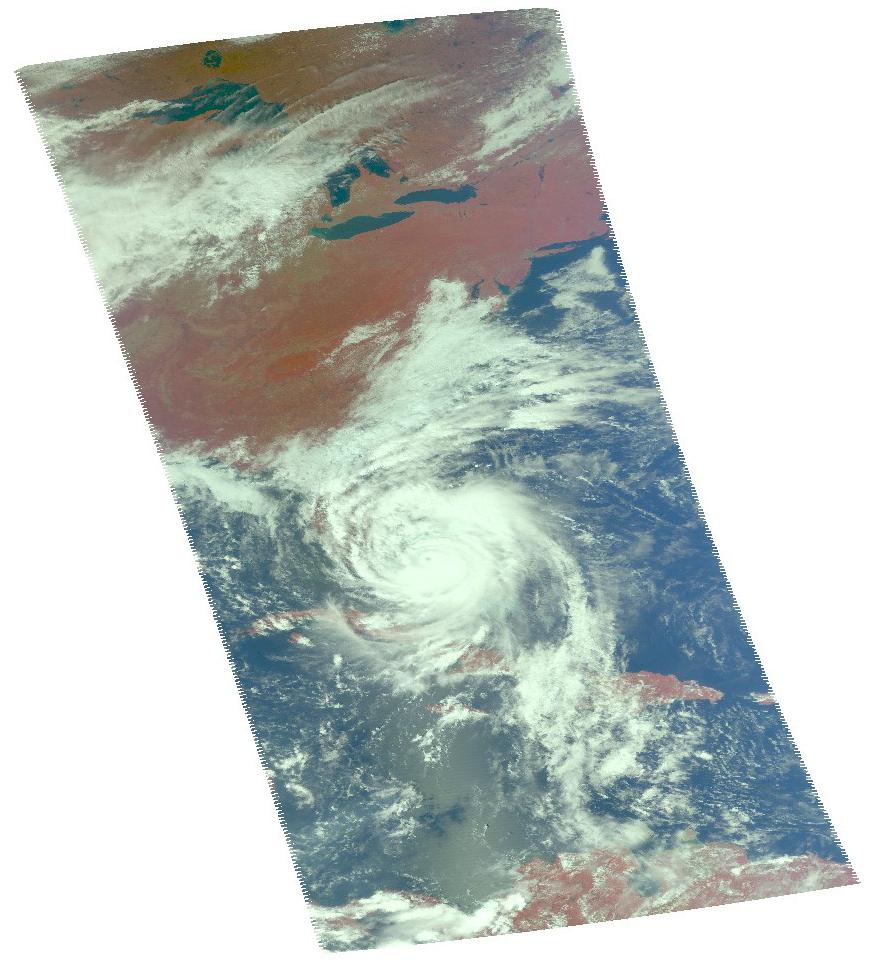
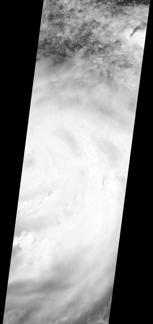
2016-10-14 |
Earth
|
Aqua
|
MODIS
VIIRS
|
1000x1000x3 |
|
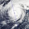
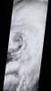
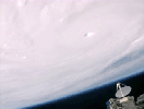
-
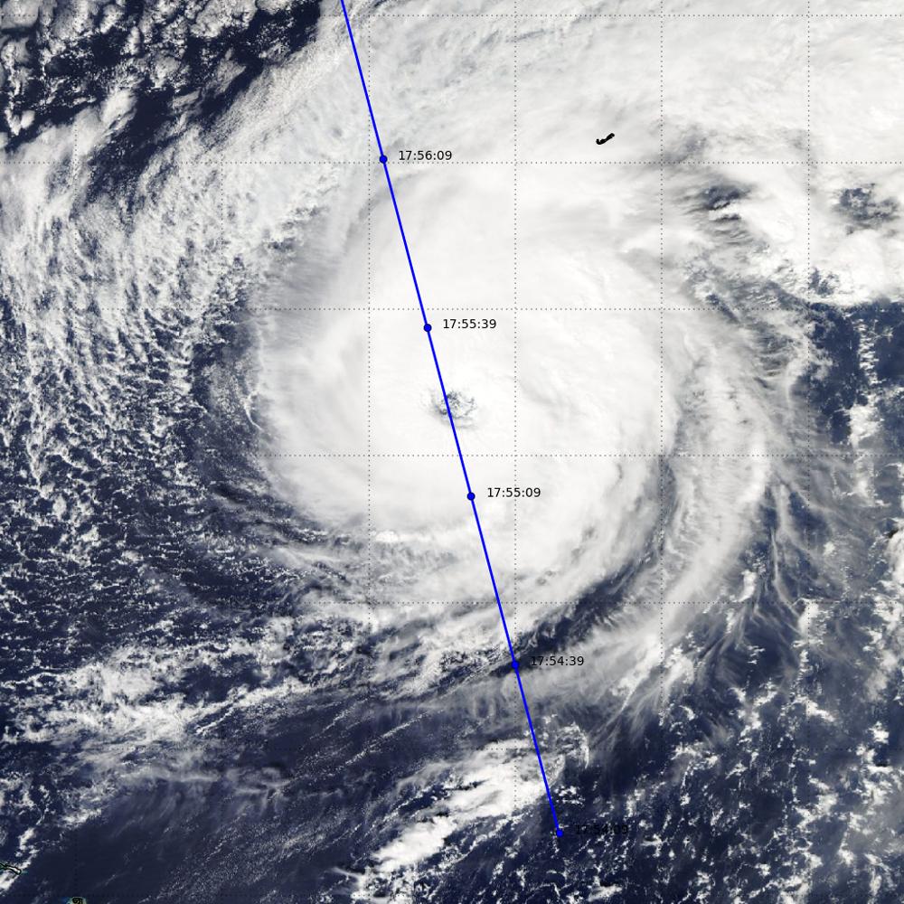
PIA21098:
-
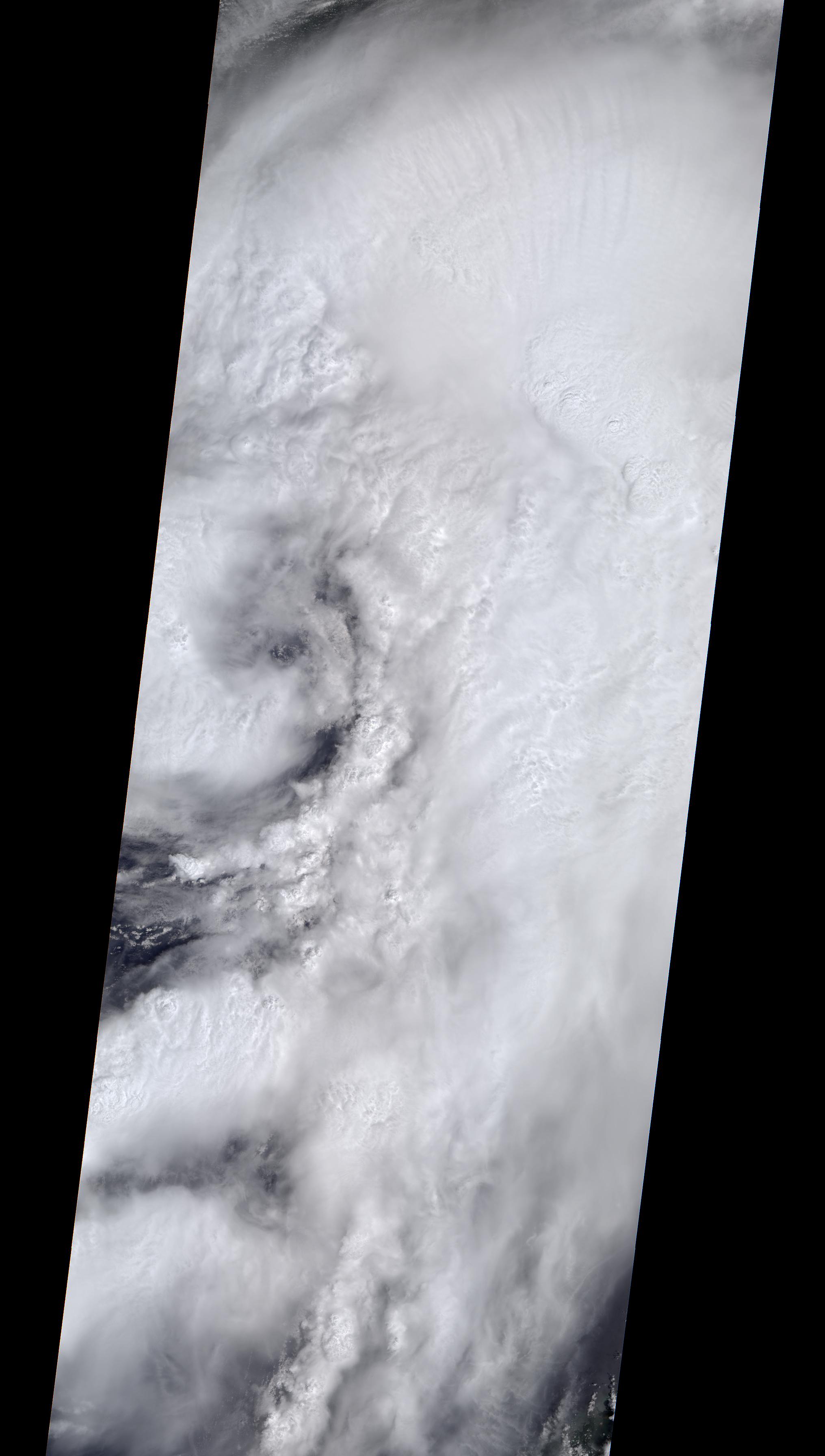
NASA's CloudSat Looks Hurricane Nicole in the Eye
Full Resolution:
TIFF
(2.794 MB)
JPEG
(195.4 kB)
|
|
|
2016-10-13 |
Earth
|
Terra
|
ASTER
|
2763x1493x3 |
|
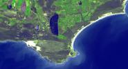
-
PIA21014:
-
Cape Agulhas, South Africa
Full Resolution:
TIFF
(11.42 MB)
JPEG
(573.9 kB)
|
|
|
2016-10-07 |
Earth
|
Aquarius
|
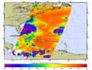
AIRS
|
1041x800x3 |
|
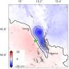
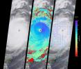
-
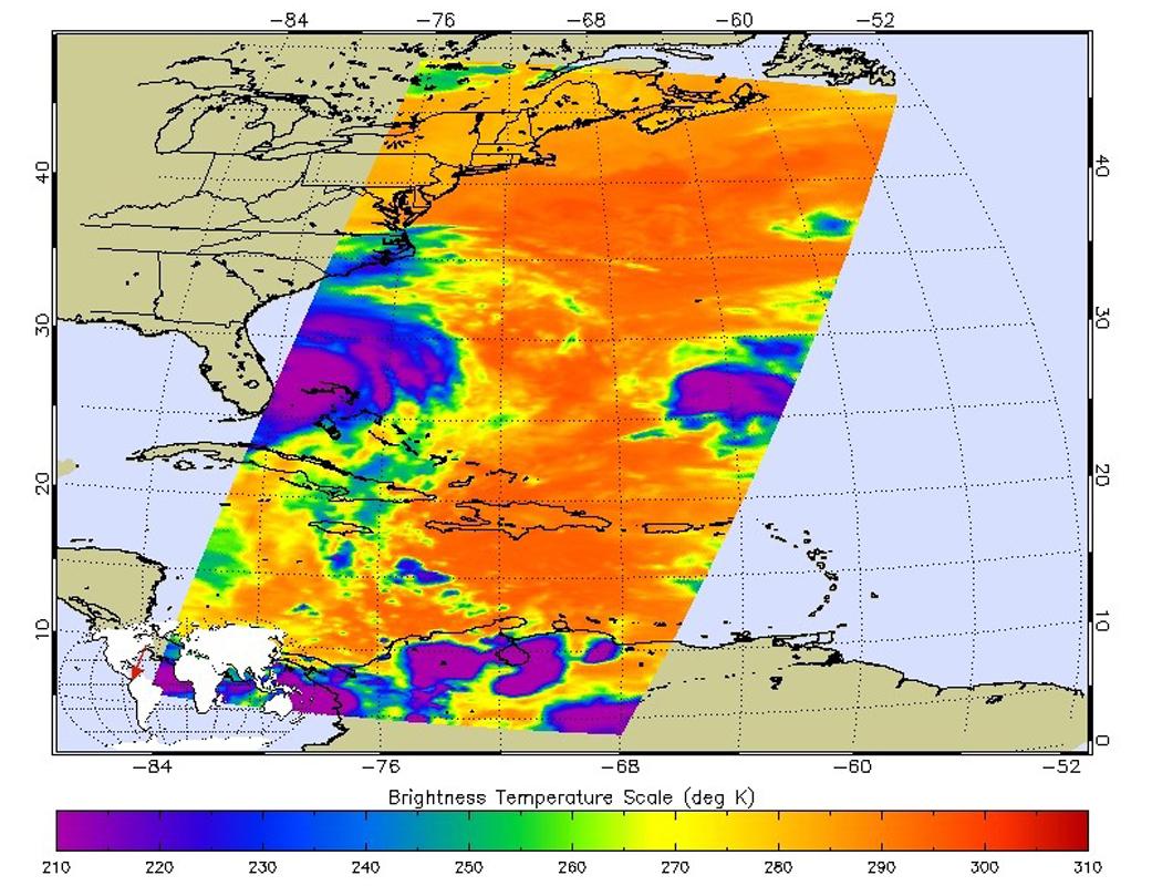
PIA21097:
-
NASA's AIRS Examines Hurricane Matthew's Cloud Top Temperatures
Full Resolution:
TIFF
(1.728 MB)
JPEG
(159.9 kB)
|
|
|
2016-10-07 |
Earth
|
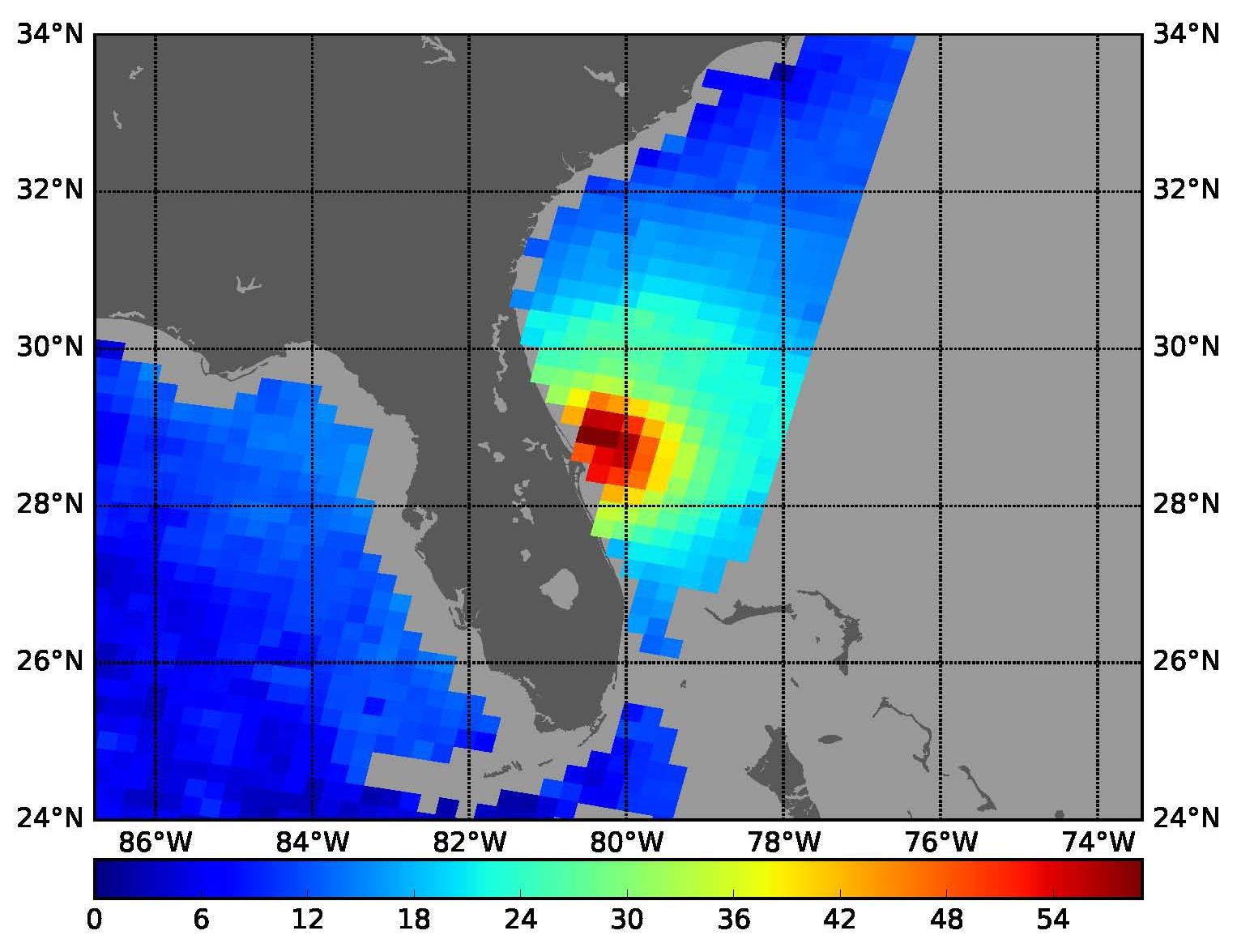
SMAP
|
|
1527x1175x3 |

|
-
PIA21096:
-
SMAP Takes a New Measure of Hurricane Matthew's Winds
Full Resolution:
TIFF
(1.8 MB)
JPEG
(167.8 kB)
|
|
|
2016-10-07 |
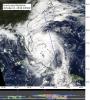
Earth
|
CloudSat
|
Cloudsat
|
1258x1395x3 |
|
-
PIA21095:
-
CloudSat Takes a 3D Slice of Hurricane Matthew
Full Resolution:
TIFF
(4.619 MB)
JPEG
(337.9 kB)
|
|
|
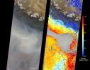
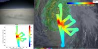
2016-10-07 |
Earth
|
|
HAMSR
|
2888x1455x3 |
|
-
PIA21094:
-
JPL's HAMSR Looks Inside Hurricane Matthew's Spiral Cloud Bands
Full Resolution:
TIFF
(9.106 MB)
JPEG
(329.1 kB)
|
|
|
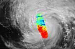
2016-10-07 |
Earth
|
|
HAMSR
|
3325x2160x3 |
|
-
PIA21093:
-
JPL's HAMSR Takes Hurricane Matthew's Temperature
Full Resolution:
TIFF
(8.53 MB)
JPEG
(533.2 kB)
|
|
|
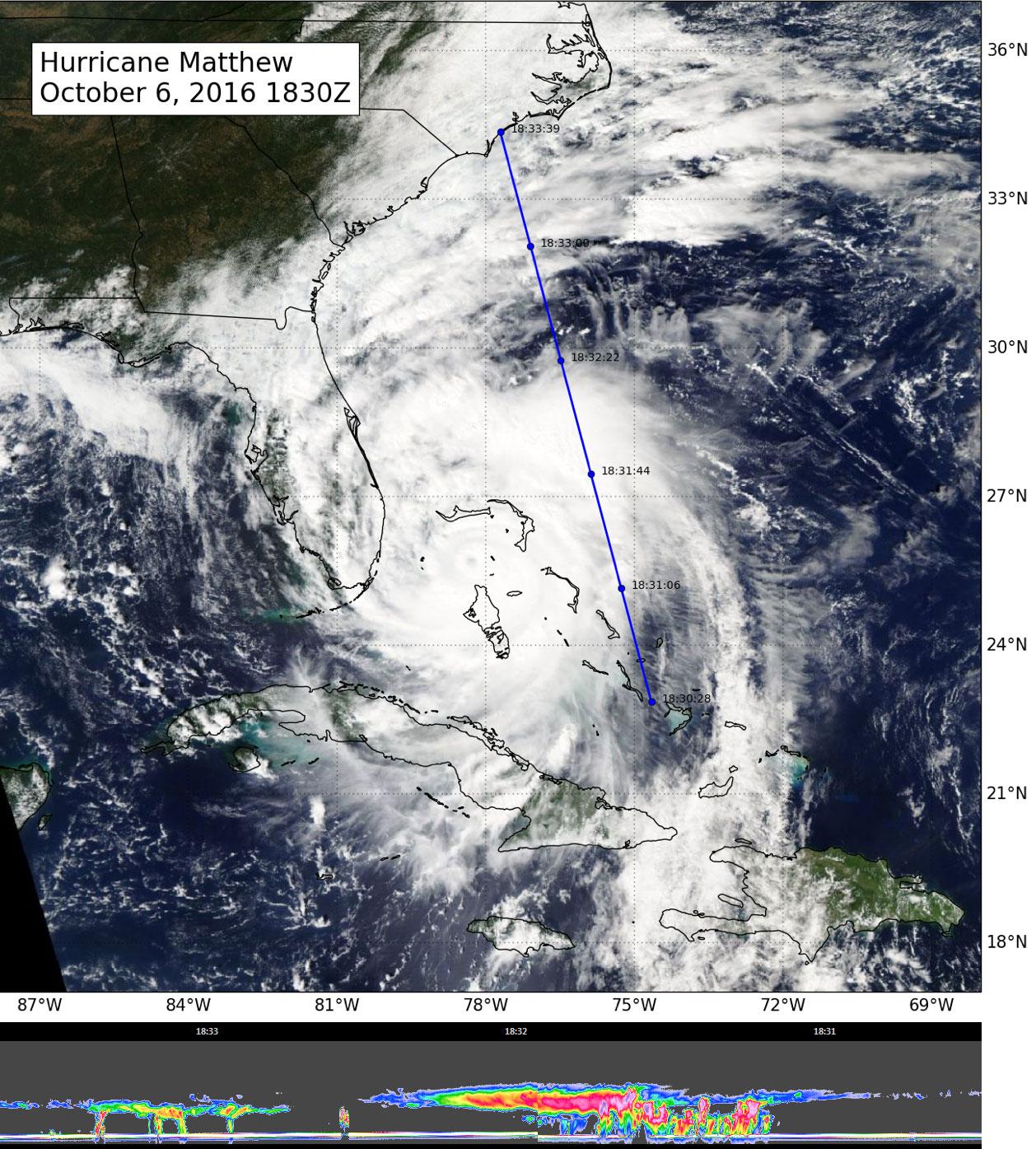
2016-10-06 |
Earth
|
Aqua
|
AIRS
|
876x960x3 |
|
-
PIA21092:
-
A Look at Hurricane Matthew from NASA's AIRS
Full Resolution:
TIFF
(1.696 MB)
JPEG
(107.9 kB)
|
|
|
2016-10-05 |
Earth
|
ARIA
|
|
1313x1164x3 |
|
-
PIA21091:
-
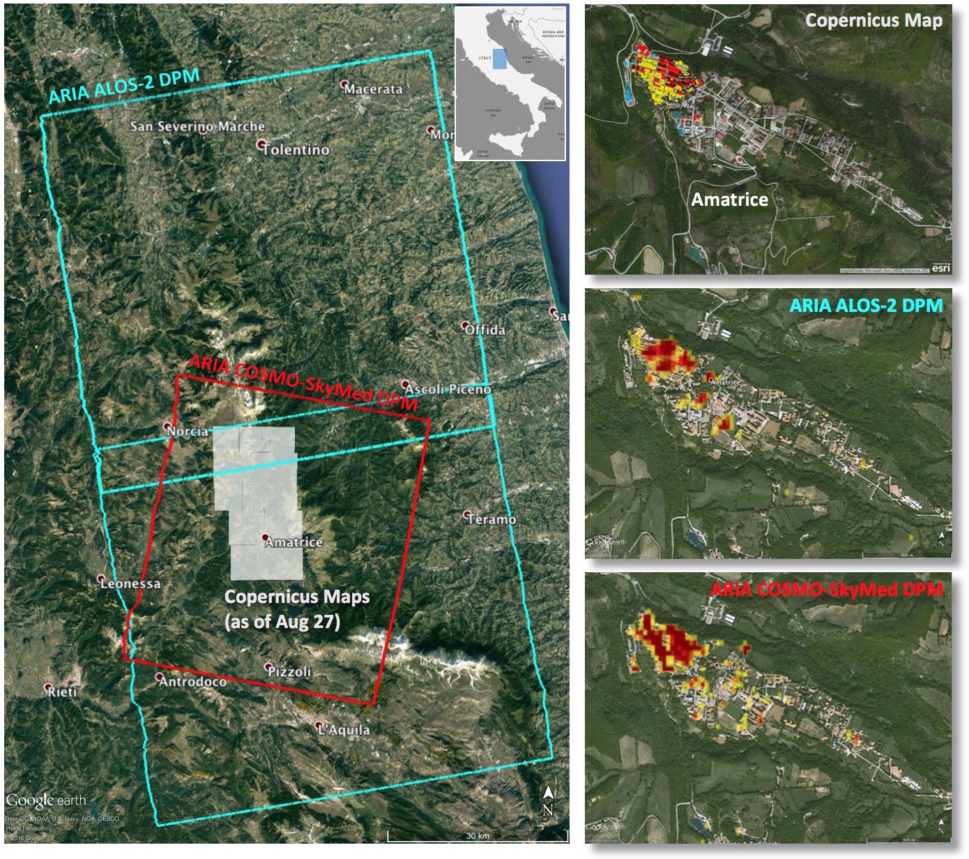
NASA-Produced Maps Help Gauge Italy Earthquake Damage
Full Resolution:
TIFF
(4.587 MB)
JPEG
(324.8 kB)
|
|
|
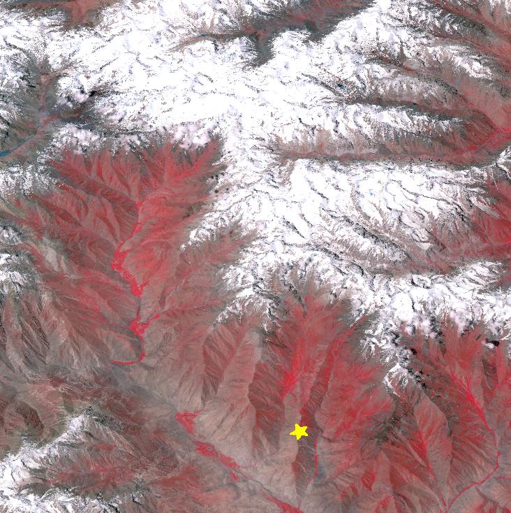
2016-10-05 |
Earth
|
Terra
|
ASTER
|
1094x839x3 |
|
-
PIA21069:
-
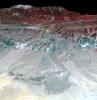
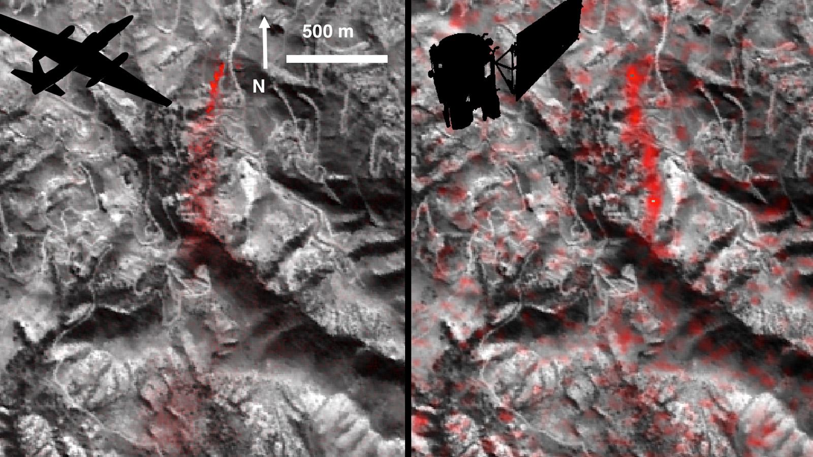
NASA Satellite Eyes Deadly Tibetan Landslide
Full Resolution:
TIFF
(2.297 MB)
JPEG
(101 kB)
|
|
|
2016-10-04 |
Earth
|
Terra
|
MISR
|
493x1040x1 |
|
-
PIA21070:
-
Hurricane Matthew over Haiti seen by NASA's MISR

Full Resolution:
TIFF
(303.2 kB)
JPEG
(32.93 kB)
|
|
|
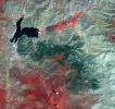
2016-09-30 |
Earth
|
Terra
|
ASTER
|
1403x1442x3 |
|
-
PIA21008:
-
Blackhawk Landslide, California
Full Resolution:
TIFF
(5.732 MB)
JPEG
(419.1 kB)
|
|
|
2016-09-29 |
Earth
|
Terra
|
ASTER
|
1988x1101x3 |
|
-
PIA20900:
-
A Bird's Eye View of Australia's Heron Island
Full Resolution:
TIFF
(5.33 MB)
JPEG
(203.1 kB)
|
|
|
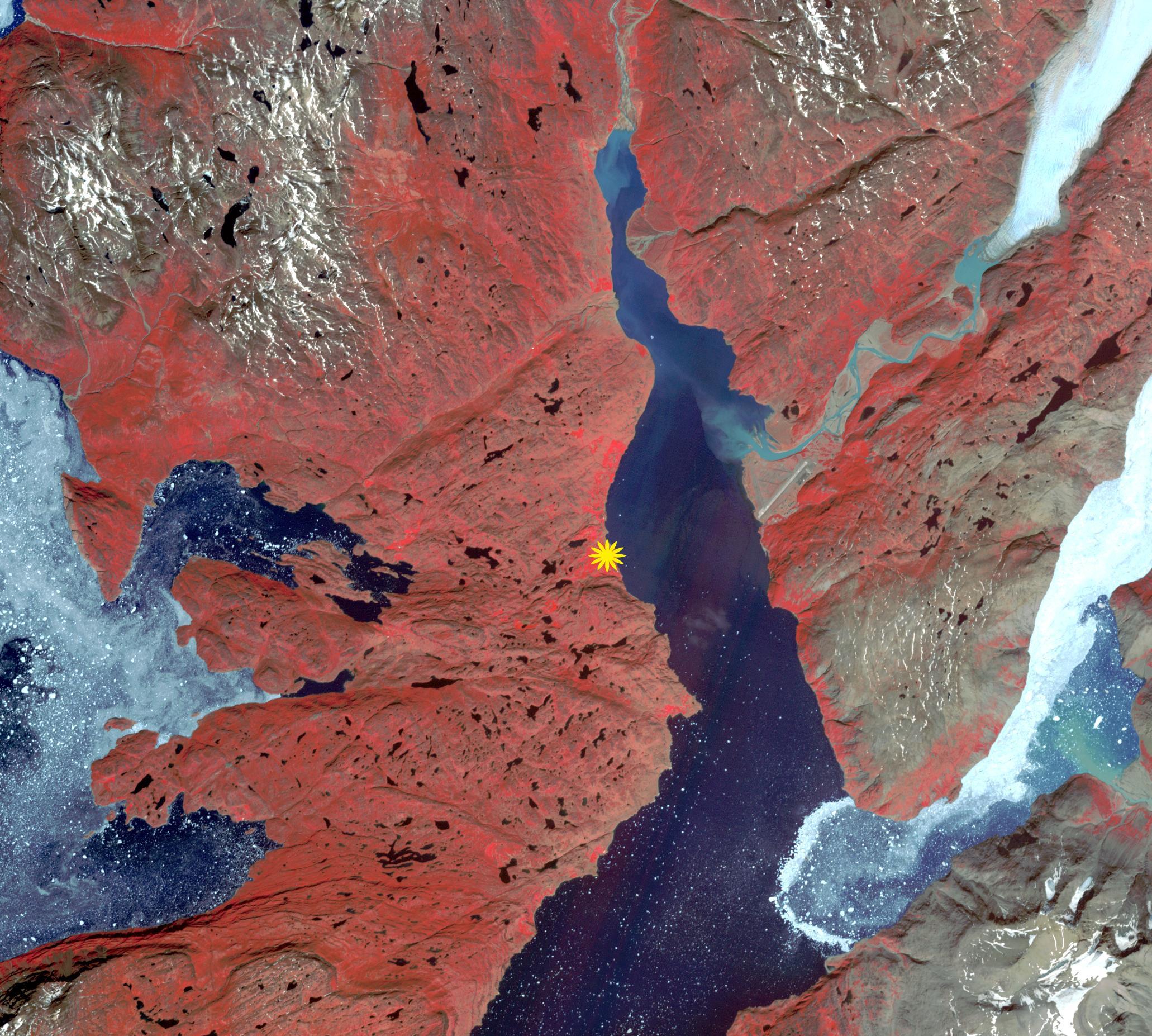
2016-09-16 |
Earth
|
Terra
|
ASTER
|
2062x1854x3 |
|
-
PIA20996:
-
Qassiarsuk, Greenland
Full Resolution:
TIFF
(11.47 MB)
JPEG
(698.3 kB)
|
|
|
2016-09-14 |
Earth
|
Terra
|
MISR
|
5440x4284x3 |
|
-
PIA17309:
-
Huge Super Typhoon Meranti Over Taiwan Spotted by NASA's MISR
Full Resolution:
TIFF
(33.77 MB)
JPEG
(1.745 MB)
|
|
|
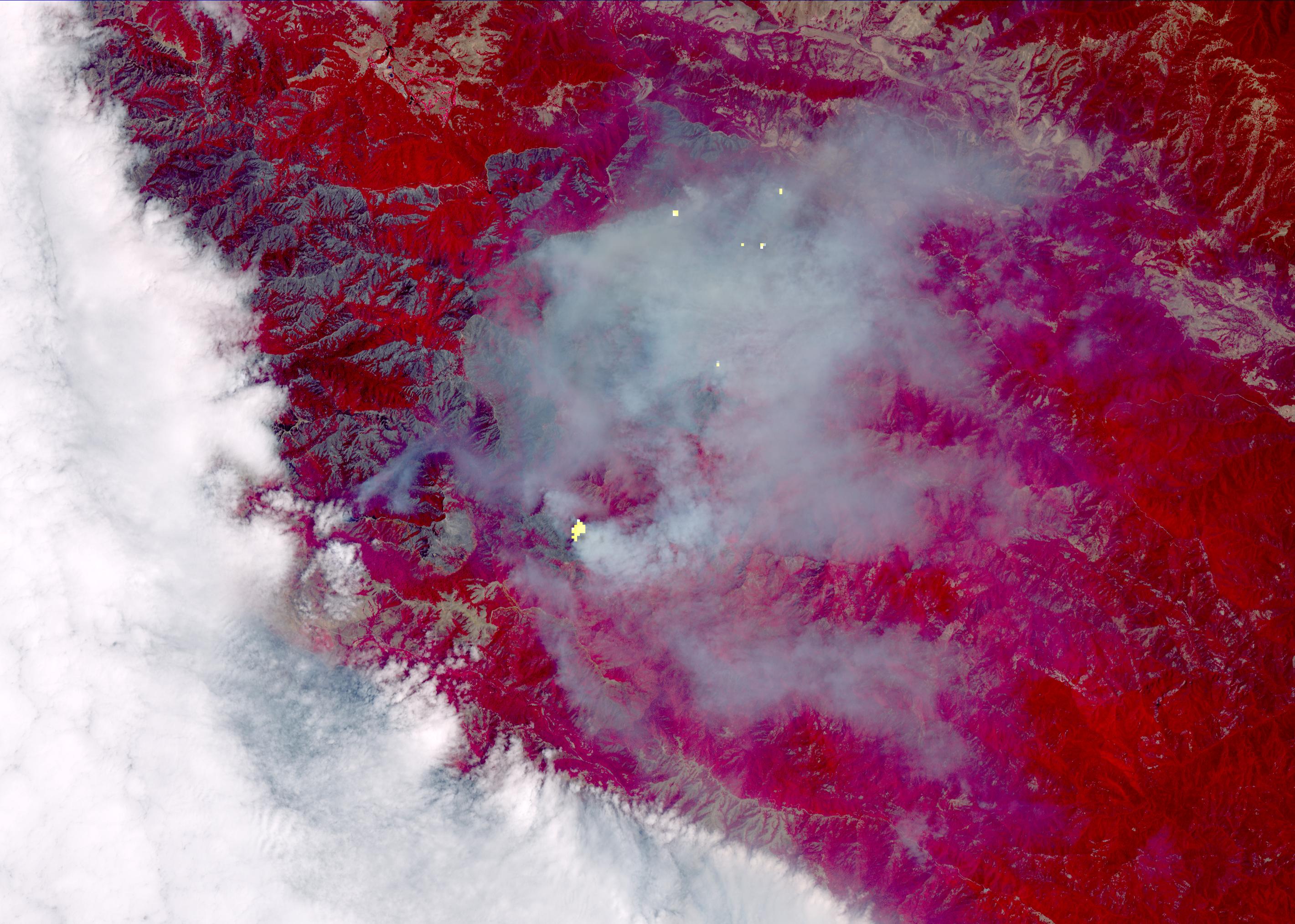
2016-09-07 |
Earth
|
Terra
|
ASTER
|
1812x1456x3 |
|
-
PIA20899:
-
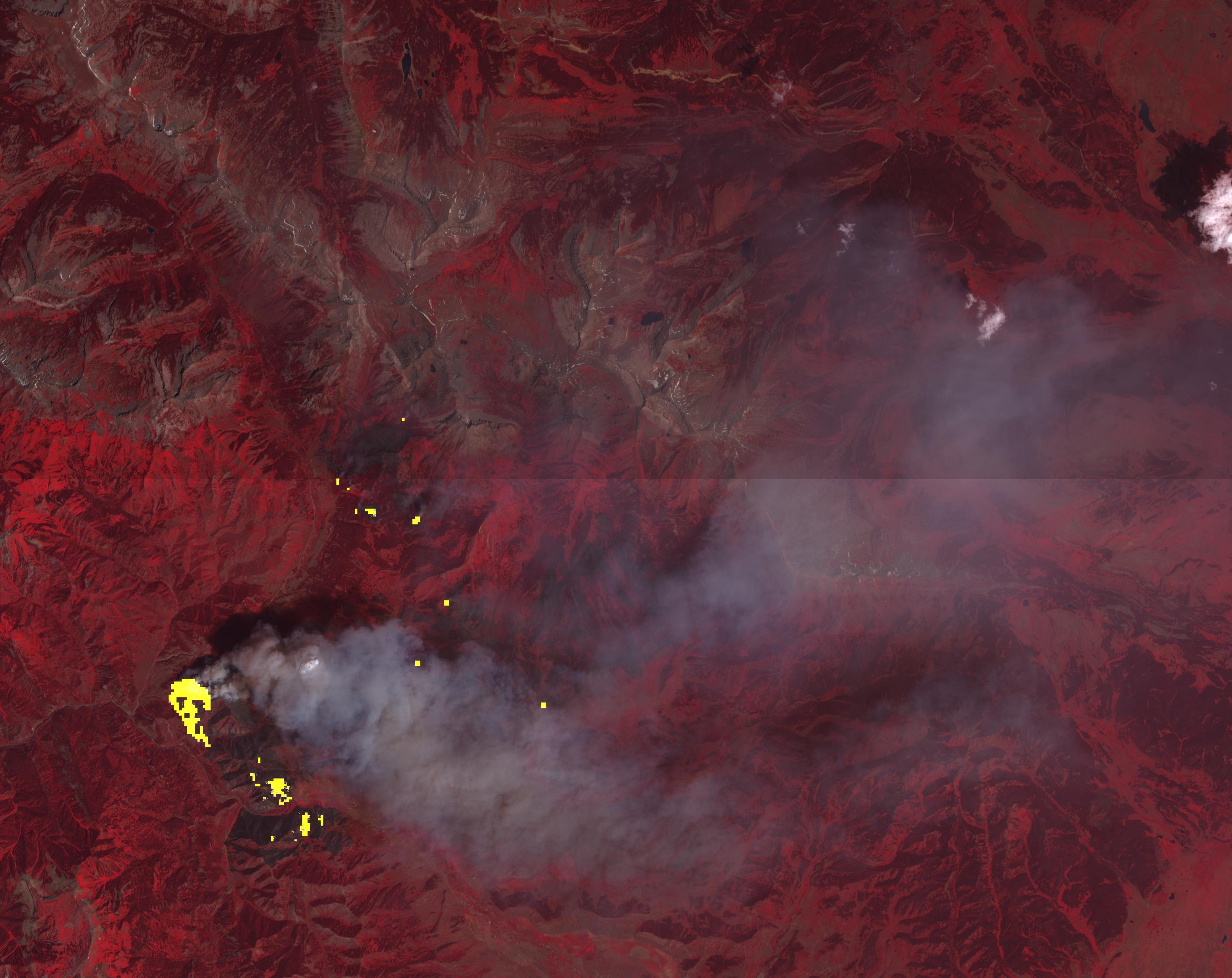
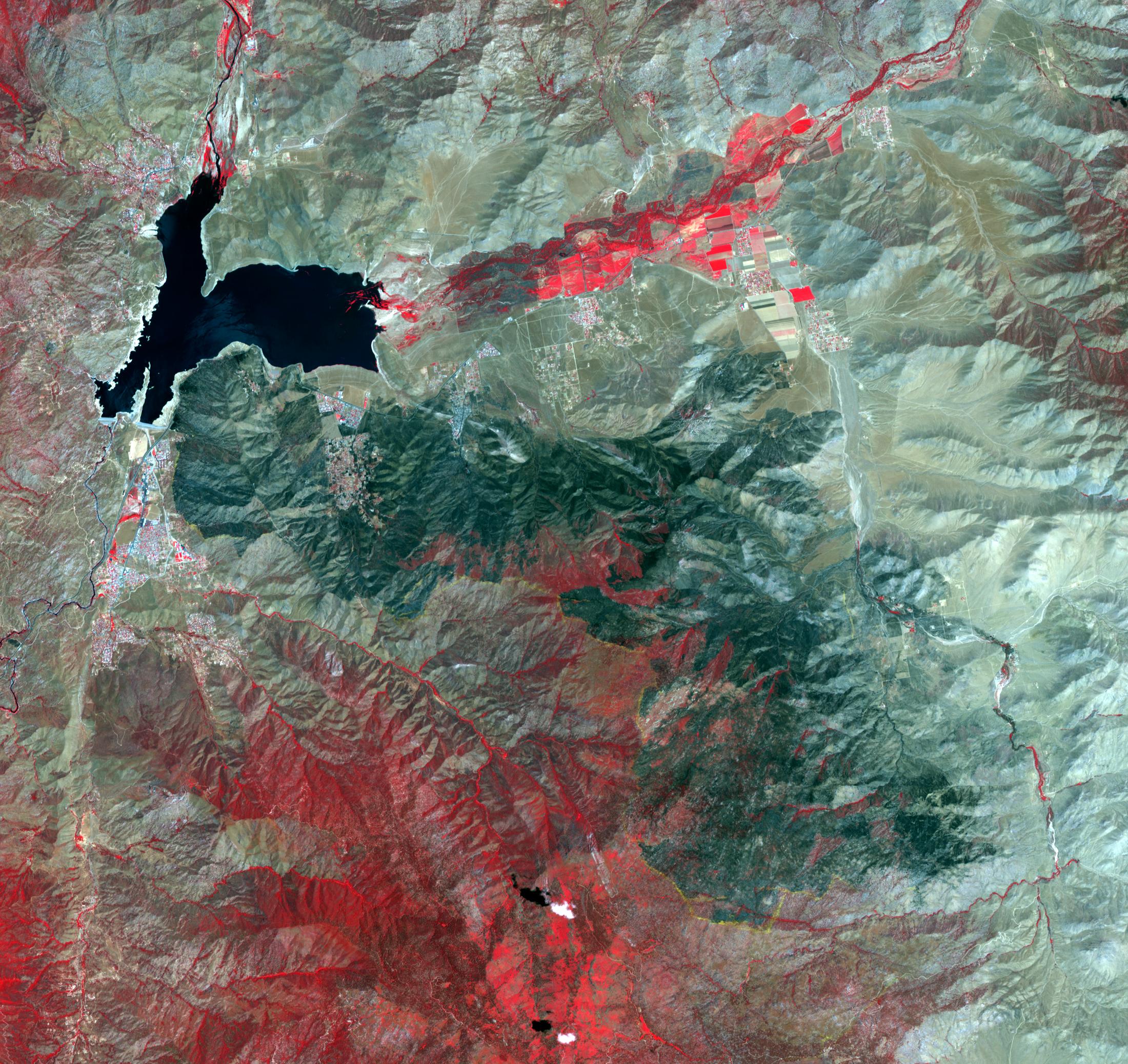
Extent of California Blue Cut Fire Devastation Seen by NASA Spacecraft
Full Resolution:
TIFF
(7.918 MB)
JPEG
(602.8 kB)
|
|
|
2016-09-07 |
Earth
|
Terra
|
ASTER
|
546x411x3 |
|
-
PIA20986:
-
Five-Hundred-Meter Aperture Spherical Telescope, China
Full Resolution:
TIFF
(673.7 kB)
JPEG
(43.08 kB)
|
|
|
2016-09-01 |
Earth
|
Terra
|
MISR
|
2031x3584x3 |
|
-
PIA20898:
-
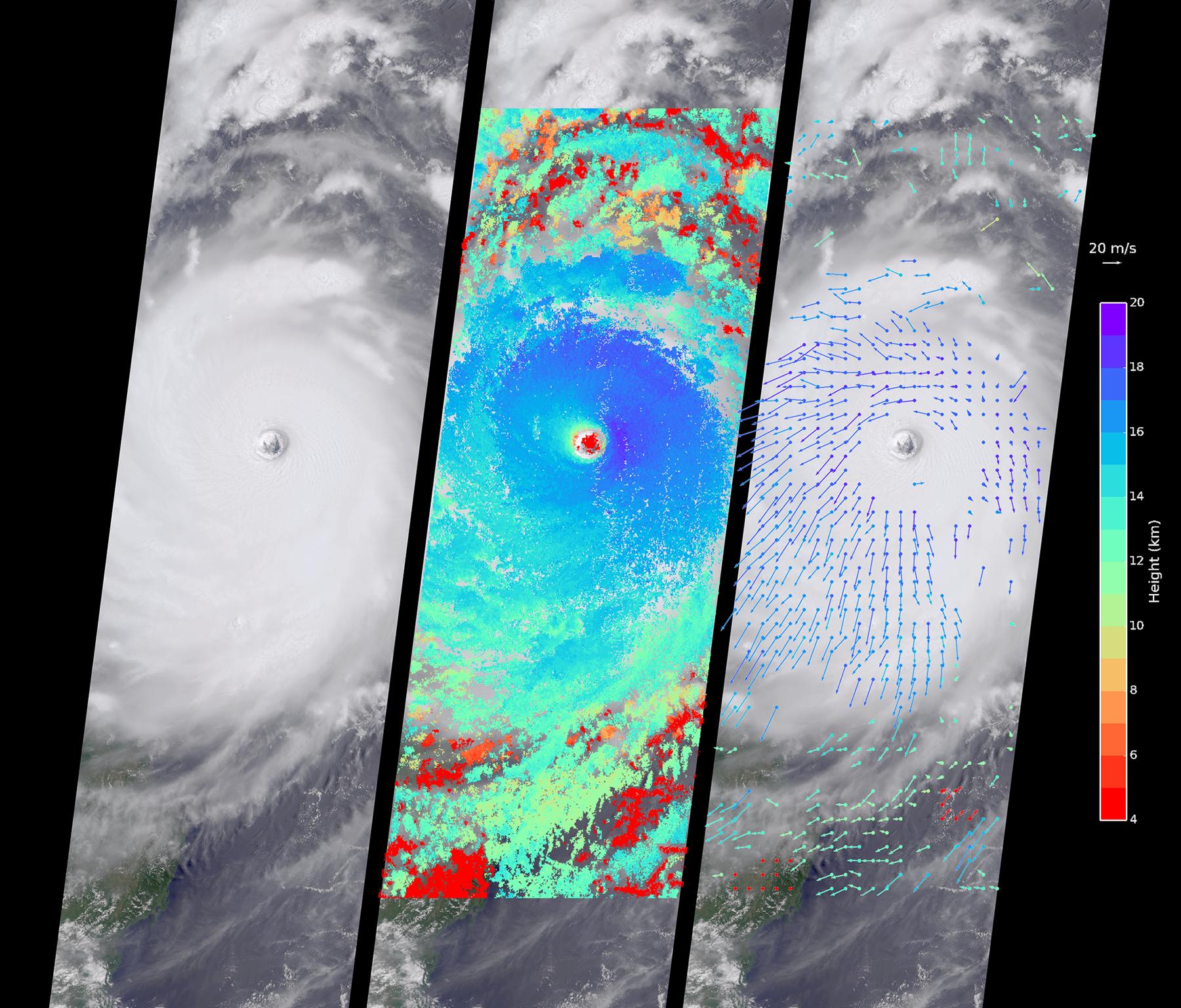
NASA's MISR Spots Hurricane Hermine Approaching Florida
Full Resolution:
TIFF
(11.2 MB)
JPEG
(331.2 kB)
|
|
|
2016-09-01 |
Earth
|
ARIA
|
|
1390x1231x3 |

|
-
PIA20897:
-
New Satellite Damage Maps Assist Italy's Earthquake Disaster Response
Full Resolution:
TIFF
(5.135 MB)
JPEG
(388.6 kB)
|
|
|
2016-08-31 |
Earth
|
ARIA
|
|
668x675x3 |
|
-
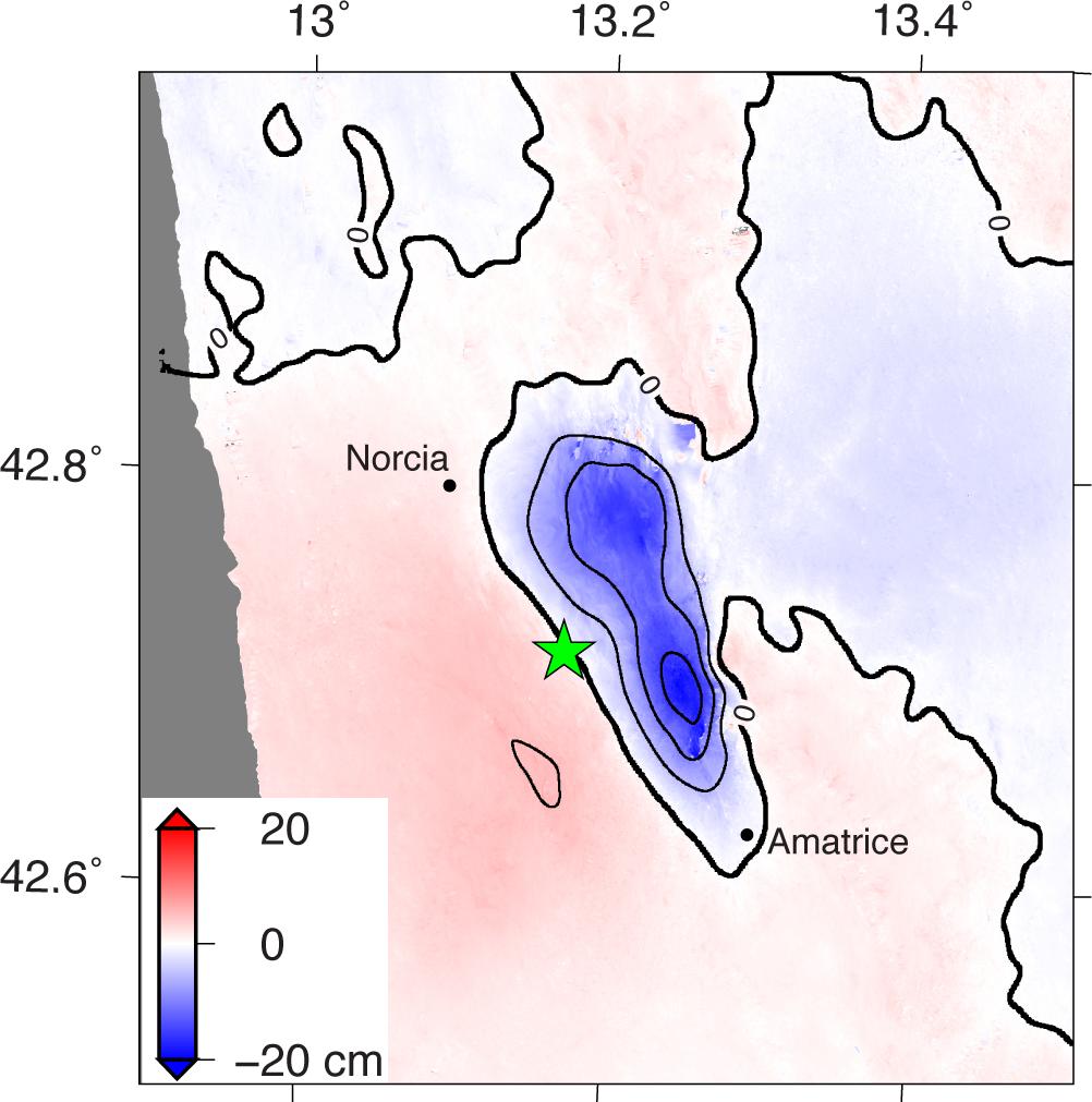
PIA20896:
-
Automated Radar Image of Deformation for Amatrice, Italy Earthquake
Full Resolution:
TIFF
(588.1 kB)
JPEG
(58.05 kB)
|
|
|
2016-08-31 |
Earth
|
Terra
|
MISR
|
1600x762x3 |
|
-
PIA20894:
-
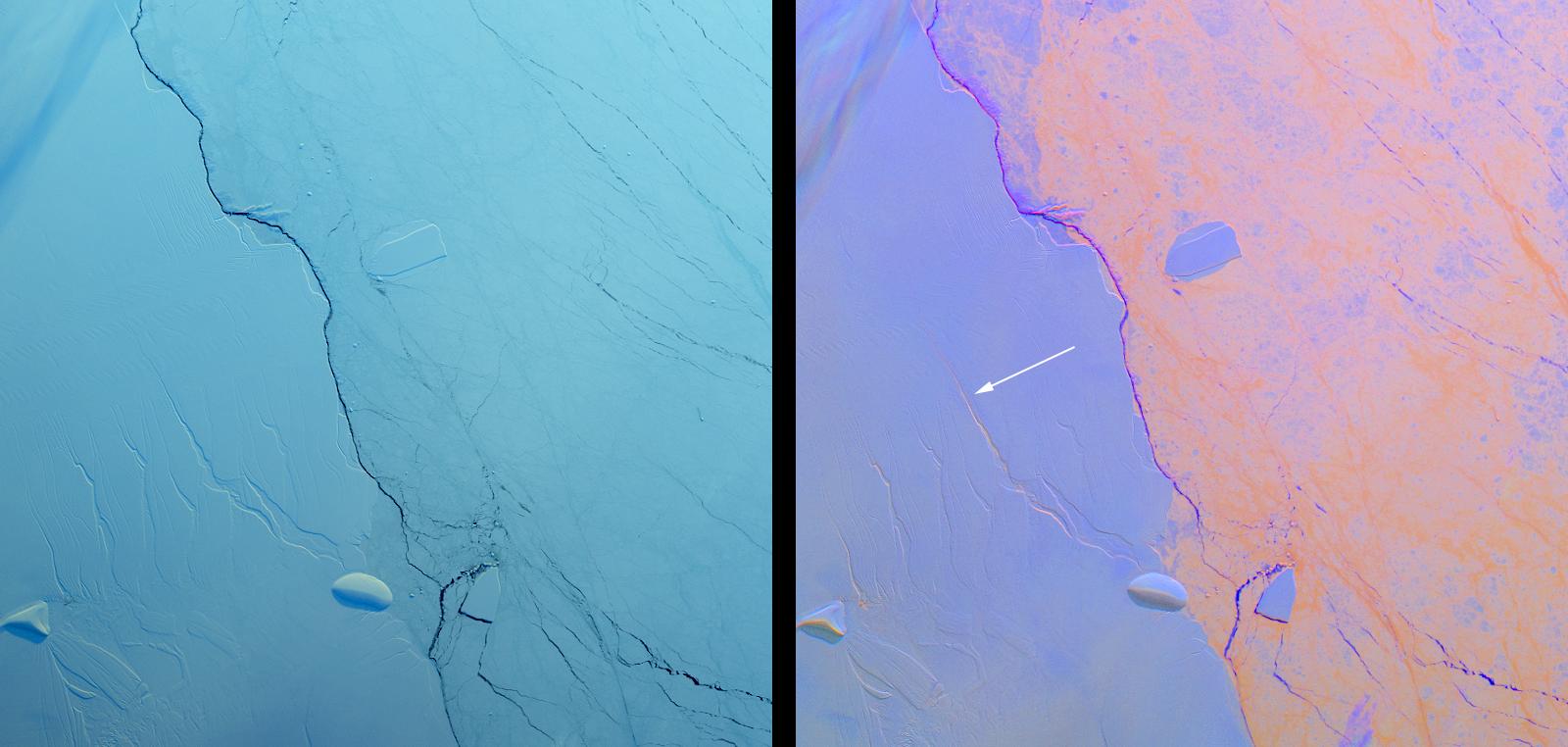
Growing Crack in Antarctica's Larsen C Ice Shelf Spotted by NASA's MISR
Full Resolution:
TIFF
(3.173 MB)
JPEG
(110.6 kB)
|
|
|
2016-08-27 |
Earth
|
ARIA
|
PALSAR-2
|
1002x1011x3 |

|
-
PIA20893:
-
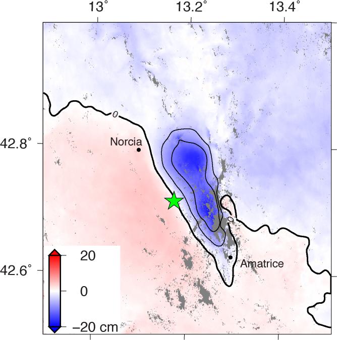
Radar Shows Italy Area Moved 8 Inches by Amatrice Earthquake
Full Resolution:
TIFF
(1.094 MB)
JPEG
(99.43 kB)
|
|
|
2016-08-25 |
Earth
|
Terra
|
MISR
|
1672x1752x3 |
|
-
PIA20892:
-
America's National Parks Viewed in 3D by NASA's MISR (Anaglyph 4)
Full Resolution:
TIFF
(8.792 MB)
JPEG
(502.7 kB)
|
|
|
2016-08-25 |
Earth
|
Terra
|
MISR
|
1652x1496x3 |
|
-
PIA20891:
-
America's National Parks Viewed in 3D by NASA's MISR (Anaglyph 3)
Full Resolution:
TIFF
(6.972 MB)
JPEG
(421 kB)
|
|
|
2016-08-25 |
Earth
|
Terra
|
MISR
|
1656x1498x3 |
|
-
PIA20890:
-
America's National Parks Viewed in 3D by NASA's MISR (Anaglyph 2)
Full Resolution:
TIFF
(6.698 MB)
JPEG
(370.7 kB)
|
|
|
2016-08-25 |
Earth
|
Terra
|
MISR
|
1936x1503x3 |
|
-
PIA20889:
-
America's National Parks Viewed in 3D by NASA's MISR (Anaglyph 1)
Full Resolution:
TIFF
(8.342 MB)
JPEG
(370.6 kB)
|
|
|
2016-08-24 |
Earth
|
Terra
|
ASTER
|
1299x1943x3 |
|
-
PIA20973:
-
Chiquicamata Mine, Chile
Full Resolution:
TIFF
(7.575 MB)
JPEG
(539.6 kB)
|
|
|
2016-08-17 |
Earth
|
Terra
|
MISR
|
1872x2714x3 |
|
-
PIA20888:
-
Long Smoke Plumes from California's Destructive Blue Cut Fire Spotted by NASA's MISR
Full Resolution:
TIFF
(13.21 MB)
JPEG
(578.8 kB)
|
|
|
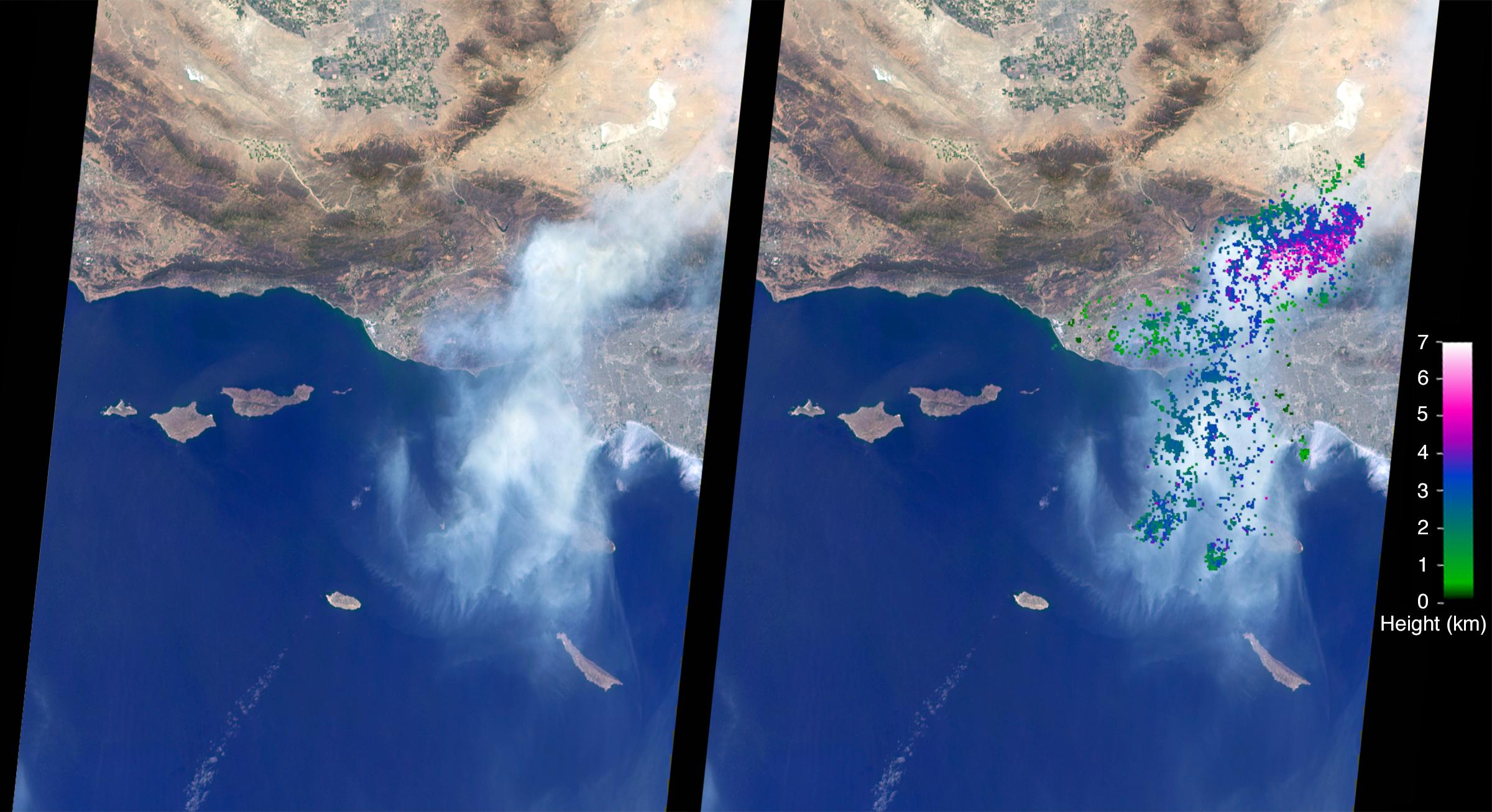
2016-08-12 |
Earth
|
Terra
|
MISR
|
3743x2048x3 |
|
-
PIA20887:
-
Deadly Fires Engulfing Madeira seen by NASA's MISR
Full Resolution:
TIFF
(15.73 MB)
JPEG
(743.9 kB)
|
|
|
2016-08-12 |
Earth
|
Terra
|
MISR
|
2048x2240x3 |
|
-
PIA20886:
-
Deadly Fires Engulfing Madeira seen by NASA's MISR (Anaglyph)
Full Resolution:
TIFF
(7.375 MB)
JPEG
(477.1 kB)
|
|
|
2016-08-10 |
Earth
|
Terra
|
ASTER
|
1440x1584x3 |
|
-
PIA20804:
-
Lilongwe, Malawi
Full Resolution:
TIFF
(6.846 MB)
JPEG
(835.5 kB)
|
|
|
2016-08-10 |
Earth
|
Terra
|
MISR
|
3546x1849x3 |

|
-
PIA20885:
-
Site of the 2016 Summer Olympic Games viewed by NASA's MISR
Full Resolution:
TIFF
(14.09 MB)
JPEG
(945.5 kB)
|
|
|
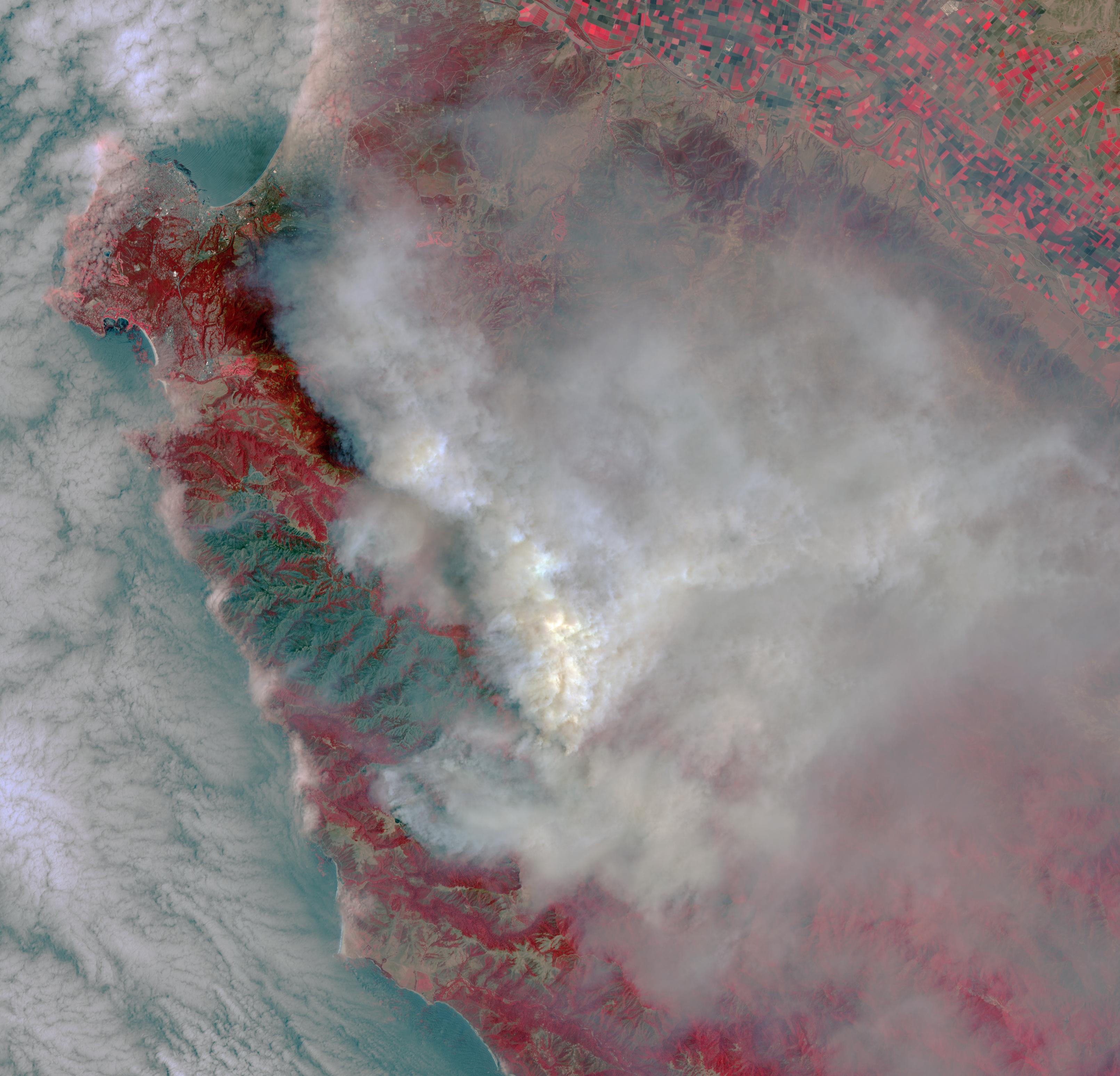
2016-08-09 |
Earth
|
Terra
|
ASTER
|
2841x2028x3 |
|
-
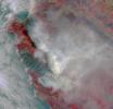
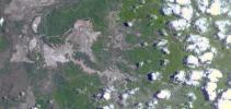
PIA20725:
-
Growing Wildfire Near Big Sur, California Imaged by NASA's Terra Spacecraft
Full Resolution:
TIFF
(13.66 MB)
JPEG
(749.1 kB)
|
|
|
2016-08-02 |
Earth
|
Terra
|
MISR
|
2400x1307x3 |
|
-
PIA20724:
-
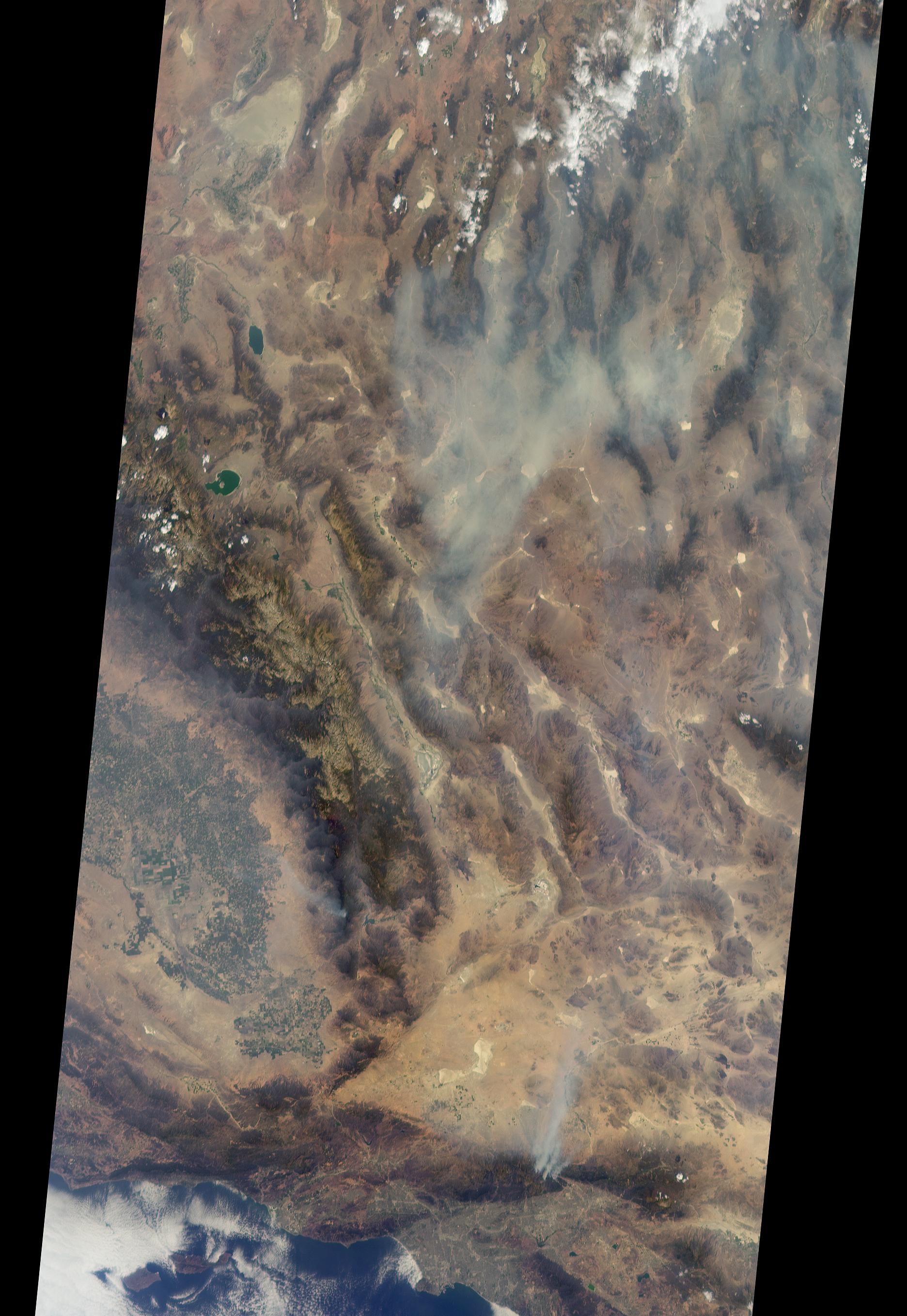
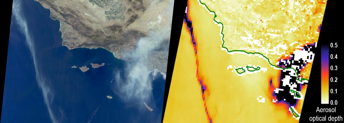
NASA's MISR Studies Smoke Plumes from California's Sand Fire
Full Resolution:
TIFF
(8.226 MB)
JPEG
(312.6 kB)
|
|
|
2016-08-02 |
Earth
|
Terra
|
ASTER
|
2085x1716x3 |
|
-
PIA20723:
-
NASA Spacecraft Spots Aftermath of Destructive Wildfire in LA's Backyard
Full Resolution:
TIFF
(9.242 MB)
JPEG
(832.7 kB)
|
|
|
2016-08-01 |
Earth
|
Terra
|
ASTER
|
3222x3096x3 |
|
-
PIA20722:
-
Destructive Wildfire Near Big Sur, California. Captured NASA's Terra Satellite
Full Resolution:
TIFF
(25.04 MB)
JPEG
(770.3 kB)
|
|
|
2016-07-28 |
Earth
|
Terra
|
ASTER
|
2820x2240x3 |

|
-
PIA20721:
-
Wyoming Wildfire Spotted by NASA Spacecraft
Full Resolution:
TIFF
(17.15 MB)
JPEG
(537.7 kB)
|
|
|
2016-07-26 |
Earth
|
Terra
|
ASTER
|
1753x1485x3 |
|
-
PIA18670:
-
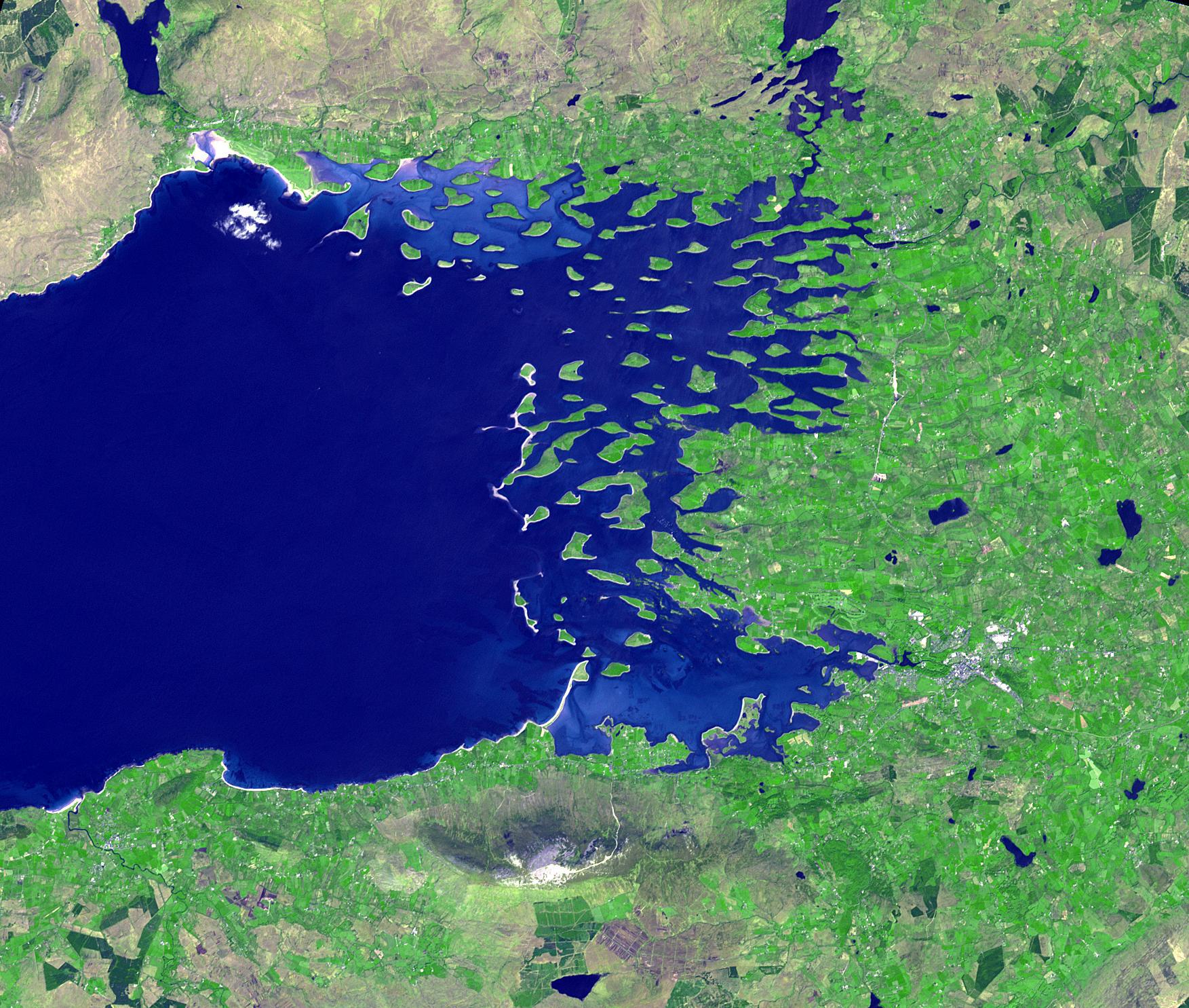
Clew Bay, Ireland
Full Resolution:
TIFF
(7.813 MB)
JPEG
(536.9 kB)
|
|
|
2016-07-26 |
Earth
|
Terra
|
MISR
|
1200x431x3 |
|
-
PIA20720:
-
Smoke from California's Sand and Soberanes Fires Observed by NASA's MISR
Full Resolution:
TIFF
(1.252 MB)
JPEG
(69.32 kB)
|
|
|
2016-07-08 |
Earth
|
Terra
|
MISR
|
1800x1536x3 |
|
-
PIA20719:
-
Supertyphoon Nepartak Barreling Toward Taiwan Viewed by NASA's MISR
Full Resolution:
TIFF
(5.588 MB)
JPEG
(393 kB)
|
|
|
2016-07-05 |
Earth
|
Terra
|
ASTER
|
3039x2821x3 |
|
-
PIA20776:
-
Rostov, Russia
Full Resolution:
TIFF
(25.73 MB)
JPEG
(2.126 MB)
|
|
|
2016-07-01 |
Earth
|
Terra
|
ASTER
|
2200x2076x3 |
|
-
PIA20741:
-
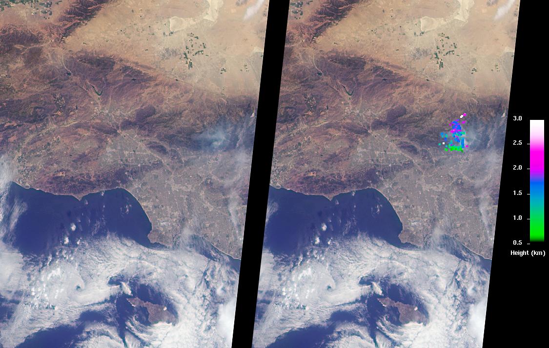
Impact of Destructive California Wildfire Captured by NASA Spacecraft
Full Resolution:
TIFF
(12.45 MB)
JPEG
(885.2 kB)
|
|
|
2016-06-27 |
Earth
|
Earth Observing System (EOS)
|
AVIRIS
|
1019x1278x3 |
|
-
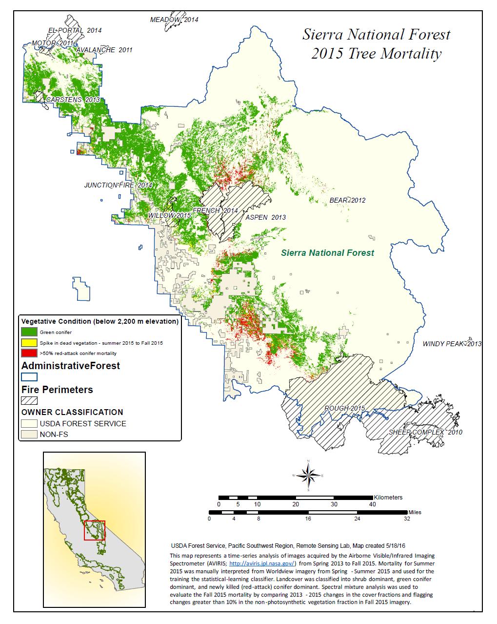
PIA20717:
-
California Drought Effects on Sierra Trees Mapped by NASA
Full Resolution:
TIFF
(635.6 kB)
JPEG
(227.2 kB)
|
|
|
2016-06-24 |
Earth
|
Terra
|
MISR
|
1125x714x3 |
|
-
PIA20718:
-
Southern California Wildfires Observed by NASA's MISR
Full Resolution:
TIFF
(1.988 MB)
JPEG
(138.3 kB)
|
|
|
2016-06-22 |
Earth
|
Terra
|
ASTER
|
2160x1635x3 |
|
-
PIA20734:
-
Major Wildfire Near Santa Barbara seen by NASA Spacecraft
Full Resolution:
TIFF
(10.46 MB)
JPEG
(770.8 kB)
|
|
|
2016-06-15 |
Earth
|
Terra
|
ASTER
|
3652x4200x3 |
|
-
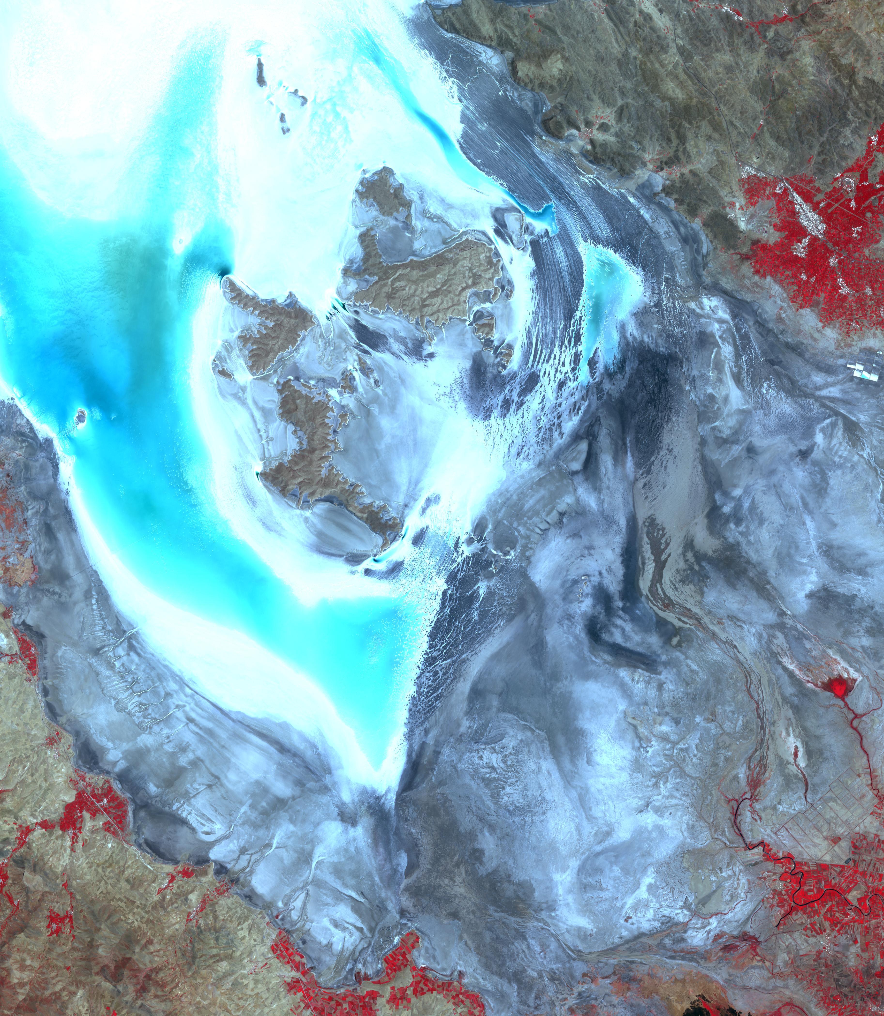
PIA20637:
-
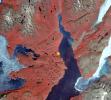
Lake Urmia, Iran
Full Resolution:
TIFF
(45.65 MB)
JPEG
(2.036 MB)
|
|
|
2016-06-14 |
Earth
|
Earth Observing System (EOS)
|
AVIRIS
Hyperion Hyperspectral Imager
|
1600x900x3 |
|
-
PIA20716:
-
A First: NASA Spots Single Methane Leak from Space
Full Resolution:
TIFF
(4.049 MB)
JPEG
(236.9 kB)
|
|
|
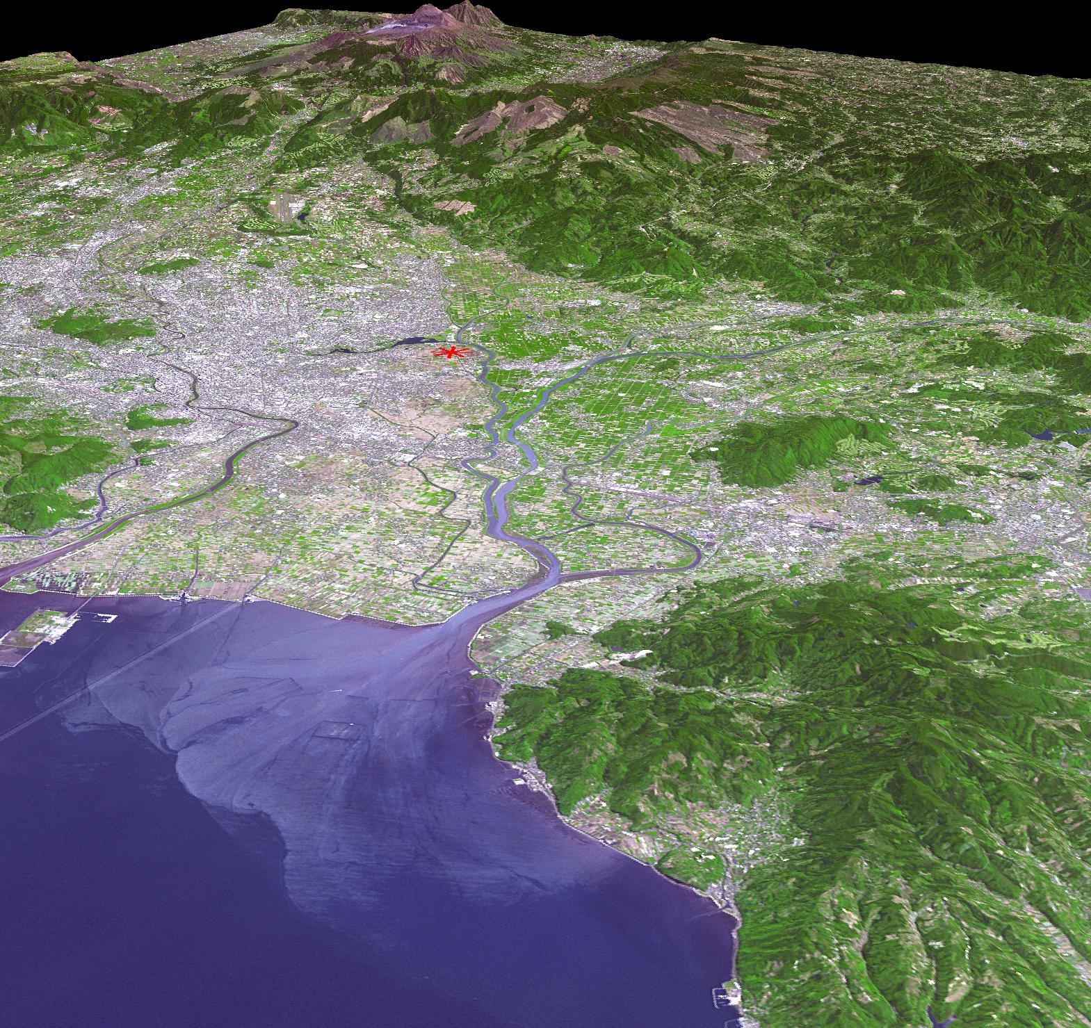
2016-05-27 |
Earth
|
Terra
|
ASTER
|
2415x2022x3 |
|
-
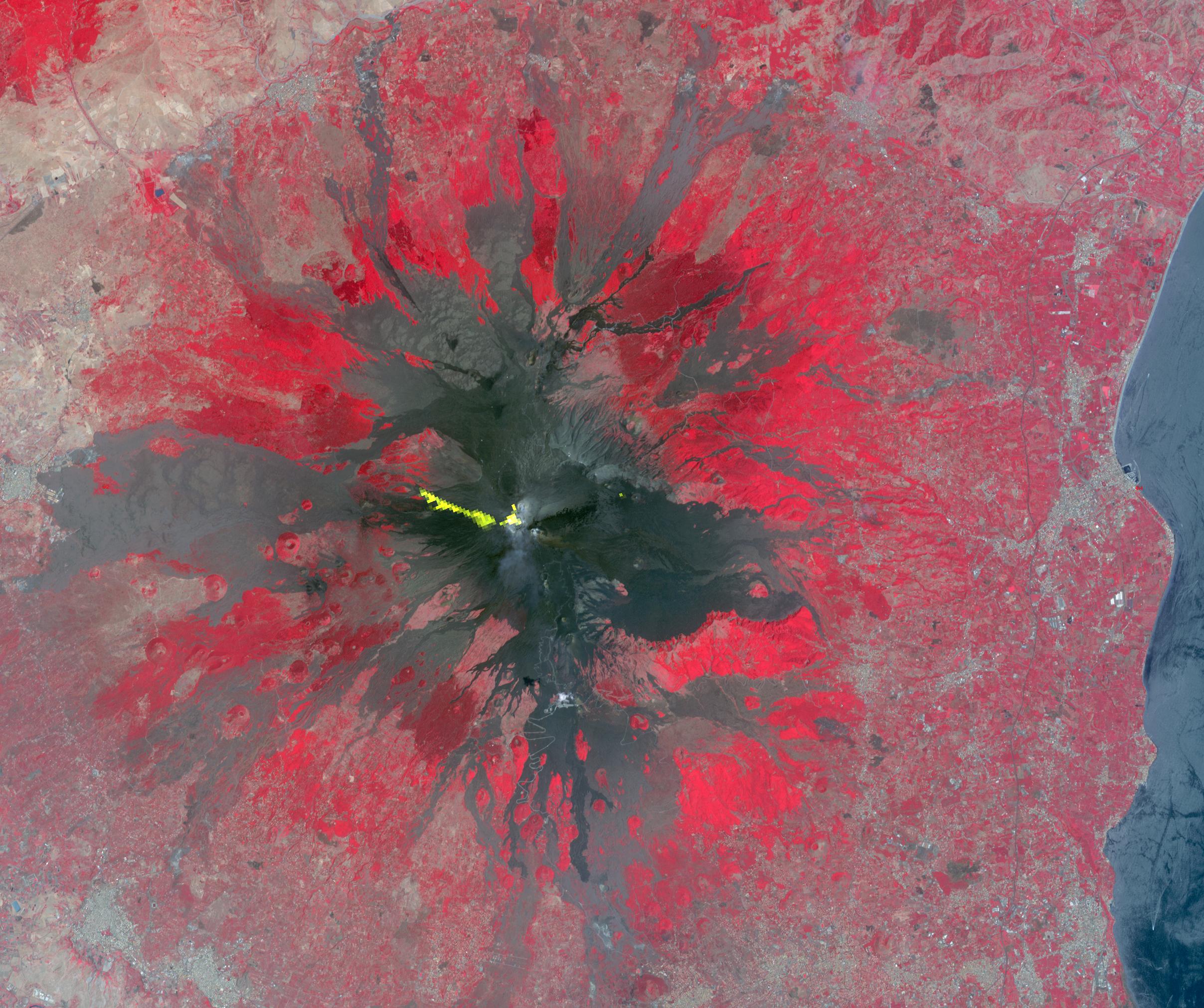
PIA14456:
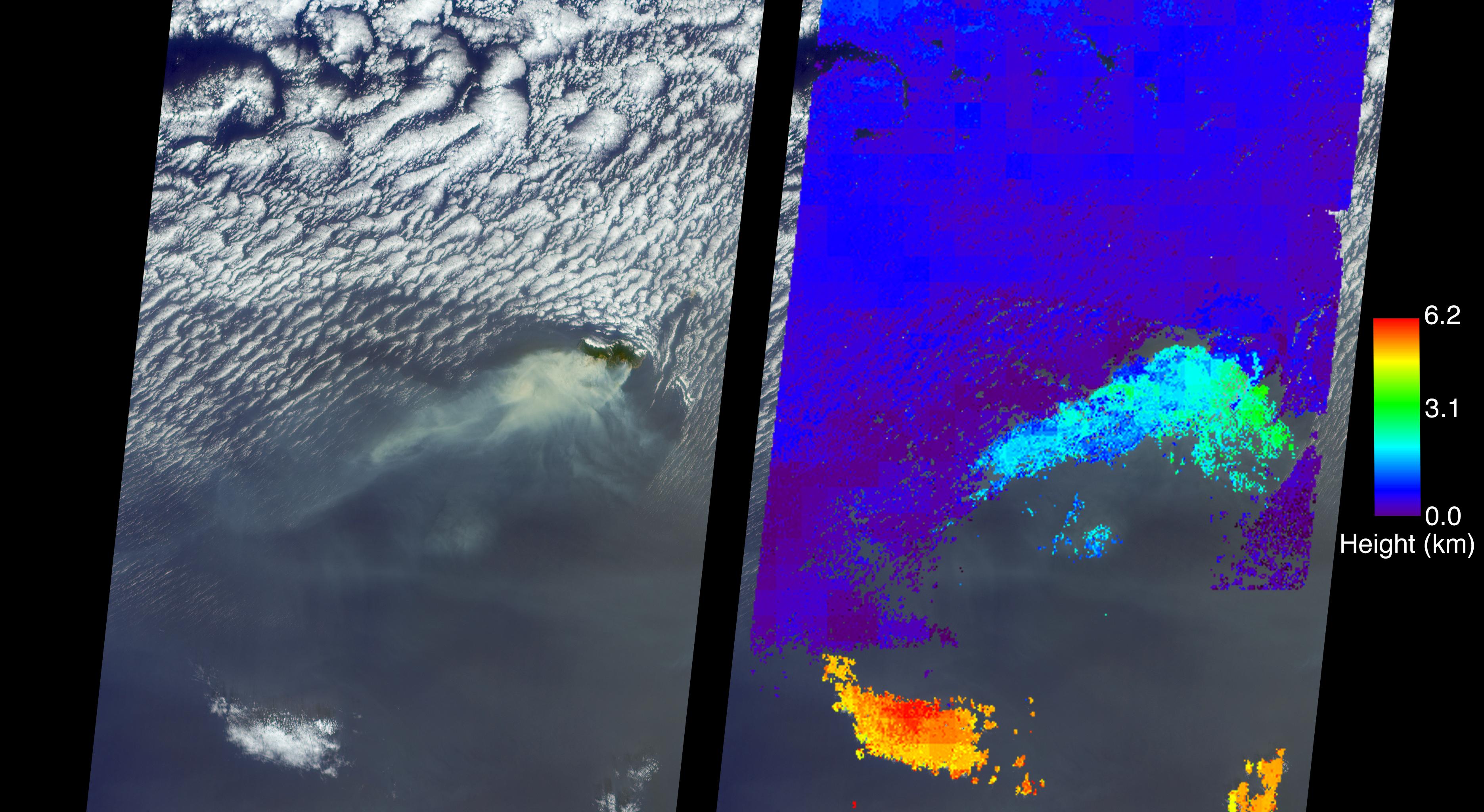
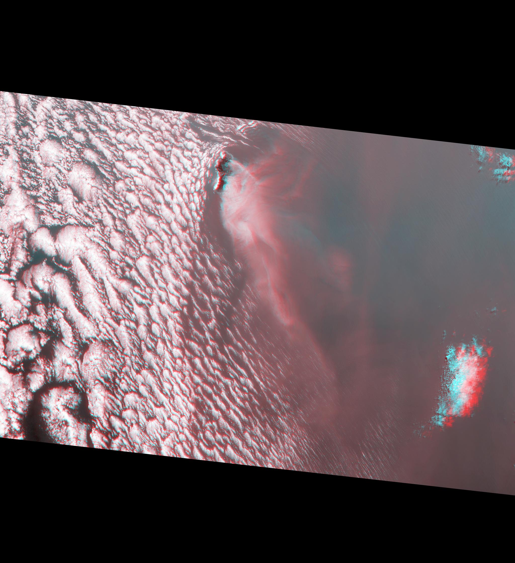
-
Activity at Europe's Most Active Volcano Eyed by NASA Spacecraft
Full Resolution:
TIFF
(14.45 MB)
JPEG
(746.4 kB)
|
|
|
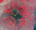
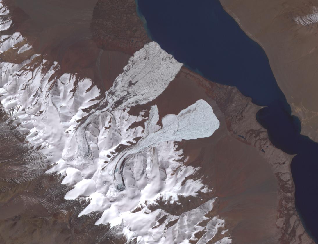
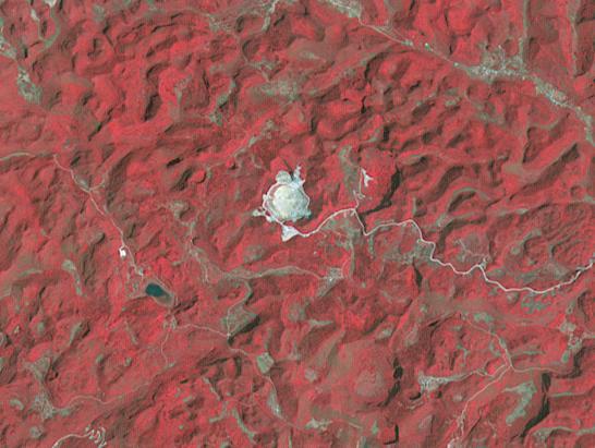
2016-05-24 |
Earth
|
Terra
|
ASTER
|
1507x1482x3 |
|
-
PIA20622:
-
St. Matthew Island, Alaska
Full Resolution:
TIFF
(1.266 MB)
JPEG
(86.54 kB)
|
|
|
2016-05-18 |
Earth
|
Terra
|
ASTER
|
1335x894x3 |
|
-
PIA20586:
-
Devastating Fort McMurray Wildfire in Canada seen by NASA Spacecraft
Full Resolution:
TIFF
(3.284 MB)
JPEG
(159.6 kB)
|
|
|
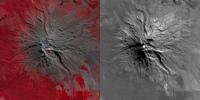
2016-05-13 |
Earth
|
Terra
|
ASTER
|
2800x1400x3 |
|
-
PIA20665:
-
Signs of Life in Mighty New Zealand Volcano seen by NASA Spacecraft
Full Resolution:
TIFF
(5.634 MB)
JPEG
(460.3 kB)
|
|
|
2016-05-11 |
Earth
|
Aqua
|
AIRS
|
914x569x3 |
|
-
PIA20664:
-
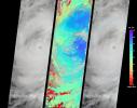
Ozone Hole Formation Over South Pole Observed by NASA's AIRS
Full Resolution:
TIFF
(1.122 MB)
JPEG
(31.32 kB)
|
|
|
2016-05-11 |
Earth
|
Terra
|
MISR
|
3000x2223x3 |
|
-
PIA20663:
-
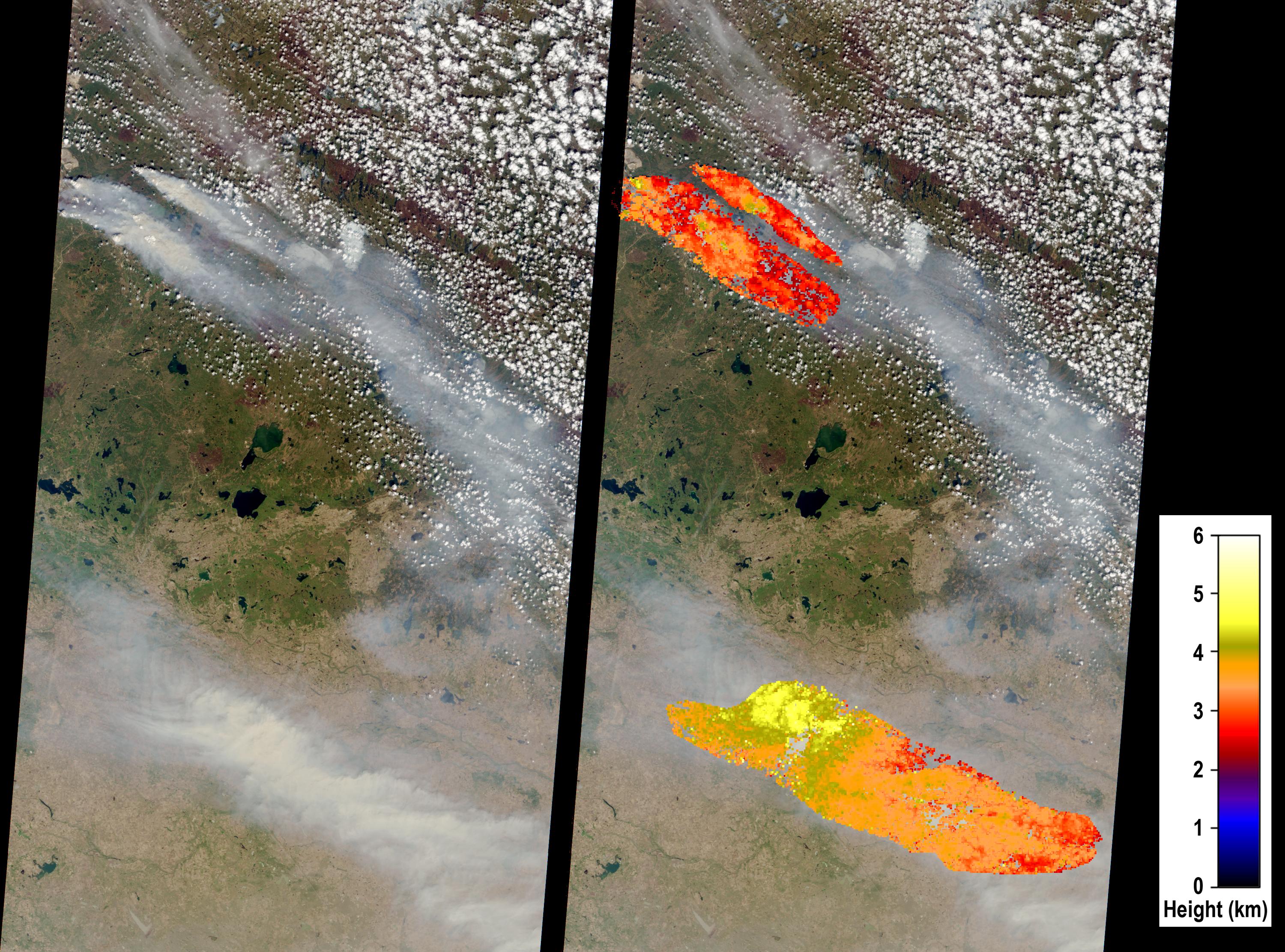
Large Smoke Plumes from Alberta, Canada Fires Observed by NASA's MISR
Full Resolution:
TIFF
(18.27 MB)
JPEG
(1.077 MB)
|
|
|
2016-05-10 |
Earth
|
Terra
|
ASTER
|
544x568x3 |
|
-
PIA20610:
-
Nome, Alaska
Full Resolution:
TIFF
(927.5 kB)
JPEG
(83.04 kB)
|
|
|
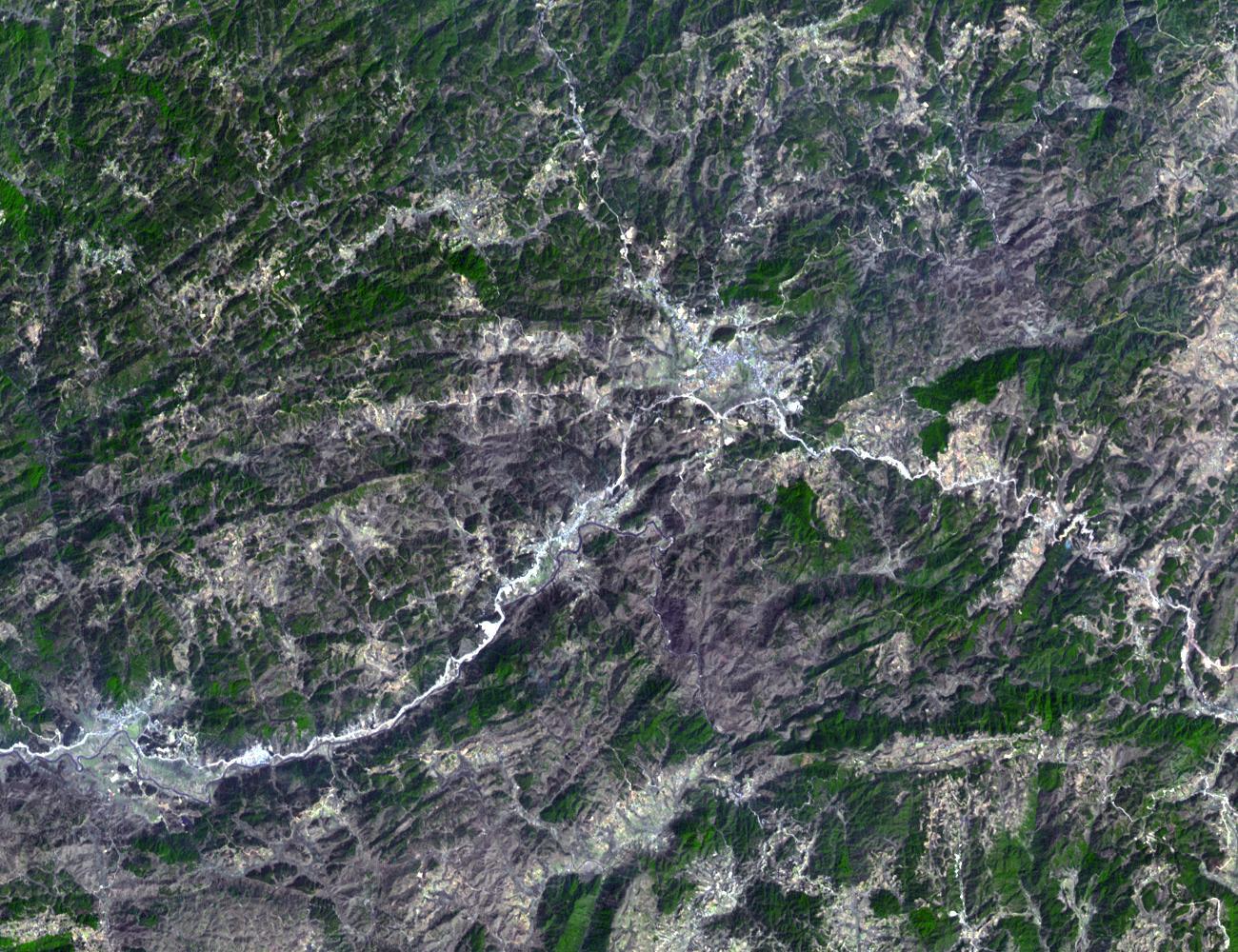
2016-04-20 |
Earth
|
Terra
|
ASTER
|
1569x1479x3 |

|
-
PIA20591:
-
NASA Satellite Shows Site of Devastating Japan Quakes
Full Resolution:
TIFF
(6.964 MB)
JPEG
(633.3 kB)
|
|
|
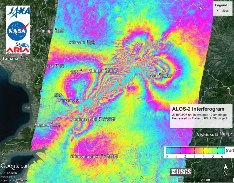
2016-04-20 |
Earth
|
ARIA
|
PALSAR-2
|
970x759x3 |

|
-
PIA20460:
-
NASA's ARIA Project, JAXA Examine Earth Surface Deformation from Kumamoto, Japan Quakes
Full Resolution:
TIFF
(2.21 MB)
JPEG
(165.3 kB)
|
|
|
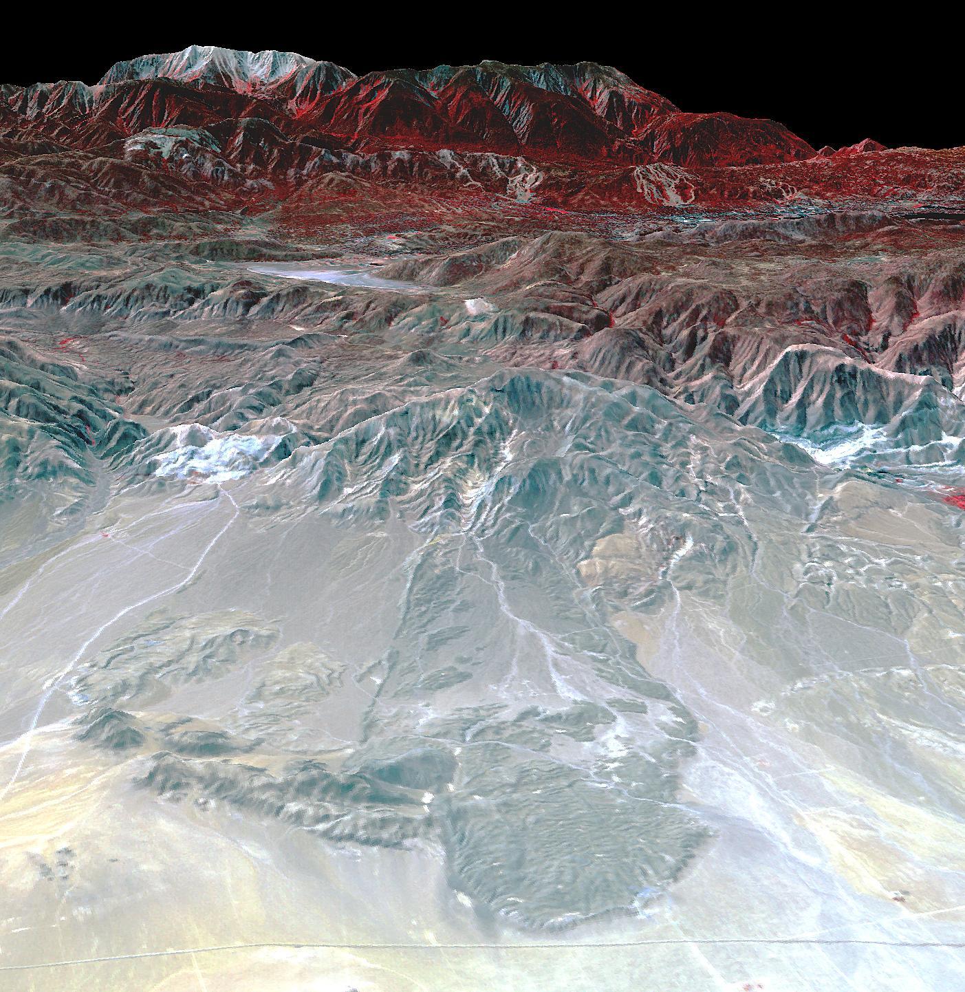
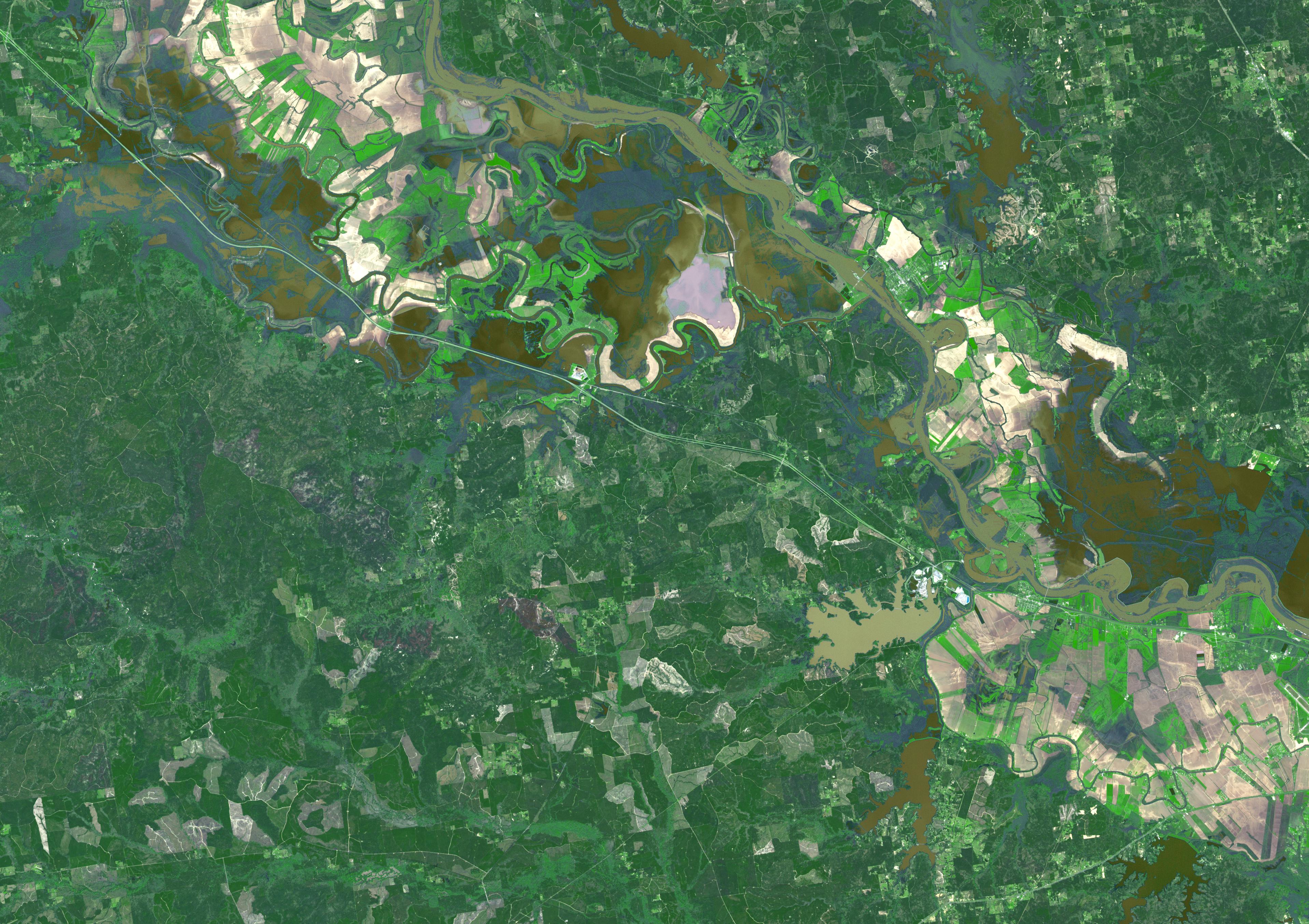
2016-03-21 |
Earth
|
Terra
|
ASTER
|
3836x2710x3 |
|
-
PIA20533:
-
Persistent Flooding in Louisiana Imaged by NASA Spacecraft
Full Resolution:
TIFF
(23.38 MB)
JPEG
(1.729 MB)
|
|
|
2016-03-16 |
Earth
|
Terra
|
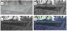
ASTER
|
1300x1000x3 |
|
-
PIA20437:
-
Mawsynram, India
Full Resolution:
TIFF
(3.902 MB)
JPEG
(336.3 kB)
|
|
|
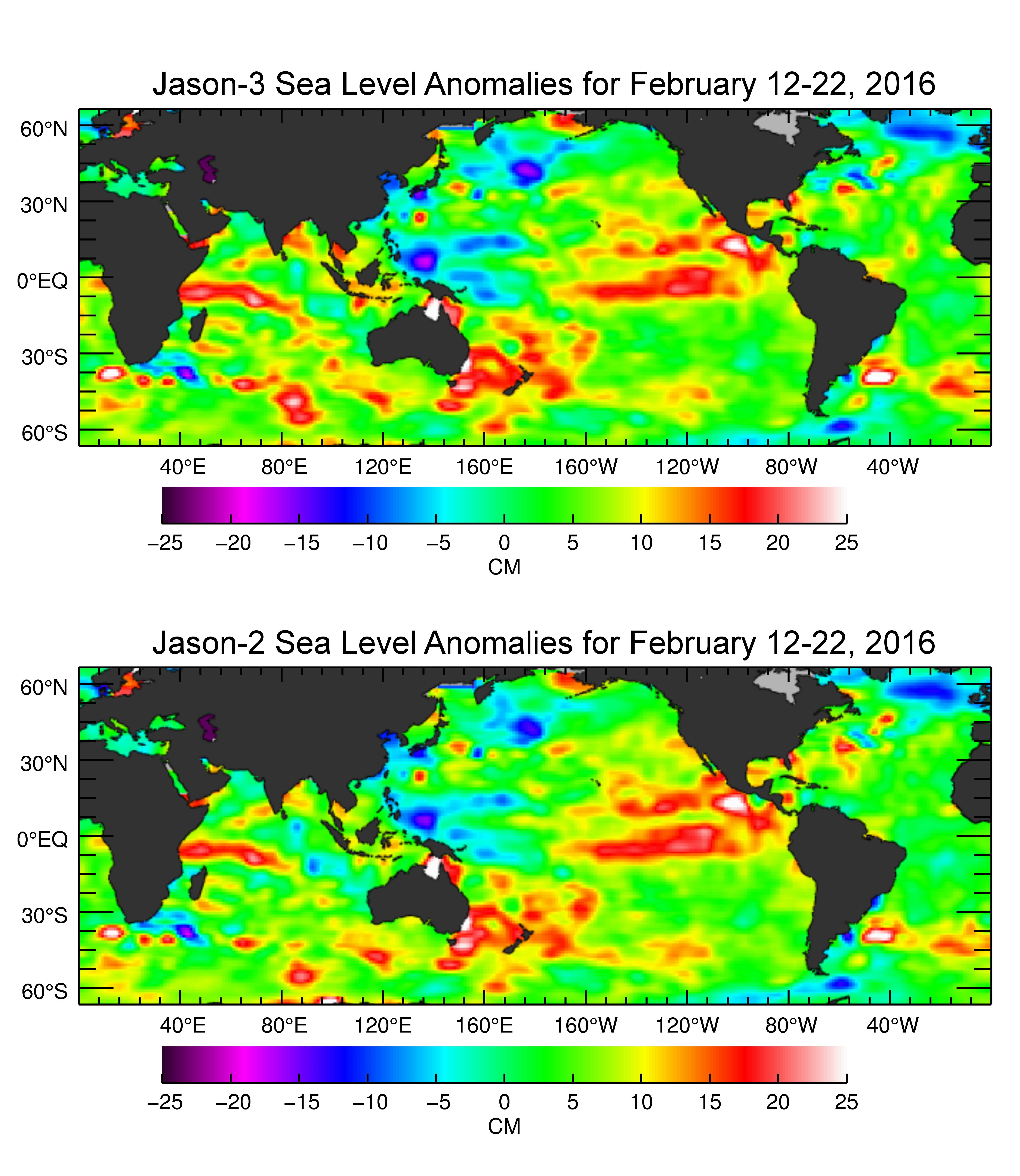
2016-03-16 |
Earth
|
Jason-3
|
|
4769x5500x3 |
|
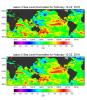
-
PIA20532:
-
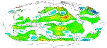
Jason-3 Produces First Global Map of Sea Surface Height
Full Resolution:
TIFF
(20.12 MB)
JPEG
(1.521 MB)
|
|
|
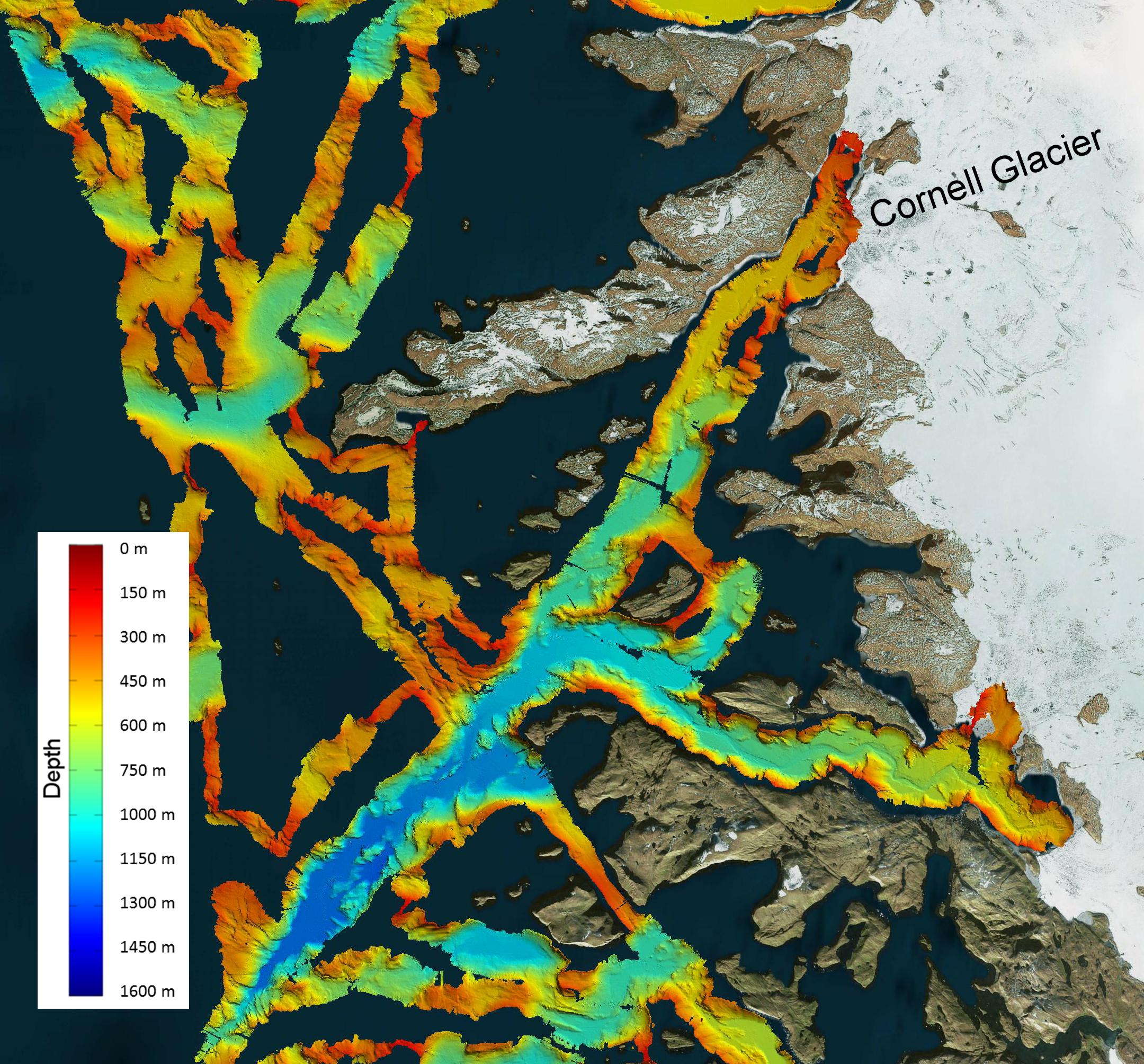
2016-03-08 |
Earth
|
OMG
|
|
2160x2008x3 |
|
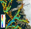
-
PIA20476:
-
NASA's OMG Mission Maps Sea Floor Depth off Greenland's Coast
Full Resolution:
TIFF
(11.12 MB)
JPEG
(733.1 kB)
|
|
|
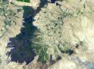
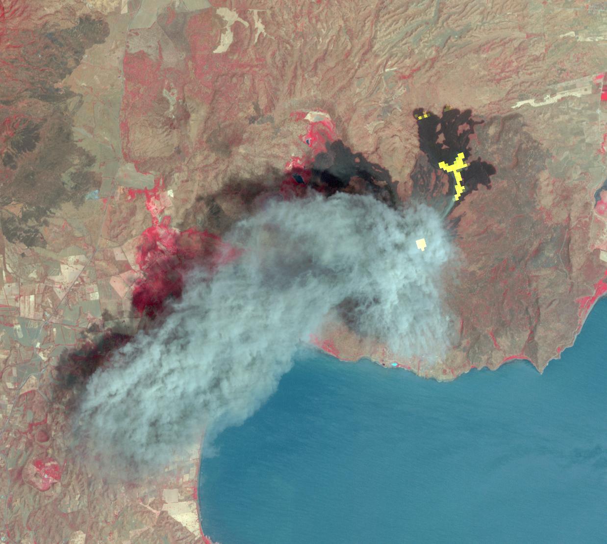
2016-03-02 |
Earth
|
Terra
|
ASTER
|
1238x1108x3 |
|
-
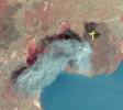
PIA20475:
-
Momotombo's Fury in Nicaragua Captured by NASA Satellite
Full Resolution:
TIFF
(3.738 MB)
JPEG
(162.3 kB)
|
|
|
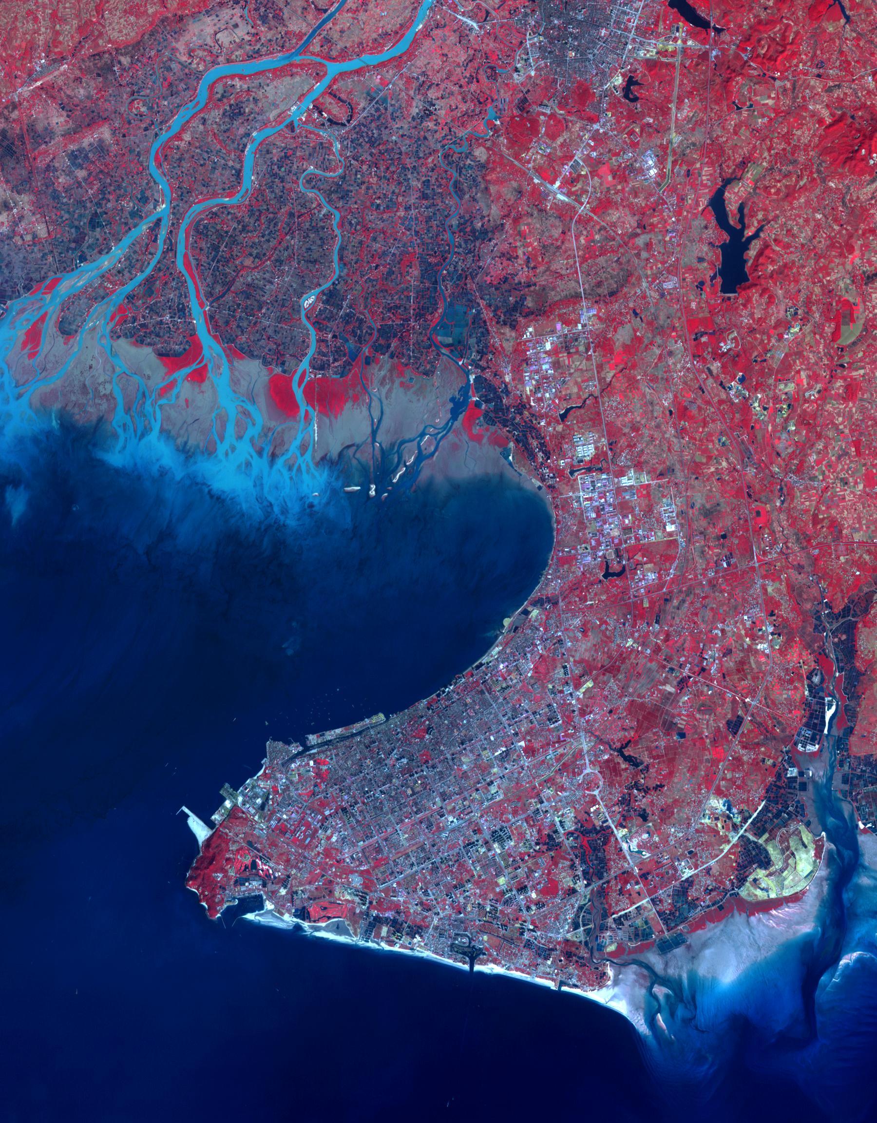
2016-02-29 |
Earth
|
Terra
|
ASTER
|
1800x2304x3 |
|
-
PIA20421:
-
Beihai, Guanxi, China
Full Resolution:
TIFF
(12.45 MB)
JPEG
(701.6 kB)
|
|
|
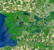
2016-02-16 |
Earth
|
Terra
|
ASTER
|
3790x3400x3 |
|
-
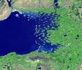
PIA20263:
-
Poyang Lake, China
Full Resolution:
TIFF
(38.67 MB)
JPEG
(1.709 MB)
|
|
|
2016-02-05 |
Earth
|
UAVSAR
|
L-Band UAVSAR
|
1800x2344x1 |
|
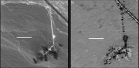
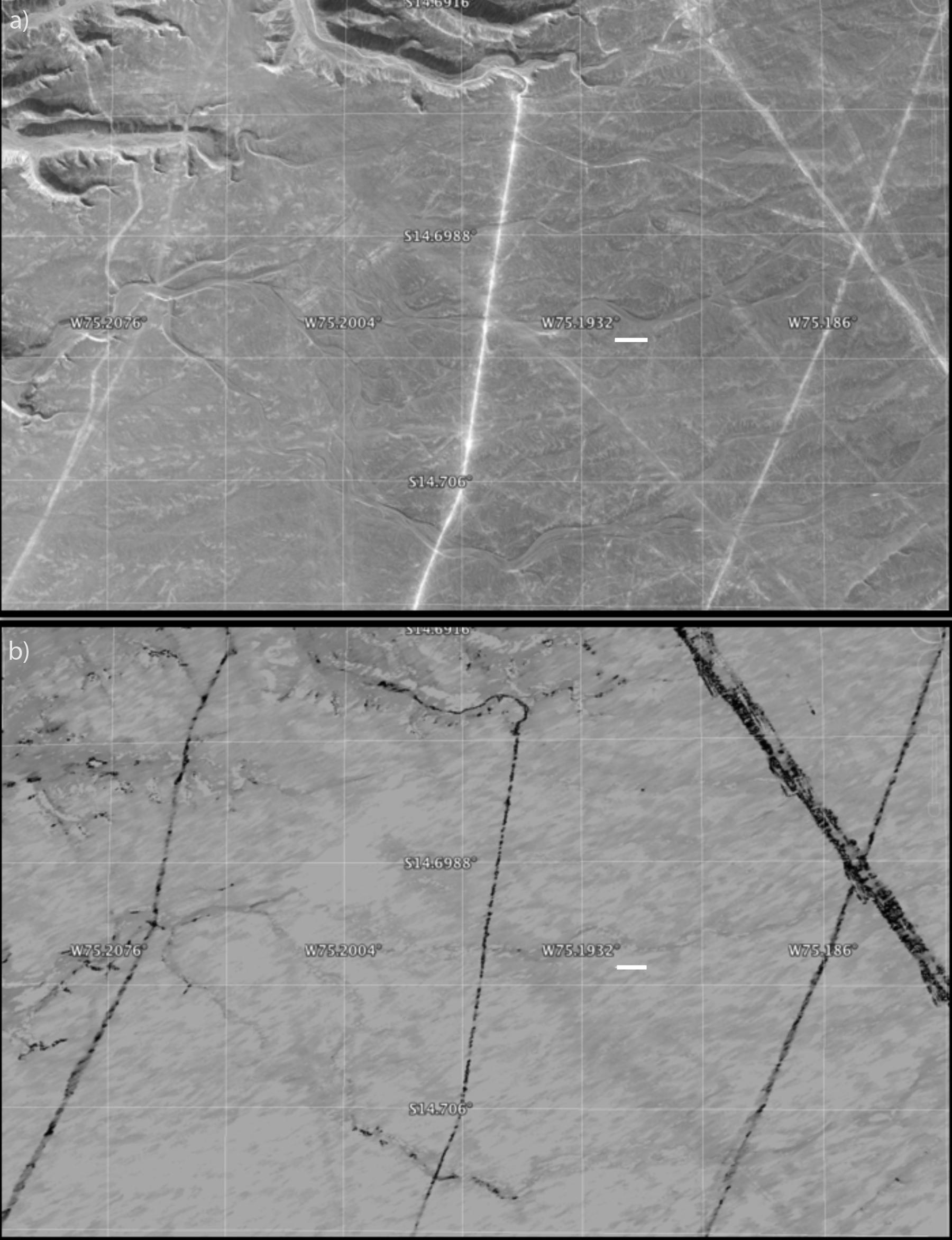
-
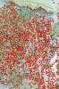
PIA20378:
-
Disturbance on Dirt Roads Crossing Peru's Nasca World Heritage Site seen by NASA's UAVSAR
Full Resolution:
TIFF
(3.03 MB)
JPEG
(327.7 kB)
|
|
|
2016-02-05 |
Earth
|
UAVSAR
|
L-Band UAVSAR
|
1800x882x1 |
|
-
PIA20377:
-
Disturbance at Peru's Nasca World Heritage Site seen by NASA's UAVSAR
Full Resolution:
TIFF
(1.158 MB)
JPEG
(112.2 kB)
|
|
|
2016-02-05 |
Earth
|
UAVSAR
|
L-Band UAVSAR
|
1041x1043x1 |
|
-
PIA20376:
-
Peruvian Geometric Geoglyphs Detected by NASA's UAVSAR
Full Resolution:
TIFF
(3.339 MB)
JPEG
(226.5 kB)
|
|
|
2016-01-28 |
Earth
|
RapidScat
|
ISS-RapidScat
|
682x593x3 |
|
-
PIA20372:
-
Winter Storm Winds on U.S. East Coast, as Viewed by ISS-RapidScat
Full Resolution:
TIFF
(287.4 kB)
JPEG
(85.58 kB)
|
|
|
2016-01-27 |
Earth
|
UAVSAR
|
L-Band UAVSAR
|
1800x2721x1 |
|
-
PIA20367:
-
NASA Radar Brings a New View of World Heritage Site
Full Resolution:
TIFF
(3.714 MB)
JPEG
(332.4 kB)
|
|
|
2016-01-25 |
Earth
|
RapidScat
|
ISS-RapidScat
|
751x479x3 |
|
-
PIA20366:
-
Winter Storm Winds in Southern New Jersey, as Viewed by ISS-RapidScat
Full Resolution:
TIFF
(247.3 kB)
JPEG
(74.27 kB)
|
|
|
2016-01-21 |
Earth
|
RapidScat
|
ISS-RapidScat
|
1532x696x3 |
|
-
PIA20365:
-
NASA's RapidScat Observes El Niño Blowing in the Winds
Full Resolution:
TIFF
(811.4 kB)
JPEG
(252.2 kB)
|
|
|
2016-01-20 |
Earth
|
Terra
|
ASTER
|
2532x2544x3 |

|
-
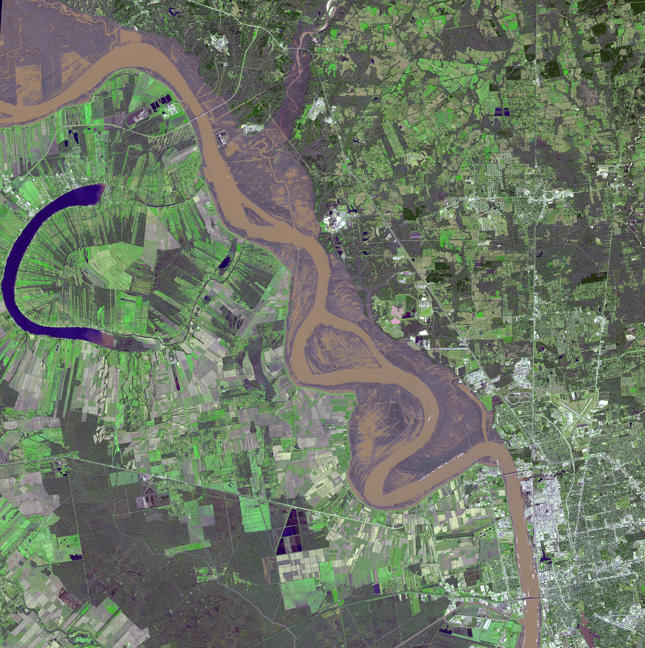
PIA20364:
-
Flooding on the Mississippi River Captured by NASA Spacecraft
Full Resolution:
TIFF
(19.33 MB)
JPEG
(1.766 MB)
|
|
|
2016-01-19 |
Earth
|
Terra
|
ASTER
|
3592x2652x3 |
|
-
PIA20363:
-
Effects of Devastating Australian Bushfires Seen by NASA Spacecraft
Full Resolution:
TIFF
(27.43 MB)
JPEG
(1.902 MB)
|
|
|
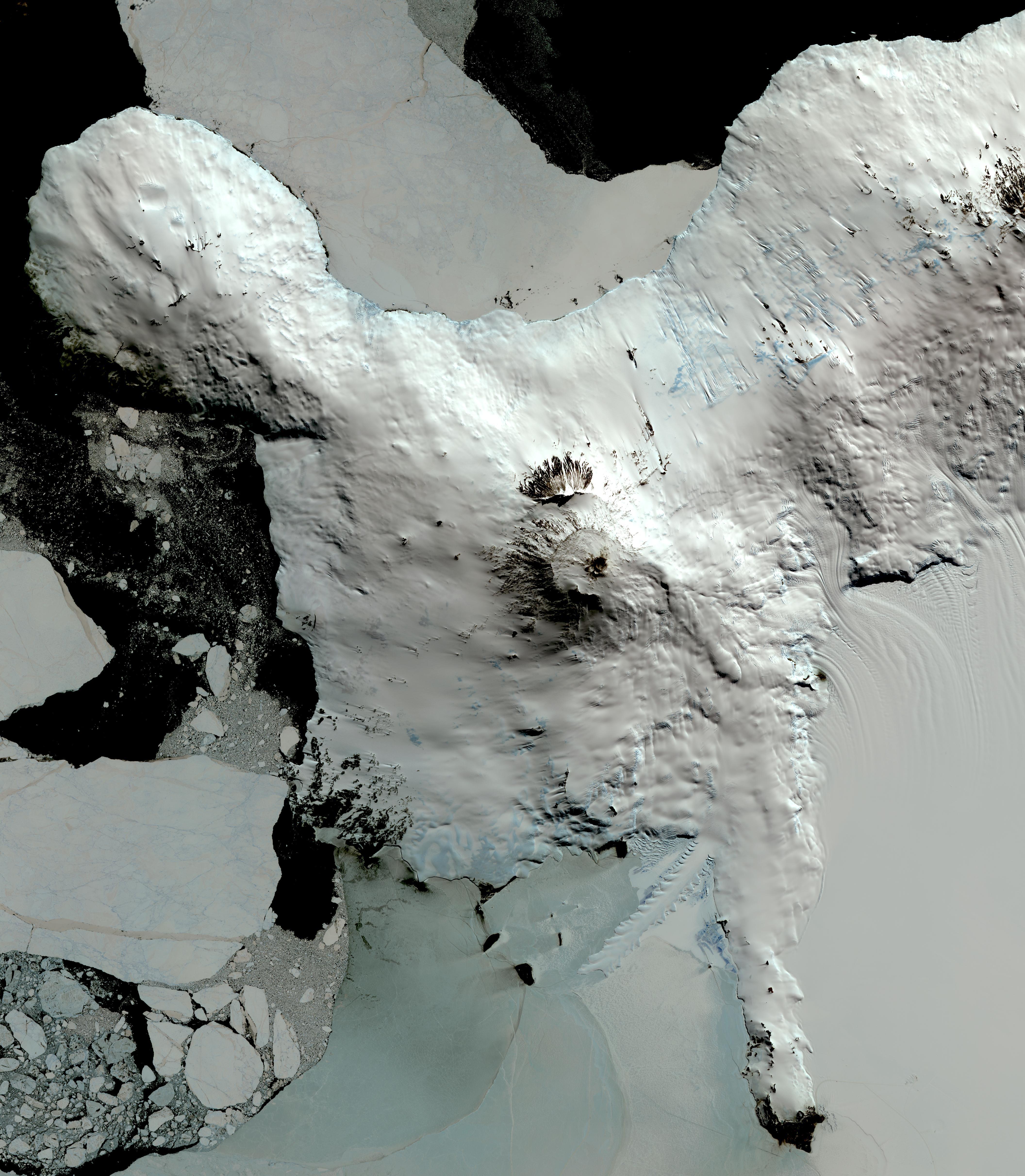
2016-01-15 |
Earth
|
Terra
|
ASTER
|
4224x4846x3 |
|
-
PIA20239:
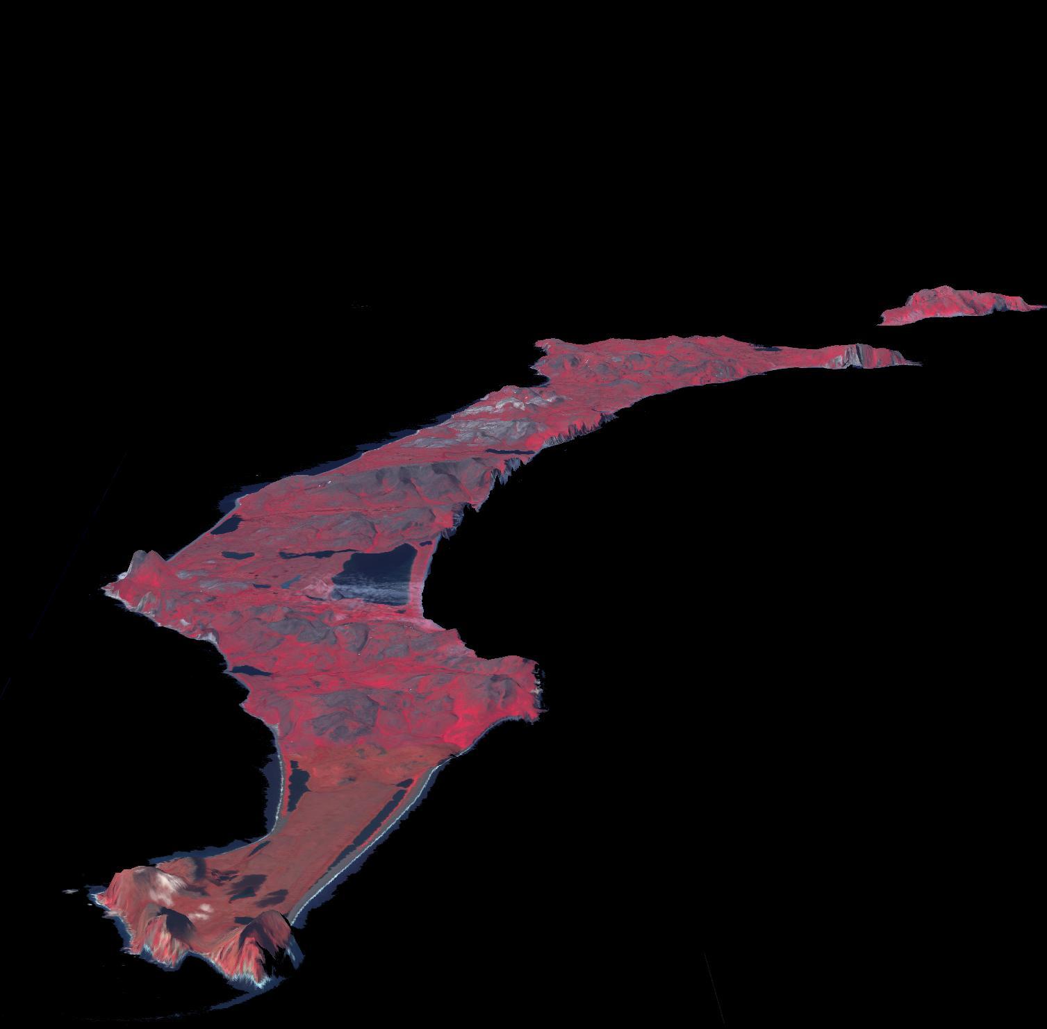
-
Mt. Erebus, Antarctica
Full Resolution:
TIFF
(39.98 MB)
JPEG
(2.048 MB)
|
|
|
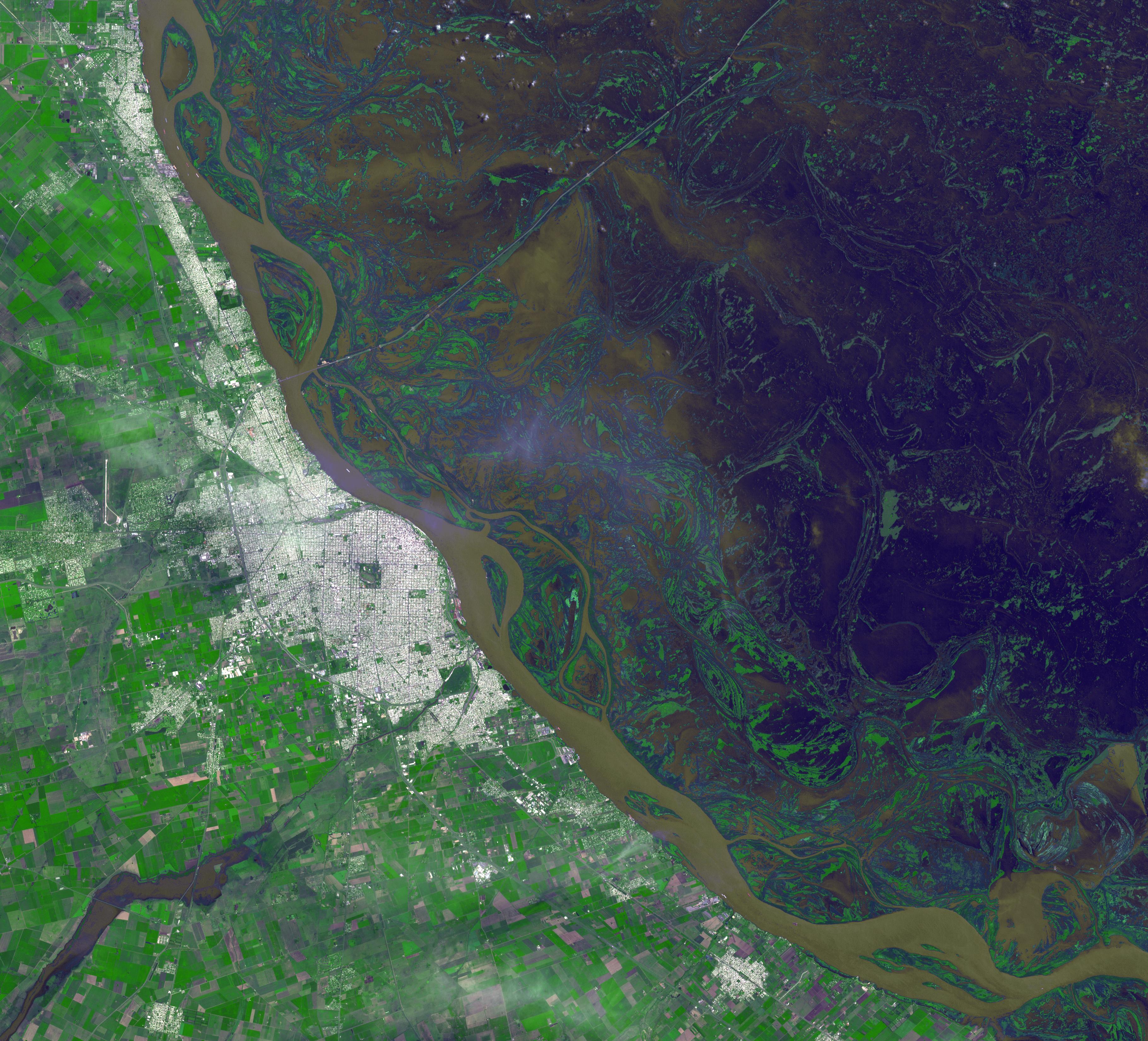
2016-01-07 |
Earth
|
Terra
|
ASTER
|
3640x3300x3 |
|
-
PIA20295:
-
Argentine Flooding Observed by NASA Satellite
Full Resolution:
TIFF
(27.22 MB)
JPEG
(1.895 MB)
|
|
|
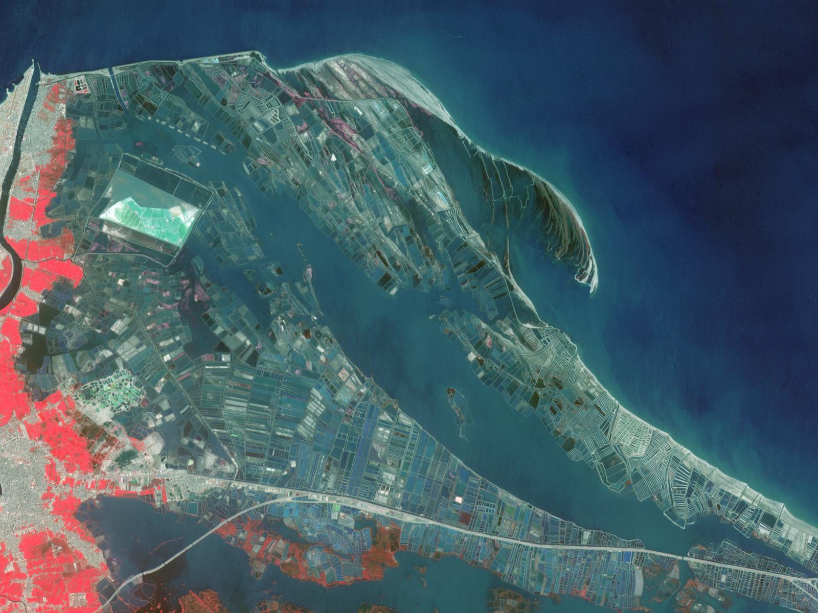
2015-12-09 |
Earth
|
Terra
|
ASTER
|
1600x1200x3 |
|
-
PIA20216:
-
Nile Delta Fisheries, Egypt
Full Resolution:
TIFF
(5.762 MB)
JPEG
(253 kB)
|
|
|
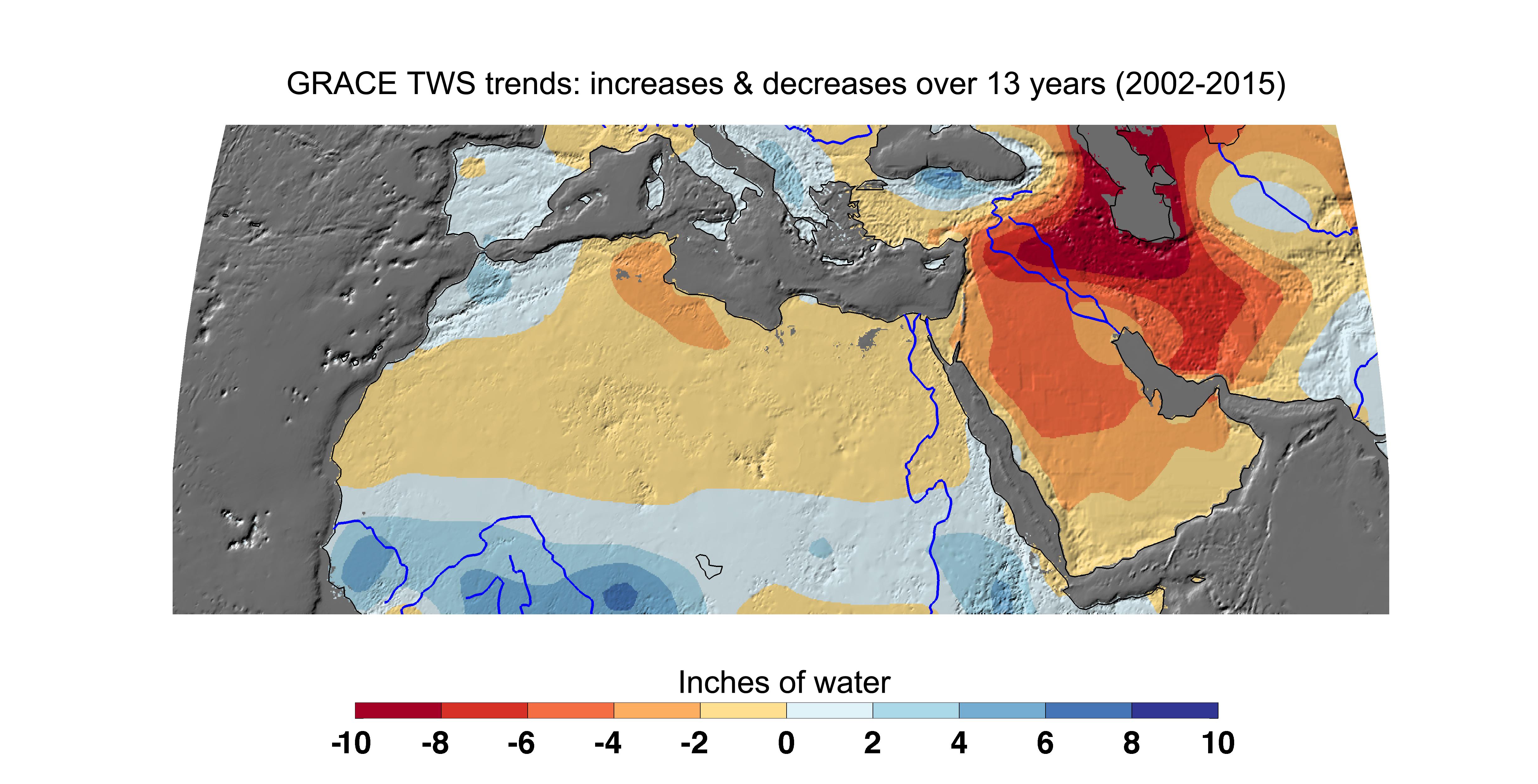
2015-12-08 |
Earth
|
GRACE
|
K-Band Ranging System
|
4900x2500x3 |
|
-
PIA20207:
-
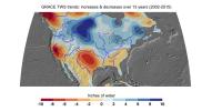
Cumulative Total Middle East/North Africa Freshwater Losses as Seen by NASA's GRACE, 2002-15
Full Resolution:
TIFF
(7.868 MB)
JPEG
(961.7 kB)
|
|
|
2015-12-08 |
Earth
|
GRACE
|
K-Band Ranging System
|
3675x3127x3 |
|
-
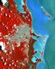
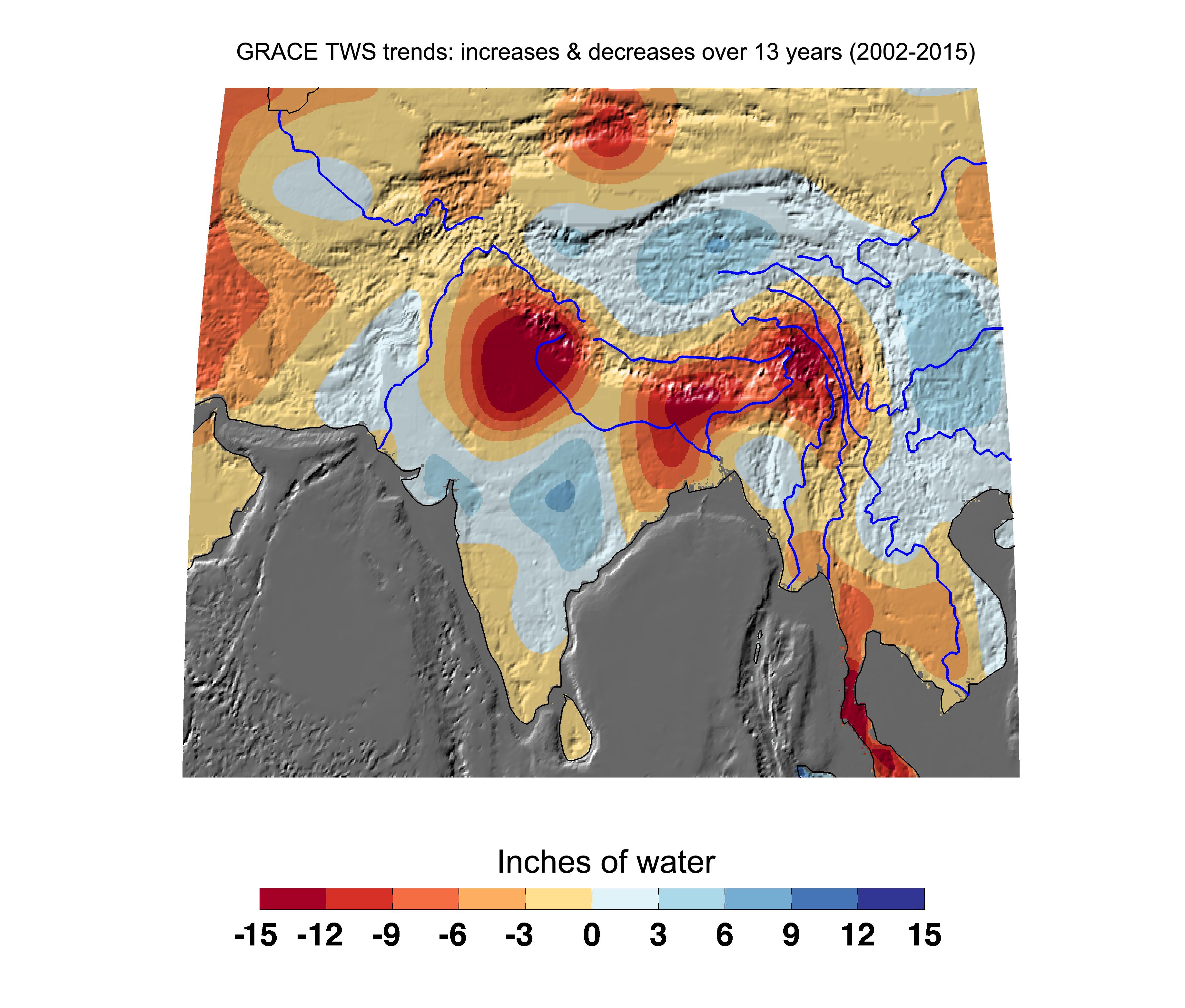
PIA20206:
-
Cumulative Total India Freshwater Losses as Seen by NASA's GRACE, 2002-15
Full Resolution:
TIFF
(7.855 MB)
JPEG
(947.3 kB)
|
|
|
2015-12-08 |
Earth
|
GRACE
|
K-Band Ranging System
|
3335x3332x3 |
|
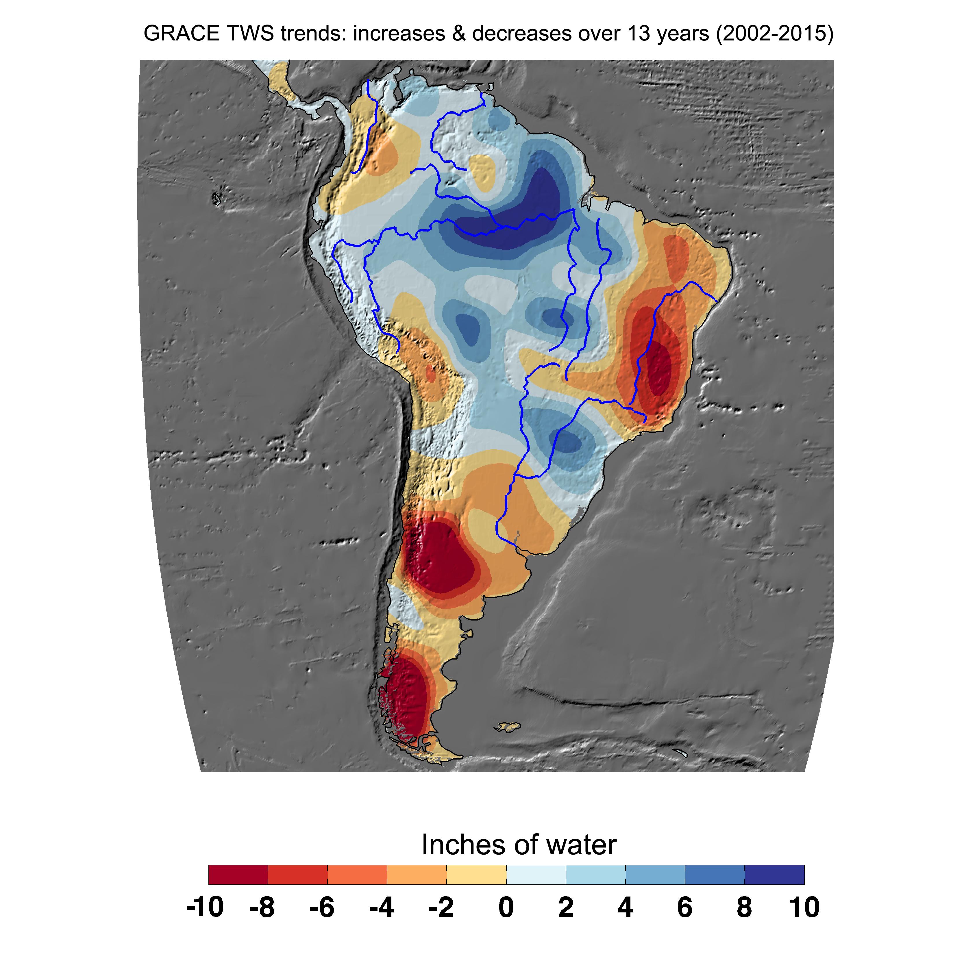
-
PIA20205:
-
Cumulative Total South America Freshwater Losses as Seen by NASA's GRACE, 2002-15
Full Resolution:
TIFF
(6.343 MB)
JPEG
(772.7 kB)
|
|
|
2015-12-08 |
Earth
|
GRACE
|
K-Band Ranging System
|
5198x2724x3 |
|
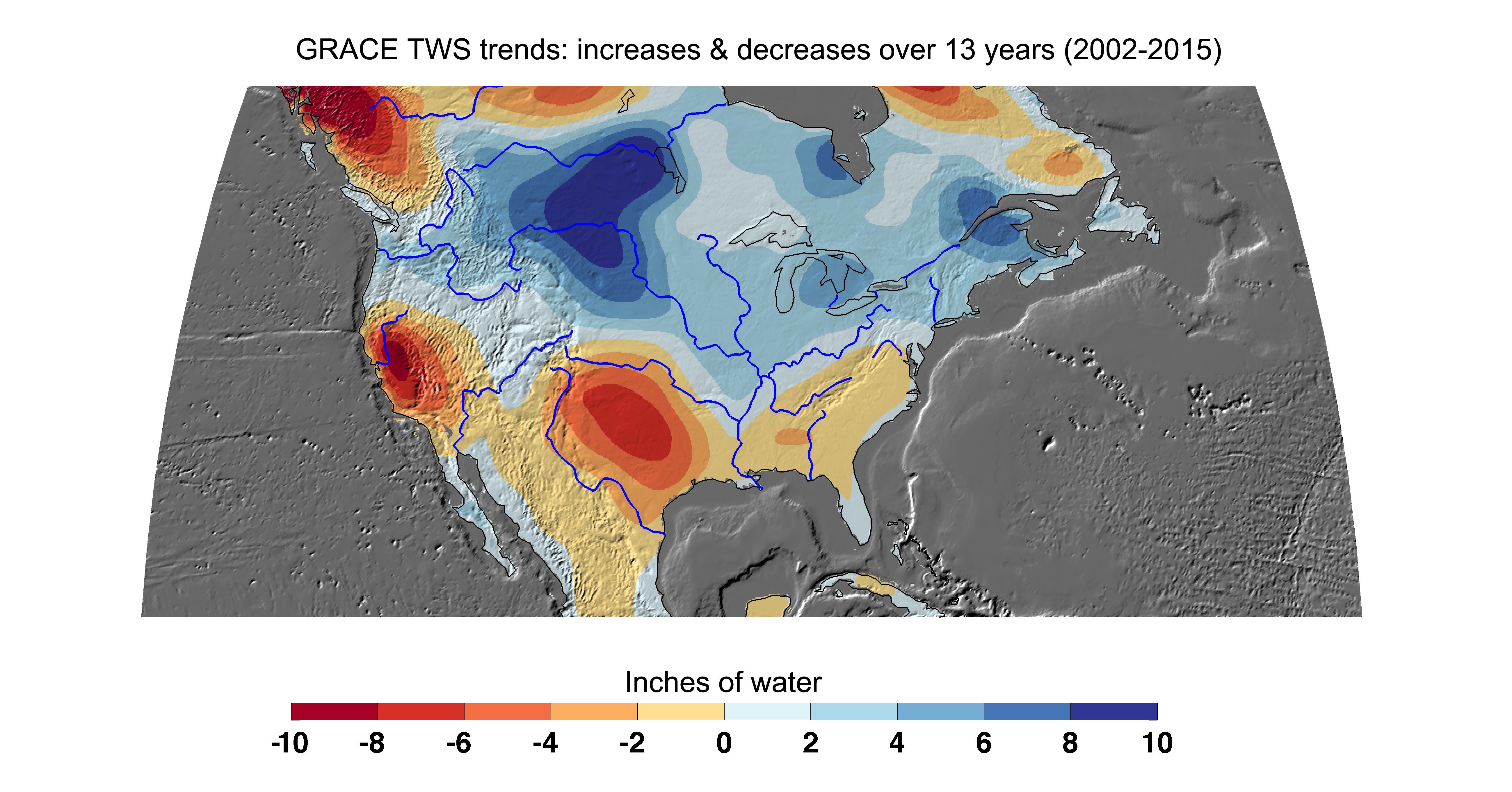
-
PIA20204:
-
Cumulative Total U.S. Freshwater Losses as Seen by NASA's GRACE, 2002-15
Full Resolution:
TIFF
(8.747 MB)
JPEG
(1.212 MB)
|
|
|
2015-12-07 |
Earth
|
Earth Observing-1 (EO-1)
|
Advanced Land Imager (ALI)
|
3000x4828x3 |
|
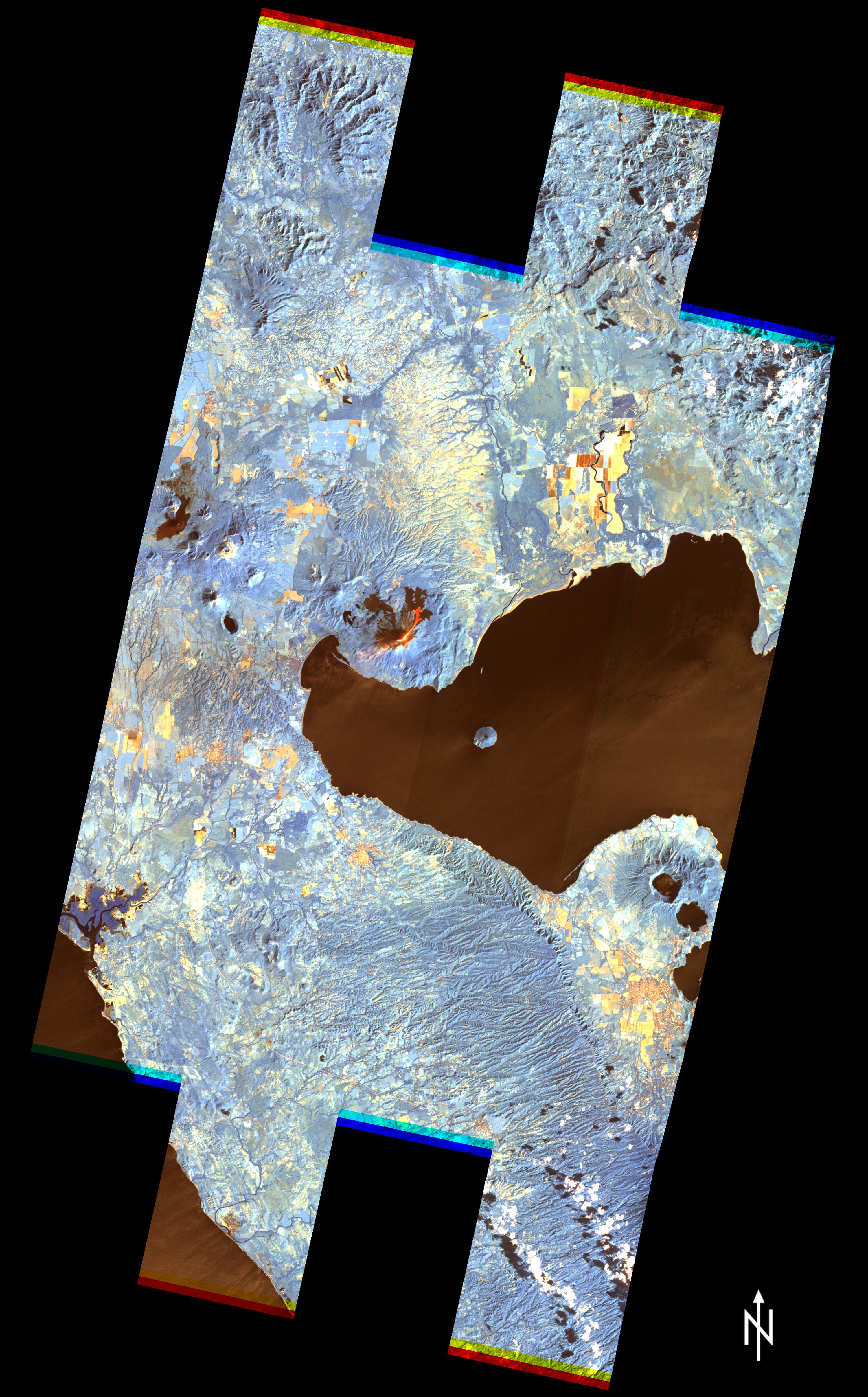
-
PIA20203:
-
Nicaragua Eruption Lava Threat Closely Monitored by NASA EO-1 Spacecraft
Full Resolution:
TIFF
(28.74 MB)
JPEG
(1.71 MB)
|
|
|
2015-11-23 |
Earth
|
|
|
3090x2506x3 |
|
-
PIA20178:
-
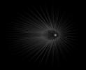
Dark Matter 'Hairs' Around Jupiter
Full Resolution:
TIFF
(1.95 MB)
JPEG
(549.1 kB)
|
|
|
2015-11-23 |
Earth
|
|
|
2550x1769x3 |

|
-
PIA20177:
-
Dark Matter 'Hairs' Around Earth -- Close-up
Full Resolution:
TIFF
(432.9 kB)
JPEG
(129.3 kB)
|
|
|
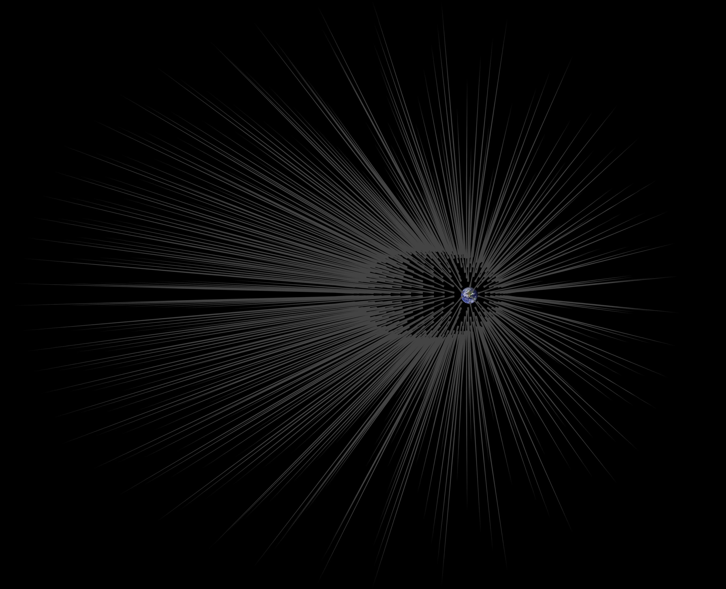
2015-11-23 |
Earth
|
|
|
3090x2506x3 |
|
-
PIA20176:
-
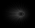
Dark Matter 'Hairs' Around Earth
Full Resolution:
TIFF
(1.94 MB)
JPEG
(549.7 kB)
|
|
|
2015-11-16 |
Earth
|
Terra
|
ASTER
|
2997x1845x3 |
|
-
PIA20104:
-
Orapa Diamond Mine, Botswana
Full Resolution:
TIFF
(16.6 MB)
JPEG
(972.6 kB)
|
|
|
2015-11-14 |
Earth
|
Terra
|
ASTER
|
1583x749x3 |
|
-
PIA20156:
-
Flooding at Iron-Ore Mine, SE Brazil
Full Resolution:
TIFF
(3.558 MB)
JPEG
(217.6 kB)
|
|
|
2015-11-06 |
Earth
|
RapidScat
|
ISS-RapidScat
|
2816x2134x3 |
|
-
PIA20049:
-
RapidScat and Hurricane Patricia
Full Resolution:
TIFF
(8.031 MB)
JPEG
(159.9 kB)
|
|
|
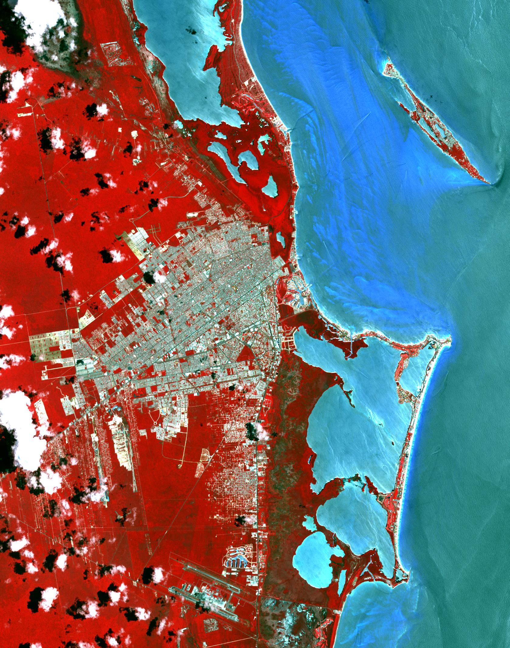
2015-11-02 |
Earth
|
Terra
|
ASTER
|
1678x2134x3 |
|
-
PIA20086:
-
Cancun, Mexico
Full Resolution:
TIFF
(10.75 MB)
JPEG
(711.6 kB)
|
|
|
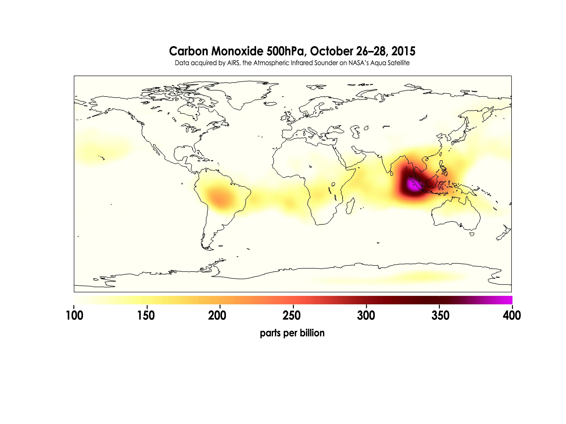
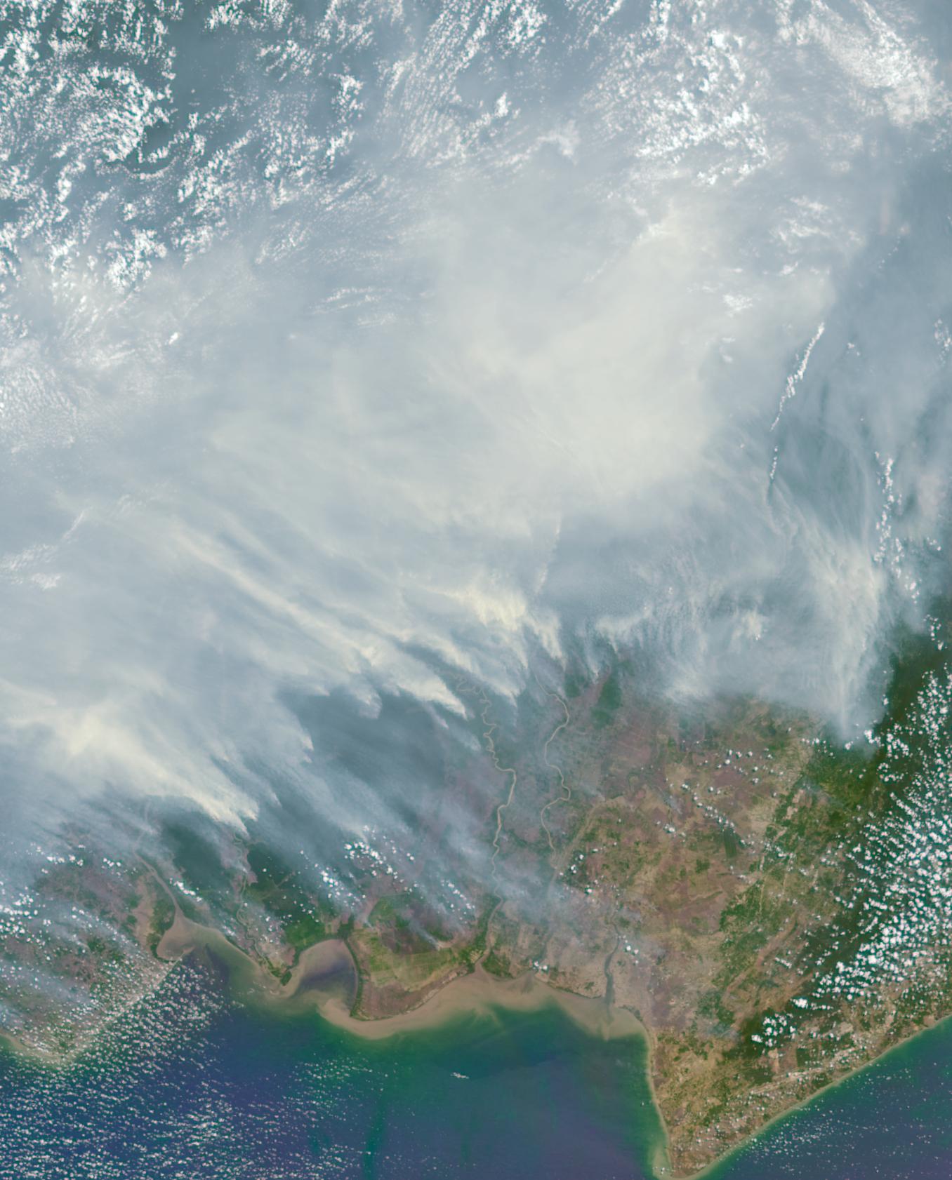
2015-10-30 |
Earth
|
Aquarius
|
AIRS
|
2400x1800x3 |

|
-
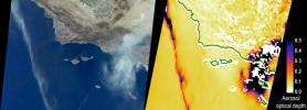
PIA20042:
-
Carbon Monoxide in Mid-Troposphere over Indonesia Fires, October 2015
Full Resolution:
TIFF
(1.047 MB)
JPEG
(259.9 kB)
|
|
|
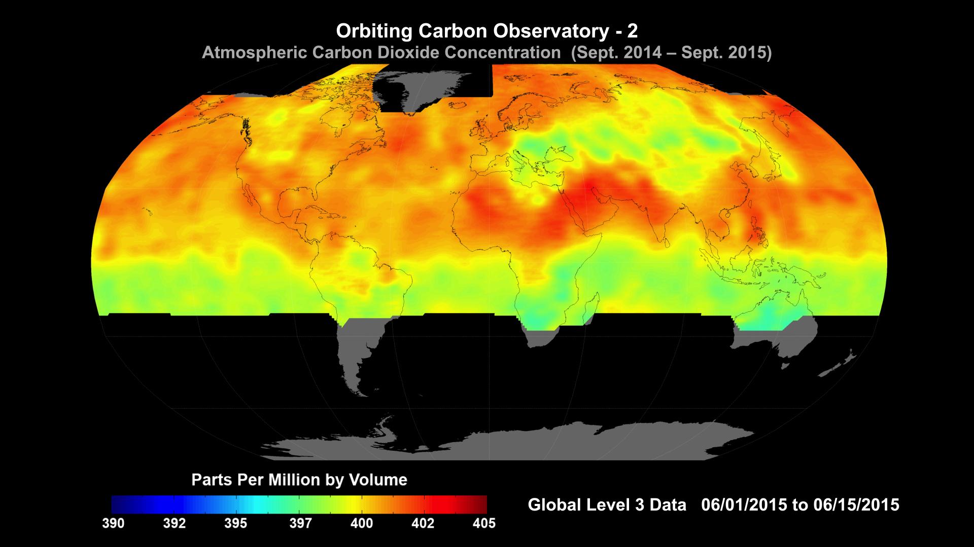
2015-10-29 |
Earth
|
OCO-2
|
OCO-2
|
1920x1080x3 |

|
-
PIA20039:
-
NASA Carbon Sleuth Begins Year Two
Full Resolution:
TIFF
(1.773 MB)
JPEG
(162.3 kB)
|
|
|
2015-10-27 |
Earth
|
Terra
|
ASTER
|
732x734x3 |

|
-
PIA20035:
-
Earthquake in Hindu Kush Region, Afghanistan
Full Resolution:
TIFF
(1.479 MB)
JPEG
(143.1 kB)
|
|
|
2015-10-23 |
Earth
|
RapidScat
|
ISS-RapidScat
|
584x593x3 |
|
-
PIA20031:
-
Hurricane Patricia Viewed by NASA's ISS-RapidScat
Full Resolution:
TIFF
(266.3 kB)
JPEG
(76.25 kB)
|
|
|
2015-10-21 |
Earth
|
Terra
|
MISR
|
1356x1682x3 |
|
-
PIA11218:
-
Borneo on Fire
Full Resolution:
TIFF
(6.253 MB)
JPEG
(246.6 kB)
|
|
|
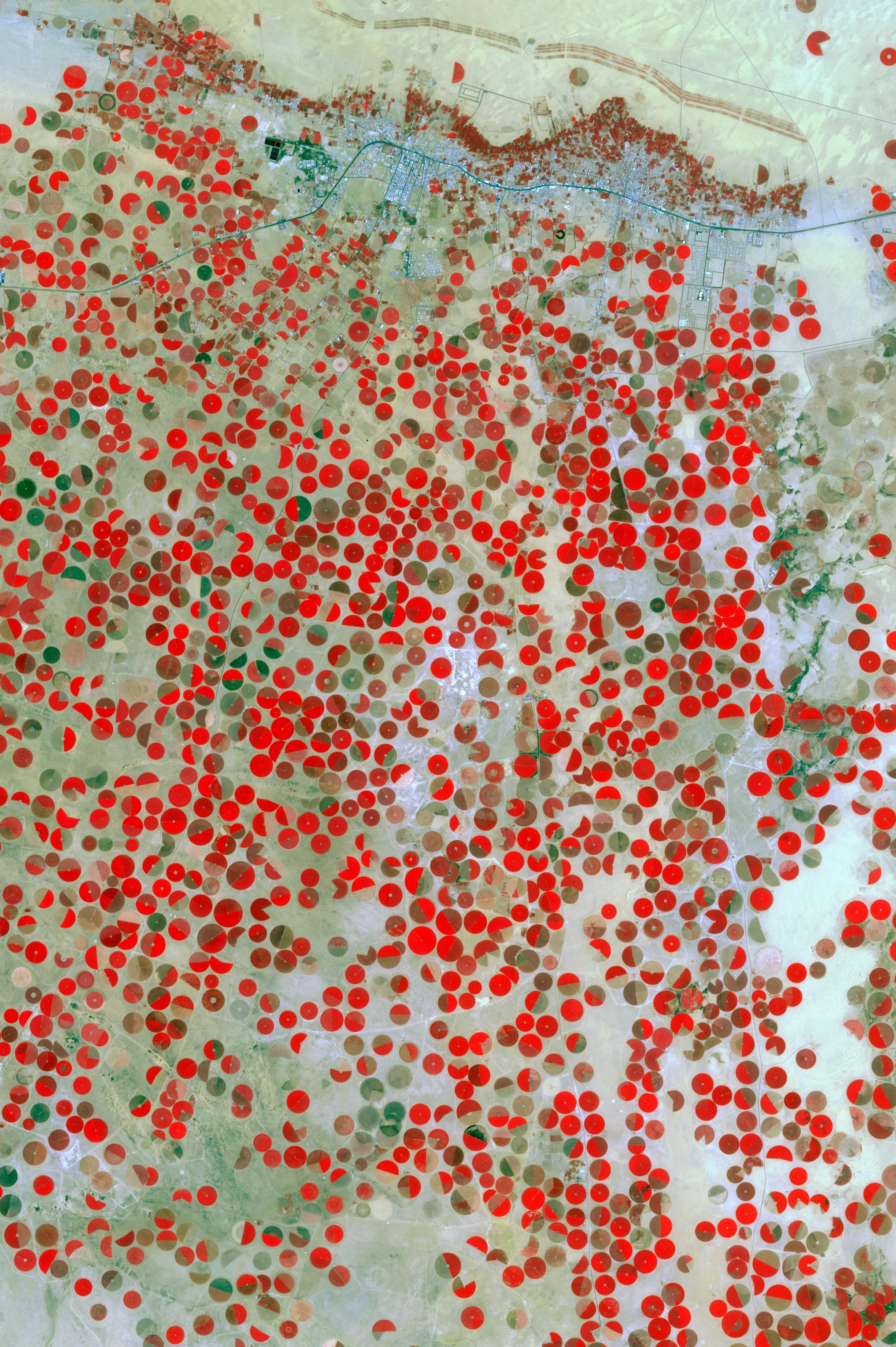
2015-10-20 |
Earth
|
Terra
|
ASTER
|
2034x3059x3 |
|
-
PIA20077:
-
Wadi Al Dawasir, Saudi Arabia
Full Resolution:
TIFF
(18.67 MB)
JPEG
(1.025 MB)
|
 Planetary Data System


