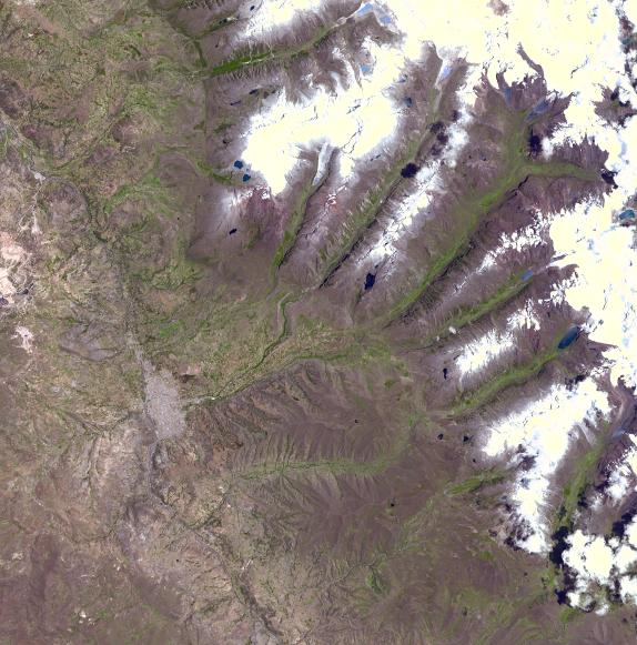
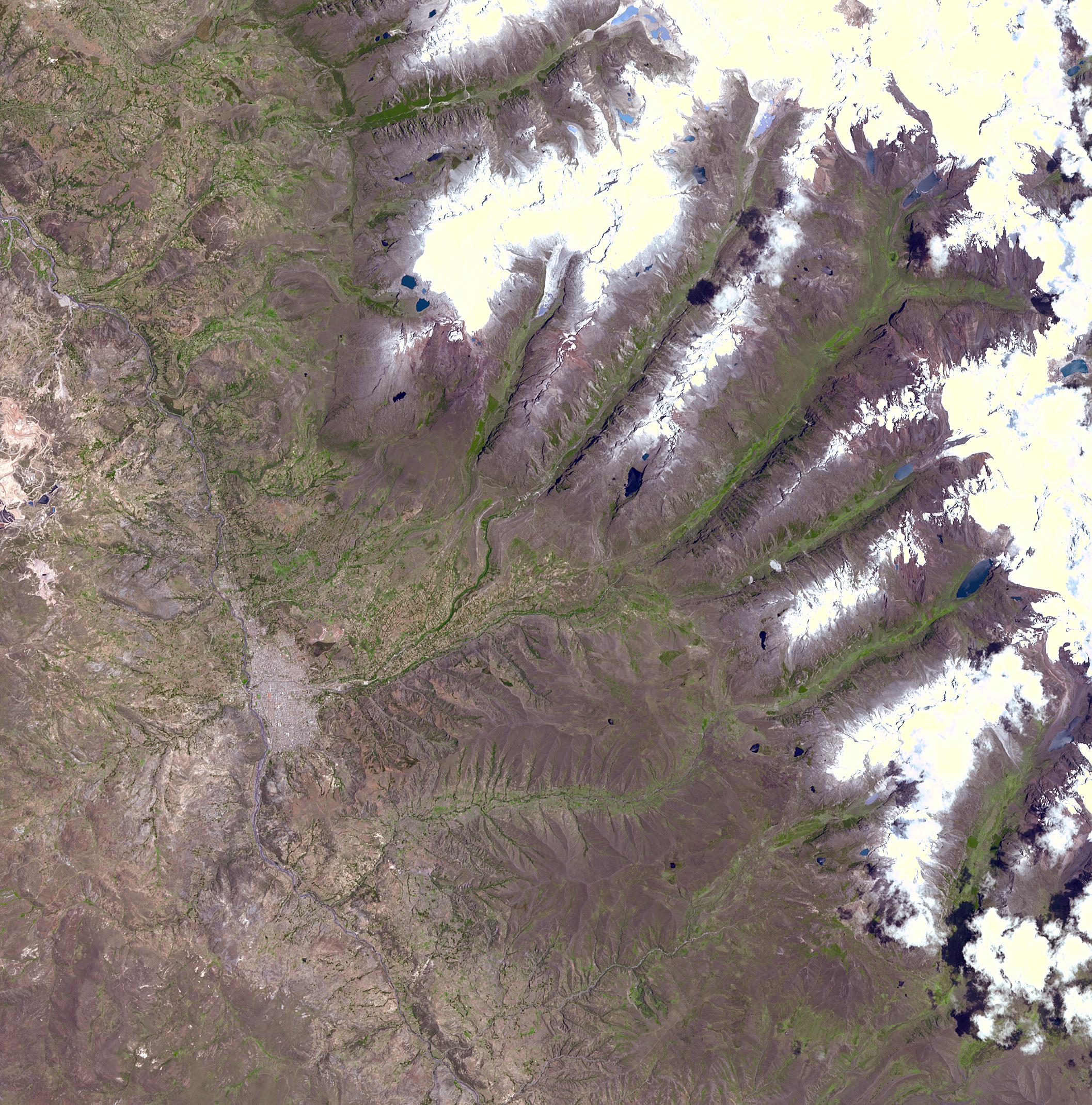
A chunk of glacier was threatening to fall into an Andean lake and cause major flooding in a Peruvian city of 60,000. A fissure has appeared in the glacier that feeds the Lake Palcacocha near the city of Huaraz, 270 km north of Lima. If the piece breaks off, ensuing floods would take 15 minutes to reach the city. In 1941, the lake overflowed and caused massive destruction, killing 7,000 people. The city can be seen in the left-center part of the image. Lake Palcacocha is in the upper right corner of the image at the head of a valley, below the snow and glacier cap. The ASTER instrument is being tasked to obtain current images of the glacier to help monitor the situation.
This image was acquired on November 5, 2001 by the Advanced Spaceborne Thermal Emission and Reflection Radiometer (ASTER) on NASA's Terra satellite. With its 14 spectral bands from the visible to the thermal infrared wavelength region, and its high spatial resolution of 15 to 90 meters (about 50 to 300 feet), ASTER images Earth to map and monitor the changing surface of our planet.
ASTER is one of five Earth-observing instruments launched December 18, 1999, on NASA's Terra satellite. The instrument was built by Japan's Ministry of Economy, Trade and Industry. A joint U.S./Japan science team is responsible for validation and calibration of the instrument and the data products.
The broad spectral coverage and high spectral resolution of ASTER will provide scientists in numerous disciplines with critical information for surface mapping, and monitoring of dynamic conditions and temporal change. Example applications are: monitoring glacial advances and retreats; monitoring potentially active volcanoes; identifying crop stress; determining cloud morphology and physical properties; wetlands evaluation; thermal pollution monitoring; coral reef degradation; surface temperature mapping of soils and geology; and measuring surface heat balance. Dr. Anne Kahle at NASA's Jet Propulsion Laboratory, Pasadena, California, is the U.S. Science team leader; Bjorn Eng of JPL is the project manager. The Terra mission is part of NASA's Earth Science Enterprise, a long- term research effort to understand and protect our home planet. Through the study of Earth, NASA will help to provide sound science to policy and economic decision-makers so as to better life here, while developing the technologies needed to explore the universe and search for life beyond our home planet.
Size: 31.8 x 31.8 km (19.7 x 19.7 miles)
Location: 9.5 deg. South lat., 77.5 deg. West long.
Orientation: North at top
Image Data: ASTER bands 1,2, and 3.
Original Data Resolution: 15 m
Date Acquired: November 5, 2001
 Planetary Data System


