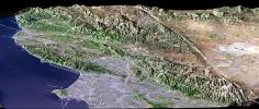
Los Angeles, Calif., is one of the world's largest metropolitan areas with a population of about 15 million people. The urban areas mostly cover the coastal plains and lie within the inland valleys. The intervening and adjacent mountains are generally too rugged for much urban development. This in large part because the mountains are "young," meaning they are still building (and eroding) in this seismically active (earthquake prone) region.
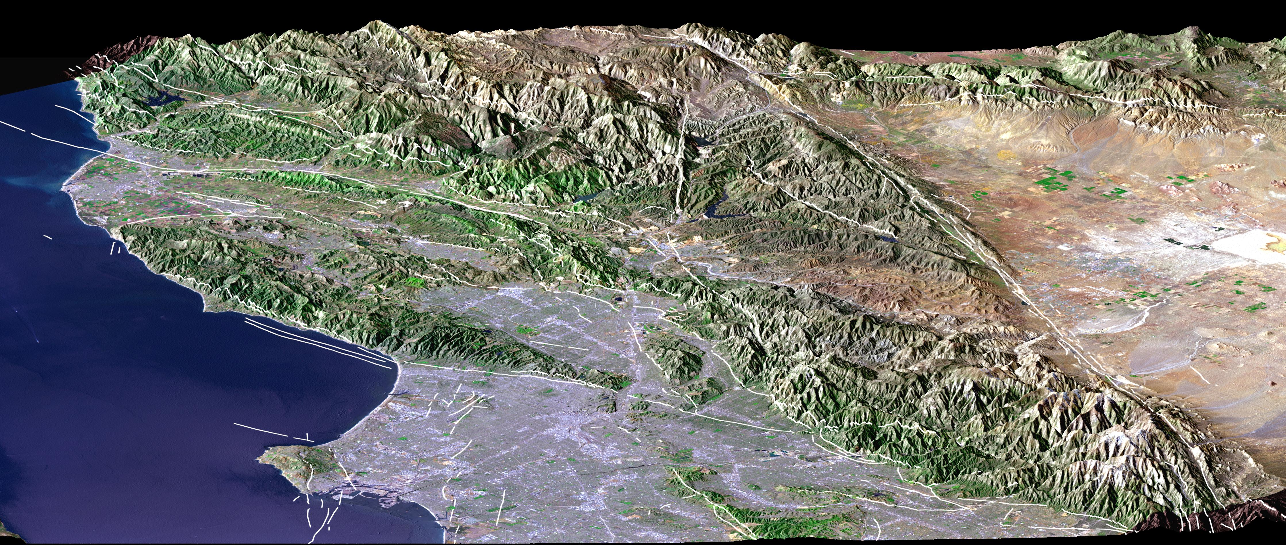
Earthquake faults commonly lie between the mountains and the lowlands. The San Andreas fault, the largest fault in California, likewise divides the very rugged San Gabriel Mountains from the low-relief Mojave Desert, thus forming a straight topographic boundary between the top center and lower right corner of the image. We present two versions of this perspective image from NASA's Shuttle Radar Topography Mission (SRTM): one with and one without a graphic overlay that maps faults that have been active in Late Quaternary times (white lines). The fault database was provided by the U.S. Geological Survey.
For the annotated version of this image, please select Figure 1, below:
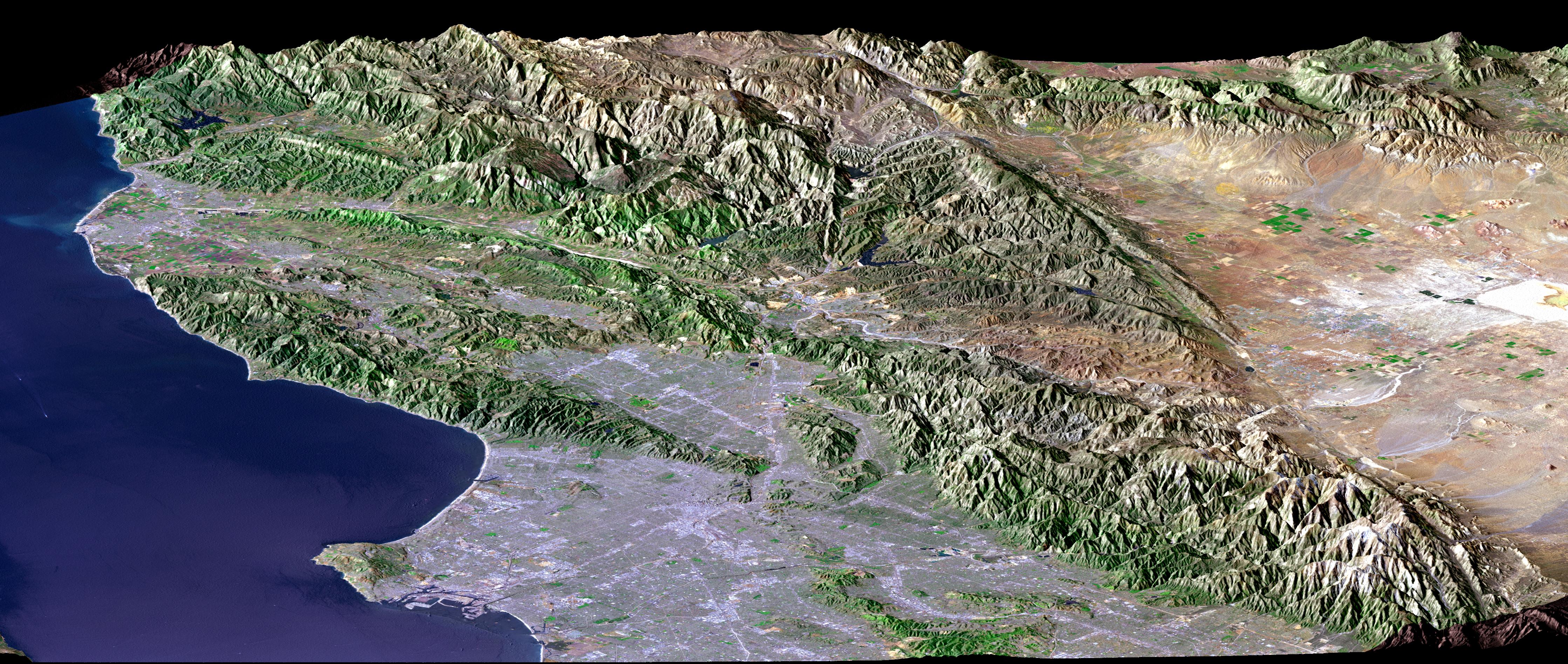
(Large image: ~2 mB jpeg)The Landsat image used here was acquired on May 4, 2001, about seven weeks before the summer solstice, so natural terrain shading is not particularly strong. It is also not especially apparent given a view direction (northwest) nearly parallel to the sun illumination (shadows generally fall on the backsides of mountains). Consequently, topographic shading derived from the SRTM elevation model was added to the Landsat image, with a false sun illumination from the left (southwest). This synthetic shading enhances the appearance of the topography.
Landsat has been providing visible and infrared views of the Earth since 1972. SRTM elevation data matches the 30-meter (98-foot) resolution of most Landsat images and substantially helps in analyzing the large and growing Landsat image archive. This Landsat 7 Thematic Mapper image was provided to the SRTM project by the United States Geological Survey, Earth Resources Observation Systems (EROS) Data Center, Sioux Falls, S.D.
Elevation data used in this image was acquired by the SRTM aboard the Space Shuttle Endeavour, launched on Feb. 11, 2000. SRTM used the same radar instrument that comprised the Spaceborne Imaging Radar-C/X-Band Synthetic Aperture Radar (SIR-C/X-SAR) that flew twice on the Space Shuttle Endeavour in 1994. SRTM was designed to collect 3-D measurements of the Earth's surface. To collect the 3-D data, engineers added a 60-meter (approximately 200-foot) mast, installed additional C-band and X-band antennas, and improved tracking and navigation devices. The mission is a cooperative project between NASA, the National Imagery and Mapping Agency (NIMA) of the U.S. Department of Defense and the German and Italian space agencies. It is managed by NASA's Jet Propulsion Laboratory, Pasadena, Calif., for NASA's Earth Science Enterprise, Washington, D.C.
Size: View width 134 kilometers (83 miles); view distance 150 kilometers (93 miles)
Location: 34.3 degrees North latitude, 118.4 degrees West longitude
Orientation: View west-northwest, 1.8 X vertical exaggeration
Image Data: Landsat Bands 3, 2+4, 1 as red, green, blue, respectively
Original Data Resolution: SRTM 1 arcsecond (30 meters or 98 feet), Landsat 30 meters (98 feet)
Graphic Data: earthquake faults active in Late Quaternary times
Date Acquired: February 2000 (SRTM), May 4, 2001 (Landsat).
