|
Your search criteria found 2605 images Target is Earth (and available satellites) |
| My List |
Addition Date | Target |
Mission
|
Instrument | Size |

|
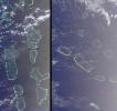
2003-06-04 | Earth |
Terra |
MISR |
1466x896x3 |
|
|||||
|
|
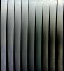
2003-06-11 | Earth |
Terra |
MISR |
1797x2300x3 |
|
|||||
|
|
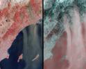
2003-06-25 | Earth |
Terra |
MISR |
1438x620x3 |

|
|||||
|
|
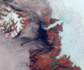
2003-07-01 | Earth |
Terra |
ASTER |
2748x3156x3 |

|
|||||
|
|
2003-07-16 | Earth |
Terra |
MISR |
1174x970x3 |

|
|||||
|
|
2003-08-13 | Earth |
Terra |
MISR |
1798x920x3 |
|
|||||
|
|
2003-09-10 | Earth |
Terra |
MISR |
1280x866x3 |
|
|||||
|
|
2003-09-18 | Earth |
Terra |
MISR |
1011x1115x3 |
|
|||||
|
|
2003-09-24 | Earth |
Terra |
MISR |
1291x1683x3 |
|
|||||
|
|
2003-10-08 | Earth |
Terra |
MISR |
1270x1468x3 |

|
|||||
|
|
2003-10-22 | Earth |
Terra |
MISR |
1539x2131x3 |
|
|||||
|
|
2003-10-29 | Earth |
Terra |
MISR |
2464x2300x3 |
|
|||||
|
|
2003-11-12 | Earth |
Terra |
MISR |
945x805x3 |

|
|||||
|
|
2003-11-19 | Earth |
Terra |
ASTER |
4038x3056x3 |

|
|||||
|
|
2003-11-19 | Earth |
Terra |
MISR |
1200x1128x3 |
|
|||||
|
|
2003-11-26 | Earth |
Terra |
MISR |
877x1185x3 |

|
|||||
|
|
2003-12-04 | Earth |
Terra |
MISR |
2895x3200x3 |
|
|||||
|
|
2003-12-10 | Earth |
Terra |
MISR |
1062x860x3 |
|
|||||
|
|
2003-12-23 | Earth |
Terra |
MISR |
924x764x3 |
|
|||||
|
|
2004-01-07 | Earth |
Terra |
MISR |
1374x889x3 |
|
|||||
|
|
2004-01-21 | Earth |
Terra |
MISR |
2574x2766x3 |
|
|||||
|
|
2004-02-04 | Earth |
Terra |
MISR |
1352x1548x3 |

|
|||||
|
|
2004-02-18 | Earth |
Terra |
MISR |
2384x2675x3 |
|
|||||
|
|
2004-03-03 | Earth |
Terra |
MISR |
3020x1941x3 |
|
|||||
|
|
2004-03-17 | Earth |
Terra |
MISR |
2244x1392x3 |
|
|||||
|
|
2004-03-31 | Earth |
Terra |
MISR |
2602x1511x3 |
|
|||||
|
|
2004-08-04 | Earth |
Terra |
MISR |
1365x1480x3 |

|
|||||
|
|
2004-04-14 | Earth |
Terra |
MISR |
1732x1421x3 |
|
|||||
|
|
2004-04-28 | Earth |
Terra |
MISR |
1337x1692x3 |

|
|||||
|
|
2004-05-12 | Earth |
Terra |
MISR |
1106x1355x3 |
|
|||||
|
|
2004-05-26 | Earth |
Terra |
MISR |
680x792x3 |
|
|||||
|
|
2004-06-09 | Earth |
Terra |
MISR |
1140x1187x3 |
|
|||||
|
|
2004-07-09 | Earth |
Terra |
ASTER |
2713x2262x3 |
|
|||||
|
|
2004-07-07 | Earth |
Terra |
MISR |
3141x2477x3 |
|
|||||
|
|
2004-07-21 | Earth |
Terra |
MISR |
2927x1778x3 |
|
|||||
|
|
2004-08-18 | Earth |
Terra |
MISR |
1526x1162x3 |
|
|||||
|
|
2004-09-01 | Earth |
Terra |
MISR |
2544x1527x3 |
|
|||||
|
|
2004-09-14 | Earth |
Terra |
MISR |
1693x1262x3 |

|
|||||
|
|
2004-09-22 | Earth |
Terra |
ASTER |
870x390x3 |
|
|||||
|
|
2004-09-29 | Earth |
Terra |
MISR |
3292x3608x3 |
|
|||||
|
|
2004-10-02 | Earth |
Terra |
MISR |
1336x924x3 |

|
|||||
|
|
2004-10-27 | Earth |
Terra |
MISR |
1669x2088x3 |
|
|||||
|
|
2004-11-10 | Earth |
Terra |
MISR |
1723x1838x3 |
|
|||||
|
|
2005-01-12 | Earth |
Terra |
MISR |
1245x1090x3 |
|
|||||
|
|
2005-01-12 | Earth |
Terra |
ASTER |
1320x1840x3 |
|
|||||
|
|
2005-01-26 | Earth |
Terra |
MISR |
1516x1504x3 |

|
|||||
|
|
2005-02-23 | Earth |
Terra |
MISR |
1548x1224x3 |
|
|||||
|
|
2005-03-09 | Earth |
Terra |
MISR |
1371x1181x3 |
|
|||||
|
|
2005-03-18 | Earth |
Terra |
ASTER |
1595x1458x3 |

|
|||||
|
|
2005-03-23 | Earth |
Terra |
MISR |
2076x1670x3 |
|
|||||
|
|
2005-04-13 | Earth |
Terra |
MISR |
2037x1732x3 |
|
|||||
|
|
2005-05-04 | Earth |
Terra |
MISR |
1264x1445x3 |
|
|||||
|
|
2005-05-18 | Earth |
Terra |
MISR |
1786x943x3 |
|
|||||
|
|
2005-06-08 | Earth |
Terra |
MISR |
1058x696x3 |
|
|||||
|
|
2005-06-22 | Earth |
Terra |
MISR |
1362x1004x3 |

|
|||||
|
|
2005-07-28 | Earth |
Terra |
MISR |
1222x3591x3 |
|
|
|||||
|
|
2005-08-03 | Earth |
Terra |
MISR |
2390x1110x3 |
|
|||||
|
|
2005-08-31 | Earth |
Terra |
MISR |
3008x3164x3 |
|
|||||
|
|
2005-09-07 | Earth |
Terra |
MISR |
1050x1792x3 |
|
|||||
|
|
2005-09-21 | Earth |
Terra |
MISR |
2820x1626x3 |

|
|||||
|
|
2005-09-14 | Earth |
Terra |
ASTER |
821x1200x3 |
|
|||||
|
|
2005-10-12 | Earth |
Terra |
ASTER |
1936x1860x3 |
|
|||||
|
|
2005-10-12 | Earth |
Terra |
ASTER |
2496x1523x3 |
|
|||||
|
|
2005-10-26 | Earth |
Terra |
MISR |
1814x1310x3 |
|
|||||
|
|
2005-11-23 | Earth |
Terra |
MISR |
1720x1355x3 |
|
|||||
|
|
2006-02-02 | Earth |
Terra |
ASTER |
1280x720x3 |

|
|||||
|
|
2006-02-02 | Earth |
Terra |
ASTER |
577x598x3 |
|
|||||
|
|
2006-03-01 | Earth |
Terra |
ASTER |
1056x1168x3 |
|
|||||
|
|
2006-07-13 | Earth |
Terra |
MISR |
1000x896x3 |
|
|||||
|
|
2006-09-06 | Earth |
Terra |
MISR |
3882x1486x3 |
|
|||||
|
|
2010-02-16 | Earth |
Terra |
ASTER |
1532x1504x3 |
|
|||||
|
|
2006-09-30 | Earth |
Terra |
ASTER |
2066x1499x3 |

|
|||||
|
|
2001-10-22 | Earth |
Terra |
ASTER |
2000x1500x3 |

|
|||||
|
|
2006-05-01 | Earth |
Terra |
ASTER |
1073x800x3 |
|
|||||
|
|
2006-05-15 | Earth |
Terra |
ASTER |
2200x4020x3 |
|
|||||
|
|
2006-07-05 | Earth |
Terra |
ASTER |
4980x4200x3 |
|
|||||
|
|
2006-05-30 | Earth |
Terra |
ASTER |
1400x2220x3 |
|
|||||
|
|
2006-06-19 | Earth |
Terra |
ASTER |
4074x2082x3 |

|
|||||
|
|
2006-07-17 | Earth |
Terra |
ASTER |
758x1208x3 |

|
|||||
|
|
2006-08-02 | Earth |
Terra |
ASTER |
1230x3209x3 |
|
|
|||||
|
|
2006-08-11 | Earth |
Terra |
ASTER |
3960x4210x3 |
|
|||||
|
|
2006-09-01 | Earth |
Terra |
ASTER |
2176x3416x3 |
|
|||||
|
|
2006-09-15 | Earth |
Terra |
ASTER |
2514x1686x3 |
|
|||||
|
|
2006-01-19 | Earth |
Terra |
ASTER |
1956x2996x3 |

|
|||||
|
|
2006-11-08 | Earth |
Terra |
ASTER |
1794x1425x3 |
|
|||||
|
|
2006-11-09 | Earth |
Terra |
ASTER |
1362x2011x3 |
|
|||||
|
|
2010-03-08 | Earth |
Terra |
ASTER |
2403x2274x3 |

|
|||||
|
|
2007-04-30 | Earth |
Terra |
ASTER |
2560x1400x3 |
|
|||||
|
|
2007-05-04 | Earth |
Terra |
MISR |
1217x835x3 |
|
|||||
|
|
2007-06-12 | Earth |
Terra |
ASTER |
1000x400x3 |
|
|||||
|
|
2007-06-28 | Earth |
Terra |
ASTER |
1000x1000x3 |
|
|||||
|
|
2007-07-03 | Earth |
Terra |
ASTER |
1200x800x3 |
|
|||||
|
|
2007-08-07 | Earth |
Terra |
ASTER |
754x769x3 |

|
|||||
|
|
2007-08-31 | Earth |
Terra |
ASTER |
369x518x3 |

|
|||||
|
|
2007-09-04 | Earth |
Terra |
ASTER |
752x846x3 |

|
|||||
|
|
2007-10-24 | Earth |
Terra |
MISR |
4432x2880x3 |
|
|||||
|
|
2007-11-08 | Earth |
Terra |
ASTER |
3000x5002x3 |
|
|||||
|
|
2016-08-01 | Earth |
Terra |
ASTER |
3222x3096x3 |
|
|||||
|
|
2010-02-08 | Earth |
Terra |
ASTER |
1200x1000x3 |
|
|||||
|
|
2008-04-04 | Earth |
Terra |
ASTER |
393x416x3 |

|
|||||

|
 |
|
|
 |
 |
|
|
|
|
|

|
| 1-100 | 101-200 | 201-300 | 301-400 | 401-500 | 501-600 | 601-700 | 701-800 | 801-900 | 901-1000 |
| Currently displaying images: 301 - 400 of 2605 |