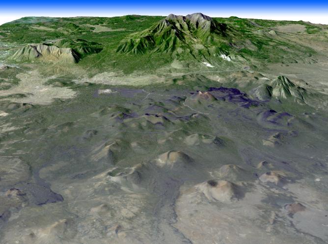
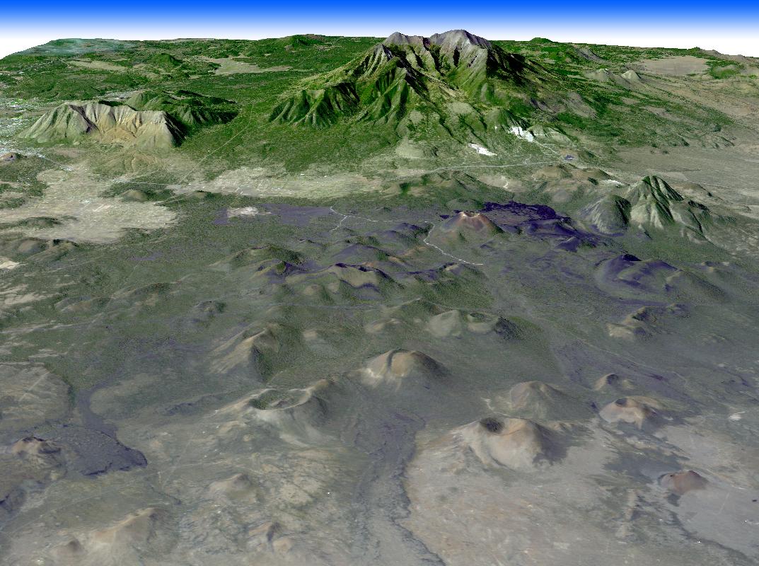
Northern Arizona is best known for the Grand Canyon. Less widely known are the hundreds of geologically young volcanoes, at least one of which buried the homes of local residents. San Francisco Mtn., a truncated stratovolcano at 3887 meters, was once a much taller structure (about 4900 meters) before it exploded some 400,000 years ago a la Mt. St. Helens. The young cinder cone field to its east includes Sunset Crater, that erupted in 1064 and buried Native American homes. This ASTER perspective was created by draping ASTER image data over topographic data from the U.S. Geological Survey National Elevation Data.
With its 14 spectral bands from the visible to the thermal infrared wavelength region, and its high spatial resolution of 15 to 90 meters (about 50 to 300 feet), ASTER images Earth to map and monitor the changing surface of our planet.
ASTER is one of five Earth-observing instruments launched December 18, 1999, on NASA's Terra satellite. The instrument was built by Japan's Ministry of Economy, Trade and Industry. A joint U.S./Japan science team is responsible for validation and calibration of the instrument and the data products.
The broad spectral coverage and high spectral resolution of ASTER provides scientists in numerous disciplines with critical information for surface mapping, and monitoring of dynamic conditions and temporal change. Example applications are: monitoring glacial advances and retreats; monitoring potentially active volcanoes; identifying crop stress; determining cloud morphology and physical properties; wetlands evaluation; thermal pollution monitoring; coral reef degradation; surface temperature mapping of soils and geology; and measuring surface heat balance.
The U.S. science team is located at NASA's Jet Propulsion Laboratory, Pasadena, Calif. The Terra mission is part of NASA's Science Mission Directorate.
Size: 20.4 by 24.6 kilometers (12.6 by 15.2 miles)
Location: 35.3 degrees North latitude, 111.5 degrees West longitude
Orientation: North at top
Image Data: ASTER Bands 3, 2, and 1
Original Data Resolution: Landsat 30 meters (24.6 feet); ASTER 15 meters (49.2 feet)
Dates Acquired: October 21, 2003