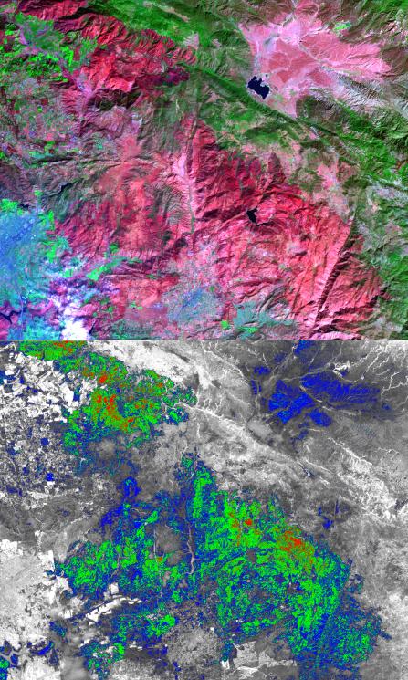
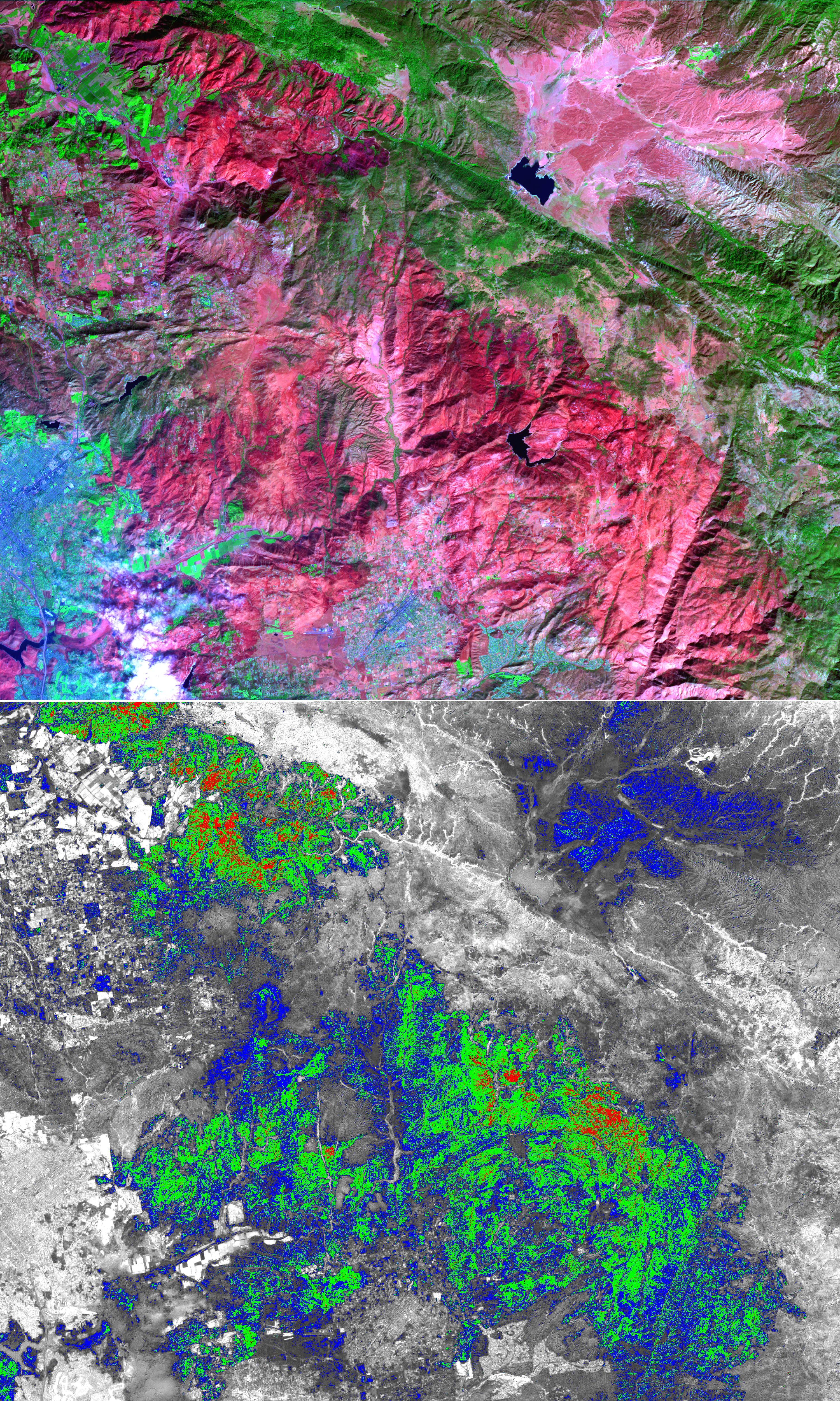
The October wildfires that plagued southern California were some of the worst on record. One of these, the Witch Wildland fire, burned 198,000 acres north of San Diego, destroying 1125 homes, commercial structures, and outbuildings. Over 3,000 firefighters finally contained the fire two weeks after it started on October 21. Now begins the huge task of planning and implementing mitigation measures to replant and reseed the burned areas. This ASTER image depicts the area after the fire, on November 6; vegetation is green, burned areas are dark red, and urban areas are blue. On the burn severity index image, calculated using infrared and visible bands, red areas are the most severely burned, followed by green and blue. This information can help the US Forest Service to plan post-fire activities.
With its 14 spectral bands from the visible to the thermal infrared wavelength region, and its high spatial resolution of 15 to 90 meters (about 50 to 300 feet), ASTER images Earth to map and monitor the changing surface of our planet.
ASTER is one of five Earth-observing instruments launched December 18, 1999, on NASA's Terra spacecraft. The instrument was built by Japan's Ministry of Economy, Trade and Industry. A joint U.S./Japan science team is responsible for validation and calibration of the instrument and the data products.
The broad spectral coverage and high spectral resolution of ASTER provides scientists in numerous disciplines with critical information for surface mapping, and monitoring of dynamic conditions and temporal change. Example applications are: monitoring glacial advances and retreats; monitoring potentially active volcanoes; identifying crop stress; determining cloud morphology and physical properties; wetlands evaluation; thermal pollution monitoring; coral reef degradation; surface temperature mapping of soils and geology; and measuring surface heat balance.
The U.S. science team is located at NASA's Jet Propulsion Laboratory, Pasadena, Calif. The Terra mission is part of NASA's Science Mission Directorate.
Size: 37.5 by 45 kilometers (23.1 by 27.8 miles)
Location: 33 degrees North latitude, 116.9 degrees West longitude
Orientation: North at top
Image Data: ASTER Bands 6, 3, and 1
Original Data Resolution: ASTER 15 meters (49.2 feet)
Dates Acquired: November 6, 2007
 Planetary Data System


