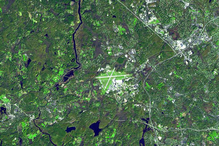
On the night of April 18/19, 1775, Paul Revere rode from Boston to Lexington, Mass., to warn John Hancock and Samuel Adams that the British were coming. On April 19, there was a skirmish on the Battle Green, with shots being fired both from the Battle Green and the nearby Buckman Tavern. After the rout, the British marched on toward Concord. The battle in Lexington allowed the Concord militia time to organize at the Old North Bridge, where they were able to turn back the British and prevent them from capturing and destroying the militia's arms stores.
This image from the Advanced Spaceborne Thermal Emission and Reflection Radiometer instrument on NASA's Terra satellite, acquired in October 2006, depicts this area of great importance in U.S. history. These two small Massachusetts towns are now dwarfed by Hanscom Air Force Base between them.
With its 14 spectral bands from the visible to the thermal infrared wavelength region, and its high spatial resolution of 15 to 90 meters (about 50 to 300 feet), ASTER images Earth to map and monitor the changing surface of our planet.
ASTER is one of five Earth-observing instruments launched December 18, 1999, on NASA's Terra spacecraft. The instrument was built by Japan's Ministry of Economy, Trade and Industry. A joint U.S./Japan science team is responsible for validation and calibration of the instrument and the data products.
The broad spectral coverage and high spectral resolution of ASTER provides scientists in numerous disciplines with critical information for surface mapping, and monitoring of dynamic conditions and temporal change. Example applications are: monitoring glacial advances and retreats; monitoring potentially active volcanoes; identifying crop stress; determining cloud morphology and physical properties; wetlands evaluation; thermal pollution monitoring; coral reef degradation; surface temperature mapping of soils and geology; and measuring surface heat balance.
The U.S. science team is located at NASA's Jet Propulsion Laboratory, Pasadena, Calif. The Terra mission is part of NASA's Science Mission Directorate.
Size: 12 by 18 kilometers (7.4 by 11.1 miles)
Location: 42.5 degrees North latitude, 71.2 degrees West longitude
Orientation: North at top
Image Data: ASTER Bands 3, 2, and 1
Original Data Resolution: ASTER 15 meters (49.2 feet)
Date Acquired: October 21, 2006.