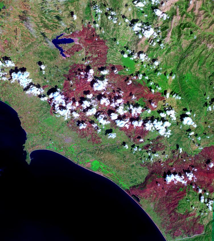
The last major fire in southern Greece was brought under control this weekend, but not until over 469,000 acres of mostly forest and farmland were destroyed. An estimated 4000 people lost their homes, and over 60 deaths were reported. These were the worst fires ever to occur in Greece. In this Advanced Spaceborne Thermal Emission and Reflection Radiometer (ASTER) image acquired September 4 over the western coast of the Peloponnesus Peninsula, burned areas appear in dark red, and unburned vegetation is green. The area includes the ancient site of Olympia, the site of the Olympic Games in classical times. The fires came within 2 kilometers (1.2 miles) of the archaeological site, but spared it.
With its 14 spectral bands from the visible to the thermal infrared wavelength region, and its high spatial resolution of 15 to 90 meters (about 50 to 300 feet), ASTER images Earth to map and monitor the changing surface of our planet.
ASTER is one of five Earth-observing instruments launched December 18, 1999, on NASA's Terra spacecraft. The instrument was built by Japan's Ministry of Economy, Trade and Industry. A joint U.S./Japan science team is responsible for validation and calibration of the instrument and the data products.
The broad spectral coverage and high spectral resolution of ASTER provides scientists in numerous disciplines with critical information for surface mapping, and monitoring of dynamic conditions and temporal change. Example applications are: monitoring glacial advances and retreats; monitoring potentially active volcanoes; identifying crop stress; determining cloud morphology and physical properties; wetlands evaluation; thermal pollution monitoring; coral reef degradation; surface temperature mapping of soils and geology; and measuring surface heat balance.
The U.S. science team is located at NASA's Jet Propulsion Laboratory, Pasadena, Calif. The Terra mission is part of NASA's Science Mission Directorate.
Size: 56.4 by 63.5 kilometers (35 by 39.4 miles)
Location: 37.9 degrees North latitude, 21.6 degrees East longitude
Orientation: North at top
Image Data: ASTER Bands 6, 3, and 1
Original Data Resolution: ASTER 15 meters (49.2 feet
Dates Acquired: September 4, 2007.
 Planetary Data System


