My
List |
Addition Date
|
Target
|
Mission
|
Instrument
|
Size
|

|
2004-10-11 |
Earth
|
Terra
|
ASTER
|
2771x3000x3 |
|
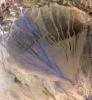
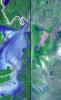
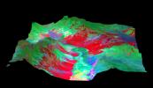
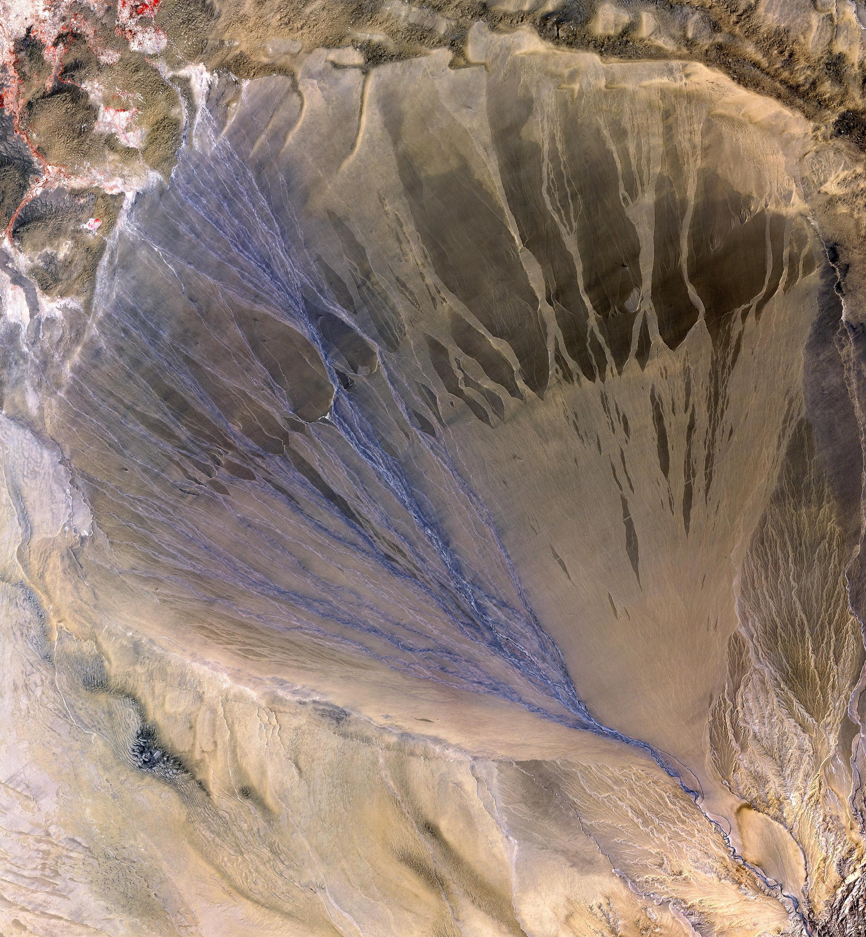
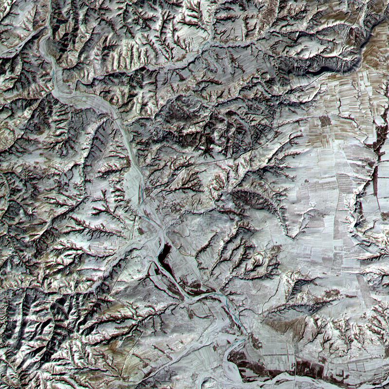
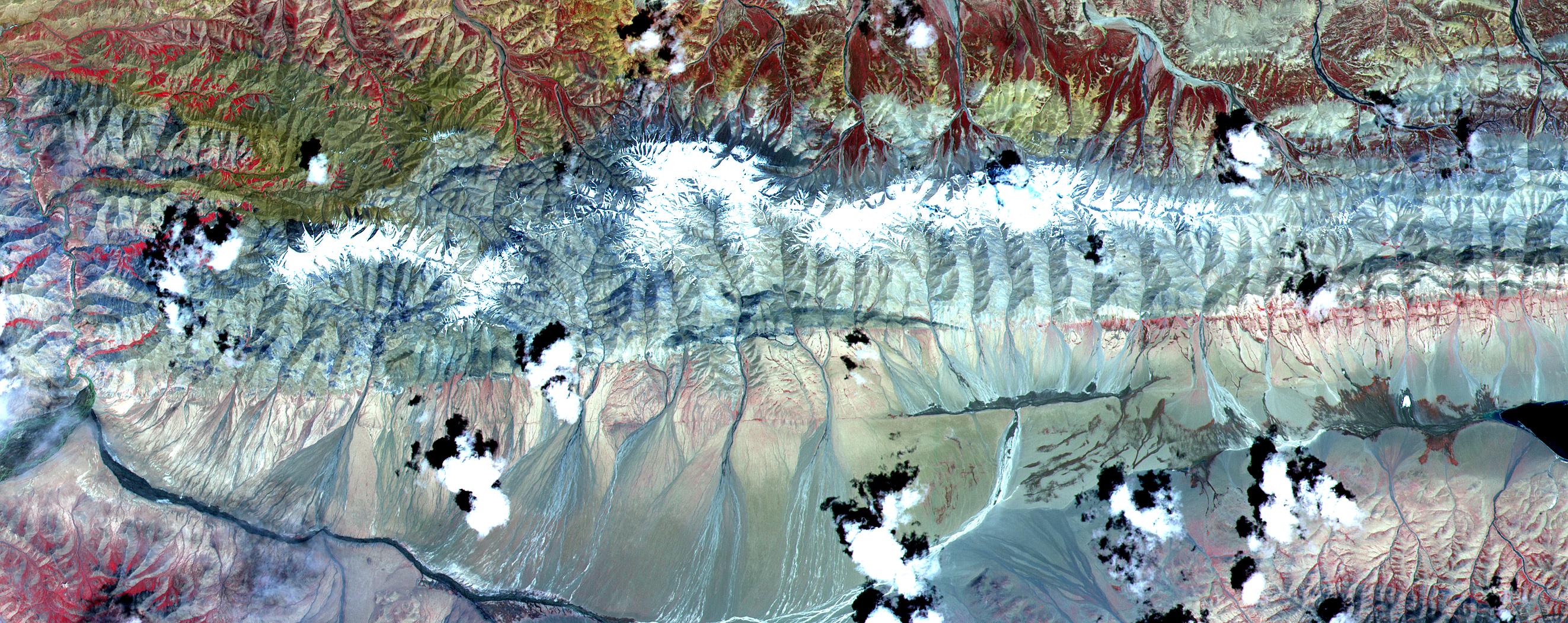
-
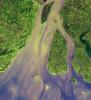
PIA12070:
-
Alluvial Fan, China
Full Resolution:
TIFF
(24.94 MB)
JPEG
(1.935 MB)
|
|
|
2004-09-22 |
Earth
|
Terra
|
ASTER
|
870x390x3 |
|
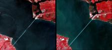
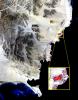
-
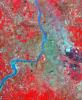
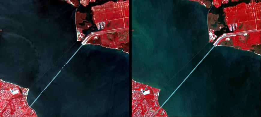
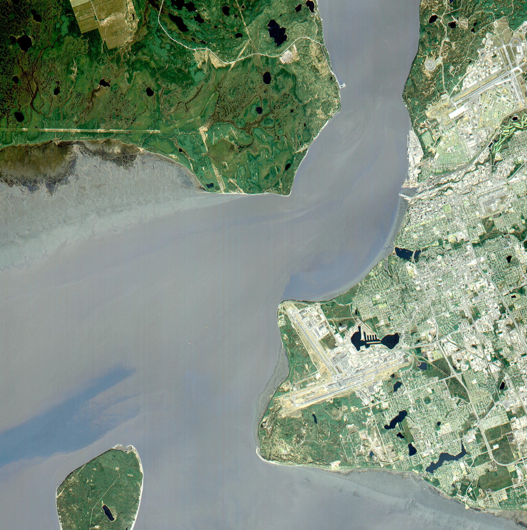
PIA06873:
-
Damage by Hurricane Ivan over Pensacola Bay, Florida
Full Resolution:
TIFF
(723.5 kB)
JPEG
(42.85 kB)
|
|
|
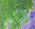
2004-07-09 |
Earth
|
Terra
|
ASTER
|
2713x2262x3 |
|
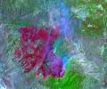
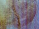
-
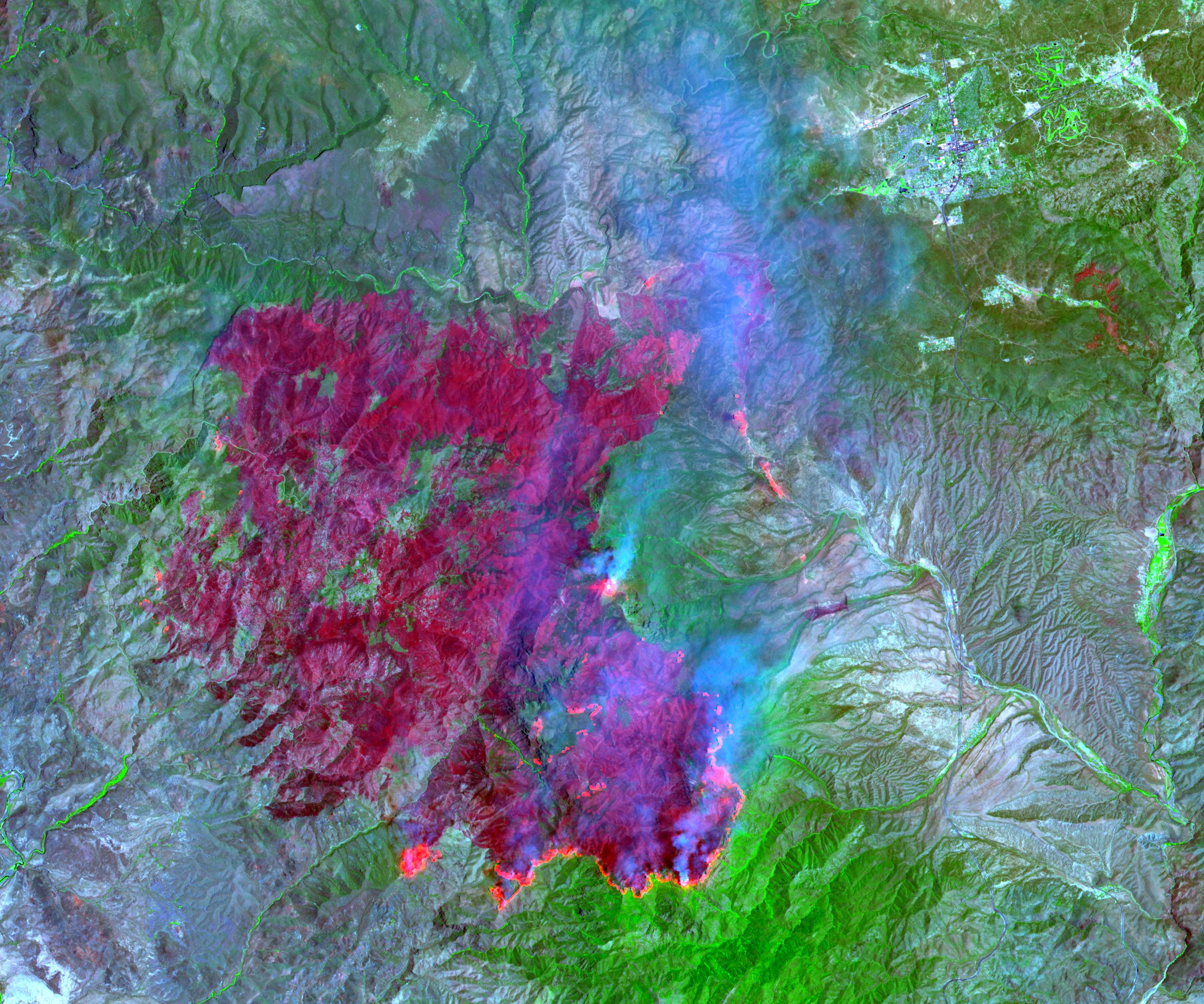
PIA06375:
-
Willow Fire Near Payson, Arizona
Full Resolution:
TIFF
(17.49 MB)
JPEG
(1.148 MB)
|
|
|
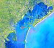
2003-11-19 |
Earth
|
Terra
|
ASTER
|
4038x3056x3 |

|
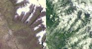
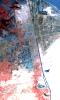
-
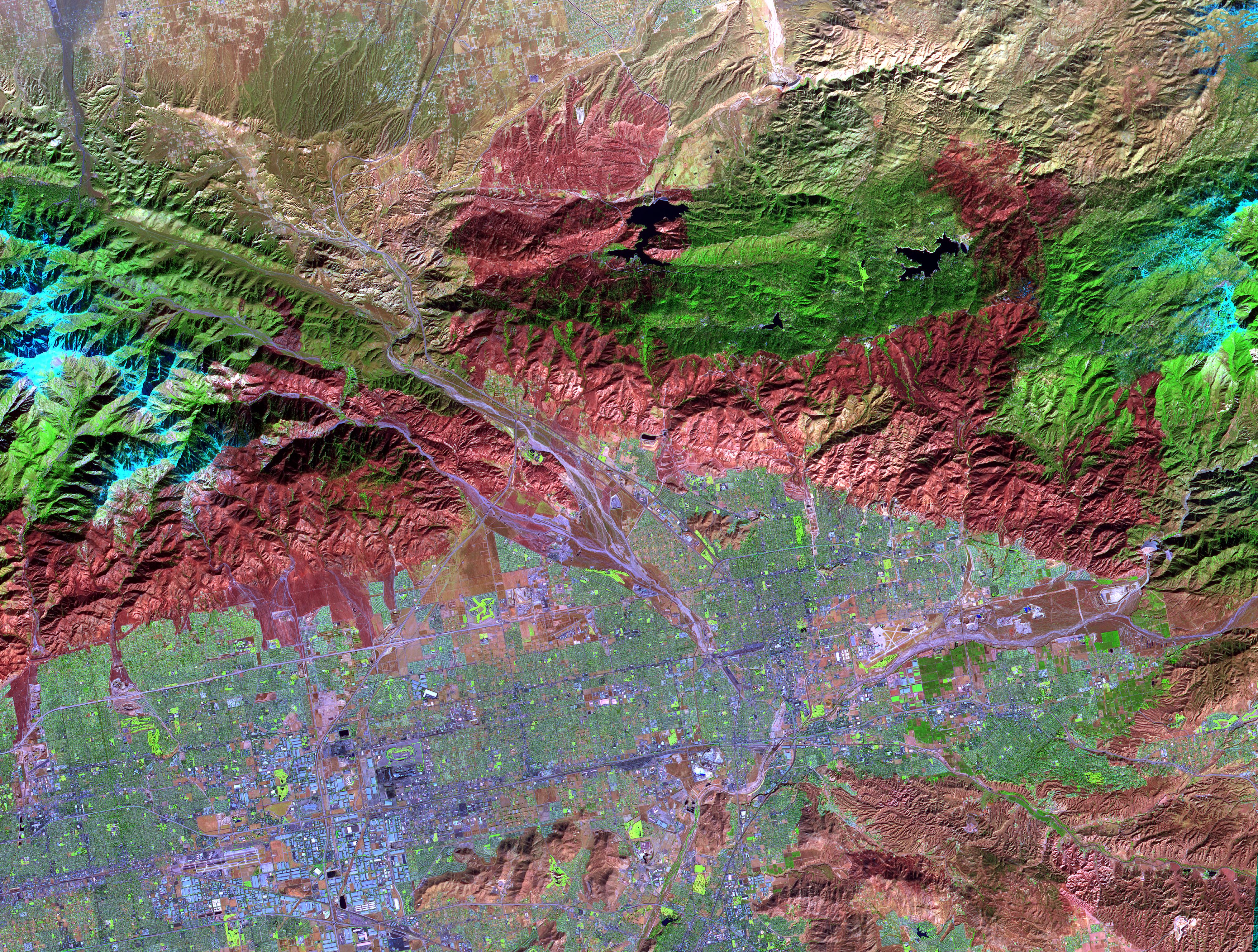
PIA04879:
-
Old Fire/Grand Prix Fire, California
Full Resolution:
TIFF
(37.02 MB)
JPEG
(3.971 MB)
|
|
|
2003-07-01 |
Earth
|
Terra
|
ASTER
|
2748x3156x3 |

|
-
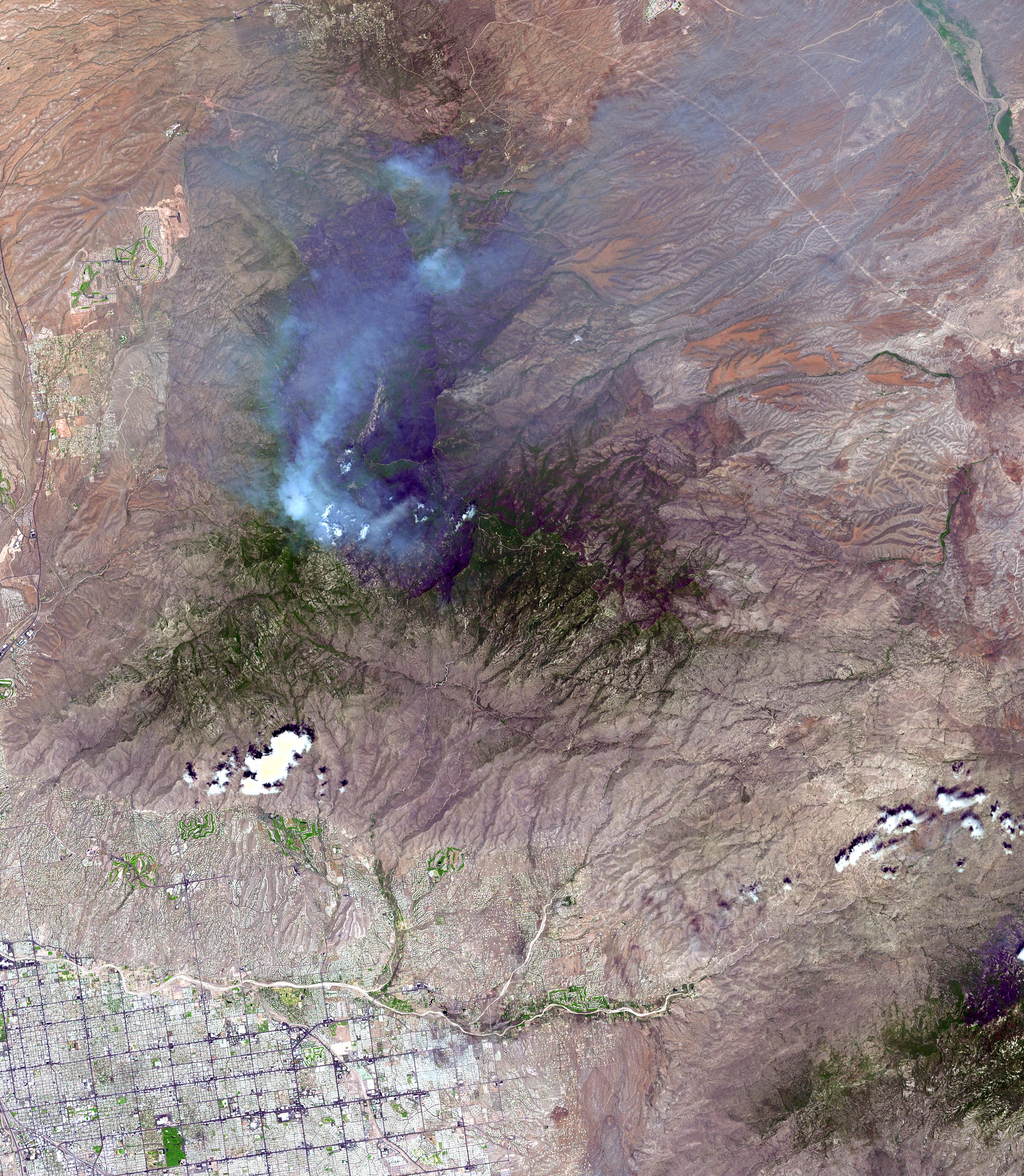
PIA04602:
-
Aspen Fire, Arizona
Full Resolution:
TIFF
(26.02 MB)
JPEG
(2.055 MB)
|
|
|
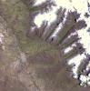
2003-04-11 |
Earth
|
Terra
|
ASTER
|
3782x2037x3 |
|
-
PIA03899:
-
NASA Keeps Watch on a Potential Disaster in the Icy Andes
Full Resolution:
TIFF
(23.11 MB)
JPEG
(1.499 MB)
|
|
|
2003-04-02 |
Earth
|
Terra
|
ASTER
|
2115x2139x3 |
|
-
PIA03898:
-
Huaraz, Peru
Full Resolution:
TIFF
(13.59 MB)
JPEG
(963.6 kB)
|
|
|
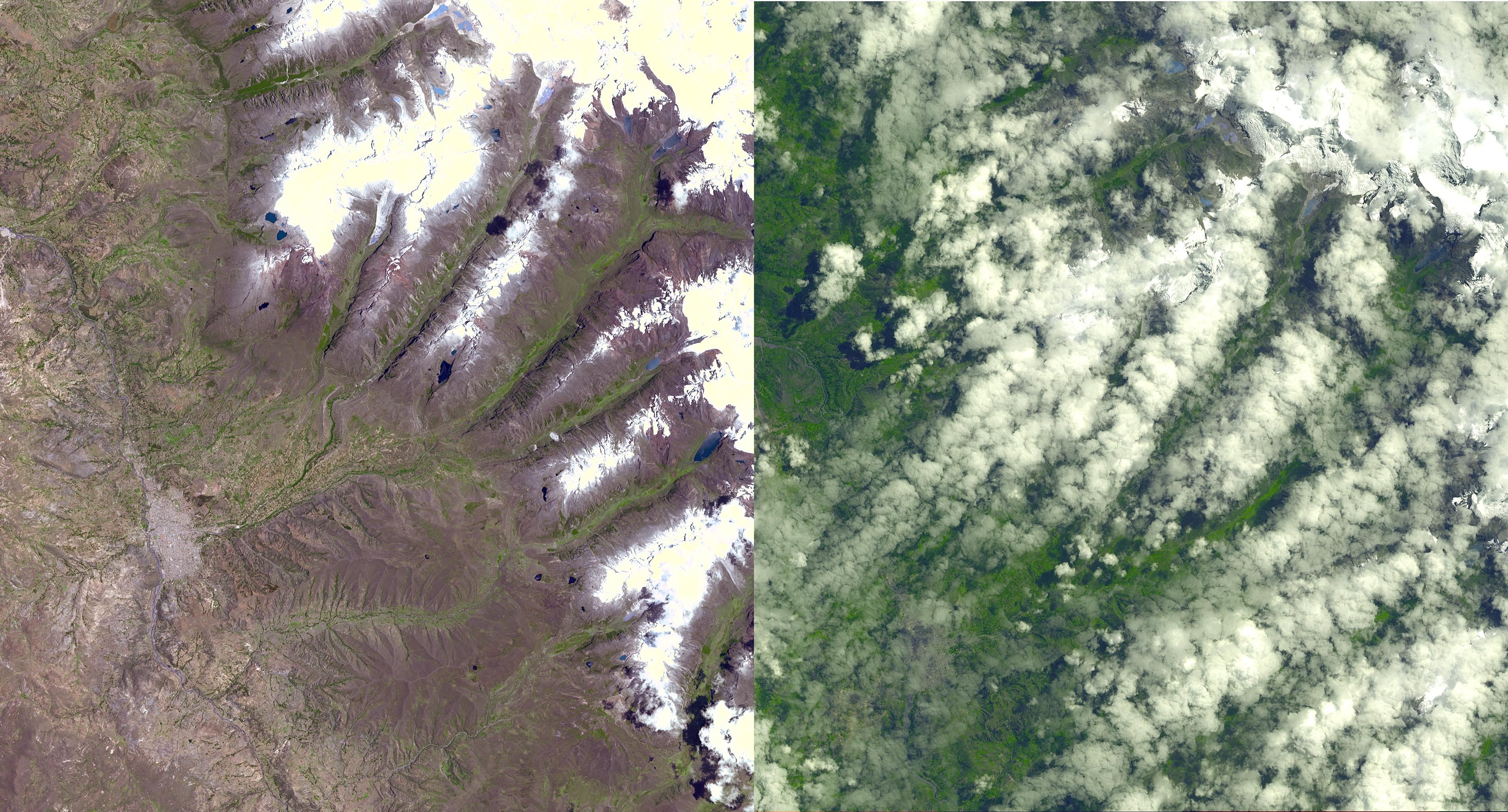
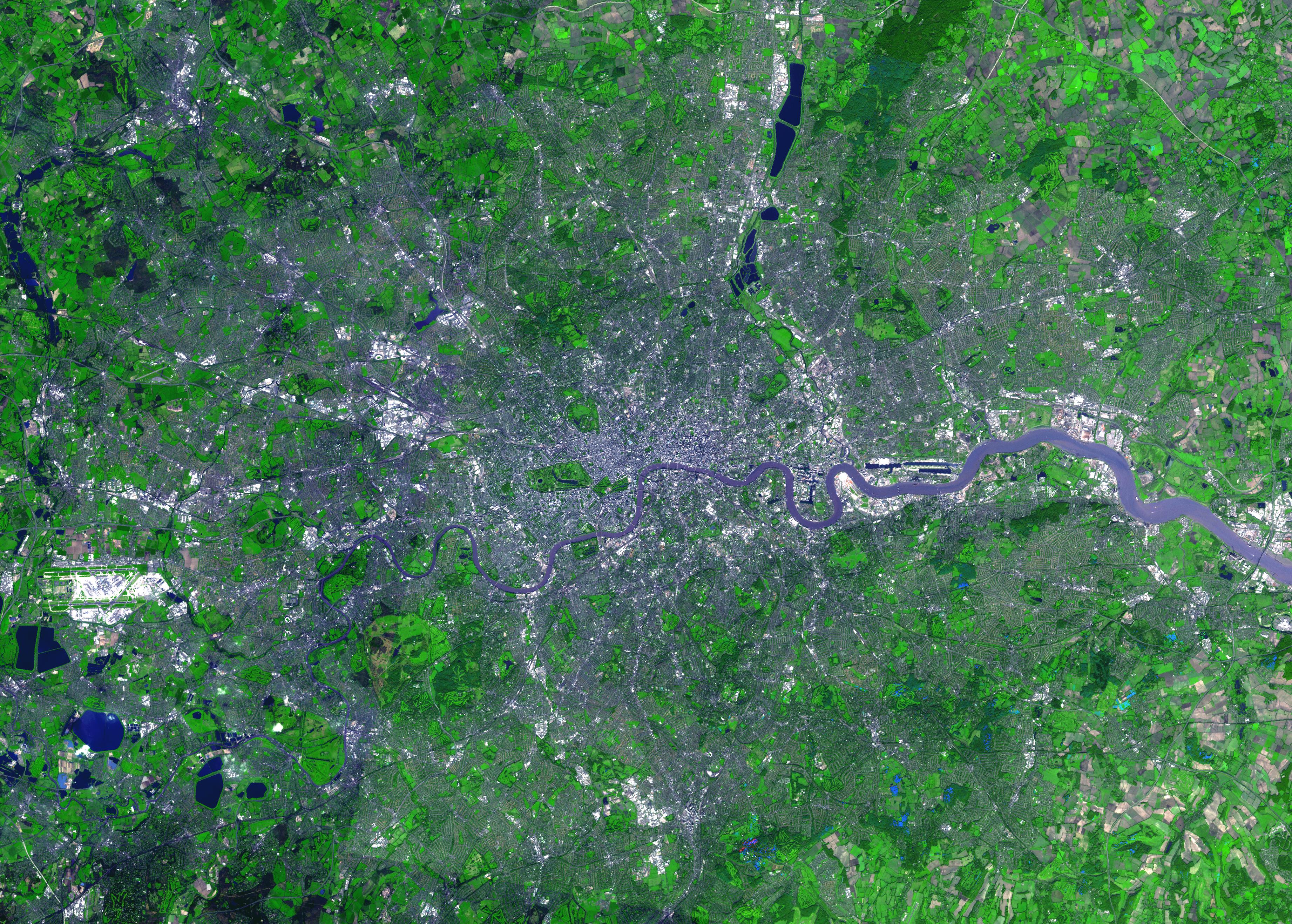
2003-01-18 |
Earth
|
Terra
|
ASTER
|
3685x2635x3 |
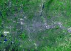
|
-
PIA04301:
-
London, England
Full Resolution:
TIFF
(23.03 MB)
JPEG
(2.731 MB)
|
|
|
2003-01-08 |
Earth
|
Terra
|
ASTER
|
1914x1960x3 |
|
-
PIA03893:
-
Anti-Atlas Mountains, Morocco
Full Resolution:
TIFF
(11.27 MB)
JPEG
(1.133 MB)
|
|
|
2002-12-23 |
Earth
|
Terra
|
ASTER
|
700x910x3 |

|
-
PIA03891:
-
Santa Claus, Ga./Ind.
Full Resolution:
TIFF
(1.914 MB)
JPEG
(205.6 kB)
|
|
|
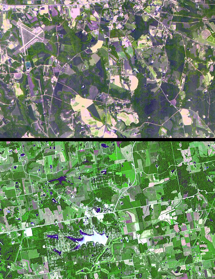
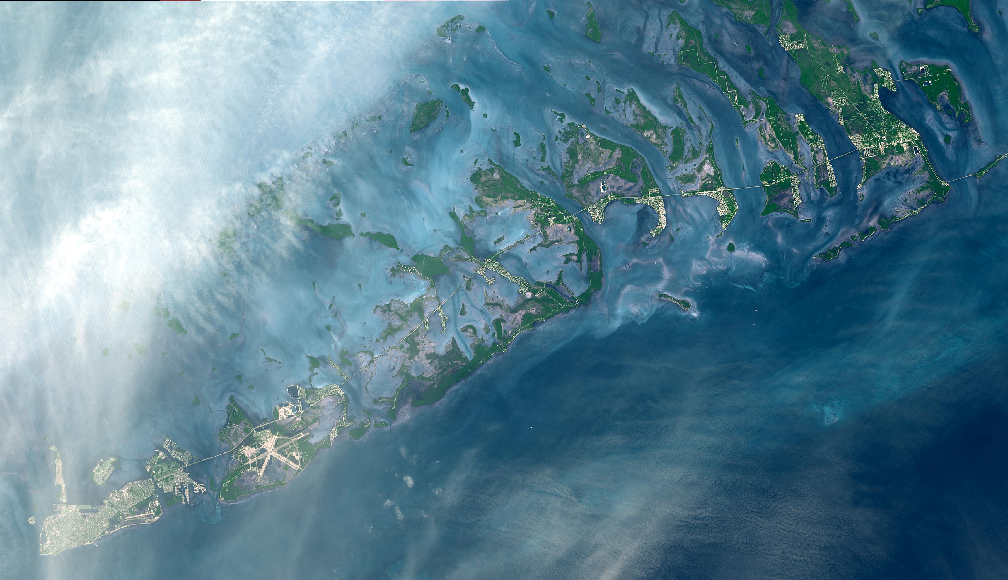
2002-12-13 |
Earth
|
Terra
|
ASTER
|
3441x1982x3 |

|
-
PIA03890:
-
Florida Keys
Full Resolution:
TIFF
(20.46 MB)
JPEG
(724 kB)
|
|
|
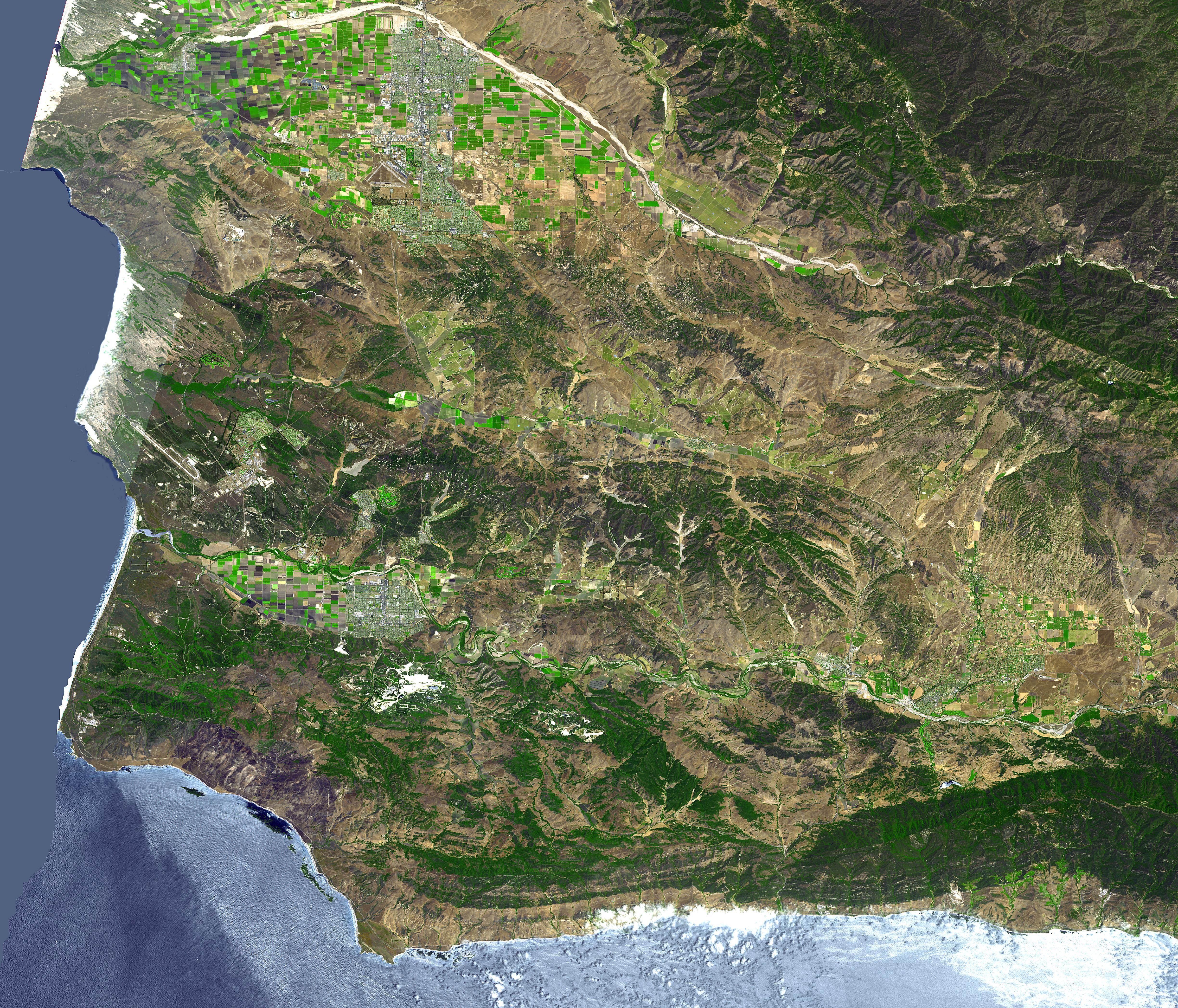
2002-11-07 |
Earth
|
Terra
|
ASTER
|
4896x4188x3 |
|
-
PIA03882:
-
Lompoc, CA
Full Resolution:
TIFF
(61.51 MB)
JPEG
(5.752 MB)
|
|
|
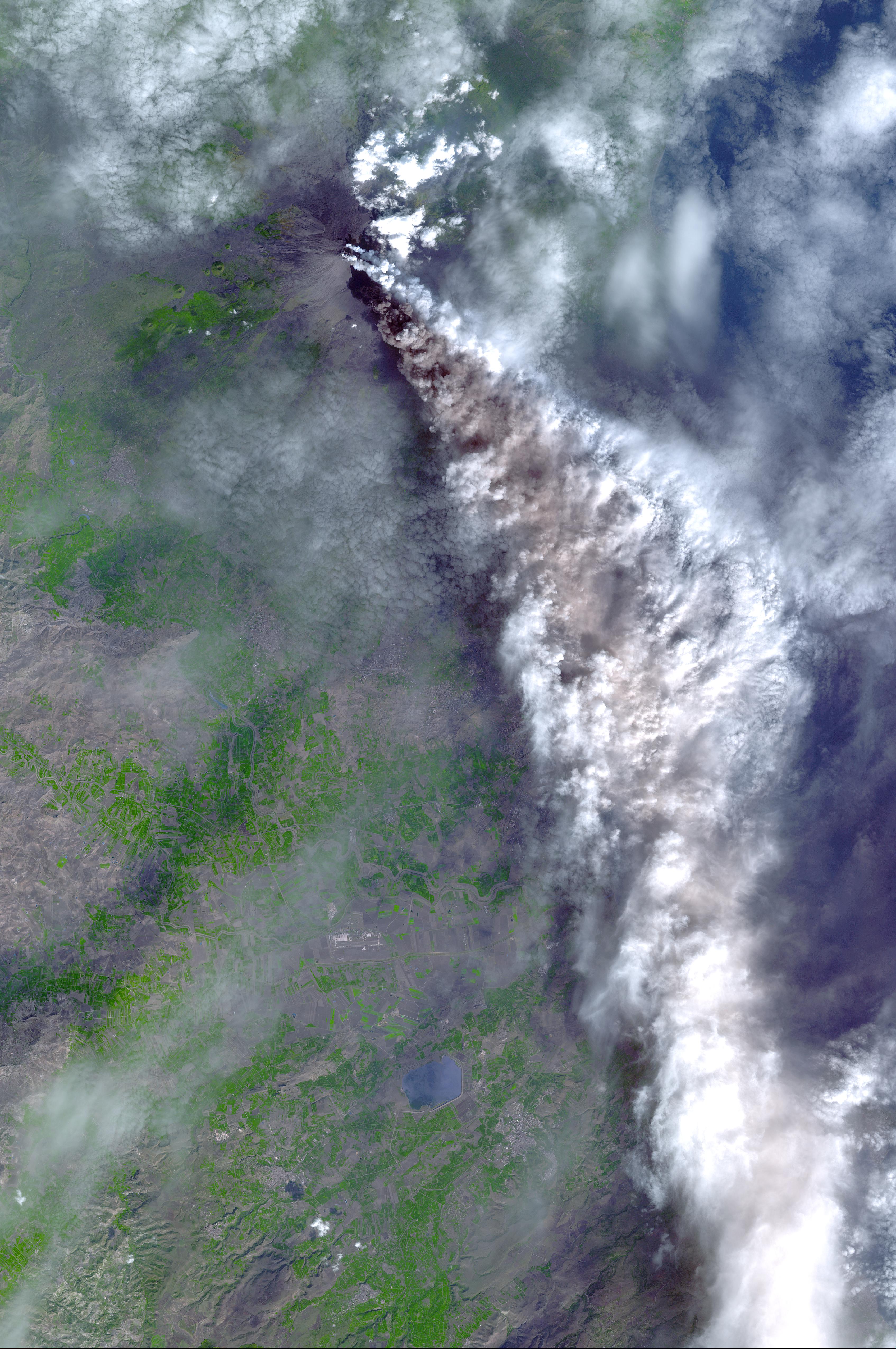
2002-11-07 |
Earth
|
Terra
|
ASTER
|
3388x5100x3 |
|
-
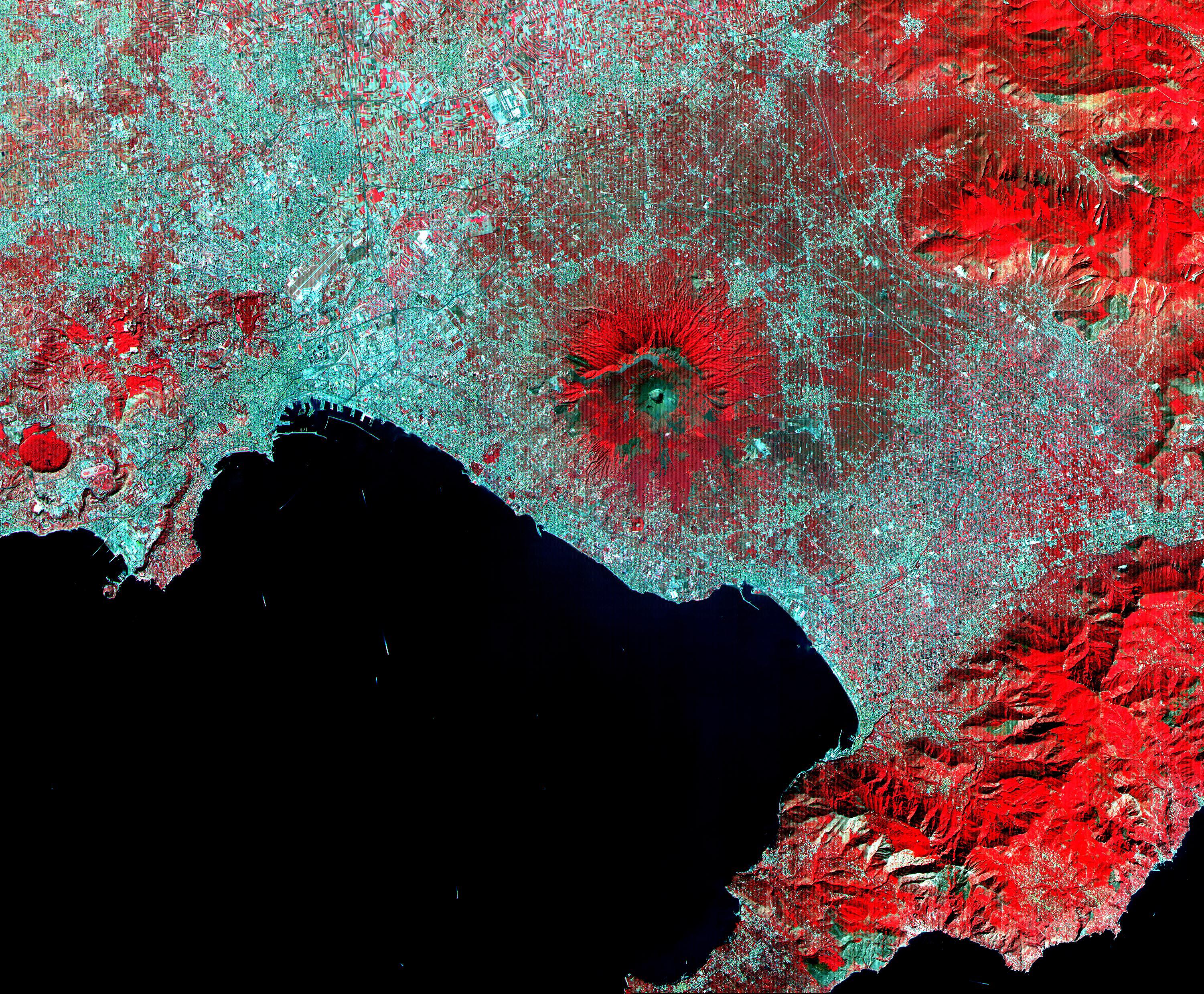
PIA03881:
-
Mt. Etna, Italy
Full Resolution:
TIFF
(51.84 MB)
JPEG
(2.133 MB)
|
|
|
2002-11-07 |
Earth
|
Terra
|
ASTER
|
2730x2694x3 |
|
-
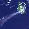
PIA03880:
-
Soufriere Hills Volcano
Full Resolution:
TIFF
(17.55 MB)
JPEG
(964.6 kB)
|
|
|
2002-11-01 |
Earth
|
Shuttle Radar Topography Mission (SRTM)
Terra
|
ASTER
C-Band Interferometric Radar
|
1152x870x3 |

|
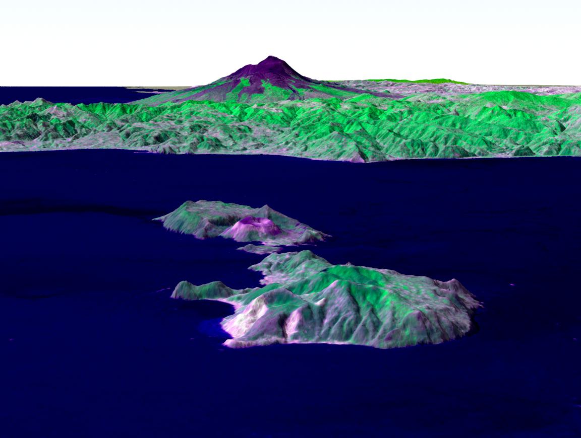
-
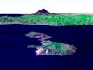
PIA03371:
-
Perspective View, Mt. Etna, Italy
Full Resolution:
TIFF
(2.617 MB)
JPEG
(148.7 kB)
|
|
|
2002-11-01 |
Earth
|
Shuttle Radar Topography Mission (SRTM)
Terra
|
ASTER
C-Band Interferometric Radar
|
1152x870x3 |
|
-
PIA03370:
-
Perspective View, Mt. Etna, Italy & the Aeolian Islands
Full Resolution:
TIFF
(1.534 MB)
JPEG
(86.35 kB)
|
|
|
2002-10-29 |
Earth
|
Terra
|
ASTER
|
1400x1100x3 |
|
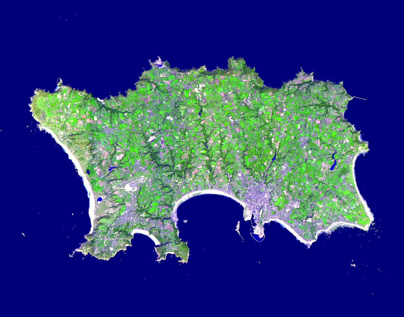
-
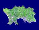
PIA03879:
-
Isle of Jersey
Full Resolution:
TIFF
(2.241 MB)
JPEG
(236.9 kB)
|
|
|
2002-10-22 |
Earth
|
Terra
|
ASTER
|
2720x1670x3 |
|
-
PIA03877:
-
Tarpum Bay, Bahamas
Full Resolution:
TIFF
(10.64 MB)
JPEG
(522.8 kB)
|
|
|
2002-10-15 |
Earth
|
Terra
|
ASTER
|
4812x4642x3 |
|
-
PIA03875:
-
Yellowstone Park
Full Resolution:
TIFF
(67.01 MB)
JPEG
(6.522 MB)
|
|
|
2002-09-24 |
Earth
|
Terra
|
ASTER
|
2576x2308x3 |
|
-
PIA03860:
-
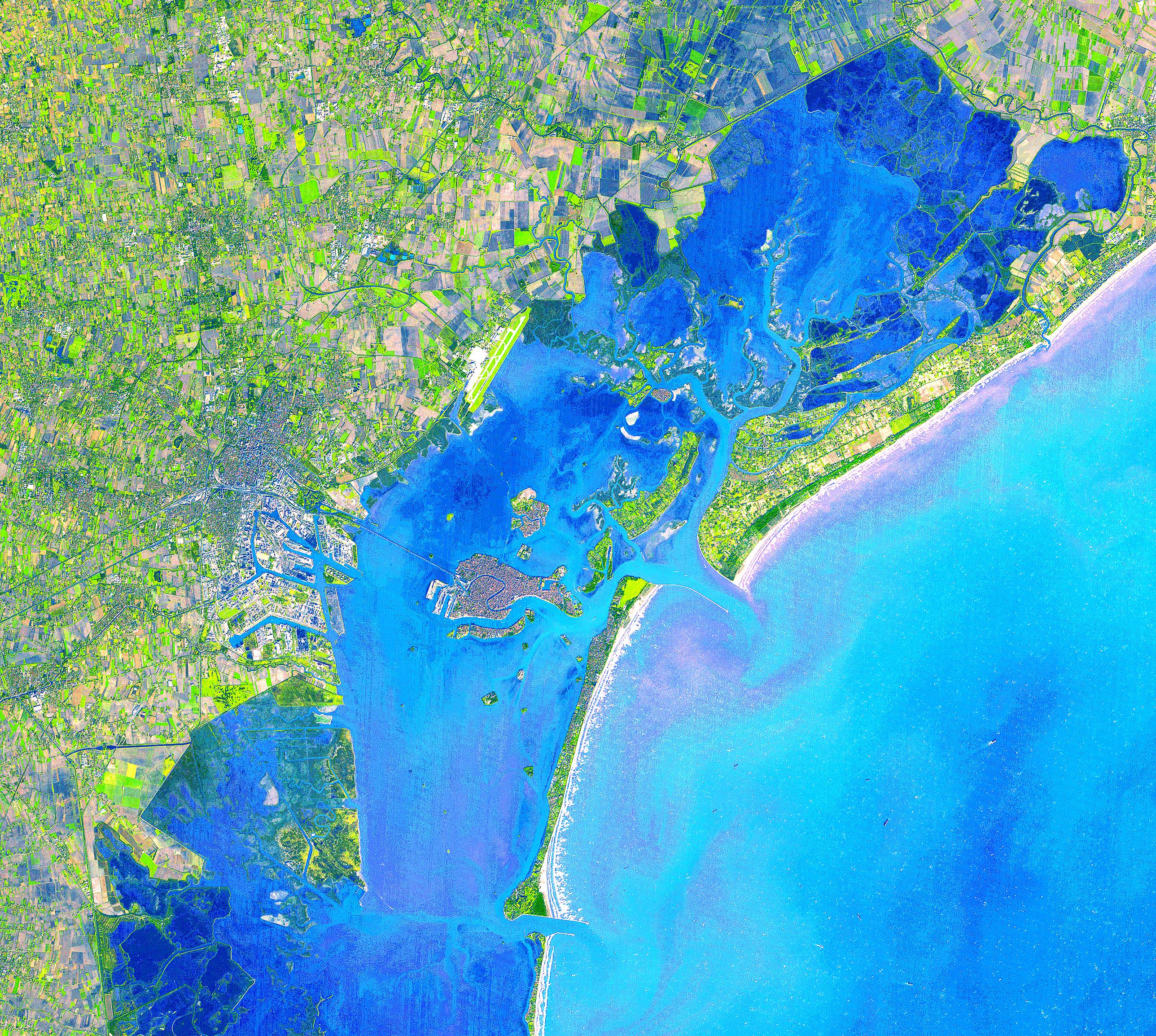
Venice, Italy
Full Resolution:
TIFF
(17.56 MB)
JPEG
(2.723 MB)
|
|
|
2002-09-17 |
Earth
|
Terra
|
ASTER
|
1192x998x3 |
|
-
PIA03859:
-
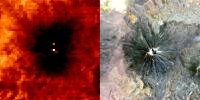
Iturralde Crater, Bolivia
Full Resolution:
TIFF
(3.573 MB)
JPEG
(482.4 kB)
|
|
|
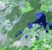
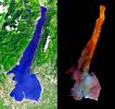
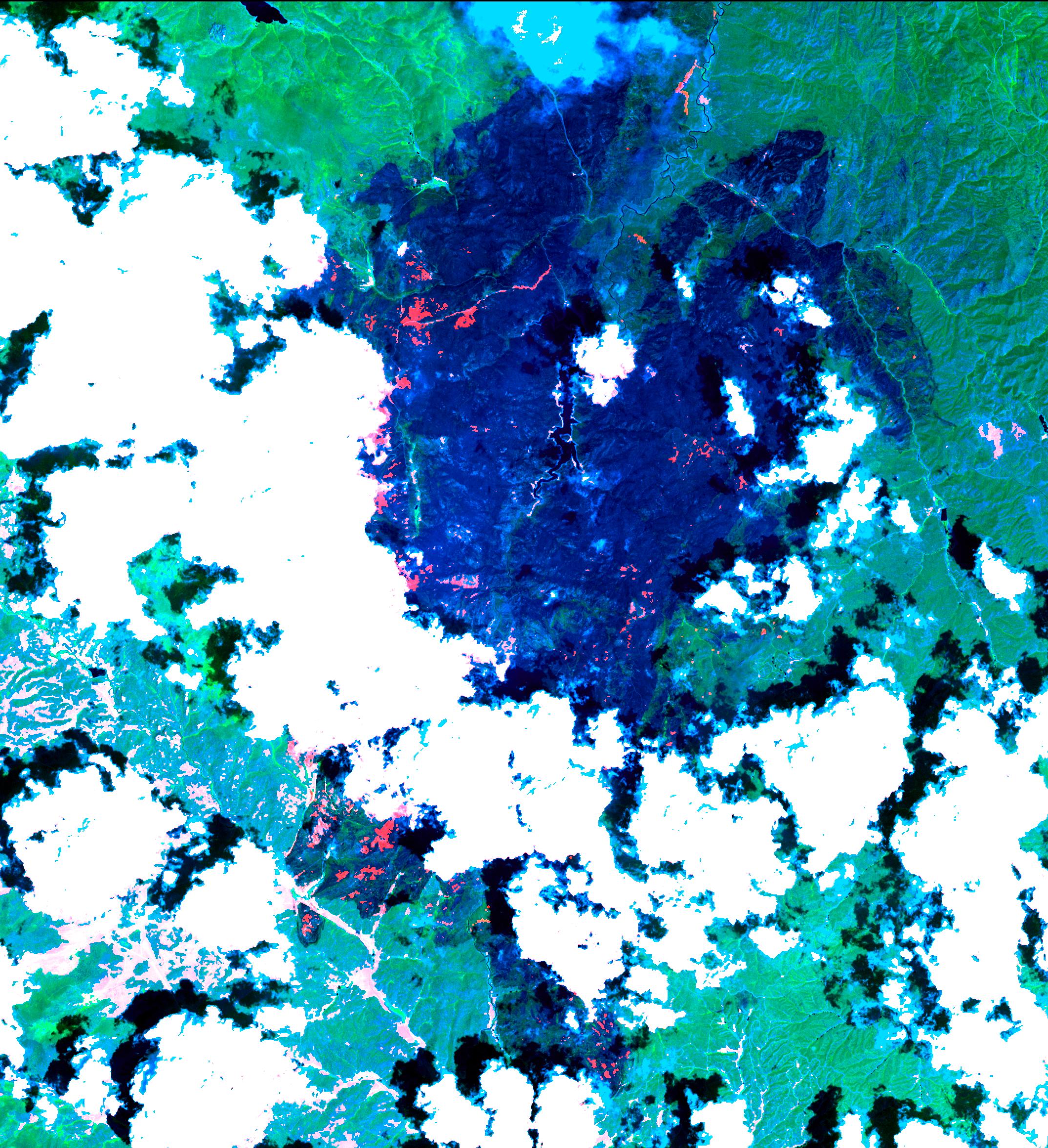
2002-09-15 |
Earth
|
Terra
|
ASTER
|
4850x7960x3 |
|
-
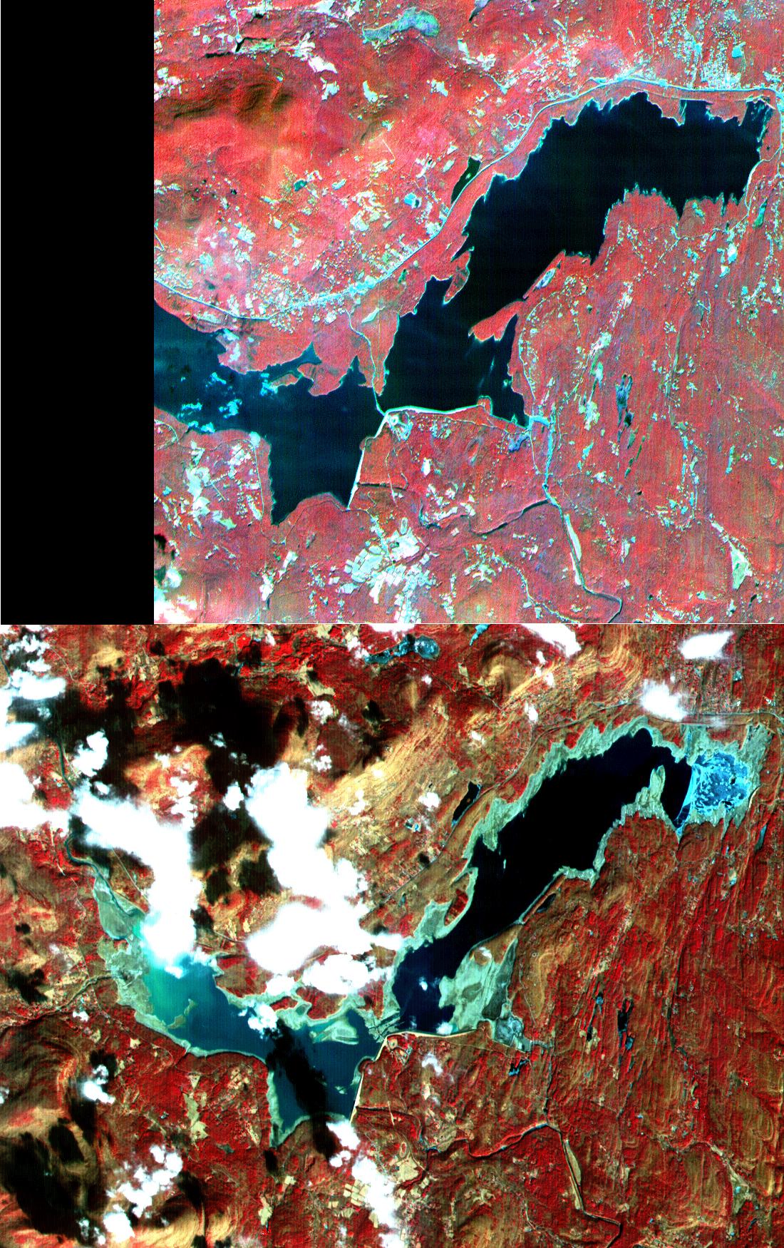
PIA03858:
-
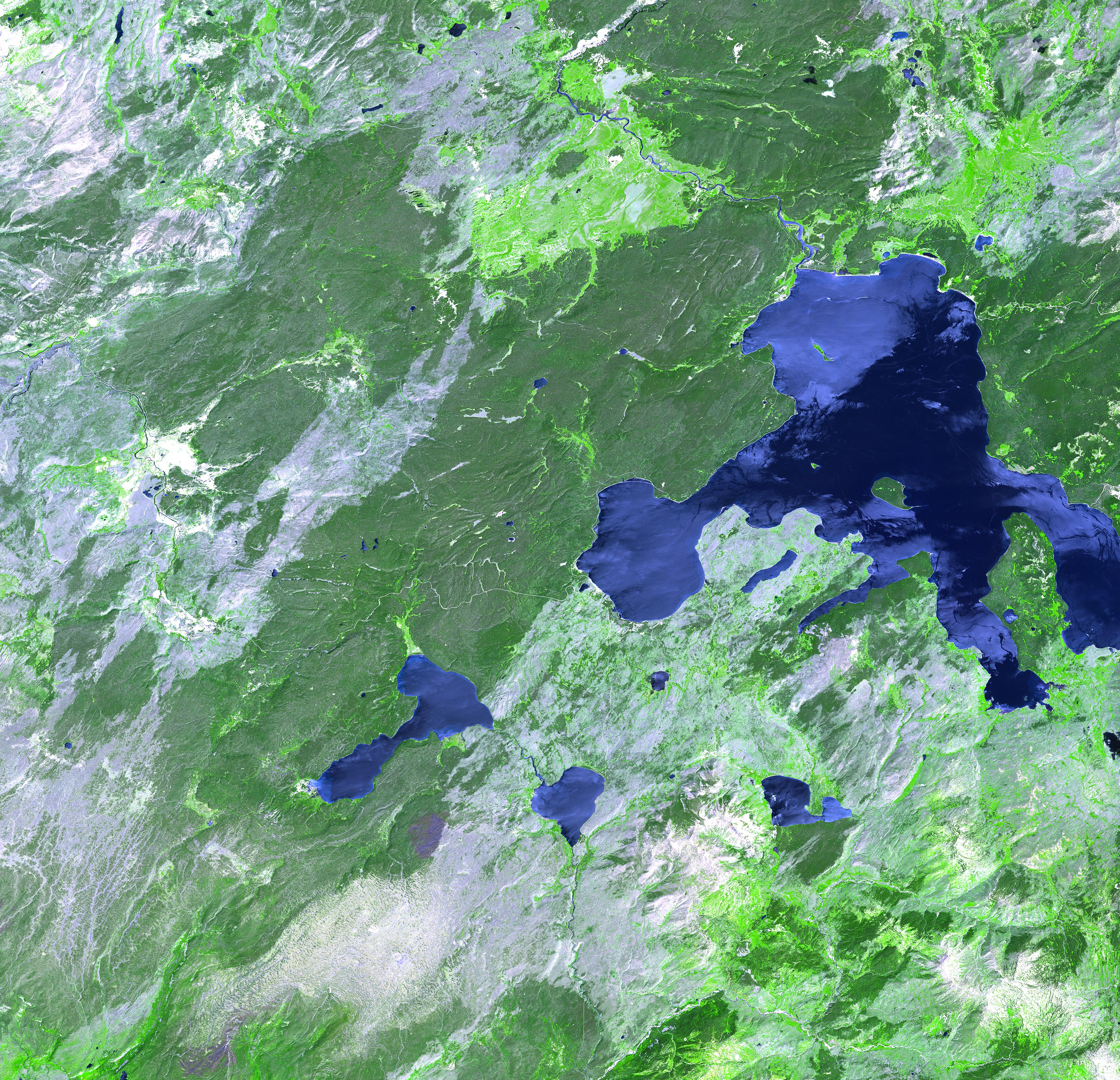
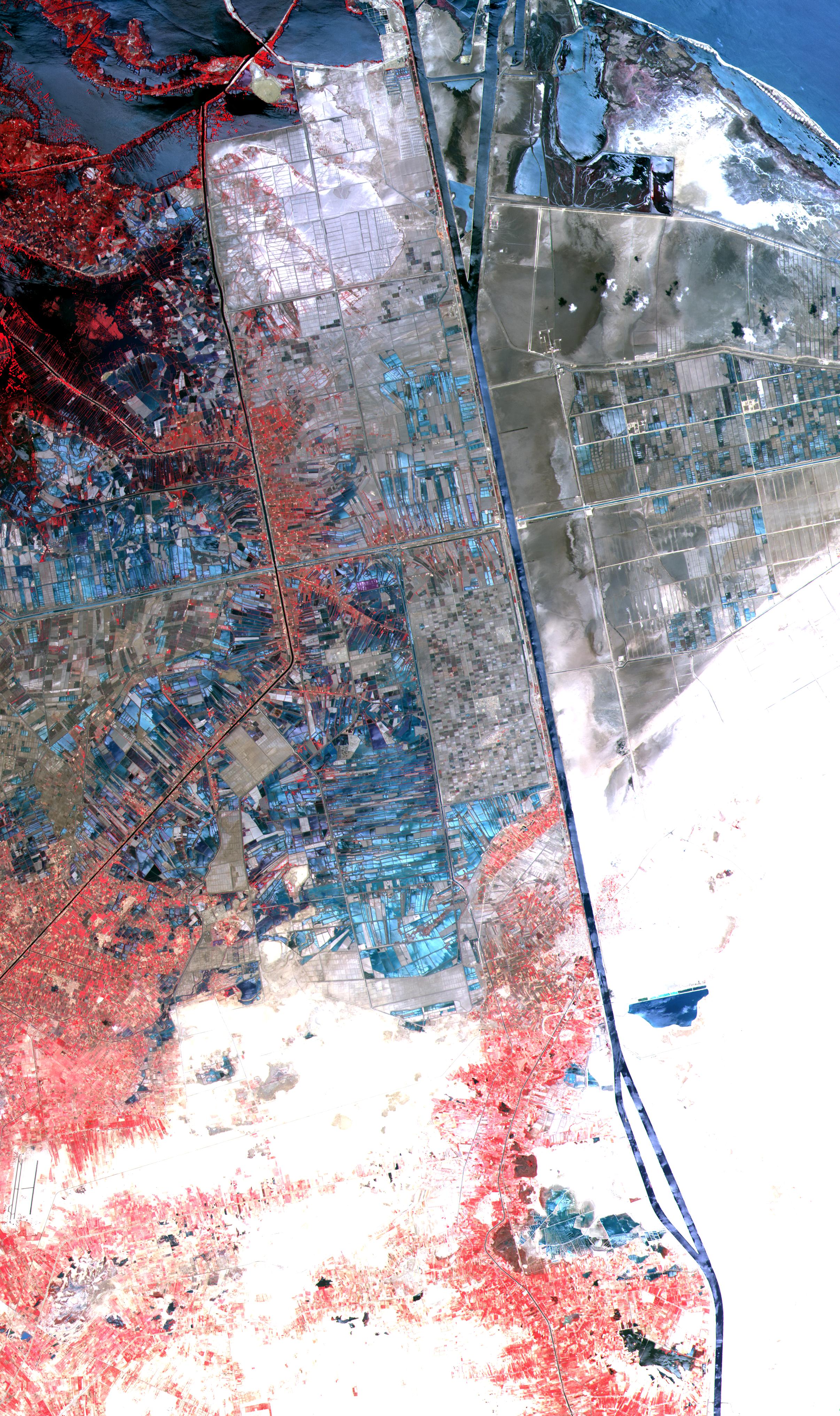
Dongting Lake, China
Full Resolution:
TIFF
(107.1 MB)
JPEG
(5.536 MB)
|
|
|
2002-09-03 |
Earth
|
Terra
|
ASTER
|
3966x3732x3 |
|
-
PIA03857:
-
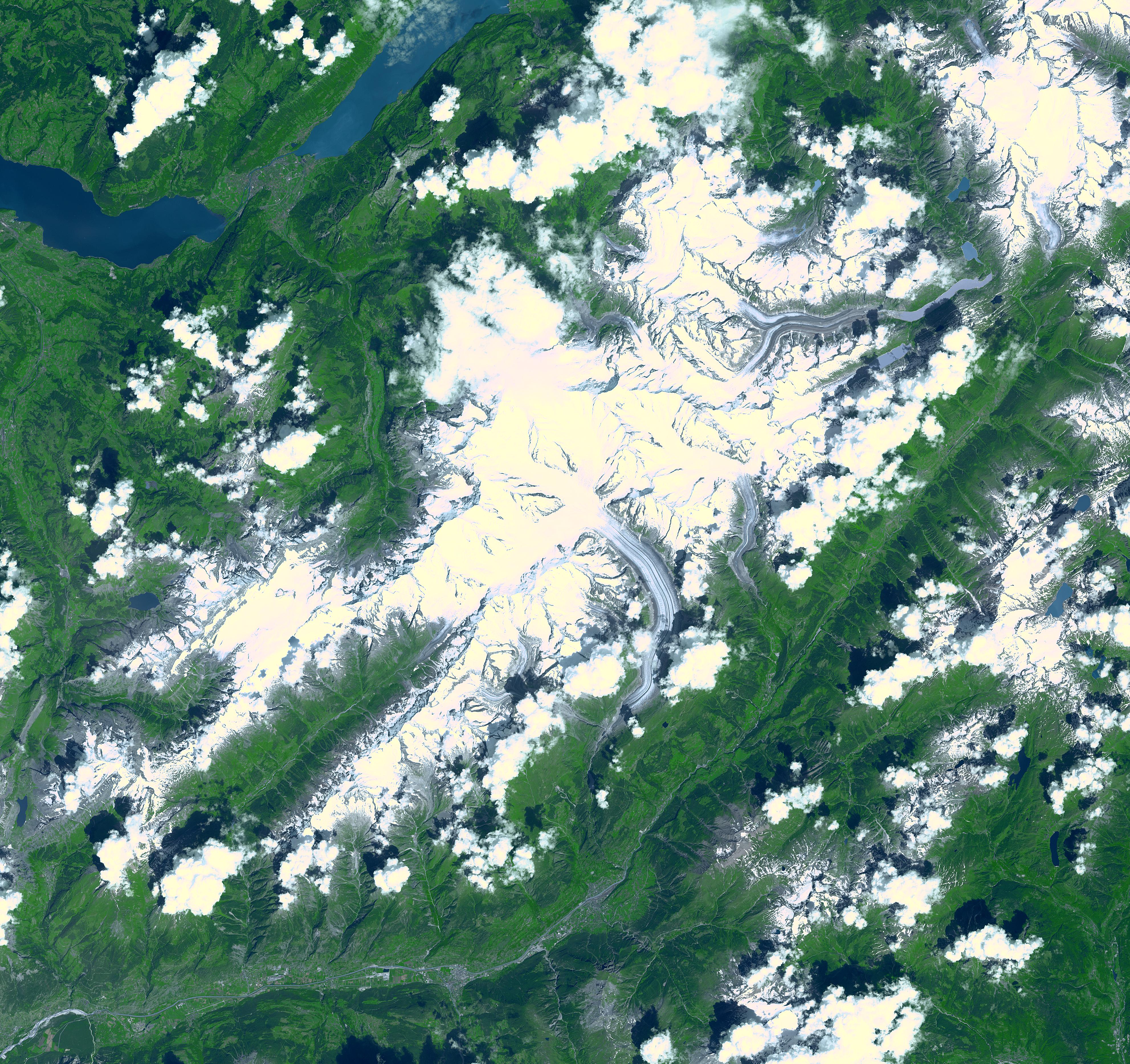
Aletsch Glacier, Switzerland
Full Resolution:
TIFF
(49.02 MB)
JPEG
(3.103 MB)
|
|
|
2002-08-22 |
Earth
|
Terra
|
ASTER
|
2976x3942x3 |
|
-
PIA03856:
-
Biscuit Fire, OR
Full Resolution:
TIFF
(38.28 MB)
JPEG
(1.679 MB)
|
|
|
2002-08-06 |
Earth
|
Terra
|
ASTER
|
3124x2554x3 |
|
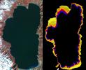
-
PIA03854:
-
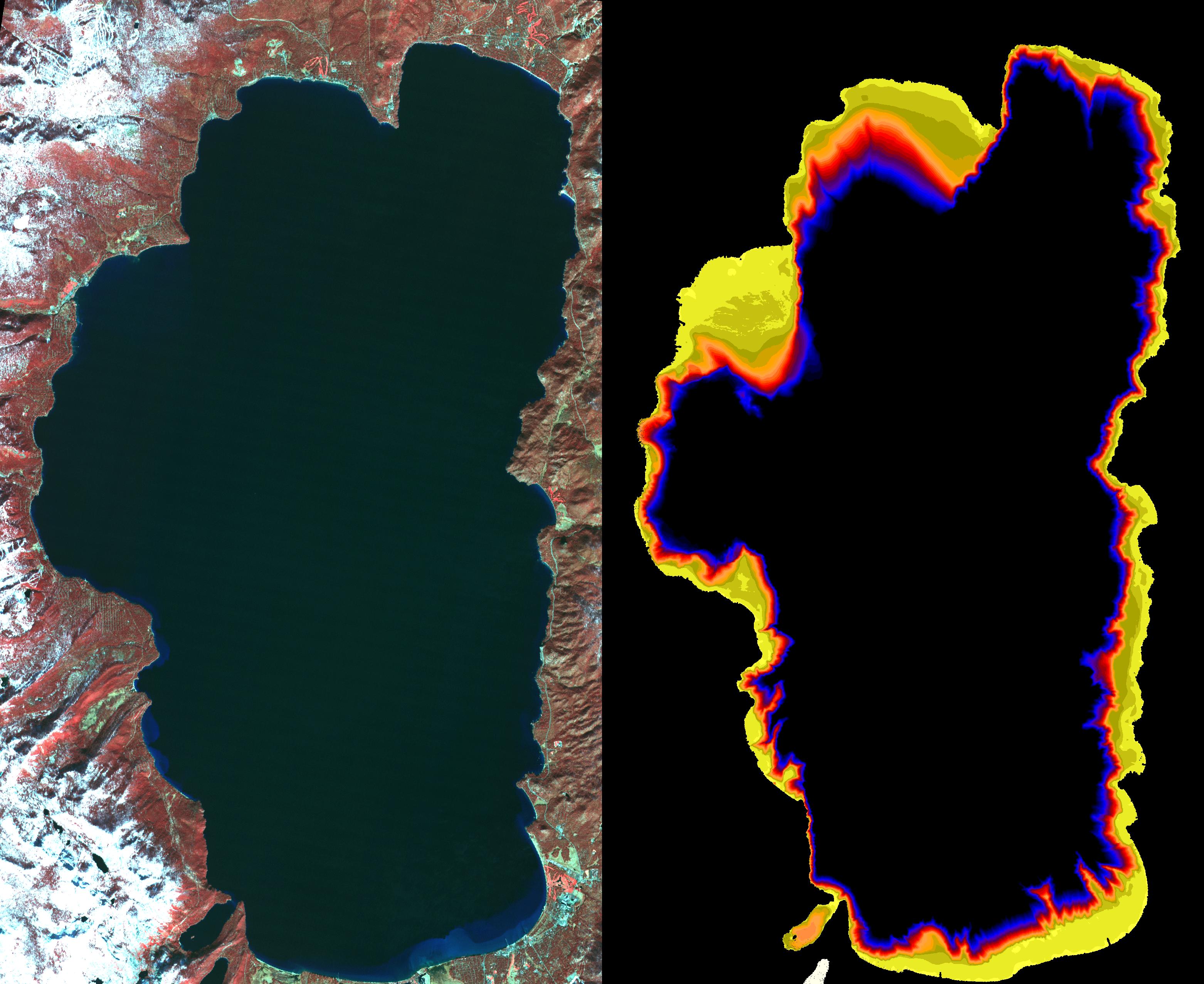
NASA Images Show Decreased Clarity in Lake Tahoe's Water
Full Resolution:
TIFF
(6.831 MB)
JPEG
(703 kB)
|
|
|
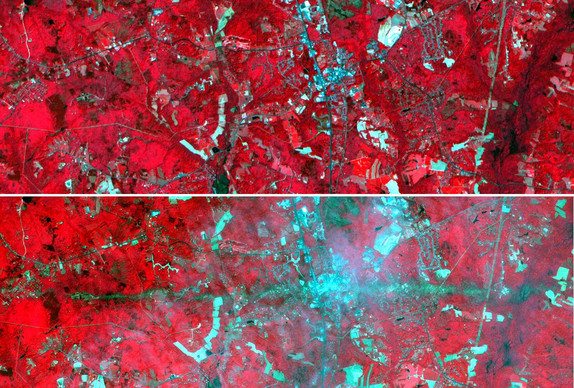
2002-07-31 |
Earth
|
Terra
|
ASTER
|
1028x798x3 |
|
-
PIA03853:
-
Machu Picchu, Peru
Full Resolution:
TIFF
(3.095 MB)
JPEG
(270 kB)
|
|
|
2002-07-25 |
Earth
|
Terra
|
ASTER
|
3924x2394x3 |
|
-
PIA03852:
-
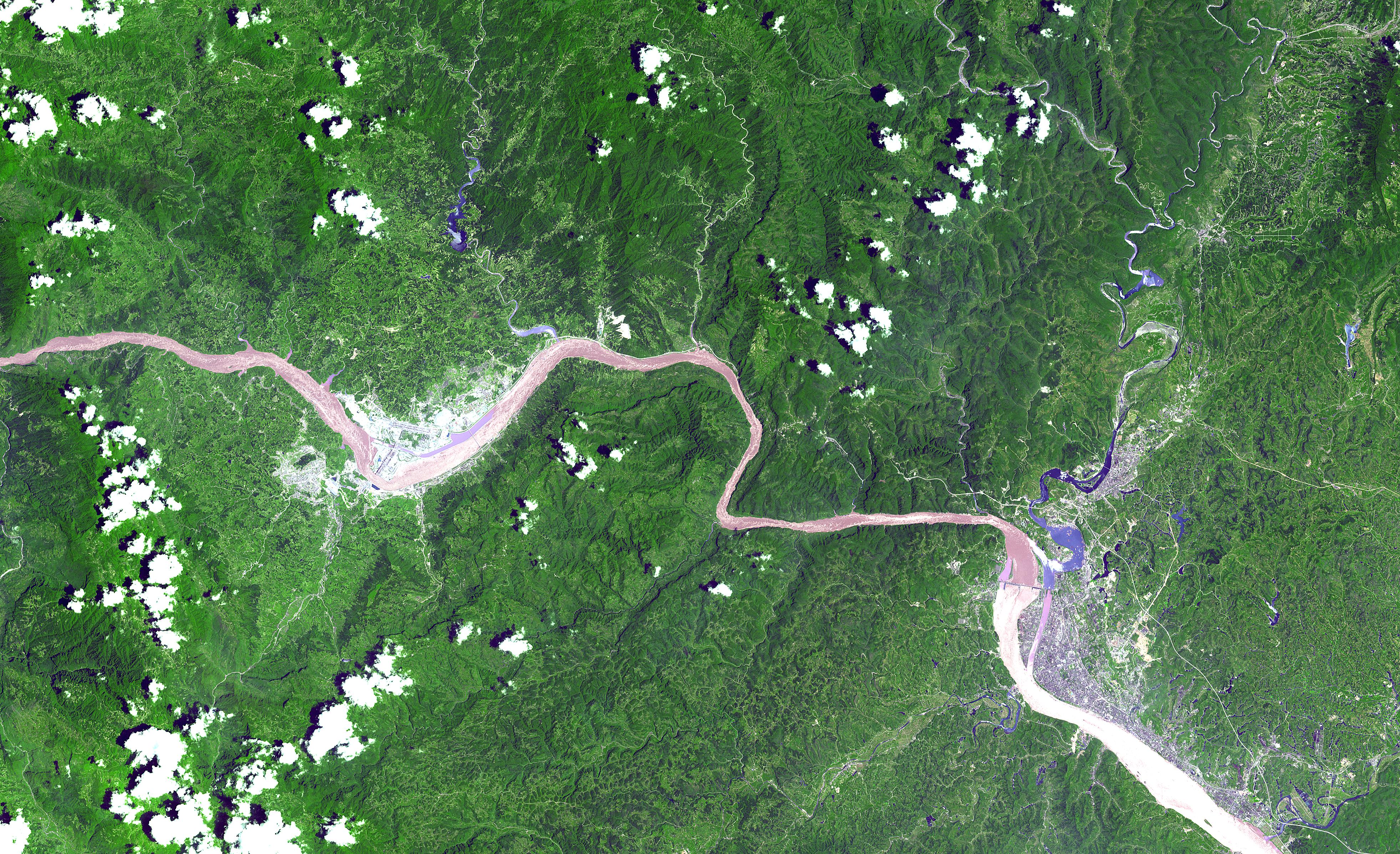
Three Gorges Dam, China
Full Resolution:
TIFF
(32.99 MB)
JPEG
(2.964 MB)
|
|
|
2002-07-16 |
Earth
|
Terra
|
ASTER
|
3885x2852x3 |
|
-
PIA03851:
-
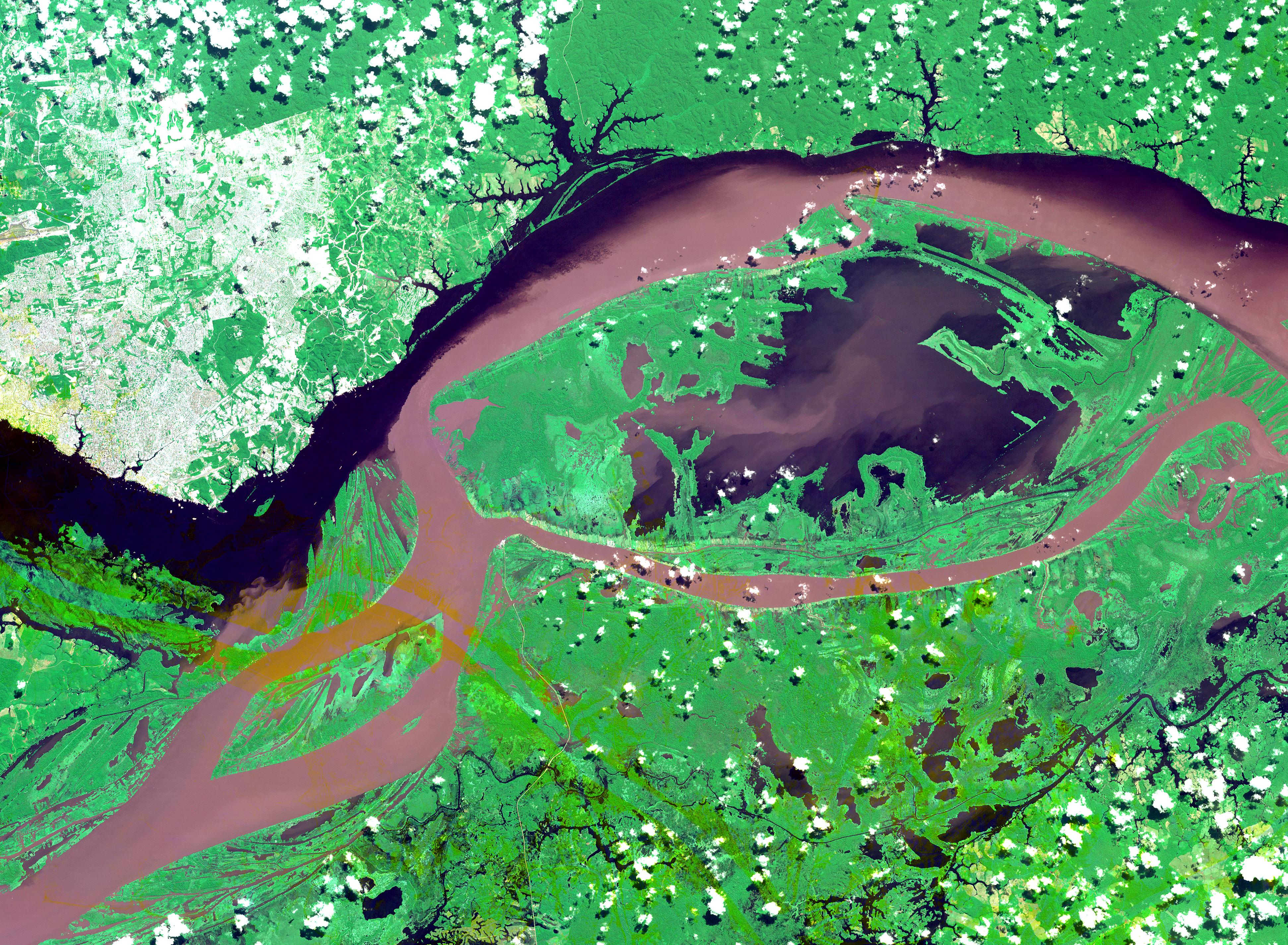
Manaus, Brazil
Full Resolution:
TIFF
(37.82 MB)
JPEG
(2.893 MB)
|
|
|
2002-06-18 |
Earth
|
Terra
|
ASTER
|
2146x2349x3 |
|
-
PIA03499:
-
Hayman Fire, Colorado
Full Resolution:
TIFF
(7.811 MB)
JPEG
(952.3 kB)
|
|
|
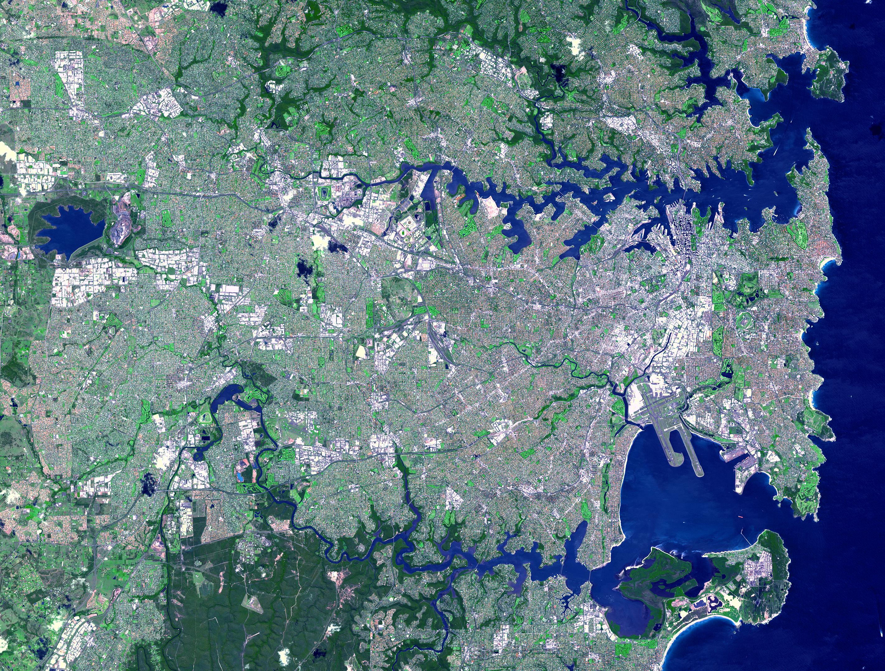
2002-06-11 |
Earth
|
Terra
|
ASTER
|
2840x2155x3 |
|
-
PIA03498:
-
Sydney, Australia
Full Resolution:
TIFF
(22.68 MB)
JPEG
(2.19 MB)
|
|
|
2002-06-11 |
Earth
|
Terra
|
ASTER
|
3594x3819x3 |
|
-
PIA03497:
-
Mississippi River Delta
Full Resolution:
TIFF
(46.09 MB)
JPEG
(3.446 MB)
|
|
|
2002-05-07 |
Earth
|
Terra
|
ASTER
|
1200x600x3 |
|
-
PIA03494:
-
La Plata, Maryland
Full Resolution:
TIFF
(3.1 MB)
JPEG
(253.9 kB)
|
|
|
2002-04-19 |
Earth
|
Terra
|
ASTER
|
1200x600x3 |
|
-
PIA03493:
-
Chiliques Volcano, Chile
Full Resolution:
TIFF
(1.548 MB)
JPEG
(103.7 kB)
|
|
|
2002-04-19 |
Earth
|
Terra
|
ASTER
|
1597x1082x3 |
|
-
PIA03492:
-
Cascade Mtns. Oregon
Full Resolution:
TIFF
(3.096 MB)
JPEG
(292.4 kB)
|
|
|
2002-04-03 |
Earth
|
Terra
|
ASTER
|
1100x1750x3 |
|
-
PIA03491:
-
New York State
Full Resolution:
TIFF
(3.654 MB)
JPEG
(519.1 kB)
|
|
|
2002-03-12 |
Earth
|
Terra
|
ASTER
|
1208x797x3 |
|
-
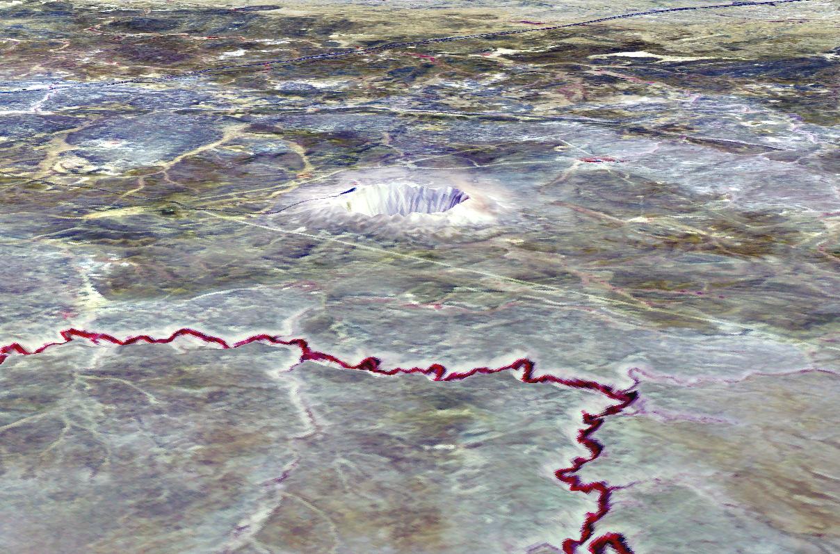
PIA03490:
-
Meteor Crater, AZ
Full Resolution:
TIFF
(2.53 MB)
JPEG
(218 kB)
|
|
|
2002-02-26 |
Earth
|
Terra
|
ASTER
|
1650x1800x3 |
|
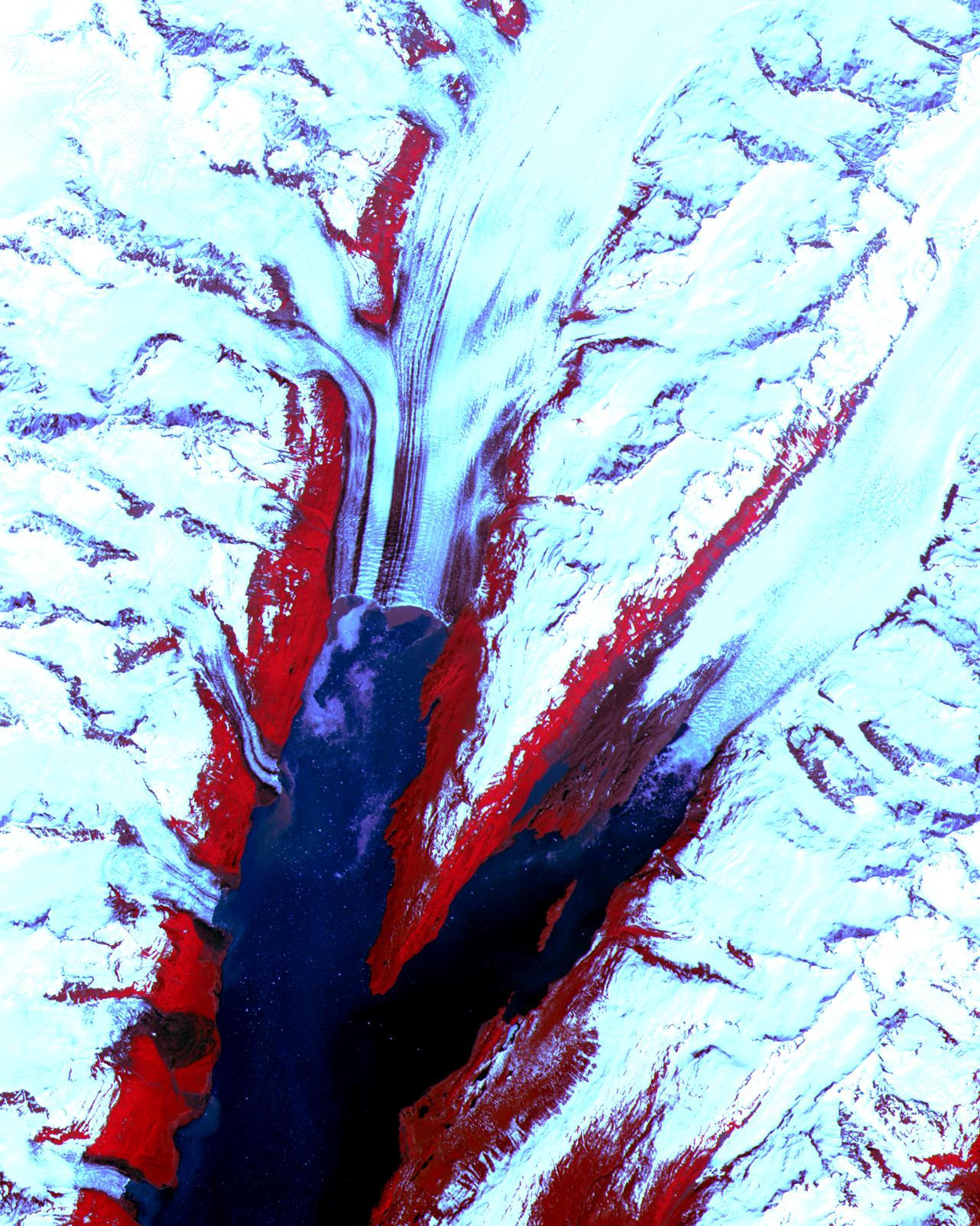
-
PIA03475:
-
Malaspina Glacier, Alaska
Full Resolution:
TIFF
(7.824 MB)
JPEG
(547.8 kB)
|
|
|
2002-02-07 |
Earth
|
Terra
|
ASTER
|
1500x1137x3 |
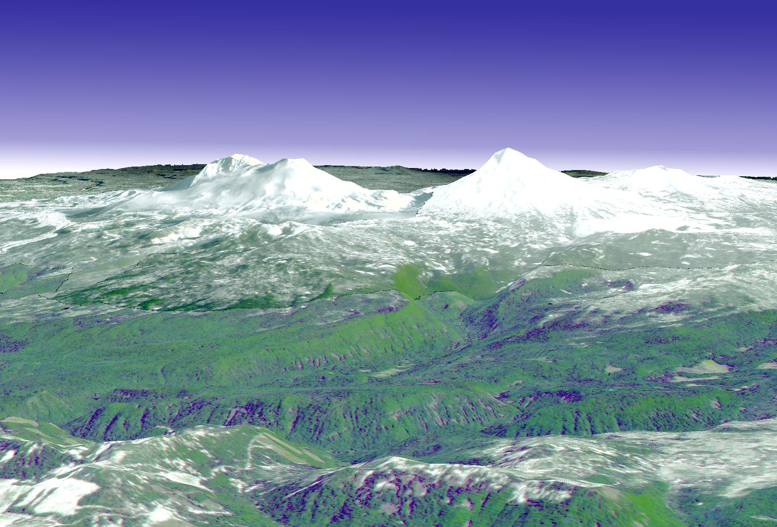
|
-
PIA03466:
-
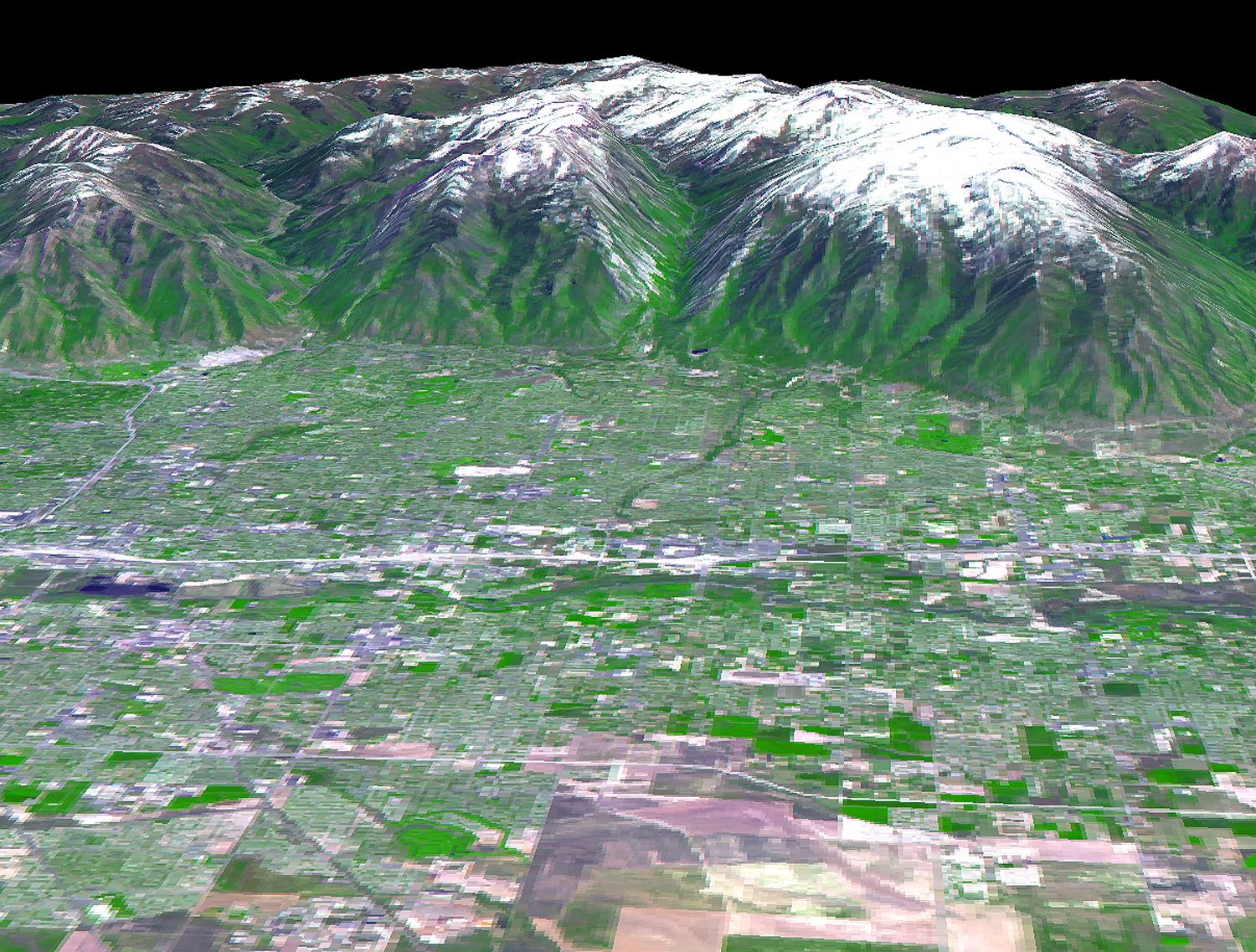
Salt Lake City, Utah, Perspective View
Full Resolution:
TIFF
(5.424 MB)
JPEG
(418.7 kB)
|
|
|
2002-02-07 |
Earth
|
Terra
|
ASTER
|
4100x8221x3 |
|
-
PIA03465:
-
Salt Lake City, Utah, Winter 2001
Full Resolution:
TIFF
(97.99 MB)
JPEG
(8.545 MB)
|
|
|
2002-02-07 |
Earth
|
Terra
|
ASTER
|
4100x8220x3 |
|
-
PIA03464:
-
Salt Lake City, Utah
Full Resolution:
TIFF
(103.2 MB)
JPEG
(6.455 MB)
|
|
|
2002-02-01 |
Earth
|
Terra
|
ASTER
|
600x1250x3 |
|
-
PIA03463:
-
Railroad Valley, Nevada
Full Resolution:
TIFF
(940.3 kB)
JPEG
(98.08 kB)
|
|
|
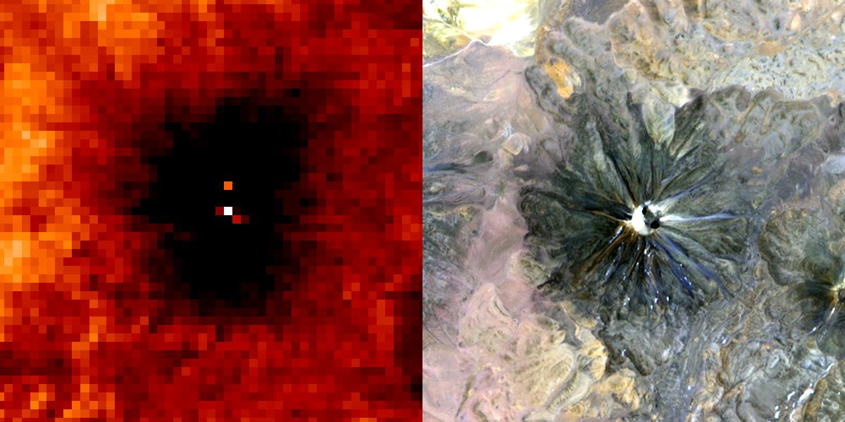
2002-02-01 |
Earth
|
Terra
|
ASTER
|
692x829x3 |
|
-
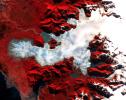
PIA03462:
-
Nyiragonga Volcano
Full Resolution:
TIFF
(997.9 kB)
JPEG
(119.6 kB)
|
|
|
2002-01-03 |
Earth
|
Terra
|
ASTER
|
516x946x3 |

|
-
PIA03514:
-
Shiveluch Volcano, Kamchatka Peninsula, Russia
Full Resolution:
TIFF
(375.8 kB)
JPEG
(98.03 kB)
|
|
|
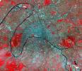
2001-10-22 |
Earth
|
Terra
|
ASTER
|
1528x1322x3 |
|
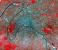
-
PIA11168:
-
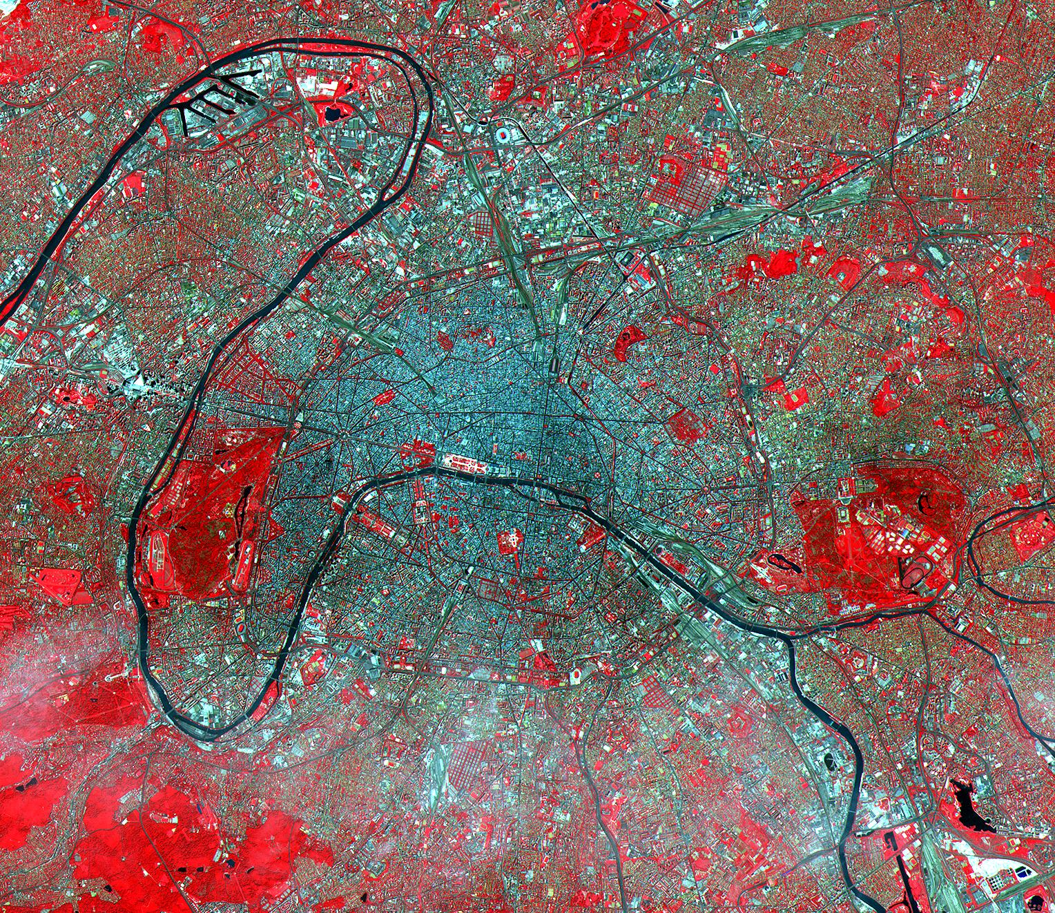
Paris
Full Resolution:
TIFF
(6.071 MB)
JPEG
(1.008 MB)
|
|
|
2001-10-22 |
Earth
|
Terra
|
ASTER
|
2280x3887x3 |

|
-
PIA11167:
-
Strait of Gibraltar
Full Resolution:
TIFF
(26.62 MB)
JPEG
(1.024 MB)
|
|
|
2001-10-22 |
Earth
|
Terra
|
ASTER
|
340x256x3 |

|
-
PIA11166:
-
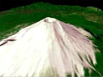
Mt. Fuji, Japan

Full Resolution:
TIFF
(261.6 kB)
JPEG
(12.14 kB)
|
|
|
2001-10-22 |
Earth
|
Terra
|
ASTER
|
3138x2611x3 |
|
-
PIA11165:
-
Oregon Forests
Full Resolution:
TIFF
(24.58 MB)
JPEG
(2.054 MB)
|
|
|
2001-10-22 |
Earth
|
Terra
|
ASTER
|
1960x2100x3 |
|
-
PIA11164:
-
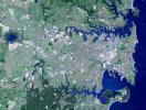
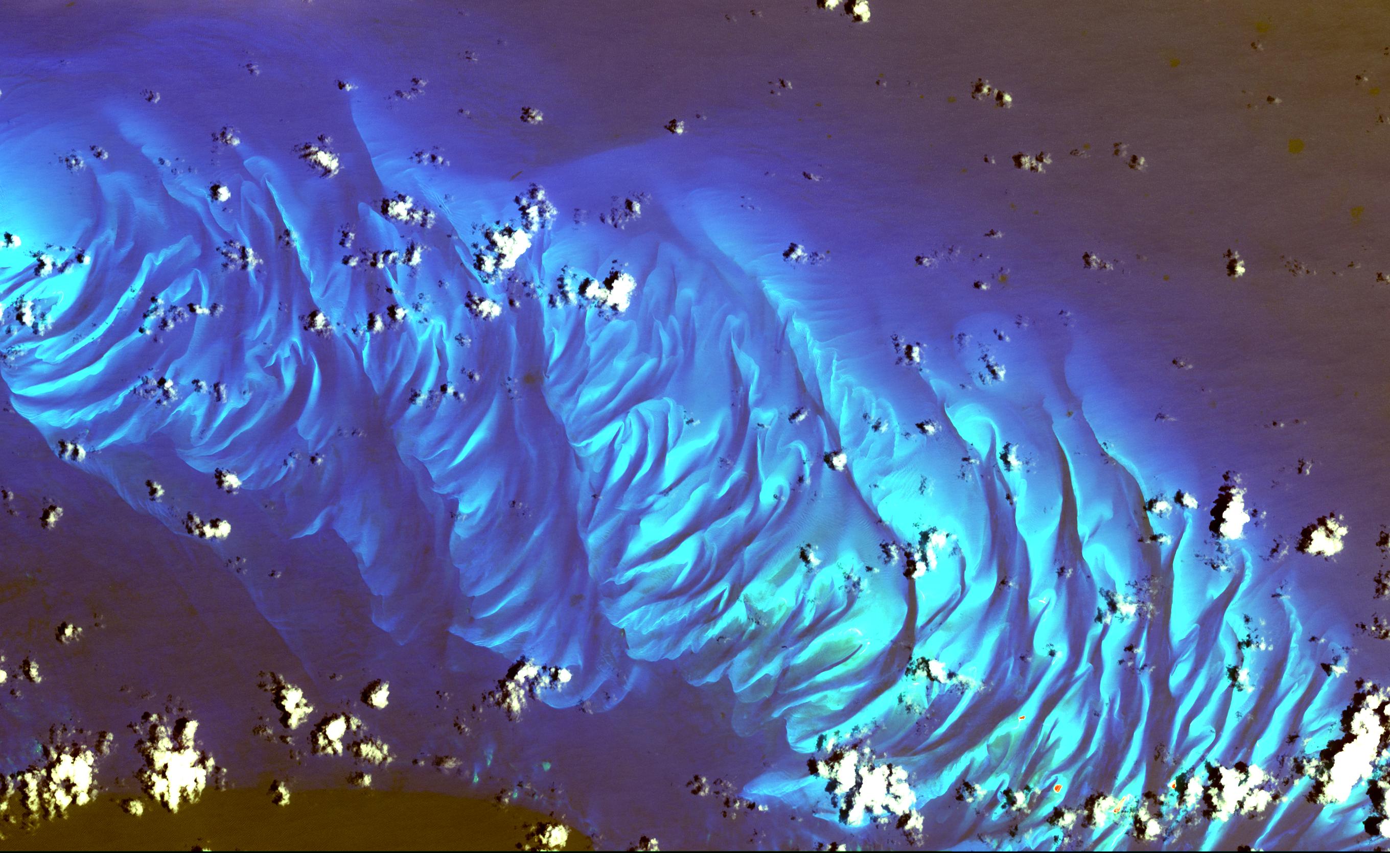
Saline Valley
Full Resolution:
TIFF
(12.37 MB)
JPEG
(1.34 MB)
|
|
|
2001-10-22 |
Earth
|
Terra
|
ASTER
|
1711x1575x3 |
|
-
PIA11163:
-
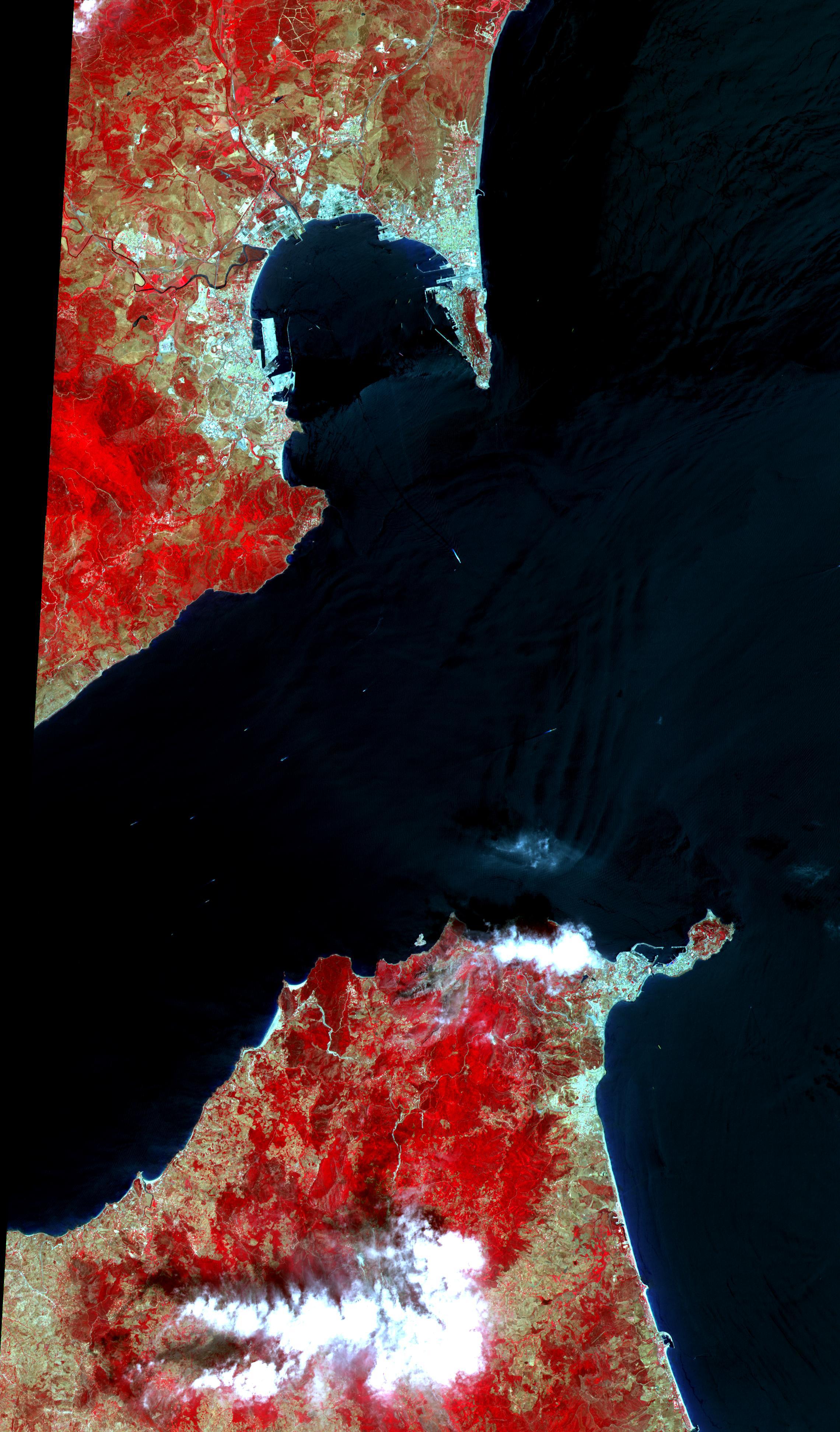
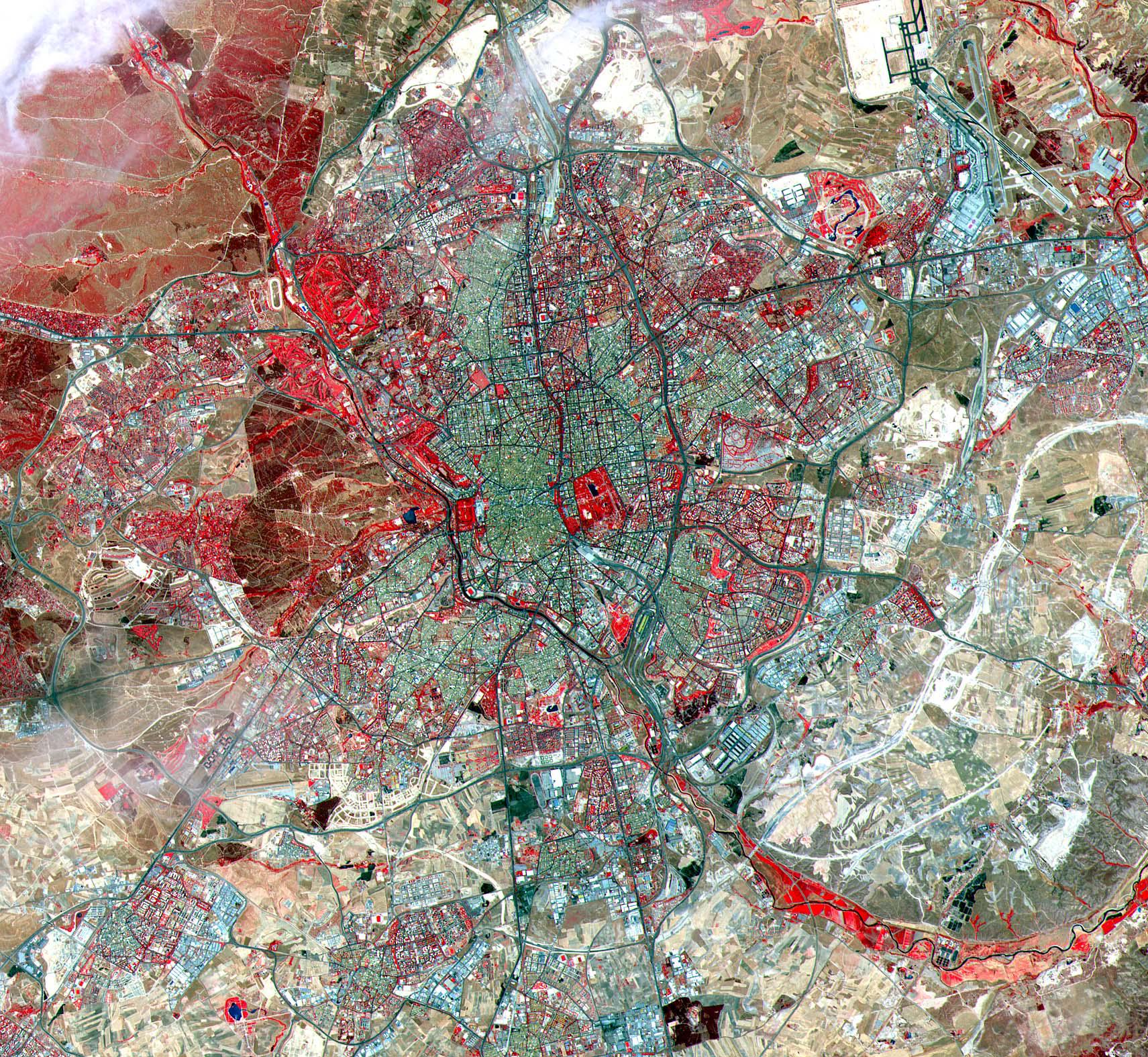
Madrid
Full Resolution:
TIFF
(8.097 MB)
JPEG
(889.5 kB)
|
|
|
2001-10-22 |
Earth
|
Terra
|
ASTER
|
3851x2645x3 |

|
-
PIA11162:
-
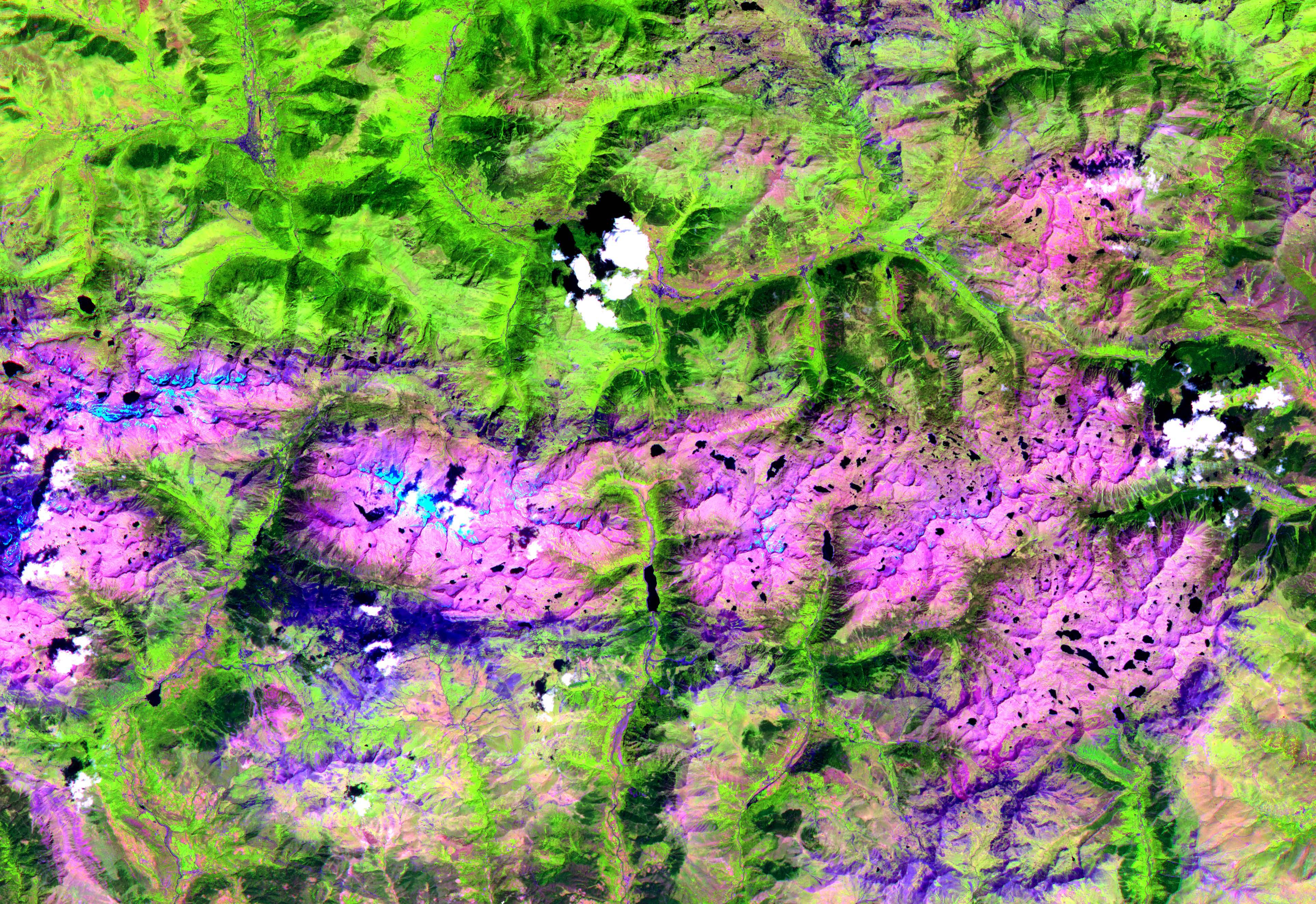
Pyrenees Mtns., Spain
Full Resolution:
TIFF
(30.56 MB)
JPEG
(2.239 MB)
|
|
|
2001-10-22 |
Earth
|
Terra
|
ASTER
|
1567x1811x3 |
|
-
PIA11161:
-
Coachella Valley, CA
Full Resolution:
TIFF
(8.528 MB)
JPEG
(676 kB)
|
|
|
2001-10-22 |
Earth
|
Terra
|
ASTER
|
1200x1354x3 |
|
-
PIA11160:
-
Mt. St. Helens
Full Resolution:
TIFF
(4.88 MB)
JPEG
(460.2 kB)
|
|
|
2001-10-22 |
Earth
|
Terra
|
ASTER
|
713x729x3 |
|
-
PIA11159:
-
Chile Altiplano Unconformity
Full Resolution:
TIFF
(1.562 MB)
JPEG
(147.2 kB)
|
|
|
2001-10-22 |
Earth
|
Terra
|
ASTER
|
3636x4008x3 |
|
-
PIA11158:
-
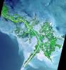
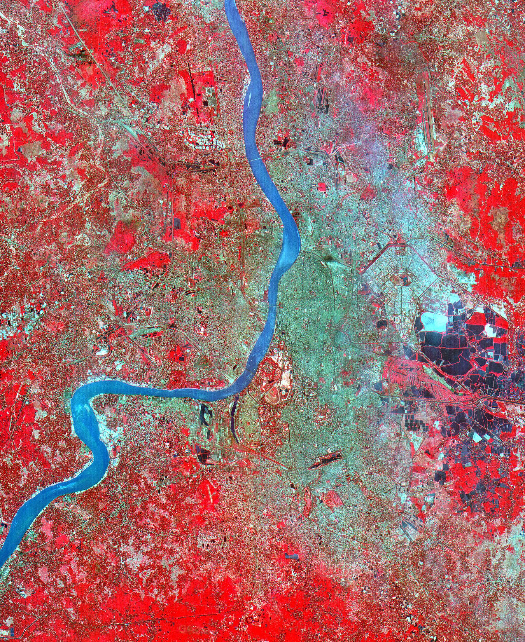
Hugli River Delta, India
Full Resolution:
TIFF
(43.72 MB)
JPEG
(2.484 MB)
|
|
|
2001-10-22 |
Earth
|
Terra
|
ASTER
|
1800x2200x3 |
|
-
PIA11157:
-
Calcutta
Full Resolution:
TIFF
(11.9 MB)
JPEG
(1.91 MB)
|
|
|
2001-10-22 |
Earth
|
Terra
|
ASTER
|
1000x700x3 |
|
-
PIA11099:
-
Sand Dunes, Afghanistan
Full Resolution:
TIFF
(2.103 MB)
JPEG
(229.1 kB)
|
|
|
2001-10-22 |
Earth
|
Terra
|
ASTER
|
700x800x3 |
|
-
PIA11098:
-
Jerusalem
Full Resolution:
TIFF
(1.682 MB)
JPEG
(193.9 kB)
|
|
|
2001-10-22 |
Earth
|
Terra
|
ASTER
|
1273x925x3 |
|
-
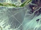
PIA11097:
-
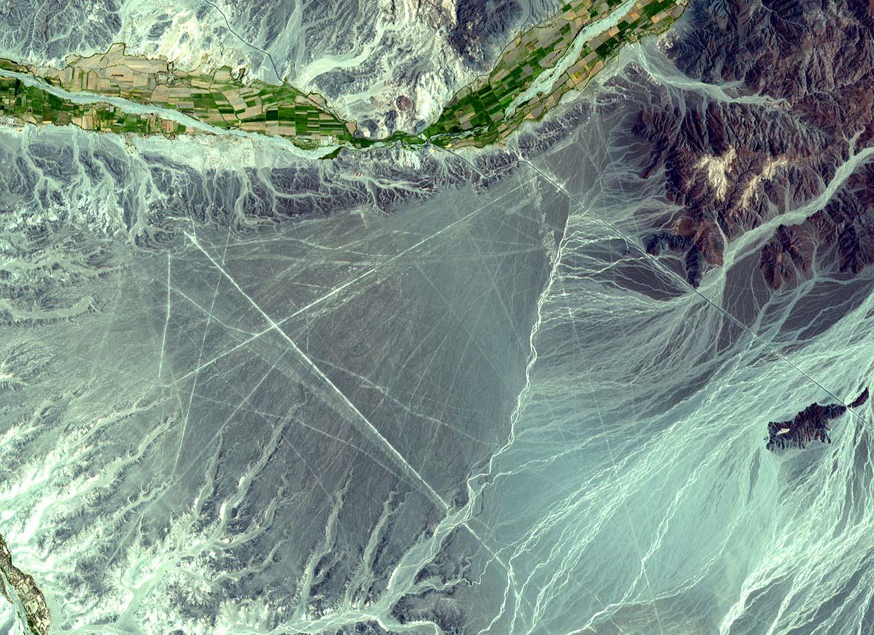
Nasca Lines, Peru
Full Resolution:
TIFF
(3.537 MB)
JPEG
(301.1 kB)
|
|
|
2001-10-22 |
Earth
|
Terra
|
ASTER
|
2254x1887x3 |
|
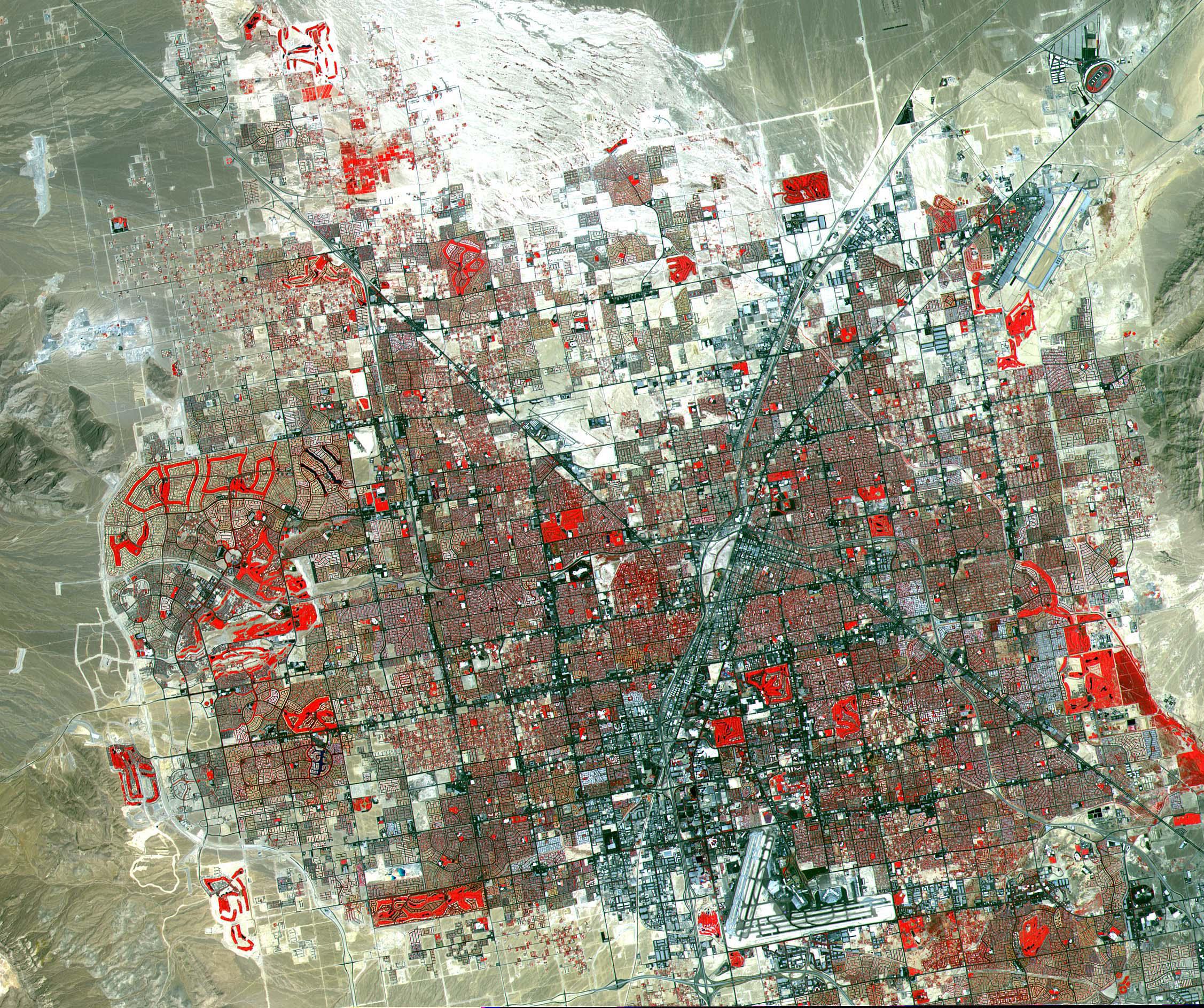
-
PIA11096:
-
Las Vegas
Full Resolution:
TIFF
(12.78 MB)
JPEG
(1.252 MB)
|
|
|
2001-10-22 |
Earth
|
Terra
|
ASTER
|
2547x3222x1 |
|
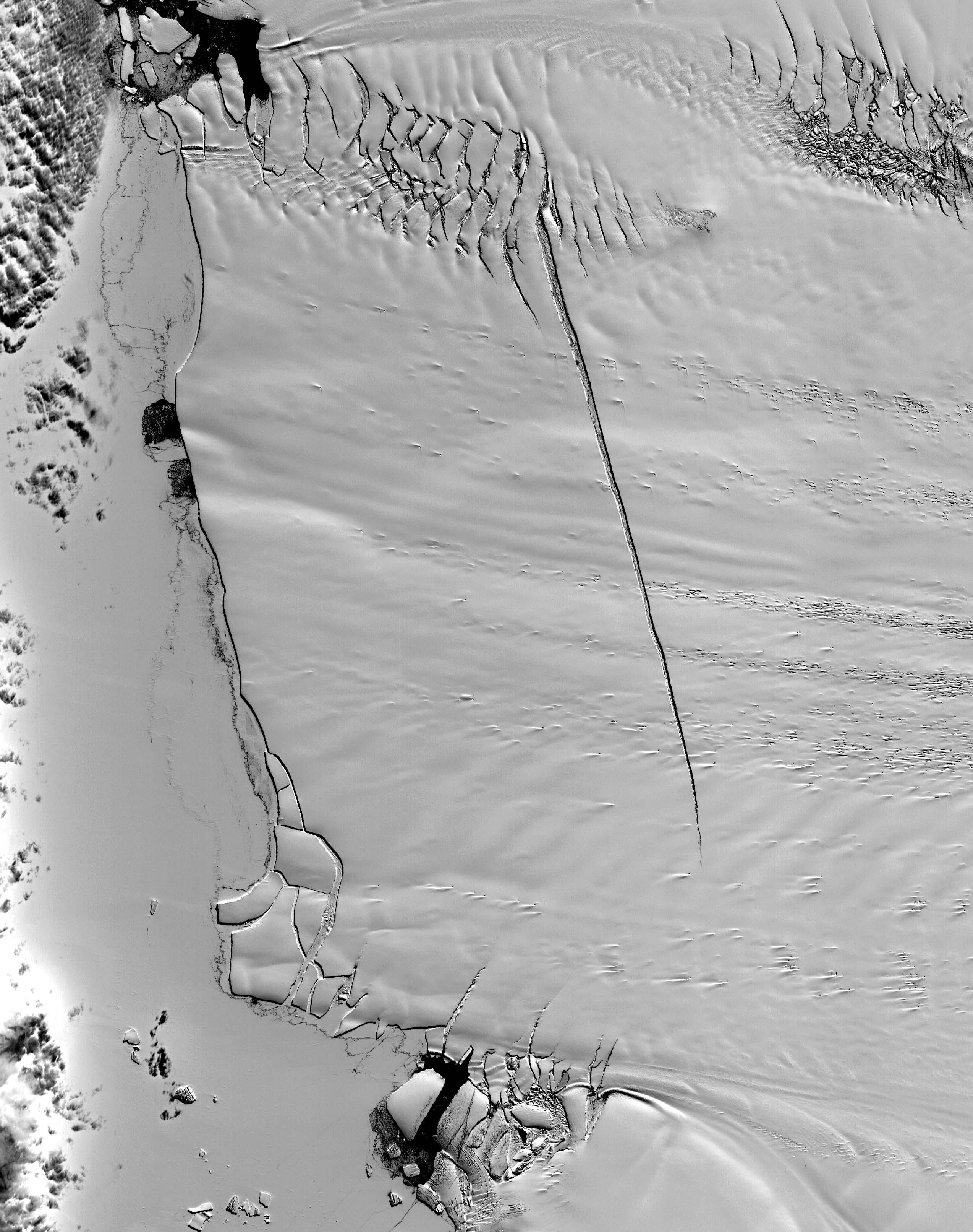
-
PIA11095:
-
Pine Island Glacier, Antarctica
Full Resolution:
TIFF
(8.215 MB)
JPEG
(785.4 kB)
|
|
|
2001-10-22 |
Earth
|
Terra
|
ASTER
|
1300x1000x3 |
|
-
PIA11094:
-
Thar Desert
Full Resolution:
TIFF
(3.904 MB)
JPEG
(351.1 kB)
|
|
|
2001-10-22 |
Earth
|
Terra
|
ASTER
|
1694x921x3 |
|
-
PIA11092:
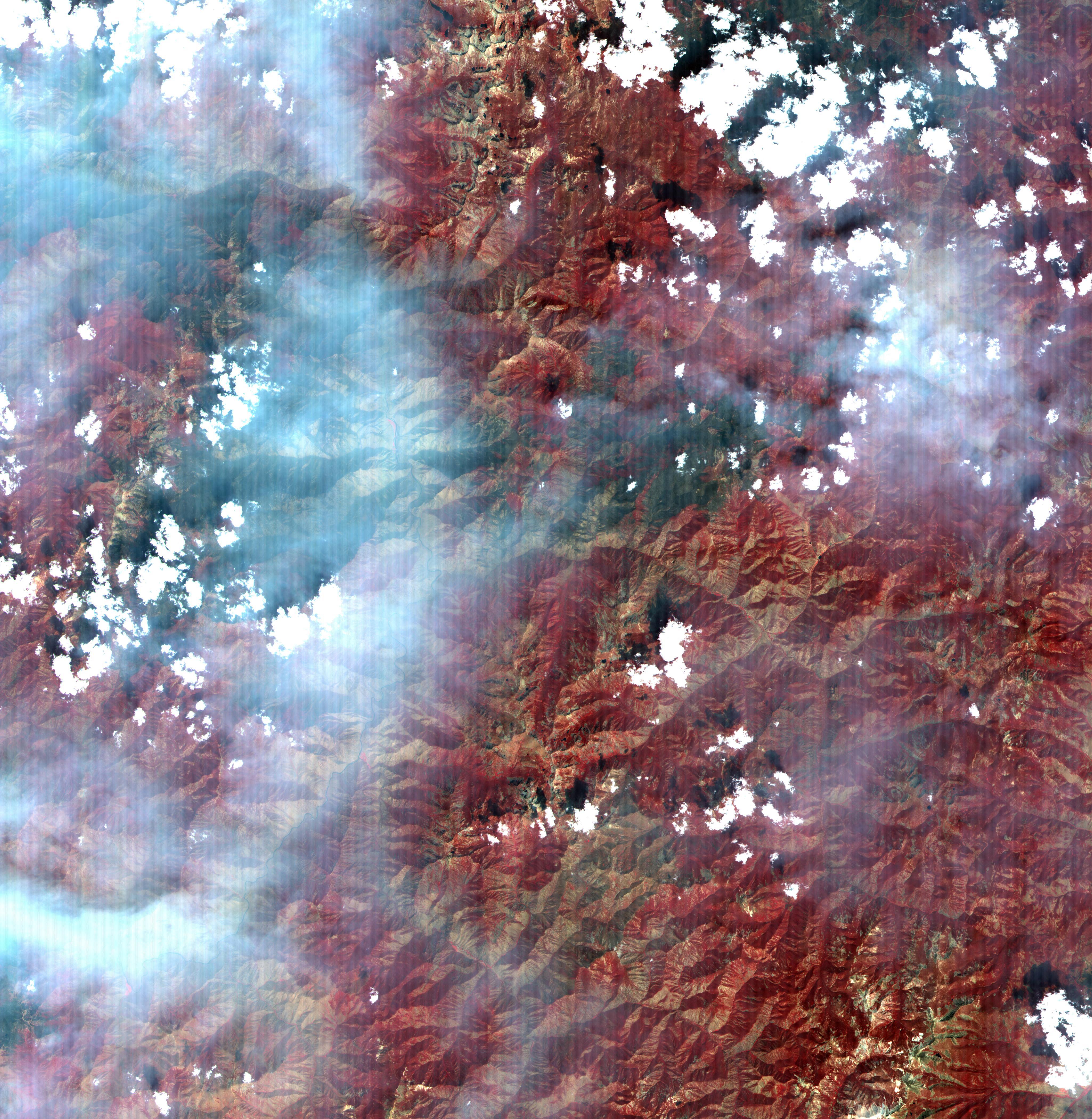
-
Arizona Forest Fire
Full Resolution:
TIFF
(4.688 MB)
JPEG
(343.9 kB)
|
|
|
2001-10-22 |
Earth
|
Terra
|
ASTER
|
600x540x3 |

|
-
PIA11093:
-
Hawaii Lava Flows
Full Resolution:
TIFF
(973.3 kB)
JPEG
(26.82 kB)
|
|
|
2001-10-22 |
Earth
|
Terra
|
ASTER
|
3002x2477x3 |
|
-
PIA11091:
-
Mt. Vesuvius, Italy
Full Resolution:
TIFF
(22.31 MB)
JPEG
(2.267 MB)
|
|
|
2001-10-22 |
Earth
|
Terra
|
ASTER
|
2000x2500x3 |
|
-
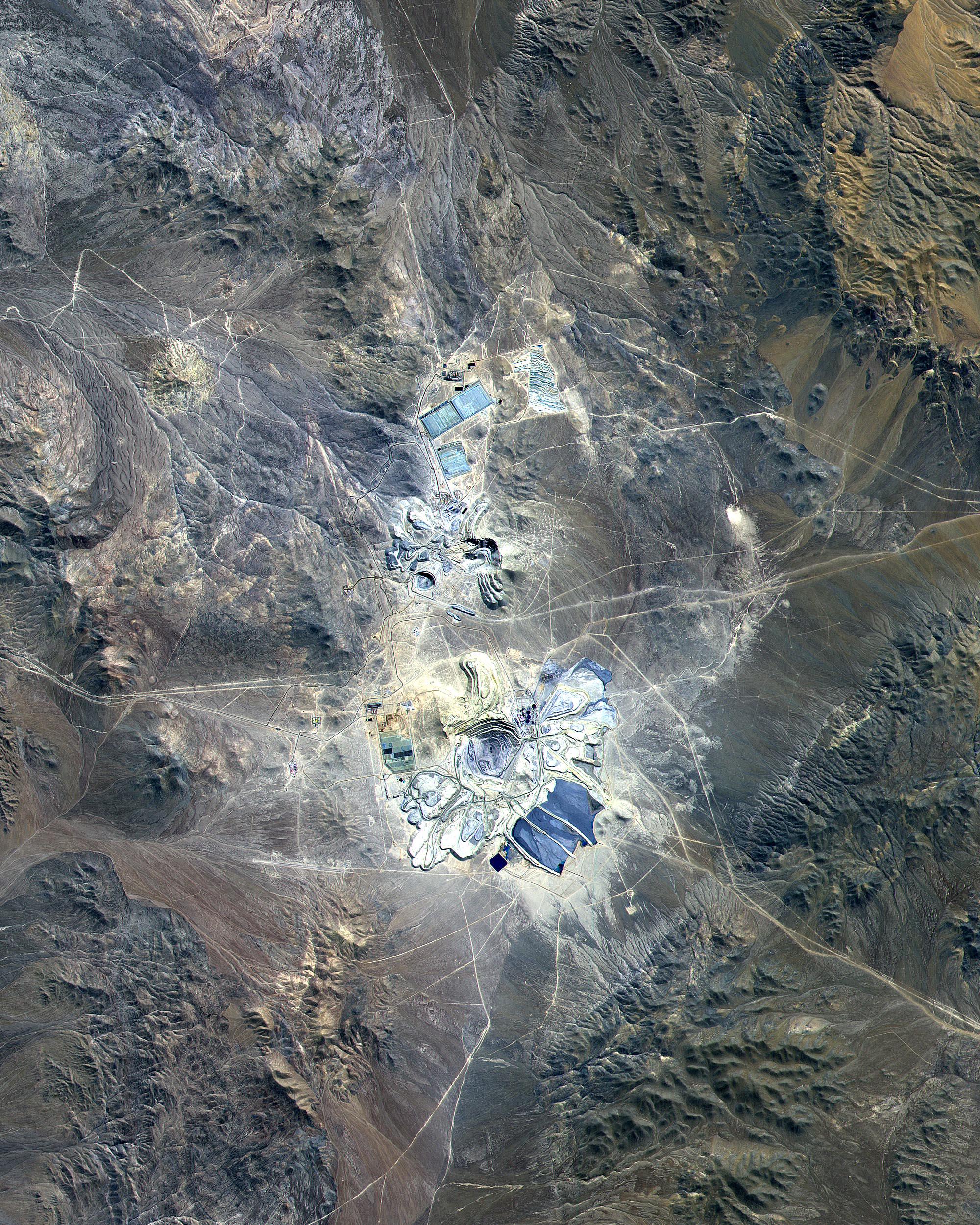
PIA11090:
-
Escondida Mine, Chile
Full Resolution:
TIFF
(15.02 MB)
JPEG
(1.402 MB)
|
|
|
2001-10-22 |
Earth
|
Terra
|
ASTER
|
1388x1167x3 |
|
-
PIA11089:
-
Baltimore, MD
Full Resolution:
TIFF
(4.869 MB)
JPEG
(565.4 kB)
|
|
|
2001-10-22 |
Earth
|
Terra
|
ASTER
|
4100x4200x3 |
|
-
PIA11088:
-
Idaho Fires
Full Resolution:
TIFF
(51.66 MB)
JPEG
(2.704 MB)
|
|
|
2001-10-22 |
Earth
|
Terra
|
ASTER
|
837x690x3 |

|
-
PIA11087:
-
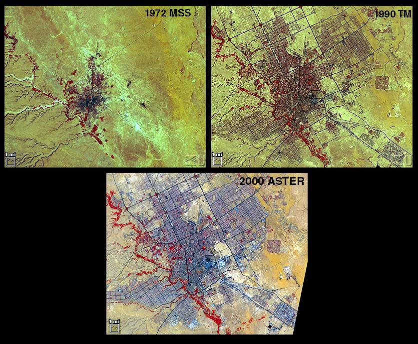
Urbanization: Riyadh, Saudi Arabia
Full Resolution:
TIFF
(1.735 MB)
JPEG
(157.5 kB)
|
|
|
2001-10-22 |
Earth
|
Terra
|
ASTER
|
2000x1500x3 |

|
-
PIA01908:
-
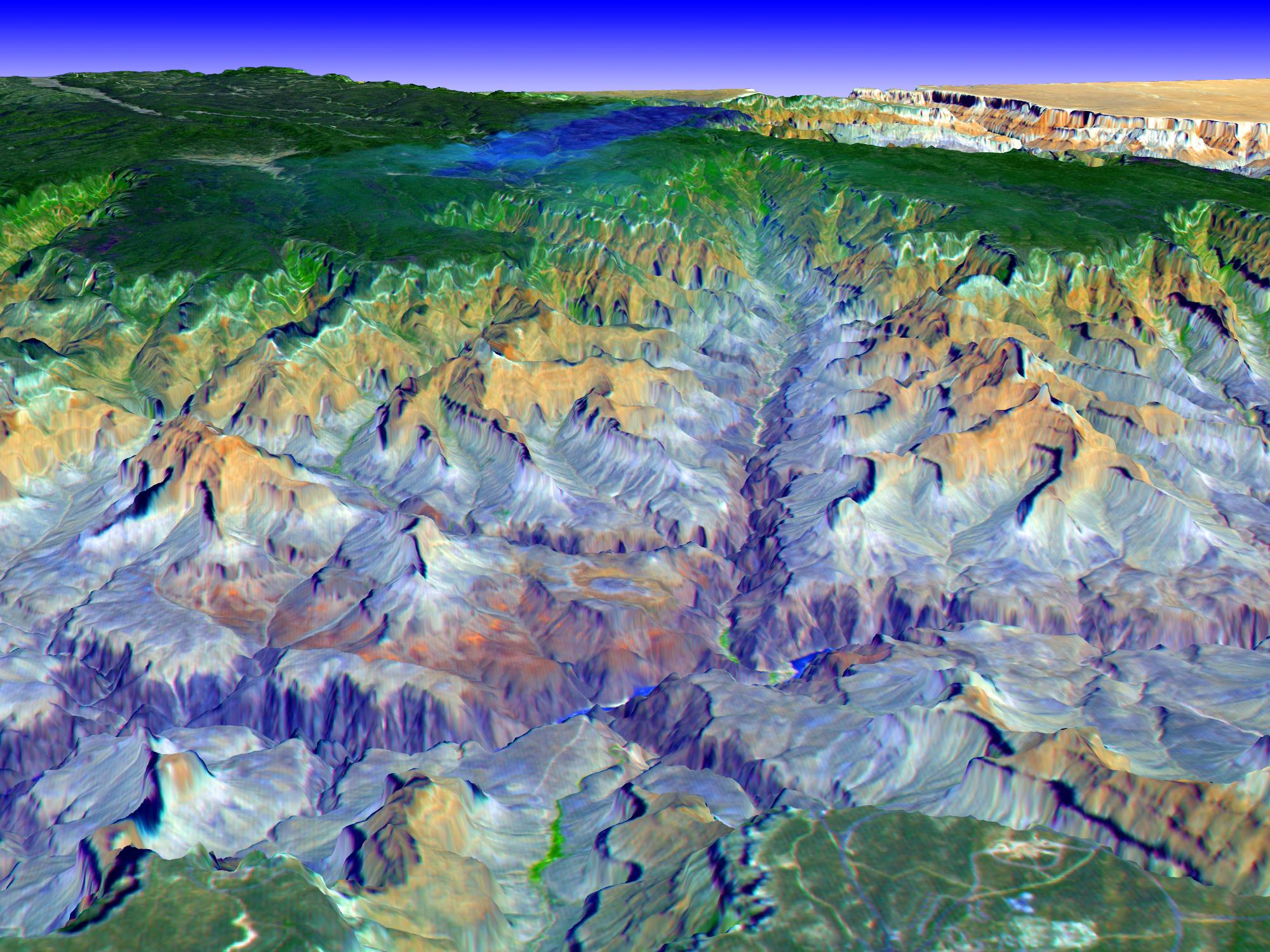
Perspective view over the Grand Canyon, Arizona
Full Resolution:
TIFF
(9.012 MB)
JPEG
(477.4 kB)
|
|
|
2001-08-27 |
Earth
|
Terra
|
ASTER
|
4376x4820x3 |
|
-
PIA02679:
-
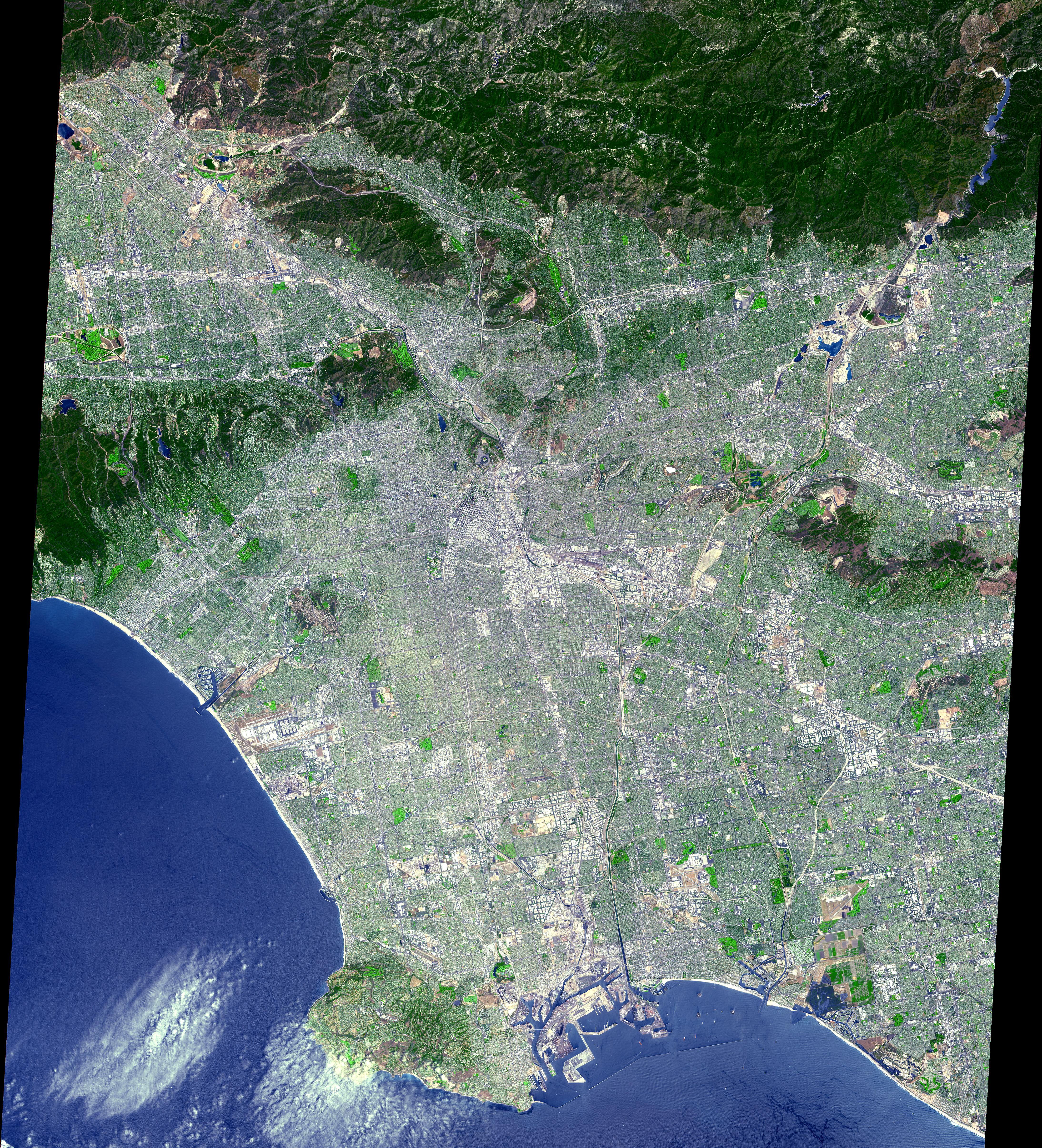
Los Angeles from Space
Full Resolution:
TIFF
(67.34 MB)
JPEG
(7.226 MB)
|
|
|
2001-08-03 |
Earth
|
Terra
|
ASTER
|
576x720x3 |
|
-
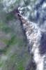
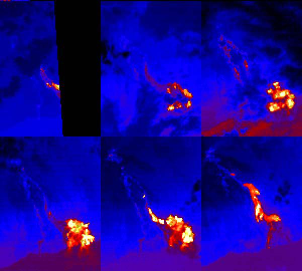
PIA02678:
-
Sulfur Dioxide Plume During the Continuing Eruption of Mt. Etna, Italy
Full Resolution:
TIFF
(1.463 MB)
JPEG
(140 kB)
|
|
|
2001-08-03 |
Earth
|
Terra
|
ASTER
|
1600x2000x3 |
|
-
PIA02677:
-
Lava Flows During the Continuing Eruption of Mt. Etna, Italy
Full Resolution:
TIFF
(10.01 MB)
JPEG
(465.8 kB)
|
|
|
2001-08-01 |
Earth
|
Terra
|
ASTER
|
2000x2400x3 |
|
-
PIA02676:
-
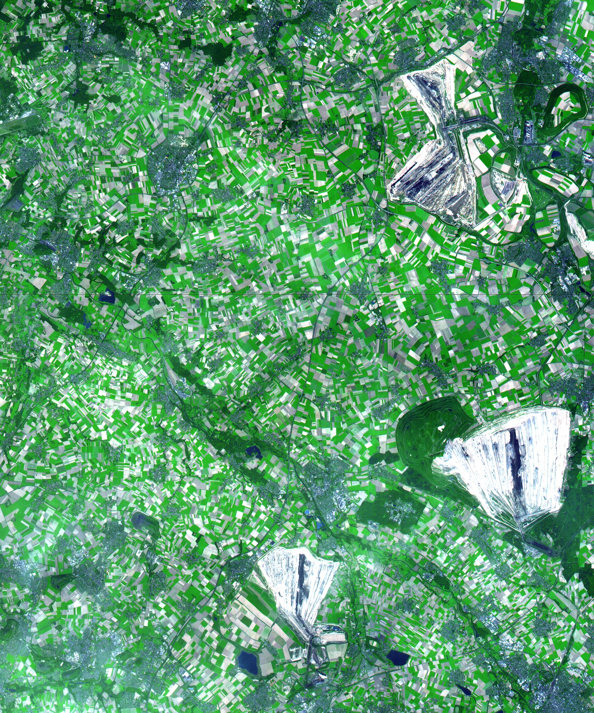
Coal Mining, Germany
Full Resolution:
TIFF
(18.15 MB)
JPEG
(1.438 MB)
|
|
|
2001-07-26 |
Earth
|
Terra
|
ASTER
|
2000x2011x3 |
|
-
PIA02675:
-
Anchorage, AK
Full Resolution:
TIFF
(13.23 MB)
JPEG
(775.5 kB)
|
|
|
2001-07-21 |
Earth
|
Terra
|
ASTER
|
516x946x3 |

|
-
PIA02674:
-
Eruption of Shiveluch Volcano, Kamchatka, Russia
Full Resolution:
TIFF
(375.8 kB)
JPEG
(98.03 kB)
|
|
|
2001-07-21 |
Earth
|
Terra
|
ASTER
|
1191x1230x3 |
|
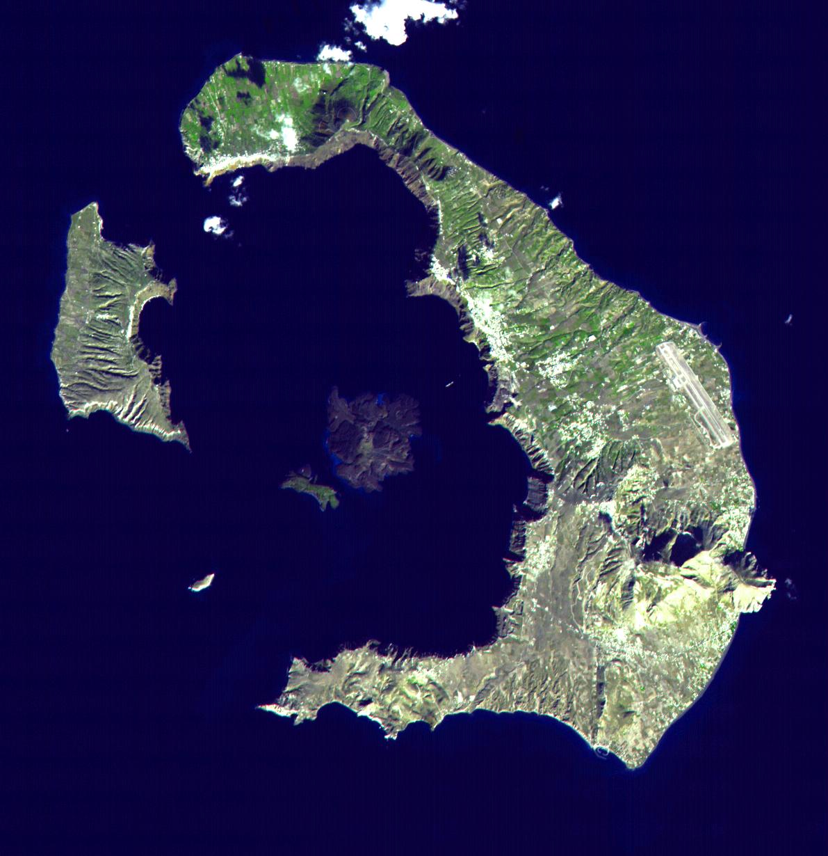
-
PIA02673:
-
Santorini, Greece
Full Resolution:
TIFF
(2.163 MB)
JPEG
(154 kB)
|
|
|
2001-07-21 |
Earth
|
Terra
|
ASTER
|
4200x3600x3 |
|
-
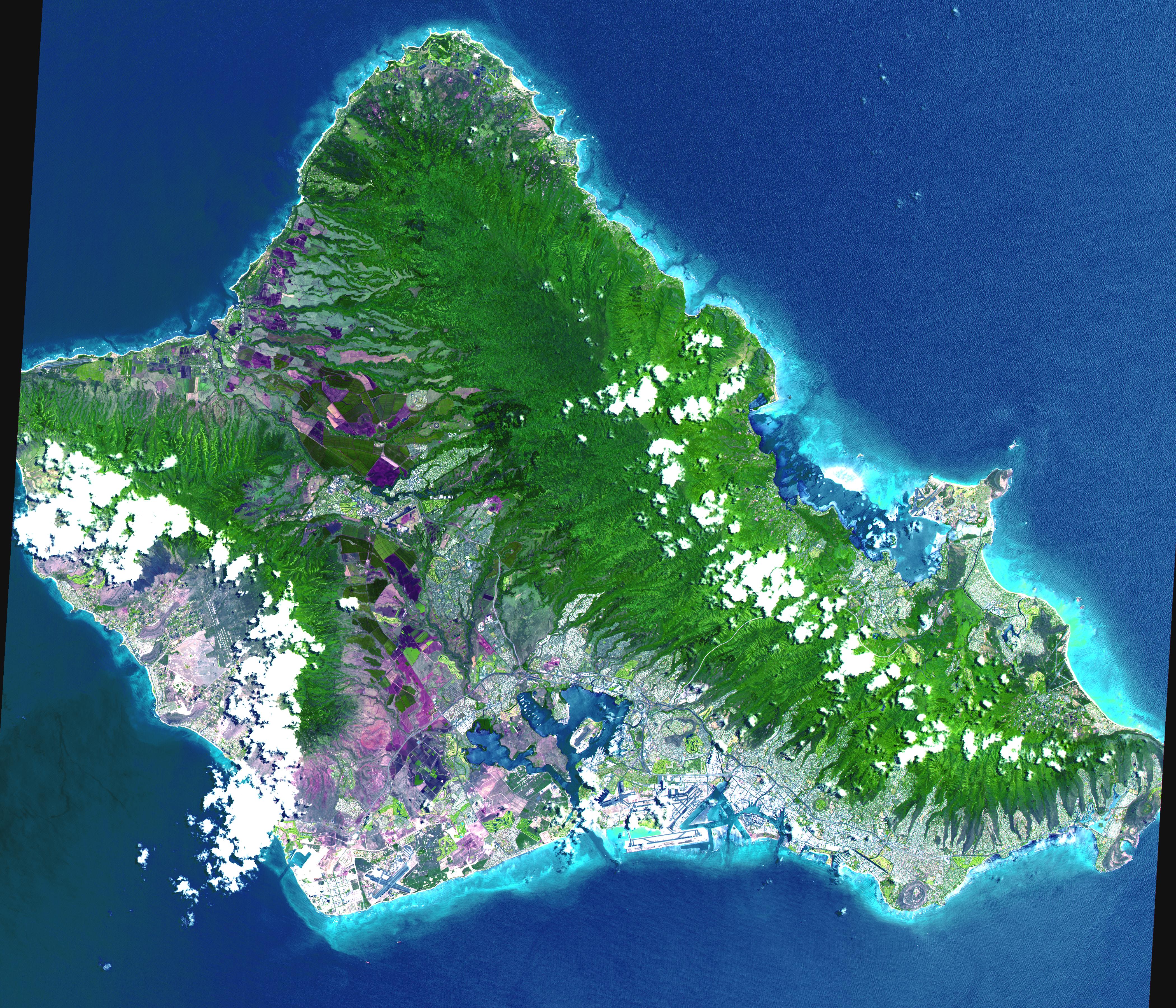
PIA02672:
-
Oahu, Hawaii
Full Resolution:
TIFF
(44.7 MB)
JPEG
(3.314 MB)
|
|
|
2001-07-21 |
Earth
|
Terra
|
ASTER
|
4048x3824x3 |
|
-
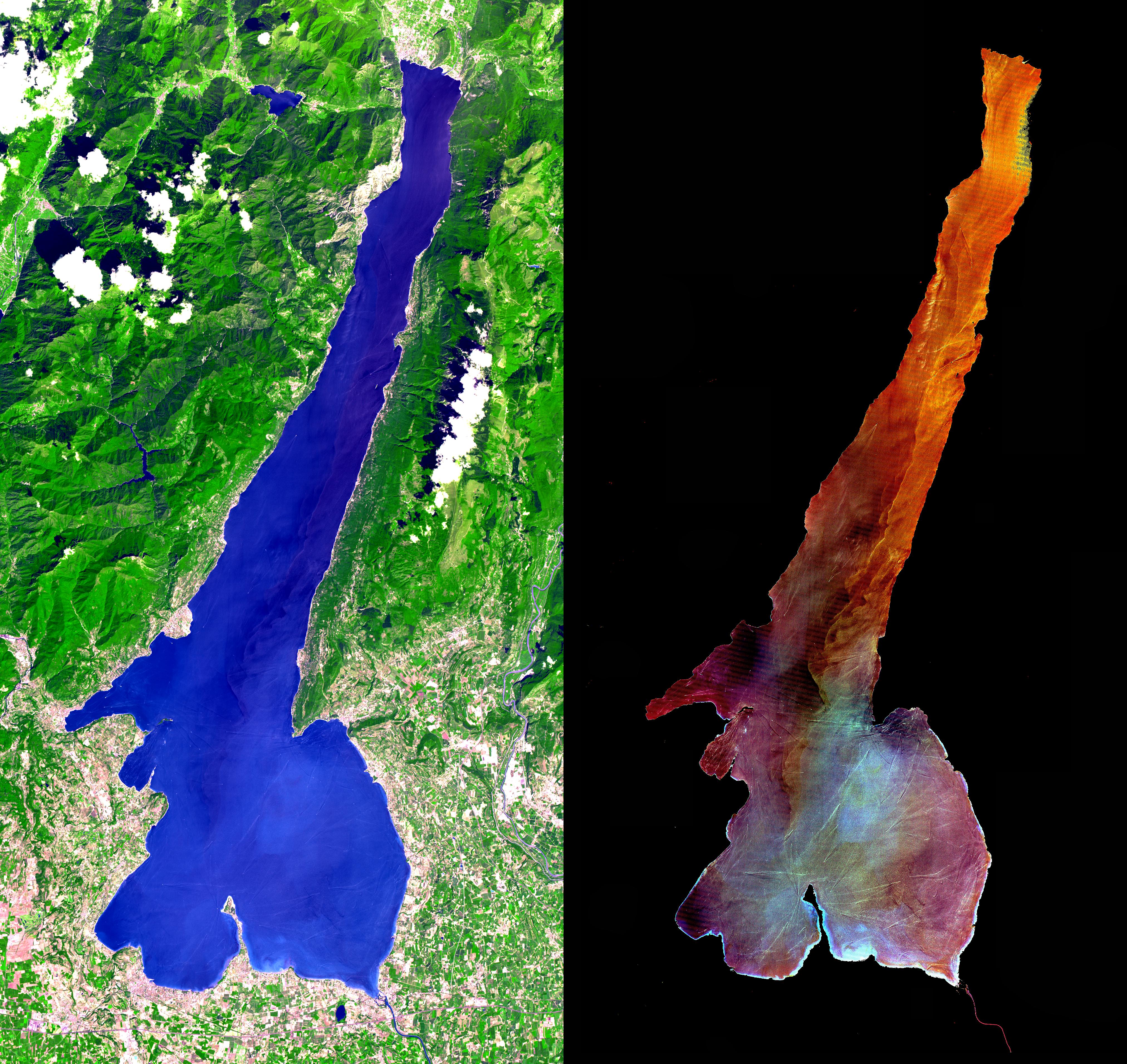
PIA02671:
-
Lake Garda, Italy
Full Resolution:
TIFF
(28.47 MB)
JPEG
(2.608 MB)
|
|
|
2001-07-21 |
Earth
|
Terra
|
ASTER
|
2412x1925x3 |
|
-
PIA02670:
-
Patagonia Glacier, Chile
Full Resolution:
TIFF
(11.47 MB)
JPEG
(883.8 kB)
|
|
|
2001-07-21 |
Earth
|
Terra
|
ASTER
|
800x800x3 |
|
-
PIA02669:
-
Great Wall of China
Full Resolution:
TIFF
(2.432 MB)
JPEG
(228 kB)
|
|
|
2001-07-21 |
Earth
|
Terra
|
ASTER
|
2000x1500x3 |

|
-
PIA02668:
-
3-D View of Grand Canyon, Arizona
Full Resolution:
TIFF
(10.35 MB)
JPEG
(477.4 kB)
|
|
|
2001-07-21 |
Earth
|
Terra
|
ASTER
|
4368x4140x3 |
|
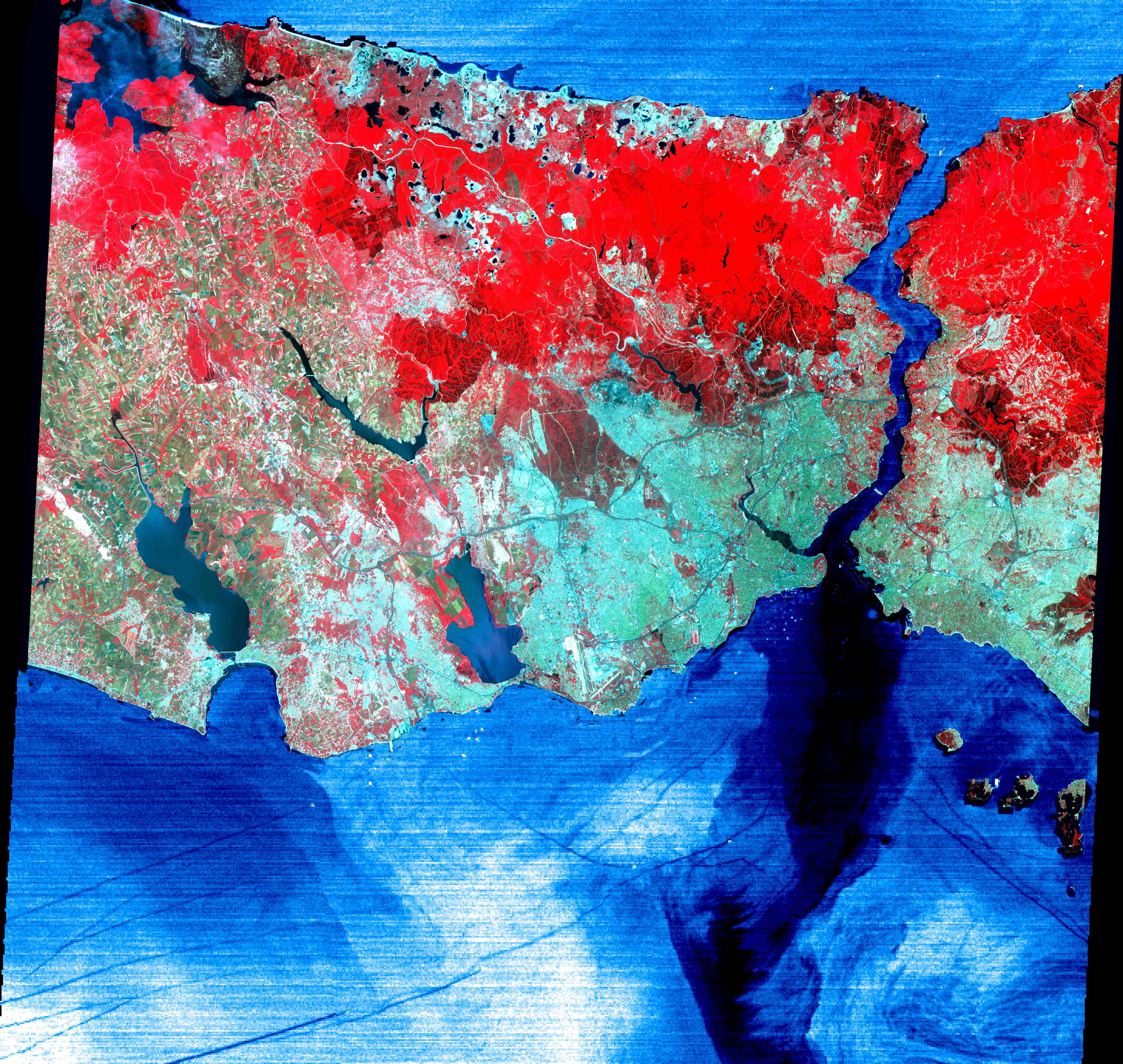
-
PIA02665:
-
Istanbul, Turkey
Full Resolution:
TIFF
(32.35 MB)
JPEG
(3.96 MB)
|
|
|
2001-07-21 |
Earth
|
Terra
|
ASTER
|
1282x1603x3 |

|
-
PIA02664:
-
College Fjord, Prince Williams Sound
Full Resolution:
TIFF
(4.17 MB)
JPEG
(395.8 kB)
|
|
|
2001-07-21 |
Earth
|
Terra
|
ASTER
|
1228x709x3 |
|
-
PIA02663:
-
3-D View of Death Valley, California
Full Resolution:
TIFF
(1.19 MB)
JPEG
(112 kB)
|
|
|
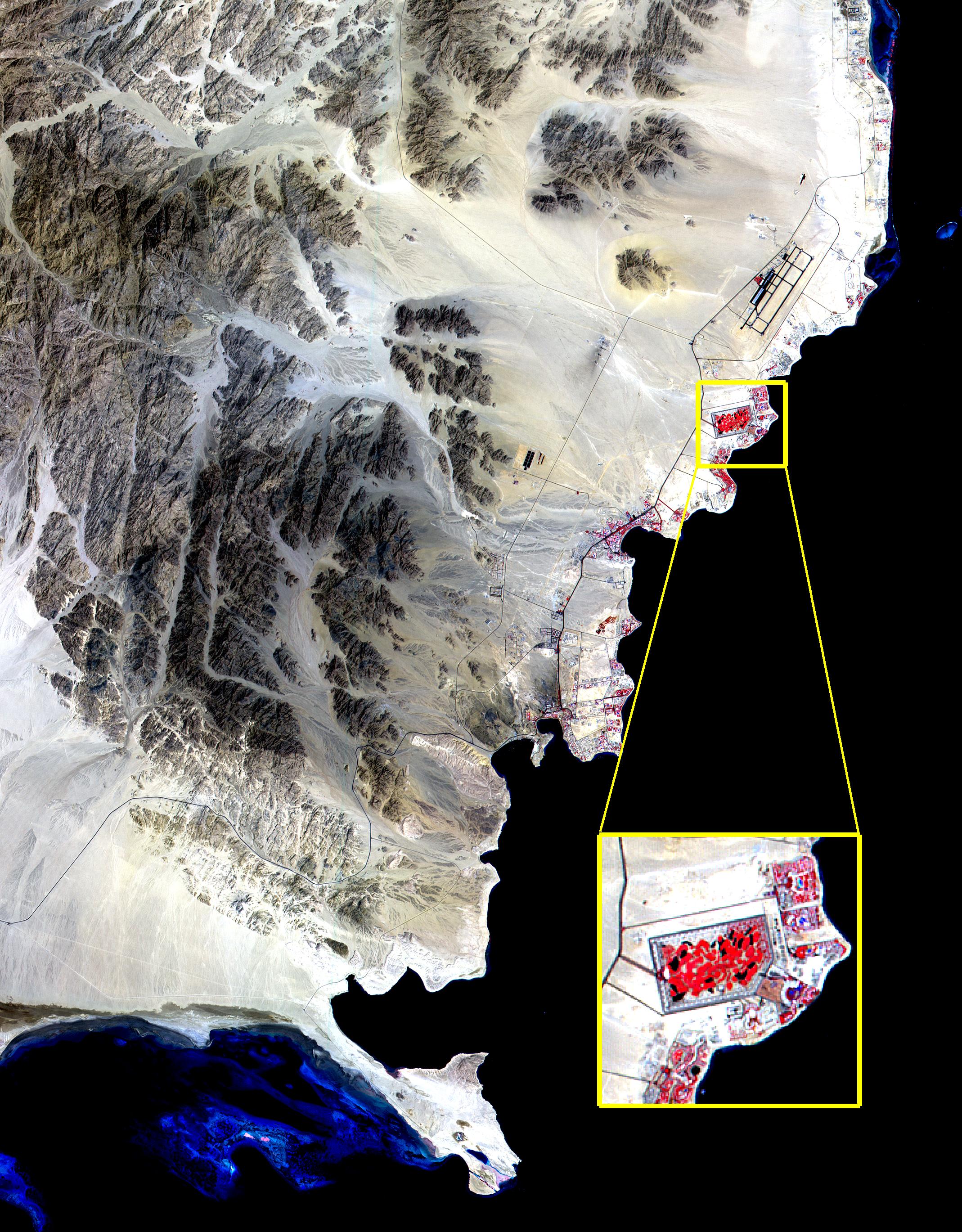
2000-10-20 |
Earth
|
Terra
|
ASTER
|
2138x2738x3 |
|
-
PIA02667:
-
ASTER View of Sharm El Sheik, Egypt
Full Resolution:
TIFF
(10.1 MB)
JPEG
(1.06 MB)
|
|
|
2000-10-06 |
Earth
|
Terra
|
ASTER
|
1211x911x3 |
|
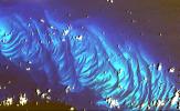
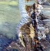
-
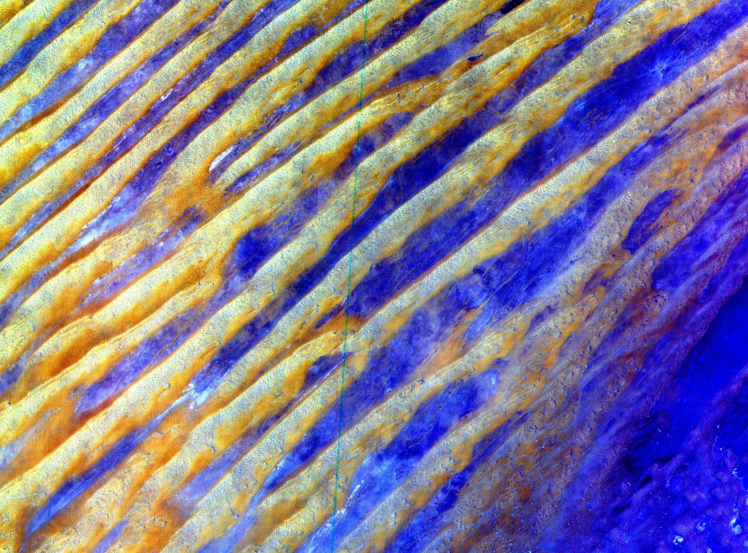
PIA02662:
-
ASTER Waves
Full Resolution:
TIFF
(2.22 MB)
JPEG
(370.5 kB)
|
|
|
2000-10-06 |
Earth
|
Terra
|
ASTER
|
2412x4065x3 |
|
-
PIA02661:
-
ASTER Suez Canal
Full Resolution:
TIFF
(19.92 MB)
JPEG
(1.805 MB)
|
|
|
2000-10-06 |
Earth
|
Terra
|
ASTER
|
1528x1322x3 |
|
-
PIA02660:
-
ASTER Paris
Full Resolution:
TIFF
(7.75 MB)
JPEG
(1.034 MB)
|
|
|
2000-10-06 |
Earth
|
Terra
|
ASTER
|
1595x1925x3 |
|
-
PIA02659:
-
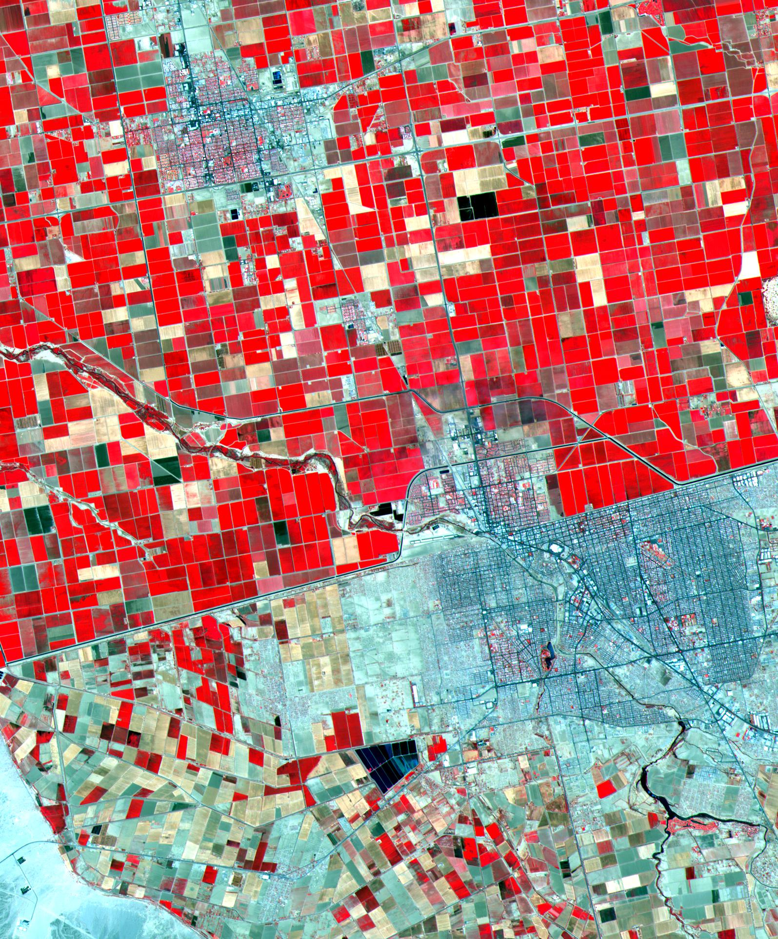
ASTER Mexicali
Full Resolution:
TIFF
(8.303 MB)
JPEG
(748.7 kB)
|
|
|
2000-10-06 |
Earth
|
Terra
|
ASTER
|
2645x1050x3 |

|
-
PIA02658:
-
ASTER Tibet
Full Resolution:
TIFF
(8.443 MB)
JPEG
(746.1 kB)
|
|
|
2000-10-06 |
Earth
|
Terra
|
ASTER
|
2280x3887x3 |
|
-
PIA02657:
-
ASTER Gibraltar
Full Resolution:
TIFF
(15.58 MB)
JPEG
(1.026 MB)
|
|
|
2000-10-06 |
Earth
|
Terra
|
ASTER
|
2470x1828x3 |
|
-
PIA02656:
-
ASTER Dunes
Full Resolution:
TIFF
(7.112 MB)
JPEG
(1.33 MB)
|
|
|
2000-10-06 |
Earth
|
Terra
|
ASTER
|
930x911x3 |
|
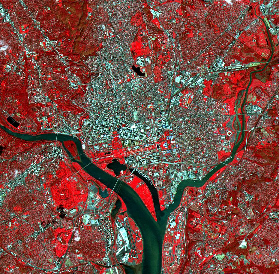
-
PIA02655:
-
ASTER Washington, D.C.
Full Resolution:
TIFF
(3.209 MB)
JPEG
(342.5 kB)
|
|
|
2000-10-06 |
Earth
|
Terra
|
ASTER
|
4980x4200x3 |
|
-
PIA02654:
-
ASTER Andes
Full Resolution:
TIFF
(47.55 MB)
JPEG
(4.841 MB)
|
|
|
2000-08-10 |
Earth
|
Shuttle Radar Topography Mission (SRTM)
Terra
|
ASTER
C-Band Interferometric Radar
|
1866x605x3 |

|
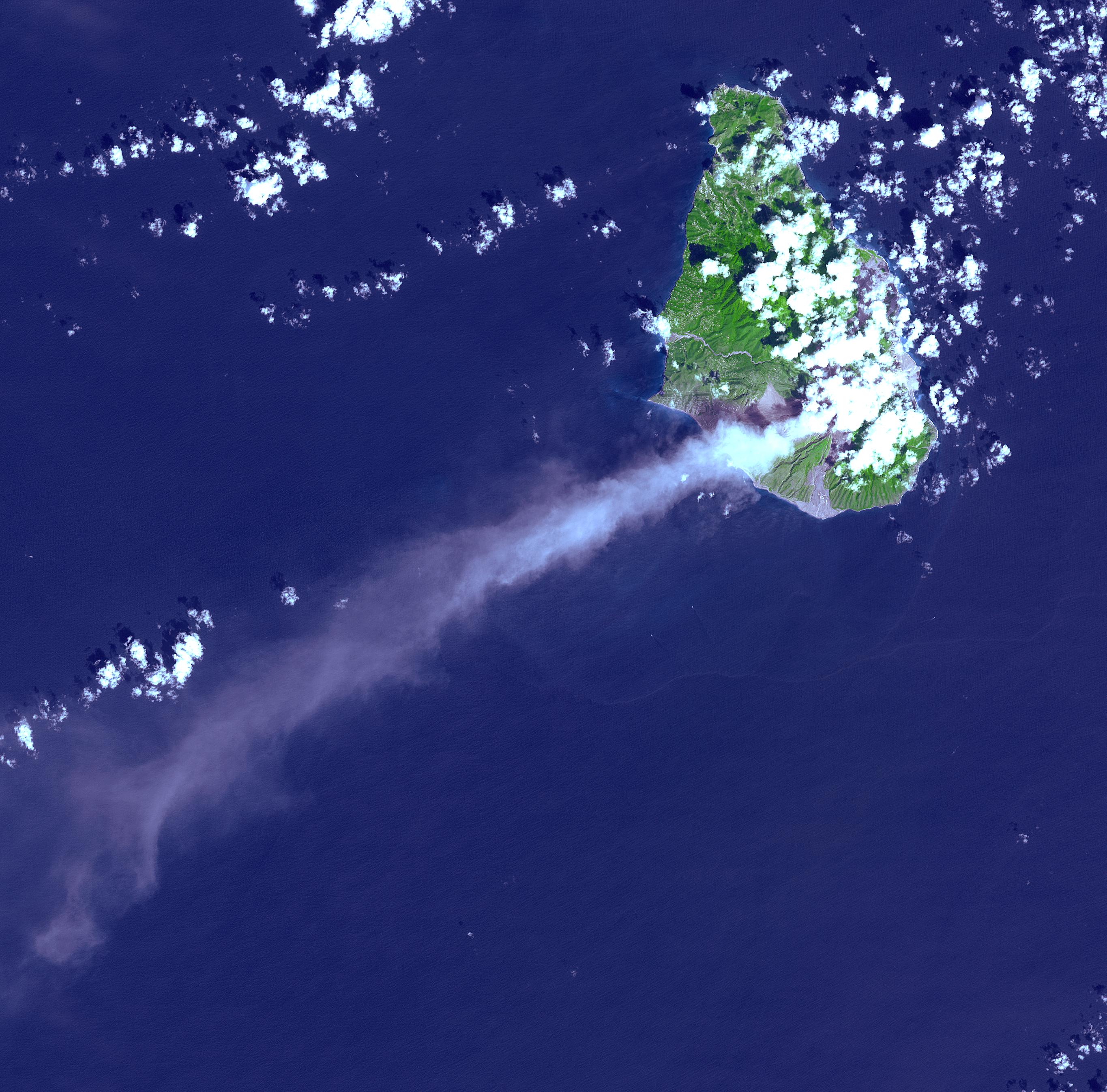
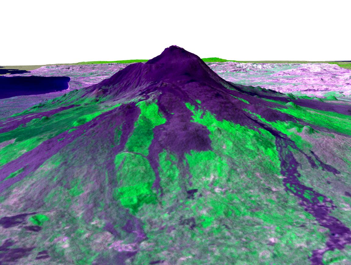
-
PIA02771:
-
ASTER-SRTM Perspective of Mount Oyama Volcano, Miyake-Jima Island, Japan
Full Resolution:
TIFF
(1.26 MB)
JPEG
(101 kB)
|
|
|
2000-04-26 |
Earth
|
Terra
|
ASTER
|
1174x1447x3 |
|
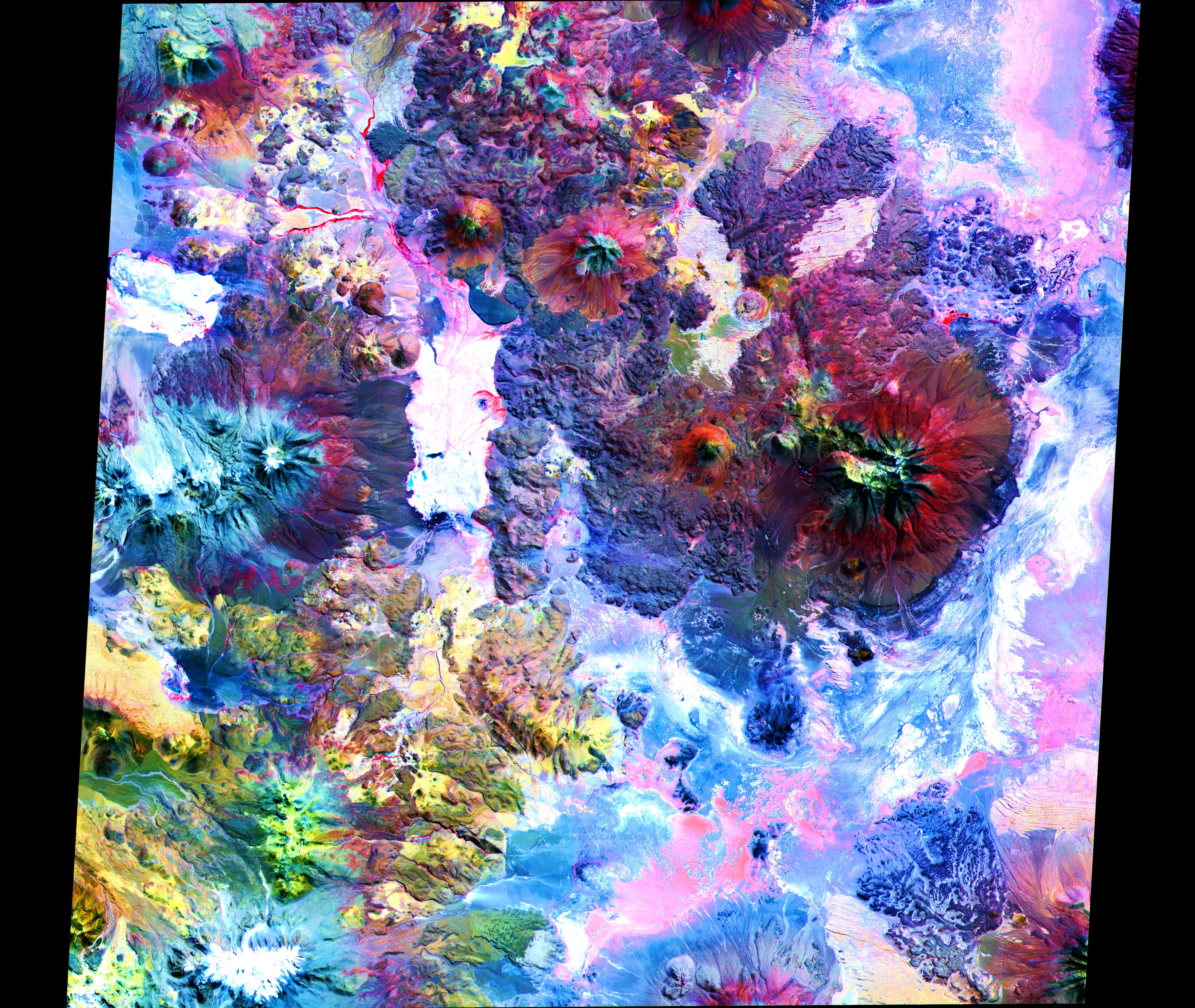
-
PIA02608:
-
ASTER Images Mt. Usu Volcano
Full Resolution:
TIFF
(3.631 MB)
JPEG
(681 kB)
|
|
|
2000-04-26 |
Earth
|
Terra
|
ASTER
|
4100x6177x3 |
|
-
PIA02607:
-
ASTER Images Tokyo
Full Resolution:
TIFF
(75.98 MB)
JPEG
(12.25 MB)
|
|
|
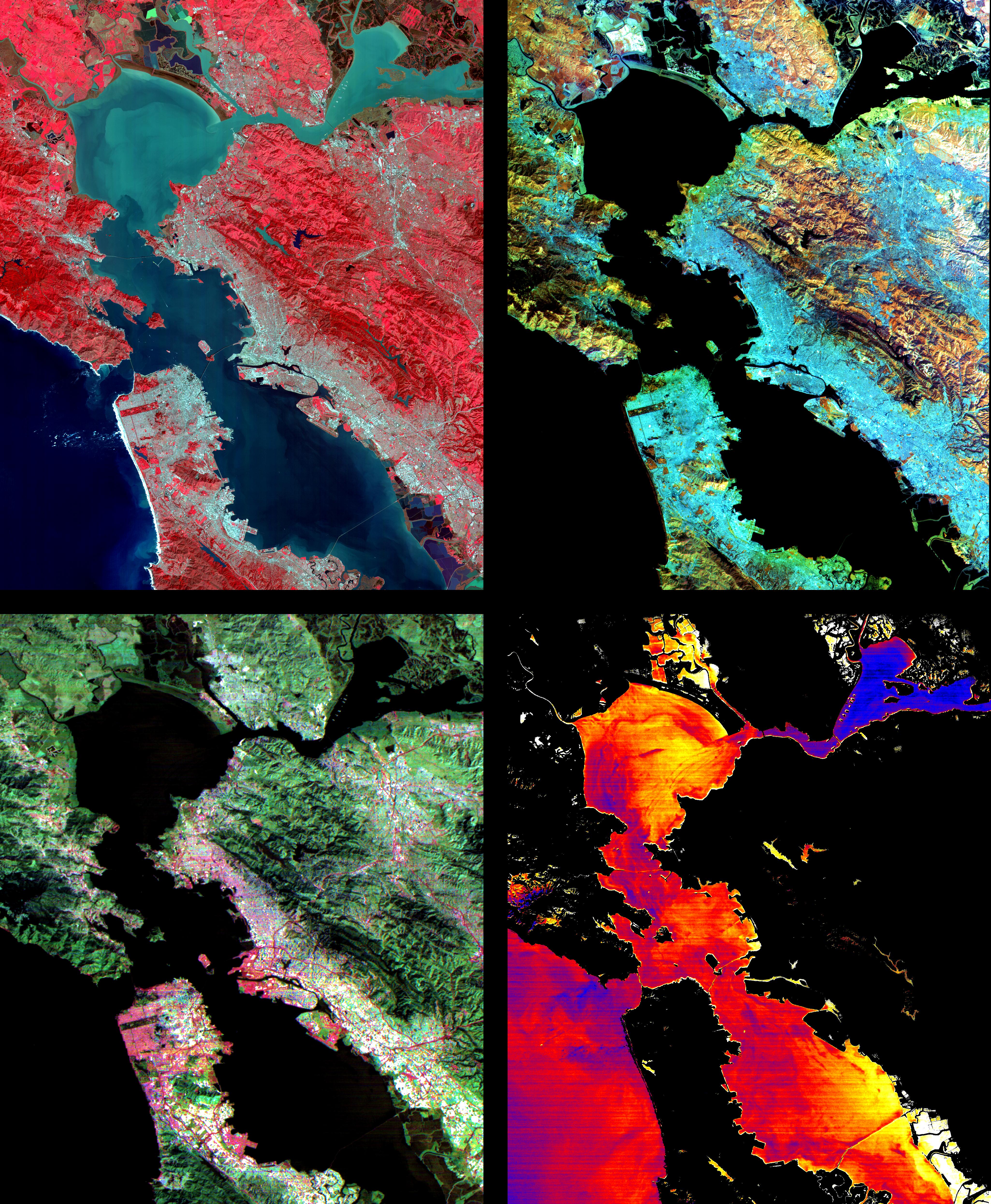
2000-04-26 |
Earth
|
Terra
|
ASTER
|
4100x5400x3 |
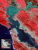
|
-
PIA02606:
-
ASTER Images San Francisco Bay Area
Full Resolution:
TIFF
(54.36 MB)
JPEG
(4.828 MB)
|
|
|
2000-04-26 |
Earth
|
Terra
|
ASTER
|
4100x4980x3 |
|
-
PIA02605:
-
ASTER Images San Francisco Bay Area
Full Resolution:
TIFF
(36.23 MB)
JPEG
(3.773 MB)
|
|
|
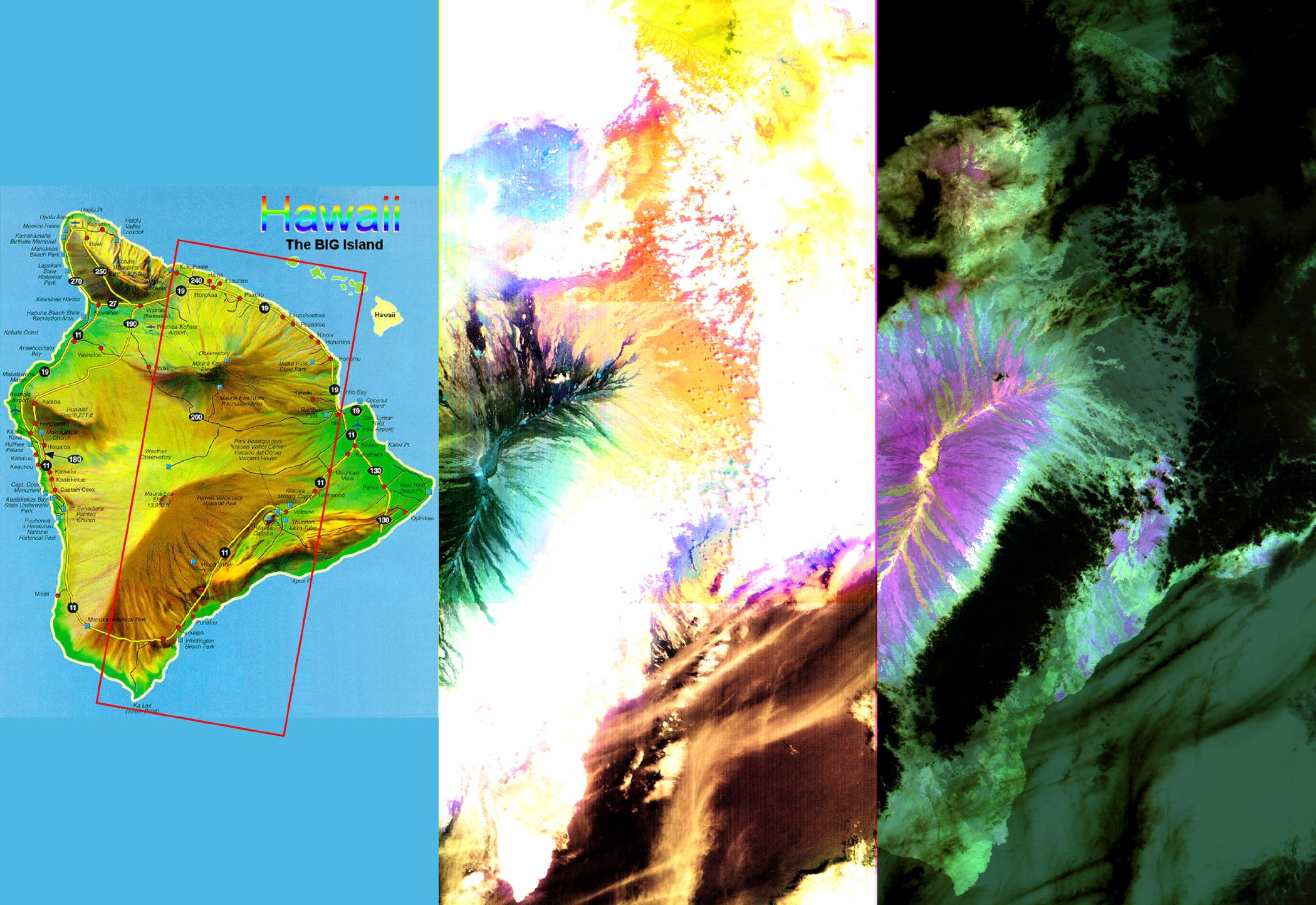
2000-04-26 |
Earth
|
Terra
|
ASTER
|
2100x1445x3 |
|
-
PIA02604:
-
ASTER Images the Island of Hawaii
Full Resolution:
TIFF
(7.393 MB)
JPEG
(430.3 kB)
|
 Planetary Data System


