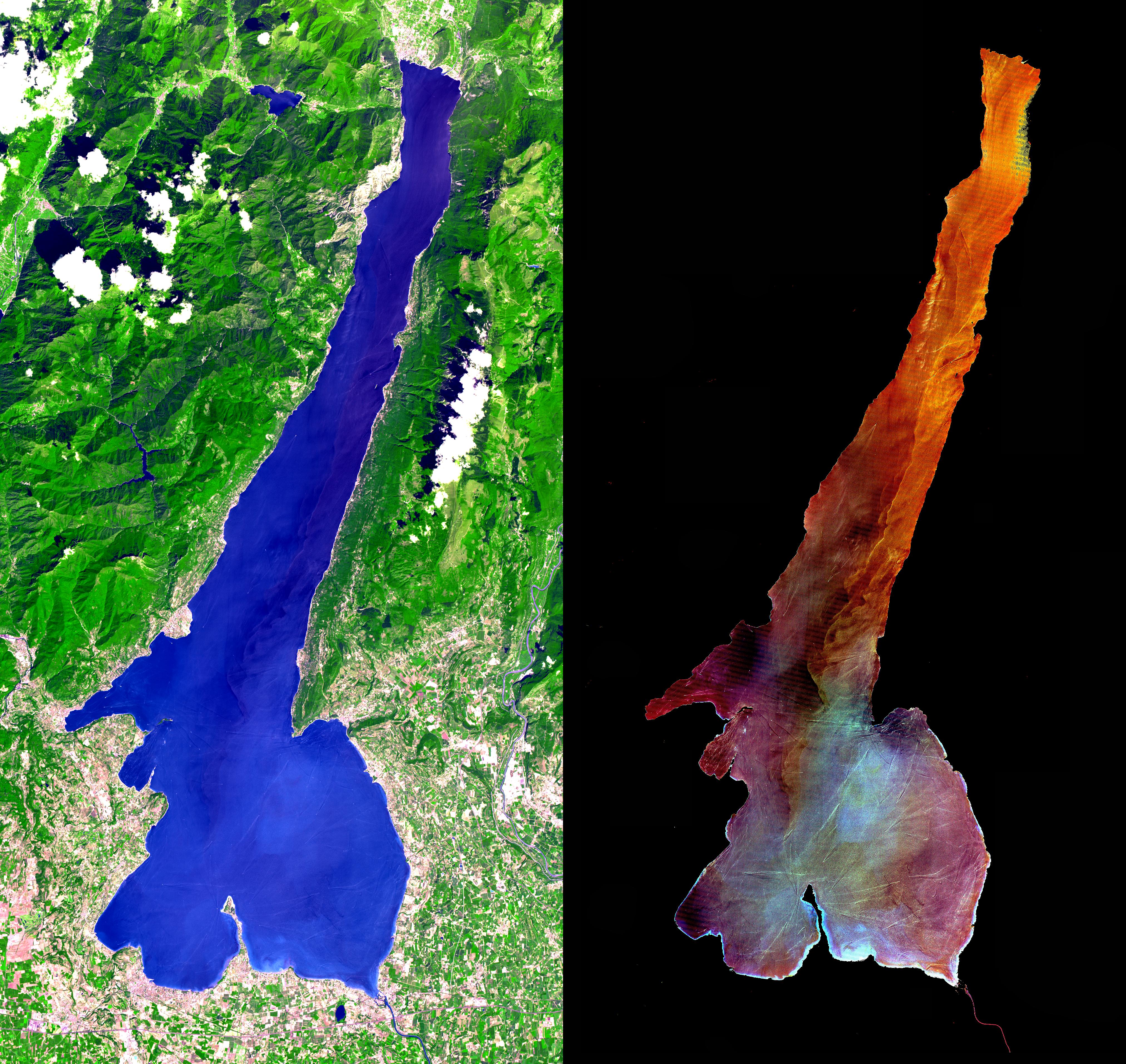
This ASTER image was acquired on July 29, 2000 and covers an area of 30 by 57 km in northern Italy. Lake Garda was formed by glaciers during the last Ice Age, and is Italy's largest lake. Lago di Garda lies in the provinces of Verona, Brescia, and Trento, and is 51 kilometers (32 miles) long and from 3 to 18 kilometers (2 to 11 miles) wide. The Sarca is its chief affluent, and the lake is drained southward by the Mincio, which discharges into the Po River. Many villas are situated on its shores. On the peninsula of Sirmione, at the southern end of the lake, are the ruins of a Roman villa and a castle of the Scaligers, an Italian family of the 16th century. The RIGHT image has the land area masked out, and a harsh stretch was applied to the lake values to display variations in sediment load. Also visible are hundreds of boats and their wakes, criss-crossing the lake.
The image is centered at 45.6 degrees north latitude, 10.6 degrees east longitude.
Advanced Spaceborne Thermal Emission and Reflection Radiometer (ASTER) is one of five Earth-observing instruments launched December 18, 1999, on NASA's Terra satellite. The instrument was built by Japan's Ministry of International Trade and Industry. A joint U.S./Japan science team is responsible for validation and calibration of the instrument and the data products. Dr. Anne Kahle at NASA's Jet Propulsion Laboratory, Pasadena, Calif., is the U.S. Science team leader; Moshe Pniel of JPL is the project manager. ASTER is the only high resolution imaging sensor on Terra. The primary goal of the ASTER mission is to obtain high-resolution image data in 14 channels over the entire land surface, as well as black and white stereo images. With revisit time of between 4 and 16 days, ASTER will provide the capability for repeat coverage of changing areas on Earth's surface.
The broad spectral coverage and high spectral resolution of ASTER will provide scientists in numerous disciplines with critical information for surface mapping, and monitoring dynamic conditions and temporal change. Example applications are: monitoring glacial advances and retreats, monitoring potentially active volcanoes, identifying crop stress, determining cloud morphology and physical properties, wetlands Evaluation, thermal pollution monitoring, coral reef degradation, surface temperature mapping of soils and geology, and measuring surface heat balance.
 Planetary Data System


