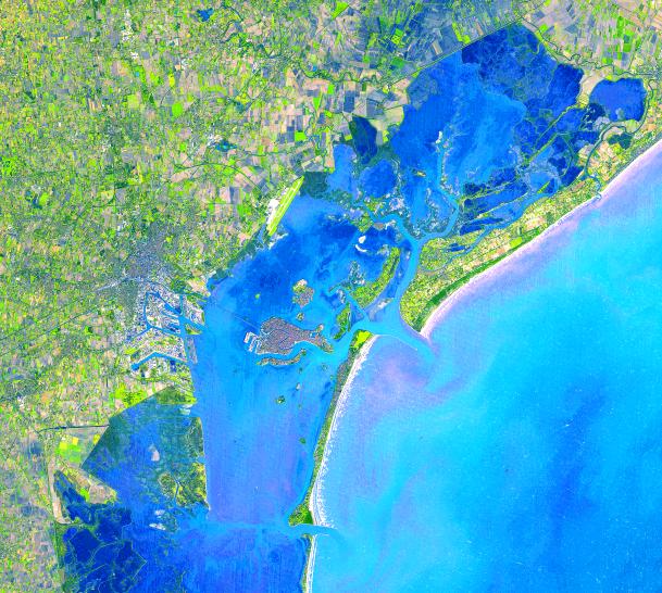
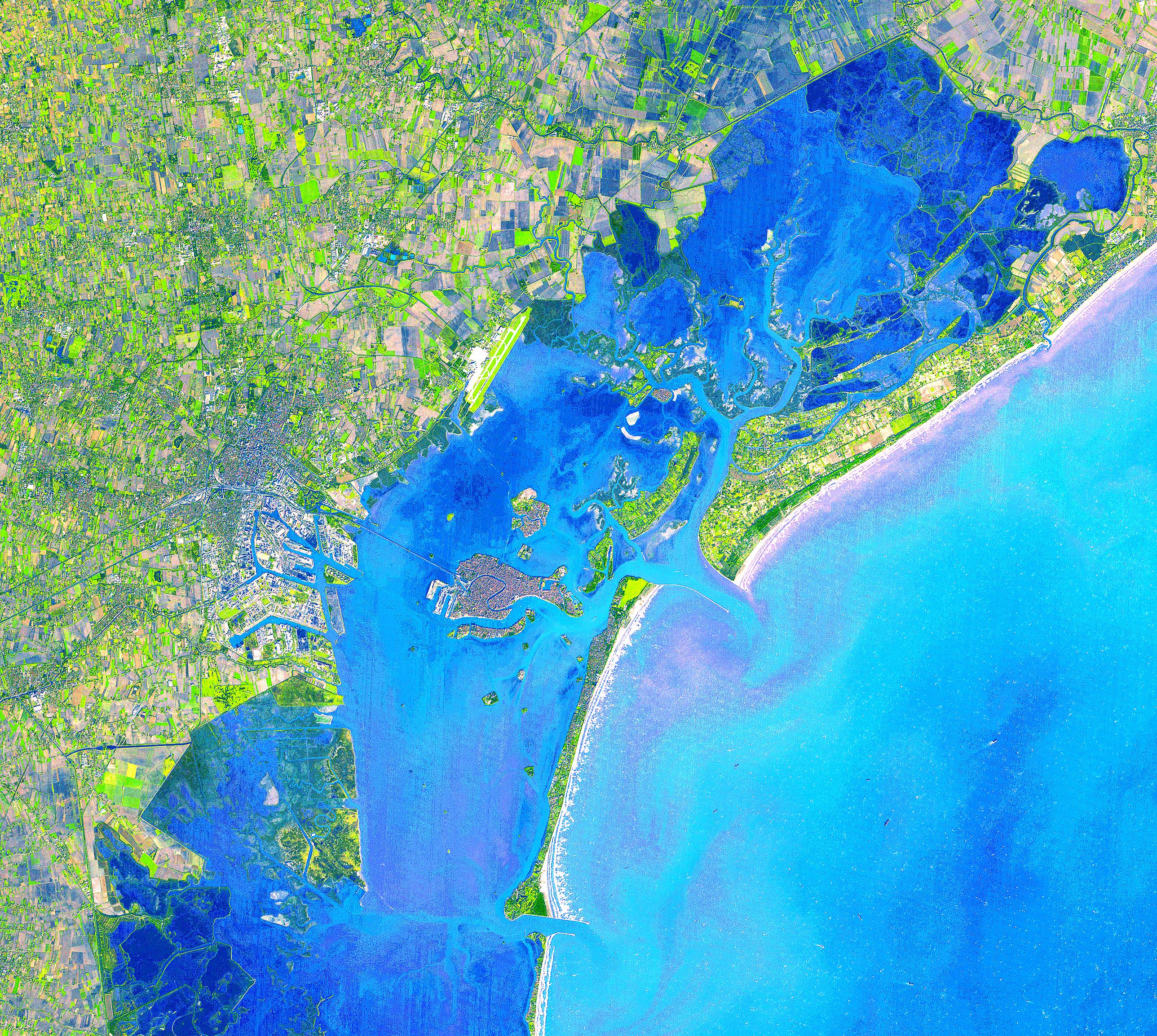
Four hundred bridges cross the labyrinth of canals that form the 120 islands of Venice, situated in a saltwater lagoon between the mouths of the Po and Piave rivers in northeast Italy. All traffic in the city moves by boat. Venice is connected to the mainland, 4 kilometers (2.5 miles) away, by ferries as well as a causeway for road and rail traffic. The Grand Canal winds through the city for about 3 kilometers (about 2 miles), dividing it into two nearly equal sections. According to tradition, Venice was founded in 452, when the inhabitants of Aquileia, Padua, and several other northern Italian cities took refuge on the islands of the lagoon from the Teutonic tribes invading Italy at that time.
This image was acquired on December 9, 2001 by the Advanced Spaceborne Thermal Emission and Reflection Radiometer (ASTER) on NASA's Terra satellite. With its 14 spectral bands from the visible to the thermal infrared wavelength region, and its high spatial resolution of 15 to 90 meters (about 50 to 300 feet), ASTER will image Earth for the next 6 years to map and monitor the changing surface of our planet.
ASTER is one of five Earth-observing instruments launched December 18, 1999, on NASA's Terra satellite. The instrument was built by Japan's Ministry of Economy, Trade and Industry. A joint U.S./Japan science team is responsible for validation and calibration of the instrument and the data products.
The broad spectral coverage and high spectral resolution of ASTER will provide scientists in numerous disciplines with critical information for surface mapping, and monitoring dynamic conditions and temporal change. Example applications are: monitoring glacial advances and retreats; monitoring potentially active volcanoes; identifying crop stress; determining cloud morphology and physical properties; wetlands evaluation; thermal pollution monitoring; coral reef degradation; surface temperature mapping of soils and geology; and measuring surface heat balance.
Dr. Anne Kahle at NASA's Jet Propulsion Laboratory, Pasadena, California, is the U.S. Science team leader; Bjorn Eng of JPL is the project manager. The Terra mission is part of NASA's Earth Science Enterprise, a long-term research and technology program designed to examine Earth's land, oceans, atmosphere, ice and life as a total integrated system.
Size: 38.6 x 34.5 km (23.9 x 21.4 miles)
Location: 45.4 deg. North lat., 12.3 deg. East long.
Orientation: North at top
Image Data: ASTER bands 1,2, and 3.
Original Data Resolution: 15 m
Date Acquired: December 9, 2001
 Planetary Data System


