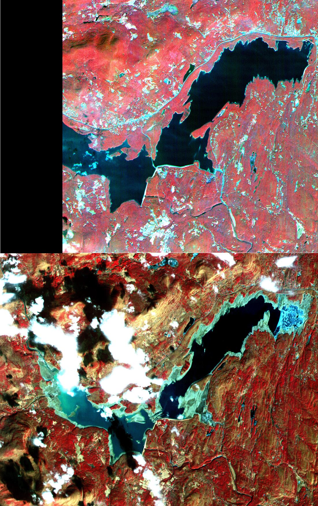
On March 26, New York Mayor Michael Bloomberg declared a drought emergency for the city and four upstate counties in response to the worst drought to hit the eastern United States in nearly 70 years. Restrictions on water use will affect more than 8 million residents of New York. The city's reservoirs, located in the Catskill Mountains, are at 52 percent capacity. One of these, Ashokan Reservoir, is seen in this pair of ASTER images acquired on September 18, 2000 and February 3, 2002.
These images were acquired by the Advanced Spaceborne Thermal Emission and Reflection Radiometer (ASTER) on NASA's Terra satellite. With its 14spectral bands from the visible to the thermal infrared wavelength region, and its high spatial resolution of 15 to 90 meters (about 50 to 300 feet), ASTER will image Earth for the next 6 years to map and monitor the changing surface of our planet.
ASTER is one of five Earth-observing instruments launched December 18, 1999, on NASA's Terra satellite. The instrument was built by Japan's Ministry of Economy, Trade and Industry. A joint U.S./Japan science team is responsible for validation and calibration of the instrument and the data products. Dr. Anne Kahle at NASA's Jet Propulsion Laboratory, Pasadena, California, is the U.S. Science team leader; Bjorn Eng of JPL is the project manager. ASTER is the only high resolution imaging sensor on Terra. The Terra mission is part of NASA's Earth Science Enterprise, along-term research and technology program designed to examine Earth's land, oceans, atmosphere, ice and life as a total integrated system.
The broad spectral coverage and high spectral resolution of ASTER will provide scientists in numerous disciplines with critical information for surface mapping, and monitoring dynamic conditions and temporal change. Example applications are: monitoring glacial advances and retreats; monitoring potentially active volcanoes; identifying crop stress; determining cloud morphology and physical properties; wetlands evaluation; thermal pollution monitoring; coral reef degradation; surface temperature mapping of soils and geology; and measuring surface heat balance.
Size: 16.5 x 13 km (10.2 x 8.1 miles)
Location: 41.9 deg. North lat., 74.2 deg. West long.
Orientation: North at top
Image Data: ASTER bands 1,2, and 3.
Original Data Resolution: 15 m
Date Acquired: September 18, 2000 and February 3, 2002
