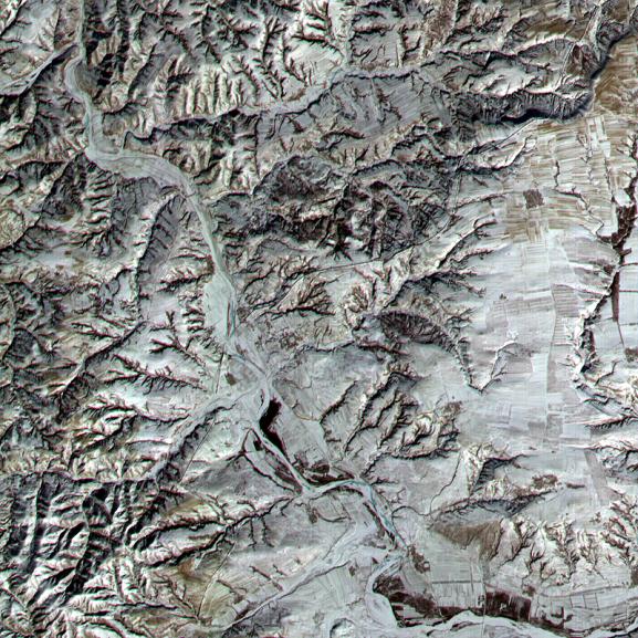
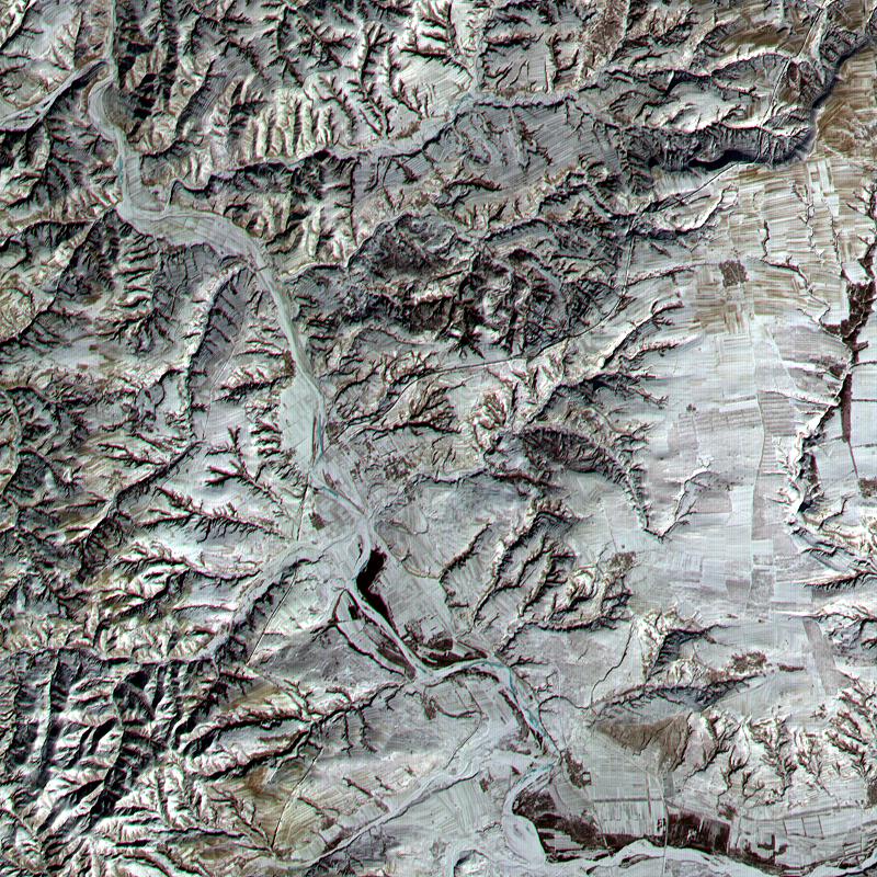
This ASTER sub-image covers a 12 x 12 km area in northern Shanxi Province, China, and was acquired January 9, 2001. The low sun angle, and light snow cover highlight a section of the Great Wall, visible as a black line running diagonally through the image from lower left to upper right. The Great Wall is over 2000 years old and was built over a period of 1000 years. Stretching 4500 miles from Korea to the Gobi Desert it was first built to protect China from marauders from the north.
This image is located at 40.2 degrees north latitude and 112.8 degrees east longitude.
Advanced Spaceborne Thermal Emission and Reflection Radiometer (ASTER) is one of five Earth-observing instruments launched December 18, 1999, on NASA's Terra satellite. The instrument was built by Japan's Ministry of International Trade and Industry. A joint U.S./Japan science team is responsible for validation and calibration of the instrument and the data products. Dr. Anne Kahle at NASA's Jet Propulsion Laboratory, Pasadena, Calif., is the U.S. Science team leader; Moshe Pniel of JPL is the project manager. ASTER is the only high resolution imaging sensor on Terra. The primary goal of the ASTER mission is to obtain high-resolution image data in 14 channels over the entire land surface, as well as black and white stereo images. With revisit time of between 4 and 16 days, ASTER will provide the capability for repeat coverage of changing areas on Earth's surface.
The broad spectral coverage and high spectral resolution of ASTER will provide scientists in numerous disciplines with critical information for surface mapping, and monitoring dynamic conditions and temporal change. Example applications are: monitoring glacial advances and retreats, monitoring potentially active volcanoes, identifying crop stress, determining cloud morphology and physical properties, wetlands Evaluation, thermal pollution monitoring, coral reef degradation, surface temperature mapping of soils and geology, and measuring surface heat balance.