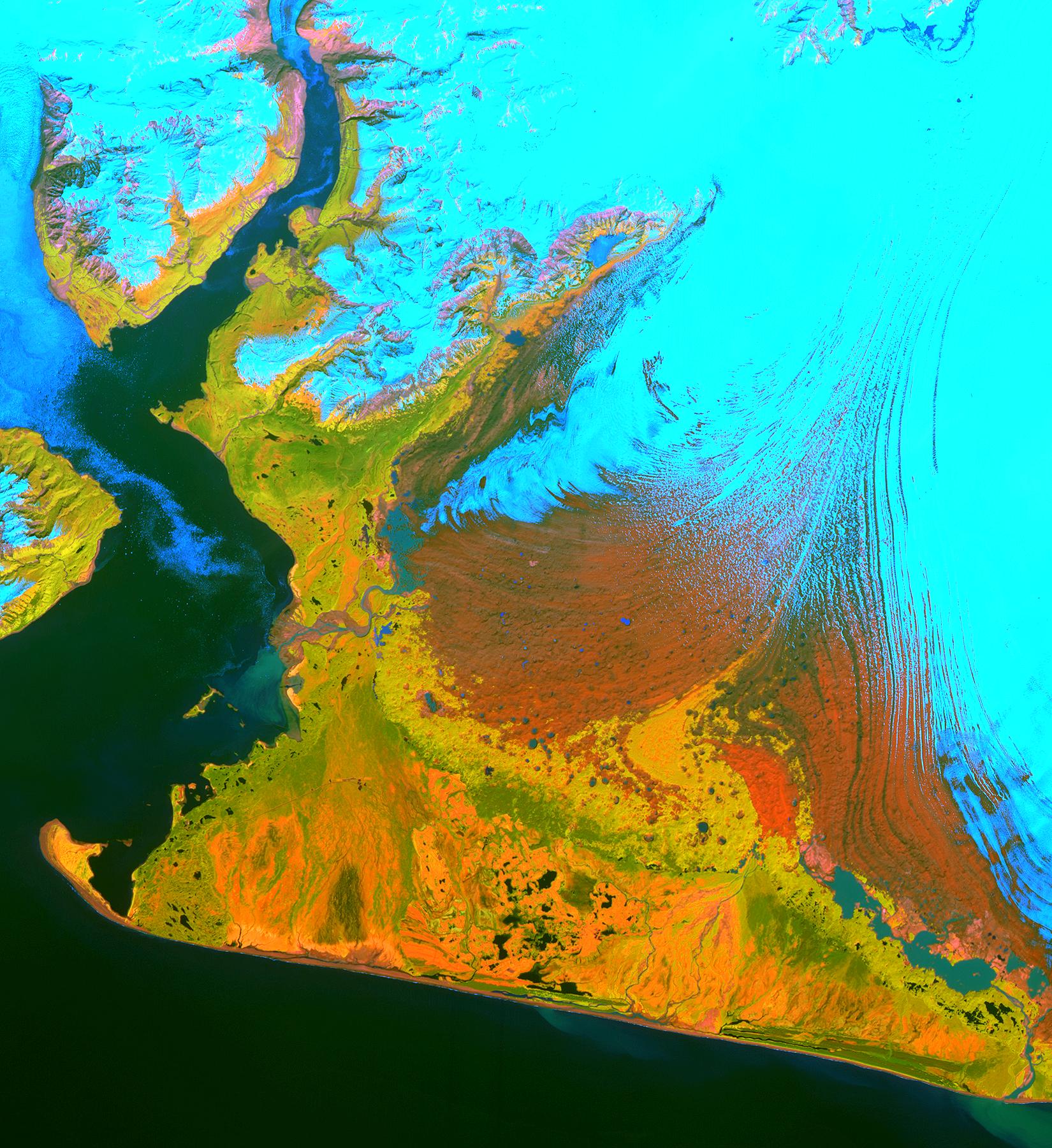
This image from the Advanced Spaceborne Thermal Emission and Reflection Radiometer (ASTER) instrument on NASA's Terra satellite covers an area of 55 by 40 kilometers (34 by 25 miles) over the southwest part of the Malaspina Glacier and Icy Bay in Alaska. The composite of infrared and visible bands results in the snow and ice appearing light blue, dense vegetation is yellow-orange and green, and less vegetated, gravelly areas are in orange. According to Dr. Dennis Trabant (U.S. Geological Survey, Fairbanks, Alaska), the Malaspina Glacier is thinning. Its terminal moraine protects it from contact with the open ocean; without the moraine, or if sea level rises sufficiently to reconnect the glacier with the ocean, the glacier would start calving and retreat significantly. ASTER data are being used to help monitor the size and movement of some 15,000 tidal and piedmont glaciers in Alaska. Evidence derived from ASTER and many other satellite and ground-based measurements suggests that only a few dozen Alaskan glaciers are advancing. The overwhelming majority of them are retreating.
This ASTER image was acquired on June 8, 2001. With its 14 spectral bands from the visible to the thermal infrared wavelength region, and its high spatial resolution of 15 to 90 meters (about 50 to 300 feet), ASTER will image Earth for the next six years to map and monitor the changing surface of our planet.
ASTER is one of five Earth-observing instruments launched December 18, 1999, on NASA's Terra satellite. The instrument was built by Japan's Ministry of Economy, Trade and Industry. A joint U.S./Japan science team is responsible for validation and calibration of the instrument and the data products. Dr. Anne Kahle at NASA's Jet Propulsion Laboratory, Pasadena, Calif., is the U.S. science team leader; Bjorn Eng of JPL is the project manager. ASTER is the only high-resolution imaging sensor on Terra. The Terra mission is part of NASA's Earth Science Enterprise, along-term research and technology program designed to examine Earth's land, oceans, atmosphere, ice and life as a total integrated system.
The broad spectral coverage and high spectral resolution of ASTER will provide scientists in numerous disciplines with critical information for surface mapping, and monitoring dynamic conditions and temporal change. Example applications are: monitoring glacial advances and retreats; monitoring potentially active volcanoes; identifying crop stress; determining cloud morphology and physical properties; wetlands evaluation; thermal pollution monitoring; coral reef degradation; surface temperature mapping of soils and geology; and measuring surface heat balance.
Size: 55 by 40 kilometers (34 by 25 miles)
Location: 60.0 degrees North latitude, 140.7 degrees West longitude
Orientation: North at top
Image Data: ASTER bands 2, 3 and 4
Original Data Resolution: 15 meters (49 feet)
Date Acquired: June 8, 2001
