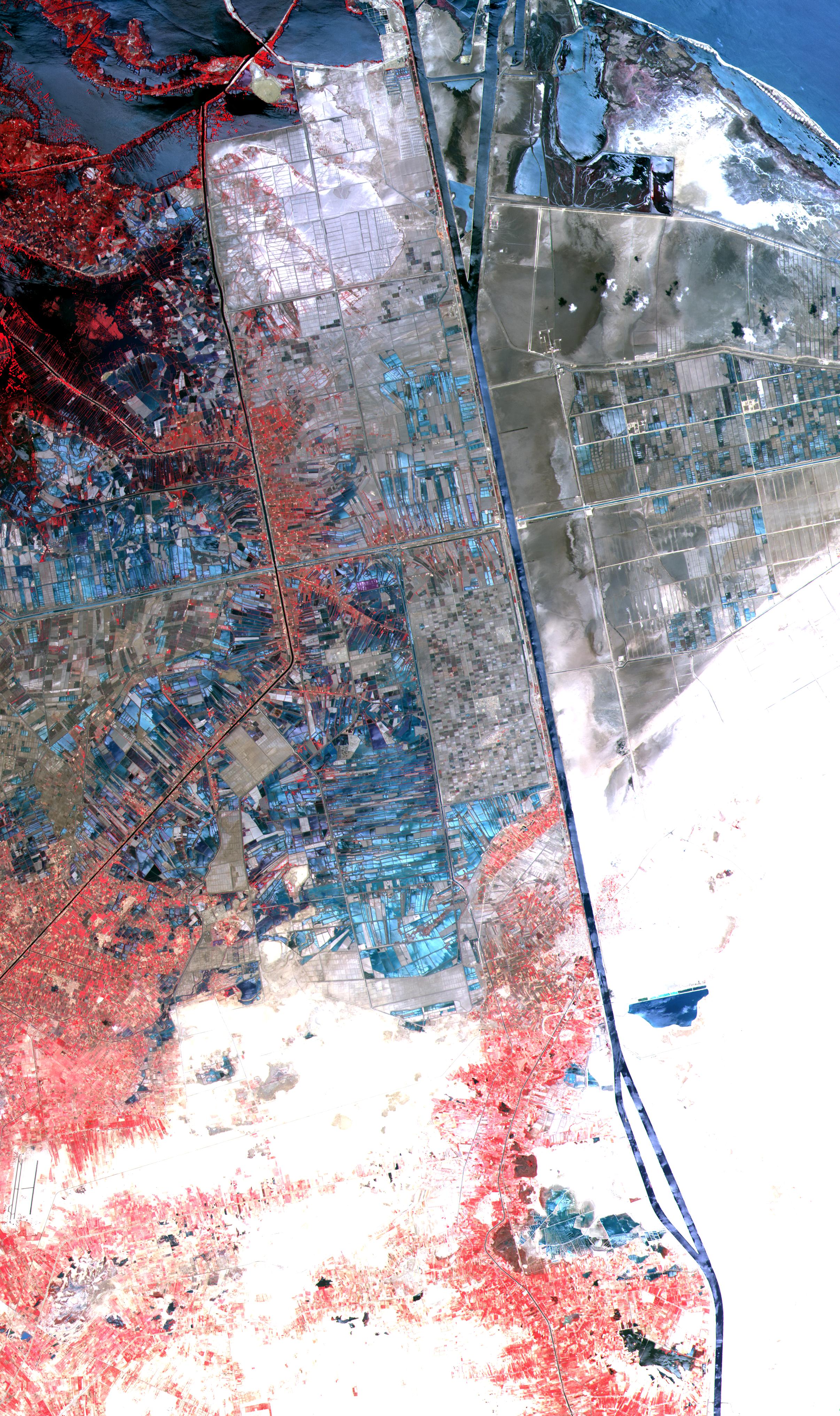
One of the most important waterways in the world, the Suez Canal runs north to south across the Isthmus of Suez in northeastern Egypt. This image of the canal covers an area 36 kilometers (22 miles) wide and 60 kilometers (47 miles) long in three bands of the reflected visible and infrared wavelength region. It shows the northern part of the canal, with the Mediterranean Sea just visible in the upper right corner. The Suez Canal connects the Mediterranean Sea with the Gulf of Suez, an arm of the Red Sea. The artificial canal provides an important shortcut for ships operating between both European and American ports and ports located in southern Asia, eastern Africa, and Oceania. With a length of about 195 kilometers (121 miles) and a minimum channel width of 60 meters (197 feet), the Suez Canal is able to accommodate ships as large as 150,000 tons fully loaded. Because no locks interrupt traffic on this sea level waterway, the transit time only averages about 15 hours. ASTER acquired this scene on May 19, 2000.
Advanced Spaceborne Thermal Emission and Reflection Radiometer (ASTER) is one of five Earth-observing instruments launched December 18, 1999, on NASA's Terra satellite. The instrument was built by Japan's Ministry of International Trade and Industry. A joint U.S./Japan science team is responsible for validation and calibration of the instrument and the data products. Dr. Anne Kahle at NASA's Jet Propulsion Laboratory, Pasadena, California, is the U.S. science team leader; Moshe Pniel of JPL is the project manager. ASTER is the only high-resolution imaging sensor on Terra. The primary goal of the ASTER mission is to obtain high-resolution image data in 14 channels over the entire land surface, as well as black and white stereo images. With revisit time of between 4 and 16 days, ASTER will provide the capability for repeat coverage of changing areas on Earth's surface. Advanced Spaceborne Thermal Emission and Reflection Radiometer (ASTER) is one of five Earth-observing instruments launched December 18, 1999, on NASA's Terra satellite. The instrument was built by Japan's Ministry of International Trade and Industry. A joint U.S./Japan science team is responsible for validation and calibration of the instrument and the data products. Dr. Anne Kahle at NASA's Jet Propulsion Laboratory, Pasadena, California, is the U.S. science team leader; Moshe Pniel of JPL is the project manager. ASTER is the only high-resolution imaging sensor on Terra. The primary goal of the ASTER mission is to obtain high-resolution image data in 14 channels over the entire land surface, as well as black and white stereo images. With revisit time of between 4 and 16 days, ASTER will provide the capability for repeat coverage of changing areas on Earth's surface.
The broad spectral coverage and high spectral resolution of ASTER will provide scientists in numerous disciplines with critical information for surface mapping and monitoring dynamic conditions and temporal change. Examples of applications include monitoring glacial advances and retreats, potentially active volcanoes, thermal pollution, and coral reef degradation; identifying crop stress; determining cloud morphology and physical properties; evaluating wetlands; mapping surface temperature of soils and geology; and measuring surface heat balance.
