- Original Caption Released with Image:
-
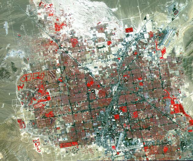
This image of Las Vegas, NV was acquired on August, 2000 and covers an area 42 km (25 miles) wide and 30 km (18 miles) long. The image displays three bands of the reflected visible and infrared wavelength region, with a spatial resolution of 15 m. McCarran International Airport to the south and Nellis Air Force Base to the NE are the two major airports visible. Golf courses appear as bright red areas of worms. The first settlement in Las Vegas (which is Spanish for The Meadows) was recorded back in the early 1850s when the Mormon church, headed by Brigham Young, sent a mission of 30 men to construct a fort and teach agriculture to the Indians. Las Vegas became a city in 1905 when the railroad announced this city was to be a major division point. Prior to legalized gambling in 1931, Las Vegas was developing as an agricultural area. Las Vegas' fame as a resort area became prominent after World War II. The image is located at 36.1 degrees north latitude and 115.1 degrees west longitude. The U.S. science team is located at NASA's Jet Propulsion Laboratory, Pasadena, Calif. The Terra mission is part of NASA's Science Mission Directorate.
- Image Credit:
-
NASA/GSFC/METI/ERSDAC/JAROS, and U.S./Japan ASTER Science Team
Image Addition Date: -
2001-10-22
|