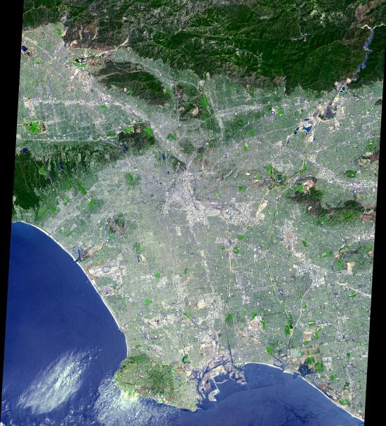
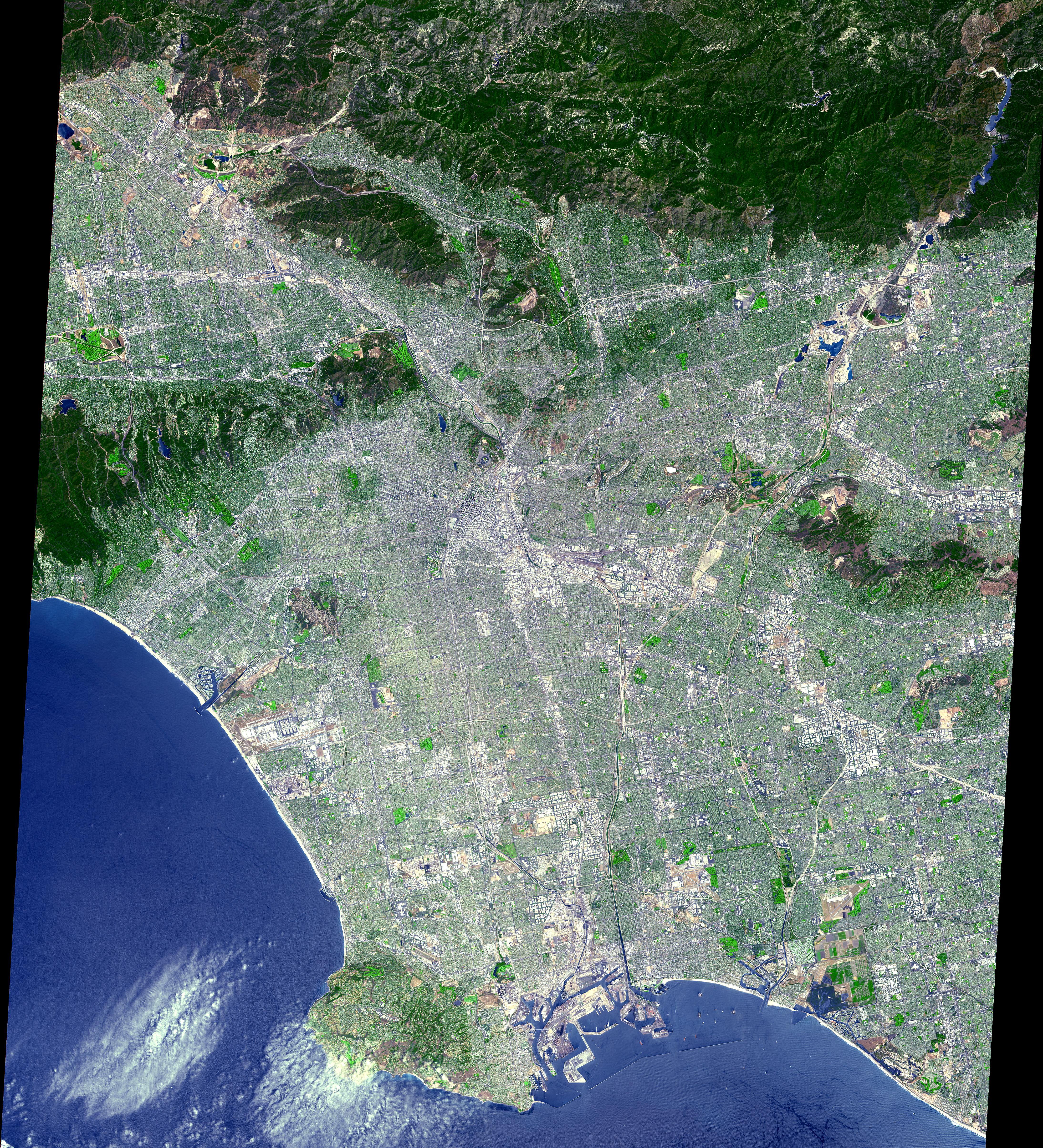
This ASTER image was acquired on July 23, 2001 and covers an area of 64 x 72 km. The data were processed to create a simulated natural color image. From its start as a sleepy Spanish pueblo in 1781, LA and its metropolitan area has grown to become an ethnically diverse, semitropical megalopolis, laying claim as the principal center of the western US and the nation's second largest urban area. The city's economy is based on international trade, aerospace, agriculture, tourism, and filmmaking. LA provides a glimpse of the typically cosmopolitan and global city of the future.
The image is located at 34.1 degrees north latitude and 118.2 degrees west longitude.
Advanced Spaceborne Thermal Emission and Reflection Radiometer (ASTER) is one of five Earth-observing instruments launched December 18, 1999, on NASA's Terra satellite. The instrument was built by Japan's Ministry of International Trade and Industry. A joint U.S./Japan science team is responsible for validation and calibration of the instrument and the data products. Dr. Anne Kahle at NASA's Jet Propulsion Laboratory, Pasadena, Calif., is the U.S. Science team leader; Moshe Pniel of JPL is the project manager. ASTER is the only high resolution imaging sensor on Terra. The primary goal of the ASTER mission is to obtain high-resolution image data in 14 channels over the entire land surface, as well as black and white stereo images. With revisit time of between 4 and 16 days, ASTER will provide the capability for repeat coverage of changing areas on Earth's surface. The broad spectral coverage and high spectral resolution of ASTER will provide scientists in numerous disciplines with critical information for surface mapping, and monitoring dynamic conditions and temporal change. Example applications are: monitoring glacial advances and retreats, monitoring potentially active volcanoes, identifying crop stress, determining cloud morphology and physical properties, wetlands Evaluation, thermal pollution monitoring, coral reef degradation, surface temperature mapping of soils and geology, and measuring surface heat balance.
 Planetary Data System


