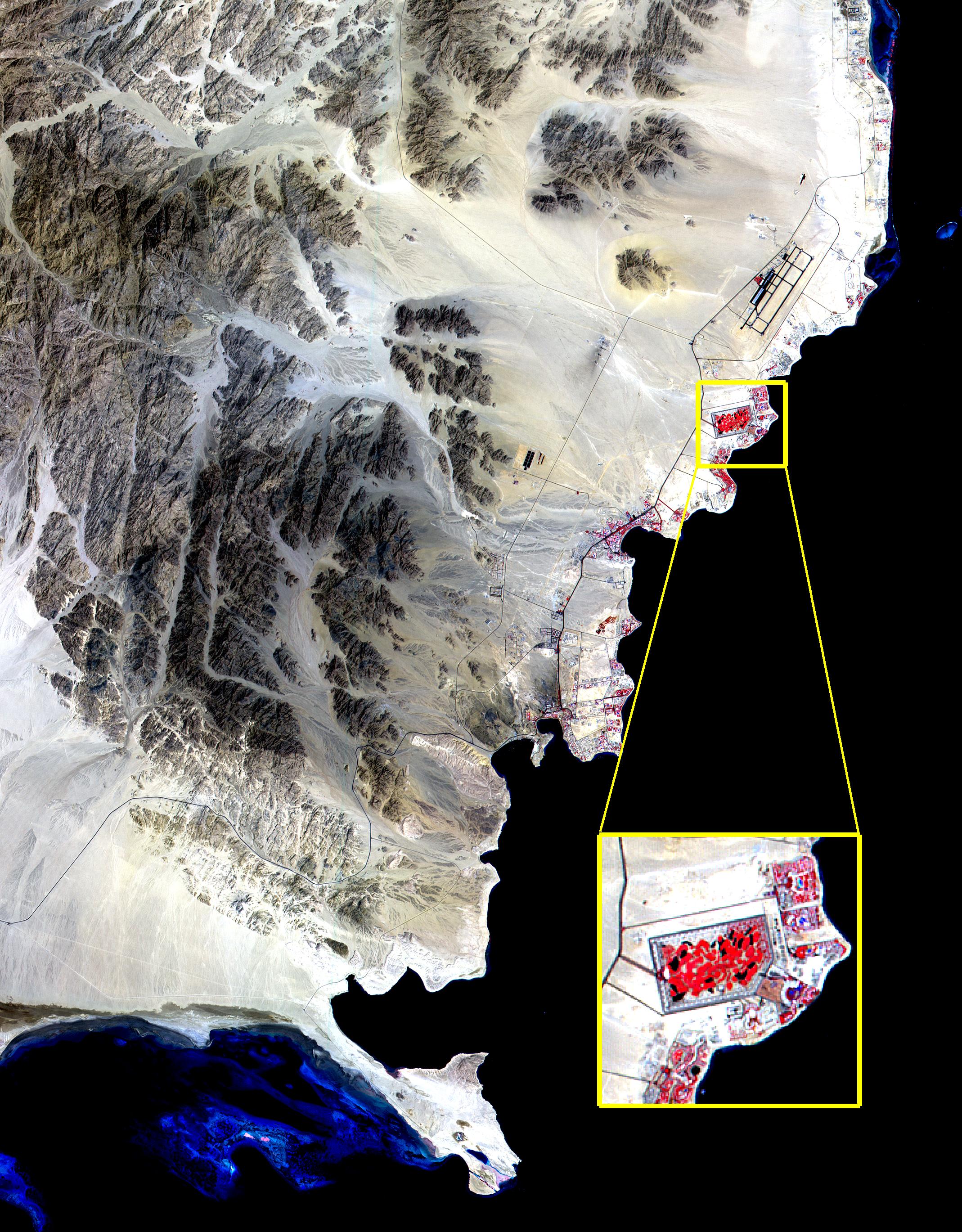
The Red Sea golf resort in Sharm El Sheik, Egypt, where President Clinton met with Israeli Prime Minister Ehud Barak and Palestinian Authority President Yasser Arafat, stands out against the desert landscape in this image acquired on August 25, 2000.
This image of the southern tip of the Sinai Peninsula shows an area about 30 by 40 kilometers (19 by 25 miles) in the visible and near infrared wavelength region. Vegetation appears in red. The blue areas in the water at the top and bottom of the image are coral reefs. The airport is visible just to the north of the golf resort.
Advanced Spaceborne Thermal Emission and Reflection Radiometer (ASTER) is one of five Earth-observing instruments launched December 18, 1999, on NASA's Terra satellite. The instrument was built by Japan's Ministry of International Trade and Industry. A joint U.S./Japan science team is responsible for validation and calibration of the instrument and the data products. Dr. Anne Kahle at NASA's Jet Propulsion Laboratory, Pasadena, Calif., is the U.S. Science team leader; Moshe Pniel of JPL is the project manager. ASTER is the only high resolution imaging sensor on Terra. The primary goal of the ASTER mission is to obtain high-resolution image data in 14 channels over the entire land surface, as well as black and white stereo images. With revisit time of between 4 and 16 days, ASTER will provide the capability for repeat coverage of changing areas on Earth's surface.
The broad spectral coverage and high spectral resolution of ASTER will provide scientists in numerous disciplines with critical information for surface mapping, and monitoring dynamic conditions and temporal change. Example applications are: monitoring glacial advances and retreats, monitoring potentially active volcanoes, identifying crop stress, determining cloud morphology and physical properties, wetlands Evaluation, thermal pollution monitoring, coral reef degradation, surface temperature mapping of soils and geology, and measuring surface heat balance.
