Your search criteria found 2308 images
Target is Earth
Go to PIAxxxxx:
Refine this list of images by:
Target:
Mission:
Spacecraft:
Instrument:
Click on an image for detailed information
Click on a column heading to sort in ascending or descending order
My
List
Addition Date TargetSort Descending Mission Instrument Size
Add Image to Favorite List 1999-04-15 Earth Spaceborne Imaging Radar-C/X-Band Synthetic Aperture Radar
2076x2470x3
This is a radar image from NASA's Spaceborne Imaging Radar-C/X-band Synthetic Aperture Radar of a region in northern Sudan called the Keraf Suture that reveals newly discovered geologic features buried beneath layers of sand.
PIA01801:
Space Radar Image of Sudan Collision Zone
Full Resolution:     TIFF (16.56 MB)     JPEG (2.247 MB)
Add Image to Favorite List 1999-04-15 Earth Spaceborne Imaging Radar-C/X-Band Synthetic Aperture Radar
3800x2300x3
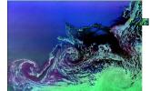
Two radar images from NASA's Spaceborne Imaging Radar C/X-Band Synthetic Aperture Radar shows two large ocean circulation features, called eddies at the northernmost edge of the sea ice pack in the Weddell Sea, off Antarctica.
PIA01802:
Space Radar Image of Weddell Sea
Full Resolution:     TIFF (28.59 MB)     JPEG (1.717 MB)
Add Image to Favorite List 1999-04-15 Earth Spaceborne Imaging Radar-C/X-Band Synthetic Aperture Radar
1644x3604x3
This is a radar image from NASA's Spaceborne Imaging Radar-C/X-band Synthetic Aperture of an offshore drilling field W of Bombay, India, in the Arabian Sea. Dark streaks of extensive oil slicks surrounding drilling platforms appear as bright white spots.
PIA01803:
Space Radar Image of Oil Slicks
Full Resolution:     TIFF (21.1 MB)     JPEG (2.086 MB)
Add Image to Favorite List 1999-04-15 Earth Spaceborne Imaging Radar-C/X-Band Synthetic Aperture Radar
2300x1617x3
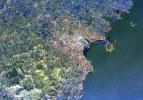
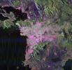
This radar image from NASA's Spaceborne Imaging Radar-C/X-band Synthetic Aperture of Dublin, Ireland, distinguishes between densely populated urban areas and unsettled areas. At center is the city's natural harbor along the Irish Sea.
PIA01804:
Space Radar Image of Dublin, Ireland
Full Resolution:     TIFF (14.17 MB)     JPEG (1.381 MB)
Add Image to Favorite List 1999-04-15 Earth Airborne Synthetic Aperture Radar (AIRSAR)
AirSAR
1081x2137x3
This is a combined radar and topography image acquired by NASA's Airborne Synthetic Aperture Radar of an area along the Missouri River that experienced severe flooding and levee failure in the summer of 1993.
PIA01806:
Space Radar Image of Missouri River - TOPSAR
Full Resolution:     TIFF (2.212 MB)     JPEG (780.9 kB)
Add Image to Favorite List 1999-04-15 Earth Spaceborne Imaging Radar-C/X-Band Synthetic Aperture Radar
4000x2392x3
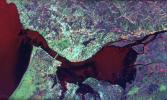
This radar image from NASA's Spaceborne Imaging Radar-C/X-band Synthetic Aperture of Lisbon, Portugal shows different land use patterns that are present in coastal Portugal. Lisbon lies on the north bank of the Rio Tejo where it enters the Atlantic Ocean.
PIA01807:
Space Radar Image of Lisbon, Portugal
Full Resolution:     TIFF (34.58 MB)     JPEG (2.158 MB)
Add Image to Favorite List 1999-04-15 Earth Spaceborne Imaging Radar-C/X-Band Synthetic Aperture Radar
1920x1035x3
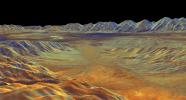
This is a three-dimensional perspective view from NASA's Spaceborne Imaging Radar C/X-Band Synthetic Aperture Radar of Saline Valley, about 30 km (19 miles) east of the town of Independence, California.
PIA01808:
Space Radar Image of Saline Valley, California
Full Resolution:     TIFF (5.441 MB)     JPEG (241.2 kB)
Add Image to Favorite List 2015-02-19 Earth Terra
ASTER
3300x2000x3
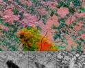
Pyroclastic flows from Guatemala's Fuego volcano eruptions sent ash plumes spewing over Guatemala City in early February, 2015. This image is from the ASTER instrument onboard NASA's Terra spacecraft.
PIA19297:
Guatemala Volcanic Eruption Captured in NASA Spacecraft Image
Full Resolution:     TIFF (19.81 MB)     JPEG (1.452 MB)
Add Image to Favorite List 1999-04-15 Earth Spaceborne Imaging Radar-C/X-Band Synthetic Aperture Radar
1920x1035x3
This is a three-dimensional perspective view from NASA's Spaceborne Imaging Radar C/X-Band Synthetic Aperture Radar of Owens Valley, near the town of Bishop, California.
PIA01809:
Space Radar Image of Owens Valley, California
Full Resolution:     TIFF (5.689 MB)     JPEG (234.3 kB)
Add Image to Favorite List 1999-04-15 Earth Spaceborne Imaging Radar-C/X-Band Synthetic Aperture Radar
2000x2026x3
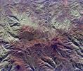
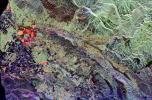
This radar image from NASA's Spaceborne Imaging Radar-C/X-band Synthetic Aperture is of the Andes Mountains in northern Ecuador. The city of Otavalo and Lake Otavalo lie within the triangle formed by three volcanoes.
PIA01810:
Space Radar Image of North Ecuador
Full Resolution:     TIFF (15.34 MB)     JPEG (1.338 MB)
Add Image to Favorite List 1999-04-15 Earth Spaceborne Imaging Radar-C/X-Band Synthetic Aperture Radar
2004x3000x3
This radar image from NASA's Spaceborne Imaging Radar-C/X-band Synthetic Aperture shows the volcanic island of Reunion, east of Madagascar in the SW Indian Ocean. The southern half of the island is dominated by the active volcano, Piton de la Fournaise.
PIA01811:
Space Radar Image of Reunion Island
Full Resolution:     TIFF (22.31 MB)     JPEG (1.61 MB)
Add Image to Favorite List 1999-04-15 Earth Spaceborne Imaging Radar-C/X-Band Synthetic Aperture Radar
1365x3000x3
This radar image from NASA's Spaceborne Imaging Radar C/X-Band Synthetic Aperture Radar of the area surrounding Boston, Mass.
PIA01812:
Space Radar Image of Boston, Massachusetts
Full Resolution:     TIFF (15.55 MB)     JPEG (1.138 MB)
Add Image to Favorite List 1999-04-15 Earth Spaceborne Imaging Radar-C/X-Band Synthetic Aperture Radar
2840x1243x3
This is an image from NASA's Spaceborne Imaging Radar-C/X-band Synthetic Aperture of the Bolivian capital city of La Paz that was created using three radar frequencies.
PIA01813:
Space Radar Image of La Paz, Bolivia
Full Resolution:     TIFF (13.04 MB)     JPEG (1.023 MB)
Add Image to Favorite List 1999-04-15 Earth Spaceborne Imaging Radar-C/X-Band Synthetic Aperture Radar
1750x2950x3
This space radar image from NASA's Spaceborne Imaging Radar-C/X-band Synthetic Aperture shows the area surrounding the Dead Sea along the West Bank between Israel and Jordan.
PIA01814:
Space Radar Image of Jerusalem and the Dead Sea
Full Resolution:     TIFF (19.16 MB)     JPEG (1.522 MB)
Add Image to Favorite List 1999-04-15 Earth Spaceborne Imaging Radar-C/X-Band Synthetic Aperture Radar
2016x1951x3
The city of Washington, D.C., is shown is this space radar image from NASA's Spaceborne Imaging Radar-C/X-band Synthetic Aperture.
PIA01815:
Space Radar Image of Washington D.C.
Full Resolution:     TIFF (14.94 MB)     JPEG (1.6 MB)
Add Image to Favorite List 1999-04-15 Earth Spaceborne Imaging Radar-C/X-Band Synthetic Aperture Radar
3425x2778x3
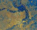
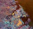
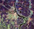
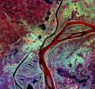
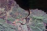
This is an image from NASA's Spaceborne Imaging Radar C/X-Band Synthetic Aperture Radar of St. Louis, Missouri, where the Mississippi and Missouri Rivers come together. St. Louis is the bright gold area within a bend in the Mississippi River.
PIA01817:
Space Radar Image of St. Louis, Missouri
Full Resolution:     TIFF (34.15 MB)     JPEG (3.708 MB)
Add Image to Favorite List 1999-04-15 Earth Spaceborne Imaging Radar-C/X-Band Synthetic Aperture Radar
2820x4000x3
This space radar image from NASA's Spaceborne Imaging Radar-C/X-band Synthetic Aperture shows urban development along the lower Colorado River at the Nevada/Arizona state line. Lake Mojave is the dark feature that occupies the river valley.
PIA01818:
Space Radar Image of Colorado River
Full Resolution:     TIFF (41.37 MB)     JPEG (2.792 MB)
Add Image to Favorite List 1999-04-15 Earth Spaceborne Imaging Radar-C/X-Band Synthetic Aperture Radar
4000x2850x3
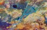
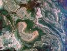
Ancient lava flows dating back 2,000 to 15,000 years are shown in light green and red on the left side of this space radar image from NASA's Spaceborne Imaging Radar-C/X-band Synthetic Aperture of the Craters of the Moon National Monument area in Idaho.
PIA01819:
Space Radar Image of Craters of the Moon, Idaho
Full Resolution:     TIFF (42.98 MB)     JPEG (3.466 MB)
Add Image to Favorite List 1999-04-15 Earth Spaceborne Imaging Radar-C/X-Band Synthetic Aperture Radar
2495x4970x3
Bright, arc-shaped limestone hills and complex, branching drainage patterns dominate this three-frequency space radar image from NASA's Spaceborne Imaging Radar-C/X-band Synthetic Aperture of a desert area in the north central plain of Oman.
PIA01820:
Space Radar Image of Central Plain, Oman
Full Resolution:     TIFF (44.4 MB)     JPEG (3.969 MB)
Add Image to Favorite List 1999-04-15 Earth Spaceborne Imaging Radar-C/X-Band Synthetic Aperture Radar
2817x2273x3
This multi-frequency space radar image from NASA's Spaceborne Imaging Radar-C/X-band Synthetic Aperture of a tropical rainforest in western Brazil.
PIA01821:
Space Radar Image of Randonia Rain Cell
Full Resolution:     TIFF (20.31 MB)     JPEG (2.657 MB)
Add Image to Favorite List 1999-04-15 Earth Spaceborne Imaging Radar-C/X-Band Synthetic Aperture Radar
2540x4396x3
This three-frequency space radar image from NASA's Spaceborne Imaging Radar-C/X-band Synthetic Aperture of west central Egypt shows detailed patterns of eroded sedimentary rock formations emerging through a vast sea of sand dunes.
PIA01822:
Space Radar Image of Egypt Sand Dunes
Full Resolution:     TIFF (28.15 MB)     JPEG (3.102 MB)
Add Image to Favorite List 1999-04-15 Earth Spaceborne Imaging Radar-C/X-Band Synthetic Aperture Radar
[NULL]
4000x2100x3
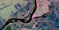
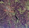
This three-frequency space radar image from NASA's Spaceborne Imaging Radar-C/X-band Synthetic Aperture shows the city of Samara, Russia in pink and light green right of center. Samara is at the junction of the Volga and Samara Rivers southeast of Moscow.
PIA01823:
Space Radar Image of Samara, Russia
Full Resolution:     TIFF (28.13 MB)     JPEG (2.748 MB)
Add Image to Favorite List 1999-04-15 Earth Spaceborne Imaging Radar-C/X-Band Synthetic Aperture Radar
3612x3502x3
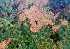
This space radar image from NASA's Spaceborne Imaging Radar-C/X-band Synthetic Aperture of Athens, Greece, shows the sprawling, modern development of this ancient capital city. Densely populated urban areas appear in shades of pink and light green.
PIA01824:
Space Radar Image of Athens, Greece
Full Resolution:     TIFF (42.86 MB)     JPEG (2.881 MB)
Add Image to Favorite List 1999-04-15 Earth Spaceborne Imaging Radar-C/X-Band Synthetic Aperture Radar
2413x4151x3
This three-frequency space radar image from NASA's Spaceborne Imaging Radar C/X-Band Synthetic Aperture Radar of south-central Egypt shows penetration of thin sand cover in arid regions to reveal hidden details below the surface.
PIA01825:
Space Radar Image of Safsaf Oasis, Egypt
Full Resolution:     TIFF (39.25 MB)     JPEG (3.539 MB)
Add Image to Favorite List 1999-04-15 Earth Spaceborne Imaging Radar-C/X-Band Synthetic Aperture Radar
2913x2485x3
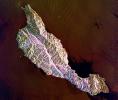
This space radar image from NASA's Spaceborne Imaging Radar-C/X-band Synthetic Aperture shows the rugged topography of Santa Cruz Island, part of the Channel Islands National Park in the Pacific Ocean off the coast of Santa Barbara and Ventura, Calif.
PIA01826:
Space Radar Image of Santa Cruz Island, California
Full Resolution:     TIFF (22.87 MB)     JPEG (1.617 MB)
Add Image to Favorite List 1999-04-15 Earth Spaceborne Imaging Radar-C/X-Band Synthetic Aperture Radar
3997x3408x3
This spaceborne radar image from NASA's Spaceborne Imaging Radar C/X-Band Synthetic Aperture Radar shows the Ruiz-Tolima volcanic region in central Colombia, west of Bogata. The town of Manizales, Colombia, is the pinkish area.
PIA01827:
Space Radar Image of Ruiz Volcano, Colombia
Full Resolution:     TIFF (47.97 MB)     JPEG (3.49 MB)
Add Image to Favorite List 1999-04-15 Earth Spaceborne Imaging Radar-C/X-Band Synthetic Aperture Radar
3000x2612x3
This spaceborne radar image from NASA's Spaceborne Imaging Radar C/X-Band Synthetic Aperture Radar is dominated by the metropolitan area of Australia's largest city, Sydney.
PIA01828:
Space Radar Image of Sydney, Australia
Full Resolution:     TIFF (28.37 MB)     JPEG (2.644 MB)
Add Image to Favorite List 1999-04-15 Earth Spaceborne Imaging Radar-C/X-Band Synthetic Aperture Radar
2000x2400x3
Australia's capital city, Canberra, is shown in the center of this spaceborne radar image from NASA's Spaceborne Imaging Radar C/X-Band Synthetic Aperture Radar. Images like this can help urban planners assess land use patterns.
PIA01829:
Space Radar Image of Canberra, Australia
Full Resolution:     TIFF (17.97 MB)     JPEG (1.306 MB)
Add Image to Favorite List 1999-04-15 Earth Spaceborne Imaging Radar-C/X-Band Synthetic Aperture Radar
3321x2916x3
This radar image from NASA's Spaceborne Imaging Radar C/X-Band Synthetic Aperture Radar shows the southern end of Vancouver Island on the west coast of Canada. The white area is the city of Victoria, the capital of the province of British Columbia.
PIA01830:
Space Radar Image of Victoria, Canada
Full Resolution:     TIFF (26.86 MB)     JPEG (2.501 MB)
Add Image to Favorite List 1999-04-15 Earth Spaceborne Imaging Radar-C/X-Band Synthetic Aperture Radar
2447x1789x3
The impact of an asteroid or comet several hundred million years ago left scars in the landscape that are still visible in this radar image from NASA's Spaceborne Imaging Radar C/X-Band Synthetic Aperture of an area in the Sahara Desert of northern Chad.
PIA01831:
Space Radar Image of Possible String of Impact Creaters
Full Resolution:     TIFF (16.99 MB)     JPEG (1.246 MB)
Add Image to Favorite List 1999-04-15 Earth Spaceborne Imaging Radar-C/X-Band Synthetic Aperture Radar
2206x1758x3
The impact of an asteroid or comet several hundred million years ago left scars in the landscape that are still visible in this radar image from NASA's Spaceborne Imaging Radar C/X-Band Synthetic Aperture of an area in the Sahara Desert of northern Chad.
PIA01833:
Space Radar of Image Aorounga Impact Crater, Chad
Full Resolution:     TIFF (14.7 MB)     JPEG (1.28 MB)
Add Image to Favorite List 1999-05-01 Earth Spaceborne Imaging Radar-C/X-Band Synthetic Aperture Radar
3536x5297x3
This spaceborne radar image from NASA's Spaceborne Imaging Radar C/X-Band Synthetic Aperture Radar of Orange County, Calif., shows the massive urbanization of this rapidly growing region located just south of Los Angeles.
PIA01835:
Space Radar Image of Orange County, California (Annotated Version)
Full Resolution:     TIFF (68.47 MB)     JPEG (5.452 MB)
Add Image to Favorite List 1999-04-15 Earth Spaceborne Imaging Radar-C/X-Band Synthetic Aperture Radar
2233x3024x3
This spaceborne radar image from NASA's Spaceborne Imaging Radar C/X-Band Synthetic Aperture Radar shows the area just north of the city of Cairo, Egypt, where the Nile River splits into two main branches.
PIA01836:
Space Radar Image of Nile River Delta, Egypt
Full Resolution:     TIFF (25.89 MB)     JPEG (2.052 MB)
Add Image to Favorite List 1999-04-15 Earth Spaceborne Imaging Radar-C/X-Band Synthetic Aperture Radar
2325x1521x3
This spaceborne radar image from NASA's Spaceborne Imaging Radar C/X-Band Synthetic Aperture Radar of a mineral-rich region in southern China is being used by geologists to identify potential new areas for mineral exploration.
PIA01837:
Space Radar Image of Mineral Resources, China
Full Resolution:     TIFF (9.551 MB)     JPEG (1.02 MB)
Add Image to Favorite List 1999-04-15 Earth Spaceborne Imaging Radar-C/X-Band Synthetic Aperture Radar
2050x3120x3
These spaceborne radar images from NASA's Spaceborne Imaging Radar C/X-Band Synthetic Aperture Radar show a segment of the Great Wall of China in a desert region of north-central China, about 700 kilometers (434 miles) west of Beijing.
PIA01838:
Space Radar Image of Great Wall of China
Full Resolution:     TIFF (16.51 MB)     JPEG (1.113 MB)
Add Image to Favorite List 1999-04-15 Earth Spaceborne Imaging Radar-C/X-Band Synthetic Aperture Radar
2805x2472x3
This spaceborne radar image from NASA's Spaceborne Imaging Radar C/X-Band Synthetic Aperture Radar of Belgrade, Serbia, illustrates the variety of land use patterns that can be observed with a multiple wavelength radar system.
PIA01839:
Space Radar Image of Belgrade, Serbia
Full Resolution:     TIFF (26.23 MB)     JPEG (2.34 MB)
Add Image to Favorite List 1999-04-15 Earth Spaceborne Imaging Radar-C/X-Band Synthetic Aperture Radar
1920x1080x3
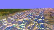
This is a three-dimensional perspective from NASA's Spaceborne Imaging Radar-C/X-band Synthetic Aperture of the eastern front range of the Rocky Mountains, about 120 kilometers (75 miles) west of Great Falls, Montana.
PIA01840:
Space Radar Image of Rocky Mountains, Montana
Full Resolution:     TIFF (5.591 MB)     JPEG (319.5 kB)
Add Image to Favorite List 1999-04-15 Earth Spaceborne Imaging Radar-C/X-Band Synthetic Aperture Radar
1920x1080x3
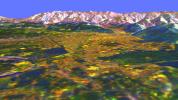
This is a three-dimensional perspective view from NASA's Spaceborne Imaging Radar C/X-Band Synthetic Aperture Radar of Missoula, Montana, created by combining using a technique known as interferometry.
PIA01841:
Space Radar Image of Missoula, Montana in 3-D
Full Resolution:     TIFF (6.282 MB)     JPEG (267.3 kB)
Add Image to Favorite List 2002-10-29 Earth Terra
ASTER
1400x1100x3
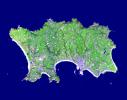
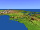
The Isle of Jersey (officially called the Bailiwick of Jersey) is the largest Channel Island, positioned in the Bay of Mont St Michel off the north-west coast of France. This image was acquired by NASA's Terra satellite on September 23, 2000.
PIA03879:
Isle of Jersey
Full Resolution:     TIFF (2.241 MB)     JPEG (236.9 kB)
Add Image to Favorite List 1999-04-15 Earth Spaceborne Imaging Radar-C/X-Band Synthetic Aperture Radar
1648x2449x3
This spaceborne radar image from NASA's Spaceborne Imaging Radar C/X-Band Synthetic Aperture Radar shows the city of Honolulu, Hawaii and adjacent areas on the island of Oahu. Honolulu lies on the south shore of the island.
PIA01842:
Space Radar Image of Honolulu, Oahu, Hawaii
Full Resolution:     TIFF (12.13 MB)     JPEG (961.7 kB)
Add Image to Favorite List 1999-04-15 Earth Spaceborne Imaging Radar-C/X-Band Synthetic Aperture Radar
1792x2496x3
This spaceborne radar image from NASA's Spaceborne Imaging Radar C/X-Band Synthetic Aperture Radar shows part of the British territory of Hong Kong, adjacent to mainland China. The South China Sea is shown in dark blue and red on the image.
PIA01843:
Space Radar Image of Hong Kong
Full Resolution:     TIFF (13.68 MB)     JPEG (1.002 MB)
Add Image to Favorite List 1999-04-15 Earth Spaceborne Imaging Radar-C/X-Band Synthetic Aperture Radar
1196x627x3
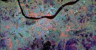
This radar image from NASA's Spaceborne Imaging Radar-C/X-band Synthetic Aperture of Calcutta, India, illustrates different urban land use patterns; it is the largest city in India, located on the banks of the Hugli River, shown as the thick, dark line.
PIA01844:
Space Radar Image of Calcutta, West Bengal, India
Full Resolution:     TIFF (2.759 MB)     JPEG (203.7 kB)
Add Image to Favorite List 1999-04-15 Earth Spaceborne Imaging Radar-C/X-Band Synthetic Aperture Radar
2466x2881x3
This spaceborne radar image from NASA's Spaceborne Imaging Radar C/X-Band Synthetic Aperture Radar of Munich, Germany highlights different land use patterns in the area surrounding Bavaria's largest city.
PIA01845:
Space Radar Image of Munich, Germany
Full Resolution:     TIFF (26.31 MB)     JPEG (2.135 MB)
Add Image to Favorite List 1999-04-15 Earth Spaceborne Imaging Radar-C/X-Band Synthetic Aperture Radar
5881x4501x3
This spaceborne radar image from NASA's Spaceborne Imaging Radar C/X-Band Synthetic Aperture Radar shows part of the remote central Asian region of Tuva, a mostly mountainous region that lies between western Mongolia and southern Siberia.
PIA01846:
Space Radar Image of Tuva, Central Asia
Full Resolution:     TIFF (80.21 MB)     JPEG (6.547 MB)
Add Image to Favorite List 1999-04-15 Earth Spaceborne Imaging Radar-C/X-Band Synthetic Aperture Radar
2177x2057x3
This spaceborne radar image from NASA's Spaceborne Imaging Radar C/X-Band Synthetic Aperture Radar shows the city of Phnom Penh, the capital of Cambodia. Phnom Penh lies at the confluence of the Mekong River and the Basak Sab.
PIA01847:
Space Radar Image of Phnom Phen, Cambodia
Full Resolution:     TIFF (16.8 MB)     JPEG (1.418 MB)
Add Image to Favorite List 1999-04-15 Earth Spaceborne Imaging Radar-C/X-Band Synthetic Aperture Radar
3295x1662x3
The Iveragh Peninsula, one of the four peninsulas in southwestern Ireland, is shown in this spaceborne radar image from NASA's Spaceborne Imaging Radar C/X-Band Synthetic Aperture Radar. The lakes of Killarney National Park are the green patches.
PIA01848:
Space Radar Image of County Kerry, Ireland
Full Resolution:     TIFF (18.29 MB)     JPEG (1.841 MB)
Add Image to Favorite List 1999-04-15 Earth Spaceborne Imaging Radar-C/X-Band Synthetic Aperture Radar
3000x3500x3
This spaceborne radar image from NASA's Spaceborne Imaging Radar C/X-Band Synthetic Aperture Radar shows a segment of the Columbia River as it passes through the area of Wenatchee, Washington, east of Seattle.
PIA01849:
Space Radar Image of Wenatchee, Washington
Full Resolution:     TIFF (37.48 MB)     JPEG (2.441 MB)
Add Image to Favorite List 1999-04-15 Earth Spaceborne Imaging Radar-C/X-Band Synthetic Aperture Radar
2808x3500x3
This spaceborne radar image from NASA's Spaceborne Imaging Radar C/X-Band Synthetic Aperture Radar shows the intensive agricultural development in central Ukraine, along the Dnieper River. The area shown lies southeast of Kiev and northeast of Odessa.
PIA01850:
Space Radar Image of Dnieper River, Ukraine
Full Resolution:     TIFF (32.99 MB)     JPEG (2.203 MB)
Add Image to Favorite List 1999-04-15 Earth Spaceborne Imaging Radar-C/X-Band Synthetic Aperture Radar
6000x3852x3
This spaceborne radar image from NASA's Spaceborne Imaging Radar C/X-Band Synthetic Aperture shows part of the Mojave Desert in the vicinity of Barstow, California and revealing human activities in the arid environment of the southern California deserts.
PIA01851:
Space Radar Image of Barstow, California
Full Resolution:     TIFF (79.47 MB)     JPEG (9.271 MB)
Add Image to Favorite List 1999-04-15 Earth Spaceborne Imaging Radar-C/X-Band Synthetic Aperture Radar
3841x4593x3
This spaceborne radar image from NASA's Spaceborne Imaging Radar C/X-Band Synthetic Aperture Radar shows the Pinacate Volcanic Field in the state of Sonora, Mexico, southeast of Yuma, Arizona. The United States/Mexico border is evident.
PIA01852:
Space Radar Image of Pinacate Volcanic Field, Mexico
Full Resolution:     TIFF (64.12 MB)     JPEG (5.228 MB)
Add Image to Favorite List 1999-04-15 Earth Spaceborne Imaging Radar-C/X-Band Synthetic Aperture Radar
4001x2640x3
The northern end of the island country of Taiwan, including the capital city of Taipei, is shown in this spaceborne radar image from NASA's Spaceborne Imaging Radar C/X-Band Synthetic Aperture Radar. Taipei is the bright blue and red area.
PIA01853:
Space Radar Image of Taipei, Taiwan
Full Resolution:     TIFF (34.76 MB)     JPEG (2.419 MB)
Add Image to Favorite List 2000-04-27 Earth Spaceborne Imaging Radar-C/X-Band Synthetic Aperture Radar
6577x4337x3
This spaceborne radar image from NASA's Spaceborne Imaging Radar C/X-Band Synthetic Aperture Radar shows part of the vast Namib Sand Sea on the west coast of southern Africa, just northeast of the city of Luderitz, Namibia.
PIA01856:
Space Radar Image of Namibia Sand Dunes
Full Resolution:     TIFF (86.77 MB)     JPEG (8.973 MB)
Add Image to Favorite List 1999-04-15 Earth Spaceborne Imaging Radar-C/X-Band Synthetic Aperture Radar
6539x3444x3
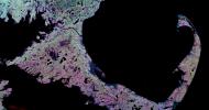
This spaceborne radar image from NASA's Spaceborne Imaging Radar C/X-Band Synthetic Aperture Radar shows the famous 'hook' of Cape Cod, Massachusetts. The Cape, which juts out into the Atlantic Ocean southeast of Boston.
PIA01857:
Space Radar Image of Cape Cod, Massachusetts
Full Resolution:     TIFF (25.1 MB)     JPEG (3.779 MB)
Add Image to Favorite List 1999-04-15 Earth Spaceborne Imaging Radar-C/X-Band Synthetic Aperture Radar
2949x1949x3
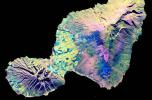
This spaceborne radar image from NASA's Spaceborne Imaging Radar C/X-Band Synthetic Aperture Radar shows the 'Valley Island' of Maui, Hawaii. Cloud-penetrating capabilities provide a rare view of many parts of the island, frequently shrouded in clouds.
PIA01858:
Space Radar Image of Maui, Hawaii
Full Resolution:     TIFF (11.52 MB)     JPEG (1.26 MB)
Add Image to Favorite List 1999-04-15 Earth Spaceborne Imaging Radar-C/X-Band Synthetic Aperture Radar
2733x2656x3
This spaceborne radar image from NASA's Spaceborne Imaging Radar C/X-Band Synthetic Aperture shows a segment of the Rhine River where it forms the border between the Alsace region of northeastern France on the left and the Black Forest region of Germany.
PIA01859:
Space Radar Image of Rhine River, France and Germany
Full Resolution:     TIFF (27.7 MB)     JPEG (2.372 MB)
Add Image to Favorite List 1999-04-15 Earth Spaceborne Imaging Radar-C/X-Band Synthetic Aperture Radar
4236x2788x3
This radar image from NASA's Spaceborne Imaging Radar-C/X-band Synthetic Aperture of Ventura County, California, shows the Santa Clara River valley and the surrounding mountains. The river valley is the linear feature that empties into the Pacific Ocean.
PIA01860:
Space Radar Image of Ventura County, California
Full Resolution:     TIFF (42.27 MB)     JPEG (3.482 MB)
Add Image to Favorite List 1999-04-15 Earth Spaceborne Imaging Radar-C/X-Band Synthetic Aperture Radar
1537x1081x3
This is a spaceborne radar image from NASA's Spaceborne Imaging Radar C/X-Band Synthetic Aperture Radar of the city of Sacramento, the capital of California. Urban areas appear pink and the surrounding agricultural areas are green and blue.
PIA01861:
Space Radar Image of Sacramento, California
Full Resolution:     TIFF (5.841 MB)     JPEG (770.2 kB)
Add Image to Favorite List 1999-04-15 Earth Spaceborne Imaging Radar-C/X-Band Synthetic Aperture Radar
2985x2361x3
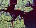
This radar image from NASA's Spaceborne Imaging Radar-C/X-band Synthetic Aperture shows the Hampton Roads, Virginia region, where the James River (upper left center) flows into the Chesapeake Bay.
PIA01862:
Space Radar Image of Hampton Roads, Virginia
Full Resolution:     TIFF (24.39 MB)     JPEG (1.869 MB)
Add Image to Favorite List 1999-04-15 Earth Spaceborne Imaging Radar-C/X-Band Synthetic Aperture Radar
3537x2708x3
This spaceborne radar image from NASA's Spaceborne Imaging Radar C/X-Band Synthetic Aperture Radar shows how the Atlas Mountains in northwestern Africa dominate the geography of Morocco.
PIA01863:
Space Radar Image of Eastern Morocco
Full Resolution:     TIFF (35.28 MB)     JPEG (3.031 MB)
Add Image to Favorite List 1999-05-15 Earth Voyager
VG ISS - Narrow Angle
565x790x3
This picture of a crescent-shaped Earth and Moon -- the first of its kind ever taken by a spacecraft -- was recorded Sept. 18, 1977, by NASA's Voyager 1 when it was 7.25 million miles (11.66 million kilometers) from Earth.
PIA01967:
Crescent-shaped Earth and Moon
Full Resolution:     TIFF (48.38 kB)     JPEG (9.77 kB)
Add Image to Favorite List 1999-12-10 Earth Voyager
VG ISS - Narrow Angle
200x200x3
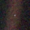
This image of the Earth is one of 60 frames taken by NASA's Voyager 1 spacecraft on Feb. 14, 1990 from a distance of approximately 4 billion miles and about 32 degrees above the ecliptic plane.
PIA02228:
Solar System Portrait - Earth
Full Resolution:     TIFF (117.8 kB)     JPEG (4.977 kB)
Add Image to Favorite List 1999-09-08 Earth QuikScat
SeaWinds Scatterometer
900x900x1
NASA's QuikScat satellite instrument kept an eye on an iceberg the size of Rhode Island, the first time this space technology had been used to track a potential threat to international shipping.
PIA02329:
SeaWinds Watches for Breakup of Giant Iceberg
Full Resolution:     TIFF (132.8 kB)     JPEG (49.24 kB)
Add Image to Favorite List 1999-09-16 Earth QuikScat
SeaWinds Scatterometer
564x400x3
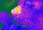
NASA's SeaWinds radar instrument eyed the center of a massive hurricane, Floyd, as it ripped past Georgia and the Carolinas Wednesday afternoon, September 15, 1999, then marched toward a midnight strike at Cape Fear, North Carolina.
PIA02334:
SeaWinds Radar Stares Into The Eye Of Angry Hurricane Floyd
Full Resolution:     TIFF (192.6 kB)     JPEG (44.92 kB)
Add Image to Favorite List 2002-10-25 Earth Shuttle Radar Topography Mission (SRTM)
C-Band Interferometric Radar
1152x870x3
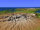
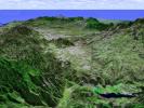
This perspective view from NASA's Shuttle Radar Topography Mission, acquired on February 2000, shows central Panama, with the remnants of the extinct volcano El Valle in the foreground and the Caribbean Sea in the distance.
PIA03369:
Perspective View with Color-Coded Shaded Relief, Central Panama
Full Resolution:     TIFF (2.588 MB)     JPEG (192.8 kB)
Add Image to Favorite List 1999-08-23 Earth TOPEX/Poseidon
Altimeter
902x900x3
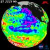
The North Pacific Ocean ran hot and cold, with abnormally low sea levels and cool waters in the northeastern Pacific contrasting with unusually high sea levels and warm waters in the northwestern Pacific shown by data from NASA's TOPEX/Poseidon satellite.
PIA02403:
TOPEX/El Niņo Watch - Pacific Ocean Conditions are Split: Cold in East, Hot in West, July 27, 1999
Full Resolution:     TIFF (872 kB)     JPEG (116.8 kB)
Add Image to Favorite List 1999-08-25 Earth QuikScat
SeaWinds Scatterometer
1000x870x3
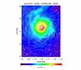
The SeaWinds instrument onboard NASA's QuikScat ocean-viewing satellite captured this image of Hurricane Dora in the eastern tropical Pacific Ocean on August 10, 1999, as it was blowing at speeds of nearly 40 meters per second (90 miles per hour).
PIA02404:
SeaWinds Radar Clocks Hurricane Dora's Wind Speeds
Full Resolution:     TIFF (1.118 MB)     JPEG (142.8 kB)
Add Image to Favorite List 1999-11-18 Earth TOPEX/Poseidon
Altimeter
902x900x3
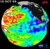
Mild La Niņa conditions -- with a stormy winter in the Pacific Northwest and a dry winter in the southwestern United States -- will be the likely outcome of sea-surface heights observed by NASA's TOPEX/Poseidon satellite in 1999.
PIA02436:
TOPEX/El Niņo Watch - La Niņa Conditions Likely to Prevail, October 10, 1999
Full Resolution:     TIFF (765.6 kB)     JPEG (113.1 kB)
Add Image to Favorite List 1999-12-01 Earth TOPEX/Poseidon
Altimeter
900x900x3
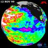
Unusually warm ocean temperatures off Asia and cool waters in the eastern and equatorial Pacific signaled La Niņa's mild return, according to sea-surface heights observed by the joint NASA-French space agency's TOPEX/Poseidon satellite.
PIA02437:
TOPEX/El Niņo Watch - Mild La Niņa Conditions Developing, November 12, 1999
Full Resolution:     TIFF (745.9 kB)     JPEG (117 kB)
Add Image to Favorite List 2002-10-25 Earth Shuttle Radar Topography Mission (SRTM)
C-Band Interferometric Radar
1152x870x3
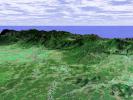
This perspective view from NASA's Shuttle Radar Topography Mission, acquired on February 2000, shows the Panama Canal with the Gulf of Panama in the foreground and the Caribbean Sea in the distance.
PIA03368:
Perspective View with Color-Coded Shaded Relief, Panama Canal
Full Resolution:     TIFF (1.584 MB)     JPEG (141.6 kB)
Add Image to Favorite List 1999-12-21 Earth Mariner Venus Mercury (Mariner 10)
922x749x3
The Earth and Moon were imaged by NASA's Mariner 10, launched on November 3, 1973, from 2.6 million km while completing the first ever Earth-Moon encounter by a spacecraft capable of returning high resolution digital color image data.
PIA02441:
Earth and Moon as Viewed by Mariner 10
Full Resolution:     TIFF (388.4 kB)     JPEG (32.07 kB)
Add Image to Favorite List 2000-01-21 Earth TOPEX/Poseidon
Altimeter
902x900x3
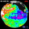
A giant horseshoe pattern of higher than normal sea-surface heights developed in 1998 and began to dominate the entire western Pacific and Asiatic oceans according to NASA's TOPEX/Poseidon satellite in 1999.
PIA02448:
TOPEX/El Niņo Watch - La Niņa Persistence May be Part of Larger Climate Pattern, January 8, 2000
Full Resolution:     TIFF (744.7 kB)     JPEG (115.1 kB)
Add Image to Favorite List 2000-03-11 Earth Terra
MISR
1383x512x3
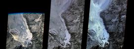
The first images taken by NASA's Multi-angle Imaging SpectroRadiometer (MISR) on February 24, 2000, show the winter landscape of James Bay, Ontario, Canada from three of the instrument's nine cameras.
PIA02450:
MISR's First Views of James Bay, Canada
Full Resolution:     TIFF (1.916 MB)     JPEG (146.1 kB)
Add Image to Favorite List 2000-03-11 Earth Terra
ASTER
2263x2027x1
This image of the San Francisco River channel, and its surrounding flood zone, in Brazil was acquired by band 3N of ASTER's Visible/Near Infrared sensor onboard NASA's Terra spacecraft.
PIA02451:
ASTER's First Views of San Francisco River, Brazil - Visible/near Infrared (VNIR) Image (monochrome)
Full Resolution:     TIFF (3.321 MB)     JPEG (256.2 kB)
Add Image to Favorite List 2000-03-11 Earth Terra
ASTER
2160x2251x1
This scene scene covers the Red Sea coastline to an inland area of Ethiopia. This image is from NASA's Terra spacecraft.
PIA02452:
ASTER's First Views of Red Sea, Ethiopia - Thermal-Infrared (TIR) Image (monochrome)
Full Resolution:     TIFF (2.76 MB)     JPEG (185.8 kB)
Add Image to Favorite List 2000-03-11 Earth Terra
ASTER
2288x2288x3
This image from NASA's Terra spacecraft is a color composite covering the Rift Valley inland area of Ethiopia.
PIA02453:
ASTER's First Views of Rift Valley, Ethiopia - Thermal-Infrared (TIR) Image (color)
Full Resolution:     TIFF (13.48 MB)     JPEG (231.5 kB)
Add Image to Favorite List 2000-05-07 Earth QuikScat
SeaWinds Scatterometer
3296x4267x3
The distribution of ocean surface winds over the Atlantic Ocean, based on September 1999 data from NASA's SeaWinds instrument on the QuikScat satellite, shows wind direction, superimposed on the color image indicating wind speed.
PIA02455:
SeaWinds Global Coverage with Detail of Hurricane Floyd
Full Resolution:     TIFF (1.921 MB)     JPEG (1.595 MB)
Add Image to Favorite List 2000-05-07 Earth QuikScat
SeaWinds Scatterometer
3296x4267x3
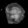
This image demonstrates the capability of the SeaWinds instrument on NASA's QuikScat satellite in monitoring both sea ice and ocean surface wind, thus helping to further our knowledge in wind-ice interaction and its effect on climate change.
PIA02456:
SeaWinds Wind-Ice Interaction
Full Resolution:     TIFF (1.974 MB)     JPEG (1.274 MB)
Add Image to Favorite List 2000-05-07 Earth QuikScat
SeaWinds Scatterometer
2638x2201x3
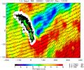
NASA's SeaWinds instrument on the QuikScat satellite shows winds are blocked by an island mountain barrier on South Georgia Island, in the South Atlantic Ocean in the year 2000.
PIA02457:
SeaWinds - South Georgia Island
Full Resolution:     TIFF (1.029 MB)     JPEG (1.018 MB)
Add Image to Favorite List 2000-05-08 Earth QuikScat
SeaWinds Scatterometer
2048x2048x3
The SeaWinds scatterometer on NASA's QuikScat satellite makes global radar measurements day and night, in clear sky and through clouds. Greenland and the polar ice cap are shown here on September 20, 1999.
PIA02458:
SeaWinds - Oceans, Land, Polar Regions
Full Resolution:     TIFF (934.2 kB)     JPEG (679.2 kB)
Add Image to Favorite List 2000-05-08 Earth QuikScat
SeaWinds Scatterometer
1452x1280x3
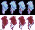
The frequent coverage provided by NASA's SeaWinds instrument on the QuikScat satellite in 1999 provided unprecedented capability to monitor daily and seasonal changes in the key melt zones of Greenland.
PIA02459:
SeaWinds - Greenland
Full Resolution:     TIFF (765.6 kB)     JPEG (205.7 kB)
Add Image to Favorite List 2000-05-07 Earth TOPEX/Poseidon
Altimeter
900x900x3
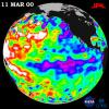
NASA's TOPEX/Poseidon data, collected over a 10-day sampling cycle from March 1 to 11, 2000, showed a La Niņa condition with sea surface heights reflecting unusual patterns of heat storage in the ocean.
PIA02460:
TOPEX/El Niņo Watch - La Niņa Still a "cool" Problem Child, March 23, 2000
Full Resolution:     TIFF (1.031 MB)     JPEG (123.2 kB)
Add Image to Favorite List 2002-10-25 Earth Landsat
Shuttle Radar Topography Mission (SRTM)
C-Band Interferometric Radar
Thematic Mapper
1152x870x3
This perspective view taken in February 2000 from NASA's Landsat and Shuttle Radar Topography Mission shows the capital city of San Jose, Costa Rica, the gray area in the center of the image.
PIA03367:
Perspective View with Landsat Overlay, San Jose, Costa Rica
Full Resolution:     TIFF (3.01 MB)     JPEG (210.8 kB)
Add Image to Favorite List 2011-11-10 Earth Terra
ASTER
4032x7962x3
NASA's Terra spacecraft acquired this image of flooding from the Chao Phraya River, Thailand on Nov. 8, 2011. The muddy water that had overflowed the banks of the river, flooding agricultural fields and villages, is seen in dark blue and blue-gray.
PIA15072:
NASA Spacecraft Depicts More Flooding in Thailand
Full Resolution:     TIFF (96.31 MB)     JPEG (4.98 MB)
Add Image to Favorite List 2002-10-25 Earth Landsat
Shuttle Radar Topography Mission (SRTM)
C-Band Interferometric Radar
Thematic Mapper
1152x870x3
This perspective view taken in February 2000 from NASA's Landsat and Shuttle Radar Topography Mission shows the Caribbean coastal plain of Costa Rica, with the Cordillera Central rising in the background.
PIA03366:
Perspective View with Landsat Overlay, Costa Rica
Full Resolution:     TIFF (3.01 MB)     JPEG (220.9 kB)
Add Image to Favorite List 2000-04-19 Earth Terra
MISR
1906x981x3
The stereo image at right is a downward-looking (nadir) view of the area around the San Cristobal volcano in Nicaragua taken by NASA's Terra satellite. 3D glasses are necessary to view this image.
PIA02600:
Nicaraguan Volcanoes, 26 February 2000
Full Resolution:     TIFF (4.239 MB)     JPEG (194.3 kB)
Add Image to Favorite List 2000-04-19 Earth Terra
MISR
1920x1079x3
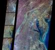
These images from NASA's Terra spacecraft show the (nadir) view of the eastern United States, stretching from Lake Ontario to northern Georgia, and spanning the Appalachian Mountains.
PIA02601:
Multi-Angle Views of the Appalachian Mountains, 6 March 2000
Full Resolution:     TIFF (5.067 MB)     JPEG (244.4 kB)
Add Image to Favorite List 2000-04-19 Earth Terra
MISR
2536x800x3
A multi-angle view of the Canary Islands in a dust storm, 29 February 2000. At left is a true-color image taken by the Multi-angle Imaging SpectroRadiometer (MISR) instrument on NASA's Terra satellite.
PIA02602:
Multi-Angle View of the Canary Islands
Full Resolution:     TIFF (3.681 MB)     JPEG (169 kB)
Add Image to Favorite List 2000-04-19 Earth Terra
MISR
1520x1264x3
These multi-angle images of Hudson Bay and James Bay, Canada, taken 24 February 2000 from NASA's Terra spacecraft, come from the downward-looking (nadir) camera on the MISR instrument onboard NASA's Terra satellite.
PIA02603:
Multi-angle Images of Hudson Bay and James Bay, Canada, 24 February 2000
Full Resolution:     TIFF (4.927 MB)     JPEG (370.2 kB)
Add Image to Favorite List 2000-04-26 Earth Terra
ASTER
2100x1445x3
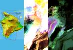
These images of the Island of Hawaii were acquired on March 19, 2000 by the Advanced Spaceborne Thermal Emission and Reflection Radiometer (ASTER) on NASA's Terra satellite.
PIA02604:
ASTER Images the Island of Hawaii
Full Resolution:     TIFF (7.393 MB)     JPEG (430.3 kB)
Add Image to Favorite List 2000-04-26 Earth Terra
ASTER
4100x4980x3
These images of the San Francisco Bay region were acquired on March 3, 2000 by the Advanced Spaceborne Thermal Emission and Reflection Radiometer (ASTER) on NASA's Terra satellite.
PIA02605:
ASTER Images San Francisco Bay Area
Full Resolution:     TIFF (36.23 MB)     JPEG (3.773 MB)
Add Image to Favorite List 2000-04-26 Earth Terra
ASTER
4100x5400x3
This image of the San Francisco Bay region was acquired on March 3, 2000 by the Advanced Spaceborne Thermal Emission and Reflection Radiometer (ASTER) on NASA's Terra satellite.
PIA02606:
ASTER Images San Francisco Bay Area
Full Resolution:     TIFF (54.36 MB)     JPEG (4.828 MB)
Add Image to Favorite List 2000-04-26 Earth Terra
ASTER
4100x6177x3
This image of the city of Tokyo was acquired on March 22, 2000 by the Advanced Spaceborne Thermal Emission and Reflection Radiometer (ASTER) on NASA's Terra satellite.
PIA02607:
ASTER Images Tokyo
Full Resolution:     TIFF (75.98 MB)     JPEG (12.25 MB)
Add Image to Favorite List 2000-04-26 Earth Terra
ASTER
1174x1447x3
On April 3, 2000, the Advanced Spaceborne Thermal Emission and Reflection Radiometer (ASTER) on NASA's Terra Satellite captured this image of the erupting Mt. Usu volcano in Hokkaido, Japan.
PIA02608:
ASTER Images Mt. Usu Volcano
Full Resolution:     TIFF (3.631 MB)     JPEG (681 kB)
Add Image to Favorite List 2000-06-20 Earth Terra
MISR
2220x2048x3
These multi-angle images of Delaware Bay, Chesapeake Bay, and the Appalachian Mountains, acquired 24 March 2000 from NASA's Terra spacecraft, come from the downward-looking (nadir) camera on the MISR instrument onboard NASA's Terra satellite.
PIA02609:
MISR Views Delaware Bay, Chesapeake Bay, and the Appalachian Mountains
Full Resolution:     TIFF (12.73 MB)     JPEG (862.5 kB)
Add Image to Favorite List 2000-06-20 Earth Terra
MISR
2548x3800x3
A plume from a large brush fire that burned about 15,000 acres in 2000 is visible at the western edge of the Big Cypress Swamp in southern Florida. NASA's Terra satellite captured acquired this image on April 9, 2000. 3D glasses are necessary.
PIA02610:
MISR Views Florida
Full Resolution:     TIFF (19.67 MB)     JPEG (1.364 MB)
Add Image to Favorite List 2000-07-08 Earth Terra
MISR
584x900x3
This anaglyph from NASA's Terra satellite's vertical (nadir) camera, shows Hurricane Carlotta's location in the eastern Pacific Ocean, about 500 km south of Puerto Vallarta, Mexico in 2000. 3D glasses are necessary to view this image.
PIA02611:
MISR Views Hurricane Carlotta
Full Resolution:     TIFF (1.25 MB)     JPEG (76.02 kB)
Add Image to Favorite List 2000-07-19 Earth Terra
MISR
1149x668x3
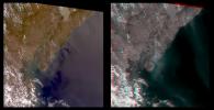
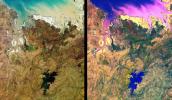
These images from NASA's Terra satellite are of tropical northern Australia acquired on June 1, 2000 (Terra orbit 2413) during the long dry season.
PIA02614:
MISR Views Northern Australia
Full Resolution:     TIFF (2.837 MB)     JPEG (182.9 kB)
Add Image to Favorite List 2000-07-26 Earth Terra
MISR
950x801x3
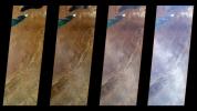
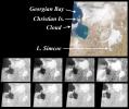
These images from NASA's Terra satellite are of the southeast portion of Georgian Bay in Ontario, Canada, acquired on March 6, 2000, during Terra orbit 1155.
PIA02615:
MISR View of Georgian Bay, Ontario, Canada
Full Resolution:     TIFF (1.027 MB)     JPEG (108.6 kB)
Add Image to Favorite List 2000-08-02 Earth Terra
MISR
959x861x3
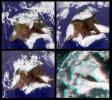
This stereo image from NASA's Terra satellite show the Mauna Kea and Mauna Loa volcanoes in Hawaii; a southern face of a line of cumulus clouds off the north coast of Hawaii is also visible. 3D glasses are necessary to view this image.
PIA02616:
MISR Views the Big Island of Hawaii
Full Resolution:     TIFF (2.201 MB)     JPEG (145.4 kB)
Add Image to Favorite List 2000-08-09 Earth Terra
MISR
1152x550x3
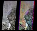
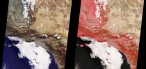
These images from NASA'sTerra satellite are of Southern California acquired on March 14, 2000 during Terra orbit 1273. North is at the top.
PIA02617:
MISR Views Southern California
Full Resolution:     TIFF (1.832 MB)     JPEG (106.9 kB)
Retrieve Previous Set  Jump to a Previous Set   Jump to a Previous Set   Current Set   Jump to a Following Set   Jump to a Following Set   Jump to a Following Set   Jump to a Following Set   Jump to a Following Set   Jump to a Following Set   Jump to a Following Set   Retrieve Next Set 
 1-100   101-200   201-300   301-400   401-500   501-600   601-700   701-800   801-900   901-1000 
Currently displaying images: 201 - 300 of 2308