- Original Caption Released with Image:
-
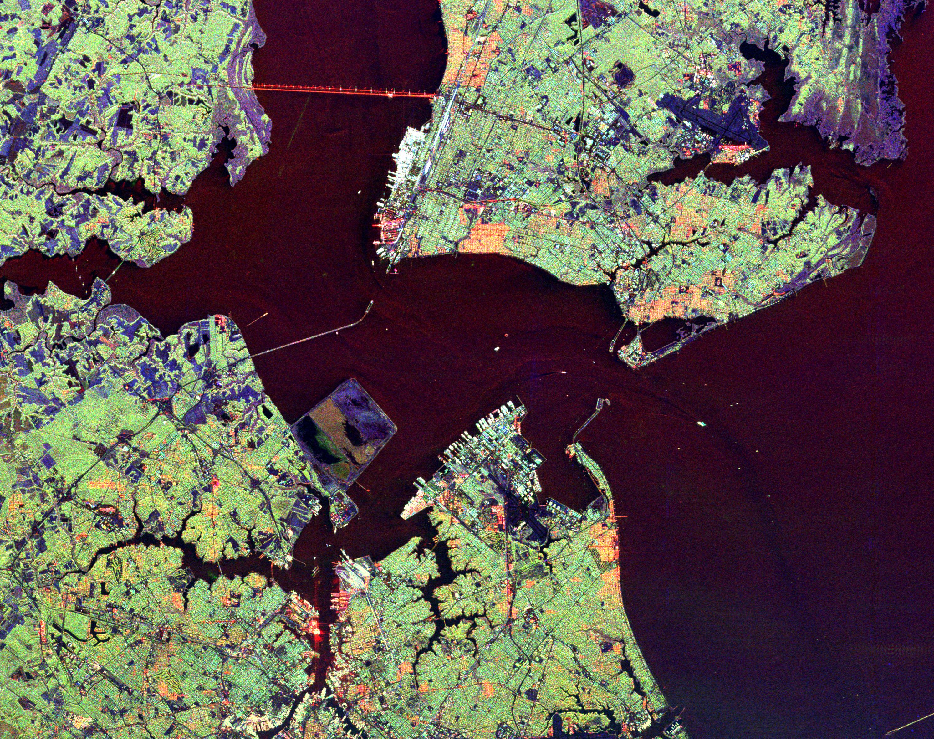
This radar image shows the Hampton Roads, Virginia region, where the James River (upper left center) flows into the Chesapeake Bay. The city of Norfolk is the bright area on the peninsula in the lower center. Norfolk is home to a large naval base, part of which can be seen as the bright white port facilities near the center of the image. The cities of Hampton and Newport News occupy the peninsula in the upper right of the image. The dark blue areas on this peninsula are the runways of Langley Air Force Base, which also houses NASA's Langley Research Center. Forested areas, including suburbs, appear as green on the image. Cities appear as green, white and orange. The purple areas along the shorelines are wetlands; blue areas are cleared for agricultural use. Faint ship wakes can be seen in the water behind ships entering and leaving Hampton Roads. Scientists are using radar images like this one to study delicate coastal environments and the effects of urbanization and other human activities on the ecosystem and landscape.
The image was acquired by the Spaceborne Imaging Radar-C/X-band Synthetic Aperture (SIR-C/X-SAR) imaging radar when it flew aboard the space shuttle Endeavour on October 5, 1994. The image is centered at 36.9 degrees north latitude, 76.4 degrees west longitude. North is towards the upper right. The area shown is 37 kilometers by 29 kilometers (23 miles by 18 miles). Colors are assigned to different frequencies and polarizations of the radar as follows: red is L-band horizontally transmitted, horizontally received; green is L-band horizontally transmitted, vertically received; blue is C-band horizontally transmitted, vertically received. SIR-C/X-SAR, a joint mission of the German, Italian and United States space agencies, is part of NASA's ongoing Mission to Planet Earth program.
- Image Credit:
-
NASA/JPL
Image Addition Date: -
1999-04-15
|
 Planetary Data System


