- Original Caption Released with Image:
-
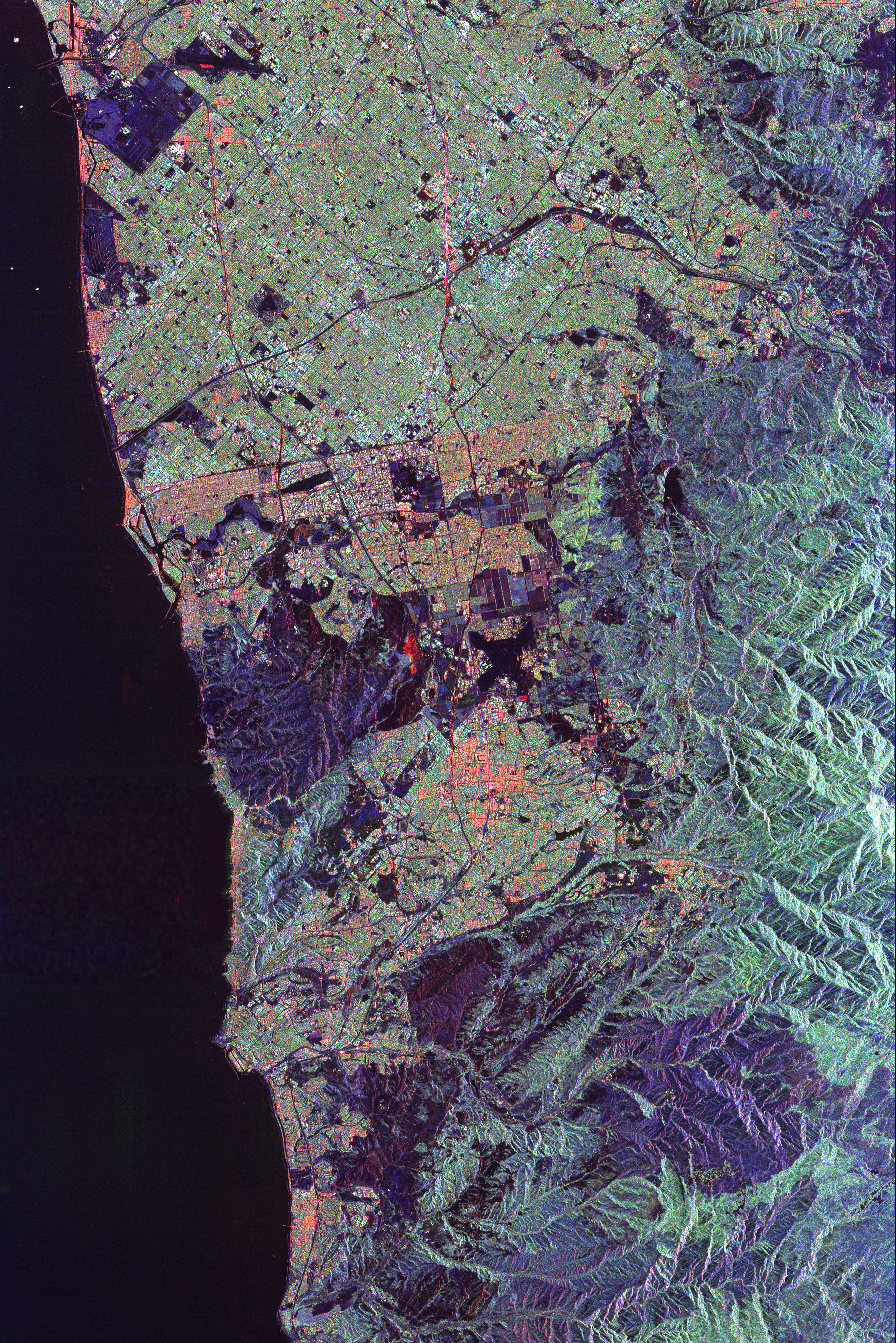
This spaceborne radar image of Orange County, Calif., shows the massive urbanization of this rapidly growing region located just south of Los Angeles. Orange County, sandwiched between rugged mountains and the Pacific Ocean, includes the communities of Anaheim, Santa Ana and Huntington Beach. Anaheim Stadium can be seen in the upper center of the image, as a small white ring to the right of a major freeway intersection. The large dark blue rectangular area in the upper left is the Seal Beach Naval Weapons Station and adjacent wildlife refuge. Runways of the El Toro Marine Air Station appear as a black "x" near the center of the image. The large purple area to the left of the Air Station and extending to the coast is the scar left by the Laguna wildfire of October 1993. The sparse vegetation left in the wake of the fire provides a weak source of radar echoes, making the burn areas distinctively dark in the image. Another large burn area, from the Ortega fire of 1993, is seen in the mountains in the lower right of the image.
The image was acquired by the Spaceborne Imaging Radar-C/X-band Synthetic Aperture Radar (SIR-C/X-SAR) onboard the space shuttle Endeavour on October 3, 1994. The image is centered at 33.7 degrees north latitude and 117.7 degrees west longitude. North is toward the upper right. The image shows an area 66.2 kilometers by 44.2 kilometers (41.0 miles by 27.4 miles). The colors are assigned todifferent frequencies and polarizations of the radar as follows: red is L-band, horizontally transmitted, horizontally received; green is L-band, horizontally transmitted, vertically received; blue is C-band, horizontally transmitted, vertically received. SIR-C/X-SAR, a joint mission of the German, Italian and United States space agencies, is part of NASA's Mission to Planet Earth program.
- Image Credit:
-
NASA/JPL
Image Addition Date: -
1999-05-01
|
 Planetary Data System


