- Original Caption Released with Image:
-
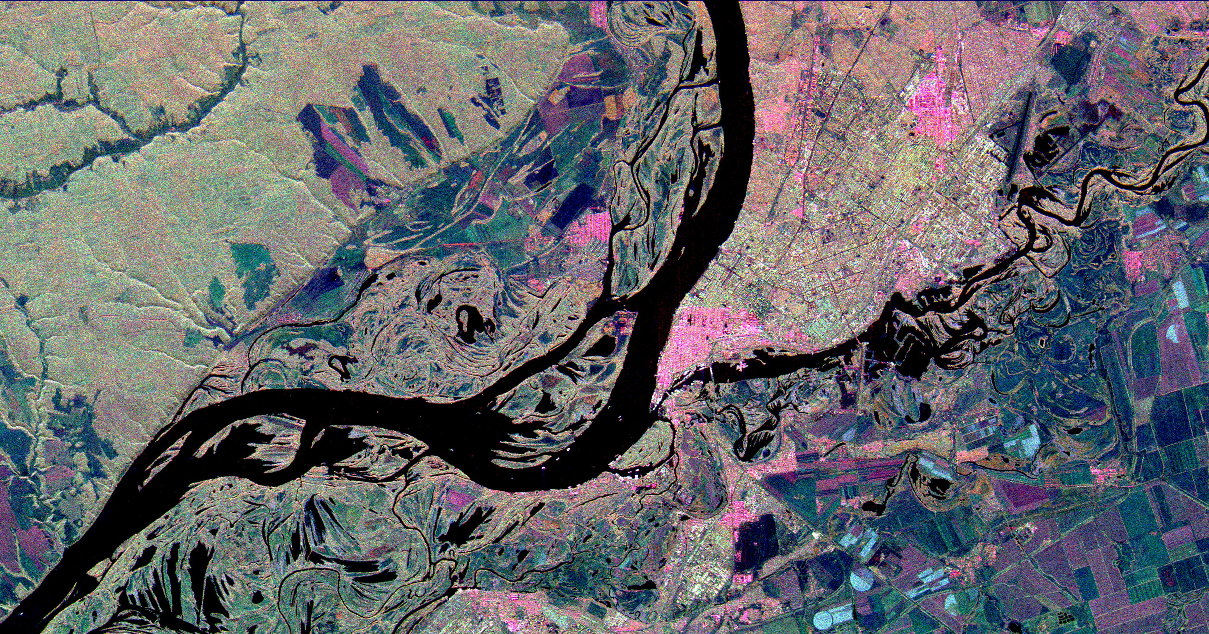
This three-frequency space radar image shows the city of Samara, Russia in pink and light green right of center. Samara is at the junction of the Volga and Samara Rivers approximately 800 kilometers (500 miles) southeast of Moscow. The wide river in the center of the image is the Volga. Samara, formerly Kuybyshev, is a busy industrial city known for its chemical, mechanical and petroleum industries. Northwest of the Volga (upper left corner of the image) are deciduous forests of the Samarskaya Luka National Park. Complex patterns in the floodplain of the Volga are caused by "cut-off" lakes and channels from former courses of the meandering river. The three radar frequencies allow scientists to distinguish different types of agricultural fields in the lower right side of the image. For example, fields which appear light blue are short grass or cleared fields. Purple and green fields contain taller plants or rough plowed soil. Scientists hope to use radar data such as these to understand the environmental consequences of industrial, agricultural and natural preserve areas coexisting in close proximity.
This image is 50 kilometers by 26 kilometers (31 by 16 miles) and is centered at 53.2 degrees north latitude, 50.1 degrees east longitude. North is toward the top of the image. The colors are assigned to different radar frequencies and polarizations as follows: red is L-band, horizontally transmitted and received; green is C-band, horizontally transmitted and vertically received; and blue is X-band, vertically transmitted and received.
The image was acquired by the Spaceborne Imaging Radar-C/X-band Synthetic Aperture Radar (SIR-C/X-SAR) on October 1, 1994 onboard the space shuttle Endeavour. SIR-C/X-SAR, a joint mission of the German, Italian and the United States space agencies, is part of NASA's Mission to Planet Earth.
- Image Credit:
-
NASA/JPL
Image Addition Date: -
1999-04-15
|
 Planetary Data System


