PDS logoPlanetary Data System
PDS Information
Find a Node - Use these links to navigate to any of the 8 publicly accessible PDS Nodes.

This bar indicates that you are within the PDS enterprise which includes 6 science discipline nodes and 2 support nodes which are overseen by the Project Management Office at NASA's Goddard Space Flight Center (GSFC). Each node is led by an expert in the subject discipline, supported by an advisory group of other practitioners of that discipline, and subject to selection and approval under a regular NASA Research Announcement.
Click here to return to the Photojournal Home Page Click here to view a list of Photojournal Image Galleries Photojournal_inner_header
Latest Images  |  Spacecraft & Technology  |  Animations  |  Space Images App  |  Feedback  |  Photojournal Search  
My Favorite Images from the Planetary Photojoural
I have 7 images in my list


The first time you select an image to My List, a separate browser window will open. This page will list the set of images you have selected as favorites from the Photojournal. This list is kept for a short period of time, approximately 60 days. The way we associate you with your list is through a persistent cookie left on your computer. This cookie is nothing more than a unique key that allows the Photojournal to make this association. Once created, this list is only modifiable from the same computer. Information stored in the cookie on your computer is used by the Photojournal server only during your session. If you configure your Web browser not to use cookies, you will not be able to create and refer back to a personal list of favorite images. To view your current list, click on a marked entry for your list from the catalog page, or add another favorite. For more information, see JPL's Privacy Policy.
My
List
Catalog # Target Mission Instrument Addition Date Size
Remove Image from Favorite List PIA02932 Eros NEAR Shoemaker
Multi-Spectral Imager
2000-07-06 472x352x1
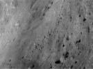
This image of asteroid Eros, taken by NASA's NEAR Shoemaker on June 19, 2000, shows an oblique view of the wall of Eros' saddle. Bright patches may originate from exposure of subsurface material that hasn't been darkened by small impacts and solar wind.
Title:
Salt Water Taffy
Remove Image from Favorite List PIA05852 Mars Mars Exploration Rover (MER)
Navigation Camera
2004-05-03 2726x989x1
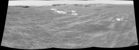
This image from NASA's Mars Rover Opportunity shows the rover's view of Meridiani Planum as it headed to Endurance Crater on Mars.
Title:
Almost There!
Remove Image from Favorite List PIA06873 Earth Terra
ASTER
2004-09-22 870x390x3
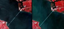
Interstate 10 across Pensacola Bay, Florida was severely damaged by Hurricane Ivan. This image was acquired by NASA's Terra satellite on September 21, 2004.
Title:
Damage by Hurricane Ivan over Pensacola Bay, Florida
Remove Image from Favorite List PIA20011 Enceladus Cassini-Huygens
ISS - Narrow Angle
2015-10-15 1020x1020x1
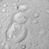
NASA's Cassini spacecraft spied this tight trio of craters as it approached Saturn's icy moon Enceladus for a close flyby on Oct. 14, 2015. The craters, located at high northern latitudes, are sliced through by thin fractures.
Title:
Saturnian Snowman
Remove Image from Favorite List PIA02413 Mercury Mariner Venus Mercury (Mariner 10)
1999-10-07 300x352x1
After passing Mercury the first time and making a trip around the Sun, NASA's Mariner 10 again flew by Mercury on Sept. 21, 1974. This encounter brought the spacecraft in front of Mercury in the southern hemisphere.
Title:
Hero Rupes Scarp
Remove Image from Favorite List PIA03743 Mars 2001 Mars Odyssey
THEMIS
2002-12-07 734x1024x3
Simultaneous infrared and visible images taken byNASA's Mars Odyssey show the Martian south polar cap in late summer. The black areas are at a temperature near -125 degrees Celsius (-193 degrees Fahrenheit) and correspond to solid carbon dioxide ice.
Title:
Mars' South Polar Cap in Summer
Remove Image from Favorite List PIA01830 Earth Spaceborne Imaging Radar-C/X-Band Synthetic Aperture Radar
1999-04-15 3321x2916x3
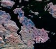
This radar image from NASA's Spaceborne Imaging Radar C/X-Band Synthetic Aperture Radar shows the southern end of Vancouver Island on the west coast of Canada. The white area is the city of Victoria, the capital of the province of British Columbia.
Title:
Space Radar Image of Victoria, Canada