- Original Caption Released with Image:
-
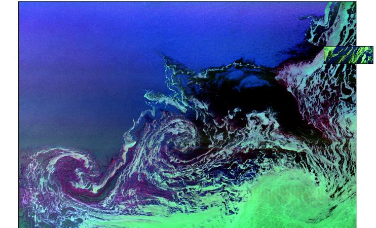
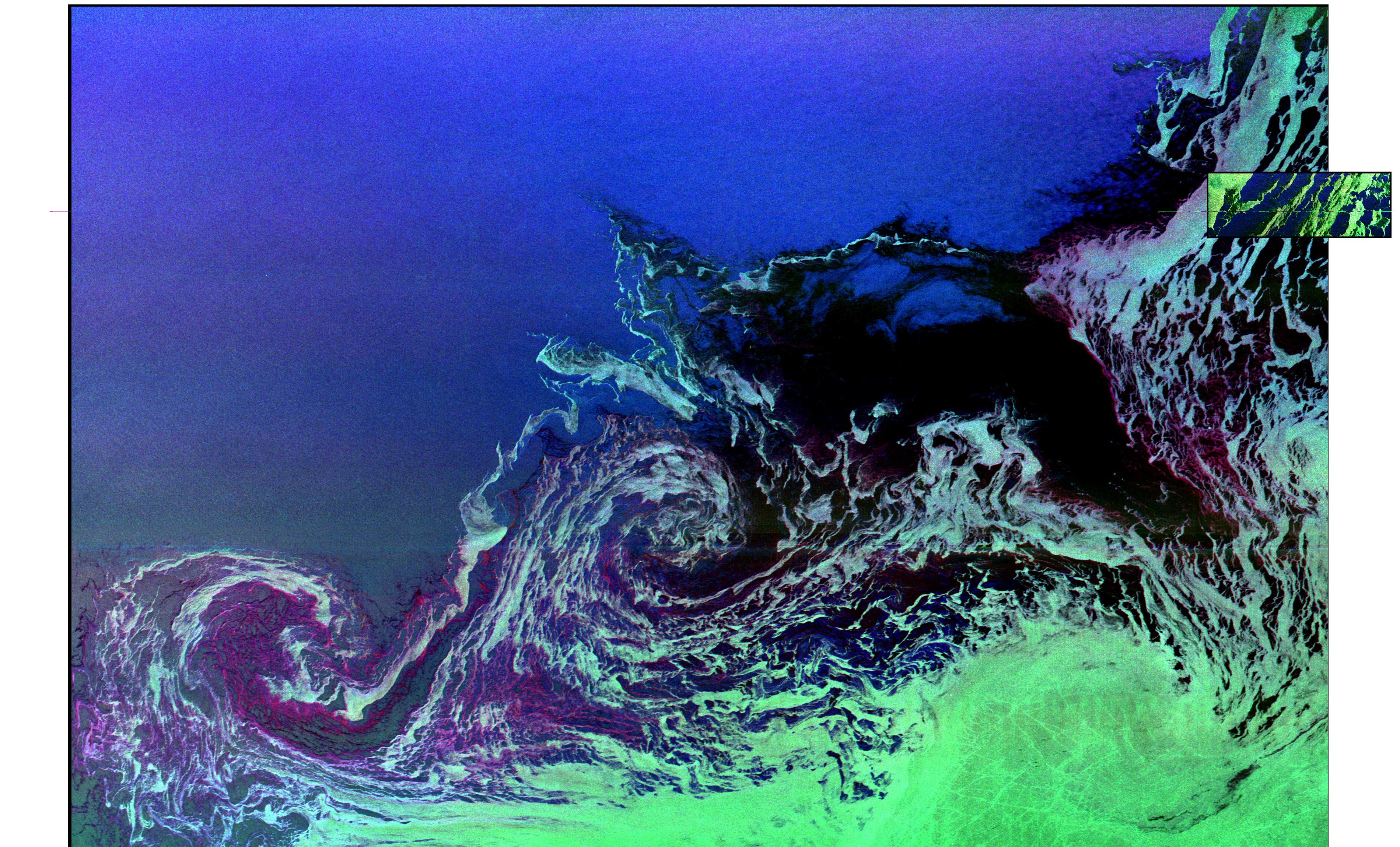
Two radar images are shown in this composite to compare the size of a standard spaceborne radar image (small inset) to the image that is created when the radar instrument is used in the ScanSAR mode (large image). The predominant image shows two large ocean circulation features, called eddies, at the northernmost edge of the sea ice pack in the Weddell Sea, off Antarctica. The eddy processes in this region play an important role in the circulation of the global ocean and the transportation of heat toward the pole. The large image is the first wide-swath, multi-frequency, multi-polarization radar image ever processed. To date, no other spaceborne radar sensors have obtained swaths exceeding 100 kilometers (62 miles) in width.
This developmental image was produced at NASA's Jet Propulsion Laboratory by the Alaska SAR Facility's ScanSAR processor system, using radar data obtained on October 5, 1994, during the second flight of the Spaceborne Imaging Radar C/X-Band Synthetic Aperture Radar (SIR-C/X-SAR) onboard the space shuttle Endeavour. The image is oriented approximately east-west, with a center location of around 56.6 degrees south latitude and 6.5 degrees west longitude. Image dimensions are 240 km by 350 km (149 miles by 218 miles). The smaller image inset (upper right edge) was obtained by SIR-C/X-SAR on October 6, 1994, and covers a portion of the same ice features that are shown in the large image. The inset image dimensions are 18 km by 50 km (11 miles by 31 miles). The ocean eddies have a clockwise (or cyclonic) rotation and are roughly 40 km to 60 km (25 miles to 37 miles) in diameter. The dark areas are new ice and the lighter green areas are small sea-ice floes that are swept along by surface currents; both of these areas are shown within the eddies and to the south of the eddies. First year seasonal ice, typically 0.5 meter to 0.8 meter (1.5 feet to 2.5 feet) thick, is shown in the darker green area in the lower right corner. The open ocean to the north is uniformly bright and appears blue, due to high winds making the surface rough. The colors in both images were obtained using the following radar channels: red is C-band vertically transmitted and vertically received; green is L-band horizontally transmitted and vertically received; and blue is L-band vertically transmitted and vertically received.
The ScanSAR processor is being designed for implementation in 1996 at NASA's Alaska SAR Facility, located at the University of Alaska, Fairbanks, and will produce digital images from the forthcoming Canadian RADARSAT satellite, since its C-band horizontally transmitted, horizontally received polarization radar routinely obtains data over a considerable range of swath-widths and resolutions, including the important wide-swath (300 km to 500 km/186 miles to 310 miles) mode.
- Image Credit:
-
NASA/JPL
Image Addition Date: -
1999-04-15
|
 Planetary Data System


