- Original Caption Released with Image:
-
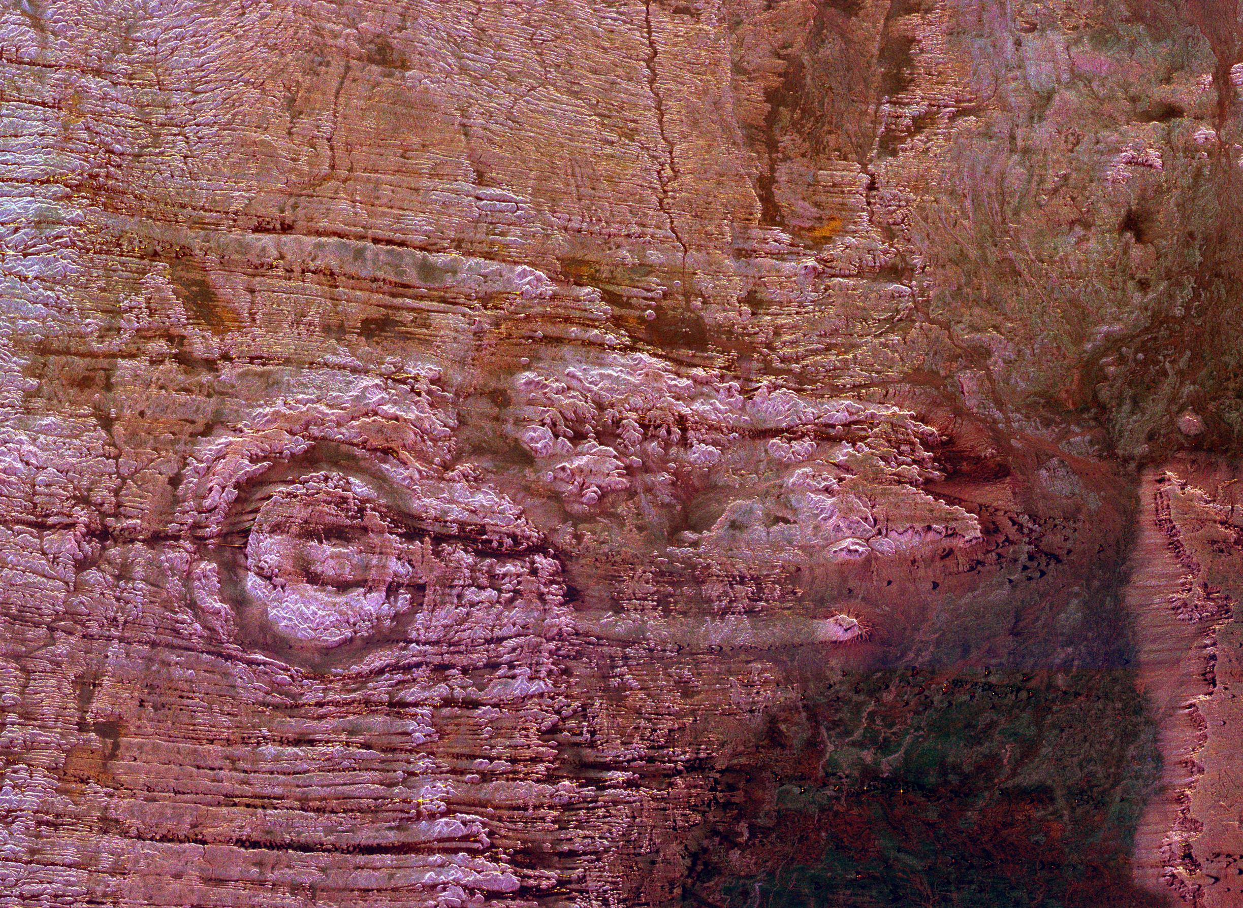
The impact of an asteroid or comet several hundred million years ago left scars in the landscape that are still visible in this spaceborne radar image of an area in the Sahara Desert of northern Chad. The concentric ring structure left of center is the Aorounga impact crater with a diameter of about 17 kilometers (10.5 miles). Scientists are using radar images to investigate the possibility that Aorounga formed as part of a multiple impact event. A proposed second crater, similar in size to the main structure, appears as a circular trough surrounding a central peak in the center of the image. A third structure, also about the same size, is seen as a dark, partial circular trough with a possible central structure in the right center of the image. The proposed crater "chain" could have formed when a 1 km to 2 km (0.5 mile to 1 mile) diameter object broke apart before impact. The dark streaks are deposits of windblown sand that migrate along valleys cut by thousands of years of wind erosion. Radar imaging is a valuable tool for the study of desert regions because the radar waves can penetrate thin layers of dry sand to reveal details of geologic structure that are invisible to other sensors.
The image was acquired by the Spaceborne Imaging Radar-C/X-band Synthetic Aperture Radar (SIR-C/X-SAR) on April 18 and 19, 1994, onboard the space shuttle Endeavour. The area shown is 45 kilometers by 61 kilometers (28 miles by 38 miles) and is centeredat 19.25 degrees north latitude, 19.25 degrees east longitude. North is toward the upper right. The colors are assigned to differentradar frequencies and polarizations as follows: red is L-band, horizontally transmitted and received; green is C-band, horizontallytransmitted and received; and blue is C-band, horizontally transmitted,vertically received. SIR-C/X-SAR, a joint mission of the German, Italian and United States space agencies, is part of NASA's Mission to Planet Earth program.
- Image Credit:
-
NASA/JPL
Image Addition Date: -
1999-04-15
|
 Planetary Data System


