New maps of two recent California megafires that combine unique data sets from the U.S. Forest Service and NASA's Jet Propulsion Laboratory in Pasadena, California, are answering some of the urgent questions that follow a huge wildfire.
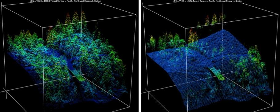
These before-and-after USFS LIght Detection And Ranging (LIDAR) images from the 2014 King fire region in El Dorado National Forest, California are among new maps. They show a small section of the Rubicon River drainage basin, where fire damage was severe. Blue indicates ground level; lighter colors are higher. A road -- bordered by dense trees in the before image at left -- and part of a bridge are in the center, with the bridge appearing green.