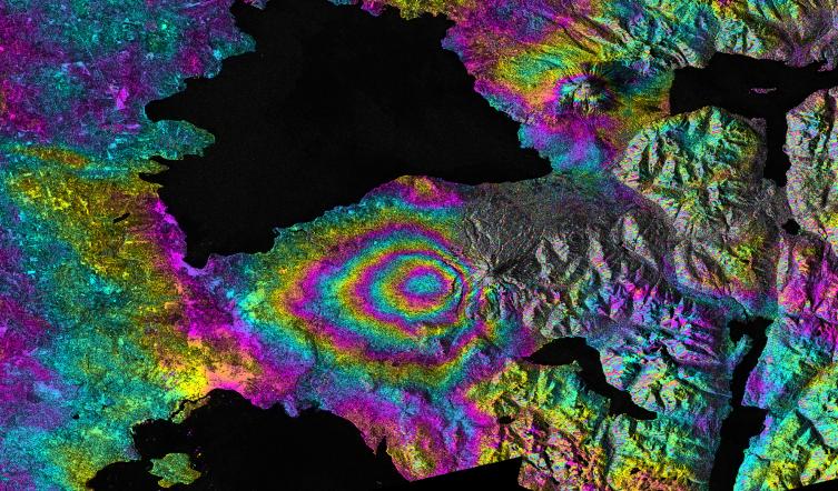
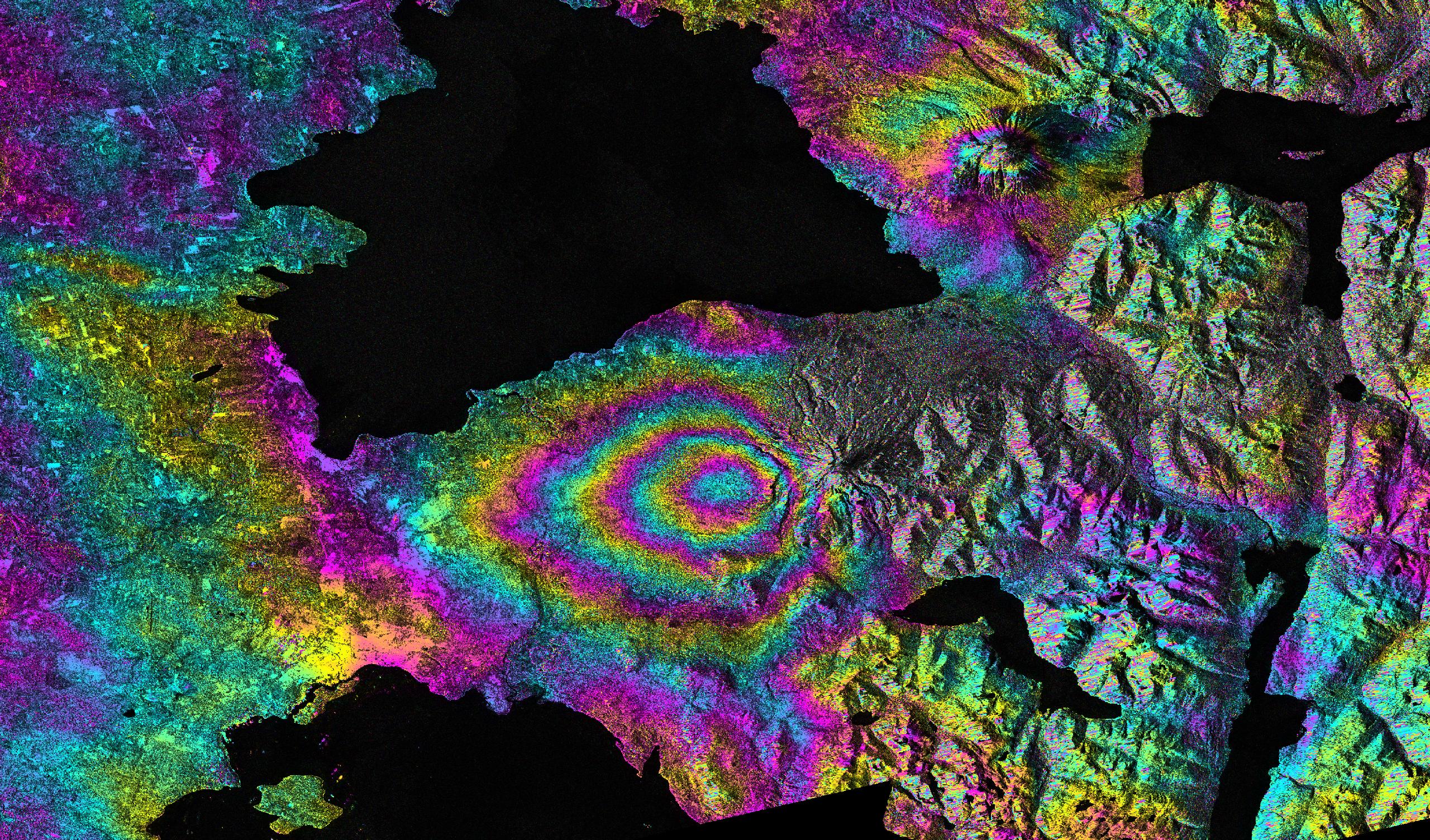
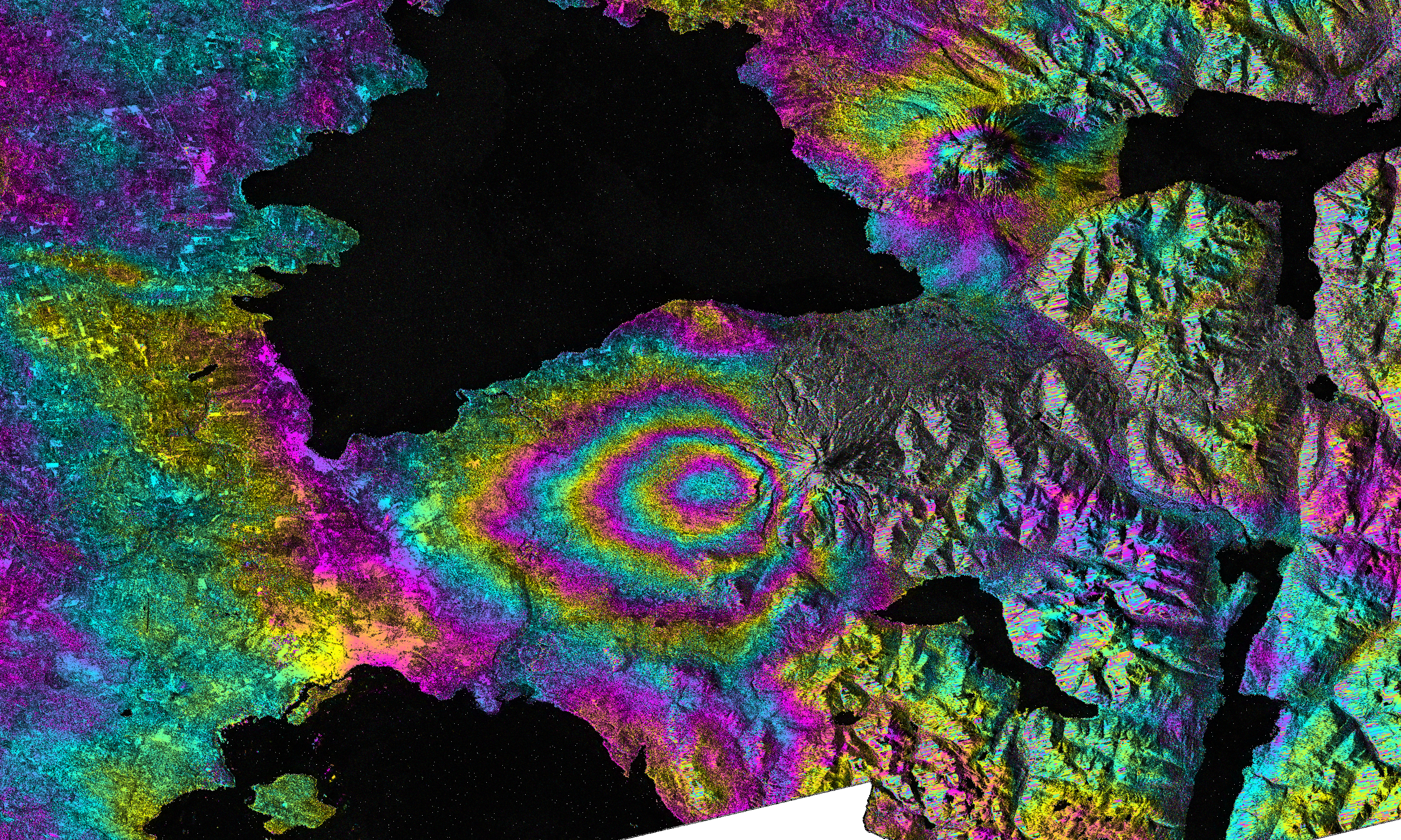
On April 22-23, 2015, significant explosive eruptions occurred at Calbuco volcano, Chile. This was the first eruptive activity at Calbuco since 1972. A satellite interferometric synthetic aperture radar image was created by Paul Lundgren of NASA's Jet Propulsion Laboratory in Pasadena, Calif., using data acquired from the European Space Agency's (ESA) Sentinel-1 radar satellite's C-SAR sensor. This image depicts the relative deformation of Earth's surface using radar data acquired on April 14 and 26, 2015, that span the eruption. The concentric, "leaf-shaped" pattern of fringes (color cycles) lies to the west of Calbuco volcano and represents subsidence of the ground surface due to deflation of a buried magma reservoir. The black areas in the image represent water, to the north lies Lago Llanquihue and to the south lies Puerto Montt Bay (Pacific Ocean).
The full-resolution data for this interferogram can be displayed in Google Earth. You will need to download both the km file and the png image.