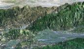
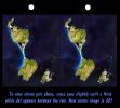
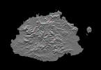
Your search criteria found 2614 images
Target is Earth (and available satellites)
Go to PIAxxxxx:
Refine this list of images by:
Target:
Mission:
Spacecraft:
Instrument:
Click on an image for detailed information
Click on a column heading to sort in ascending or descending order
My
List
Addition Date TargetSort Ascending Mission Instrument Size
Add Image to Favorite List 2000-02-17 Earth Shuttle Radar Topography Mission (SRTM)
C-Band Interferometric Radar
1357x982x3
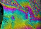
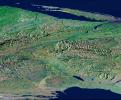
This topographic radar image acquired by NASA's Shuttle Radar Topography Mission in Feb. 2000 shows the relationships of the dense urban development of Los Angeles, Calif. and the natural contours of the land.
PIA02713:
Los Angeles, California, Radar Image, Wrapped Color as Height
Full Resolution:     TIFF (1.232 MB)     JPEG (587.3 kB)
Add Image to Favorite List 2000-02-17 Earth Shuttle Radar Topography Mission (SRTM)
C-Band Interferometric Radar
1749x4787x3
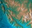
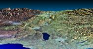
This topographic map acquired by NASA's Shuttle Radar Topography Mission from data collected on February 16, 2000 vividly displays California's famous San Andreas Fault along the southwestern edge of the Mojave Desert, Calif.
PIA02714:
San Andreas Fault, Southern California , Radar Image, Wrapped Color as Height
Full Resolution:     TIFF (7.228 MB)     JPEG (3.292 MB)
Add Image to Favorite List 2000-02-17 Earth Shuttle Radar Topography Mission (SRTM)
C-Band Interferometric Radar
1228x1093x3
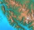
This topographic radar image acquired by NASA's Shuttle Radar Topography Mission from data collected on February 16, 2000 shows the relationship of the urban area of Pasadena, California to the natural contours of the land.
PIA02715:
San Gabriel Mountains, California, Radar Image, Color as Height
Full Resolution:     TIFF (3.906 MB)     JPEG (326.9 kB)
Add Image to Favorite List 2000-02-17 Earth Shuttle Radar Topography Mission (SRTM)
C-Band Interferometric Radar
1228x1093x3
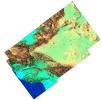
This topographic acquired by NASA's Shuttle Radar Topography Mission from data collected on February 16, 2000 shows the relationship of the urban area of Pasadena, California to the natural contours of the land.
PIA02716:
San Gabriel Mountains, California, Shaded relief, Color as Height
Full Resolution:     TIFF (4.009 MB)     JPEG (232.8 kB)
Add Image to Favorite List 2000-02-18 Earth Landsat
Shuttle Radar Topography Mission (SRTM)
C-Band Interferometric Radar
Thematic Mapper
1363x2200x3
This three-dimensional perspective view, looking up the Tigil River, acquired by NASA's Shuttle Radar Topography Mission from data collected on February 16, 2000, shows the western side of the volcanically active Kamchatka Peninsula, Russia.
PIA02717:
Kamchatka Peninsula, Russia 3-D Perspective with Landsat Overlay
Full Resolution:     TIFF (8.536 MB)     JPEG (860.9 kB)
Add Image to Favorite List 2000-02-18 Earth Landsat
Shuttle Radar Topography Mission (SRTM)
C-Band Interferometric Radar
Thematic Mapper
1939x1999x3
This perspective view, acquired by NASA's Shuttle Radar Topography Mission in Feb. 2000, shows the western part of the city of Pasadena, California, looking north towards the San Gabriel Mountains.
PIA02718:
Pasadena, California Perspective View with Aerial Photo and Landsat Overlay
Full Resolution:     TIFF (10.26 MB)     JPEG (872.3 kB)
Add Image to Favorite List 2000-03-13 Earth Shuttle Radar Topography Mission (SRTM)
C-Band Interferometric Radar
2496x2447x3
'From the desert to the mountains to the sea,' this image acquired by NASA's Shuttle Radar Topography Mission in Feb. 2000, shows in striking detail the varied topography of Southern California.
PIA02719:
Southern California Shaded Relief, Color as Height
Full Resolution:     TIFF (8.636 MB)     JPEG (654 kB)
Add Image to Favorite List 2000-02-18 Earth Shuttle Radar Topography Mission (SRTM)
C-Band Interferometric Radar
1856x1852x3
This topographic radar image acquired by NASA's Shuttle Radar Topography Mission in Feb. 2000 shows the city of Honolulu, Hawaii and adjacent areas on the island of Oahu. Honolulu lies on the south shore of the island.
PIA02720:
Honolulu, Hawaii Radar Image, Wrapped Color as Height
Full Resolution:     TIFF (2.443 MB)     JPEG (1.319 MB)
Add Image to Favorite List 2000-02-18 Earth Shuttle Radar Topography Mission (SRTM)
C-Band Interferometric Radar
737x797x3
This anaglyph shows NASA's Jet Propulsion Laboratory (JPL) in Pasadena, California as seen by the instrument onboard NASA's Shuttle Radar Topography Mission. 3D glasses are necessary to view this image.
PIA02721:
Pasadena, California Anaglyph with Aerial Photo Overlay
Full Resolution:     TIFF (1.749 MB)     JPEG (218.8 kB)
Add Image to Favorite List 2000-02-19 Earth Shuttle Radar Topography Mission (SRTM)
C-Band Interferometric Radar
1793x1314x1
This radar image acquired by NASA's Shuttle Radar Topography Mission from data collected on February 18, 2000 shows the Dallas-Fort Worth metropolitan area in Texas.
PIA02722:
C-Band Radar Imagery, Dallas-Fort Worth, Texas
Full Resolution:     TIFF (2.885 MB)     JPEG (804.4 kB)
Add Image to Favorite List 2000-02-19 Earth Shuttle Radar Topography Mission (SRTM)
C-Band Interferometric Radar
2273x1515x3
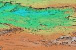
This topographic radar image acquired by NASA's Shuttle Radar Topography Mission in Feb. 2000 shows the Lanai (left) and western Maui (right) islands of Hawaii.
PIA02723:
Radar Image, Wrapped Color as Height, Lanai and West Maui, Hawaii
Full Resolution:     TIFF (1.881 MB)     JPEG (676.5 kB)
Add Image to Favorite List 2000-02-19 Earth Shuttle Radar Topography Mission (SRTM)
C-Band Interferometric Radar
1319x1062x3
This perspective view acquired by NASA's Shuttle Radar Topography Mission from data collected on February 18, 2000 shows three Hawaiian islands: Molokai (lower left), Lanai (right), and the northwest tip of Maui (upper left).
PIA02724:
Perspective View, Radar Image, Color as Height, Molokai, Lanai and Maui, Hawaii
Full Resolution:     TIFF (1.541 MB)     JPEG (141.2 kB)
Add Image to Favorite List 2000-02-19 Earth Shuttle Radar Topography Mission (SRTM)
C-Band Interferometric Radar
1877x1676x3
This radar image acquired by NASA's Shuttle Radar Topography Mission from data collected on February 15, 2000 includes the city of Salalah, the second largest city in Oman.
PIA02725:
Radar Image, Color as Height , Salalah, Oman
Full Resolution:     TIFF (6.929 MB)     JPEG (809.5 kB)
Add Image to Favorite List 2000-02-20 Earth Shuttle Radar Topography Mission (SRTM)
C-Band Interferometric Radar
1965x1347x3
This topographic image acquired by NASA's Shuttle Radar Topography Mission from data collected on February 15, 2000, of Patagonia, Argentina shows a spectacular landscape formed by volcanoes, rivers, and wind.
PIA02726:
Shaded relief, color as height Patagonia, Argentina
Full Resolution:     TIFF (9.036 MB)     JPEG (857.3 kB)
Add Image to Favorite List 2000-02-20 Earth Landsat
Shuttle Radar Topography Mission (SRTM)
C-Band Interferometric Radar
Thematic Mapper
1430x1152x3
This perspective view, acquired by NASA's Shuttle Radar Topography Mission in Feb. 2000, shows Honolulu, on the island of Oahu.
PIA02727:
Perspective view, Landsat Overlay Oahu, Hawaii
Full Resolution:     TIFF (2.192 MB)     JPEG (217.2 kB)
Add Image to Favorite List 2002-10-25 Earth Landsat
Shuttle Radar Topography Mission (SRTM)
C-Band Interferometric Radar
Thematic Mapper
1152x870x3
This perspective view acquired by NASA's Shuttle Radar Topography Mission from data collected in the year 2000 shows Lakes Managua and Nicaragua near the Pacific coast of Nicaragua.
PIA03365:
Perspective View with Landsat Overlay, Lakes Managua and Nicaragua
Full Resolution:     TIFF (2.87 MB)     JPEG (172 kB)
Add Image to Favorite List 2000-02-20 Earth Landsat
Shuttle Radar Topography Mission (SRTM)
C-Band Interferometric Radar
Thematic Mapper
940x658x3
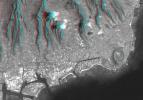
This anaglyph, from NASA's Shuttle Radar Topography Mission, is of Honolulu, on the island of Oahu .3D glasses are necessary to view this image.
PIA02728:
Anaglyph, Landsat overlay Honolulu, Hawaii
Full Resolution:     TIFF (1.436 MB)     JPEG (112.3 kB)
Add Image to Favorite List 2000-02-20 Earth Shuttle Radar Topography Mission (SRTM)
C-Band Interferometric Radar
1634x1072x3
This perspective view acquired by NASA's Shuttle Radar Topography Mission from data collected in the year 2000 shows Patagonia, Argentina, a spectacular landscape formed by volcanoes, rivers, and wind.
PIA02729:
Perspective view of shaded relief, color as height, Patagonia, Argentina
Full Resolution:     TIFF (5.989 MB)     JPEG (459.9 kB)
Add Image to Favorite List 2000-02-21 Earth Shuttle Radar Topography Mission (SRTM)
C-Band Interferometric Radar
1252x2352x1
This radar image acquired by NASA's Shuttle Radar Topography Mission from data collected on February 16, 2000 shows the San Francisco Bay Area in California. Bay, lakes, roads and airport runways appear dark; buildings and trees appear bright.
PIA02730:
Radar image San Francisco Bay Area, California
Full Resolution:     TIFF (3.475 MB)     JPEG (874.5 kB)
Add Image to Favorite List 2000-02-21 Earth Shuttle Radar Topography Mission (SRTM)
C-Band Interferometric Radar
1929x1800x3
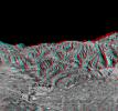
This anaglyph, from NASA's Shuttle Radar Topography Mission, is of Pasadena, California, looking north toward the San Gabriel Mountains. 3D glasses are necessary to view this image.
PIA02731:
Anaglyph of Perspective View with Aerial Photo Overlay Pasadena, California
Full Resolution:     TIFF (6.552 MB)     JPEG (663.3 kB)
Add Image to Favorite List 2000-02-21 Earth Shuttle Radar Topography Mission (SRTM)
C-Band Interferometric Radar
1603x1181x3
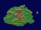
This image from NASA's Shuttle Radar Topography Mission shows Viti Levu, in the Sovereign Democratic Republic of the Fiji Islands, an independent nation consisting of some 332 islands surrounding the Koro Sea in the South Pacific Ocean.
PIA02732:
Shaded relief, color as height, Fiji
Full Resolution:     TIFF (1.396 MB)     JPEG (328.6 kB)
Add Image to Favorite List 2000-02-21 Earth Landsat
Shuttle Radar Topography Mission (SRTM)
C-Band Interferometric Radar
Thematic Mapper
4000x3000x3
The prominent linear feature straight down the center of this perspective view from NASA's Shuttle Radar Topography Mission is the San Andreas Fault. This segment of the fault lies near the city of Palmdale, CA, about 60 kilometers north of Los Angeles.
PIA02733:
Perspective view, Landsat overlay San Andreas Fault, Palmdale, California
Full Resolution:     TIFF (24.12 MB)     JPEG (879.1 kB)
Add Image to Favorite List 2000-02-21 Earth Landsat
Shuttle Radar Topography Mission (SRTM)
C-Band Interferometric Radar
Thematic Mapper
4000x3000x3
This image from NASA's Shuttle Radar Topography Mission shows of the area around Pasadena, California, just north of Los Angeles. The cluster of hills surrounded by freeways is the Verdugo Hills, which lie between the San Gabriel and San Fernando Valley.
PIA02734:
Perspective View, Landsat Overlay Pasadena, California
Full Resolution:     TIFF (27.95 MB)     JPEG (930 kB)
Add Image to Favorite List 2000-03-10 Earth Shuttle Radar Topography Mission (SRTM)
C-Band Interferometric Radar
2482x661x3
This elevation map shows a part of the southern coast of the Arabian Peninsula including parts of the countries of Oman and Yemen as seen by NASA's Shuttle Radar Topography Mission.
PIA02735:
Shaded Relief, Color as Height, Salalah, Oman
Full Resolution:     TIFF (2.65 MB)     JPEG (458.7 kB)
Add Image to Favorite List 2000-03-10 Earth Landsat
Shuttle Radar Topography Mission (SRTM)
C-Band Interferometric Radar
Thematic Mapper
1218x1366x3
This anaglyph, from NASA's Shuttle Radar Topography Mission, is of the coastal area in southernmost Oman; the Arabian Sea is on the right. 3D glasses are necessary to view this image.
PIA02736:
Anaglyph, Landsat overlay, Southernmost Coastal Oman
Full Resolution:     TIFF (4.27 MB)     JPEG (312.1 kB)
Add Image to Favorite List 2000-03-10 Earth Landsat
Shuttle Radar Topography Mission (SRTM)
C-Band Interferometric Radar
Thematic Mapper
2340x2069x3
This image from NASA's Shuttle Radar Topography Mission shows the western part of the city of Pasadena, California, looking north toward the San Gabriel Mountains. Portions of the cities of Altadena and La Canada Flintridge are also shown.
PIA02737:
Stereo Pair, Pasadena, California
Full Resolution:     TIFF (8.309 MB)     JPEG (704.7 kB)
Add Image to Favorite List 2000-03-10 Earth Landsat
Shuttle Radar Topography Mission (SRTM)
C-Band Interferometric Radar
Thematic Mapper
1591x2005x3
Honolulu, on the island of Oahu, is a large and growing urban area. This stereoscopic image pair, combining a Landsat image with topography measured by NASA's Shuttle Radar Topography Mission, shows how topography controls the urban pattern.
PIA02738:
Stereo Pair, Honolulu, Oahu
Full Resolution:     TIFF (6.849 MB)     JPEG (439.6 kB)
Add Image to Favorite List 2000-03-16 Earth Landsat
Shuttle Radar Topography Mission (SRTM)
C-Band Interferometric Radar
Thematic Mapper
4000x3000x3
This image from NASA's Shuttle Radar Topography Mission shows Miquelon and Saint Pierre Islands, located south of Newfoundland, Canada. These islands, along with five smaller islands, are a self-governing territory of France.
PIA02739:
3-D Perspective View, Miquelon and Saint Pierre Islands
Full Resolution:     TIFF (34.1 MB)     JPEG (1.338 MB)
Add Image to Favorite List 2000-03-23 Earth Landsat
Shuttle Radar Topography Mission (SRTM)
C-Band Interferometric Radar
Thematic Mapper
2220x994x3
This perspective view shows the western side of the volcanically active Kamchatka Peninsula in eastern Russia. The image was generated using the first data collected during NASA's Shuttle Radar Topography Mission.
PIA02740:
3-D Perspective View, Kamchatka Peninsula, Russia
Full Resolution:     TIFF (4.091 MB)     JPEG (304.8 kB)
Add Image to Favorite List 2000-03-28 Earth Shuttle Radar Topography Mission (SRTM)
C-Band Interferometric Radar
1176x710x3
These two images of the eastern part of the island of Oahu, Hawaii provide information on regional topography and show the relationship between urban development and sensitive ecosystems as seen by NASA's Shuttle Radar Topography Mission.
PIA02741:
SRTM Radar Image, Wrapped Color as Height/EarthKam Optical Honolulu, Hawaii
Full Resolution:     TIFF (2.756 MB)     JPEG (178.6 kB)
Add Image to Favorite List 2000-04-06 Earth Shuttle Radar Topography Mission (SRTM)
C-Band Interferometric Radar
2197x2400x3
The topography of New Zealand's North Island is rich in seismic features: the sharp line cutting through the city of Wellington is the active Wellington Fault as seen by NASA's Shuttle Radar Topography Mission.
PIA02742:
Shaded relief with Color as Height, Wellington, New Zealand
Full Resolution:     TIFF (11.9 MB)     JPEG (1.063 MB)
Add Image to Favorite List 2000-04-13 Earth Landsat
Shuttle Radar Topography Mission (SRTM)
C-Band Interferometric Radar
Thematic Mapper
1428x2200x3
The Lake Palanskoye in northern Kamchatka was formed when a large landslide disrupted the drainage pattern, forming a natural dam as seen in this image from NASA's Shuttle Radar Topography Mission.
PIA02743:
Stereo Pair, Lake Palanskoye Landslide, Kamchatka Peninsula, Russia
Full Resolution:     TIFF (7.223 MB)     JPEG (689.6 kB)
Add Image to Favorite List 2000-04-13 Earth Landsat
Shuttle Radar Topography Mission (SRTM)
C-Band Interferometric Radar
Thematic Mapper
839x651x3
This anaglyph, from NASA's Shuttle Radar Topography Mission, is of Lake Palanskoye in northern Kamchatka. 3D glasses are necessary to view this image.
PIA02744:
Anaglyph, Lake Palanskoye Landslide, Kamchatka Peninsula, Russia
Full Resolution:     TIFF (1.501 MB)     JPEG (180.1 kB)
Add Image to Favorite List 2000-04-20 Earth Landsat
Shuttle Radar Topography Mission (SRTM)
C-Band Interferometric Radar
Thematic Mapper
4000x3000x3
The prominent linear feature straight down the center of this perspective view is California's famous San Andreas Fault. The image was created with data from NASA's Shuttle Radar Topography Mission.
PIA02745:
Perspective View, San Andreas Fault
Full Resolution:     TIFF (7.318 MB)     JPEG (703.5 kB)
Add Image to Favorite List 2000-04-20 Earth Landsat
Shuttle Radar Topography Mission (SRTM)
C-Band Interferometric Radar
Thematic Mapper
4000x3000x3
The prominent linear feature straight down the center of this perspective view is the San Andreas Fault in California. This mage was created with data from NASA's shuttle Radar Topography Mission.
PIA02746:
Perspective View, San Andreas Fault
Full Resolution:     TIFF (6.834 MB)     JPEG (666.4 kB)
Add Image to Favorite List 2000-04-20 Earth Landsat
Shuttle Radar Topography Mission (SRTM)
C-Band Interferometric Radar
Thematic Mapper
4000x3000x3
California's Garlock Fault, marking the northwestern boundary of the Mojave Desert, lies at the foot of the mountains, running from the lower right to the top center of this image, which was created with data from NASA's shuttle Radar Topography Mission.
PIA02747:
Perspective View, Garlock Fault
Full Resolution:     TIFF (8.213 MB)     JPEG (756.2 kB)
Add Image to Favorite List 2000-04-27 Earth Landsat
Shuttle Radar Topography Mission (SRTM)
C-Band Interferometric Radar
Thematic Mapper
1362x900x3
This 3-D perspective view from NASA's Shuttle Radar Topography Mission looks south along the southeast coast of the North Island of New Zealand. The capital city of Wellington is off the right side of the image.
PIA02748:
Perspective View with Landsat Overlaid Owahanga, New Zealand
Full Resolution:     TIFF (2.168 MB)     JPEG (177.3 kB)
Add Image to Favorite List 2000-05-11 Earth Landsat
Shuttle Radar Topography Mission (SRTM)
C-Band Interferometric Radar
Thematic Mapper
1840x2320x3
This image from NASA's Shuttle Radar Topography Mission shows Wellington, the capital city of New Zealand, located on the shores of Port Nicholson, a natural harbor at the south end of North Island.
PIA02749:
Stereo Pair: Wellington, New Zealand
Full Resolution:     TIFF (9.859 MB)     JPEG (619.5 kB)
Add Image to Favorite List 2000-05-11 Earth Landsat
Shuttle Radar Topography Mission (SRTM)
C-Band Interferometric Radar
Thematic Mapper
2158x1540x3
This anaglyph, from NASA's Shuttle Radar Topography Mission, is of Wellington, the capital city of New Zealand, located on the shores of Port Nicholson, a natural harbor. 3D glasses are necessary to view this image.
PIA02750:
Anaglyph, Landsat Overlay: Wellington, New Zealand
Full Resolution:     TIFF (7.542 MB)     JPEG (613.9 kB)
Add Image to Favorite List 2000-05-18 Earth Shuttle Radar Topography Mission (SRTM)
C-Band Interferometric Radar
1416x2113x3
The southeast part of the island of Hokkaido, Japan, is an area dominated by volcanoes and volcanic caldera. The active Usu Volcano is at the lower right edge of the circular Lake Toya-Ko as seen by NASA's Shuttle Radar Topography Mission.
PIA02751:
Radar Image, Hokkaido, Japan
Full Resolution:     TIFF (7.544 MB)     JPEG (1.125 MB)
Add Image to Favorite List 2000-06-01 Earth Shuttle Radar Topography Mission (SRTM)
C-Band Interferometric Radar
1353x2000x3
From Lake Ontario and the St. Lawrence River extending to Long Island this image from NASA's Shuttle Radar Topography Mission shows the varied topography of eastern New York State and parts of Massachusetts, Connecticut, Pennsylvania and New Jersey.
PIA02752:
Stereo Pair of Height as Color & Shaded Relief, New York State, Lake Ontario to Long Island
Full Resolution:     TIFF (5.123 MB)     JPEG (546.7 kB)
Add Image to Favorite List 2000-06-01 Earth Shuttle Radar Topography Mission (SRTM)
C-Band Interferometric Radar
669x1427x3
This anaglyph, from NASA's Shuttle Radar Topography Mission, shows the varied topography of eastern New York State and parts of Massachusetts, Connecticut, Pennsylvania and New Jersey. 3D glasses are necessary.
PIA02753:
Anaglyph of Shaded Relief New York State, Lake Ontario to Long Island
Full Resolution:     TIFF (1.849 MB)     JPEG (193.7 kB)
Add Image to Favorite List 2000-06-15 Earth Shuttle Radar Topography Mission (SRTM)
C-Band Interferometric Radar
2336x3229x3
This image shows the northern part of central New York State, a landscape sculpted by the ice sheets of the last ice age. Lake Ontario runs across the top of the image as seen by NASA's Shuttle Radar Topography Mission.
PIA02754:
Radar with Color-wrapped Height Fringes, Syracuse and vicinity, New York State
Full Resolution:     TIFF (19.24 MB)     JPEG (3.371 MB)
Add Image to Favorite List 2000-06-22 Earth Landsat
Shuttle Radar Topography Mission (SRTM)
C-Band Interferometric Radar
Thematic Mapper
2920x4236x3
This anaglyph, from NASA's Shuttle Radar Topography Mission, shows elatively young volcanoes in northern Patagonia, at Los Menucos, Argentina. 3D glasses are necessary to view this image.
PIA02755:
Anaglyph, Patagonia, Argentina
Full Resolution:     TIFF (19.93 MB)     JPEG (2.452 MB)
Add Image to Favorite List 2000-06-22 Earth Landsat
Shuttle Radar Topography Mission (SRTM)
C-Band Interferometric Radar
Thematic Mapper
2995x3129x3
This view from NASA's Shuttle Radar Topography Mission of northern Patagonia, at Los Menucos, Argentina shows remnants of relatively young volcanoes built upon an eroded plain of much older and contorted volcanic, granitic, and sedimentary rocks.
PIA02756:
Stereo Pair, Patagonia, Argentina
Full Resolution:     TIFF (24.23 MB)     JPEG (1.777 MB)
Add Image to Favorite List 2000-06-15 Earth Landsat
Shuttle Radar Topography Mission (SRTM)
C-Band Interferometric Radar
Thematic Mapper
1828x1513x3
From Lake Ontario to the St. Lawrence River, extending to Long Island, this perspective view from NASA's Shuttle Radar Topography Mission shows topography of eastern New York State and Massachusetts, Connecticut, Pennsylvania, New Jersey and Rhode Island.
PIA02757:
Perspective View, New York State, Long Island to Lake Ontario
Full Resolution:     TIFF (8.777 MB)     JPEG (640.5 kB)
Add Image to Favorite List 2000-06-15 Earth Landsat
Shuttle Radar Topography Mission (SRTM)
C-Band Interferometric Radar
Thematic Mapper
1828x1515x3
From Lake Ontario to the St. Lawrence River, extending to Long Island, this perspective view from NASA's Shuttle Radar Topography Mission shows topography of eastern New York State and Massachusetts, Connecticut, Pennsylvania, New Jersey and Rhode Island.
PIA02758:
Perspective View, New York State, Lake Ontario to Long Island
Full Resolution:     TIFF (8.574 MB)     JPEG (617 kB)
Add Image to Favorite List 2000-06-15 Earth Landsat
Shuttle Radar Topography Mission (SRTM)
C-Band Interferometric Radar
Thematic Mapper
3717x1969x3
This perspective view from NASA's Shuttle Radar Topography Mission of upstate New York shows Lake Ontario in the lower left, the Adirondack Mountains in the upper left, and the Catskill Mountains on the right.
PIA02759:
Perspective View, Syracuse, Oneida Lake, Utica, Upstate New York
Full Resolution:     TIFF (21.13 MB)     JPEG (2.424 MB)
Add Image to Favorite List 2000-06-29 Earth Landsat
Shuttle Radar Topography Mission (SRTM)
C-Band Interferometric Radar
Thematic Mapper
1102x1105x3
This view from NASA's Shuttle Radar Topography Mission of northern Patagonia, near El Cain, Argentina shows complexly eroded volcanic terrain, with basalt mesas, sinkholes, landslide debris, playas, and relatively few integrated drainage channels.
PIA02760:
Stereo Pair: Patagonia, Argentina
Full Resolution:     TIFF (2.054 MB)     JPEG (214.7 kB)
Add Image to Favorite List 2000-06-29 Earth Landsat
Shuttle Radar Topography Mission (SRTM)
C-Band Interferometric Radar
Thematic Mapper
506x798x3
This anaglyph, from NASA's Shuttle Radar Topography Mission, shows complexly eroded volcanic terrain in northern Patagonia, near El Cain, Argentina. 3D glasses are necessary to view this image.
PIA02761:
Anaglyph: Patagonia, Argentina
Full Resolution:     TIFF (1.101 MB)     JPEG (79.37 kB)
Add Image to Favorite List 2000-07-13 Earth Landsat
Shuttle Radar Topography Mission (SRTM)
C-Band Interferometric Radar
Thematic Mapper
1631x956x3
This anaglyph, from NASA's Shuttle Radar Topography Mission, shows basalt cliffs along the northwest edge of the Meseta de Somuncura plateau near Sierra Colorada, Argentina. 3D glasses are necessary to view this image.
PIA02762:
Anaglyph: Basalt Cliffs, Patagonia, Argentina
Full Resolution:     TIFF (2.516 MB)     JPEG (296.4 kB)
Add Image to Favorite List 2000-07-13 Earth Landsat
Shuttle Radar Topography Mission (SRTM)
C-Band Interferometric Radar
Thematic Mapper
2437x1466x3
Basalt cliffs along the northwest edge of the Meseta de Somuncura plateau near Sierra Colorada, Argentina show an unusual and striking pattern of erosion in this image from NASA's Shuttle Radar Topography Mission.
PIA02763:
Stereo Pair: Basalt Cliffs, Patagonia, Argentina
Full Resolution:     TIFF (5.358 MB)     JPEG (505.6 kB)
Add Image to Favorite List 2000-07-20 Earth Landsat
Shuttle Radar Topography Mission (SRTM)
C-Band Interferometric Radar
Thematic Mapper
718x907x3
This anaglyph, from NASA's Shuttle Radar Topography Mission, shows Meseta de Somuncura, a broad plateau capped by basalt. Near its western edge is evidence of multiple volcanic events. 3D glasses are necessary to view this image.
PIA02764:
SRTM Anaglyph: Inverted Topography, Patagonia, Argentina
Full Resolution:     TIFF (1.025 MB)     JPEG (149.5 kB)
Add Image to Favorite List 2000-07-20 Earth Landsat
Shuttle Radar Topography Mission (SRTM)
C-Band Interferometric Radar
Thematic Mapper
1526x1243x3
The Meseta de Somuncura is a broad plateau capped by basalt. Near its western edge is evidence of multiple volcanic events and a complex erosion history in this image from NASA's Shuttle Radar Topography Mission.
PIA02765:
Stereo Pair: Inverted Topography, Patagonia, Argentina
Full Resolution:     TIFF (3.087 MB)     JPEG (286.3 kB)
Add Image to Favorite List 2000-07-27 Earth Landsat
Shuttle Radar Topography Mission (SRTM)
C-Band Interferometric Radar
Thematic Mapper
999x1335x3
This anaglyph, from NASA's Shuttle Radar Topography Mission, shows Meseta de Somuncura, a semi-arid basalt plateau in northern Patagonia. 3D glasses are necessary to view this image.
PIA02766:
SRTM Anaglyph: Meseta de Somuncura, Patagonia, Argentina (Near Los Menucos)
Full Resolution:     TIFF (3.633 MB)     JPEG (273.4 kB)
Add Image to Favorite List 2000-07-27 Earth Landsat
Shuttle Radar Topography Mission (SRTM)
C-Band Interferometric Radar
Thematic Mapper
2088x1795x3
The Meseta de Somuncura is a semi-arid basalt plateau in northern Patagonia. This view from NASA's Shuttle Radar Topography Mission of the northwestern part of the plateau, near Los Menucos, Argentina, shows numerous depressions.
PIA02767:
SRTM Stereo Pair: Meseta de Somuncura, Patagonia, Argentina
Full Resolution:     TIFF (5.983 MB)     JPEG (516.6 kB)
Add Image to Favorite List 2000-08-03 Earth Landsat
Shuttle Radar Topography Mission (SRTM)
C-Band Interferometric Radar
Thematic Mapper
576x800x3
This perspective view from NASA's Shuttle Radar Topography Mission includes the city of Salalah, the second largest city in Oman. The city is located on the broad, generally bright coastal plain and includes areas of green irrigated crops.
PIA02768:
Perspective View, Landsat Overlay, Salalah, Oman, Southern Arabian Peninsula
Full Resolution:     TIFF (932.8 kB)     JPEG (98.28 kB)
Add Image to Favorite List 2000-08-10 Earth Shuttle Radar Topography Mission (SRTM)
C-Band Interferometric Radar
1431x911x3
This 3D perspective view shows the Japanese island called Miyake-Jima viewed from the northeast as seen by NASA's Shuttle Radar Topography Mission.
PIA02769:
Perspective View of Shaded Relief with Color as Height, Miyake-Jima, Japan
Full Resolution:     TIFF (3.176 MB)     JPEG (185.8 kB)
Add Image to Favorite List 2000-08-17 Earth Landsat
Shuttle Radar Topography Mission (SRTM)
C-Band Interferometric Radar
Thematic Mapper
2148x1755x1
In addition to an elevation model of most of Earth's landmass, NASA's Shuttle Radar Topography Mission shows lava flows in northern Patagonia, Argentina.
PIA02770:
SRTM Radar - Landsat Image Comparison, Patagonia, Argentina
Full Resolution:     TIFF (4.223 MB)     JPEG (913 kB)
Add Image to Favorite List 2000-08-10 Earth Shuttle Radar Topography Mission (SRTM)
Terra
ASTER
C-Band Interferometric Radar
1866x605x3
This image from NASA's Terra spacecraft shows Mount Oyama, an 820-meter-high (2,700 feet) volcano on the island of Miyake-Jima, Japan.
PIA02771:
ASTER-SRTM Perspective of Mount Oyama Volcano, Miyake-Jima Island, Japan
Full Resolution:     TIFF (1.26 MB)     JPEG (101 kB)
Add Image to Favorite List 2000-08-31 Earth Landsat
Shuttle Radar Topography Mission (SRTM)
C-Band Interferometric Radar
Thematic Mapper
499x801x3
This anaglyph, from NASA's Shuttle Radar Topography Mission, shows Wheeler Ridge and vicinity, California, a site of major tectonic activity. 3D glasses are necessary to view this image.
PIA02772:
SRTM Anaglyph: Wheeler Ridge, California
Full Resolution:     TIFF (1.069 MB)     JPEG (109.4 kB)
Add Image to Favorite List 2000-08-31 Earth Landsat
Shuttle Radar Topography Mission (SRTM)
C-Band Interferometric Radar
Thematic Mapper
984x1125x3
Wheeler Ridge and vicinity, is a site of major tectonic activity, both historically and over recent geologic time, as seen in this image from NASA's Shuttle Radar Topography Mission. Both sets of images show lava flows in northern Patagonia, Argentina.
PIA02773:
SRTM Stereo Pair: Wheeler Ridge, California
Full Resolution:     TIFF (2.866 MB)     JPEG (281.4 kB)
Add Image to Favorite List 2000-09-07 Earth Landsat
Shuttle Radar Topography Mission (SRTM)
C-Band Interferometric Radar
Thematic Mapperr
1443x1175x3
Southern California's dramatic topography plays a critical role in its climate, hydrology, ecology, agriculture, and habitability in this image from NASA's Shuttle Radar Topography Mission.
PIA02774:
Perspective with Landsat Overlay: Mojave to Ventura, California
Full Resolution:     TIFF (4.508 MB)     JPEG (341 kB)
Add Image to Favorite List 2000-09-14 Earth Landsat
Shuttle Radar Topography Mission (SRTM)
C-Band Interferometric Radar
Thematic Mapper
3069x785x3
Antelope Valley is bounded by two of the most active faults in California: the Garlock fault, which fronts the distant mountains in this view from NASA's Shuttle Radar Topography Mission, as well as the San Andreas fault.
PIA02775:
Perspective with Landsat Overlay: Antelope Valley, California
Full Resolution:     TIFF (6.207 MB)     JPEG (500.9 kB)
Add Image to Favorite List 2000-09-21 Earth Landsat
Shuttle Radar Topography Mission (SRTM)
C-Band Interferometric Radar
Thematic Mapper
1951x1803x3
Northwest of Los Angeles, California, deformation of Earth's crust along the Pacific-North American crustal plate boundary has made transportation difficult as seen in this image from NASA's Shuttle Radar Topography Mission.
PIA02776:
SRTM Stereo Pair with Landsat Overlay: Los Angeles to San Joaquin Valley, California
Full Resolution:     TIFF (7.883 MB)     JPEG (685.1 kB)
Add Image to Favorite List 2000-09-21 Earth Landsat
Shuttle Radar Topography Mission (SRTM)
C-Band Interferometric Radar
Thematic Mapper
1786x2356x3
This anaglyph, from NASA's Shuttle Radar Topography Mission, shows rugged terrain between Los Angeles and California's central valley. 3D glasses are necessary to view this image.
PIA02777:
SRTM Anaglyph with Landsat Overlay: Los Angeles to San Joaquin Valley, California
Full Resolution:     TIFF (12.92 MB)     JPEG (1.054 MB)
Add Image to Favorite List 2000-09-28 Earth Landsat
Shuttle Radar Topography Mission (SRTM)
C-Band Interferometric Radar
Thematic Mapper
4000x3000x3
In the lower center of this view from NASA's Shuttle Radar Topography Mission of upstate New York, the city of Syracuse hugs the southeastern banks (top right side) of Lake Onondaga, the smaller of the two dark features that dominate the scene.
PIA02778:
SRTM Perspective View with Landsat Overlay: Syracuse, Oneida Lake, Upstate New York
Full Resolution:     TIFF (33.47 MB)     JPEG (1.766 MB)
Add Image to Favorite List 2000-10-05 Earth Landsat
Shuttle Radar Topography Mission (SRTM)
C-Band Interferometric Radar
Thematic Mapper
973x779x3
The Los Angeles, California metropolitan area spreads from the Pacific Ocean to upper and lower deserts, valleys, mountains, canyons and coastal plains as seen in this image from NASA's Shuttle Radar Topography Mission.
PIA02779:
SRTM Perspective View with Landsat Overlay: Santa Monica Bay to Mount Baden-Powell, California
Full Resolution:     TIFF (1.134 MB)     JPEG (132.1 kB)
Add Image to Favorite List 2000-10-12 Earth Landsat
Shuttle Radar Topography Mission (SRTM)
C-Band Interferometric Radar
Thematic Mapper
1099x639x3
This image from NASA's Shuttle Radar Topography Mission shows the San Fernando Valley, part of Los Angeles, California. Two major disasters have occurred here: the 1971 Sylmar earthquake and the 1994 Northridge earthquake.
PIA02780:
SRTM Perspective View with Landsat Overlay: San Fernando Valley, California
Full Resolution:     TIFF (1.74 MB)     JPEG (177.5 kB)
Add Image to Favorite List 2000-10-20 Earth Landsat
Shuttle Radar Topography Mission (SRTM)
C-Band Interferometric Radar
Thematic Mapper
1212x1518x3
This anaglyph, from NASA's Shuttle Radar Topography Mission, shows Miquelon and Saint Pierre Islands, located south of Newfoundland, Canada. 3D glasses are necessary to view this image.
PIA02781:
SRTM Anaglyph with Landsat Overlay: Miquelon and Saint Pierre Islands
Full Resolution:     TIFF (3.237 MB)     JPEG (324.2 kB)
Add Image to Favorite List 2000-10-20 Earth Landsat
Shuttle Radar Topography Mission (SRTM)
C-Band Interferometric Radar
Thematic Mapper
1150x1039x3
This stereoscopic satellite image showing Miquelon and Saint Pierre Islands, located south of Newfoundland, Canada, was generated by draping NASA's Landsat satellite image over a preliminary Shuttle Radar Topography Mission elevation model.
PIA02782:
SRTM Stereo Pair with Landsat Overlay: Miquelon and Saint Pierre Islands
Full Resolution:     TIFF (2.43 MB)     JPEG (129.1 kB)
Add Image to Favorite List 2000-10-27 Earth Landsat
Shuttle Radar Topography Mission (SRTM)
C-Band Interferometric Radar
Thematic Mapper
720x540x3
In this image of Manhattan, New York acquired by NASA's Shuttle Radar Topography Mission on February 12, 2000, the city's skyscrapers appear as ghostly white spikes.
PIA02783:
SRTM Perspective View with Landsat Overlay: Manhattan Island, New York
Full Resolution:     TIFF (1.215 MB)     JPEG (58.58 kB)
Add Image to Favorite List 2000-11-02 Earth Shuttle Radar Topography Mission (SRTM)
C-Band Interferometric Radar
1703x1181x3
This anaglyph, from NASA's Shuttle Radar Topography Mission, shows Viti Levu, the largest island in the group some 332 islands commonly known as Fiji. 3D glasses are necessary to view this image.
PIA02784:
SRTM Anaglyph: Fiji Islands
Full Resolution:     TIFF (1.719 MB)     JPEG (232.7 kB)
Add Image to Favorite List 2000-11-02 Earth Shuttle Radar Topography Mission (SRTM)
C-Band Interferometric Radar
1118x718x3
The Sovereign Democratic Republic of the Fiji Islands, commonly known as Fiji, is shown in this image acquired by NASA's Shuttle Radar Topography Mission on February 19, 2000.
PIA02785:
SRTM Stereo Pair: Fiji Islands
Full Resolution:     TIFF (753.3 kB)     JPEG (106.5 kB)
Add Image to Favorite List 2000-11-15 Earth Landsat
Shuttle Radar Topography Mission (SRTM)
C-Band Interferometric Radar
Thematic Mapper
1152x870x3
The 1,200-kilometer (800-mile) San Andreas is the longest fault in California and one of the longest in North America as seen by NASA's Shuttle Radar Topography Mission on February 16, 2000.
PIA02786:
San Andreas Fault in the Carrizo Plain
Full Resolution:     TIFF (2.877 MB)     JPEG (195.9 kB)
Add Image to Favorite List 2000-12-07 Earth Landsat
Shuttle Radar Topography Mission (SRTM)
C-Band Interferometric Radar
Thematic Mapper
1152x870x3
This image is of Ventura, California, one of this state's oldest cities, and Lake Casitas, California. NASA's Shuttle Radar Topography Mission acquired this data on February 16, 2000.
PIA02787:
SRTM Perspective View with Landsat Overlay: Ventura, and Lake Casitas, California
Full Resolution:     TIFF (2.715 MB)     JPEG (154.8 kB)
Add Image to Favorite List 2000-12-07 Earth Landsat
Shuttle Radar Topography Mission (SRTM)
C-Band Interferometric Radar
Thematic Mapper
1152x870x3
This image is of Mt. Pinos and San Joaquin Valley, California. NASA's Shuttle Radar Topography Mission acquired this data on February 16, 2000.
PIA02788:
SRTM Perspective View with Landsat Overlay: Mt. Pinos and San Joaquin Valley, California
Full Resolution:     TIFF (3.022 MB)     JPEG (222.3 kB)
Add Image to Favorite List 2000-12-14 Earth Landsat
Shuttle Radar Topography Mission (SRTM)
C-Band Interferometric Radar
Thematic Mapper
1152x870x3
Rectangular fields of the agriculturally rich Santa Clara River Valley, California are visible in this perspective view generated by using data from NASA's Shuttle Radar Topography Mission and an enhanced Landsat image.
PIA02789:
SRTM Perspective View with Landsat Overlay: Santa Paula, and Santa Clara River Valley, California
Full Resolution:     TIFF (2.807 MB)     JPEG (173.8 kB)
Add Image to Favorite List 2000-12-14 Earth Landsat
Shuttle Radar Topography Mission (SRTM)
C-Band Interferometric Radar
Thematic Mapper
1152x870x3
San Joaquin, the name given to the southern portion of California's vast Central Valley, as shown in this image acquired by NASA's Shuttle Radar Topography Mission on February 16, 2000.
PIA02790:
SRTM Perspective View with Landsat Overlay: San Joaquin Valley, California
Full Resolution:     TIFF (2.818 MB)     JPEG (180 kB)
Add Image to Favorite List 2000-12-21 Earth Shuttle Radar Topography Mission (SRTM)
C-Band Interferometric Radar
3463x4313x3
Much of Honshu, Japan's largest island, is seen in this image generated from NASA's Shuttle Radar Topography Mission data on February 19, 2000.
PIA02791:
Radar Image with Color as Height: Tokyo, Honshu, Japan
Full Resolution:     TIFF (26.5 MB)     JPEG (2.534 MB)
Add Image to Favorite List 2000-12-21 Earth Shuttle Radar Topography Mission (SRTM)
C-Band Interferometric Radar
3000x1500x3
Tokyo, located on the island of Honshu, with Mt. Fuji in the background as seen in this image generated from NASA's Shuttle Radar Topography Mission data on February 21, 2000.
PIA02792:
Perspective View with Radar Image Overlaid, Color as Height: Mt. Fuji and Tokyo, Japan
Full Resolution:     TIFF (4.121 MB)     JPEG (441.5 kB)
Add Image to Favorite List 2000-12-21 Earth Shuttle Radar Topography Mission (SRTM)
C-Band Interferometric Radar
1109x777x3
Japan's Mt. Fuji presents a beautiful backdrop for the city of Tokyo as seen in this image generated from NASA's Shuttle Radar Topography Mission data on February 21, 2000.
PIA02793:
Perspective View with Radar Image Overlaid, Color as Height: Mt. Fuji and Tokyo, Japan
Full Resolution:     TIFF (3.256 MB)     JPEG (320.8 kB)
Add Image to Favorite List 2001-01-11 Earth Landsat
Shuttle Radar Topography Mission (SRTM)
C-Band Interferometric Radar
Thematic Mapper
1152x870x3
Santa Barbara, California, is often called 'America's Riviera' as seen in this image generated from NASA's Shuttle Radar Topography Mission data on February 16, 2000.
PIA02794:
SRTM Perspective View with Landsat Overlay: Santa Barbara, California
Full Resolution:     TIFF (2.423 MB)     JPEG (157.2 kB)
Add Image to Favorite List 2001-01-11 Earth Landsat
Shuttle Radar Topography Mission (SRTM)
C-Band Interferometric Radar
Thematic Mapper
1152x870x3
Caliente Range and Cuyama Valley, California, are shown in this image acquired by NASA's Shuttle Radar Topography Mission on February 16, 2000.
PIA02795:
SRTM Perspective View with Landsat Overlay: Caliente Range and Cuyama Valley, California
Full Resolution:     TIFF (2.905 MB)     JPEG (190.6 kB)
Add Image to Favorite List 2001-04-05 Earth Landsat
Shuttle Radar Topography Mission (SRTM)
C-Band Interferometric Radar
Thematic Mapper
932x900x3
On January 26, 2001, the city of Bhuj suffered the most deadly earthquake in India's history. This stereoscopic image was generated from NASA's Landsat satellite and data from Shuttle Radar Topography Mission.
PIA02796:
SRTM Stereo Pair: Bhuj, India, Two Weeks After Earthquake
Full Resolution:     TIFF (2.291 MB)     JPEG (212.9 kB)
Add Image to Favorite List 2001-04-05 Earth Landsat
Shuttle Radar Topography Mission (SRTM)
C-Band Interferometric Radar
Thematic Mapper
451x691x3
This anaglyph, from NASA's Shuttle Radar Topography Mission, shows the city of Bhuj, India. 3D glasses are necessary to view this image.
PIA02797:
SRTM Anaglyph: Bhuj, India, Two Weeks After Earthquake
Full Resolution:     TIFF (870.6 kB)     JPEG (98.48 kB)
Add Image to Favorite List 2001-04-05 Earth Landsat
Shuttle Radar Topography Mission (SRTM)
C-Band Interferometric Radar
Thematic Mapper
1574x626x3
This perspective view shows the city of Bhuj, India, in the foreground (gray area) after an earthquake in western India on January 26, 2001. This image was generated from NASA's Landsat satellite and data from Shuttle Radar Topography Mission.
PIA02798:
SRTM Perspective View with Landsat Overlay: Bhuj, India
Full Resolution:     TIFF (3.165 MB)     JPEG (254.4 kB)
Add Image to Favorite List 2001-04-05 Earth Shuttle Radar Topography Mission (SRTM)
C-Band Interferometric Radar
2400x1593x3
This image shows the area around the January 26, 2001, earthquake in western India, the deadliest in the country's history with some 20,000 fatalities as seen by NASA's Shuttle Radar Topography Mission.
PIA02799:
SRTM Radar Image with Color as Height: Kachchh, Gujarat, India
Full Resolution:     TIFF (10.14 MB)     JPEG (1.086 MB)
Add Image to Favorite List 2000-12-11 Earth Airborne Synthetic Aperture Radar (AIRSAR)
AirSAR
1992x2018x3
This radar image acquired by NASA's Airborne Synthetic Aperture Radar in August, 2000, shows the western end of the island of Upolu in the nation of Western Samoa.
PIA02853:
Upolu Island, Western Samoa
Full Resolution:     TIFF (3.49 MB)     JPEG (1.528 MB)
Add Image to Favorite List 2000-12-11 Earth Airborne Synthetic Aperture Radar (AIRSAR)
AirSAR
2401x11984x3
This radar image acquired by NASA's Airborne Synthetic Aperture Radar in August, 2000, shows most of the northern coast of the island of Upolu in the nation of Western Samoa.
PIA02854:
Upolu Island, Western Samoa
Full Resolution:     TIFF (23.9 MB)     JPEG (10.24 MB)
Add Image to Favorite List 2002-10-23 Earth Terra
MISR
1180x764x3
Queensland, Australia. This image, acquired on November 19, 2001 from NASA's Terra satellite, is MISR Mystery Image Quiz #11.
PIA03730:
Where on Earth...? MISR Mystery Image Quiz #11:
Queensland, Australia

Full Resolution:     TIFF (2.443 MB)     JPEG (154.5 kB)
Add Image to Favorite List 2000-07-06 Earth TOPEX/Poseidon
Altimeter
900x900x3
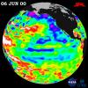
After dominating the tropical Pacific Ocean for more than two years, the 1998-2000 La Niņa 'cool pool' is continuing its slow fade and seems to be retiring from the climate stage, according to satellite data from NASA's U.S.-French TOPEX/Poseidon mission.
PIA02935:
TOPEX/El Niņo Watch - Strong, Long-lasting La Niņa Just Fading Away, June 19, 2000
Full Resolution:     TIFF (997.1 kB)     JPEG (119.1 kB)
Add Image to Favorite List 2000-08-30 Earth TOPEX/Poseidon
Altimeter
900x900x3
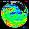
After three years of El Niņo and La Niņa, the Pacific finally calmed down in the tropics but still showed signs of being abnormal elsewhere, according to the satellite data from NASA's U.S.-French TOPEX/Poseidon mission in 2000.
PIA02969:
TOPEX/El Niņo Watch - Los Niņos may be Gone, But Pacific Pattern Remains August 14, 2000
Full Resolution:     TIFF (983.8 kB)     JPEG (113.8 kB)
Add Image to Favorite List 2000-09-20 Earth RadarSat
Imaging Radar
720x520x3
NASA researchers have insights into the mysteries of Arctic sea ice, thanks to the unique abilities of Canada's Radarsat satellite in this view of the global arctic.
PIA02970:
Global View of the Arctic Ocean
Full Resolution:     TIFF (624.4 kB)     JPEG (35.77 kB)
Add Image to Favorite List 2000-09-20 Earth RadarSat
Imaging Radar
1406x472x1
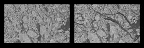
NASA researchers have insights into the mysteries of Arctic sea ice, thanks to the unique abilities of Canada's Radarsat satellite.
PIA02971:
Comparative Views of Arctic Sea Ice Growth
Full Resolution:     TIFF (664.6 kB)     JPEG (167.4 kB)
Add Image to Favorite List 2002-10-22 Earth Terra
ASTER
2720x1670x3
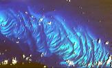
This image from NASA's Terra spacecraft shows features that look like folded material are carbonate sand dunes in the shallow waters of Tarpum Bay, southwest of Eleuthera Island in the Bahamas.
PIA03877:
Tarpum Bay, Bahamas
Full Resolution:     TIFF (10.64 MB)     JPEG (522.8 kB)
Add Image to Favorite List 2000-11-04 Earth Shuttle Imaging Radar A (SIR-A)
2452x3228x3
The objective of NASA's Shuttle Imaging Radar A (SIR-A) was to observe the Earth by use of radar imagery, acquire and transmit data of different geologic regions. This is a view of China in 2000.
PIA02986:
Radar view of China
Full Resolution:     TIFF (29.88 MB)     JPEG (3.194 MB)
Add Image to Favorite List 2000-11-04 Earth Landsat
3739x3795x3
NASA's Landsat 1 was the first of what was to become a series of satellites designed to map and monitor the Earth's land surfaces. This view of Los Angeles and vicinity is a scene acquired by a single pass of Landsat 1 on 25 June 1974.
PIA02988:
Early Landsat View of Los Angeles and Vicinity
Full Resolution:     TIFF (46.51 MB)     JPEG (3.886 MB)
Add Image to Favorite List 2000-11-09 Earth Defense Meteorological Satellite Program (DMSP)
2400x1200x3
The Eastern U.S., Europe, and Japan are brightly lit by their cities, while interiors of Africa, Asia, Australia, and South America are dark and lightly populated in this image created in 2000 by NASA's Goddard Space Flight Center.
PIA02991:
Global City Lights
Full Resolution:     TIFF (3.269 MB)     JPEG (250.4 kB)
Add Image to Favorite List 2000-11-14 Earth Shuttle Imaging Radar A (SIR-A)
1152x894x3
The objective of NASA's Shuttle Imaging Radar A (SIR-A) was to observe the Earth by use of radar imagery, acquire and transmit data of different geologic regions. This is a view of New Guinea in 2000.
PIA02994:
Radar view of New Guinea
Full Resolution:     TIFF (3.784 MB)     JPEG (327.2 kB)
Retrieve Previous Set  Jump to a Previous Set   Jump to a Previous Set   Jump to a Previous Set   Jump to a Previous Set   Jump to a Previous Set   Jump to a Previous Set   Jump to a Previous Set   Current Set   Jump to a Following Set   Jump to a Following Set   Retrieve Next Set 
 1-100   101-200   201-300   301-400   401-500   501-600   601-700   701-800   801-900   901-1000 
Currently displaying images: 701 - 800 of 2614