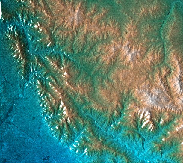
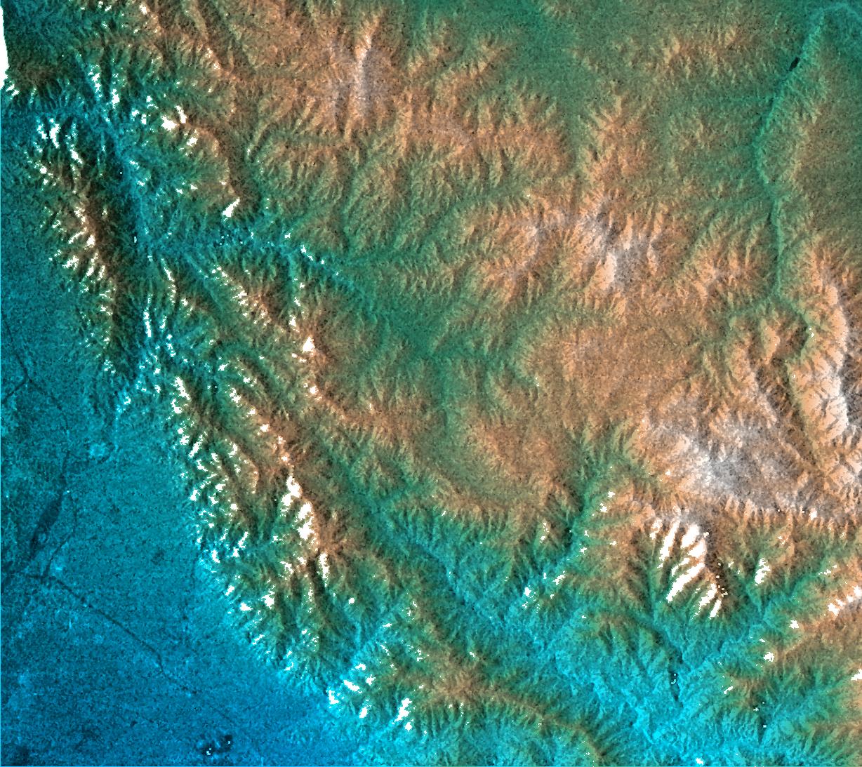
This topographic radar image shows the relationship of the urban area of Pasadena, California to the natural contours of the land. The image includes the alluvial plain on which Pasadena and the Jet Propulsion Laboratory sit, and the steep range of the San Gabriel Mountains. The mountain front and the arcuate valley running from upper left to the lower right are active fault zones, along which the mountains are rising. The chaparral-covered slopes above Pasadena are also a prime area for wildfires and mudslides. Hazards from earthquakes, floods and fires are intimately related to the topography in this area. Topographic data and other remote sensing images provide valuable information for assessing and mitigating the natural hazards for cities along the front of active mountain ranges.
This image combines two types of data from the Shuttle Radar Topography Mission. The image brightness corresponds to the strength of the radar signal reflected from the ground, while colors show the elevation as measured by SRTM. Colors range from blue at the lowest elevations to white at the highest elevations. This image contains about 2300 meters (7500 feet) of total relief. White speckles on the face of some of the mountains are holes in the data caused by steep terrain. These will be filled using coverage from an intersecting pass.
The Shuttle Radar Topography Mission (SRTM), launched on February 11, 2000, uses the same radar instrument that comprised the Spaceborne Imaging Radar-C/X-Band Synthetic Aperture Radar (SIR-C/X-SAR) that flew twice on the Space Shuttle Endeavour in 1994. The mission is designed to collect three-dimensional measurements of the Earth's surface. To collect the 3-D data, engineers added a 60-meter-long (200-foot) mast, an additional C-band imaging antenna and improved tracking and navigation devices. The mission is a cooperative project between the National Aeronautics and Space Administration (NASA), the National Imagery and Mapping Agency (NIMA) and the German (DLR) and Italian (ASI) space agencies. It is managed by NASA's Jet Propulsion Laboratory, Pasadena, CA, for NASA's Earth Science Enterprise, Washington, DC.
Size: 41 km (25 miles) x 29 km (18 miles)
Location: 34.2 deg. North lat., 118.1 deg. West lon.
Orientation: North toward upper right
Original Data Resolution: 30 meters (99 feet)
Date Acquired: February 16, 2000