PDS logoPlanetary Data System
PDS Information
Find a Node - Use these links to navigate to any of the 8 publicly accessible PDS Nodes.

This bar indicates that you are within the PDS enterprise which includes 6 science discipline nodes and 2 support nodes which are overseen by the Project Management Office at NASA's Goddard Space Flight Center (GSFC). Each node is led by an expert in the subject discipline, supported by an advisory group of other practitioners of that discipline, and subject to selection and approval under a regular NASA Research Announcement.
Click here to return to the Photojournal Home Page Click here to view a list of Photojournal Image Galleries Photojournal_inner_header
Latest Images  |  Spacecraft & Technology  |  Animations  |  Space Images App  |  Feedback  |  Photojournal Search  
My Favorite Images from the Planetary Photojoural
I have 3 images in my list


The first time you select an image to My List, a separate browser window will open. This page will list the set of images you have selected as favorites from the Photojournal. This list is kept for a short period of time, approximately 60 days. The way we associate you with your list is through a persistent cookie left on your computer. This cookie is nothing more than a unique key that allows the Photojournal to make this association. Once created, this list is only modifiable from the same computer. Information stored in the cookie on your computer is used by the Photojournal server only during your session. If you configure your Web browser not to use cookies, you will not be able to create and refer back to a personal list of favorite images. To view your current list, click on a marked entry for your list from the catalog page, or add another favorite. For more information, see JPL's Privacy Policy.
My
List
Catalog # Target Mission Instrument Addition Date Size
Remove Image from Favorite List PIA17192 Enceladus Cassini-Huygens
2015-04-14 900x900x3
This graphic plots the source locations of geysers scientists have located on Enceladus' south polar terrain, with the 36 most active geyser sources marked and color coded by the behavior of the grains erupting from the geysers.
Title:
Tendril-producing Geysers on Enceladus' South Polar Terrain
Remove Image from Favorite List PIA00665 Mars Mars Pathfinder (MPF)
Imager for Mars Pathfinder
1997-07-10 541x559x1
NASA's Mars rover Sojourner is seen here using its Alpha Proton X-Ray Spectrometer (APXS) instrument in a study of the Martian soil. The upper image is of rocky terrain and a portion of Sojourner's antenna.
Title:
End of Sol 5 Rover Image
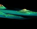
Remove Image from Favorite List PIA02724 Earth Shuttle Radar Topography Mission (SRTM)
C-Band Interferometric Radar
2000-02-19 1319x1062x3
This perspective view acquired by NASA's Shuttle Radar Topography Mission from data collected on February 18, 2000 shows three Hawaiian islands: Molokai (lower left), Lanai (right), and the northwest tip of Maui (upper left).
Title:
Perspective View, Radar Image, Color as Height, Molokai, Lanai and Maui, Hawaii