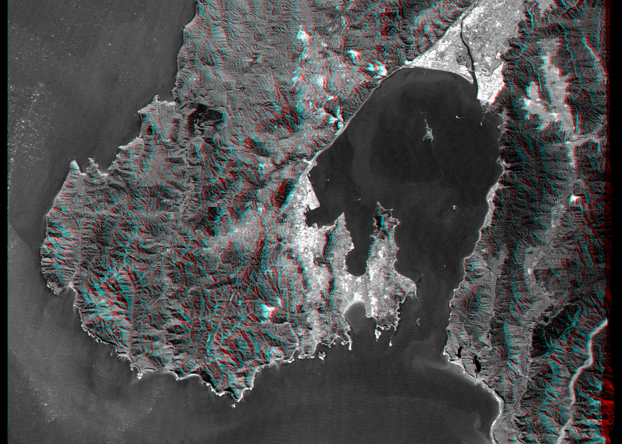
Wellington, the capital city of New Zealand, is located on the shores of Port Nicholson, a natural harbor at the south end of North Island. The city was founded in 1840 by British emigrants and now has a regional population of more than 400,000 residents. As seen here, the natural terrain imposes strong control over the urban growth pattern. Rugged hills generally rising to 300 meters (~1,000 feet) help protect the city and harbor from strong winter winds.
New Zealand is seismically active and faults are readily seen in the topography. The Wellington Fault forms the straight northwestern (upper left) shoreline of the harbor. Toward the southwest (lower left) the fault crosses through the city, then forms linear canyons in the hills before continuing offshore. Toward the northeast (upper right) the fault forms the sharp mountain front along the northern edge of the heavily populated Hutt Valley.
This anaglyph was generated by first draping a Landsat Thematic Mapper image over a topographic map from the Shuttle Radar Topography Mission, then using the topographic data to create two differing perspectives, one for each eye. When viewed through special glasses, the result is a vertically exaggerated view of the Earth's surface in its full three dimensions. Anaglyph glasses cover the left eye with a red filter and cover the right eye with a blue filter.
Landsat satellites have provided visible light and infrared images of the Earth continuously since 1972. SRTM topographic data match the 30 meter (99 foot) spatial resolution of most Landsat images and will provide a valuable complement for studying the historic and growing Landsat data archive. The Landsat 7 Thematic Mapper image used here was provided to the SRTM project by the United States Geological Survey, Earth Resources Observation Systems (EROS) data Center, Sioux Falls, South Dakota.
Elevation data used in this image was acquired by the Shuttle Radar Topography Mission (SRTM) aboard the Space Shuttle Endeavour, launched on February 11, 2000. SRTM used the same radar instrument that comprised the Spaceborne Imaging Radar-C/X-Band Synthetic Aperture Radar (SIR-C/X-SAR) that flew twice on the Space Shuttle Endeavour in 1994. SRTM was designed to collect three-dimensional measurements of the Earth's surface. To collect the 3-D data, engineers added a 60-meter-long (200-foot) mast, installed additional C-band and X-band antennas, and improved tracking and navigation devices. The mission is a cooperative project between the National Aeronautics and Space Administration (NASA), the National Imagery and Mapping Agency (NIMA) of the U.S. Department of Defense (DoD), and the German and Italian space agencies. It is managed by NASA's Jet Propulsion Laboratory, Pasadena, CA, for NASA's Earth Science Enterprise,Washington, DC.
Size: 31 by 23 kilometers (19 by 14 miles)
Location: 41.3 deg. South lat., 174.9 deg. East lon.
Orientation: North toward the top
Image Data: Combination of Landsat bands 1, 2, 3, and 8
Original Data Resolution: SRTM 30 meters (99 feet); Landsat 15 meters (50 feet)
Date Acquired: February 20, 2000 (SRTM); September 29, 1999 (Landsat)
 Planetary Data System


