My
List |
Addition Date
|
Target
|
Mission
|
Instrument
|
Size
|

|
2010-01-28 |
Earth
|
Terra
|
ASTER
|
2910x1887x3 |

|
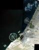
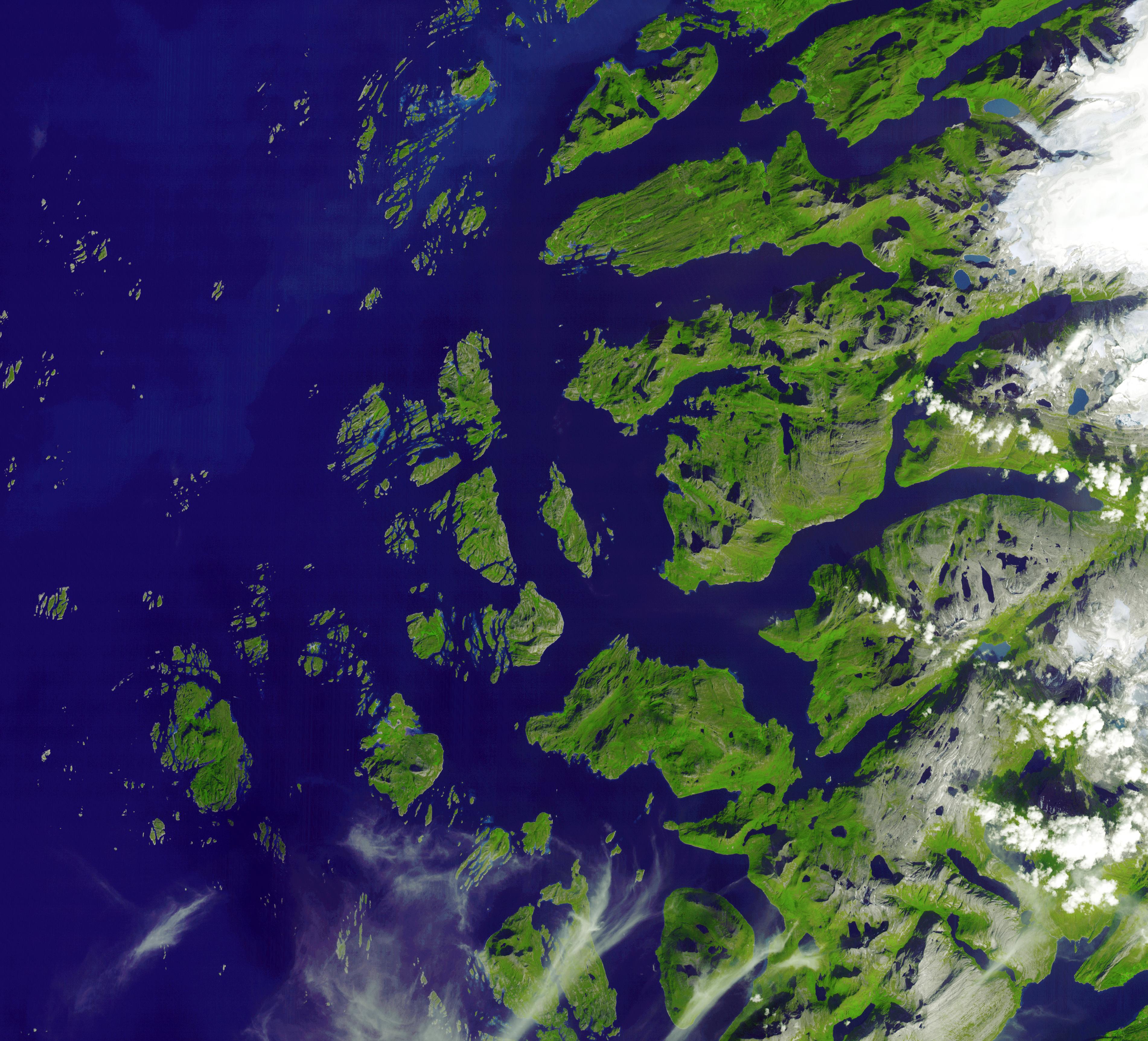
-
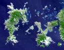
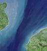
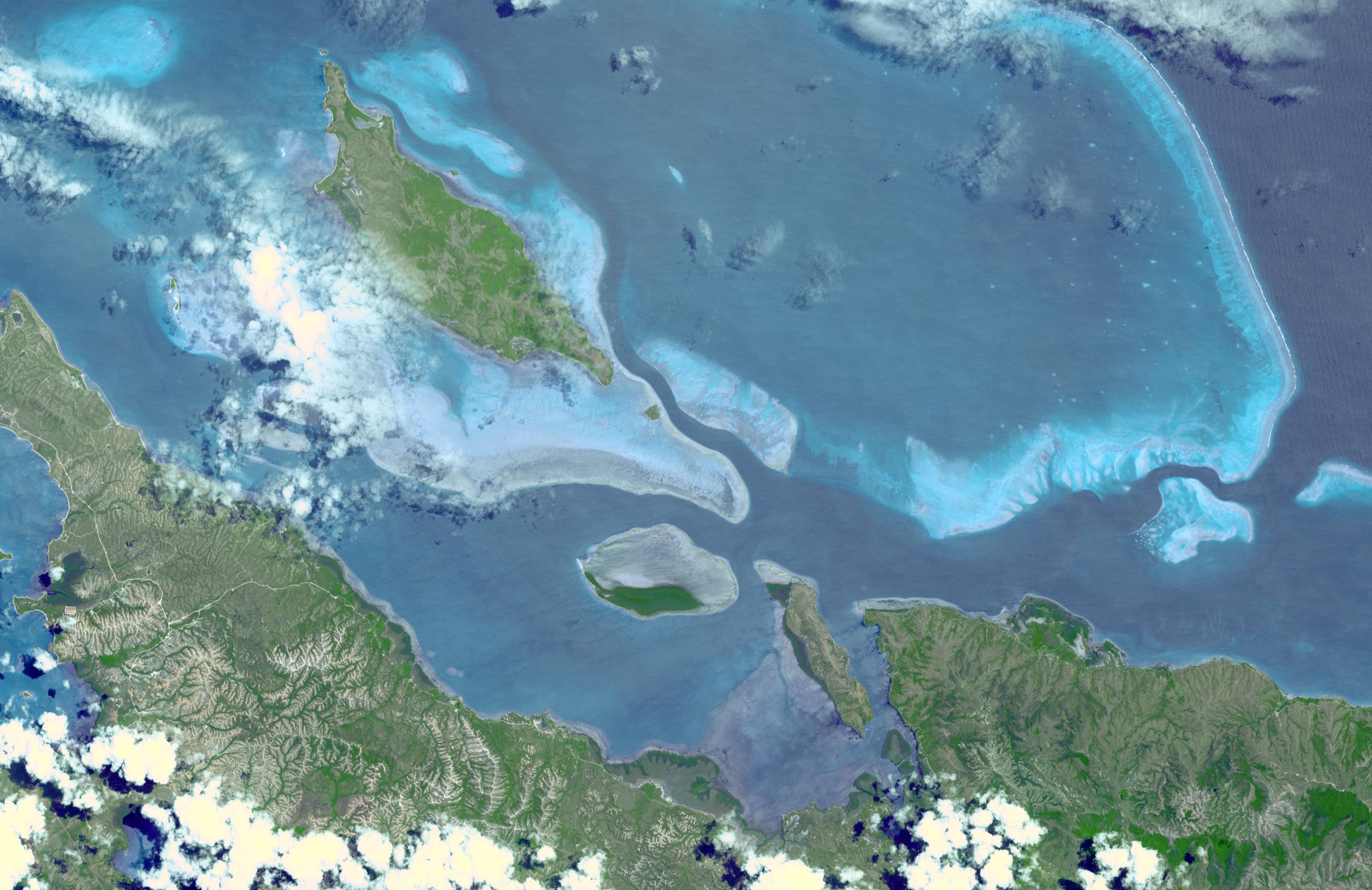
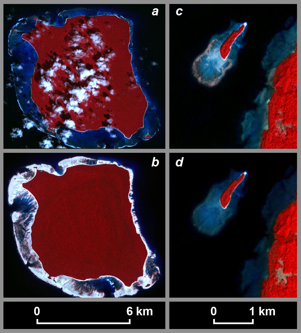
PIA12502:
-
Lagoons of New Caledonia
Full Resolution:
TIFF
(16.47 MB)
JPEG
(630.7 kB)
|
|
|
2010-01-22 |
Earth
|
Terra
|
ASTER
|
2500x2500x3 |
|
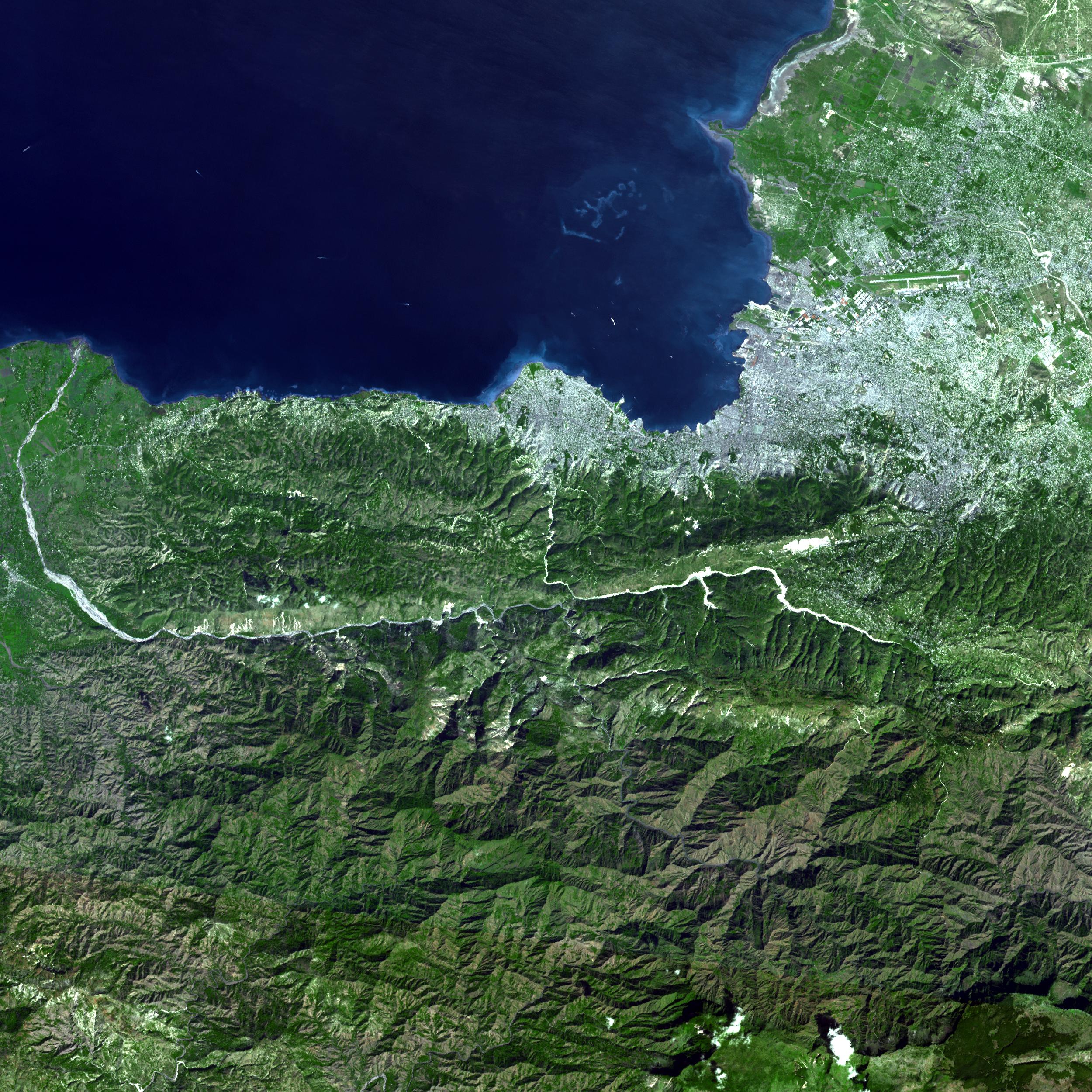
-
PIA12498:
-
ASTER Captures Clear Sky Image of Haiti Earthquake Region
Full Resolution:
TIFF
(18.77 MB)
JPEG
(1.289 MB)
|
|
|
2010-01-18 |
Earth
|
Terra
|
ASTER
|
3266x3374x3 |
|
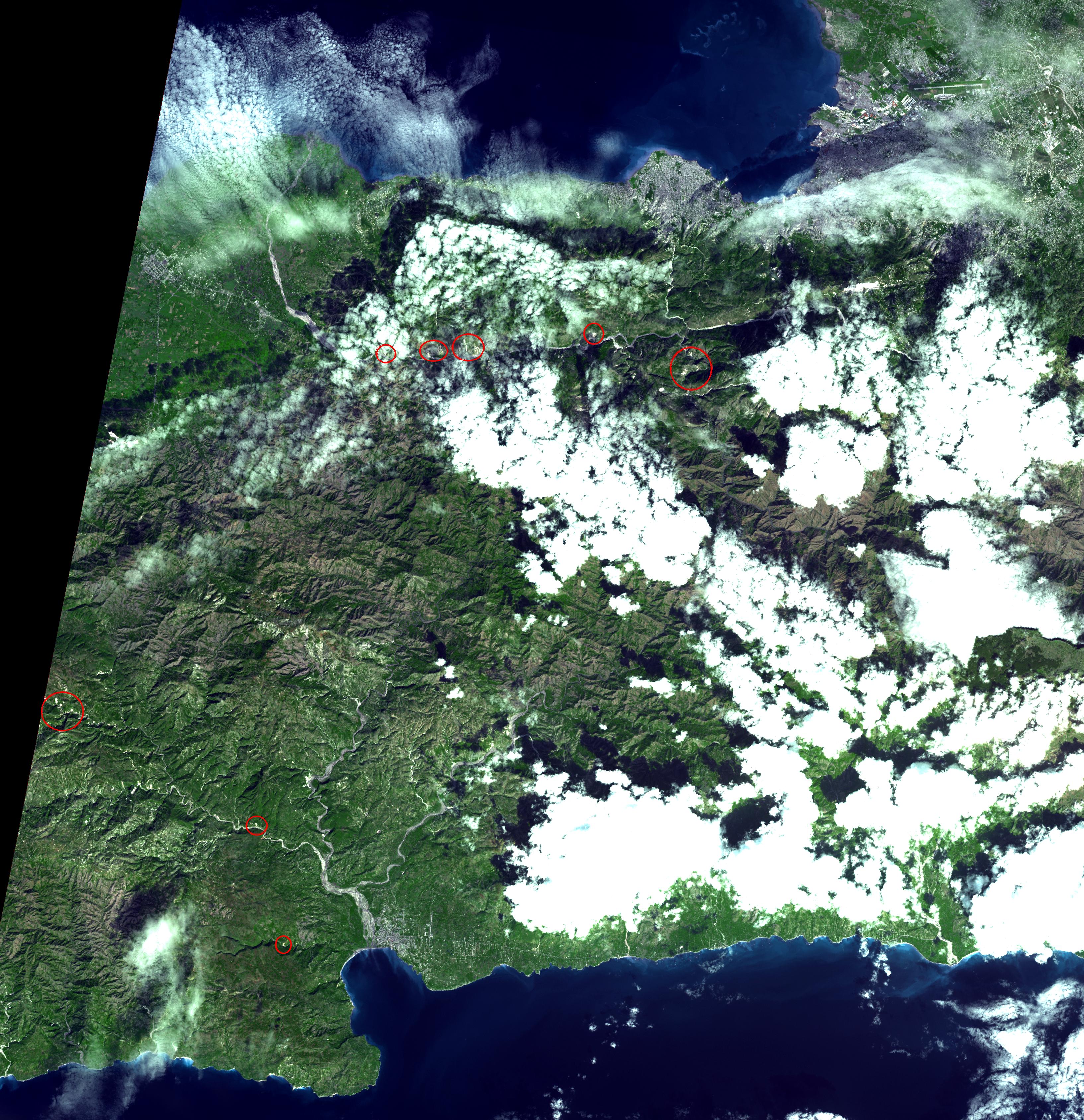
-
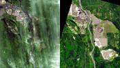
PIA12495:
-
Haiti Earthquake Landslides
Full Resolution:
TIFF
(33.06 MB)
JPEG
(1.889 MB)
|
|
|
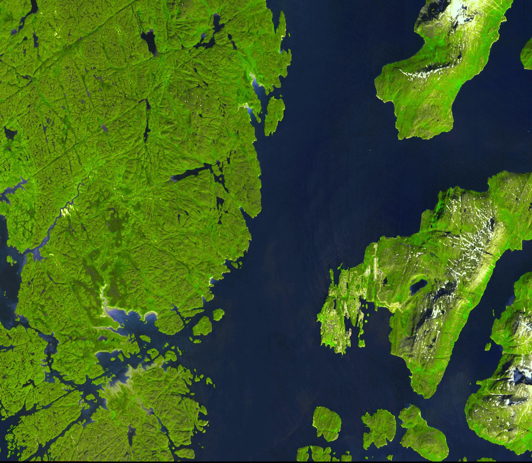
2010-01-11 |
Earth
|
Terra
|
ASTER
|
3892x2344x3 |
|
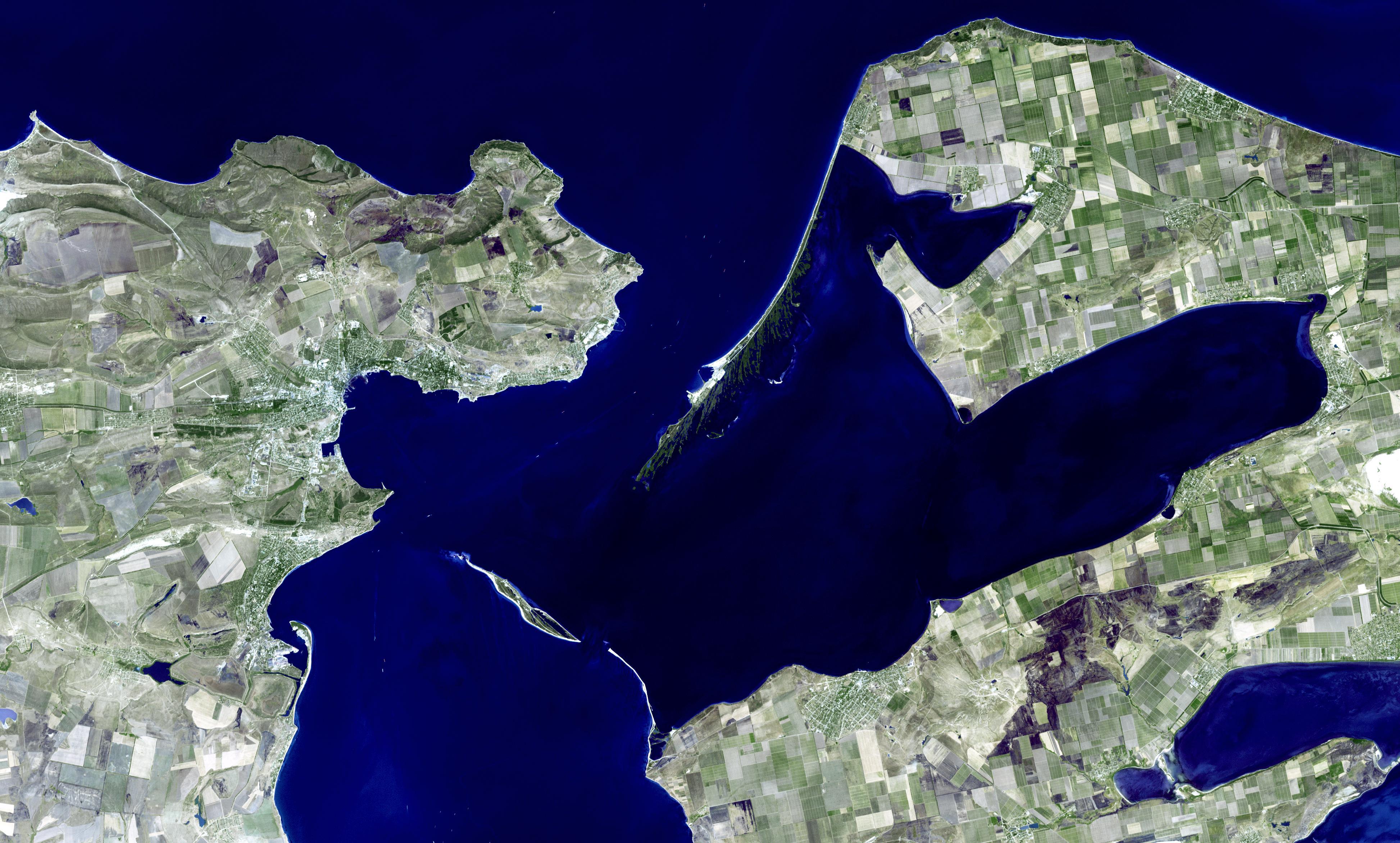
-
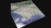
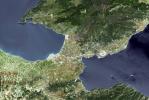
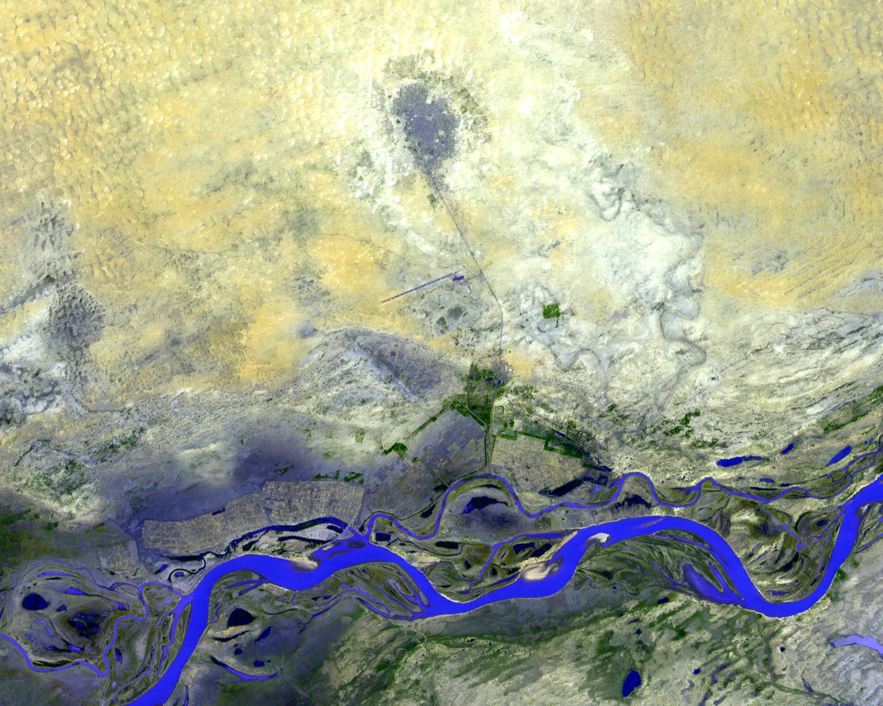
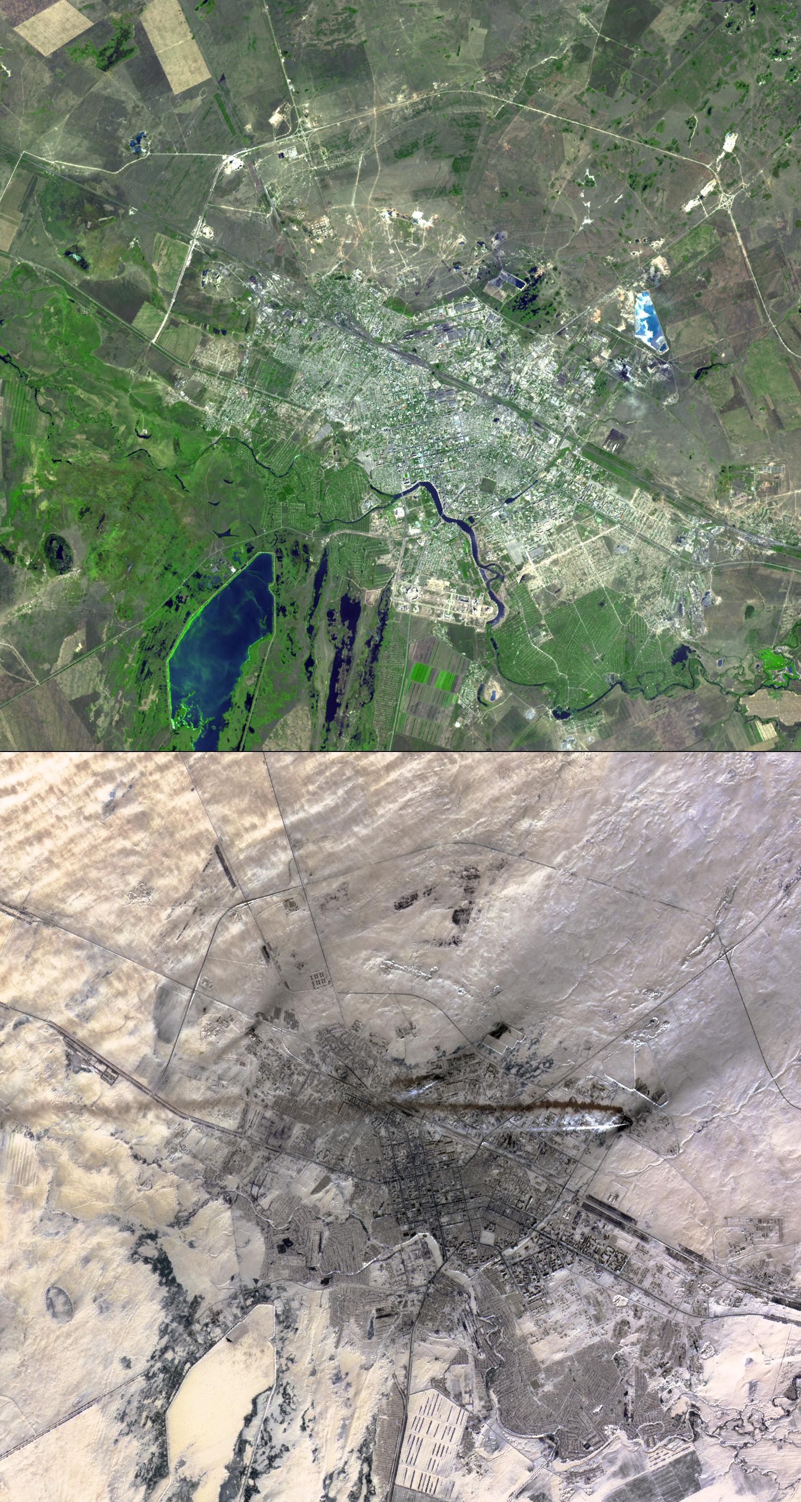
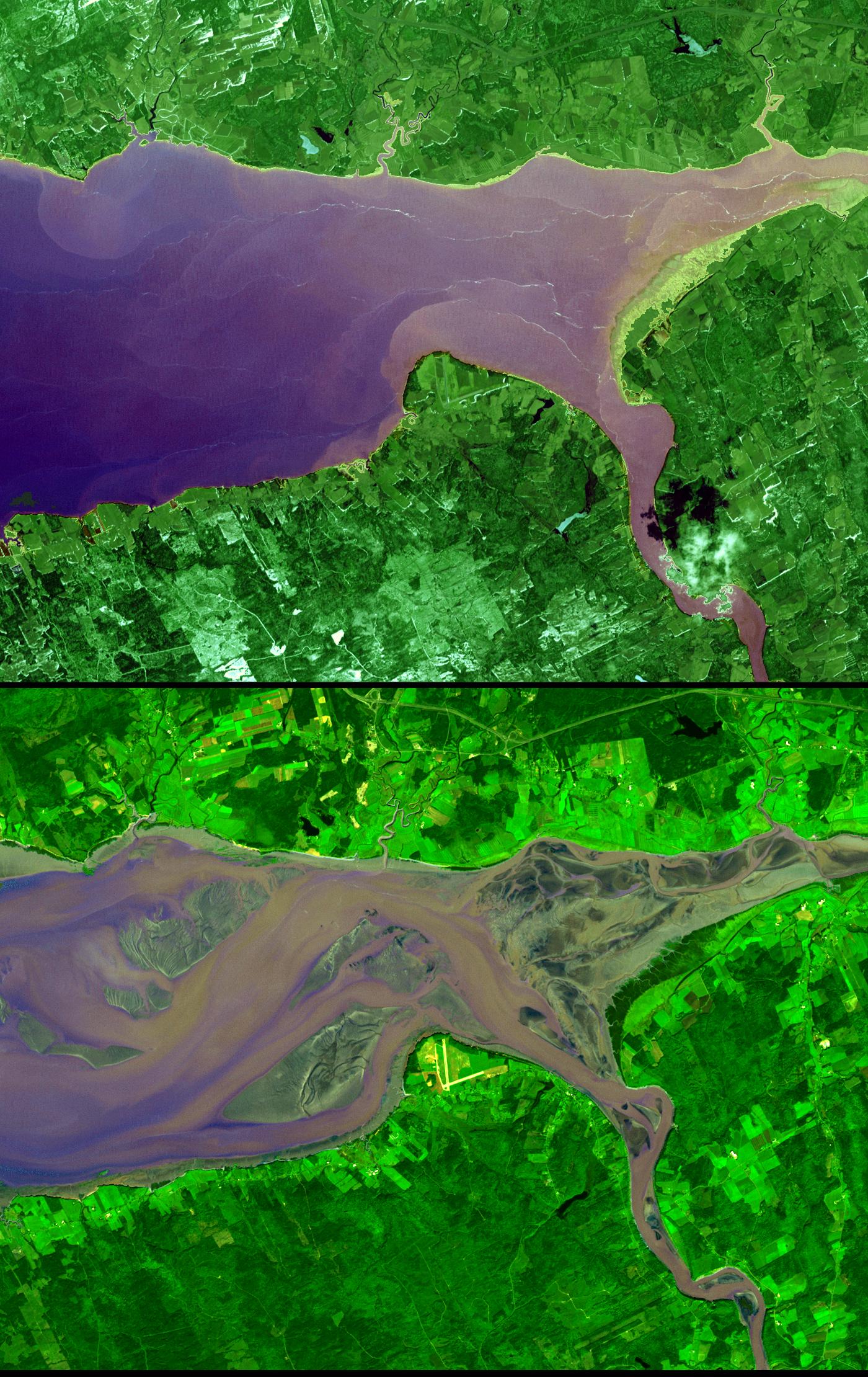
PIA12487:
-
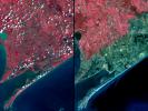
Kerch, Ukraine
Full Resolution:
TIFF
(27.37 MB)
JPEG
(1.121 MB)
|
|
|
2009-12-08 |
Earth
|
Terra
|
ASTER
|
5250x2434x3 |
|
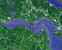
-
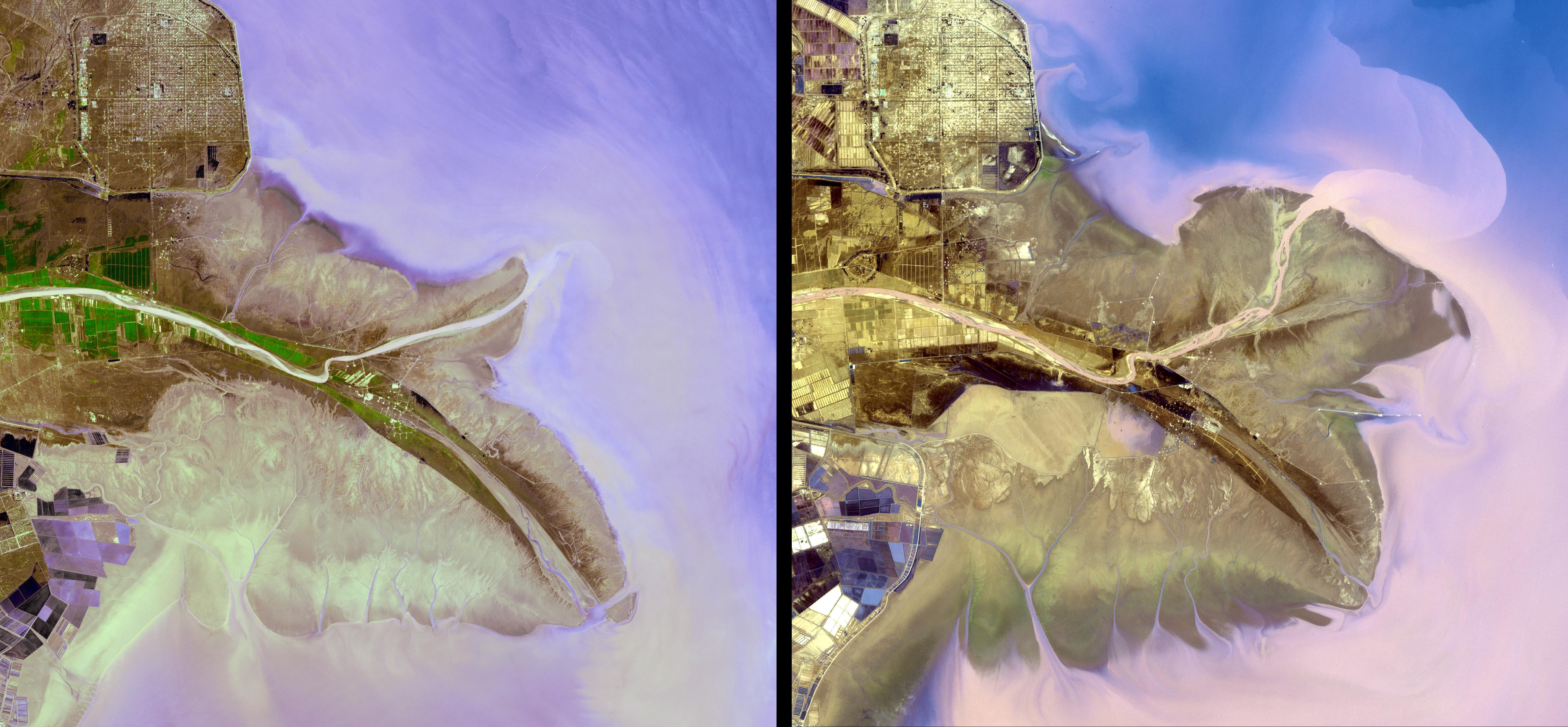
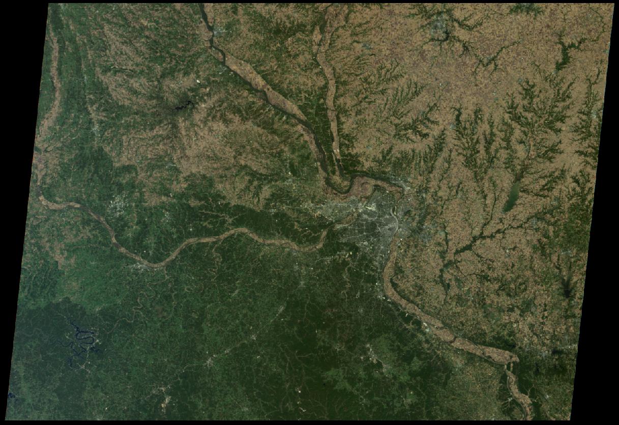
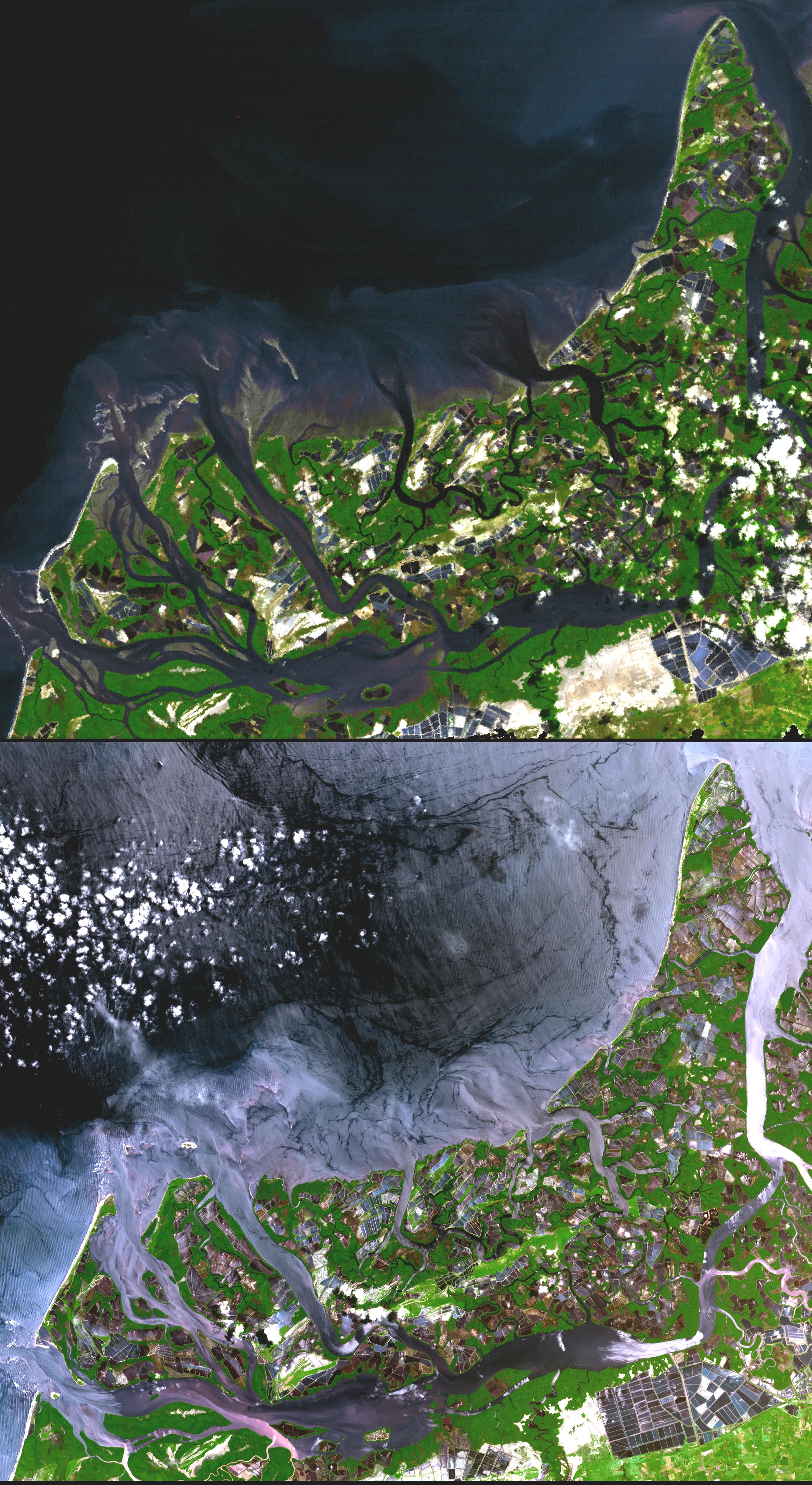
PIA12472:
-
Yellow River Delta, China
Full Resolution:
TIFF
(38.34 MB)
JPEG
(1.671 MB)
|
|
|
2009-11-10 |
Earth
|
Terra
|
MISR
|
1278x1947x1 |
|
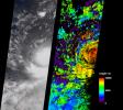
-
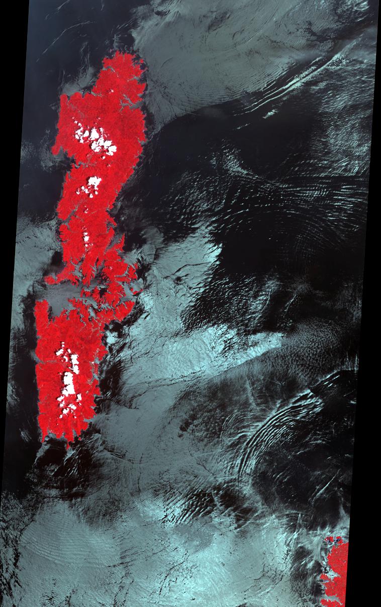
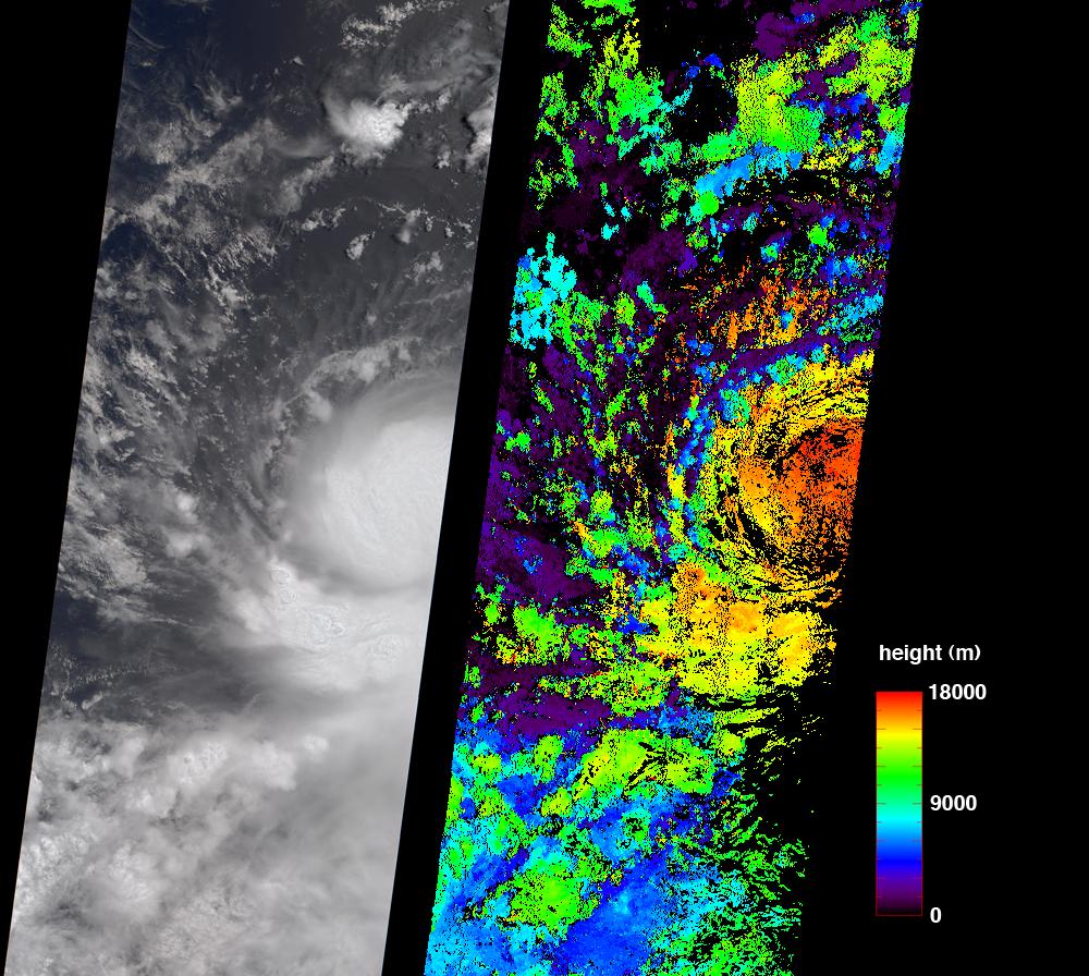
PIA12349:
-
MISR High-Resolution, Cross-Track Winds for Hurricane Ida
Full Resolution:
TIFF
(2.491 MB)
JPEG
(195.6 kB)
|
|
|
2009-11-02 |
Earth
|
Terra
|
ASTER
|
3900x4331x3 |
|
-
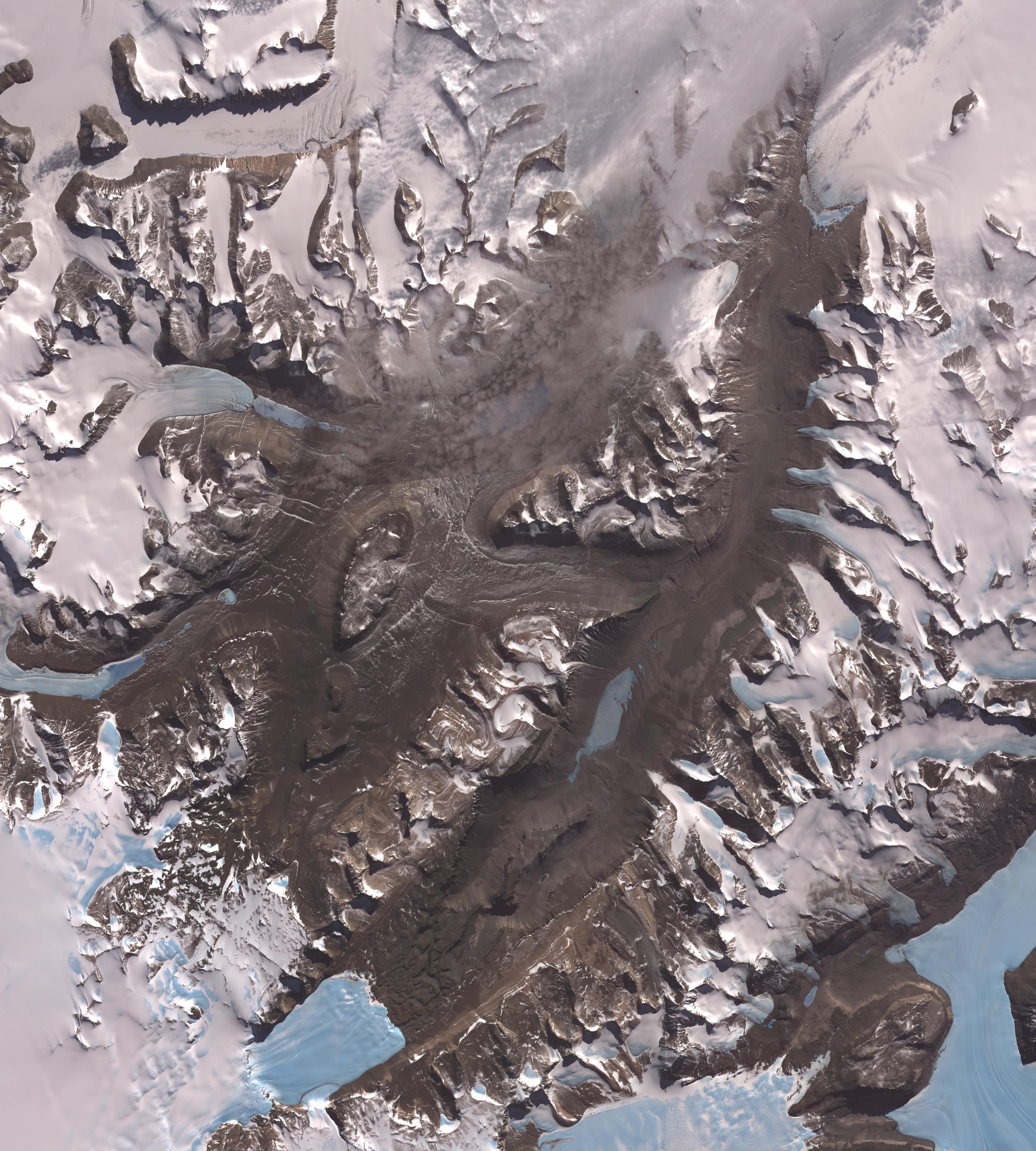
PIA12461:
-
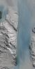
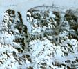
Dry Valleys, Antarctica
Full Resolution:
TIFF
(50.67 MB)
JPEG
(2.02 MB)
|
|
|
2009-10-22 |
Earth
|
Terra
|
ASTER
|
2356x2239x3 |
|
-
PIA12460:
-
Sault Ste. Marie
Full Resolution:
TIFF
(15.84 MB)
JPEG
(939.8 kB)
|
|
|
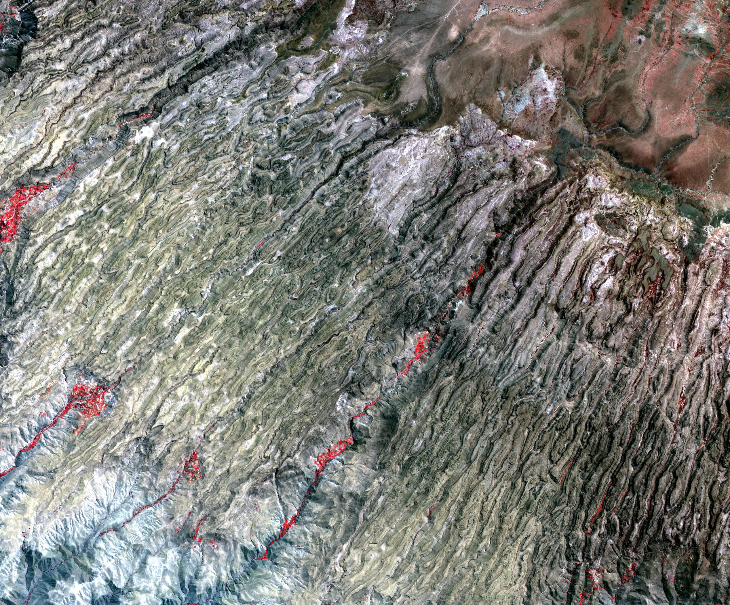
2009-10-05 |
Earth
|
Terra
|
ASTER
|
1789x1431x3 |
|
-
PIA12305:
-
Timbuktu, Mali
Full Resolution:
TIFF
(7.692 MB)
JPEG
(462.1 kB)
|
|
|
2009-10-02 |
Earth
|
Terra
|
ASTER
|
1652x1260x3 |
|
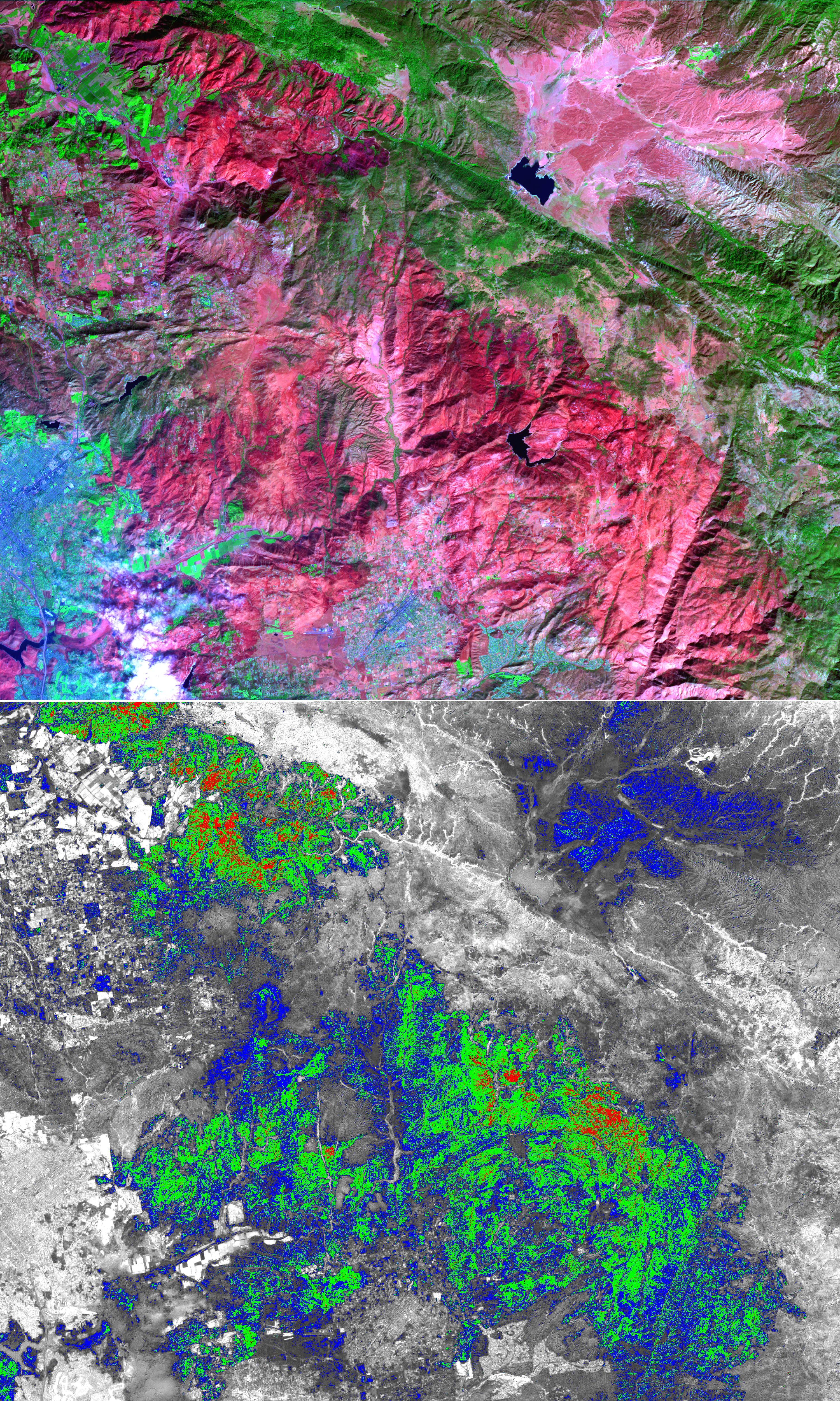
-
PIA12250:
-
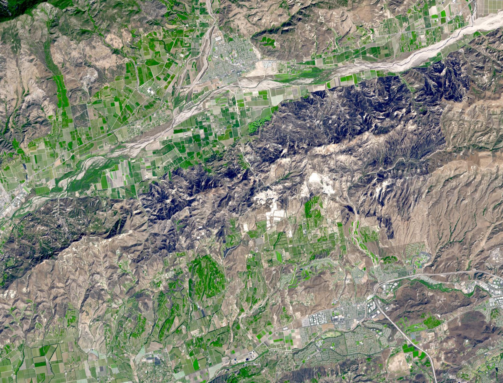
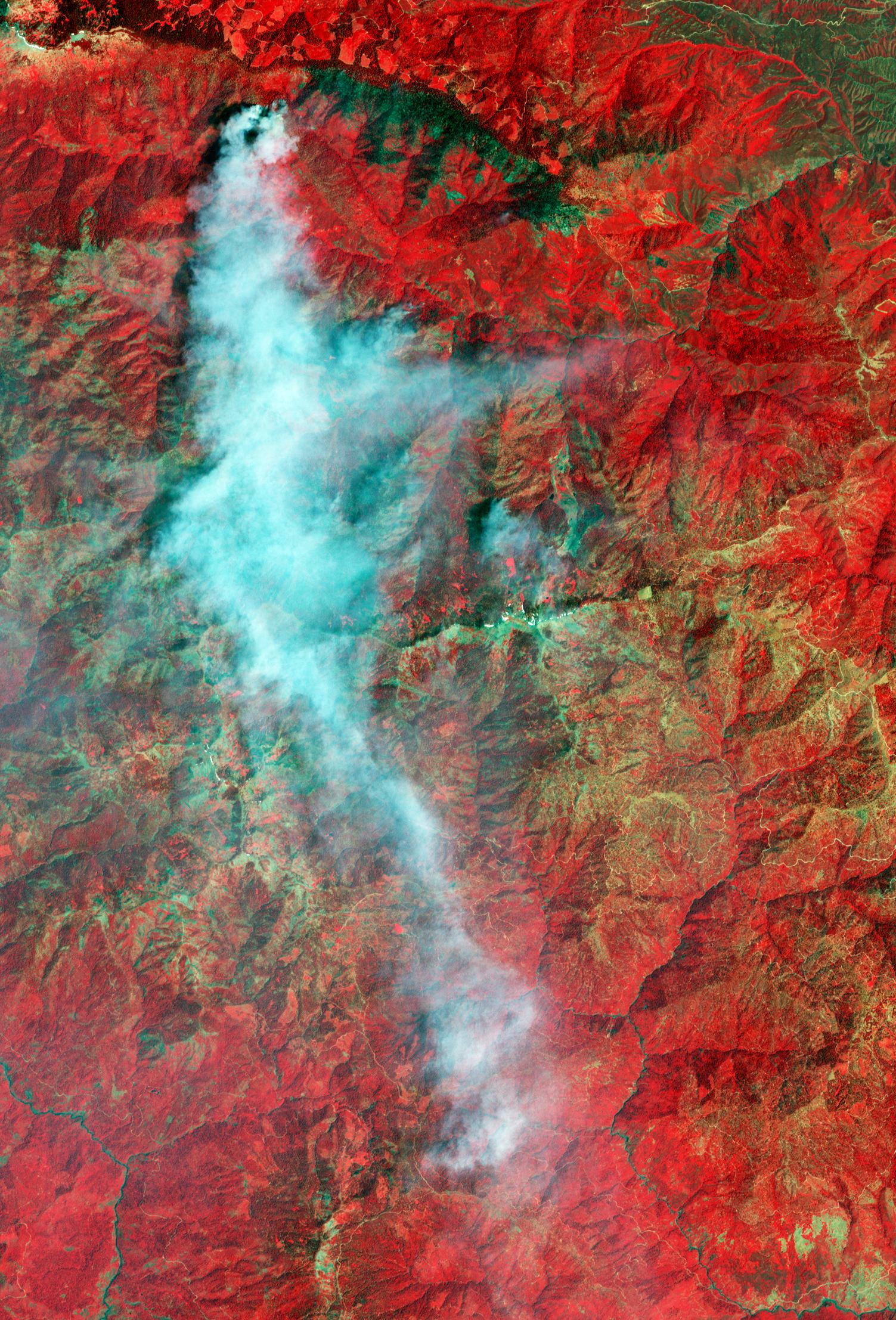
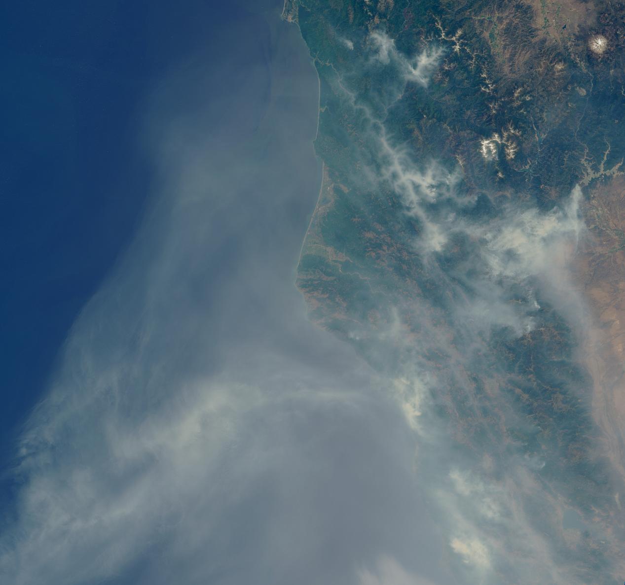
Guiberson Fire, Ventura County, Calif.
Full Resolution:
TIFF
(6.255 MB)
JPEG
(535.3 kB)
|
|
|
2009-09-25 |
Earth
|
Terra
|
MISR
|
1659x2051x3 |
|
-
PIA12240:
-
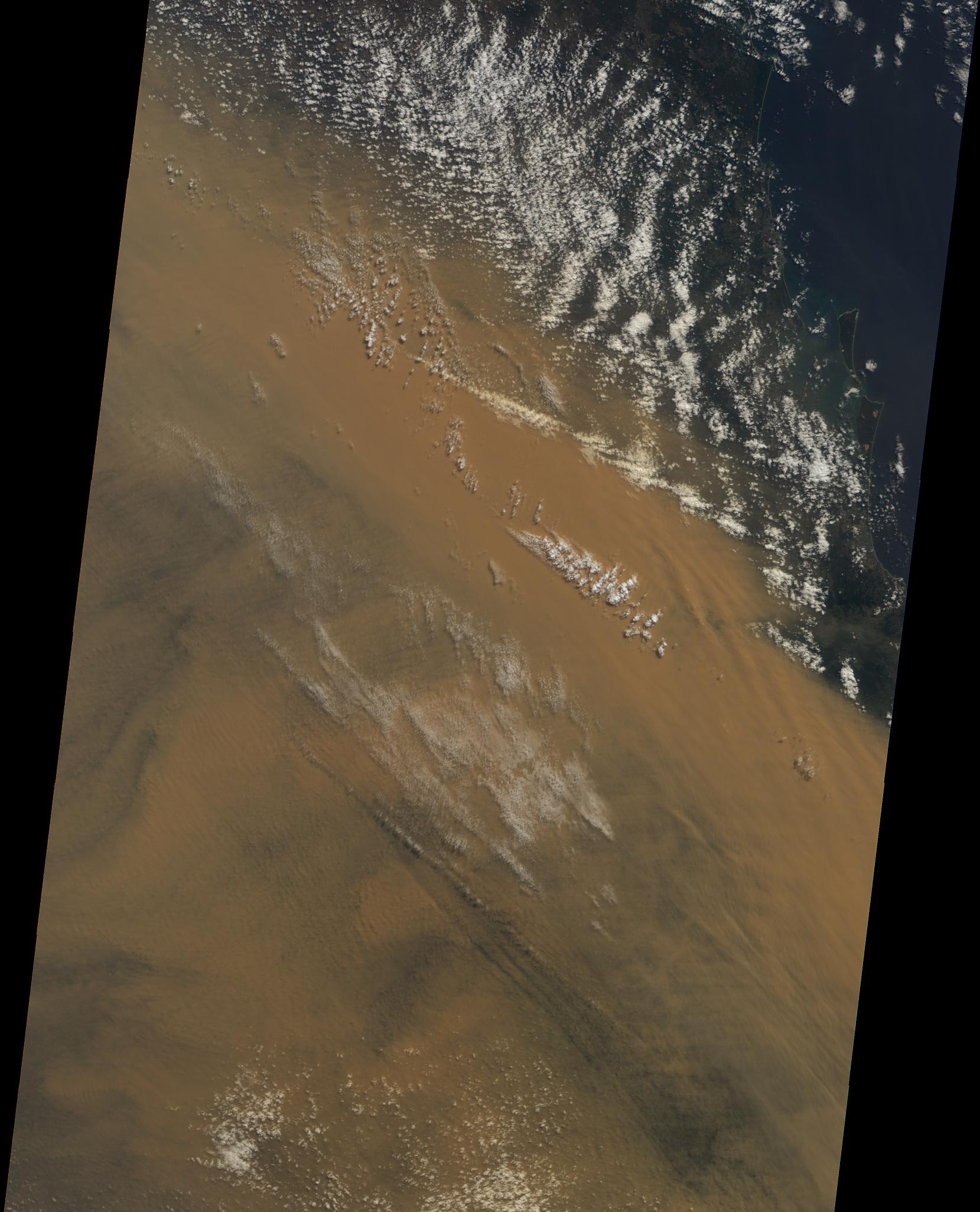
Massive Dust Storm over Australia
Full Resolution:
TIFF
(10.22 MB)
JPEG
(338.3 kB)
|
|
|
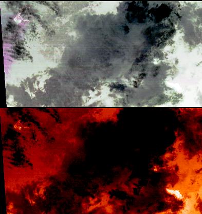
2009-09-21 |
Earth
|
Terra
|
ASTER
|
6230x3300x3 |
|
-
PIA12304:
-
Shenzhen, PRC
Full Resolution:
TIFF
(61.68 MB)
JPEG
(4.722 MB)
|
|
|
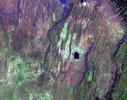
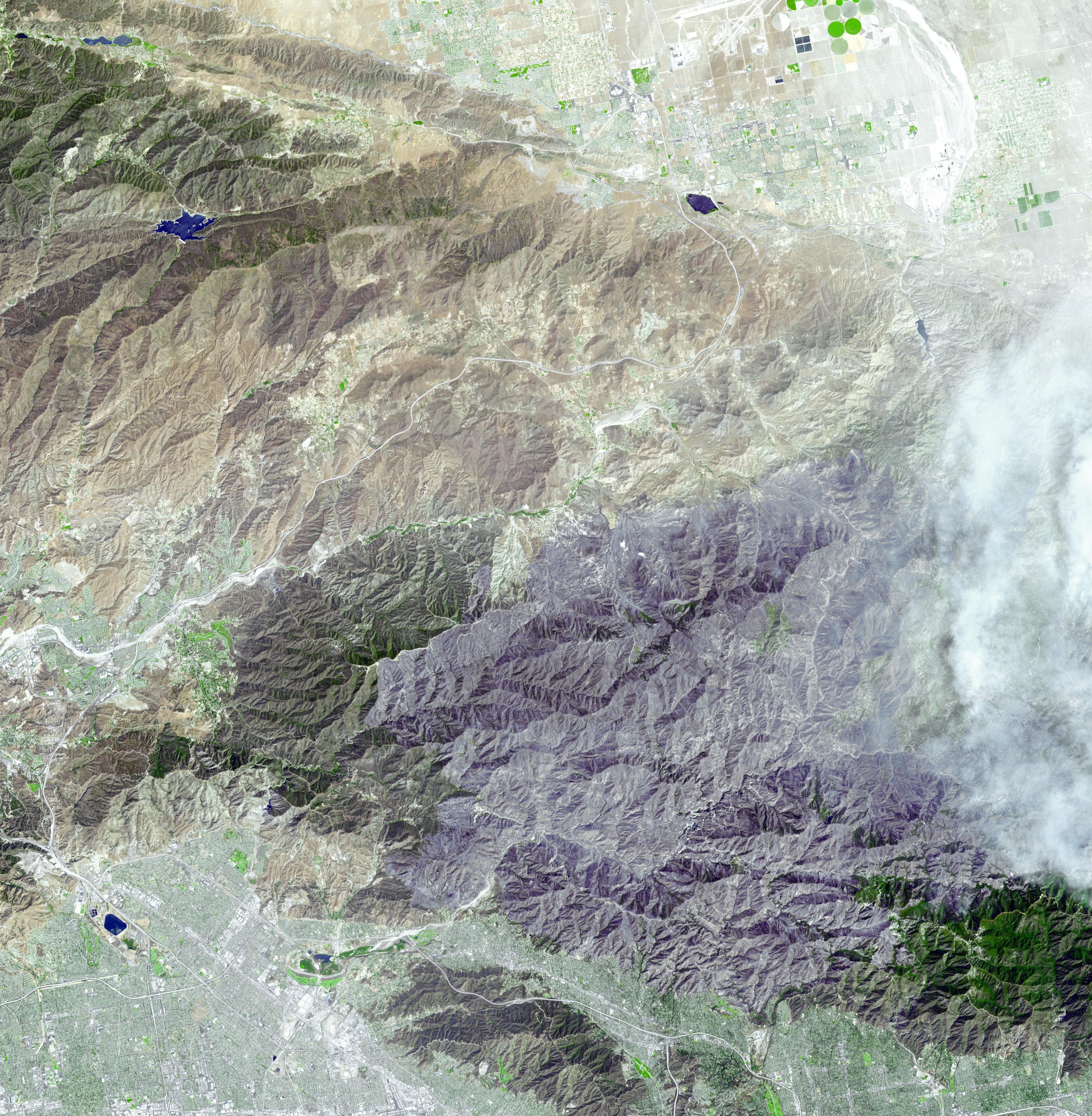
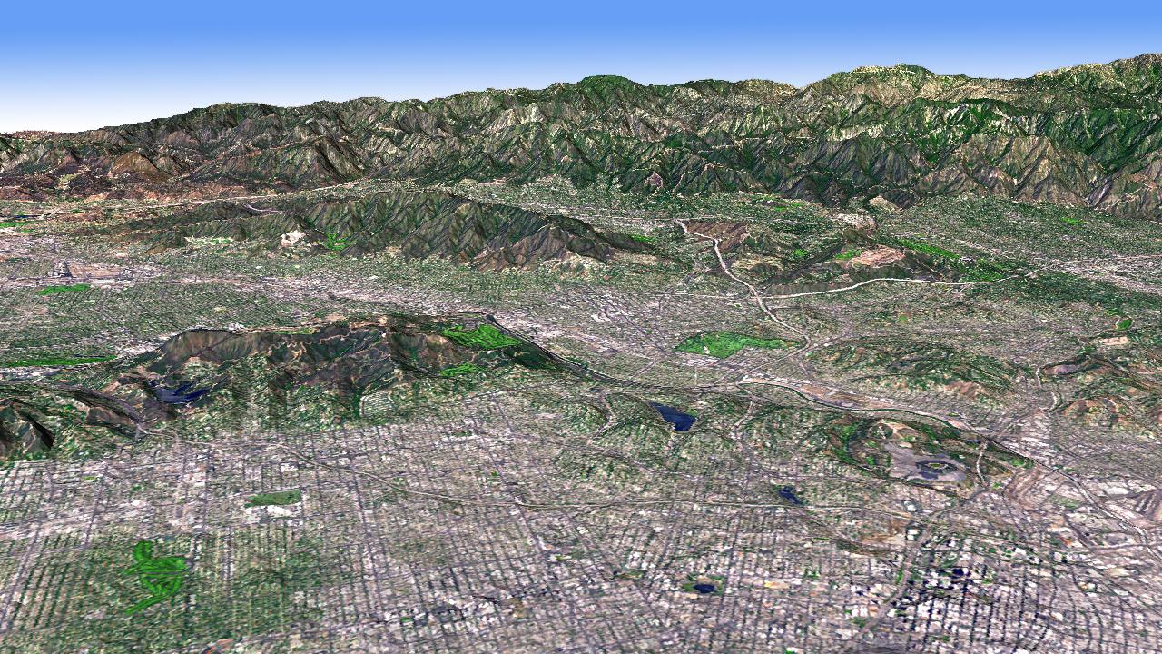
2009-09-15 |
Earth
|
Terra
|
ASTER
|
3920x2709x3 |
|
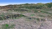
-
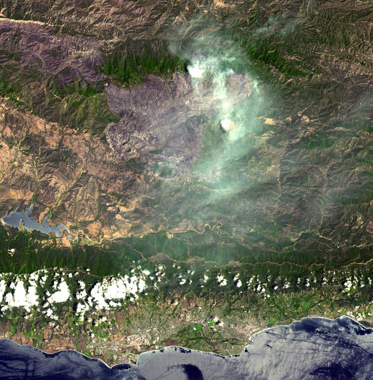
PIA12199:
-
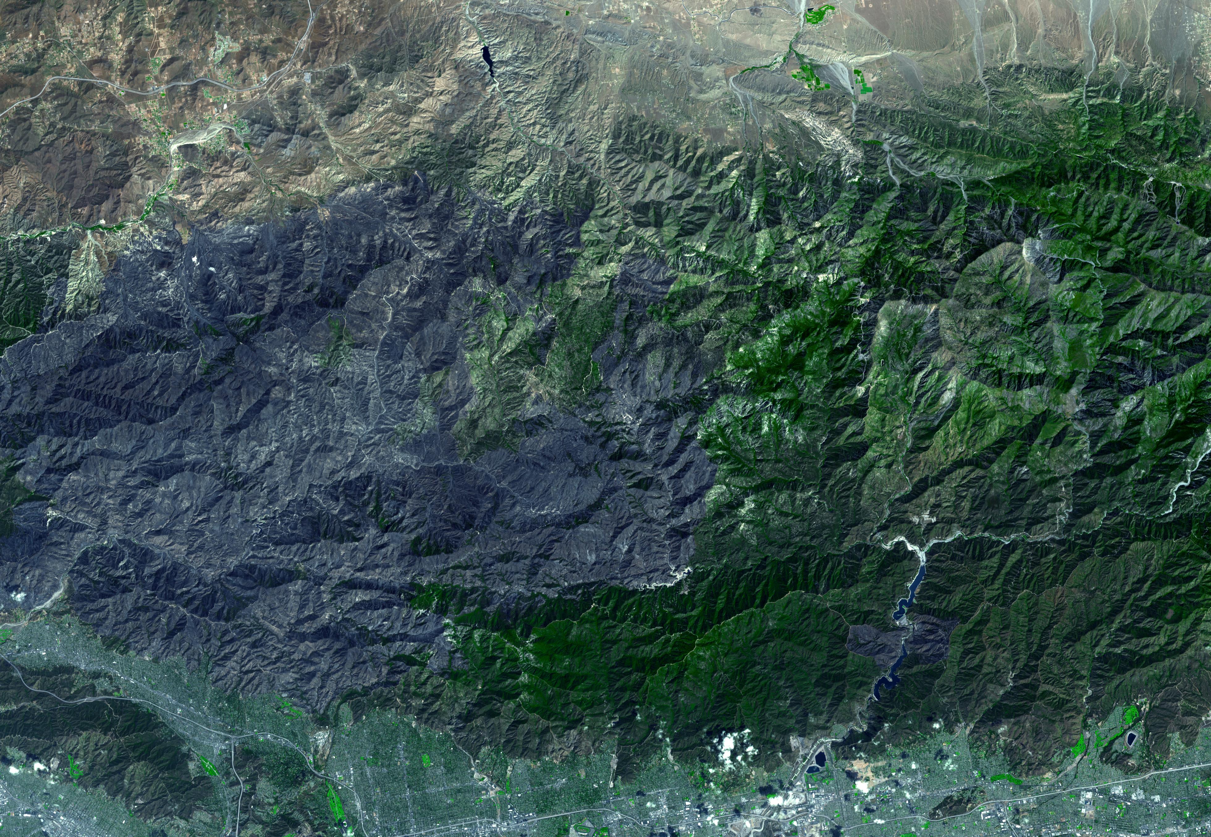
Station Fire Burns in the San Gabriel Mountains Above Los Angeles
Full Resolution:
TIFF
(31.86 MB)
JPEG
(2.289 MB)
|
|
|
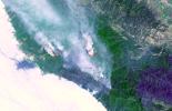
2009-09-08 |
Earth
|
Terra
|
ASTER
|
3416x3492x3 |
|
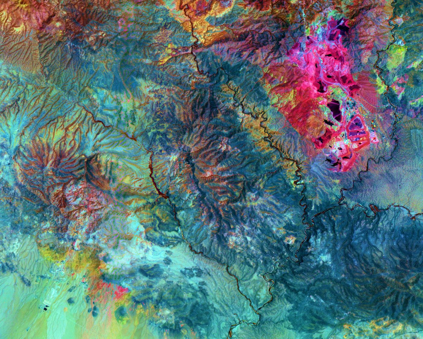
-
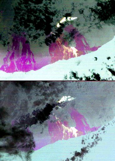
PIA12197:
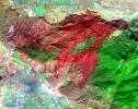
-
Extent of Station Fire Burn Seen in New NASA Image
Full Resolution:
TIFF
(35.79 MB)
JPEG
(2.482 MB)
|
|
|
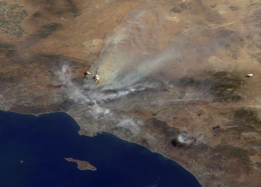
2009-09-04 |
Earth
|
Terra
|
MISR
|
1014x810x3 |
|
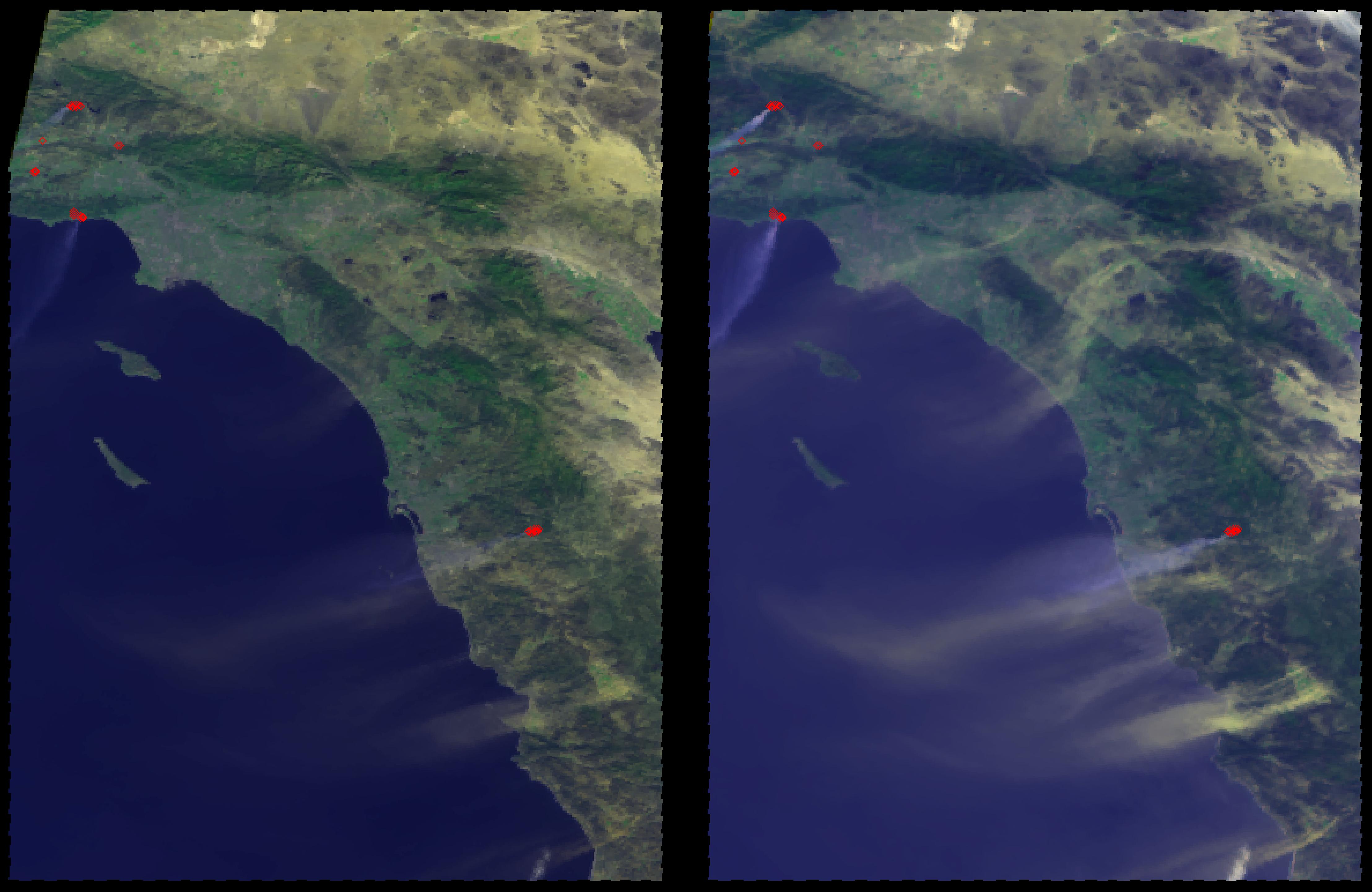
-
PIA12196:
-
Smoke from Station Fire Blankets Southern California (Anaglyph)
Full Resolution:
TIFF
(2.467 MB)
JPEG
(90.65 kB)
|
|
|
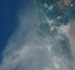
2009-09-01 |
Earth
|
Terra
|
ASTER
|
1200x1000x3 |
|
-
PIA12303:
-
Solar Power, Seville, Spain
Full Resolution:
TIFF
(3.604 MB)
JPEG
(314.5 kB)
|
|
|
2009-09-01 |
Earth
|
Terra
|
MISR
|
891x638x3 |

|
-
PIA12190:
-
Smoke from Station Fire Blankets Southern California
Full Resolution:
TIFF
(1.707 MB)
JPEG
(63.24 kB)
|
|
|
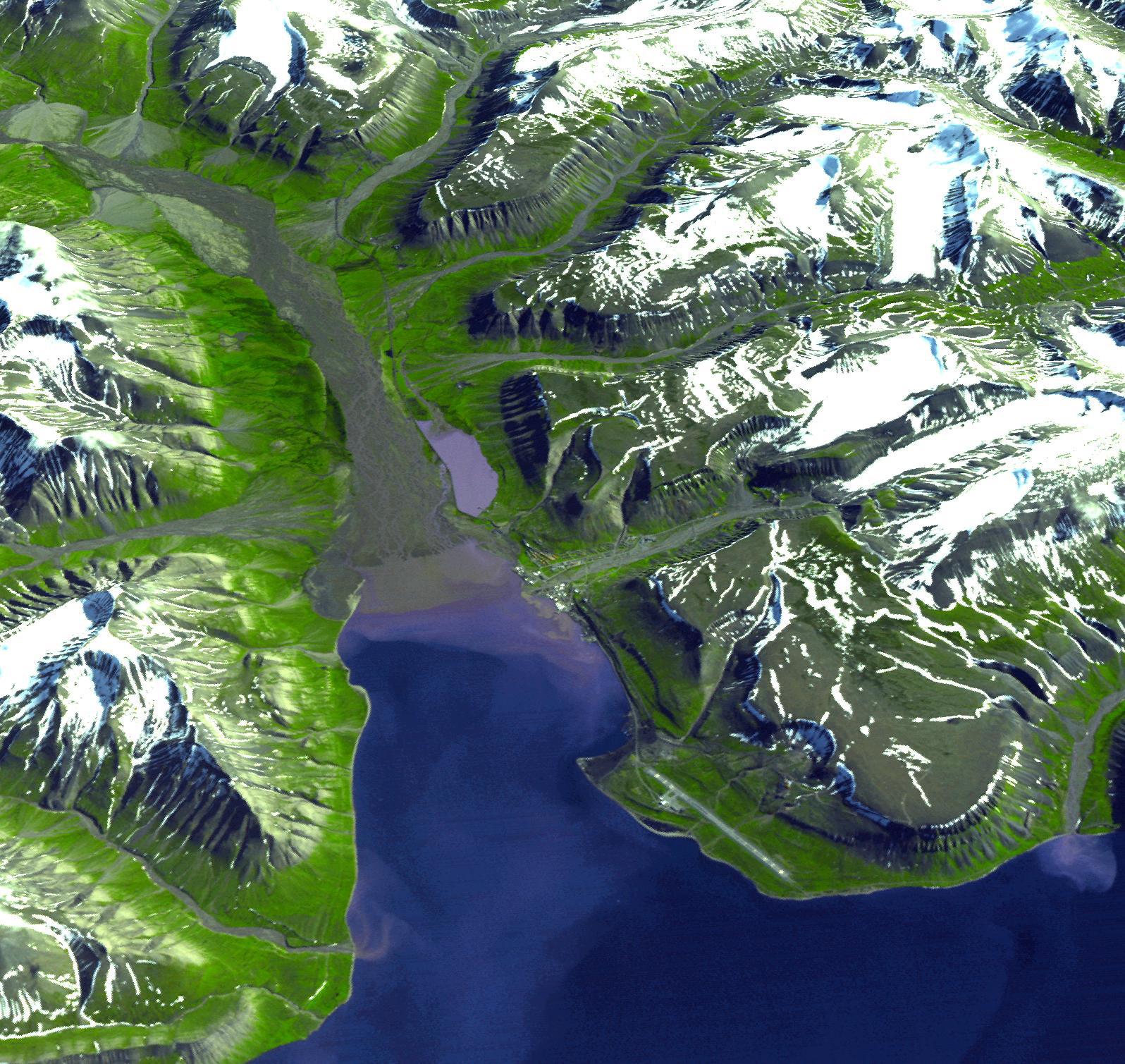
2009-08-18 |
Earth
|
Terra
|
ASTER
|
1492x1488x3 |
|
-
PIA12177:
-
Lhasa, Tibet, China
Full Resolution:
TIFF
(6.672 MB)
JPEG
(548.2 kB)
|
|
|
2009-06-29 |
Earth
|
Terra
|
ASTER
|
1280x720x3 |
|
-
PIA12095:
-
Cruising Over Los Angeles

Full Resolution:
TIFF
(2.768 MB)
JPEG
(86.7 kB)
|
|
|
2009-06-29 |
Earth
|
Terra
|
ASTER
|
1281x718x3 |
|
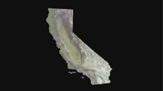
-
PIA12094:
-
Cruising Over California
Full Resolution:
TIFF
(2.762 MB)
JPEG
(37.04 kB)
|
|
|
2009-06-29 |
Earth
|
Terra
|
ASTER
|
1280x720x3 |
|
-
PIA12093:
-
Los Angeles Basin
Full Resolution:
TIFF
(2.768 MB)
JPEG
(316.6 kB)
|
|
|
2009-06-29 |
Earth
|
Terra
|
ASTER
|
1556x1370x3 |
|
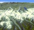
-
PIA12092:
-
Himalayan Glaciers in Bhutan
Full Resolution:
TIFF
(6.406 MB)
JPEG
(432.9 kB)
|
|
|
2009-06-29 |
Earth
|
Terra
|
ASTER
|
1488x1493x3 |

|
-
PIA12091:
-
Death Valley, California
Full Resolution:
TIFF
(6.677 MB)
JPEG
(506.6 kB)
|
|
|
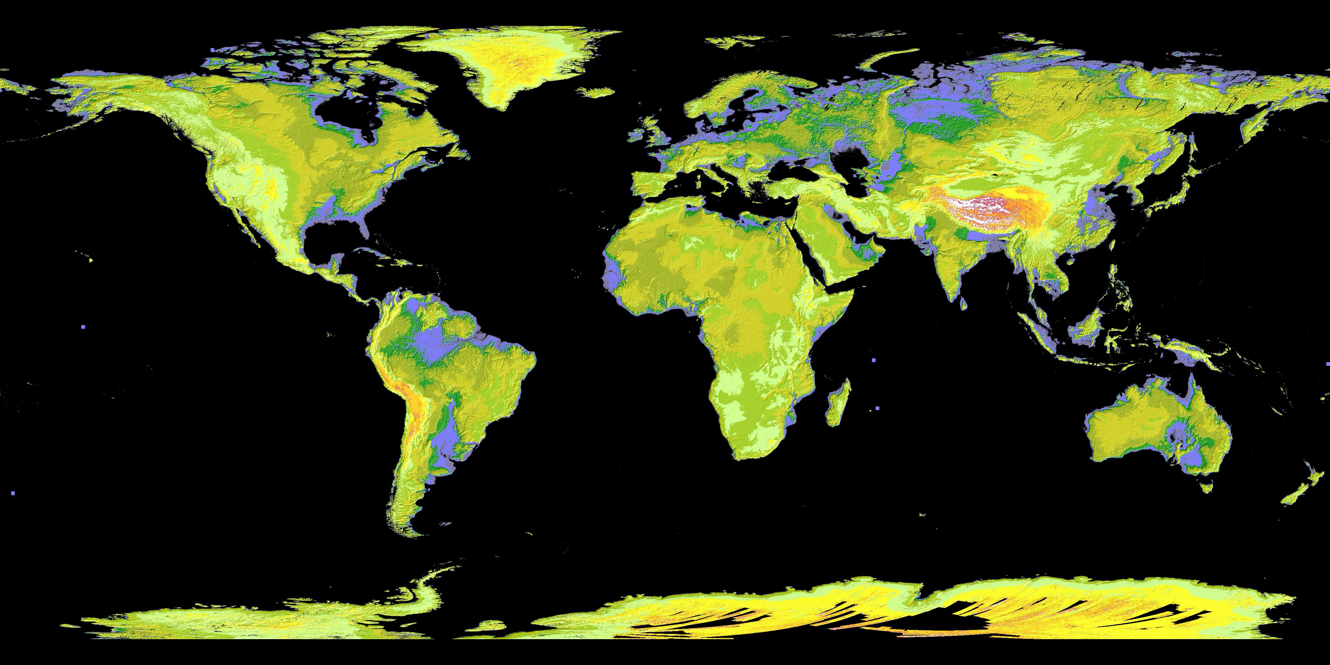
2009-06-29 |
Earth
|
Terra
|
ASTER
|
4320x2160x3 |
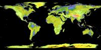
|
-
PIA12090:
-
ASTER's Global Digital Elevation Model (GDEM)
Full Resolution:
TIFF
(27.99 MB)
JPEG
(1.153 MB)
|
|
|
2009-06-02 |
Earth
|
Terra
|
ASTER
|
2282x1772x3 |

|
-
PIA12064:
-
Jack Hills, Australia
Full Resolution:
TIFF
(12.15 MB)
JPEG
(877.8 kB)
|
|
|
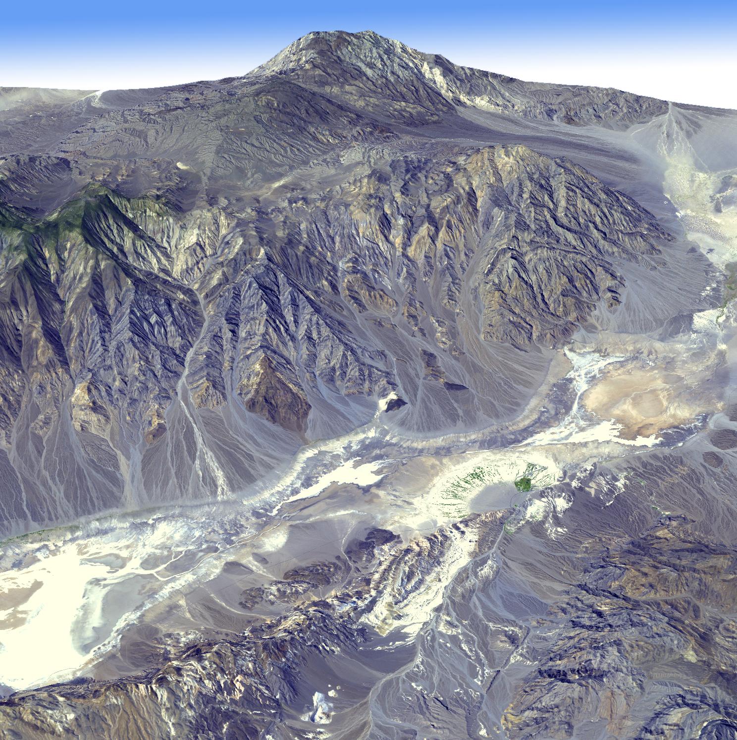
2009-05-15 |
Earth
|
Terra
|
ASTER
|
3456x2736x3 |
|
-
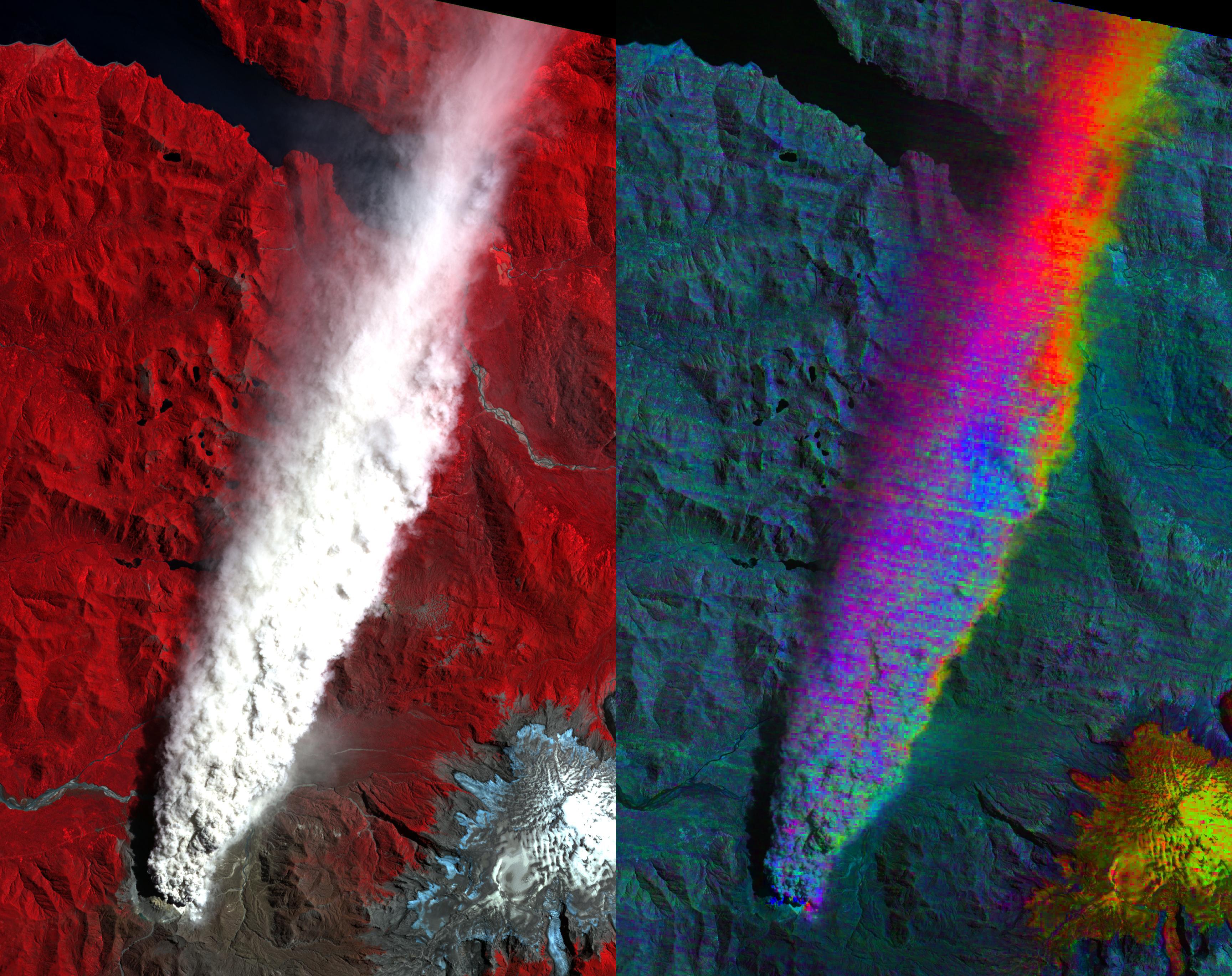
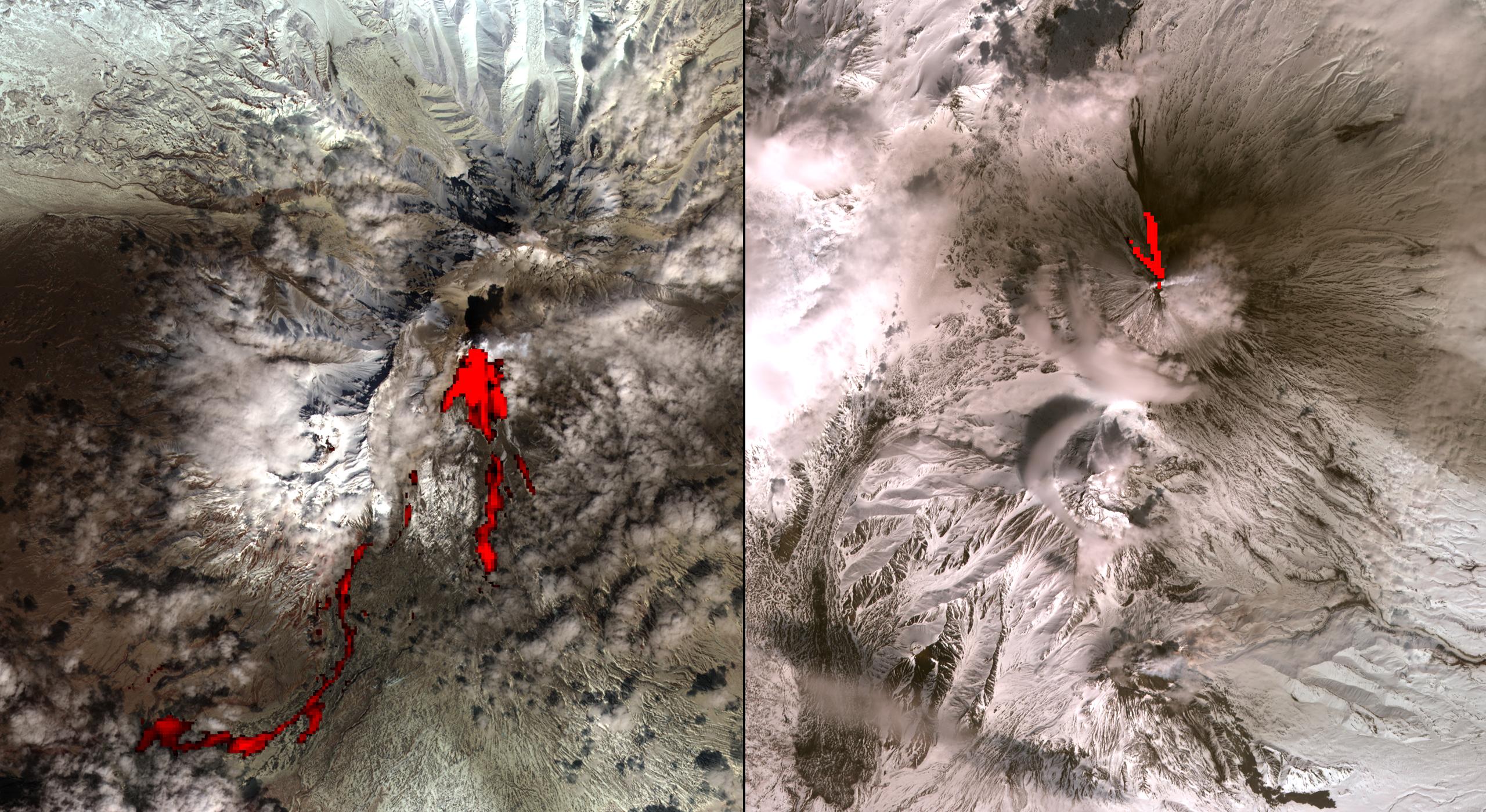
PIA12063:
-
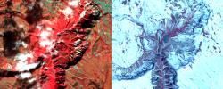
Volcano Chaiten, Chile
Full Resolution:
TIFF
(28.37 MB)
JPEG
(1.285 MB)
|
|
|
2009-05-01 |
Earth
|
Terra
|
ASTER
|
1446x803x3 |
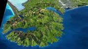
|
-
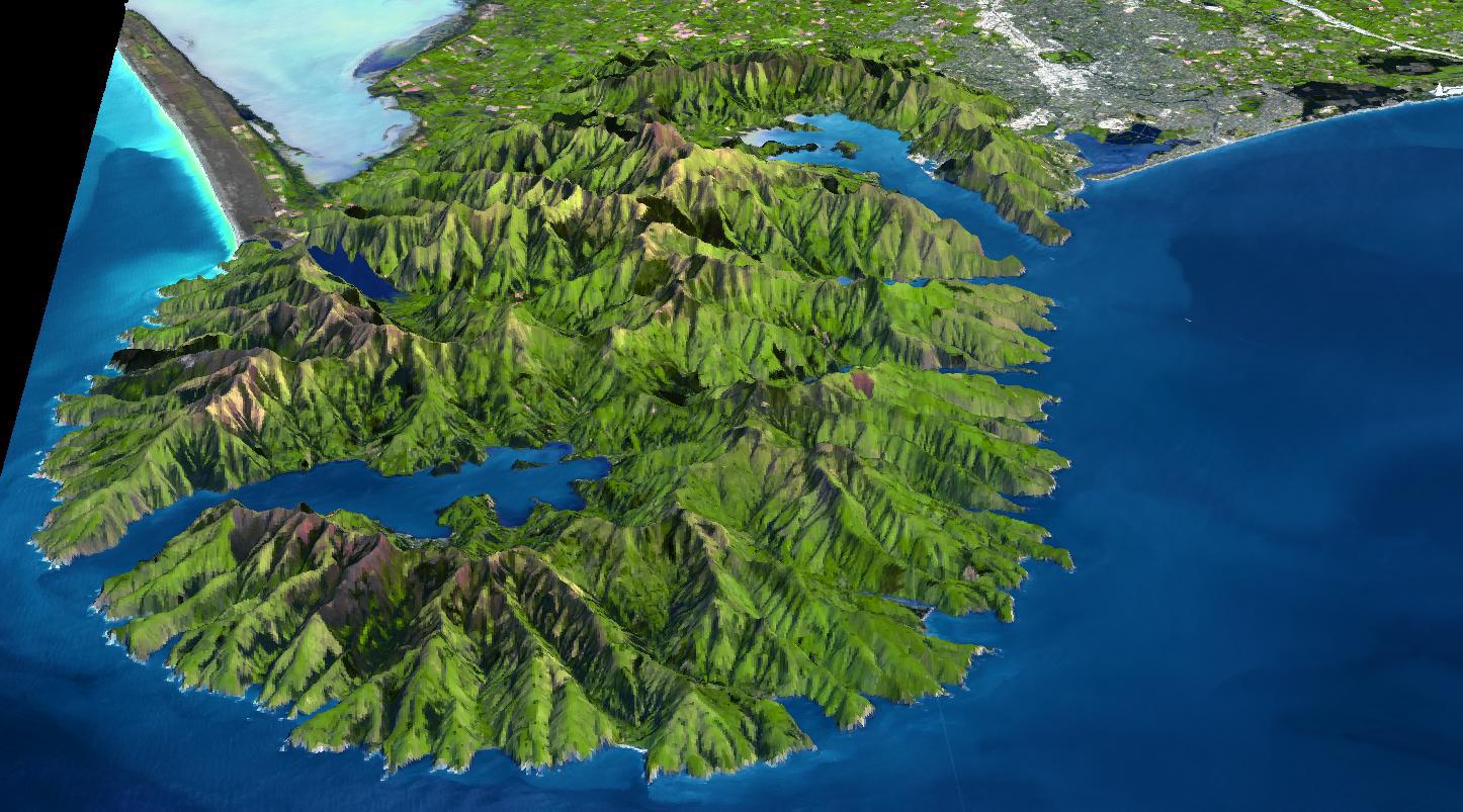
PIA12062:
-
Banks Peninsula, New Zealand
Full Resolution:
TIFF
(3.49 MB)
JPEG
(214.8 kB)
|
|
|
2009-04-20 |
Earth
|
Terra
|
ASTER
|
3235x2351x3 |
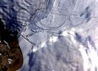
|
-
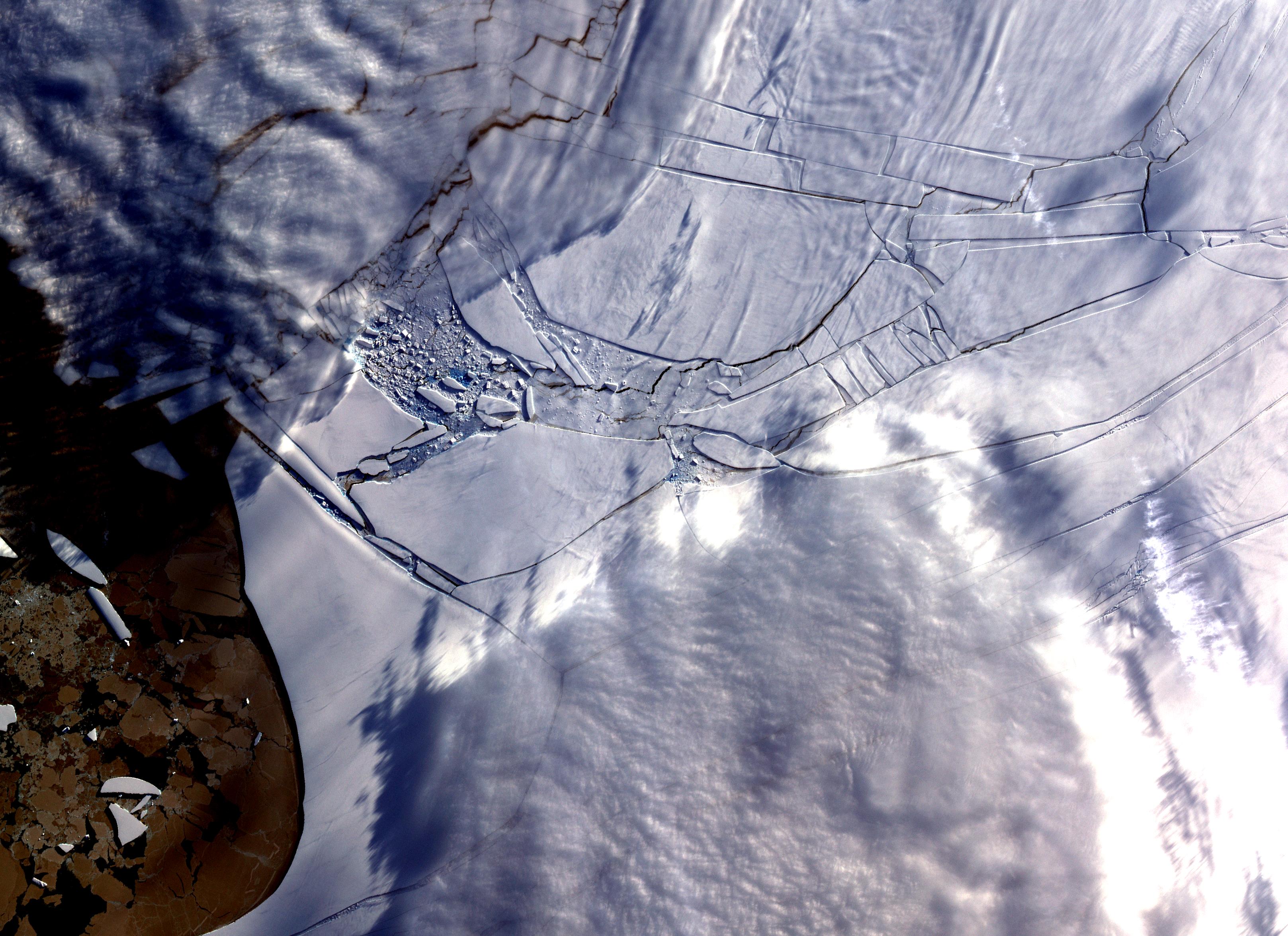
PIA11991:
-
Wilkins Ice Shelf
Full Resolution:
TIFF
(22.82 MB)
JPEG
(984.9 kB)
|
|
|
2009-04-20 |
Earth
|
Terra
|
ASTER
|
3708x2920x3 |
|
-
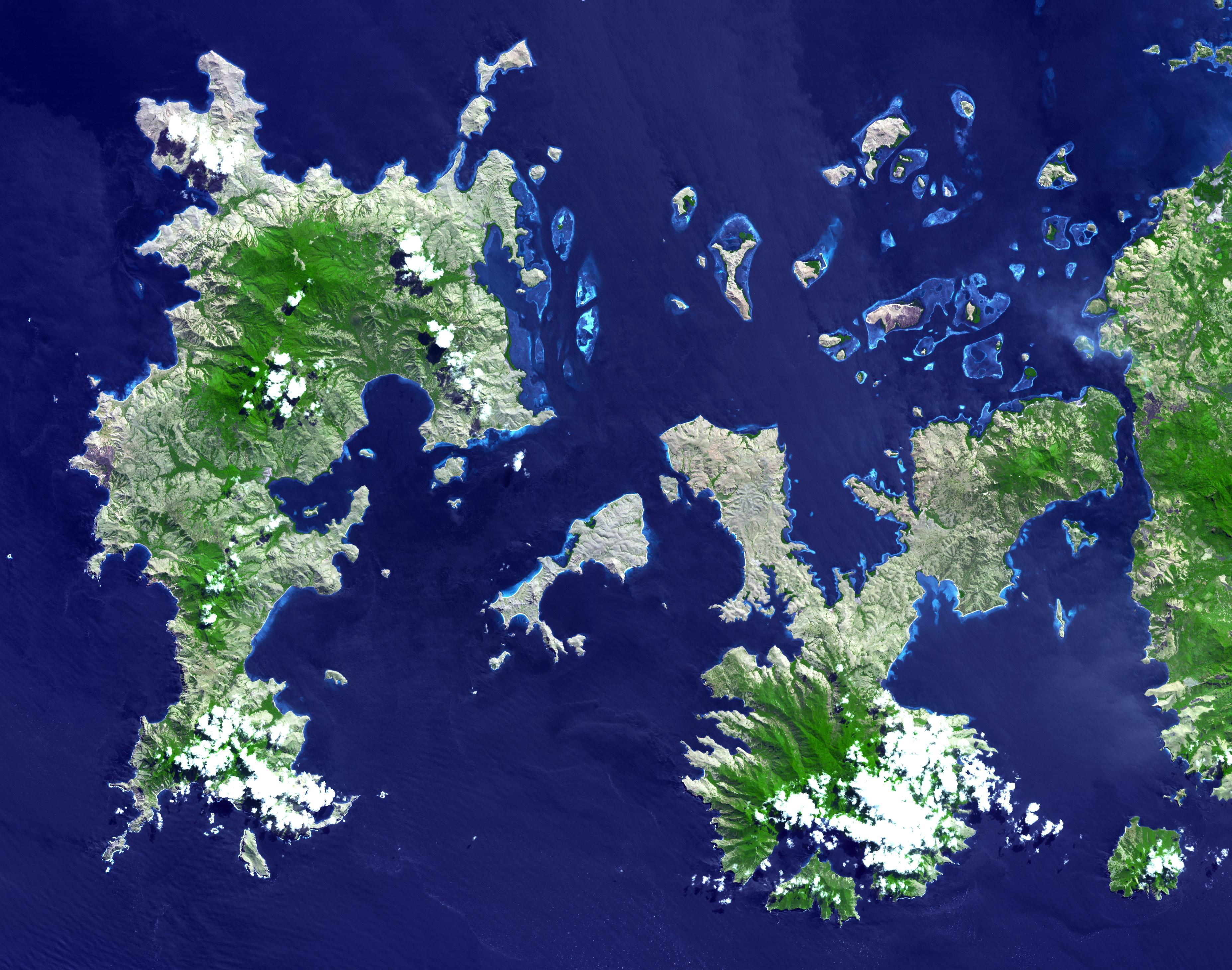
PIA12061:
-
Komodo National Park, Indonesia
Full Resolution:
TIFF
(32.48 MB)
JPEG
(1.387 MB)
|
|
|
2009-04-19 |
Earth
|
Terra
|
ASTER
|
2508x5460x3 |
|
-
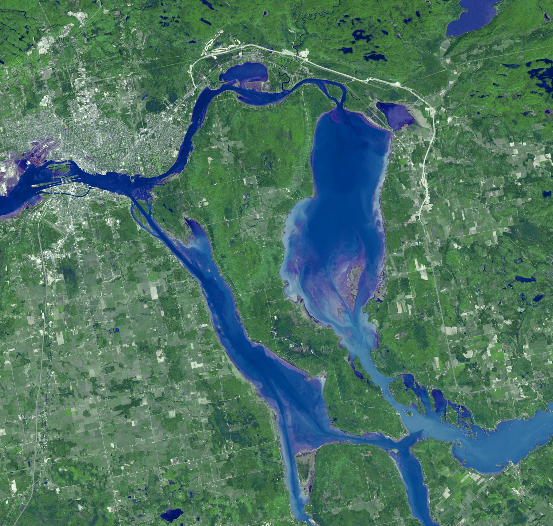
PIA11989:
-
North Dakota Floods
Full Resolution:
TIFF
(41.12 MB)
JPEG
(3.296 MB)
|
|
|
2009-04-03 |
Earth
|
Terra
|
ASTER
|
3108x4319x3 |
|
-
PIA12060:
-
Musandam Peninsula, Oman
Full Resolution:
TIFF
(40.27 MB)
JPEG
(1.593 MB)
|
|
|
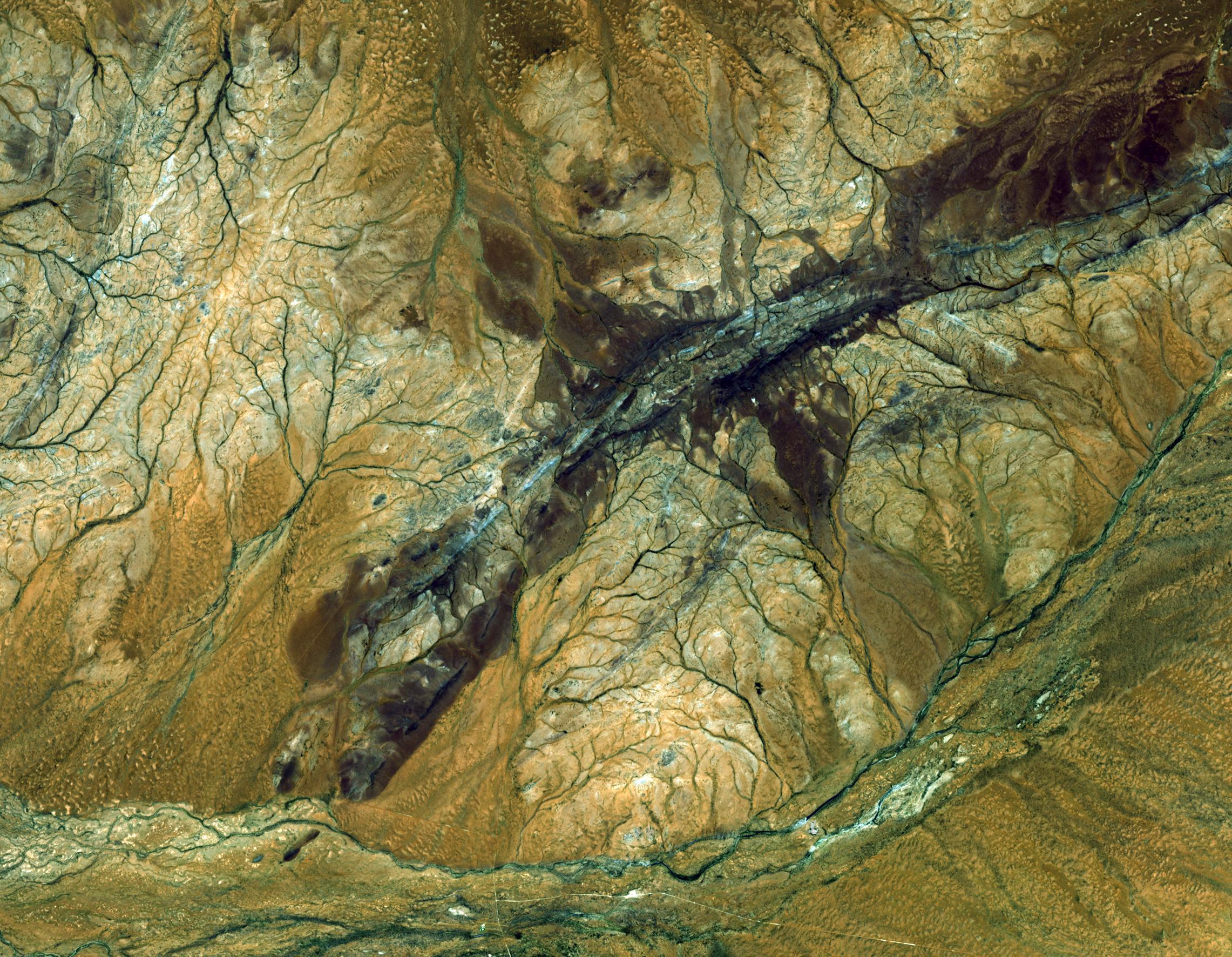
2009-03-26 |
Earth
|
Terra
|
ASTER
|
1949x2646x3 |

|
-
PIA12059:
-
Grand Turk Island
Full Resolution:
TIFF
(15.49 MB)
JPEG
(591.2 kB)
|
|
|
2009-03-16 |
Earth
|
Terra
|
ASTER
|
2676x1918x3 |
|
-
PIA12058:
-
Karymsky Volcano, Kamchatka
Full Resolution:
TIFF
(15.41 MB)
JPEG
(726.5 kB)
|
|
|
2009-03-02 |
Earth
|
Terra
|
ASTER
|
2368x3020x3 |
|
-
PIA12057:
-
Palm Islands, Dubai, UAE
Full Resolution:
TIFF
(21.48 MB)
JPEG
(700.7 kB)
|
|
|
2009-02-20 |
Earth
|
Terra
|
ASTER
|
3900x3764x3 |
|
-
PIA12056:
-
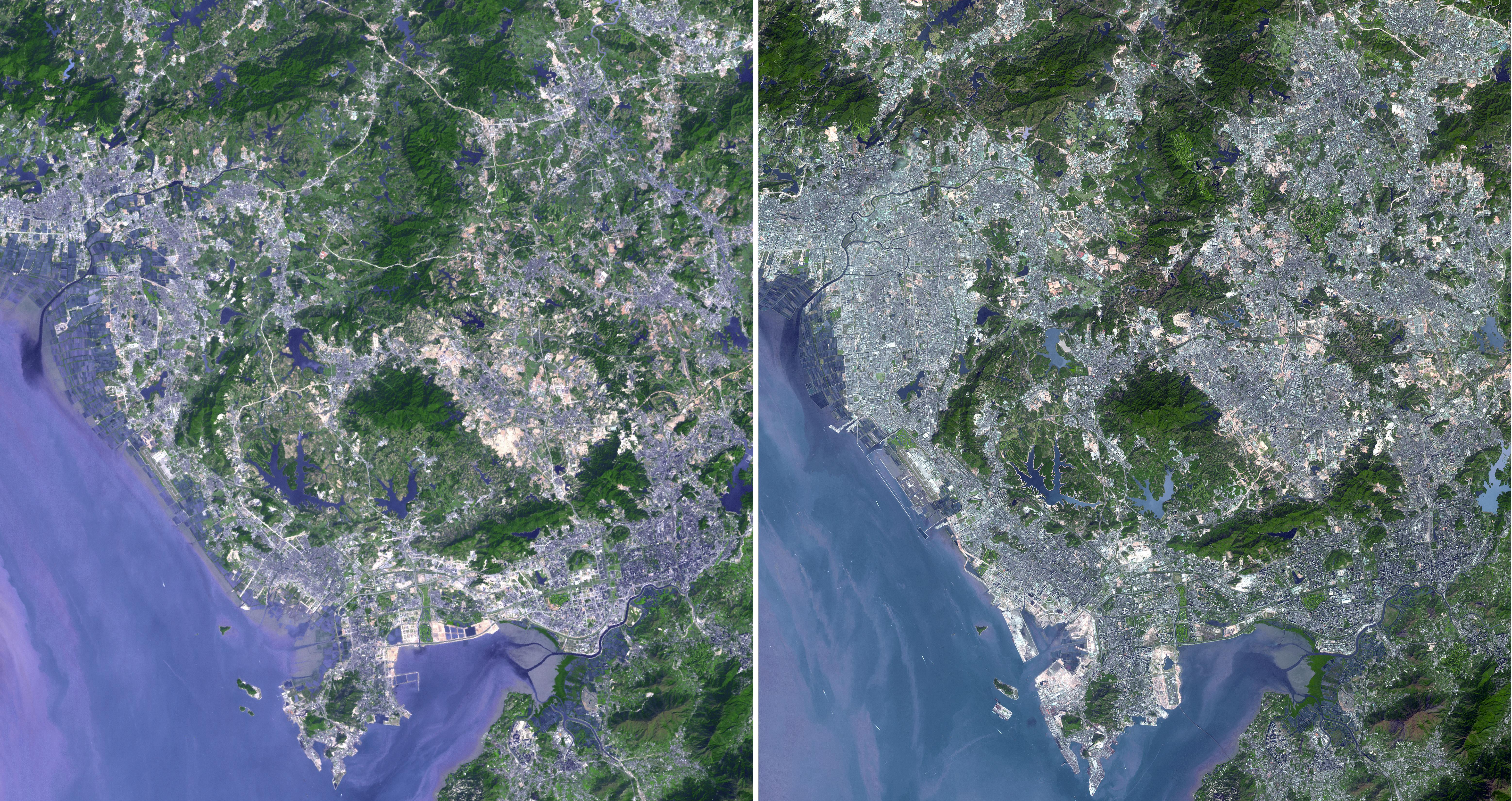
Hokkaido, Japan
Full Resolution:
TIFF
(44.04 MB)
JPEG
(1.775 MB)
|
|
|
2009-02-18 |
Earth
|
Terra
|
ASTER
|
3315x3324x3 |

|
-
PIA11806:
-
Australia Wildfires Extract a Heavy Toll in Lives, Land
Full Resolution:
TIFF
(33.06 MB)
JPEG
(1.678 MB)
|
|
|
2009-02-09 |
Earth
|
Terra
|
ASTER
|
2468x1992x3 |
|
-
PIA12055:
-
Jamestown, VA
Full Resolution:
TIFF
(14.76 MB)
JPEG
(918.7 kB)
|
|
|
2009-01-09 |
Earth
|
Terra
|
ASTER
|
3136x1656x3 |
|
-
PIA11752:
-
Bodele Sand Dunes, Chad
Full Resolution:
TIFF
(15.58 MB)
JPEG
(879.5 kB)
|
|
|
2008-11-17 |
Earth
|
Terra
|
ASTER
|
4070x8024x3 |
|
-
PIA11419:
-
Byrd Glacier, Antarctica
Full Resolution:
TIFF
(97.97 MB)
JPEG
(7.07 MB)
|
|
|
2008-11-03 |
Earth
|
Terra
|
ASTER
|
6630x5000x3 |
|
-
PIA11394:
-
Aftermath of Hurricane Ike along Texas Coast
Full Resolution:
TIFF
(99.45 MB)
JPEG
(4.42 MB)
|
|
|
2008-10-16 |
Earth
|
Terra
|
ASTER
|
1922x2982x3 |
|
-
PIA11420:
-
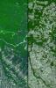
Mato Grosso, Brazil
Full Resolution:
TIFF
(17.22 MB)
JPEG
(1.446 MB)
|
|
|
2008-09-16 |
Earth
|
Terra
|
ASTER
|
3190x2810x3 |
|
-
PIA11169:
-
Northern Greenland
Full Resolution:
TIFF
(26.89 MB)
JPEG
(1.555 MB)
|
|
|
2008-08-28 |
Earth
|
Terra
|
ASTER
|
3832x2956x3 |
|
-
PIA11085:
-
Colorado River Delta
Full Resolution:
TIFF
(33.98 MB)
JPEG
(1.911 MB)
|
|
|
2008-08-08 |
Earth
|
Terra
|
ASTER
|
3656x4124x3 |
|
-
PIA11084:
-
Rub' al Khali, Arabia
Full Resolution:
TIFF
(45.23 MB)
JPEG
(3.202 MB)
|
|
|
2008-07-23 |
Earth
|
Terra
|
ASTER
|
1503x2214x3 |
|
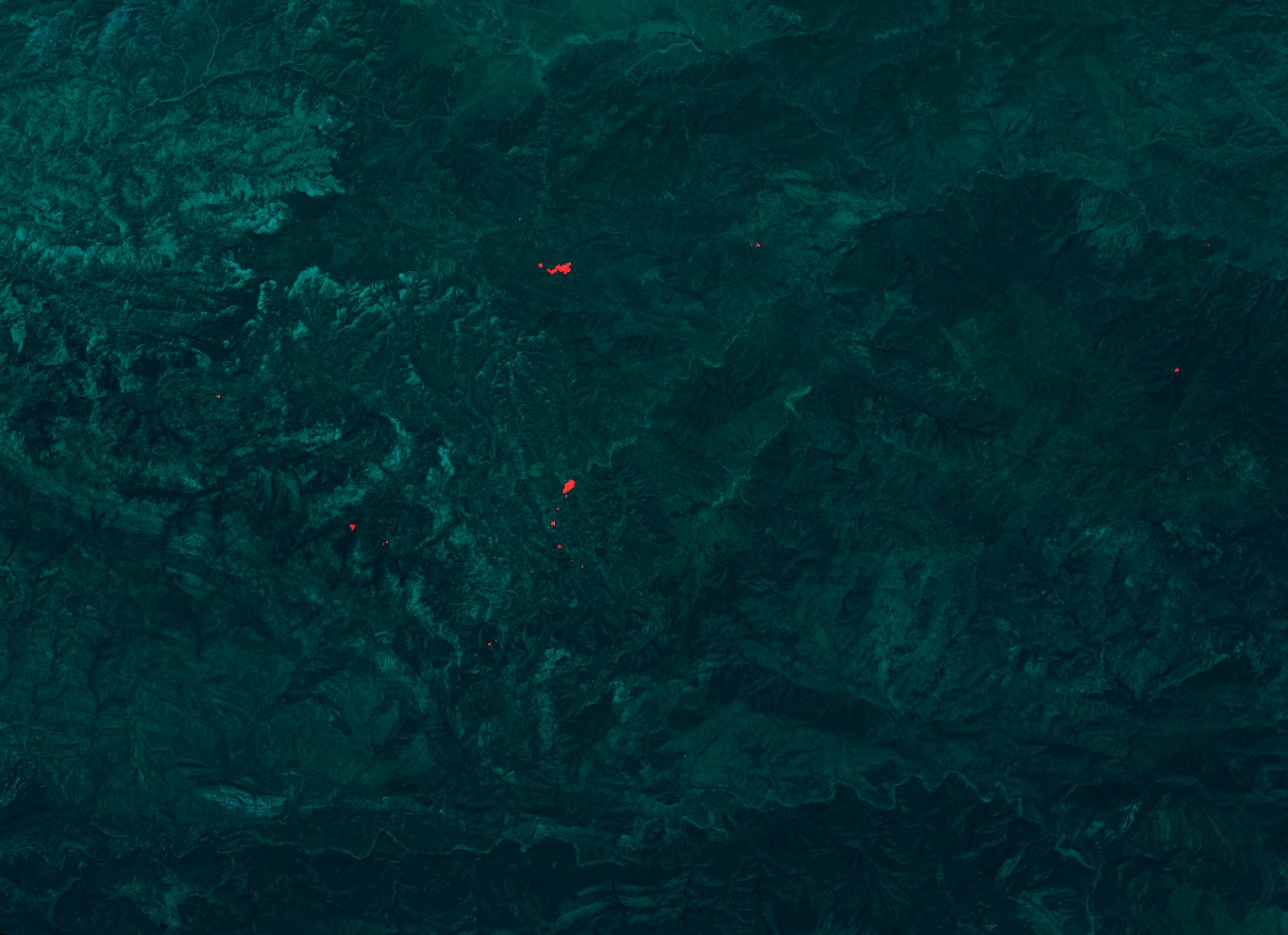
-
PIA10975:
-
Yolla Bolly Complex Wildland Fire
Full Resolution:
TIFF
(10 MB)
JPEG
(733.5 kB)
|
|
|
2008-07-18 |
Earth
|
Terra
|
ASTER
|
1639x1611x3 |
|
-
PIA11083:
-
L'Anse Aux Meadows, Newfoundland
Full Resolution:
TIFF
(7.934 MB)
JPEG
(468.6 kB)
|
|
|
2008-07-02 |
Earth
|
Terra
|
MISR
|
1267x1187x3 |
|
-
PIA10927:
-
Smoke Blankets Northern California
Full Resolution:
TIFF
(4.517 MB)
JPEG
(100.6 kB)
|
|
|
2008-06-30 |
Earth
|
Terra
|
ASTER
|
3858x2484x3 |
|
-
PIA10925:
-
Fires Burning near Big Sur, California
Full Resolution:
TIFF
(28.75 MB)
JPEG
(1.261 MB)
|
|
|
2008-06-18 |
Earth
|
Terra
|
ASTER
|
2706x2134x3 |
|
-
PIA11082:
-
East African Rift
Full Resolution:
TIFF
(17.34 MB)
JPEG
(1.272 MB)
|
|
|
2008-06-06 |
Earth
|
Terra
|
ASTER
|
1761x1054x3 |
|
-
PIA10772:
-
Sichuan Earthquake in China
Full Resolution:
TIFF
(5.577 MB)
JPEG
(375.9 kB)
|
|
|
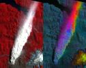
2008-05-30 |
Earth
|
Terra
|
ASTER
|
800x295x3 |
|
-
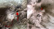
PIA11081:
-
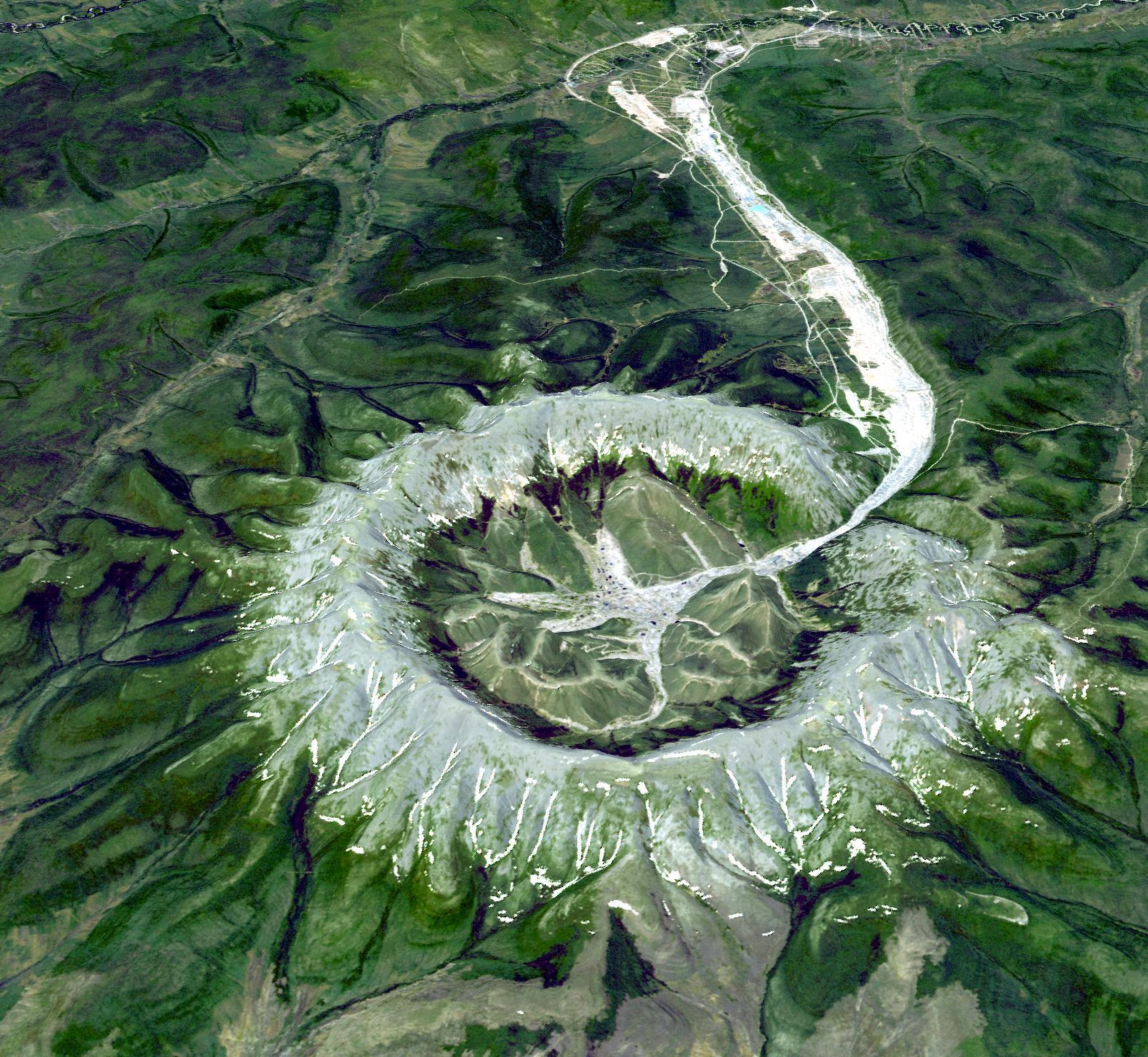
Chaiten Volcano, Chile
Full Resolution:
TIFF
(709 kB)
JPEG
(45.79 kB)
|
|
|
2008-05-23 |
Earth
|
Terra
|
ASTER
|
1735x1511x3 |

|
-
PIA11080:
-
Nuuk, Greenland
Full Resolution:
TIFF
(7.877 MB)
JPEG
(433.8 kB)
|
|
|
2008-05-09 |
Earth
|
Terra
|
ASTER
|
3732x2427x3 |

|
-
PIA11079:
-
Al Jazirah, Sudan
Full Resolution:
TIFF
(27.17 MB)
JPEG
(2.287 MB)
|
|
|
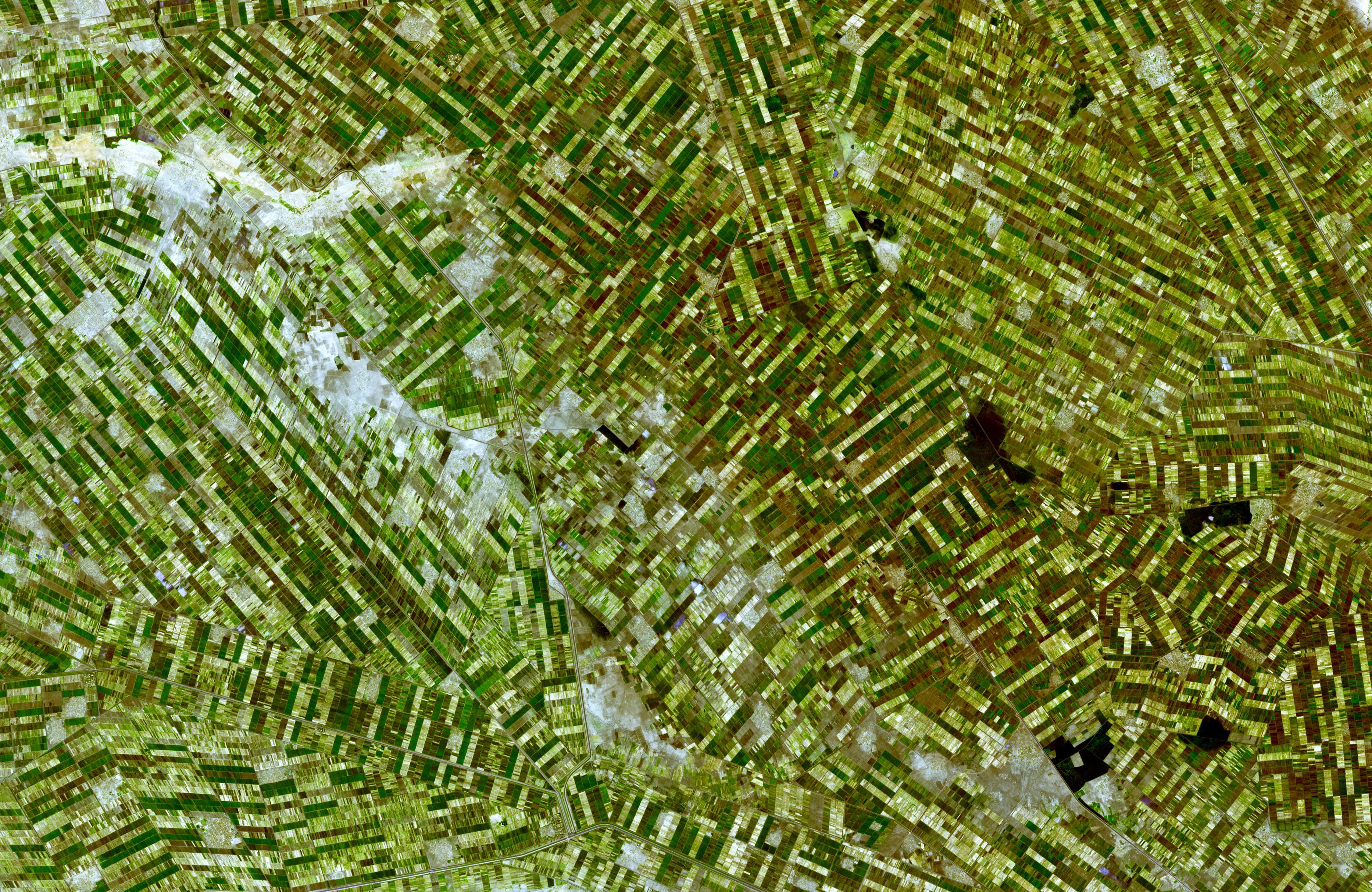
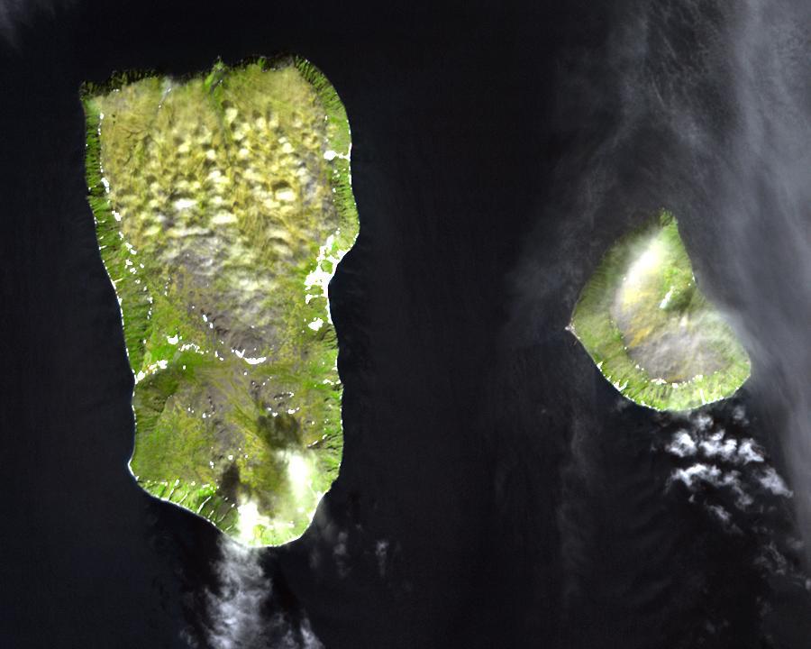
2008-04-30 |
Earth
|
Terra
|
ASTER
|
900x720x3 |
|
-
PIA10631:
-
Diomede Islands, Bering Straight
Full Resolution:
TIFF
(1.946 MB)
JPEG
(67.39 kB)
|
|
|
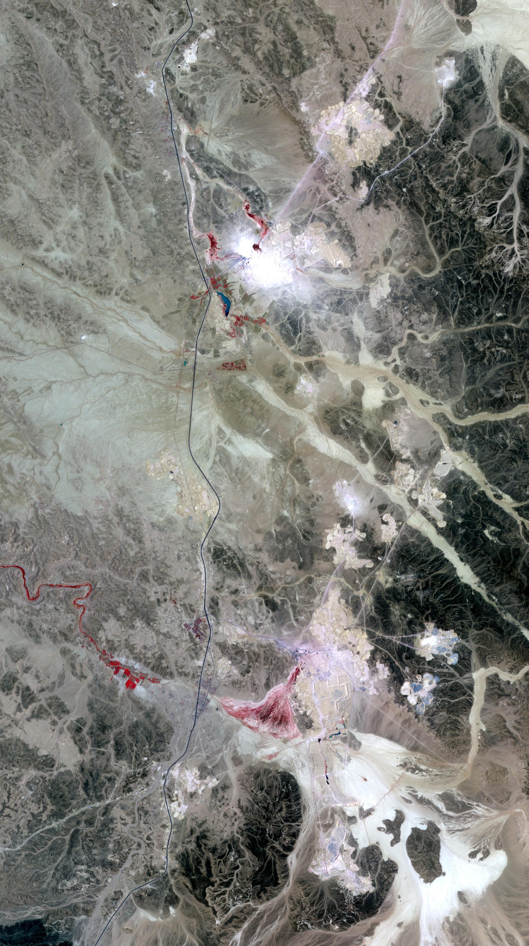
2008-04-21 |
Earth
|
Terra
|
ASTER
|
1832x3276x3 |
|
-
PIA10630:
-
Phosphate Mines, Jordan
Full Resolution:
TIFF
(18.03 MB)
JPEG
(949.6 kB)
|
|
|
2008-04-08 |
Earth
|
Terra
|
ASTER
|
1250x1091x3 |
|
-
PIA10629:
-
Nardò Ring, Italy
Full Resolution:
TIFF
(4.096 MB)
JPEG
(336.8 kB)
|
|
|
2008-04-04 |
Earth
|
Terra
|
ASTER
|
393x416x3 |

|
-
PIA10365:
-
Hawaii's Kilauea Volcano Belches a Toxic Brew
Full Resolution:
TIFF
(491.3 kB)
JPEG
(27.74 kB)
|
|
|
2008-04-01 |
Earth
|
Terra
|
ASTER
|
2536x2104x3 |
|
-
PIA10628:
-
Western Slope of Andes, Peru
Full Resolution:
TIFF
(16.02 MB)
JPEG
(1.374 MB)
|
|
|
2008-03-21 |
Earth
|
Terra
|
ASTER
|
2505x2463x3 |
|
-
PIA10627:
-
Norilsk, Siberia
Full Resolution:
TIFF
(18.53 MB)
JPEG
(1.2 MB)
|
|
|
2008-03-10 |
Earth
|
Terra
|
ASTER
|
1596x1509x3 |

|
-
PIA10626:
-
Longyearbyen, Svalbard, Norway
Full Resolution:
TIFF
(7.237 MB)
JPEG
(503.1 kB)
|
|
|
2008-02-29 |
Earth
|
Terra
|
ASTER
|
1666x1772x3 |
|
-
PIA10625:
-
Lake Naivasha, Kenya
Full Resolution:
TIFF
(8.871 MB)
JPEG
(451.1 kB)
|
|
|
2008-02-19 |
Earth
|
Terra
|
ASTER
|
1607x1480x3 |
|
-
PIA10624:
-
Kondyor Massif, Russia
Full Resolution:
TIFF
(7.147 MB)
JPEG
(530.2 kB)
|
|
|
2008-02-07 |
Earth
|
Terra
|
ASTER
|
626x464x3 |
|
-
PIA10623:
-
Anatahan Volcano, Mariana Islands
Full Resolution:
TIFF
(872.6 kB)
JPEG
(46.37 kB)
|
|
|
2008-01-30 |
Earth
|
Terra
|
ASTER
|
3047x7555x3 |
|
-
PIA10622:
-
Belcher Islands, Canada
Full Resolution:
TIFF
(69.06 MB)
JPEG
(2.072 MB)
|
|
|
2008-01-17 |
Earth
|
Terra
|
ASTER
|
2319x2037x3 |
|
-
PIA10621:
-
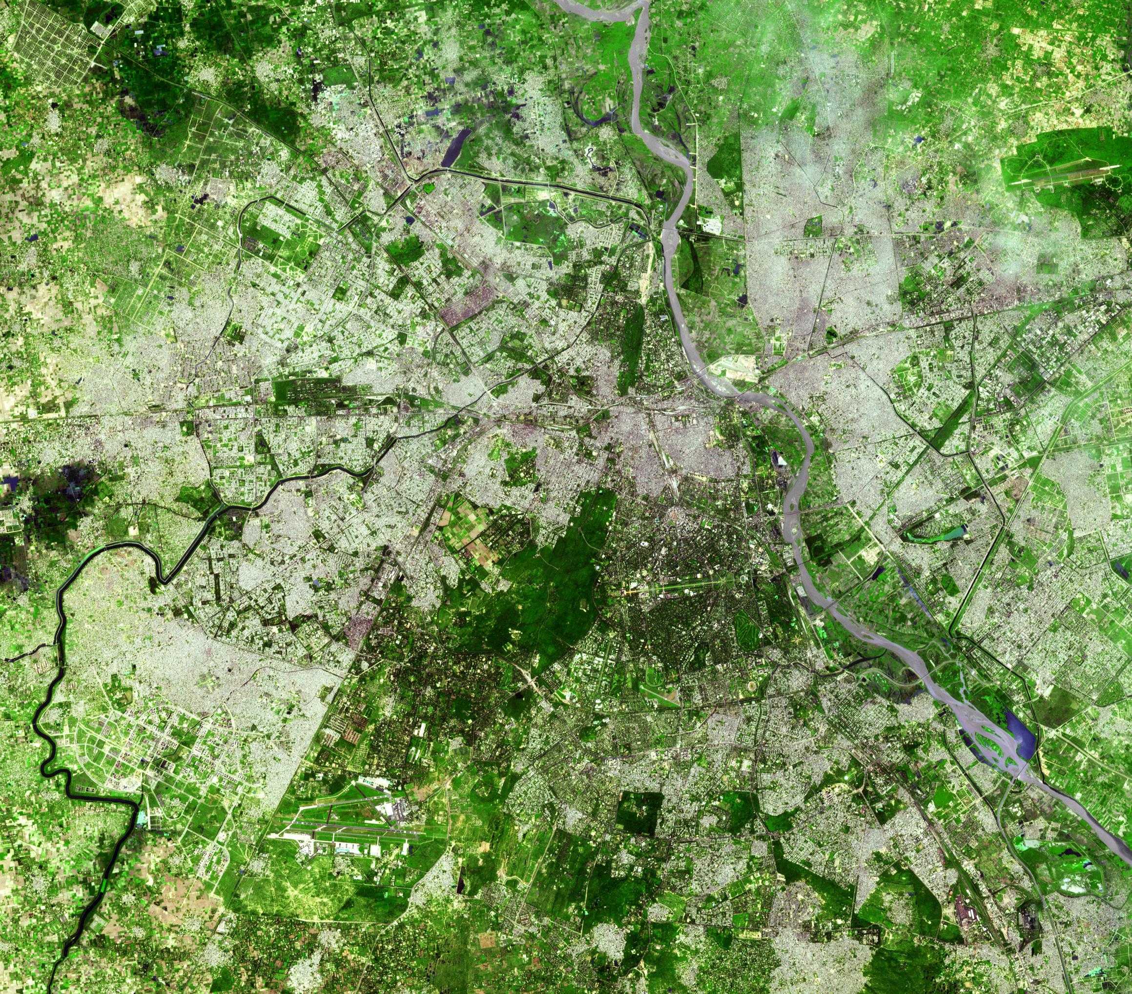
Delhi, India
Full Resolution:
TIFF
(14.19 MB)
JPEG
(1.504 MB)
|
|
|
2007-12-11 |
Earth
|
Terra
|
ASTER
|
3792x3796x3 |
|
-
PIA10620:
-
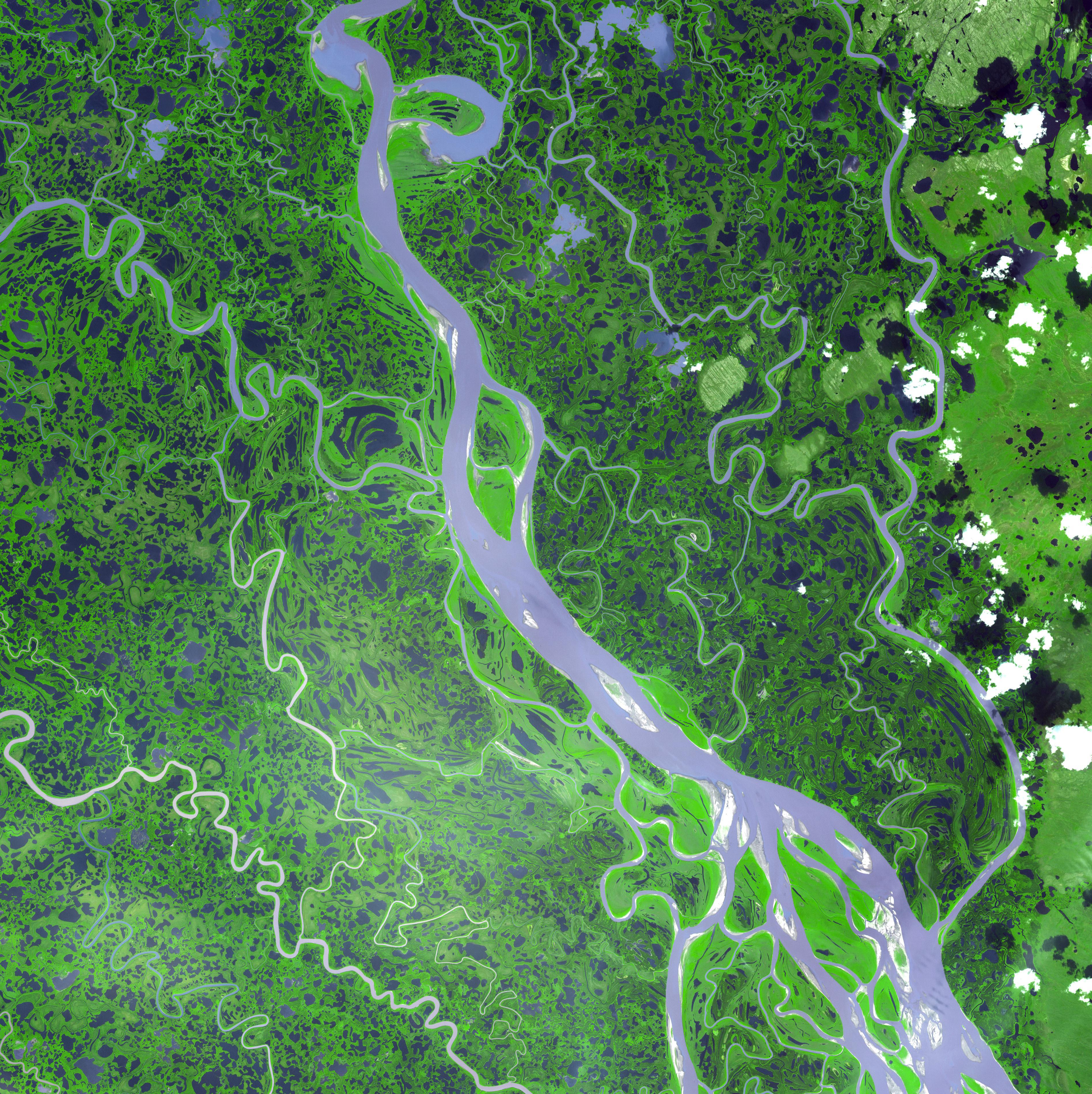
Mackenzie River Delta, Canada
Full Resolution:
TIFF
(43.18 MB)
JPEG
(2.795 MB)
|
|
|
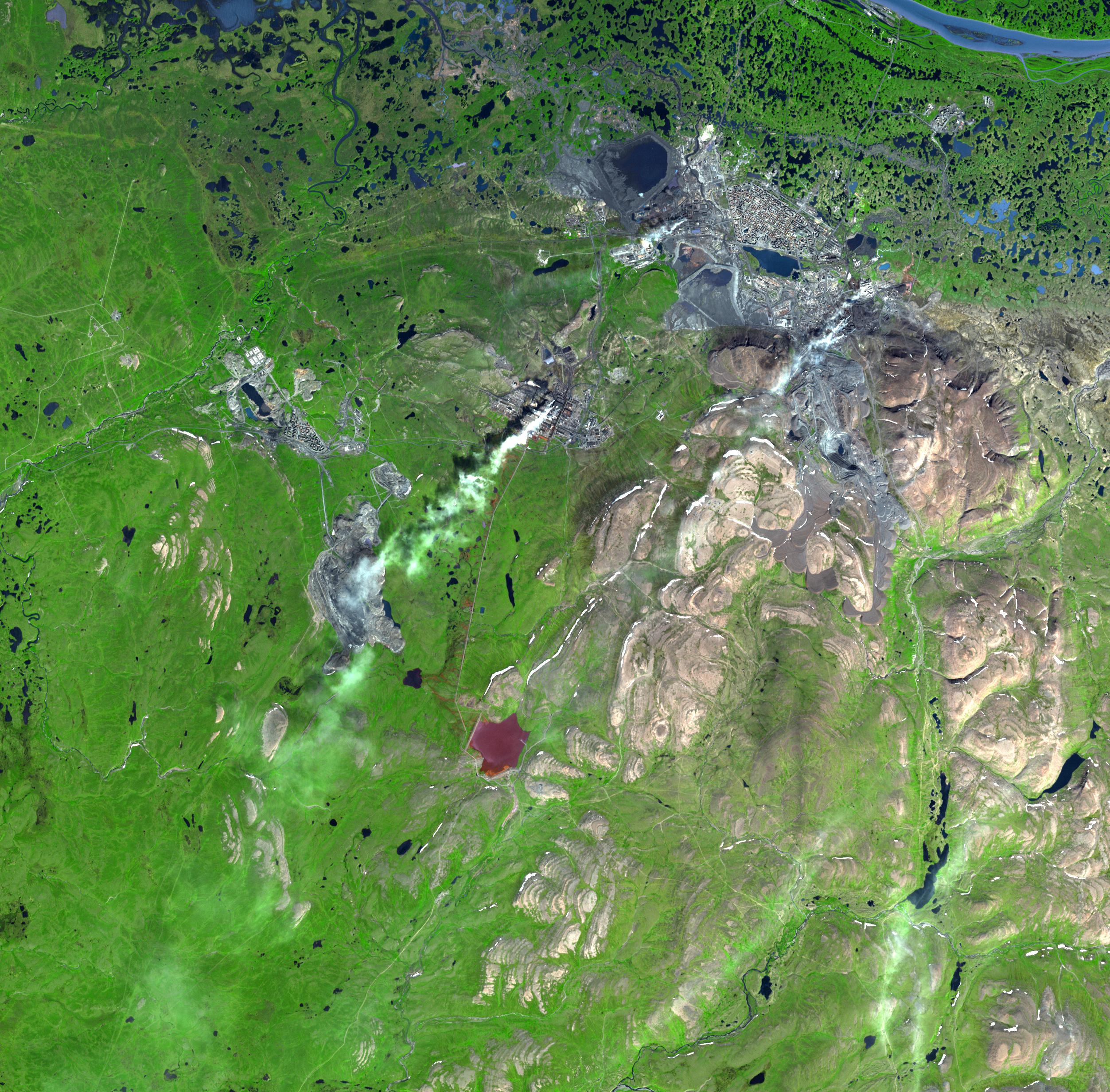
2007-11-26 |
Earth
|
Terra
|
ASTER
|
3000x1700x3 |
|
-
PIA10619:
-
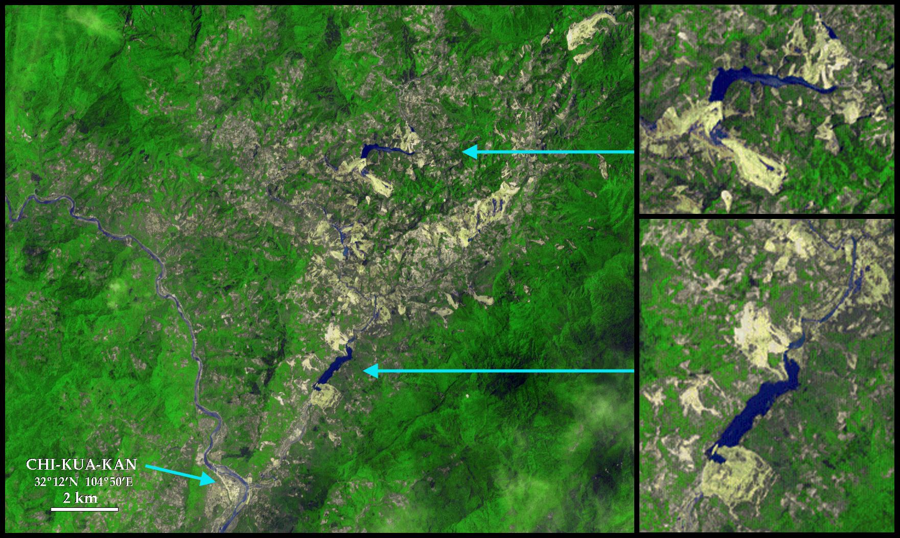
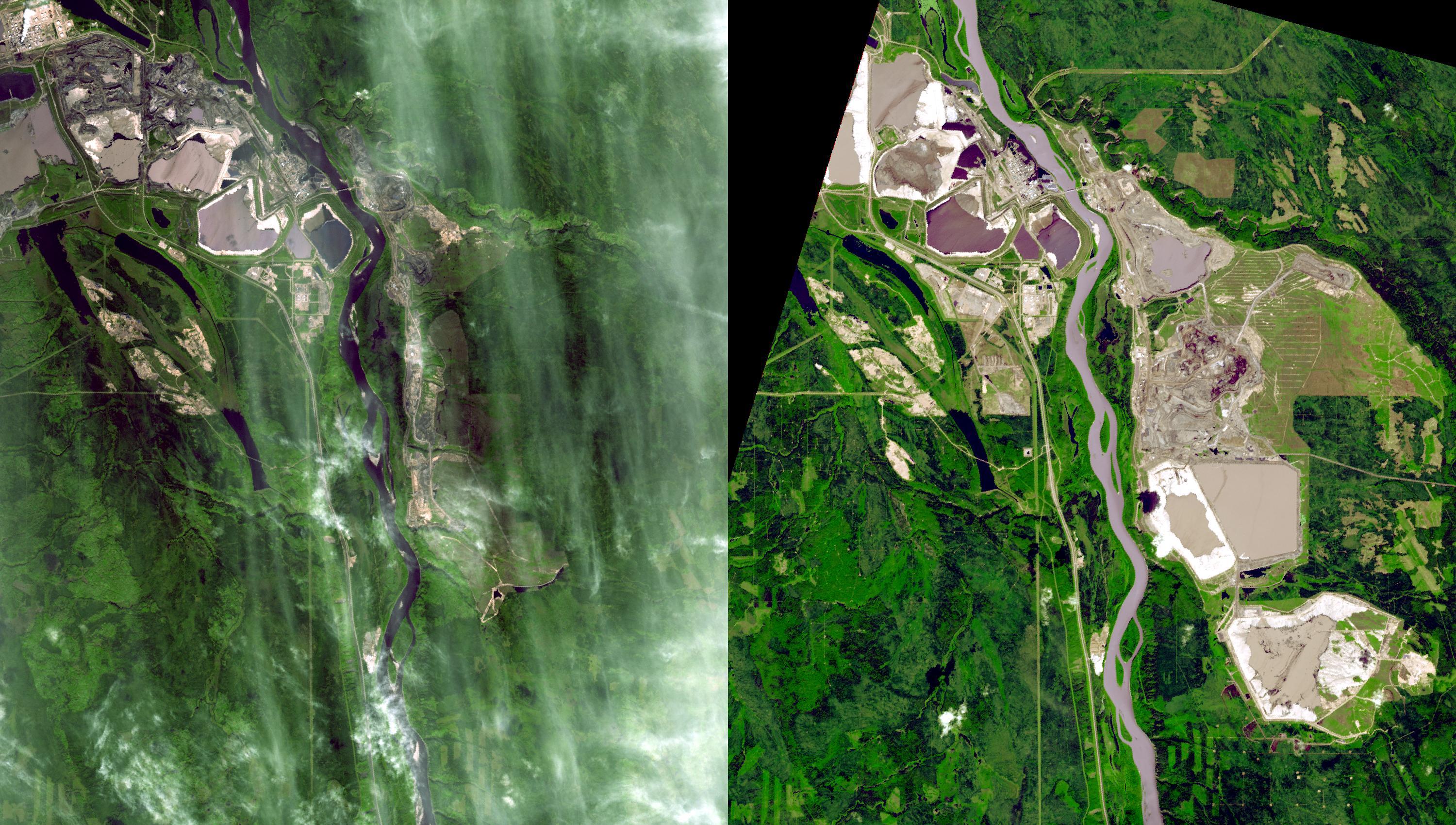
Millennium Open Pit Mine, Alberta, Canada
Full Resolution:
TIFF
(15.3 MB)
JPEG
(936.1 kB)
|
|
|
2007-11-13 |
Earth
|
Terra
|
ASTER
|
3804x3450x3 |
|
-
PIA10618:
-
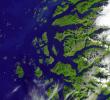
Saltfjellet-Svartisen Park, Norway
Full Resolution:
TIFF
(39.37 MB)
JPEG
(1.597 MB)
|
|
|
2007-11-08 |
Earth
|
Terra
|
ASTER
|
3000x5002x3 |
|
-
PIA10112:
-
Witch Wildland Fire, California
Full Resolution:
TIFF
(45.02 MB)
JPEG
(4.805 MB)
|
|
|
2007-10-25 |
Earth
|
Terra
|
ASTER
|
1403x1127x3 |
|
-
PIA10617:
-
Morenci Mine, AZ
Full Resolution:
TIFF
(4.753 MB)
JPEG
(409.6 kB)
|
|
|
2007-10-24 |
Earth
|
Terra
|
MISR
|
4432x2880x3 |
|
-
PIA10090:
-
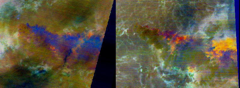
MISR Multi-angle Views of Sunday Morning Fires
Full Resolution:
TIFF
(38.29 MB)
JPEG
(703.1 kB)
|
|
|
2007-10-12 |
Earth
|
Terra
|
ASTER
|
3718x7302x3 |
|
-
PIA10616:
-
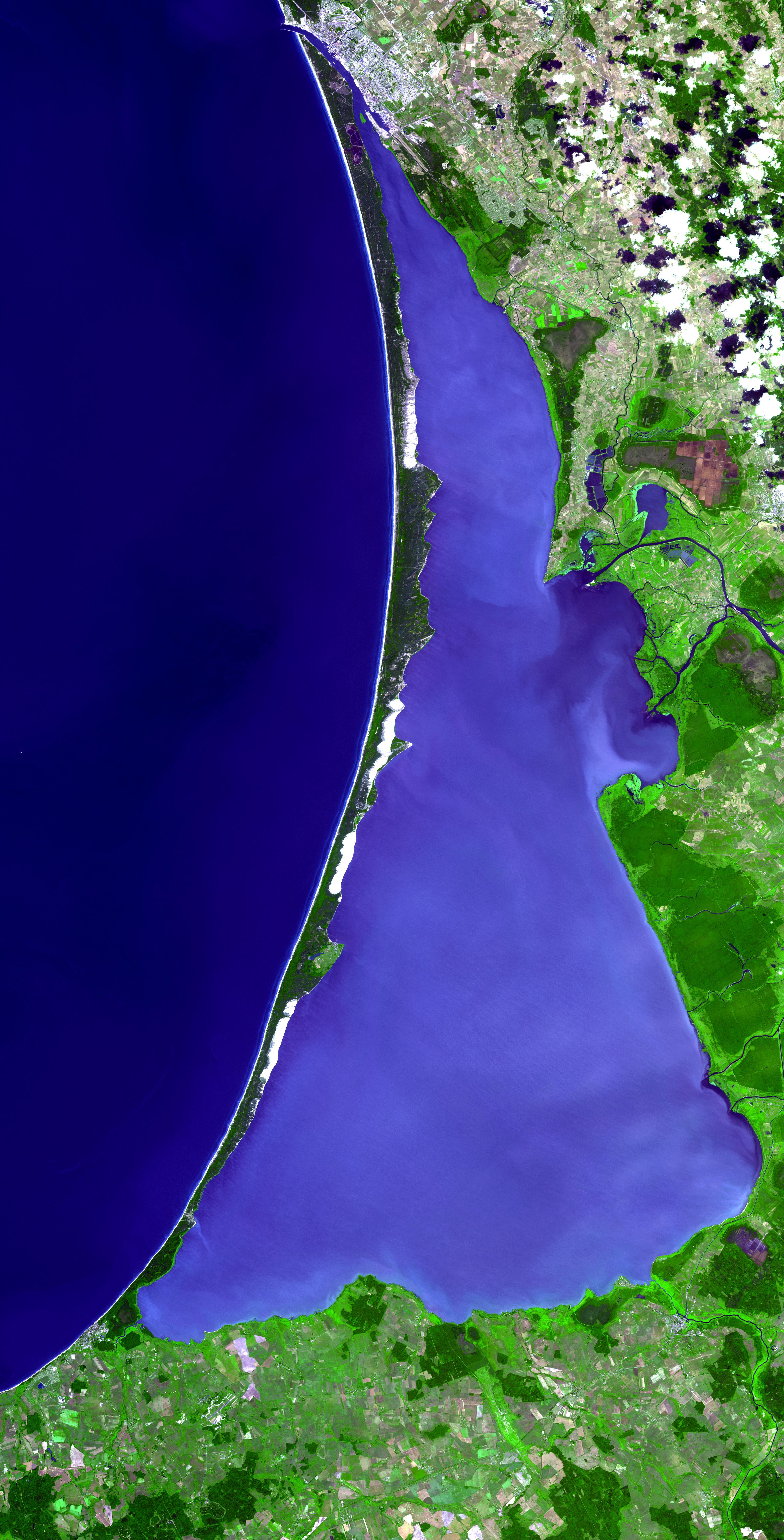
Curonian Spit, Lithuania and Russia
Full Resolution:
TIFF
(81.45 MB)
JPEG
(3.138 MB)
|
|
|
2007-10-02 |
Earth
|
Terra
|
ASTER
|
1605x2700x3 |
|
-
PIA10615:
-
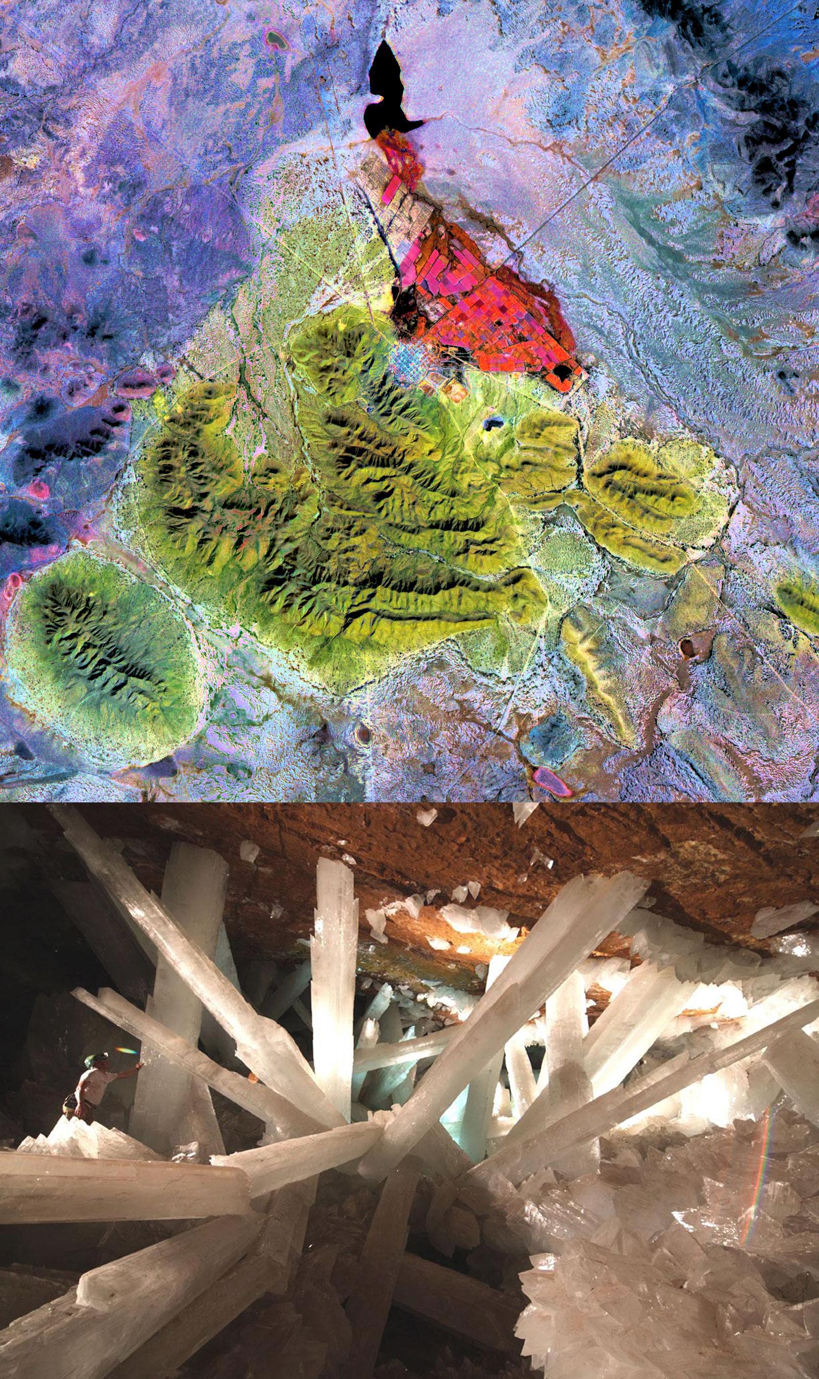
Naica Mine, Chihuahua, Mexico
Full Resolution:
TIFF
(13.02 MB)
JPEG
(962.6 kB)
|
|
|
2007-09-20 |
Earth
|
Terra
|
ASTER
|
2000x1600x3 |
|
-
PIA10614:
-
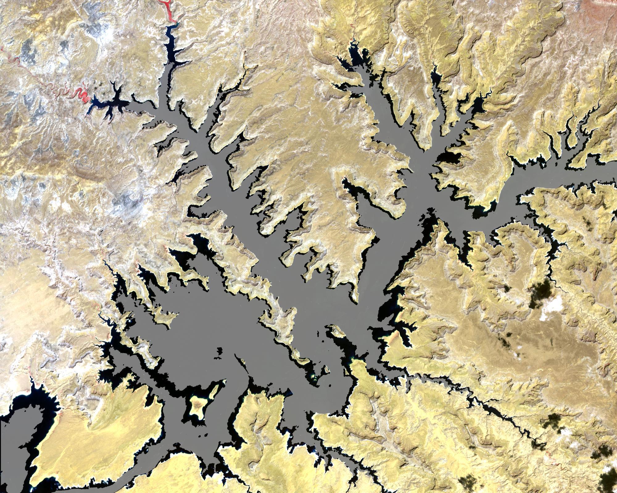
Lake Powell
Full Resolution:
TIFF
(9.613 MB)
JPEG
(644.7 kB)
|
|
|
2007-09-14 |
Earth
|
Terra
|
ASTER
|
3066x3186x3 |
|
-
PIA10613:
-
Uvs Nuur, Mongolia
Full Resolution:
TIFF
(29.31 MB)
JPEG
(1.59 MB)
|
|
|
2007-09-04 |
Earth
|
Terra
|
ASTER
|
752x846x3 |

|
-
PIA09969:
-
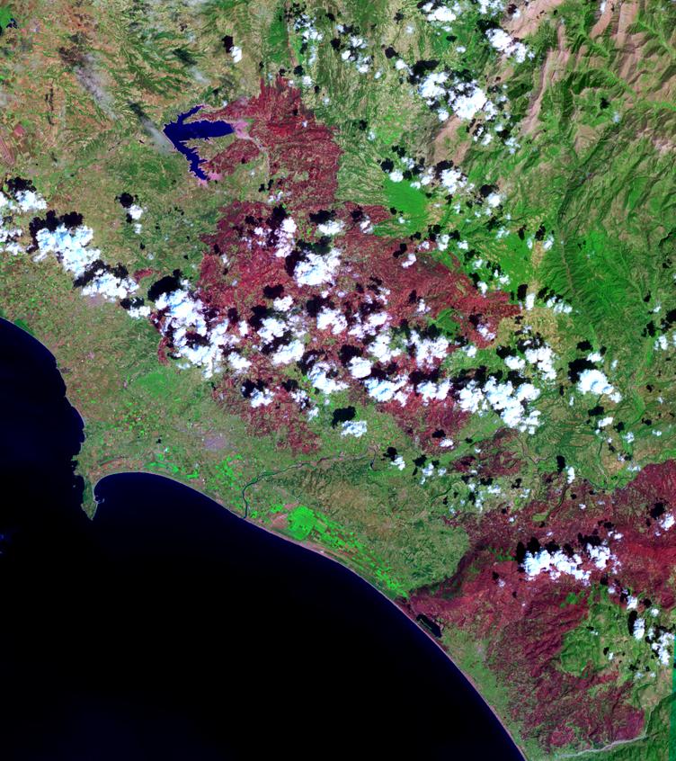
Fire in Southern Greece
Full Resolution:
TIFF
(1.911 MB)
JPEG
(151.3 kB)
|
|
|
2007-08-31 |
Earth
|
Terra
|
ASTER
|
369x518x3 |

|
-
PIA09968:
-
Lava Flow at Kilauea, Hawaii
Full Resolution:
TIFF
(574.3 kB)
JPEG
(37.96 kB)
|
|
|
2007-08-24 |
Earth
|
Terra
|
ASTER
|
1600x3000x3 |
|
-
PIA10612:
-
Astana, Kazakhstan
Full Resolution:
TIFF
(14.42 MB)
JPEG
(977.7 kB)
|
|
|
2007-08-07 |
Earth
|
Terra
|
ASTER
|
754x769x3 |

|
-
PIA02158:
-
Zaca Fire
Full Resolution:
TIFF
(1.742 MB)
JPEG
(157.2 kB)
|
|
|
2007-07-03 |
Earth
|
Terra
|
ASTER
|
1200x800x3 |
|
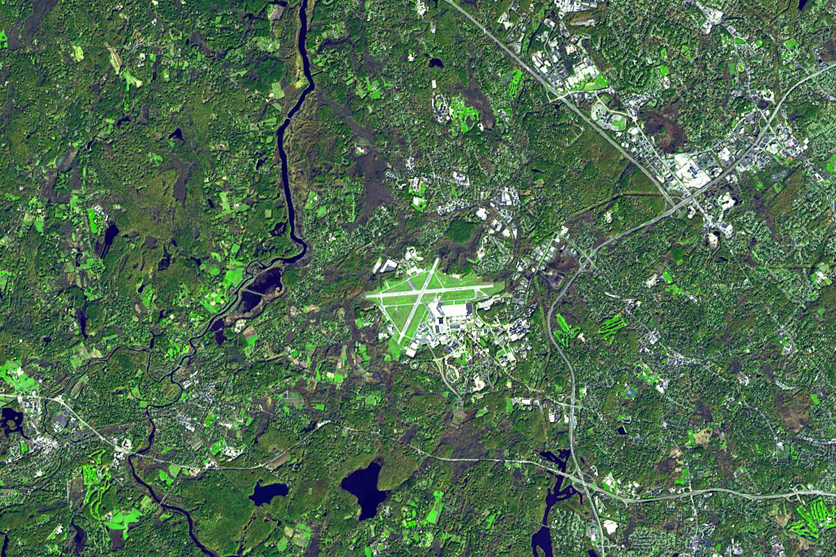
-
PIA09699:
-
Lexington and Concord, Massachusetts
Full Resolution:
TIFF
(2.883 MB)
JPEG
(358.6 kB)
|
|
|
2007-06-28 |
Earth
|
Terra
|
ASTER
|
1000x1000x3 |
|
-
PIA09698:
-
Fire near South Lake Tahoe, California
Full Resolution:
TIFF
(3.004 MB)
JPEG
(242.2 kB)
|
|
|
2007-06-12 |
Earth
|
Terra
|
ASTER
|
1000x400x3 |
|
-
PIA09603:
-
Geyser Valley on the Kamchatka Peninsula
Full Resolution:
TIFF
(1.202 MB)
JPEG
(110.1 kB)
|
|
|
2007-05-04 |
Earth
|
Terra
|
MISR
|
1217x835x3 |
|
-
PIA09362:
-
St. Louis, Missouri
Full Resolution:
TIFF
(3.052 MB)
JPEG
(187.5 kB)
|
|
|
2007-04-30 |
Earth
|
Terra
|
ASTER
|
2560x1400x3 |
|
-
PIA09334:
-
Volcanic Eruptions in Kamchatka
Full Resolution:
TIFF
(10.76 MB)
JPEG
(666.9 kB)
|
|
|
2006-11-09 |
Earth
|
Terra
|
ASTER
|
1362x2011x3 |
|
-
PIA01899:
-
Home Reef, South Pacific
Full Resolution:
TIFF
(8.225 MB)
JPEG
(511.3 kB)
|
|
|
2006-11-08 |
Earth
|
Terra
|
ASTER
|
1794x1425x3 |
|
-
PIA01900:
-
Esperanza Fire near Palm Springs, California
Full Resolution:
TIFF
(7.681 MB)
JPEG
(659.2 kB)
|
|
|
2006-09-30 |
Earth
|
Terra
|
ASTER
|
2066x1499x3 |

|
-
PIA08790:
-
Day Fire in Ventura County
Full Resolution:
TIFF
(9.303 MB)
JPEG
(295.3 kB)
|
|
|
2006-09-15 |
Earth
|
Terra
|
ASTER
|
2514x1686x3 |
|
-
PIA01919:
-
Corinth Canal, Greece
Full Resolution:
TIFF
(12.73 MB)
JPEG
(1.028 MB)
|
|
|
2006-09-06 |
Earth
|
Terra
|
MISR
|
3882x1486x3 |
|
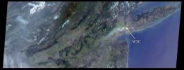
-
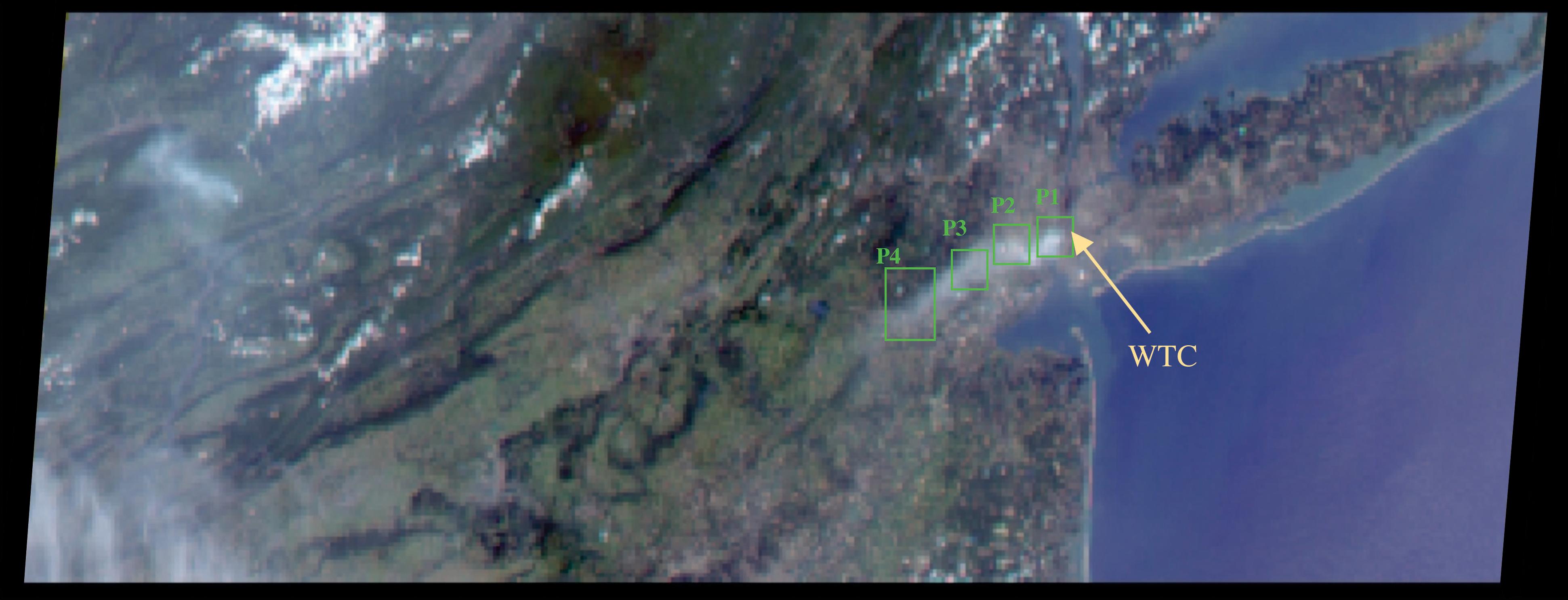
PIA04388:
-
Smoke Plume Dispersal from the World Trade Center Disaster
Full Resolution:
TIFF
(17.31 MB)
JPEG
(305.1 kB)
|
|
|
2006-09-01 |
Earth
|
Terra
|
ASTER
|
2176x3416x3 |
|
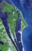
-
PIA01918:
-
John F. Kennedy Space Center
Full Resolution:
TIFF
(22.33 MB)
JPEG
(1.343 MB)
|
|
|
2006-08-11 |
Earth
|
Terra
|
ASTER
|
3960x4210x3 |
|
-
PIA01917:
-
The Channel Tunnel
Full Resolution:
TIFF
(50.02 MB)
JPEG
(1.689 MB)
|
|
|
2006-08-02 |
Earth
|
Terra
|
ASTER
|
1230x3209x3 |
|
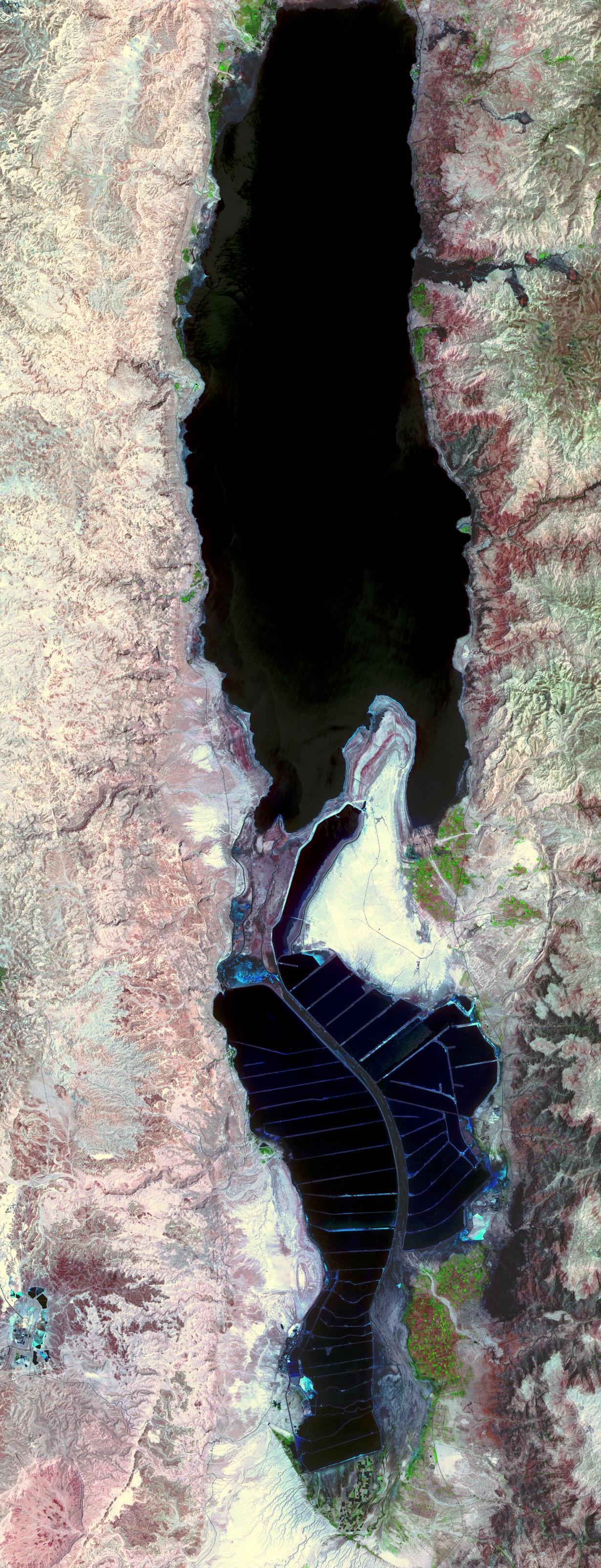
-
PIA01916:
-
The Dead Sea
Full Resolution:
TIFF
(11.85 MB)
JPEG
(859.1 kB)
|
|
|
2006-07-17 |
Earth
|
Terra
|
ASTER
|
758x1208x3 |

|
-
PIA01915:
-
Internal Ocean Waves
Full Resolution:
TIFF
(2.75 MB)
JPEG
(179.3 kB)
|
|
|
2006-07-13 |
Earth
|
Terra
|
MISR
|
1000x896x3 |
|
-
PIA08600:
-
A Strengthening Eastern Pacific Storm
Full Resolution:
TIFF
(2.692 MB)
JPEG
(228.9 kB)
|
|
|
2006-07-05 |
Earth
|
Terra
|
ASTER
|
4980x4200x3 |
|
-
PIA01914:
-
World Cup Final
Full Resolution:
TIFF
(62.75 MB)
JPEG
(4.988 MB)
|
|
|
2006-06-19 |
Earth
|
Terra
|
ASTER
|
4074x2082x3 |

|
-
PIA01913:
-
Attu, Alaska
Full Resolution:
TIFF
(25.45 MB)
JPEG
(1.285 MB)
|
|
|
2006-05-30 |
Earth
|
Terra
|
ASTER
|
1400x2220x3 |
|
-
PIA01912:
-
Bay of Fundy
Full Resolution:
TIFF
(9.342 MB)
JPEG
(594 kB)
|
|
|
2006-05-15 |
Earth
|
Terra
|
ASTER
|
2200x4020x3 |
|
-
PIA01911:
-
Shrimp Farms, Ecuador
Full Resolution:
TIFF
(26.56 MB)
JPEG
(1.473 MB)
|
|
|
2006-05-01 |
Earth
|
Terra
|
ASTER
|
1073x800x3 |
|
-
PIA01910:
-
Northern Arizona Volcanoes
Full Resolution:
TIFF
(2.579 MB)
JPEG
(165.3 kB)
|
|
|
2006-03-01 |
Earth
|
Terra
|
ASTER
|
1056x1168x3 |
|
-
PIA02435:
-
Uplift and Subsidence Associated with the Great Aceh-Andaman Earthquake
of 2004
Full Resolution:
TIFF
(3.705 MB)
JPEG
(141 kB)
|
 Planetary Data System


