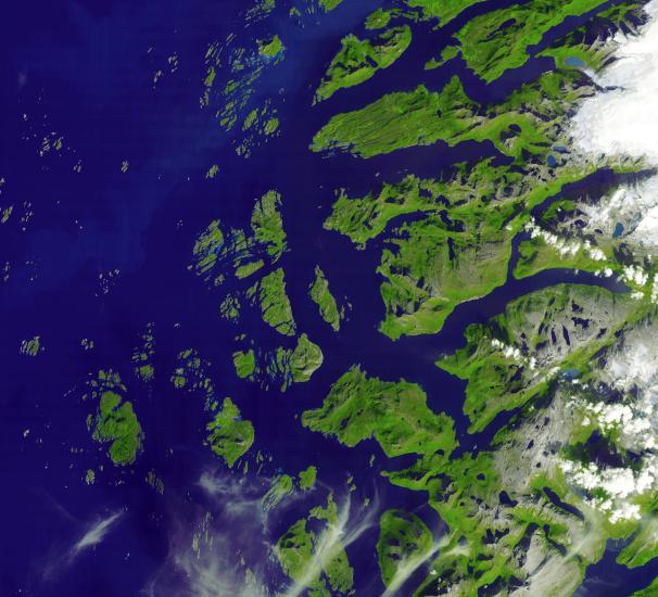
The Arctic Circle cuts through the western coast of Norway and the Saltfjellet-Svartisen National Park. This area features many glacial fjords, alpine mountain formations with glacier tongues, as well as gently sloping mountain plateaus and forested lowland valleys. The largest city here is Mo I Rana, (just off the image to the east) with a population of 25,000 (26th most populous city in Norway). Once supported entirely by the town's steel mill, the area has developed into a tourist center.
The image covers an area of 51 x 57 km, was acquired on August 23, 2006, and is located near 66.6 degrees north latitude, 13 degrees east longitude.
The U.S. science team is located at NASA's Jet Propulsion Laboratory, Pasadena, Calif. The Terra mission is part of NASA's Science Mission Directorate.