My
List |
Addition Date
|
Target
|
Mission
|
Instrument
|
Size
|

|
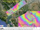
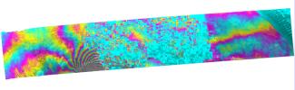
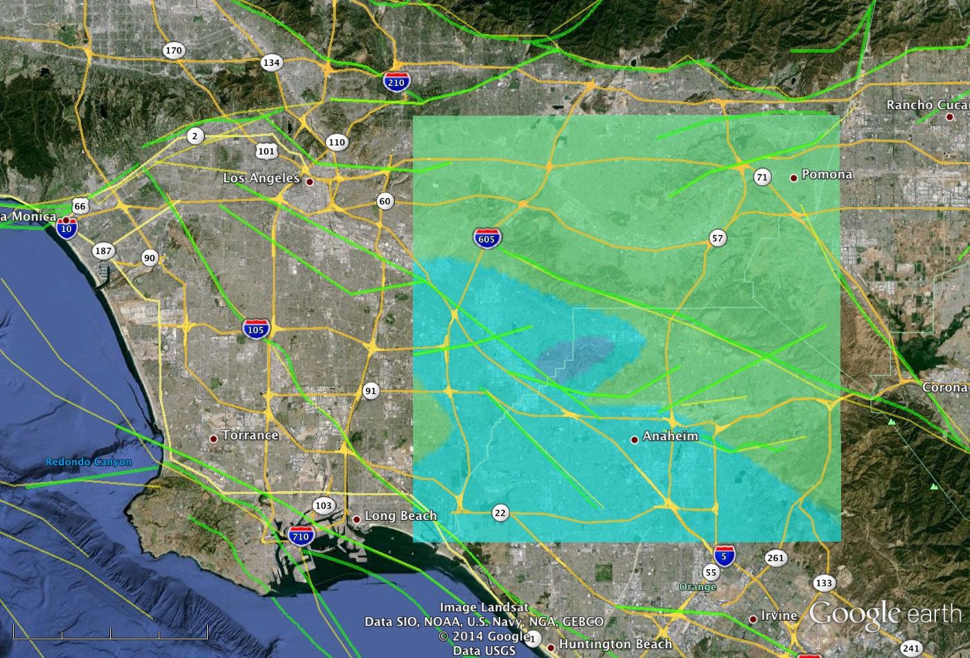
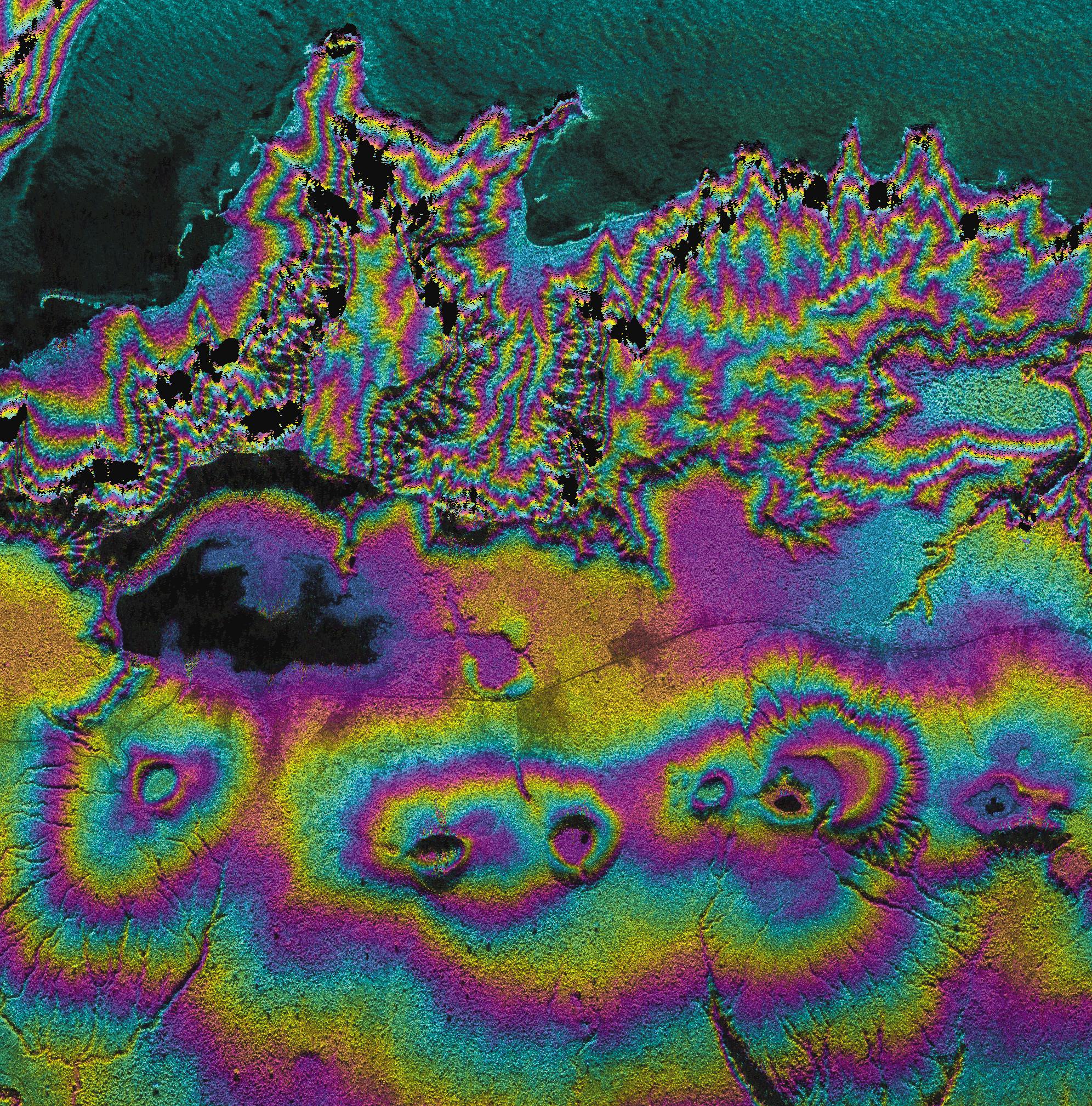
2025-02-10 |
Earth
|
|
InSAR
|
1440x1800x3 |
|
-
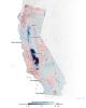
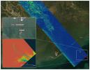
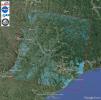
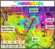
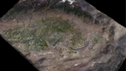
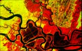
PIA25530:
-
Map of California Subsidence and Uplift
Full Resolution:
TIFF
(3.216 MB)
JPEG
(222.6 kB)
|
|
|
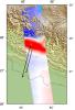
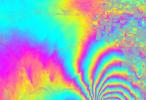
2025-01-31 |
Earth
|
|
UAVSAR
|
1440x1090x3 |
|
-
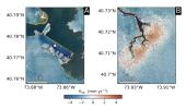
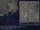
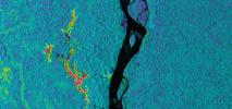
PIA26495:
-
NASA Radar Looks at Palos Verdes Landslides
Full Resolution:
TIFF
(2.762 MB)
JPEG
(259.6 kB)
|
|
|
2024-10-02 |
Earth
|
|
SAR
|
2480x3507x3 |
|
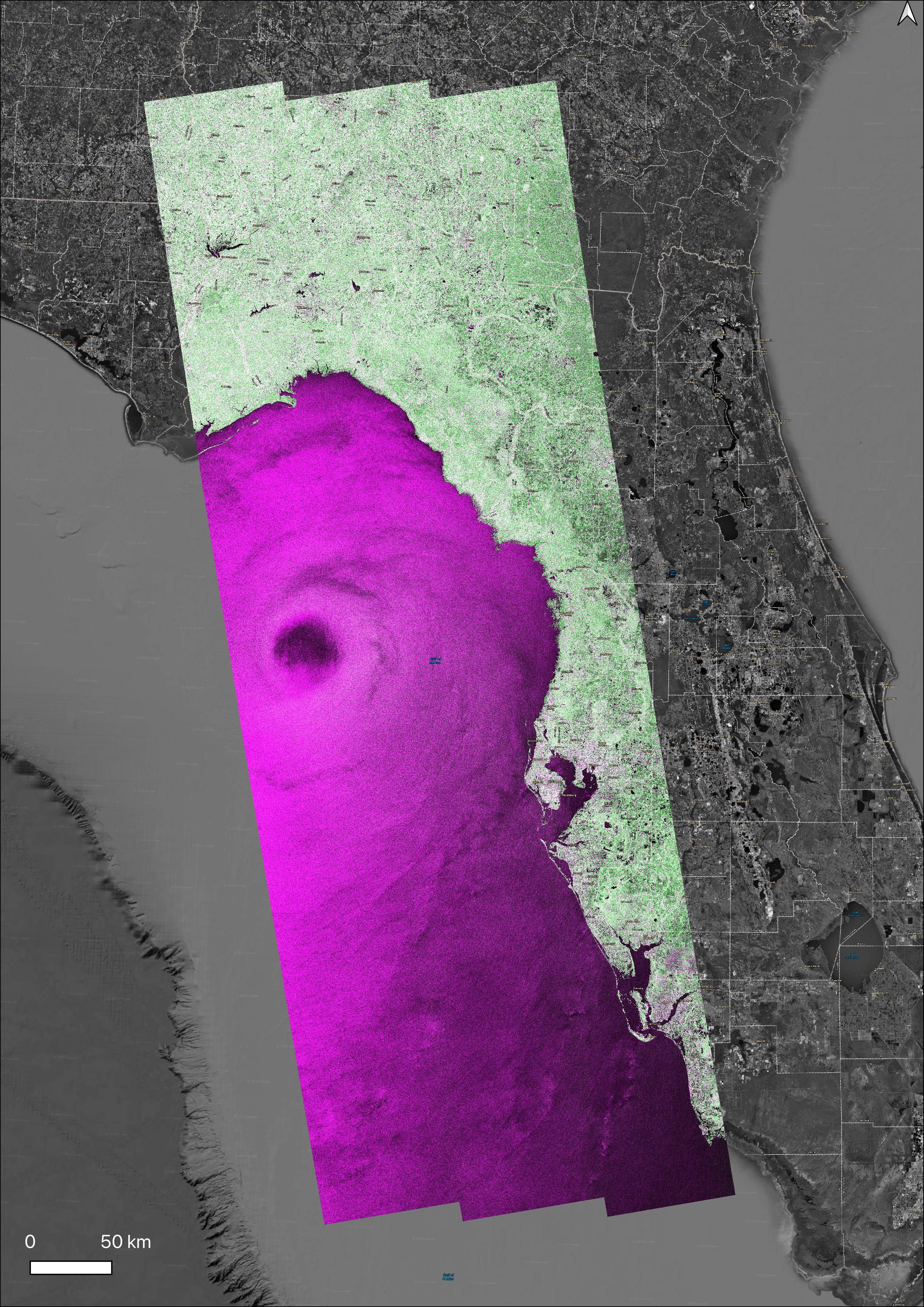
-
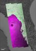
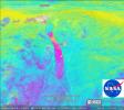
PIA26414:
-
NASA's OPERA Project Generates Radar Image of Hurricane Helene
Full Resolution:
TIFF
(18.81 MB)
JPEG
(2.337 MB)
|
|
|
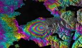
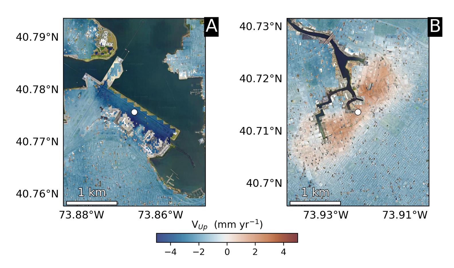
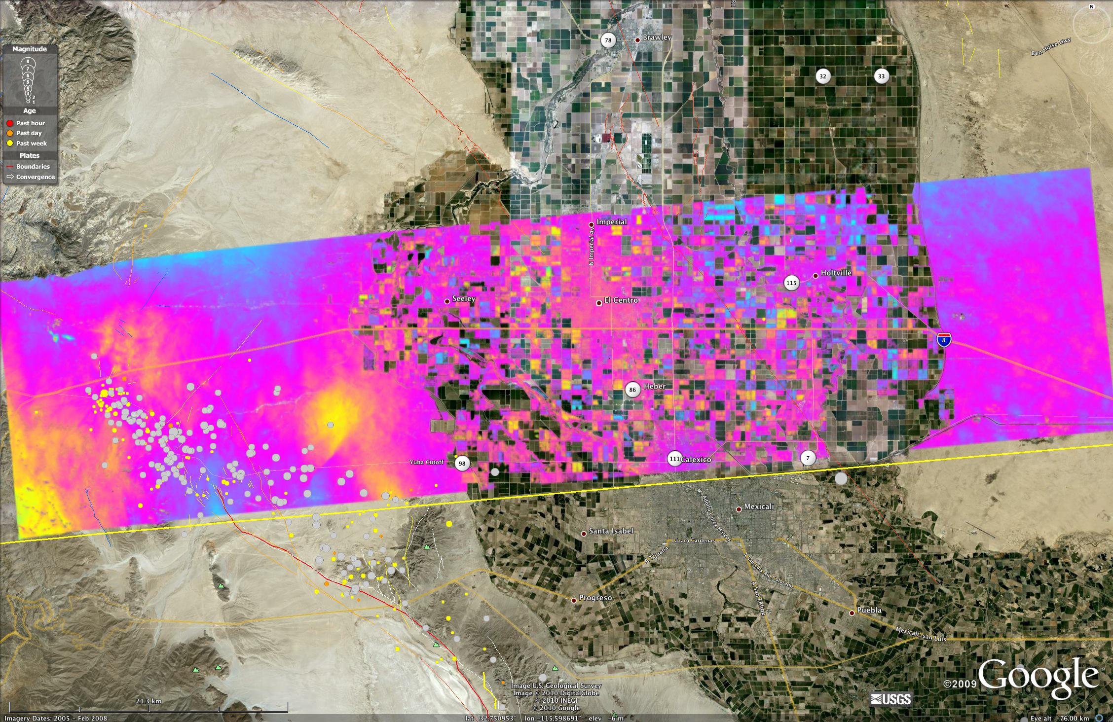
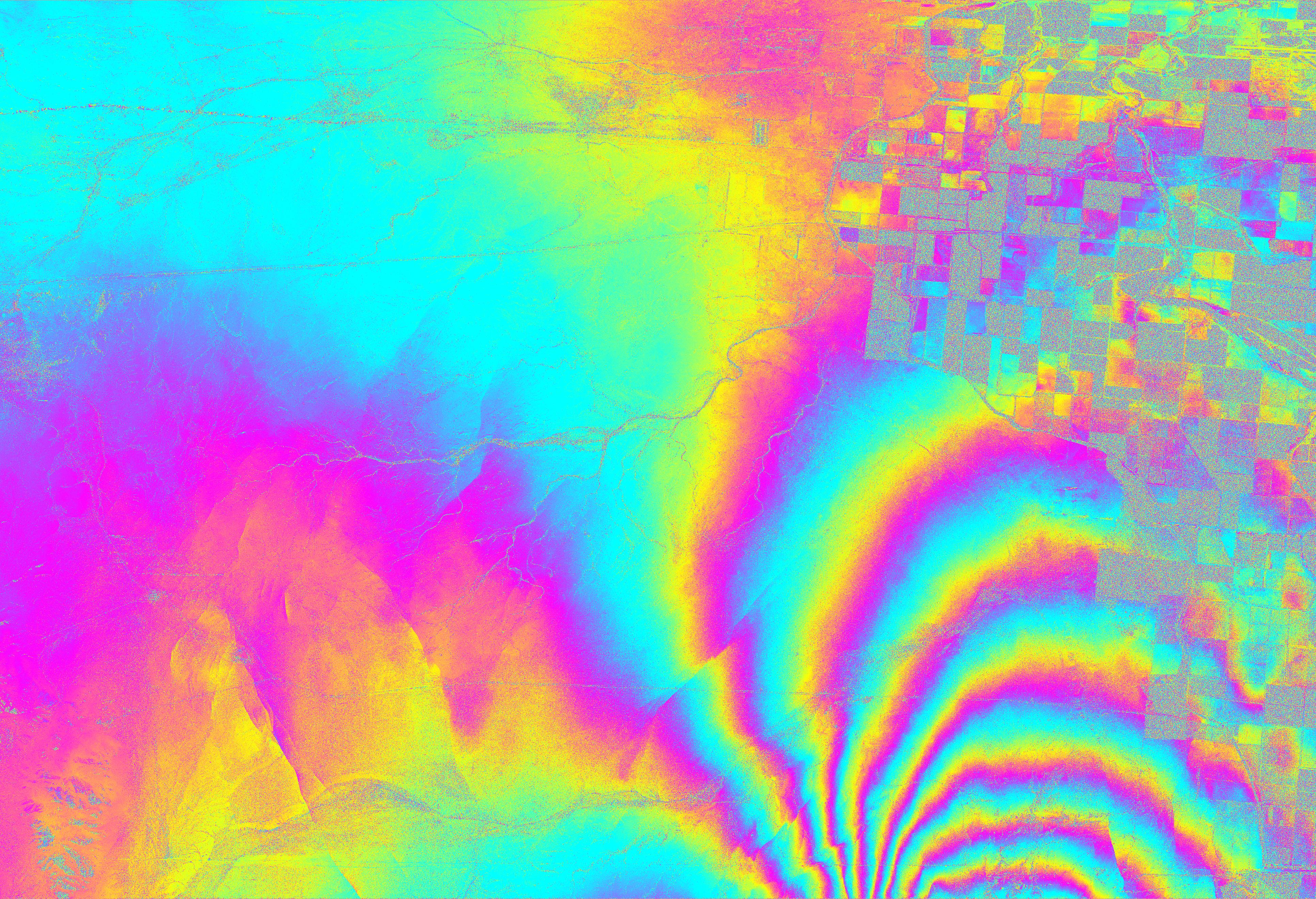
2023-09-27 |
Earth
|
|
InSAR
|
1584x934x3 |
|
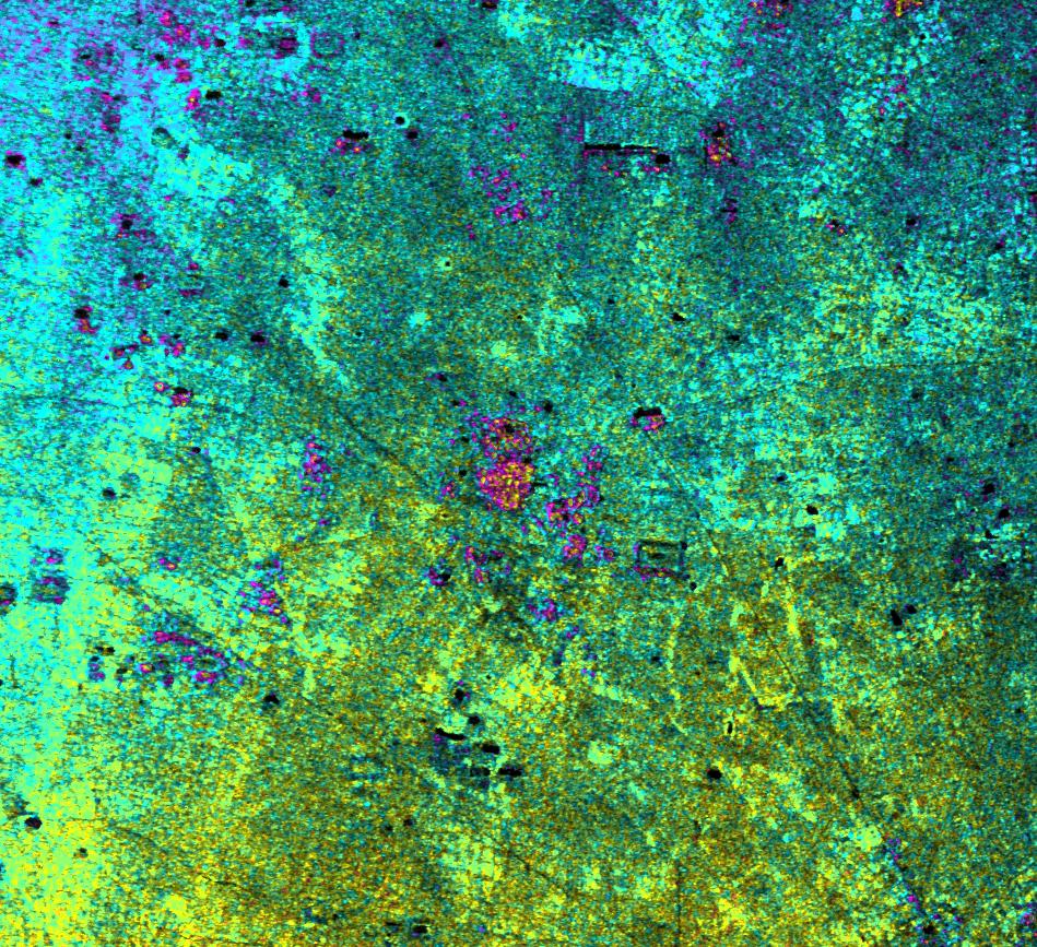
-
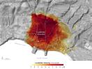
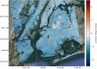
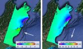
PIA25528:
-
Hot Spots of Subsidence, Uplift in New York City
Full Resolution:
TIFF
(2.374 MB)
JPEG
(173.7 kB)
|
|
|
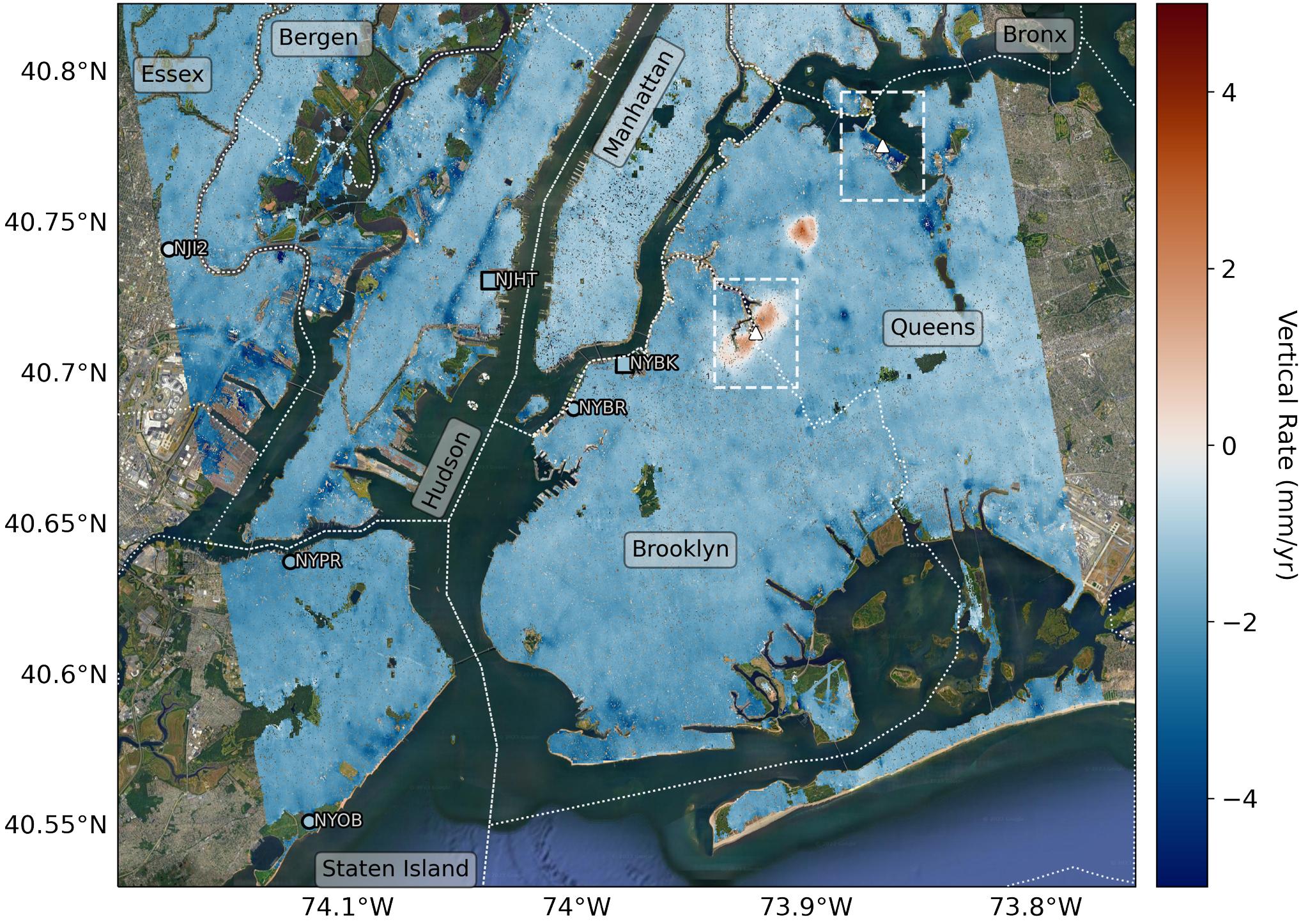
2023-09-27 |
Earth
|
|
InSAR
|
2036x1446x3 |
|
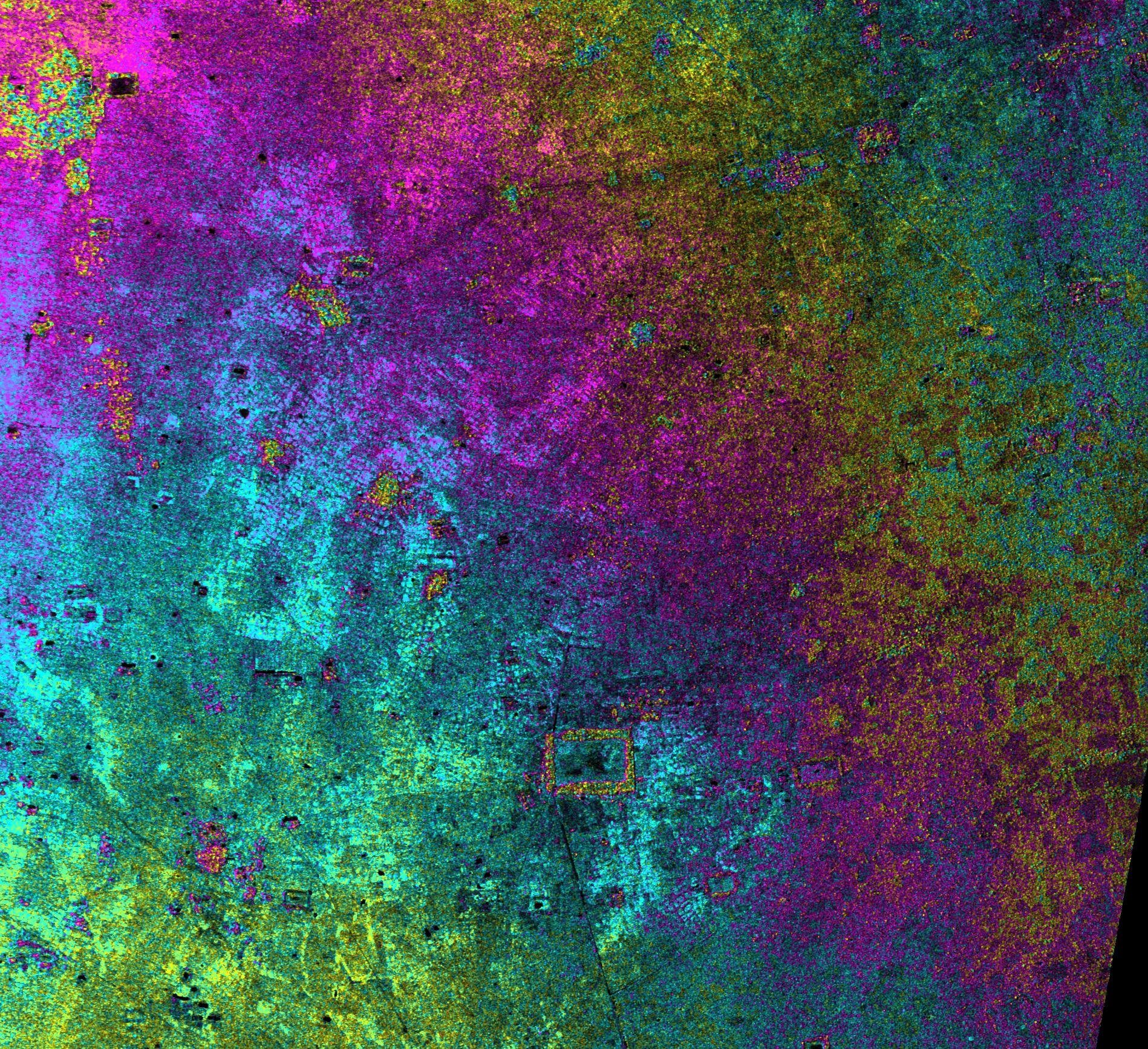
-
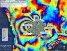
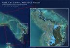
PIA25527:
-
Map of New York City Subsidence and Uplift
Full Resolution:
TIFF
(7.442 MB)
JPEG
(516.4 kB)
|
|
|
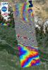
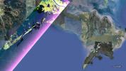
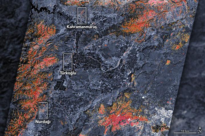
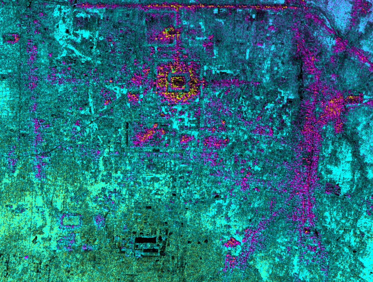
2023-02-09 |
Earth
|
ARIA
|
SAR
|
720x480x3 |

|
-
PIA25564:
-
Satellites Assess Earthquake Damage in Turkey
Full Resolution:
TIFF
(1.037 MB)
JPEG
(126.3 kB)
|
|
|
2022-12-19 |
Earth
|
|
UAVSAR
|
3750x3750x3 |

|
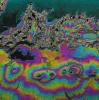
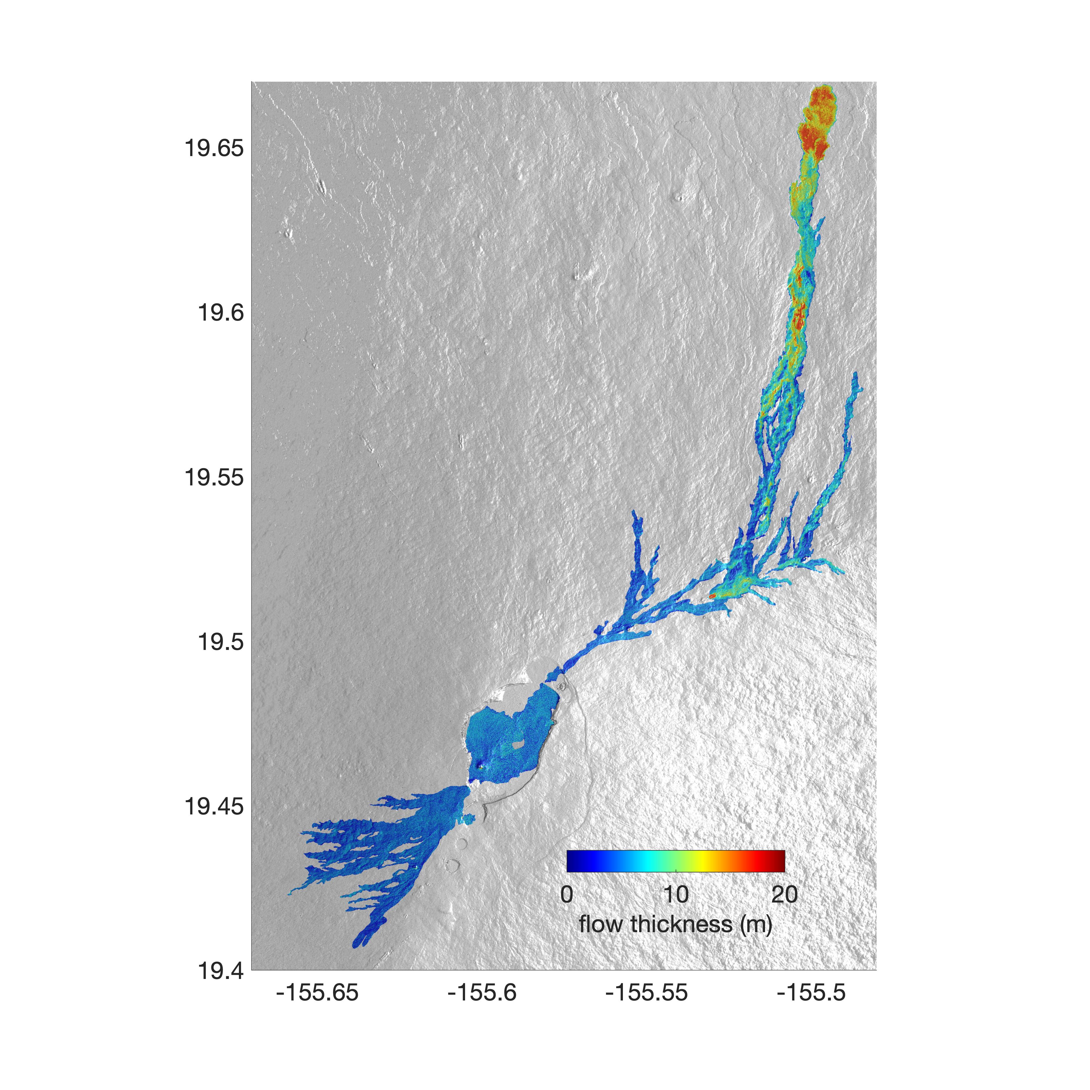
-
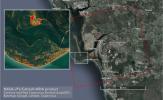
PIA25526:
-
Airborne NASA Radar Maps Mauna Loa Lava Changes in Hawaii
Full Resolution:
TIFF
(11.11 MB)
JPEG
(1.418 MB)
|
|
|
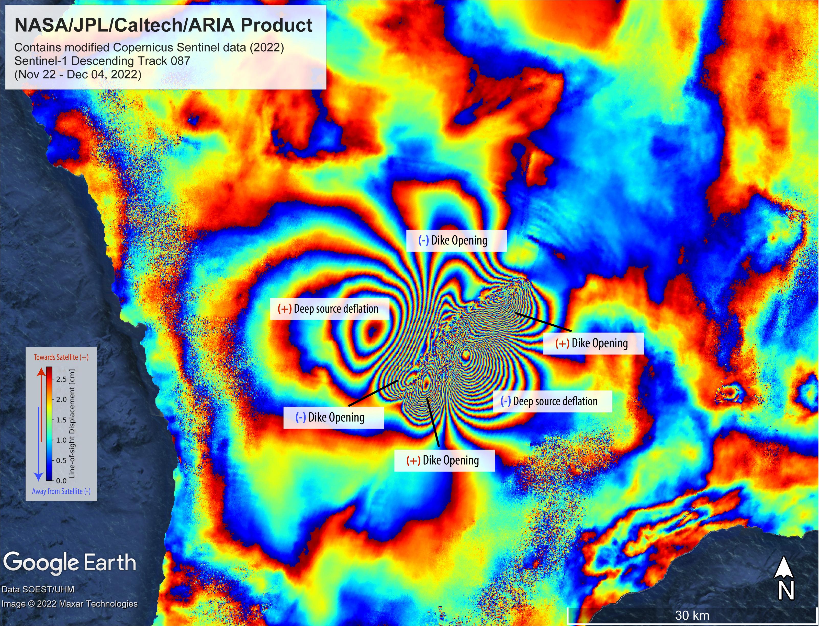
2022-12-09 |
Earth
|
ARIA
|
SAR
|
3203x2451x3 |
|
-
PIA25525:
-
Satellite Data Shows Ground Motion From Mauna Loa Volcano Eruption
Full Resolution:
TIFF
(23.12 MB)
JPEG
(1.331 MB)
|
|
|
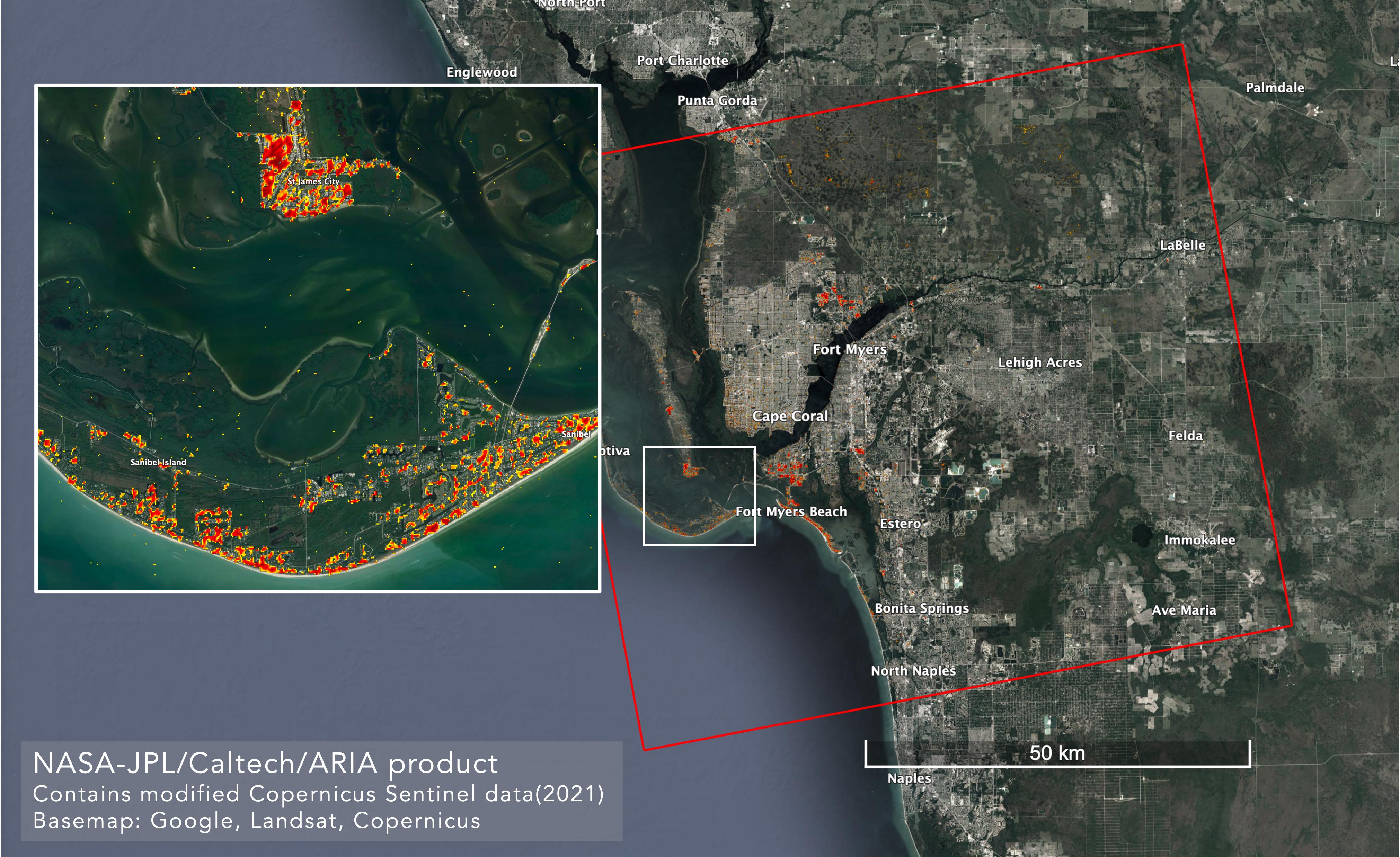
2022-10-06 |
Earth
|
ARIA
|
SAR
|
4042x2475x3 |
|
-
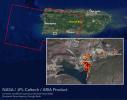
PIA25426:
-
ARIA Maps Damage in Fort Myers From Hurricane Ian
Full Resolution:
TIFF
(22.59 MB)
JPEG
(1.165 MB)
|
|
|
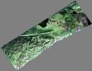
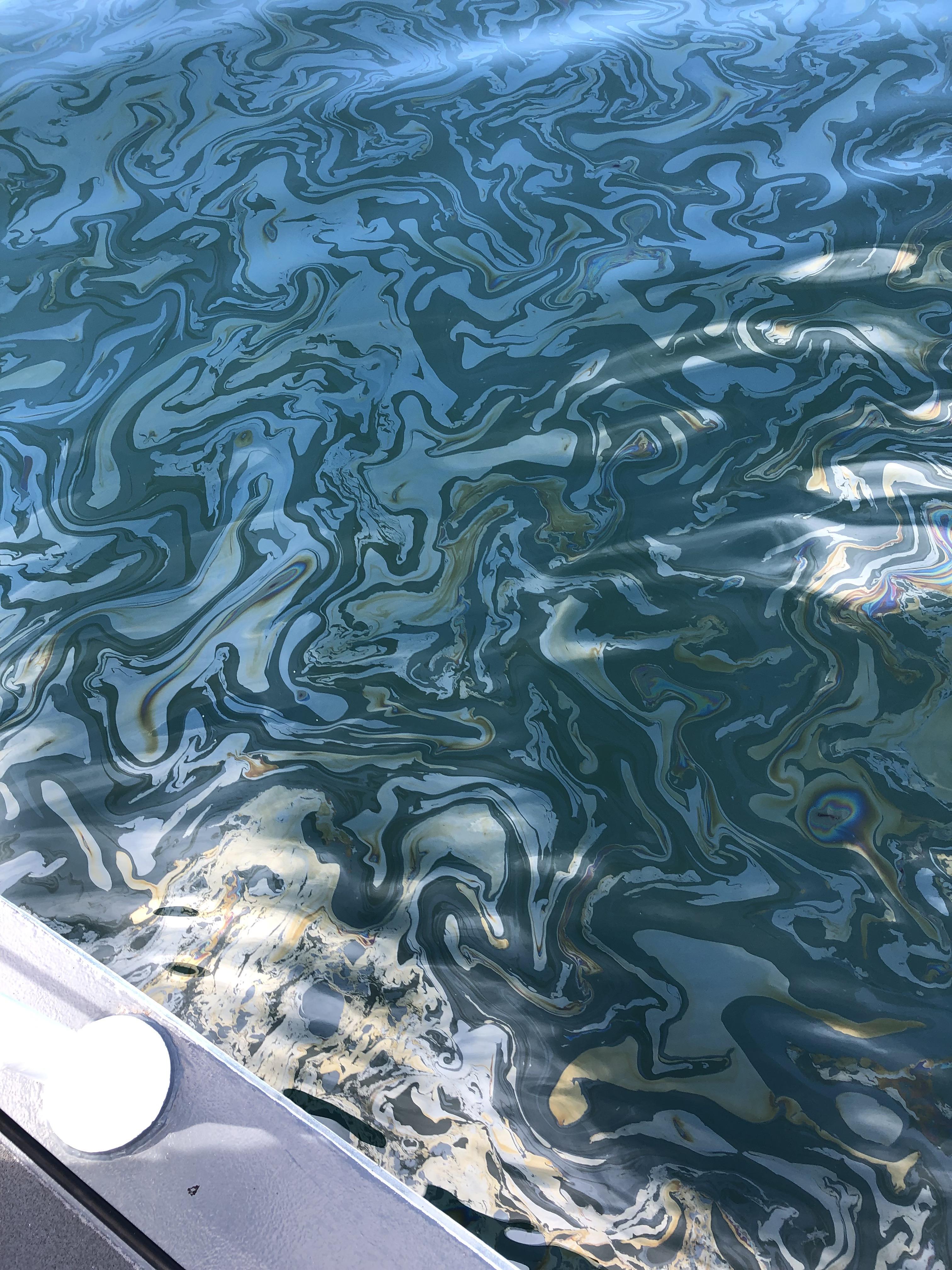
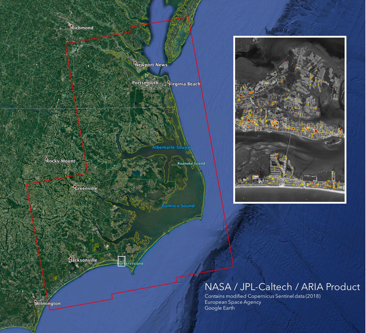
2021-12-13 |
Earth
|
|
UAVSAR
|
3024x4032x3 |

|
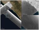
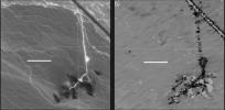
-
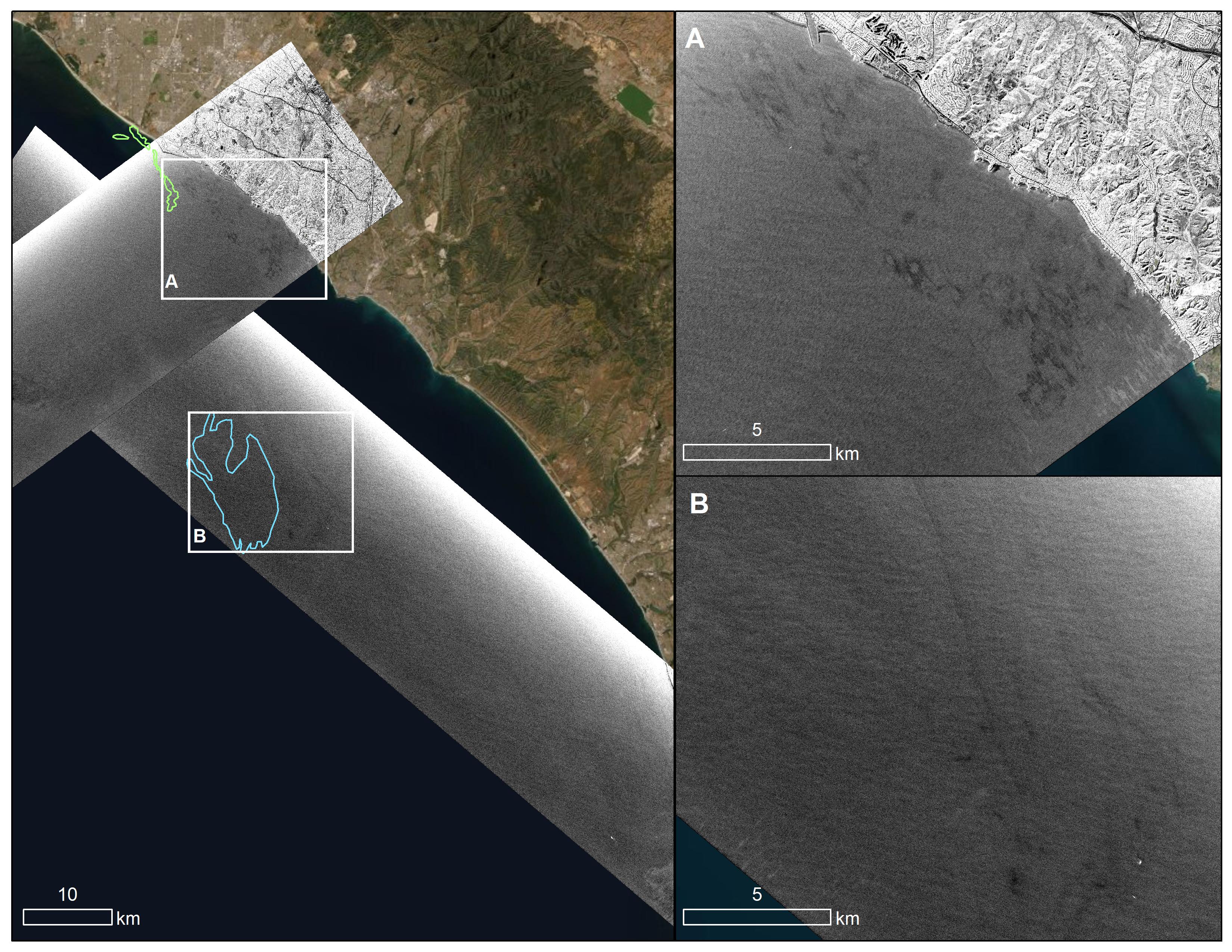
PIA23699:
-
Natural Oil Seepage Off California Coast
Full Resolution:
TIFF
(34.33 MB)
JPEG
(1.609 MB)
|
|
|
2021-10-13 |
Earth
|
|
UAVSAR
|
4032x3024x3 |

|
-
PIA24901:
-
UAVSAR Flight Crew
Full Resolution:
TIFF
(22.67 MB)
JPEG
(1.01 MB)
|
|
|
2021-10-13 |
Earth
|
|
UAVSAR
|
3300x2550x3 |
|
-
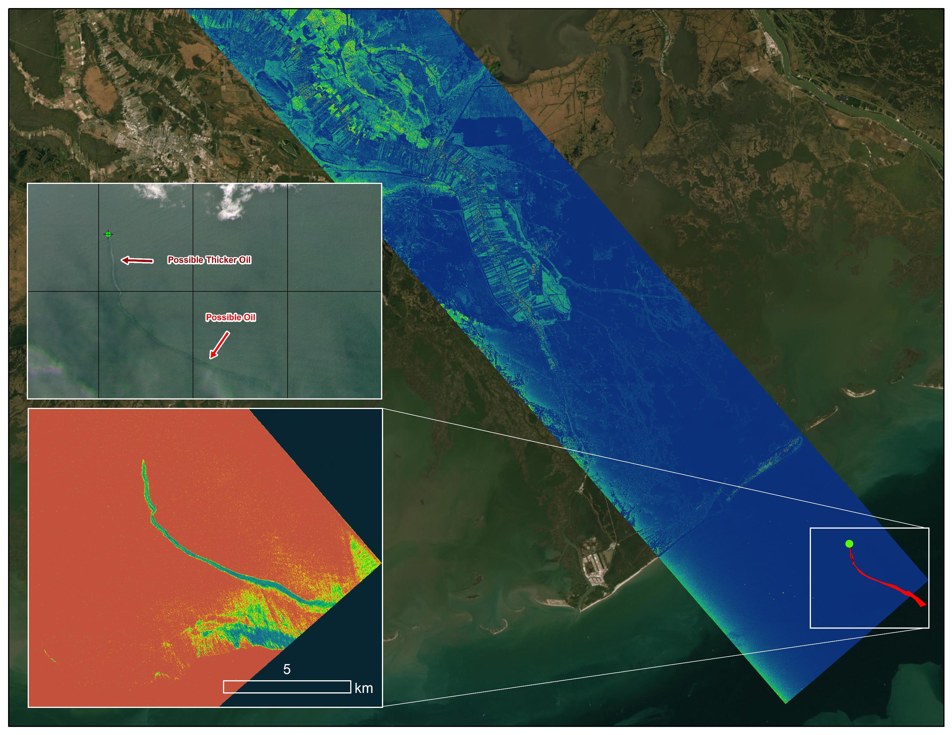
PIA23782:
-
UAVSAR Oil Slicks
Full Resolution:
TIFF
(13.21 MB)
JPEG
(2.027 MB)
|
|
|
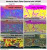
2021-09-20 |
Earth
|
Delta-X
|
UAVSAR
|
3300x2550x3 |
|
-
PIA24540:
-
Delta-X Oil Slick Radar Signal in Gulf of Mexico
Full Resolution:
TIFF
(16.81 MB)
JPEG
(966.2 kB)
|
|
|
2020-09-15 |
Earth
|
|
UAVSAR
|
1280x720x3 |

|
-
PIA24102:
-
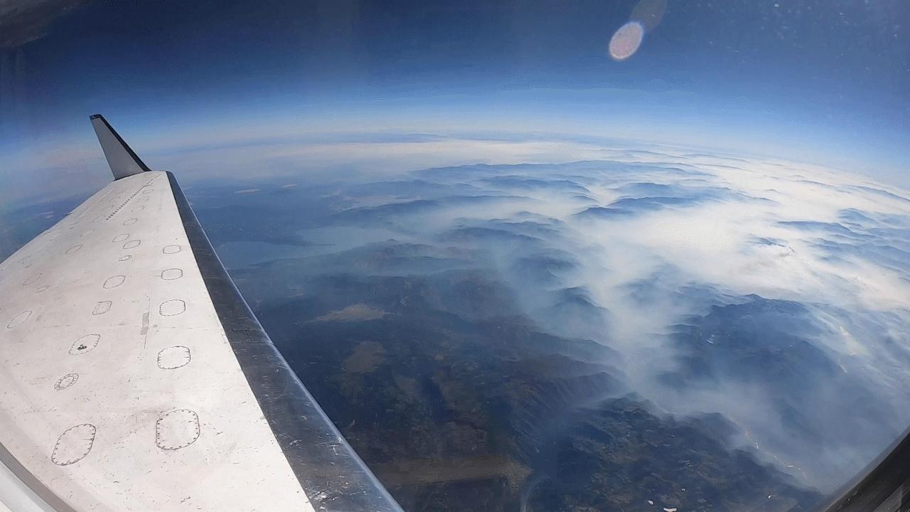
NASA's UAVSAR Flights Observe California Fires
Full Resolution:
TIFF
(2.43 MB)
JPEG
(81.83 kB)
|
|
|
2020-01-15 |
Earth
|
ARIA
|
SAR
|
2437x1918x3 |
|
-
PIA23429:
-
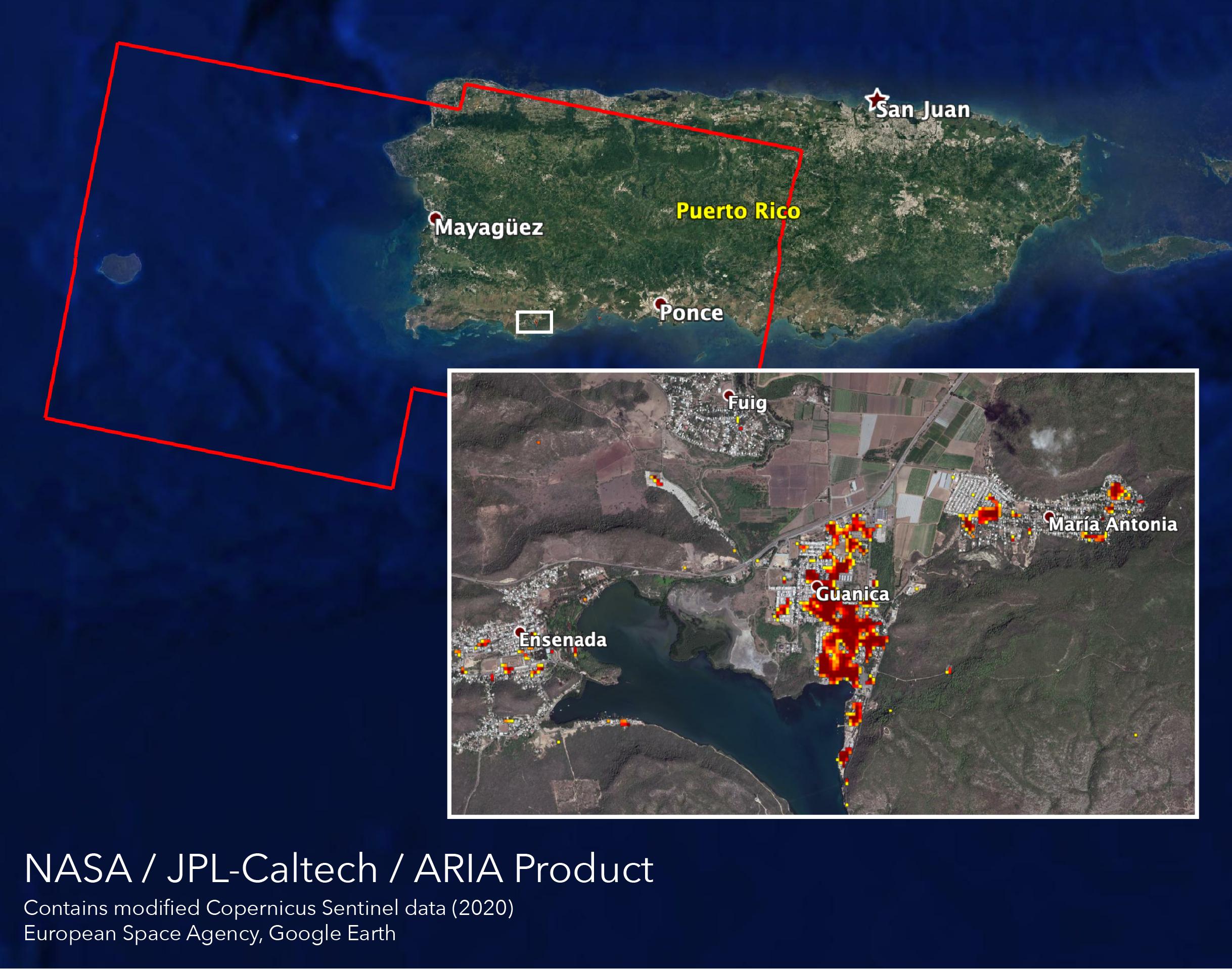
ARIA Maps Damage of Western Puerto Rico After Quakes
Full Resolution:
TIFF
(8.865 MB)
JPEG
(483.7 kB)
|
|
|
2019-10-15 |
Earth
|
ARIA
|
SAR
|
3063x2249x3 |
|
-
PIA23424:
-
New ARIA Map Shows Damage from Typhoon Hagibis
Full Resolution:
TIFF
(13.95 MB)
JPEG
(960.9 kB)
|
|
|
2019-09-03 |
Earth
|
ARIA
|
SAR
|
6900x4772x3 |
|
-
PIA23360:
-
Flooding from Dorian Seen from Space
Full Resolution:
TIFF
(71.04 MB)
JPEG
(2.466 MB)
|
|
|
2019-07-12 |
Earth
|
ARIA
|
SAR
|
2754x1965x3 |

|
-
PIA23354:
-
NASA's ARIA Team Maps California Quake Damage
Full Resolution:
TIFF
(15.93 MB)
JPEG
(1.011 MB)
|
|
|
2019-07-09 |
Earth
|
ARIA
|
SAR
|
1803x2176x3 |

|
-
PIA23150:
-
NASA's ARIA Maps Southern California Quake Damage
Full Resolution:
TIFF
(11.77 MB)
JPEG
(703 kB)
|
|
|
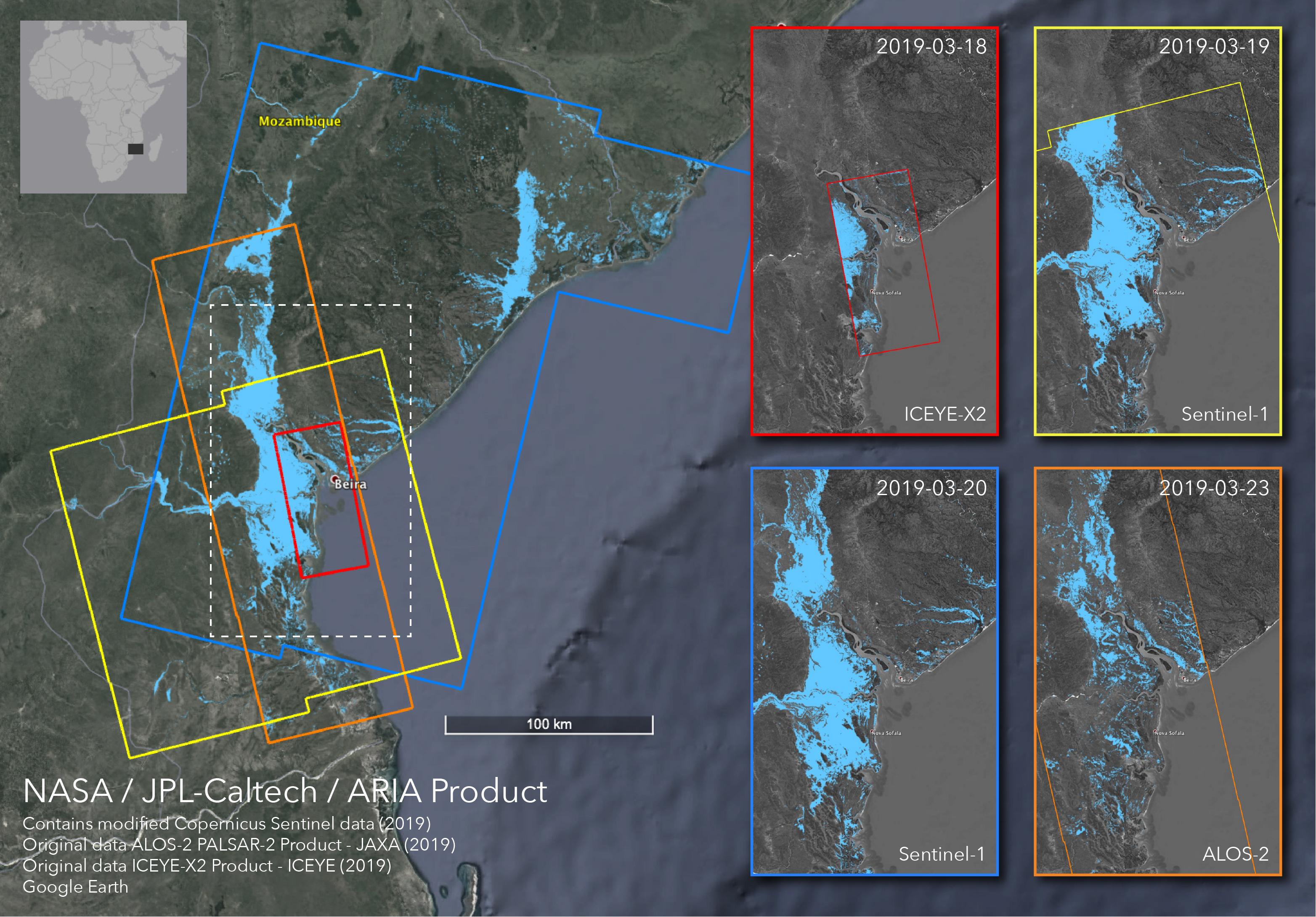
2019-04-01 |
Earth
|
ARIA
|
SAR
|
3128x2180x3 |
|
-
PIA23142:
-
Satellites Image Mozambique Flooding after Cyclone Idai
Full Resolution:
TIFF
(13 MB)
JPEG
(778.9 kB)
|
|
|
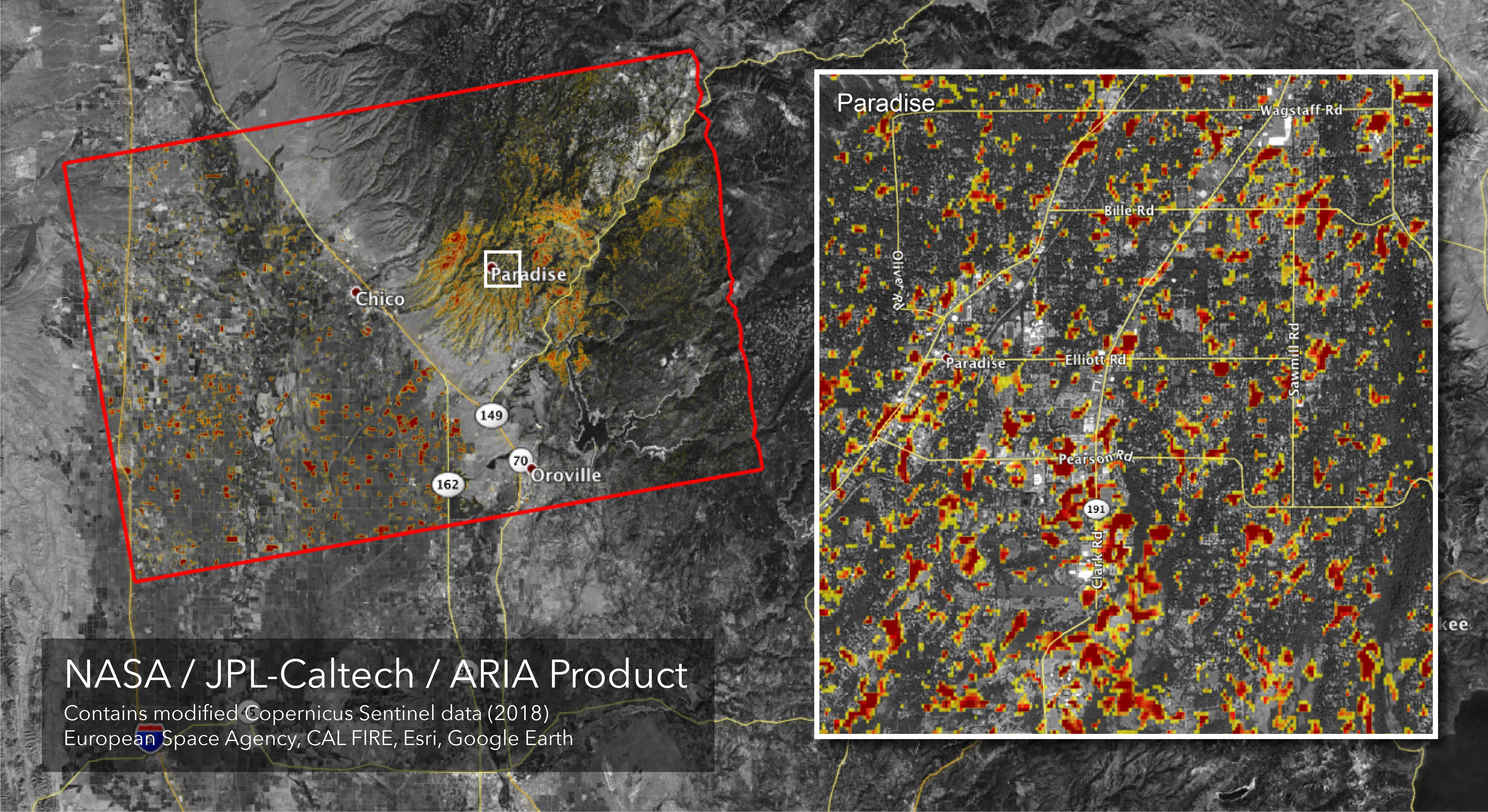
2018-11-19 |
Earth
|
ARIA
|
SAR
|
5949x3249x3 |
|
-
PIA22819:
-
Updated ARIA Map of CA Camp Fire Damage
Full Resolution:
TIFF
(21.68 MB)
JPEG
(3.068 MB)
|
|
|
2018-11-12 |
Earth
|
ARIA
|
SAR
|
5176x2873x3 |
|
-
PIA22816:
-
NASA's ARIA Maps California Fire Damage
Full Resolution:
TIFF
(16.43 MB)
JPEG
(2.572 MB)
|
|
|
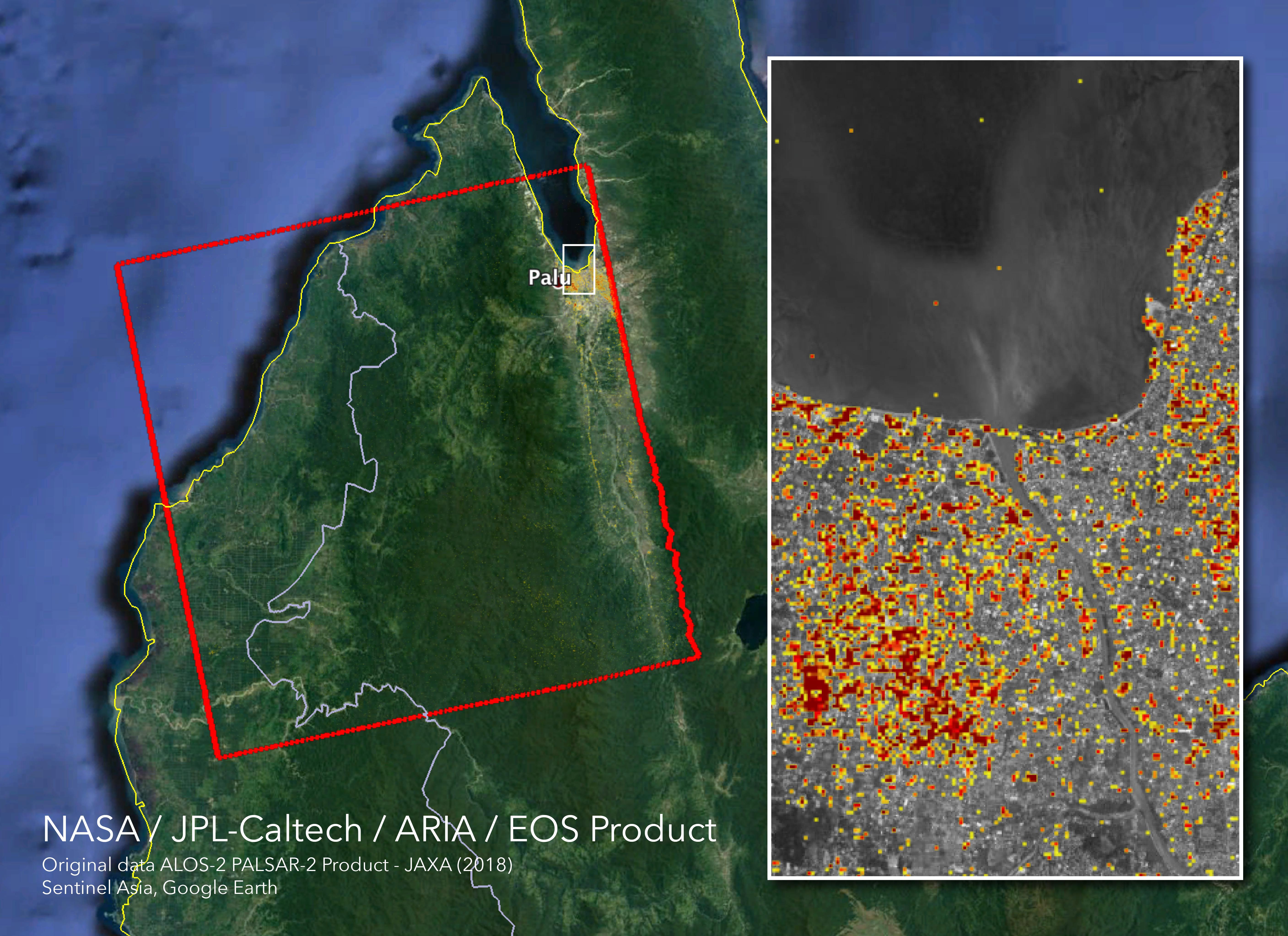
2018-10-05 |
Earth
|
ARIA
|
SAR
|
5630x4092x3 |
|
-
PIA22746:
-
NASA's ARIA Maps Indonesia Quake, Tsunami Damage
Full Resolution:
TIFF
(38.03 MB)
JPEG
(1.997 MB)
|
|
|
2018-09-18 |
Earth
|
ARIA
|
SAR
|
1231x1077x3 |
|
-
PIA22704:
-
NASA's ARIA Maps Aftermath from Florence
Full Resolution:
TIFF
(3.318 MB)
JPEG
(194.2 kB)
|
|
|
2018-09-17 |
Earth
|
ARIA
|
SAR
|
1233x1125x3 |

|
-
PIA22702:
-
NASA's ARIA Maps Damage from Florence
Full Resolution:
TIFF
(3.944 MB)
JPEG
(269.1 kB)
|
|
|
2018-09-10 |
Earth
|
ARIA
|
SAR
|
1377x964x3 |
|
-
PIA22696:
-
Japan Earthquakes (ARIA Damage Proxy Map)
Full Resolution:
TIFF
(3.89 MB)
JPEG
(229.1 kB)
|
|
|
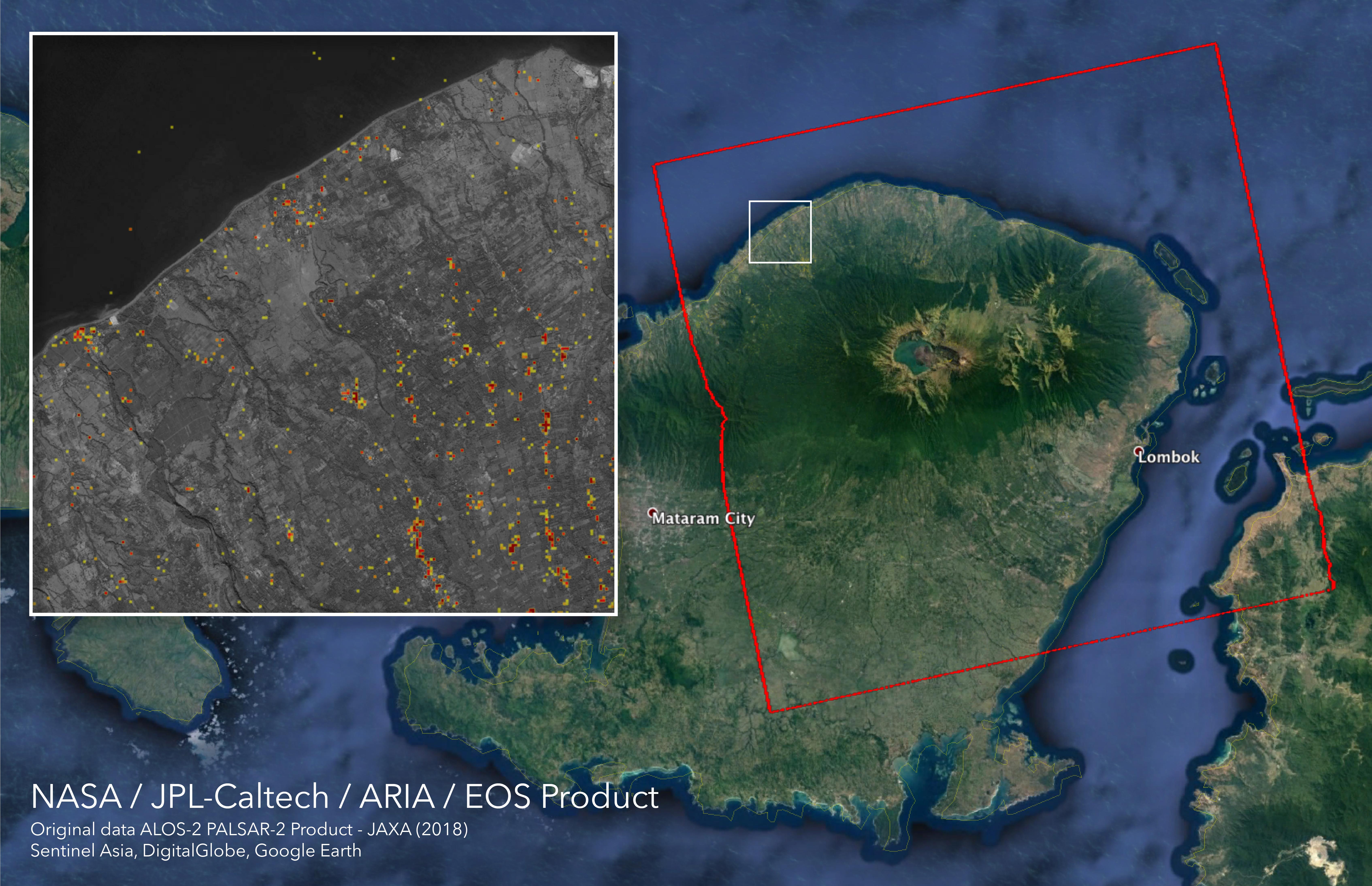
2018-09-05 |
Earth
|
ARIA
|
SAR
|
6776x4377x3 |
|
-
PIA22495:
-
ARIA Damage Proxy Map of Lombok, Indonesia Earthquakes
Full Resolution:
TIFF
(47.99 MB)
JPEG
(2.341 MB)
|
|
|
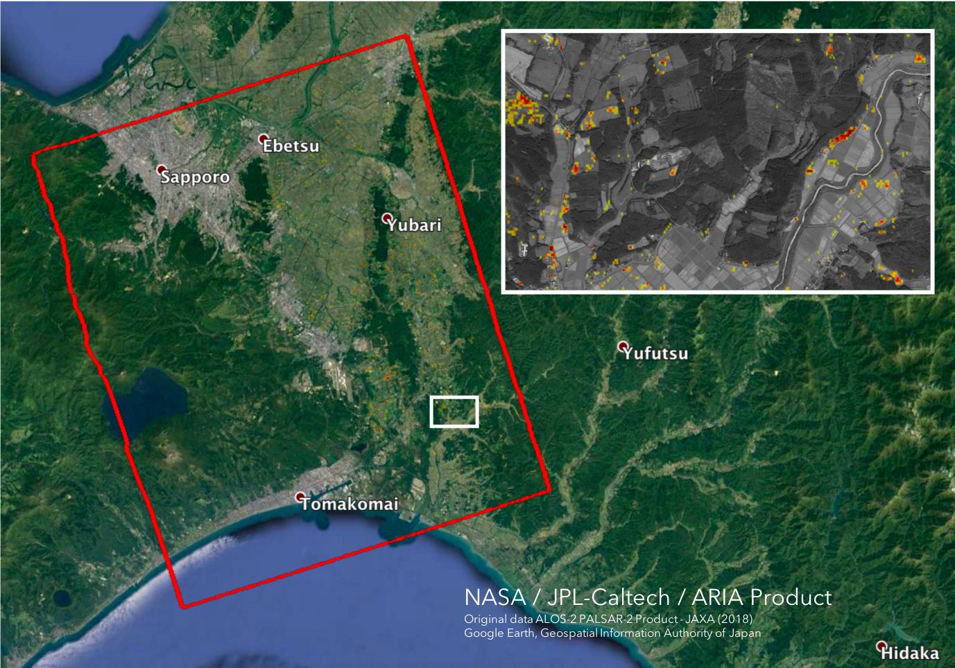
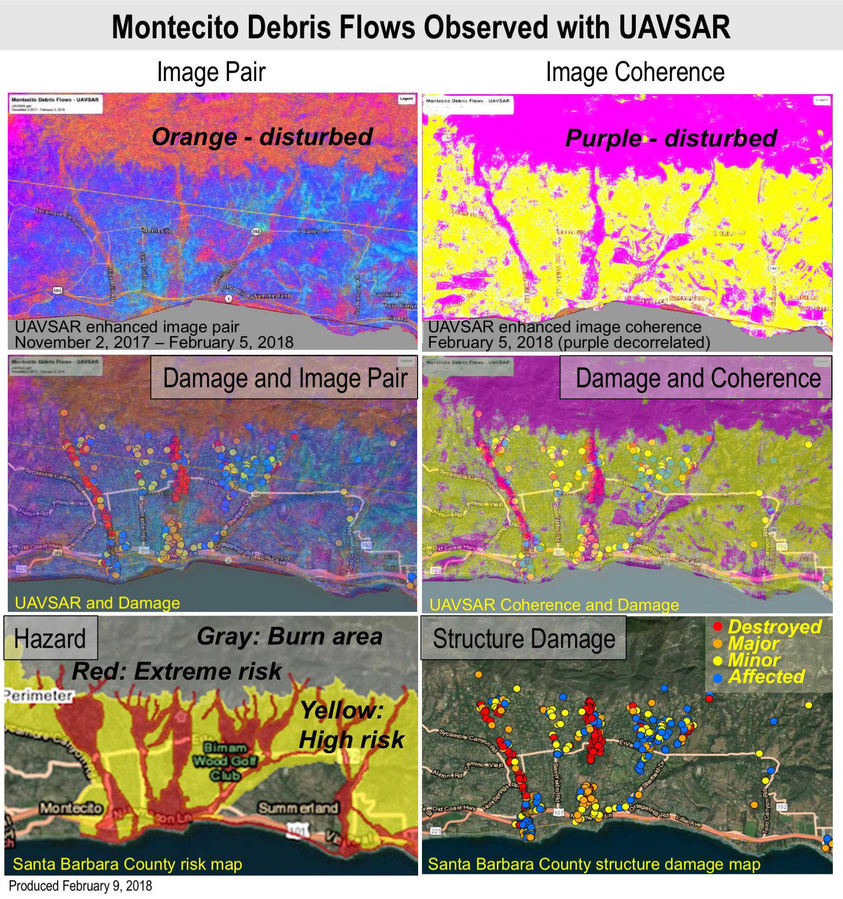
2018-02-12 |
Earth
|
UAVSAR
|
L-Band UAVSAR
|
1738x1853x3 |
|
-
PIA22243:
-
Effects of Deadly California Debris Flows Seen in Before/After Images from NASA's UAVSAR
Full Resolution:
TIFF
(8.922 MB)
JPEG
(598.4 kB)
|
|
|
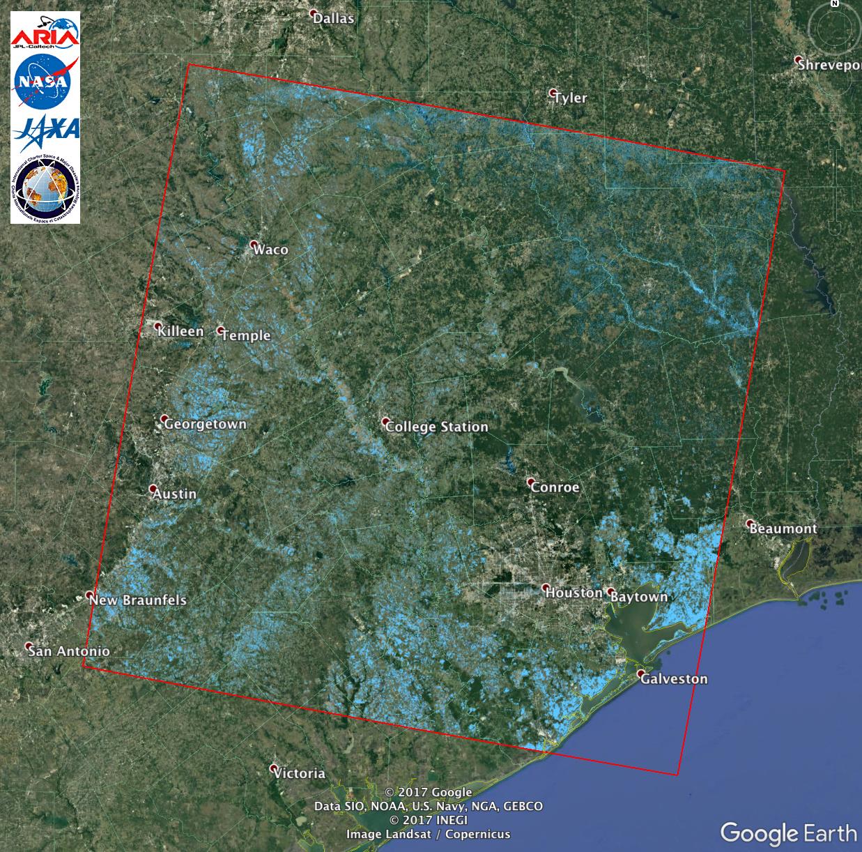
2017-08-30 |
Earth
|
ARIA
|
PALSAR-2
|
1237x1222x3 |
|
-
PIA21928:
-
Extent of Texas Flooding Shown in New NASA Map
Full Resolution:
TIFF
(4.537 MB)
JPEG
(367.5 kB)
|
|
|
2017-03-23 |
Earth
|
ARIA
|
PALSAR-2
|
4481x2682x3 |
|
-
PIA21210:
-
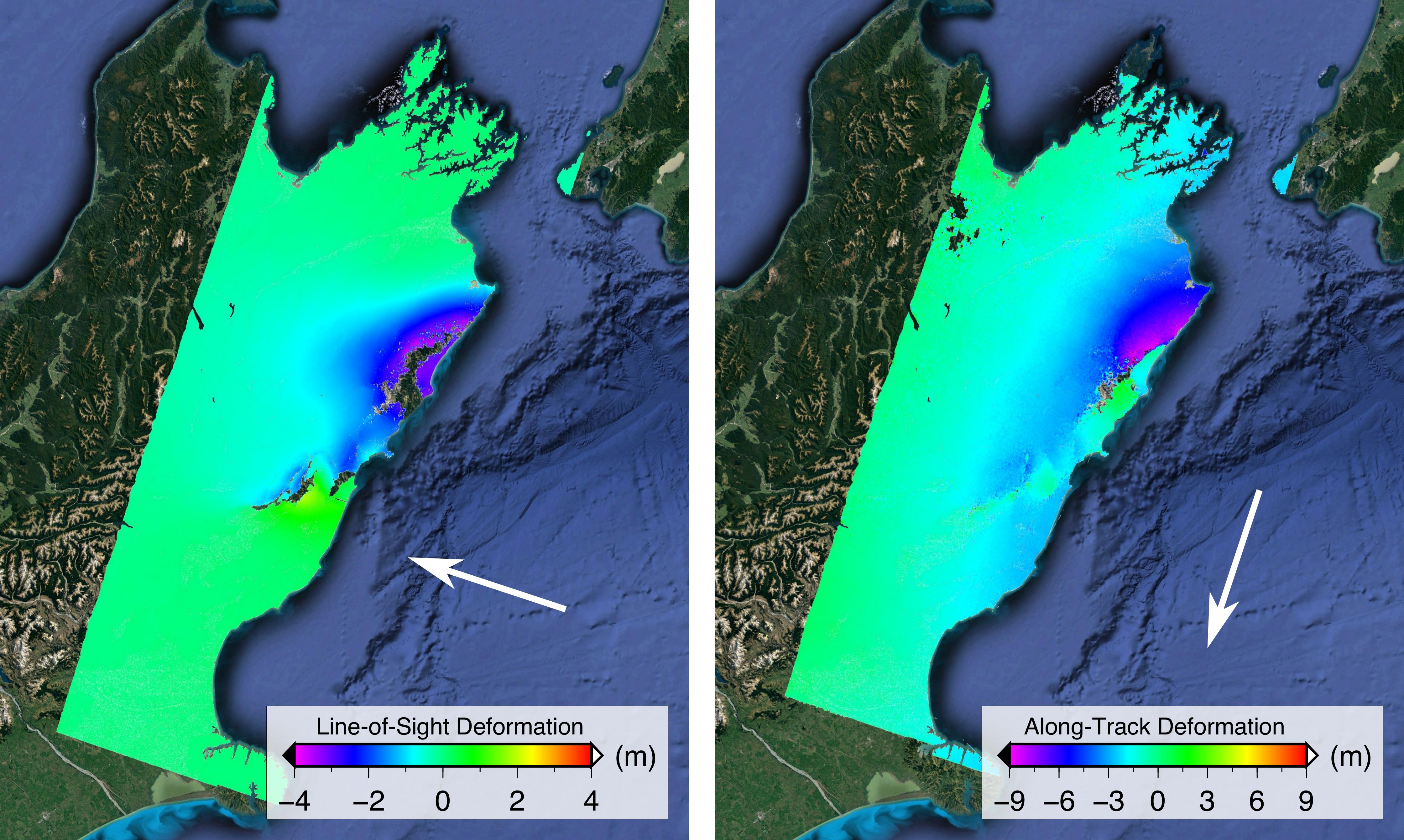
Satellite Radar Show Complex Set of Faults Moved in 2016 New Zealand Earthquake
Full Resolution:
TIFF
(32.2 MB)
JPEG
(1.209 MB)
|
|
|
2016-08-27 |
Earth
|
ARIA
|
PALSAR-2
|
1002x1011x3 |

|
-
PIA20893:
-
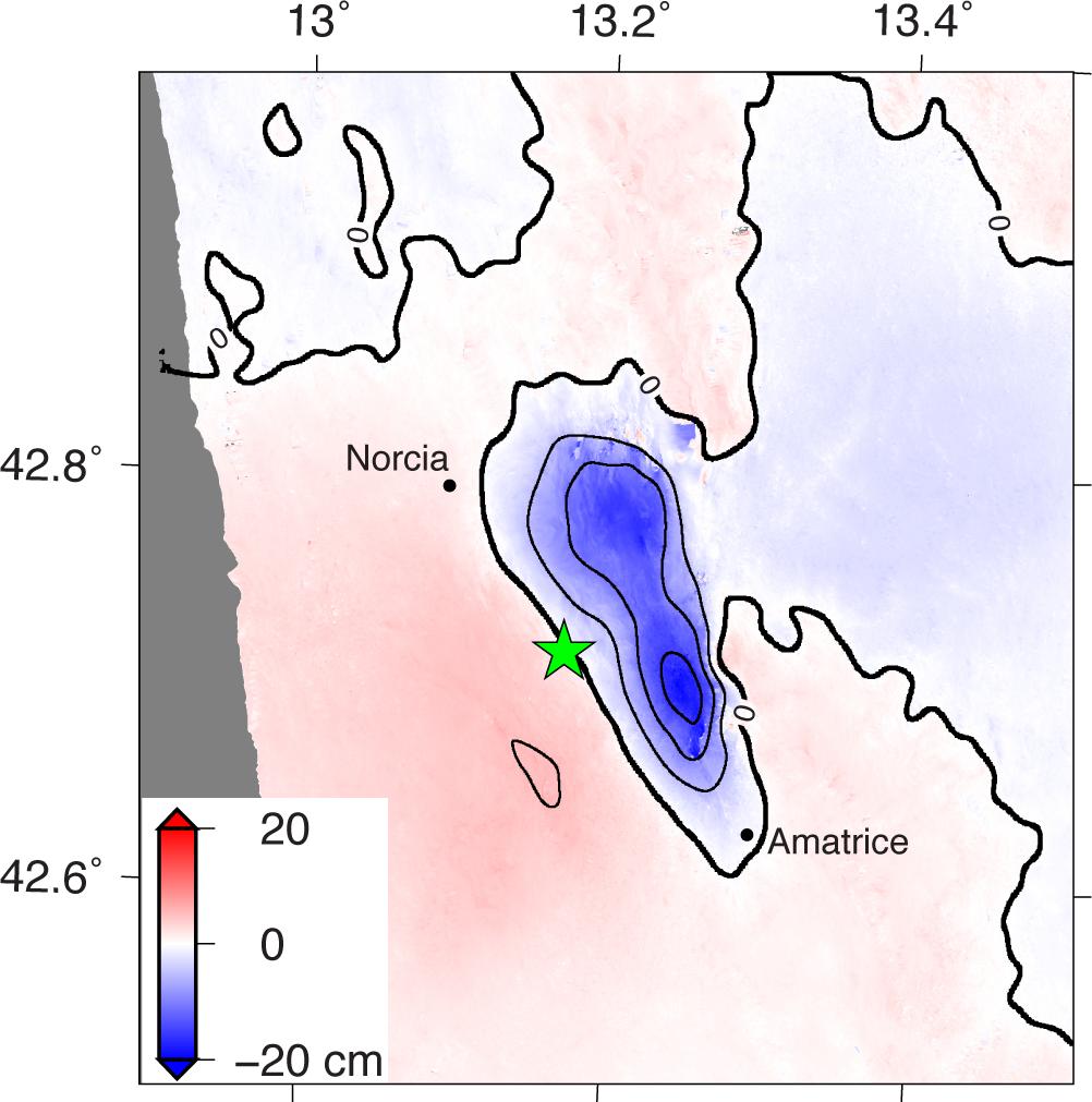
Radar Shows Italy Area Moved 8 Inches by Amatrice Earthquake
Full Resolution:
TIFF
(1.094 MB)
JPEG
(99.43 kB)
|
|
|
2016-04-20 |
Earth
|
ARIA
|
PALSAR-2
|
970x759x3 |

|
-
PIA20460:
-
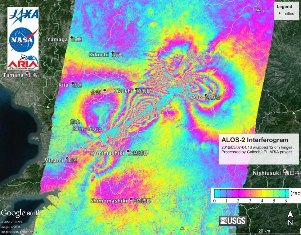
NASA's ARIA Project, JAXA Examine Earth Surface Deformation from Kumamoto, Japan Quakes
Full Resolution:
TIFF
(2.21 MB)
JPEG
(165.3 kB)
|
|
|
2016-02-05 |
Earth
|
UAVSAR
|
L-Band UAVSAR
|
1800x2344x1 |
|
-
PIA20378:
-
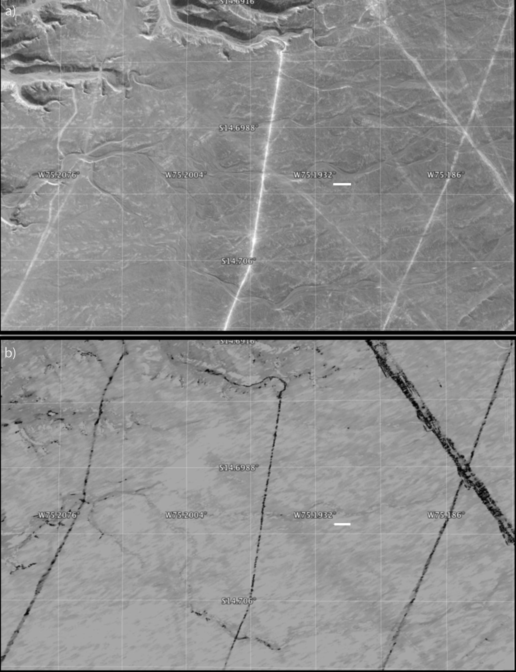
Disturbance on Dirt Roads Crossing Peru's Nasca World Heritage Site seen by NASA's UAVSAR
Full Resolution:
TIFF
(3.03 MB)
JPEG
(327.7 kB)
|
|
|
2016-02-05 |
Earth
|
UAVSAR
|
L-Band UAVSAR
|
1800x882x1 |
|
-
PIA20377:
-
Disturbance at Peru's Nasca World Heritage Site seen by NASA's UAVSAR
Full Resolution:
TIFF
(1.158 MB)
JPEG
(112.2 kB)
|
|
|
2016-02-05 |
Earth
|
UAVSAR
|
L-Band UAVSAR
|
1041x1043x1 |
|
-
PIA20376:
-
Peruvian Geometric Geoglyphs Detected by NASA's UAVSAR
Full Resolution:
TIFF
(3.339 MB)
JPEG
(226.5 kB)
|
|
|
2016-01-27 |
Earth
|
UAVSAR
|
L-Band UAVSAR
|
1800x2721x1 |
|
-
PIA20367:
-
NASA Radar Brings a New View of World Heritage Site
Full Resolution:
TIFF
(3.714 MB)
JPEG
(332.4 kB)
|
|
|
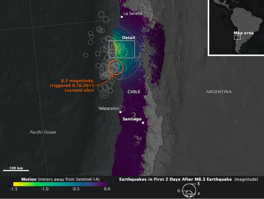
2015-10-12 |
Earth
|
Earth Observatory
|
C-Band SAR
|
898x676x3 |
|
-
PIA20002:
-
NASA Looks at Land Surface Changes Following Chilean Quake
Full Resolution:
TIFF
(888.9 kB)
JPEG
(51.91 kB)
|
|
|
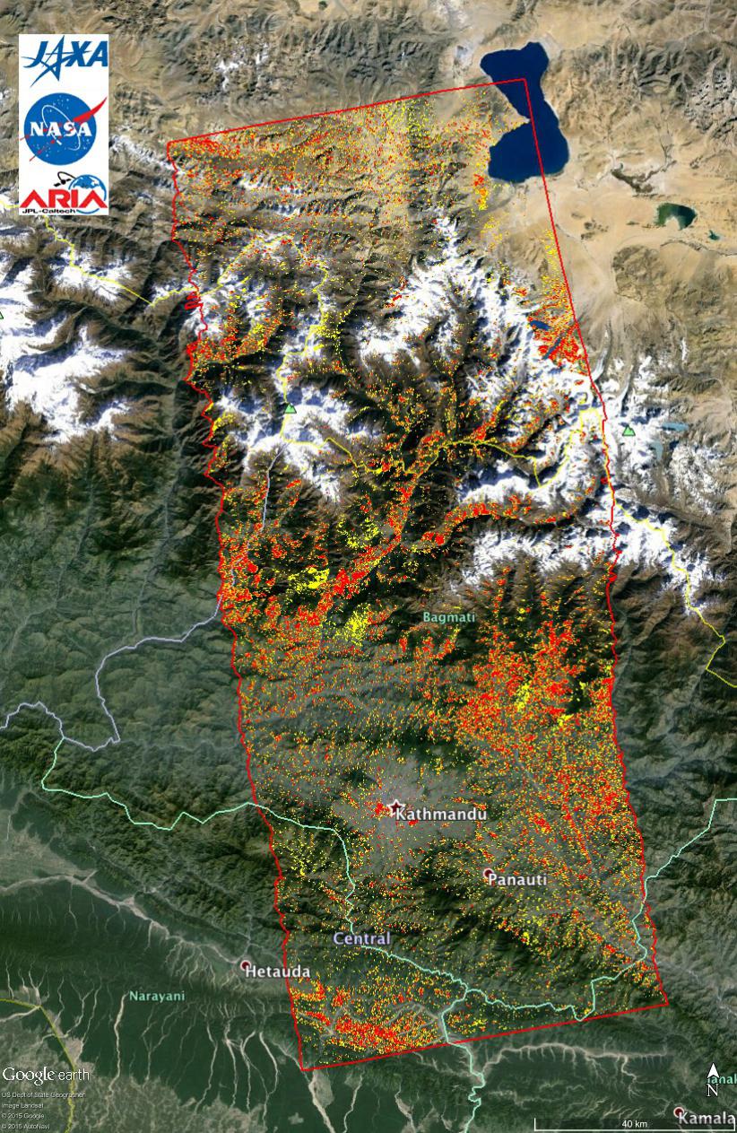
2015-05-11 |
Earth
|
ARIA
|
PALSAR-2
|
822x1263x3 |
|
-
PIA14710:
-
New ALOS-2 Damage Map Assists 2015 Gorkha, Nepal Disaster Response
Full Resolution:
TIFF
(3.116 MB)
JPEG
(307.4 kB)
|
|
|
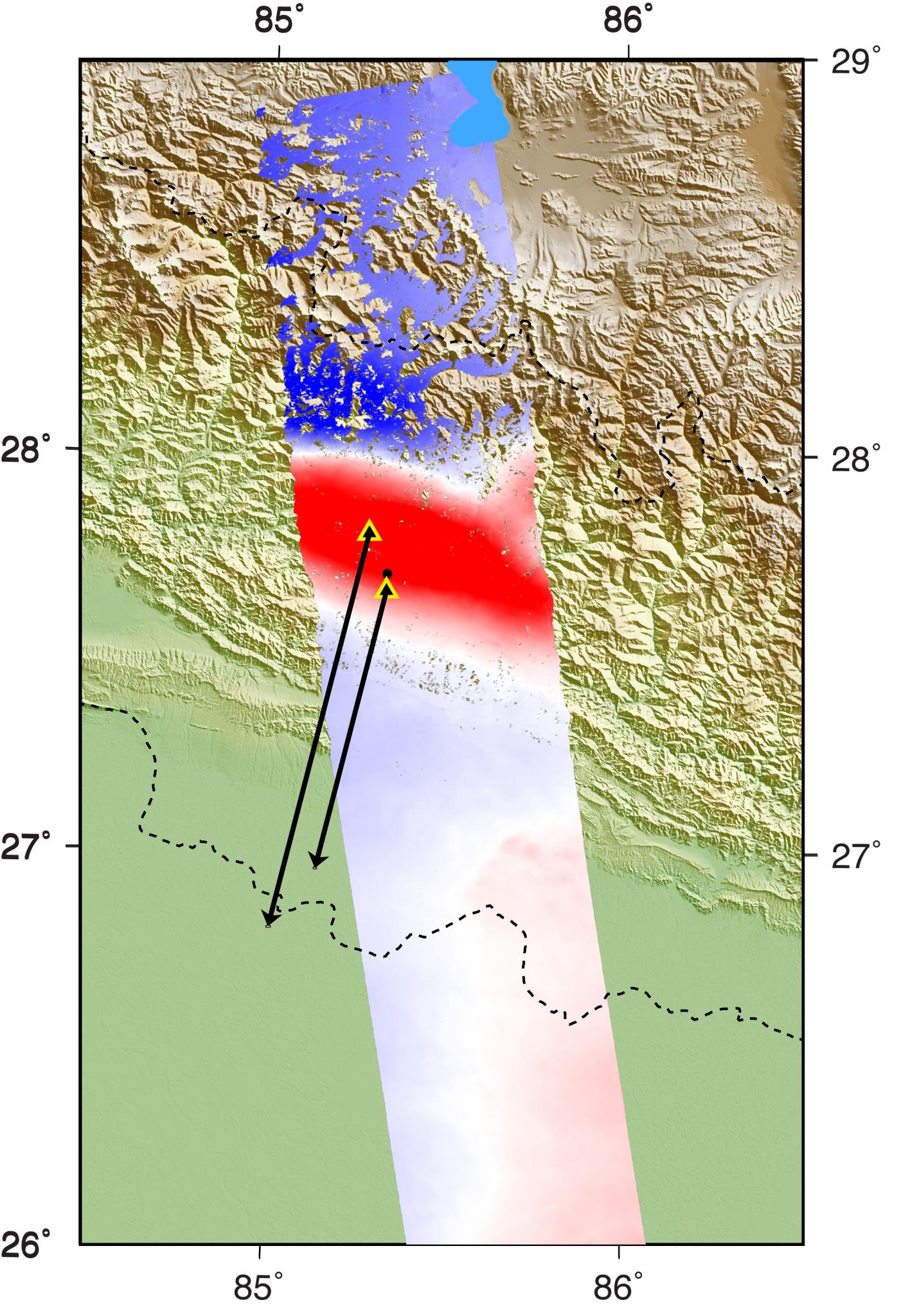
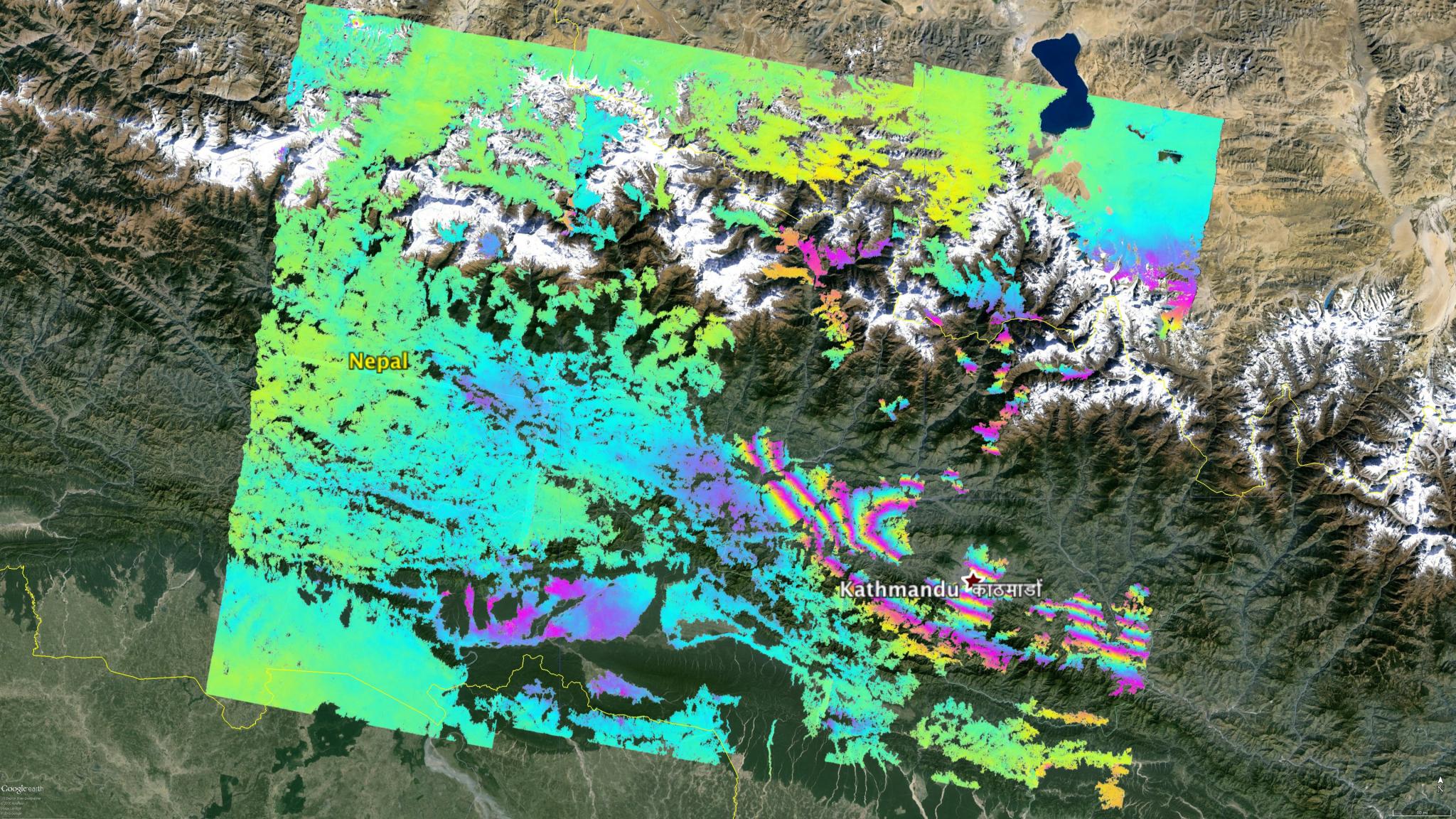
2015-05-07 |
Earth
|
ARIA
|
PALSAR-2
|
1402x2048x3 |
|
-
PIA14708:
-
Radar Shows Kathmandu Area Uplifted 5 Feet by Gorkha, Nepal Earthquake
Full Resolution:
TIFF
(8.617 MB)
JPEG
(460.9 kB)
|
|
|
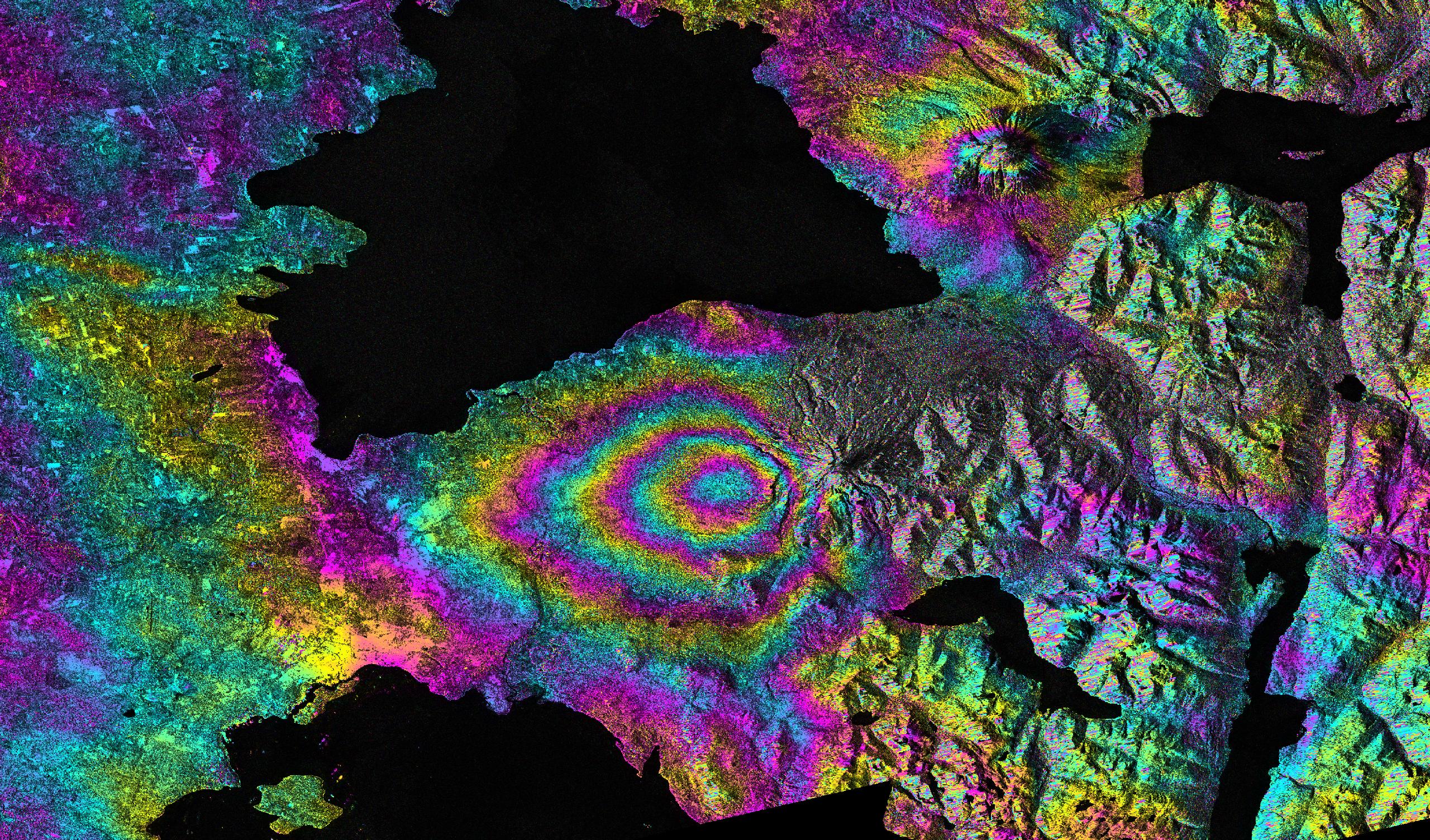
2015-05-04 |
Earth
|
ARIA
|
PALSAR-2
|
713x1047x3 |
|
-
PIA19383:
-
NASA's ARIA Project Provides New Look at Earth Surface Deformation from Nepal Quake
Full Resolution:
TIFF
(2.241 MB)
JPEG
(179.7 kB)
|
|
|
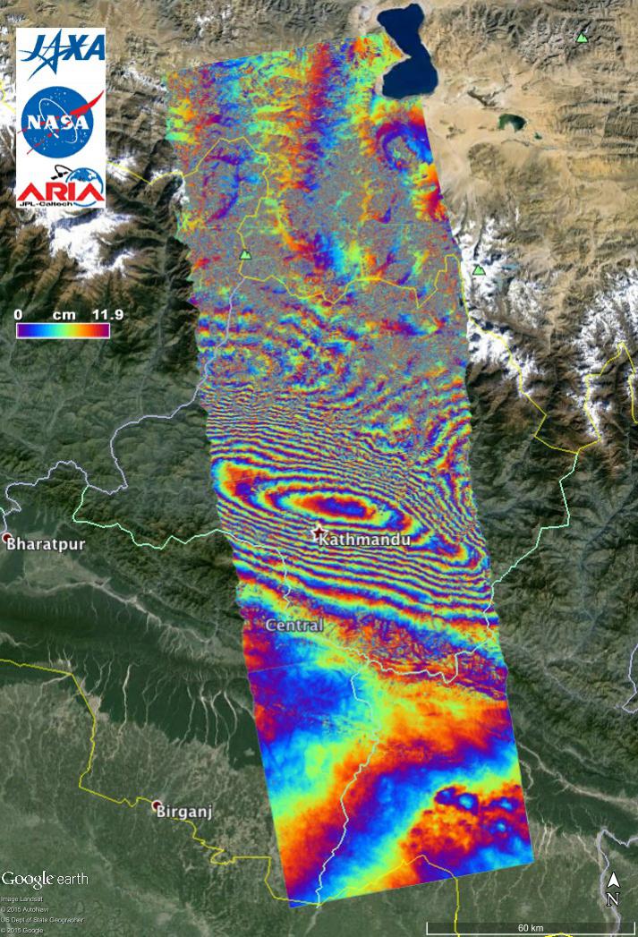
2015-05-02 |
Earth
|
ARIA
|
C-SAR Sensor
|
2048x1152x3 |

|
-
PIA19535:
-
NASA's ARIA Project Maps Deformation of Earth's Surface from Nepal Quake
Full Resolution:
TIFF
(7.08 MB)
JPEG
(600.1 kB)
|
|
|
2015-04-29 |
Earth
|
|
C-SAR Sensor
|
2560x1504x3 |
|
-
PIA11434:
-
Ground Deformation from Chilean Volcanic Eruption Shown by Satellite Radar Image
Full Resolution:
TIFF
(11.55 MB)
JPEG
(1.664 MB)
|
|
|
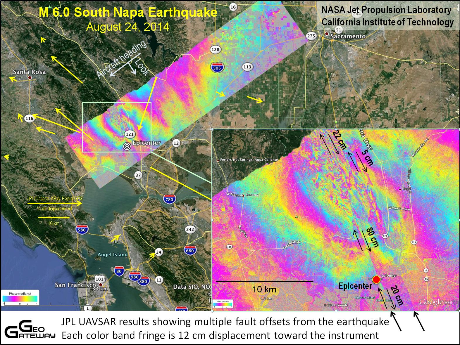
2014-09-04 |
Earth
|
UAVSAR
|
L-Band UAVSAR
|
1573x1181x3 |
|
-
PIA18801:
-
NASA's UAVSAR Studies Ground Deformation from Napa California Quake
Full Resolution:
TIFF
(5.575 MB)
JPEG
(472.8 kB)
|
|
|
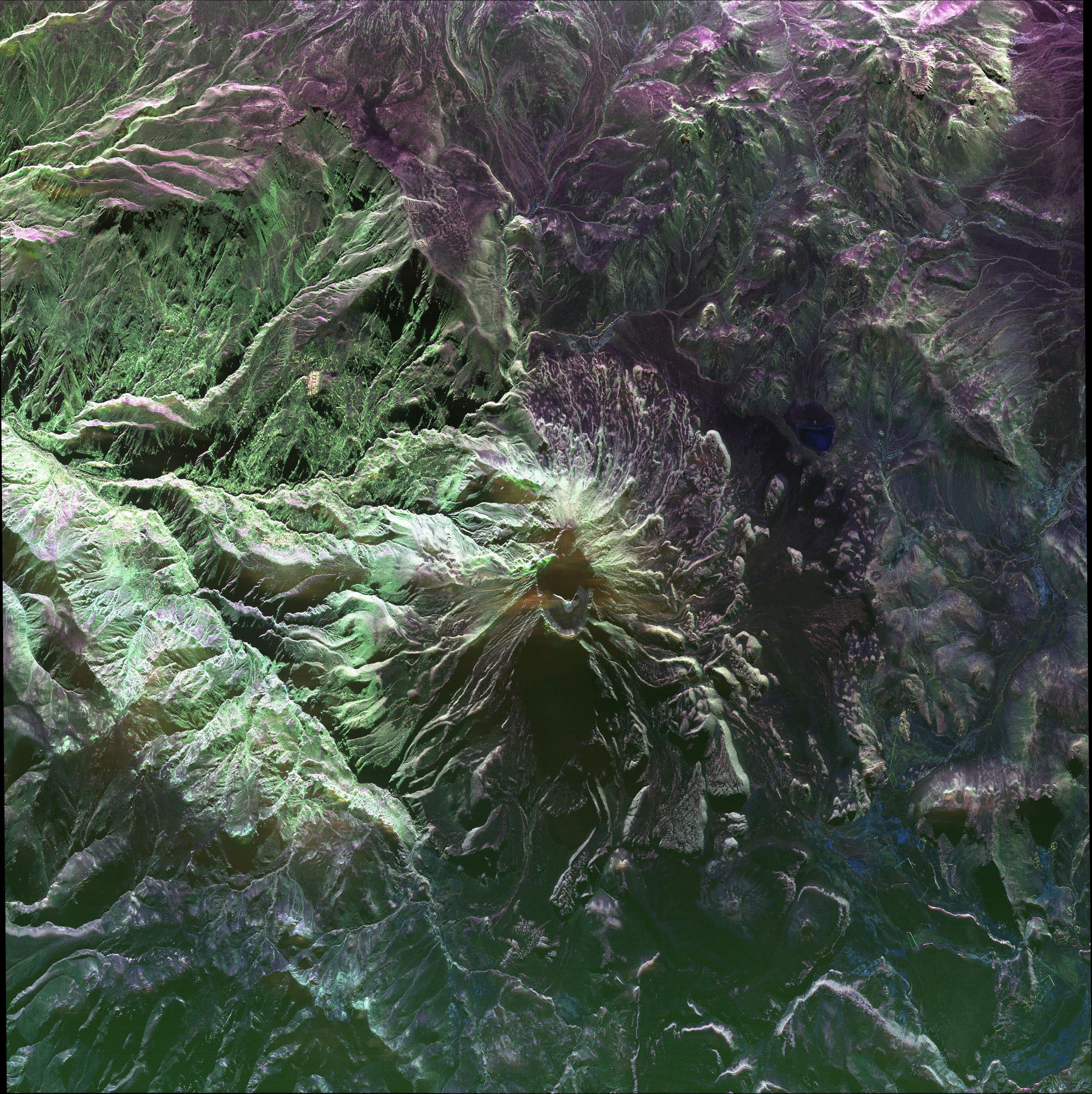
2014-05-27 |
Earth
|
UAVSAR
|
L-Band UAVSAR
|
3238x3244x3 |

|
-
PIA18049:
-
UAVSAR image of Ubinas Volcano
Full Resolution:
TIFF
(31.53 MB)
JPEG
(2.65 MB)
|
|
|
2014-03-31 |
Earth
|
UAVSAR
|
L-Band UAVSAR
|
1400x950x3 |

|
-
PIA18041:
-
NASA Model Provides 3-D Look at L.A.-area 5.1 Quake
Full Resolution:
TIFF
(3.992 MB)
JPEG
(303.4 kB)
|
|
|
2014-03-18 |
Earth
|
Seasat
|
Synthetic Aperture Radar (SAR)
|
3000x6407x3 |

|
-
PIA18137:
-
NASA's Seasat Satellite Shows Massachusetts Coast
Full Resolution:
TIFF
(57.69 MB)
JPEG
(3.845 MB)
|
|
|
2014-03-06 |
Earth
|
UAVSAR
|
L-Band UAVSAR
|
1107x981x3 |
|
-
PIA18040:
-
NASA Radar Demonstrates Ability to Foresee Sinkholes
Full Resolution:
TIFF
(3.259 MB)
JPEG
(246.1 kB)
|
|
|
2013-04-03 |
Earth
|
UAVSAR
|
L-Band UAVSAR
|
1079x863x3 |
|
-
PIA16943:
-
UAVSAR Acquires False-Color Image of Galeras Volcano, Colombia
Full Resolution:
TIFF
(2.795 MB)
JPEG
(230.9 kB)
|
|
|
2013-04-03 |
Earth
|
UAVSAR
|
L-Band UAVSAR
|
2806x1314x3 |
|
-
PIA16942:
-
NASA Sends Unmanned Aircraft To Study Volcanoes and Wetlands
Full Resolution:
TIFF
(11.07 MB)
JPEG
(1.742 MB)
|
|
|
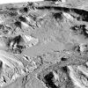
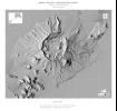
2012-12-12 |
Earth
|
Space Shuttle
|
SIR-C/X-SAR
|
2128x1612x1 |
|
-
PIA16179:
-
Nile River in Black and White
Full Resolution:
TIFF
(3.435 MB)
JPEG
(707.9 kB)
|
|
|
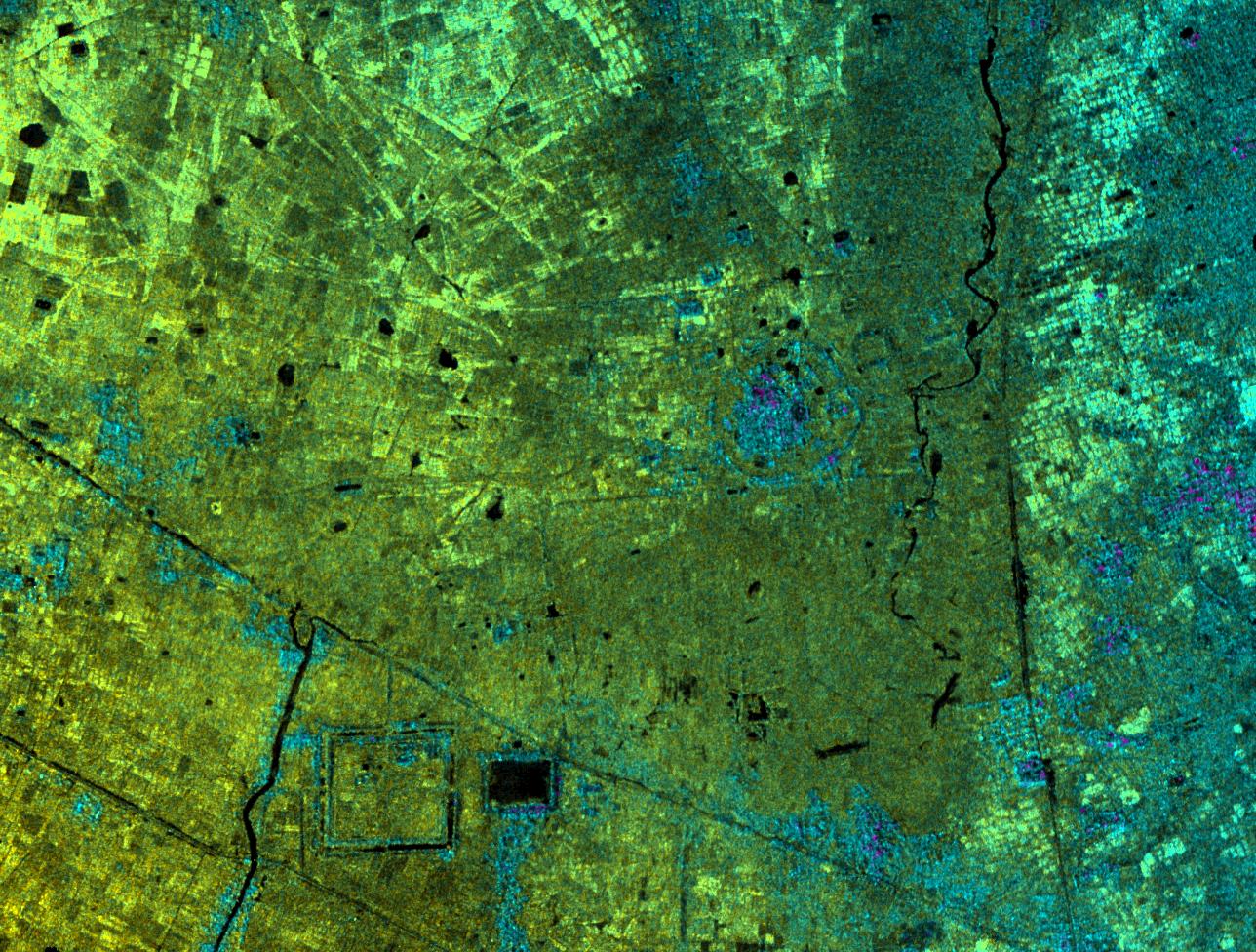
2012-10-01 |
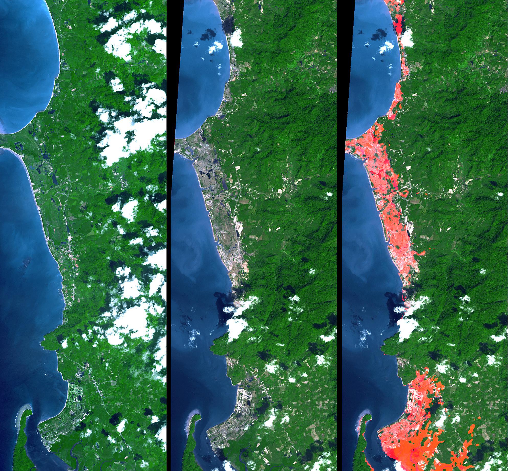
Earth
|
Terra
|
ASTER
InSAR
|
1024x575x3 |
|
-
PIA16293:
-
InSAR Measurements of Subsidence in California's Central Valley (June 2007--December 2010)

Full Resolution:
TIFF
(1.767 MB)
JPEG
(81.67 kB)
|
|
|
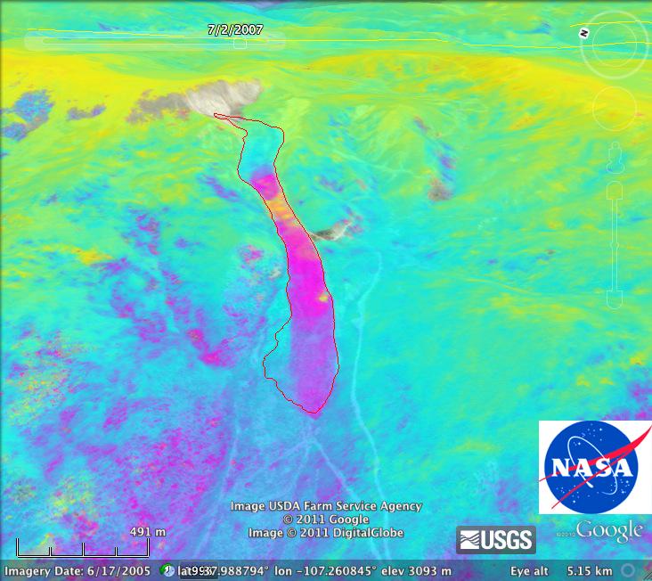
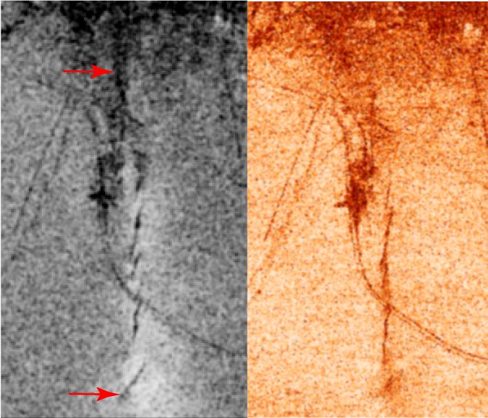
2012-08-15 |
Earth
|
UAVSAR
|
L-Band UAVSAR
|
732x652x3 |
|
-
PIA16059:
-
NASA's UAVSAR Images Colorado's Slumgullion Landslide
Full Resolution:
TIFF
(1.432 MB)
JPEG
(78.48 kB)
|
|
|
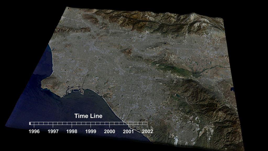
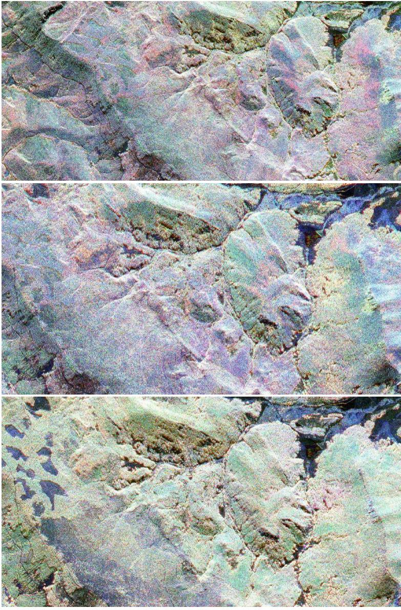
2012-02-06 |
Earth
|
European Remote Sensing Satellite Mission (ERS)
|
Synthetic Aperture Radar (SAR)
|
1023x576x3 |
|
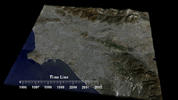
-
PIA13202:
-
Southern California INSAR Time Series
Full Resolution:
TIFF
(1.77 MB)
JPEG
(87.02 kB)
|
|
|
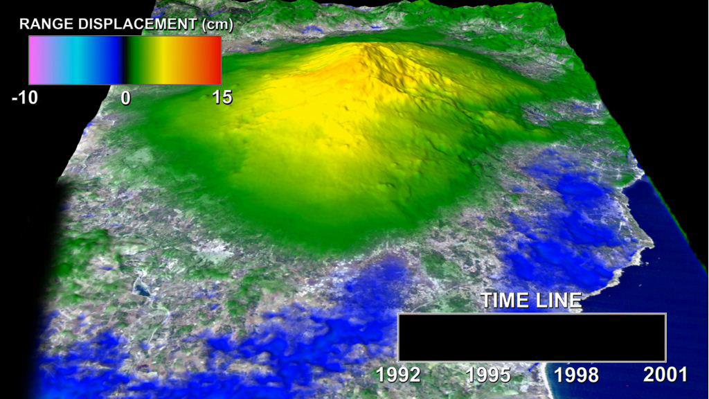
2012-02-06 |
Earth
|
European Remote Sensing Satellite Mission (ERS)
|
Synthetic Aperture Radar (SAR)
|
1024x576x3 |
|
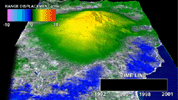
-
PIA13201:
-
Mount Etna InSAR Time Series Animation
Full Resolution:
TIFF
(1.772 MB)
JPEG
(100.7 kB)
|
|
|
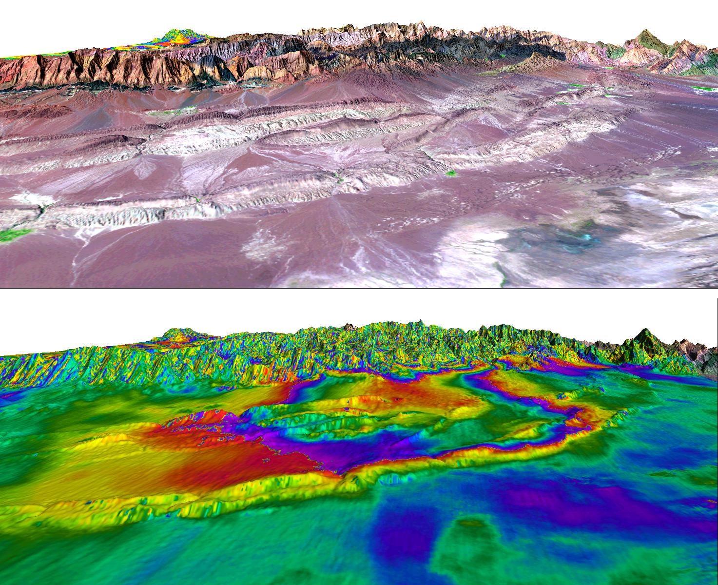
2011-03-04 |
Earth
|
UAVSAR
|
L-Band UAVSAR
|
20528x6304x3 |
|
-
PIA13902:
-
NASA Radar Captures Earth Deformation from 2010 Baja Calif. Quake
Full Resolution:
TIFF
(388.2 MB)
JPEG
(20.55 MB)
|
|
|
2010-08-04 |
Earth
|
UAVSAR
|
L-Band UAVSAR
|
2256x1464x3 |

|
-
PIA13314:
-
NASA Radar Images Show Continued Deformation from Mexico Quake
Full Resolution:
TIFF
(9.92 MB)
JPEG
(645.9 kB)
|
|
|
2010-07-01 |
Earth
|
UAVSAR
|
L-Band UAVSAR
|
1280x720x3 |
|
-
PIA13233:
-
UAVSAR Maps the Gulf Coast Oil Spill
Full Resolution:
TIFF
(2.768 MB)
JPEG
(116.7 kB)
|
|
|
2010-06-23 |
Earth
|
UAVSAR
|
L-Band UAVSAR
|
3864x2640x3 |
|
-
PIA13380:
-
NASA Radar Images Show How Mexico Quake Deformed Earth
Full Resolution:
TIFF
(30.6 MB)
JPEG
(3.349 MB)
|
|
|
2010-02-02 |
Earth
|
UAVSAR
|
L-Band UAVSAR
|
6662x5139x3 |
|
-
PIA12503:
-
NASA Airborne Radar Captures Its First Images of Post-Quake Haiti
Full Resolution:
TIFF
(102.7 MB)
JPEG
(6.338 MB)
|
|
|
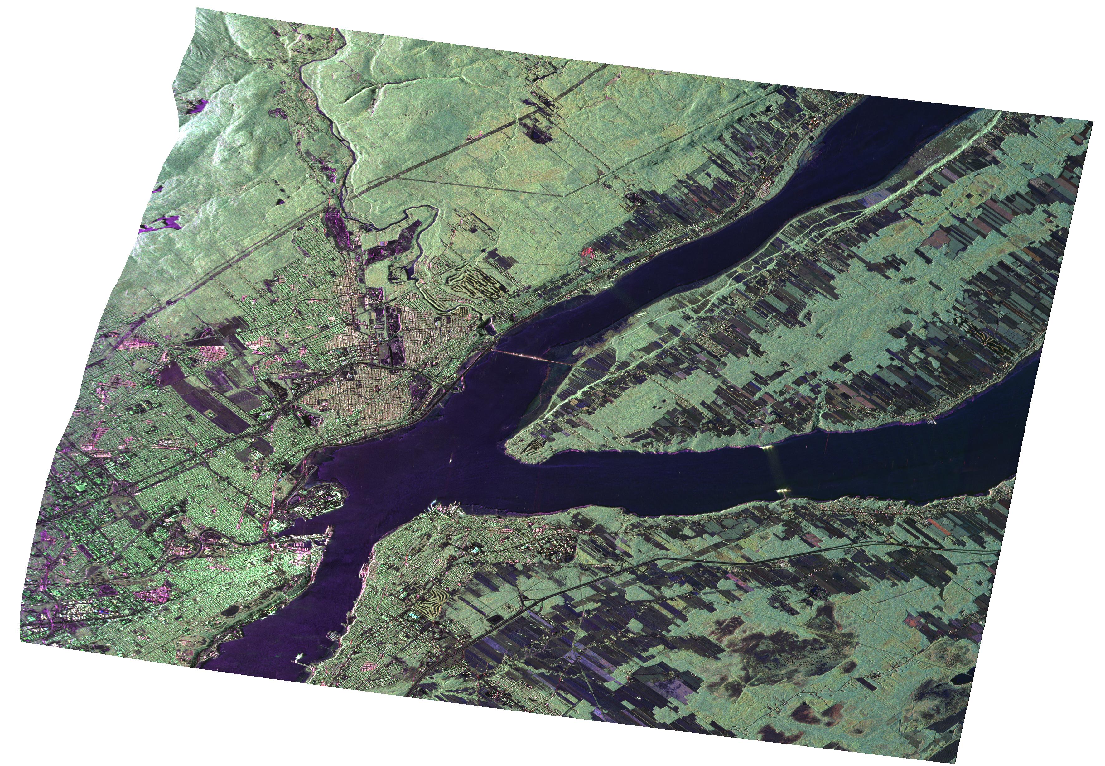
2009-09-01 |
Earth
|
UAVSAR
|
L-Band UAVSAR
|
3544x2458x3 |
|
-
PIA12189:
-
UAVSAR Radar Imagery of Boreal Forests Around Quebec City, Canada
Full Resolution:
TIFF
(26.13 MB)
JPEG
(1.734 MB)
|
|
|
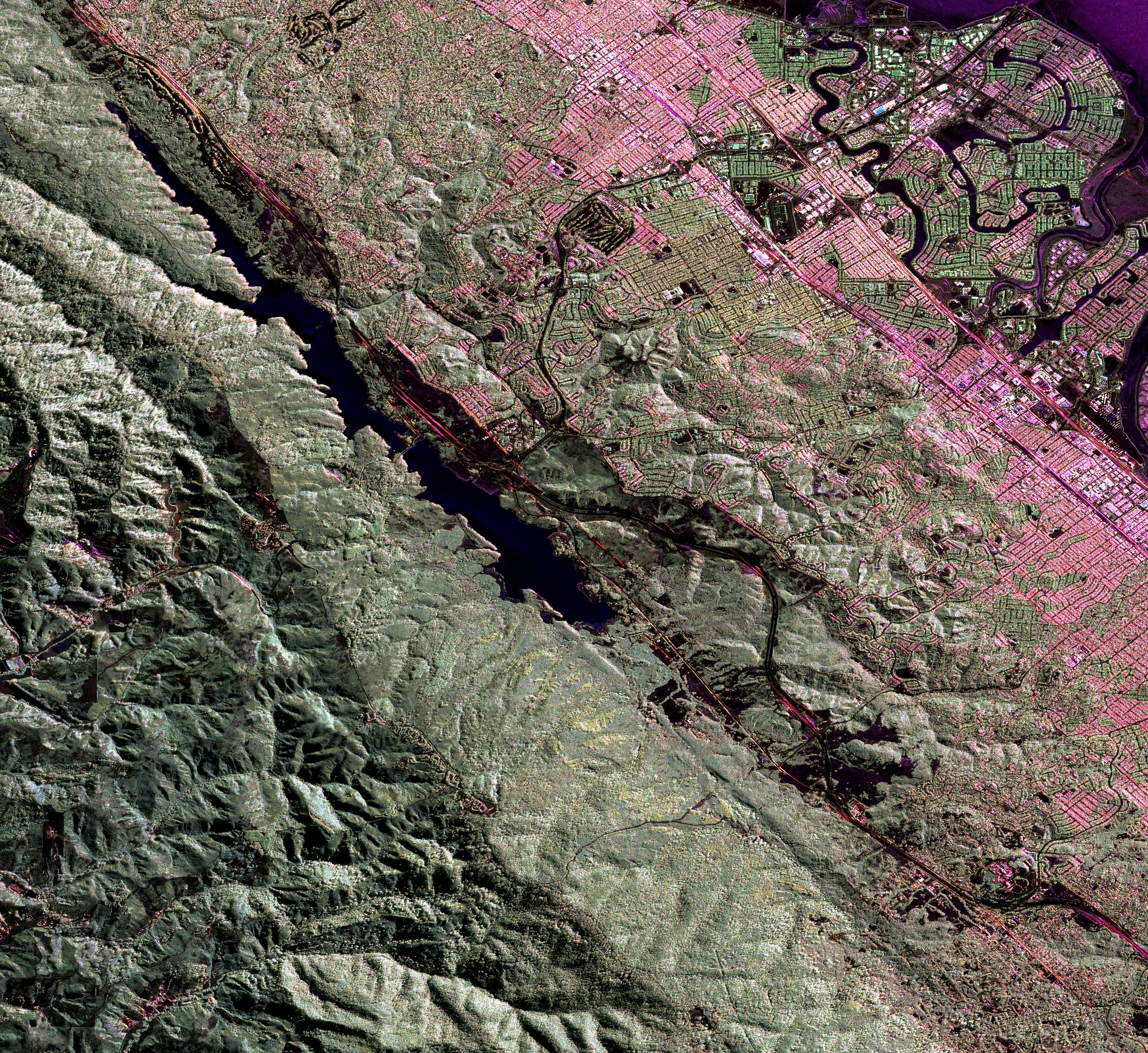
2009-06-18 |
Earth
|
UAVSAR
|
L-Band UAVSAR
|
2984x2737x3 |
|
-
PIA12075:
-
Scientists Search for a Pulse in Skies Above Earthquake Country
Full Resolution:
TIFF
(24.5 MB)
JPEG
(3.571 MB)
|
|
|
2005-01-14 |
Earth
|
Shuttle Radar Topography Mission (SRTM)
Terra
|
ASTER
SIR-C/X-SAR
|
1987x1840x3 |
|
-
PIA06671:
-
Tsunami Inundation, North of Phuket, Thailand
ASTER Images and SRTM Elevation Model
Full Resolution:
TIFF
(10.98 MB)
JPEG
(737.4 kB)
|
|
|
2004-06-25 |
Earth
|
Envisat
|
Advanced Synthetic Aperture Radar (ASAR)
|
710x609x3 |
|
-
PIA06311:
-
Bam, Iran, Radar Interferometry -- Earthquake
Full Resolution:
TIFF
(1.109 MB)
JPEG
(77.72 kB)
|
|
|
2004-06-25 |
Earth
|
European Remote Sensing Satellite Mission (ERS)
Landsat
|
Synthetic Aperture Radar (SAR)
Thematic Mapper (TM)
|
1473x1200x3 |

|
-
PIA06310:
-
Shahdad, Southeast Iran, Radar Interferometry -- Silent Earthquake, Perspective View
Full Resolution:
TIFF
(4.672 MB)
JPEG
(367.1 kB)
|
|
|
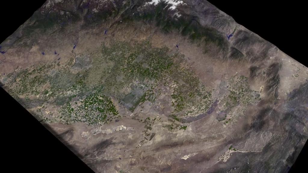
2003-03-25 |
Earth
|
Airborne Synthetic Aperture Radar (AIRSAR)
|
AirSAR
|
783x1192x3 |
|
-
PIA04266:
-
Fraser, Colorado
Full Resolution:
TIFF
(2.803 MB)
JPEG
(339 kB)
|
|
|
2002-10-11 |
Earth
|
Airborne Synthetic Aperture Radar (AIRSAR)
|
AirSAR
|
1898x1734x3 |

|
-
PIA03871:
-
Radar Image with Color as Height, Nokor Pheas Trapeng, Cambodia
Full Resolution:
TIFF
(3.296 MB)
JPEG
(1.12 MB)
|
|
|
2002-10-11 |
Earth
|
Airborne Synthetic Aperture Radar (AIRSAR)
|
AirSAR
|
949x867x3 |

|
-
PIA03870:
-
Radar Image with Color as Height, Ancharn Kuy, Cambodia
Full Resolution:
TIFF
(2.476 MB)
JPEG
(312.7 kB)
|
|
|
2002-10-11 |
Earth
|
Airborne Synthetic Aperture Radar (AIRSAR)
|
AirSAR
|
1288x976x3 |
|
-
PIA03869:
-
Radar Image with Color as Height, Hariharalaya, Cambodia
Full Resolution:
TIFF
(3.778 MB)
JPEG
(440.6 kB)
|
|
|
2002-10-11 |
Earth
|
Airborne Synthetic Aperture Radar (AIRSAR)
|
AirSAR
|
1288x976x3 |
|
-
PIA03868:
-
Radar Image with Color as Height, Lovea, Cambodia
Full Resolution:
TIFF
(3.777 MB)
JPEG
(360.3 kB)
|
|
|
2002-10-11 |
Earth
|
Airborne Synthetic Aperture Radar (AIRSAR)
|
AirSAR
|
670x671x3 |
|
-
PIA03867:
-
Radar Image with Color as Height, Old Khmer Road, Cambodia
Full Resolution:
TIFF
(1.356 MB)
JPEG
(127.8 kB)
|
|
|
2002-10-11 |
Earth
|
Airborne Synthetic Aperture Radar (AIRSAR)
|
AirSAR
|
1064x976x3 |
|
-
PIA03866:
-
Radar Image with Color as Height, Sman Teng, Temple, Cambodia
Full Resolution:
TIFF
(3.122 MB)
JPEG
(295.3 kB)
|
|
|
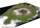
2001-11-04 |
Earth
|
Airborne Synthetic Aperture Radar (AIRSAR)
|
AirSAR
|
1000x875x3 |
|
-
PIA03513:
-
Mt. Pinatubo, Phillipines - Comparison of November, 1996 and September, 2000
Full Resolution:
TIFF
(3.403 MB)
JPEG
(366.2 kB)
|
|
|
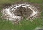
2001-11-04 |
Earth
|
Airborne Synthetic Aperture Radar (AIRSAR)
|
AirSAR
|
1467x711x3 |
|
-
PIA03512:
-
Mt. Pinatubo, Phillippines - Perspective View
Full Resolution:
TIFF
(1.938 MB)
JPEG
(172.5 kB)
|
|
|
2001-11-04 |
Earth
|
Airborne Synthetic Aperture Radar (AIRSAR)
|
AirSAR
|
899x630x1 |
|
-
PIA03511:
-
Perspective View of Okmok Volcano, Aleutian Islands, Alaska (#2)
Full Resolution:
TIFF
(511.1 kB)
JPEG
(149.9 kB)
|
|
|
2001-11-04 |
Earth
|
Airborne Synthetic Aperture Radar (AIRSAR)
|
AirSAR
|
597x597x1 |
|
-
PIA03510:
-
Perspective View of Okmok Volcano, Aleutian Islands, Alaska (#1)
Full Resolution:
TIFF
(435.5 kB)
JPEG
(120.8 kB)
|
|
|
2001-11-04 |
Earth
|
Airborne Synthetic Aperture Radar (AIRSAR)
|
AirSAR
|
3000x2878x3 |
|
-
PIA03509:
-
Shaded Relief Mosaic of Umnak Island, Aleutian Islands, Alaska
Full Resolution:
TIFF
(8.667 MB)
JPEG
(1.659 MB)
|
|
|
2001-11-04 |
Earth
|
Airborne Synthetic Aperture Radar (AIRSAR)
|
AirSAR
|
899x630x3 |
|
-
PIA03508:
-
Perspective View of Umnak Island, Aleutian Islands, Alaska (#2)
Full Resolution:
TIFF
(918.8 kB)
JPEG
(96 kB)
|
|
|
2001-11-04 |
Earth
|
Airborne Synthetic Aperture Radar (AIRSAR)
|
AirSAR
|
899x630x3 |
|
-
PIA03507:
-
Perspective View of Umnak Island, Aleutian Islands, Alaska (#1)
Full Resolution:
TIFF
(1.274 MB)
JPEG
(141.8 kB)
|
|
|
2001-03-07 |
Earth
|
Airborne Synthetic Aperture Radar (AIRSAR)
|
AirSAR
|
1321x825x3 |
|
-
PIA03157:
-
Altamaha River Delta, Georgia Sea Islands
Full Resolution:
TIFF
(2.847 MB)
JPEG
(205.7 kB)
|
|
|
2000-12-11 |
Earth
|
Airborne Synthetic Aperture Radar (AIRSAR)
|
AirSAR
|
2401x11984x3 |

|
-
PIA02854:
-
Upolu Island, Western Samoa
Full Resolution:
TIFF
(23.9 MB)
JPEG
(10.24 MB)
|
|
|
2000-12-11 |
Earth
|
Airborne Synthetic Aperture Radar (AIRSAR)
|
AirSAR
|
1992x2018x3 |
|
-
PIA02853:
-
Upolu Island, Western Samoa
Full Resolution:
TIFF
(3.49 MB)
JPEG
(1.528 MB)
|
|
|
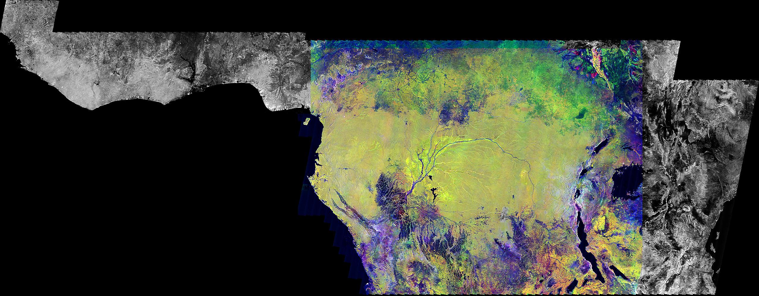
1999-09-23 |
Earth
|
Global Rain Forest Mapping Project (GRFM)
|
JERS-1 SAR
|
2552x997x3 |
|
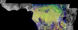
-
PIA01348:
-
Radar Mosaic of Africa
Full Resolution:
TIFF
(4.785 MB)
JPEG
(616.3 kB)
|
|
|
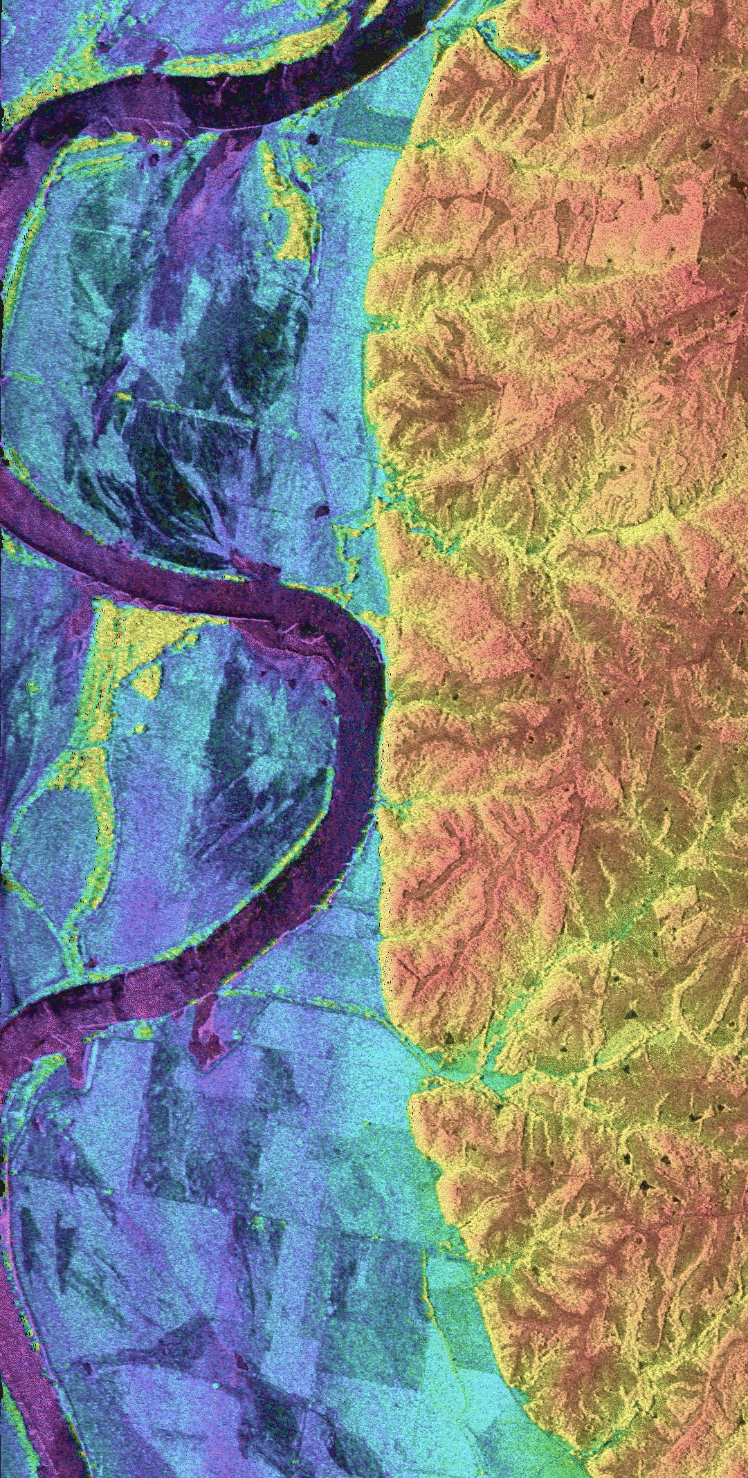
1999-04-15 |
Earth
|
Airborne Synthetic Aperture Radar (AIRSAR)
|
AirSAR
|
1081x2137x3 |
|
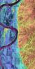
-
PIA01806:
-
Space Radar Image of Missouri River - TOPSAR
Full Resolution:
TIFF
(2.212 MB)
JPEG
(780.9 kB)
|
 Planetary Data System


