 | 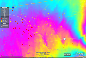 |
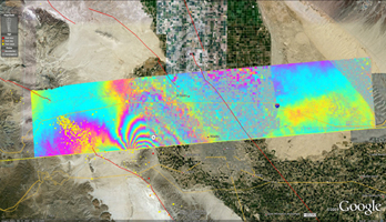
| Figure 1 | Figure 2 |
Click on an individual image for full resolution imageNASA has released the first-ever airborne radar images of the deformation in Earth's surface caused by a major earthquake -- the magnitude 7.2 temblor that rocked Mexico's state of Baja California and parts of the American Southwest on April 4.
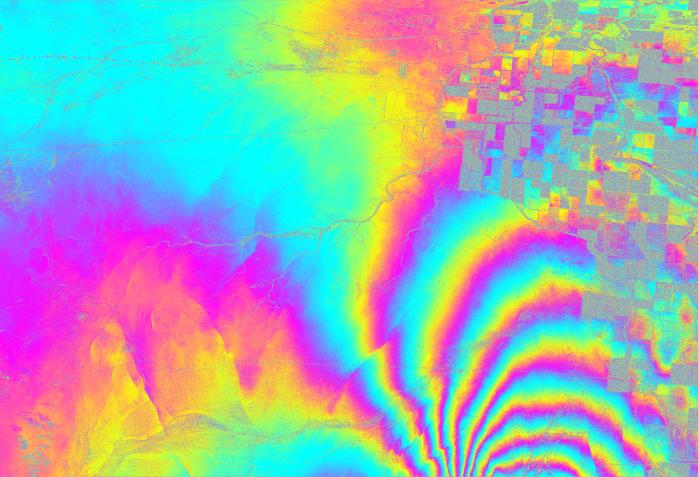
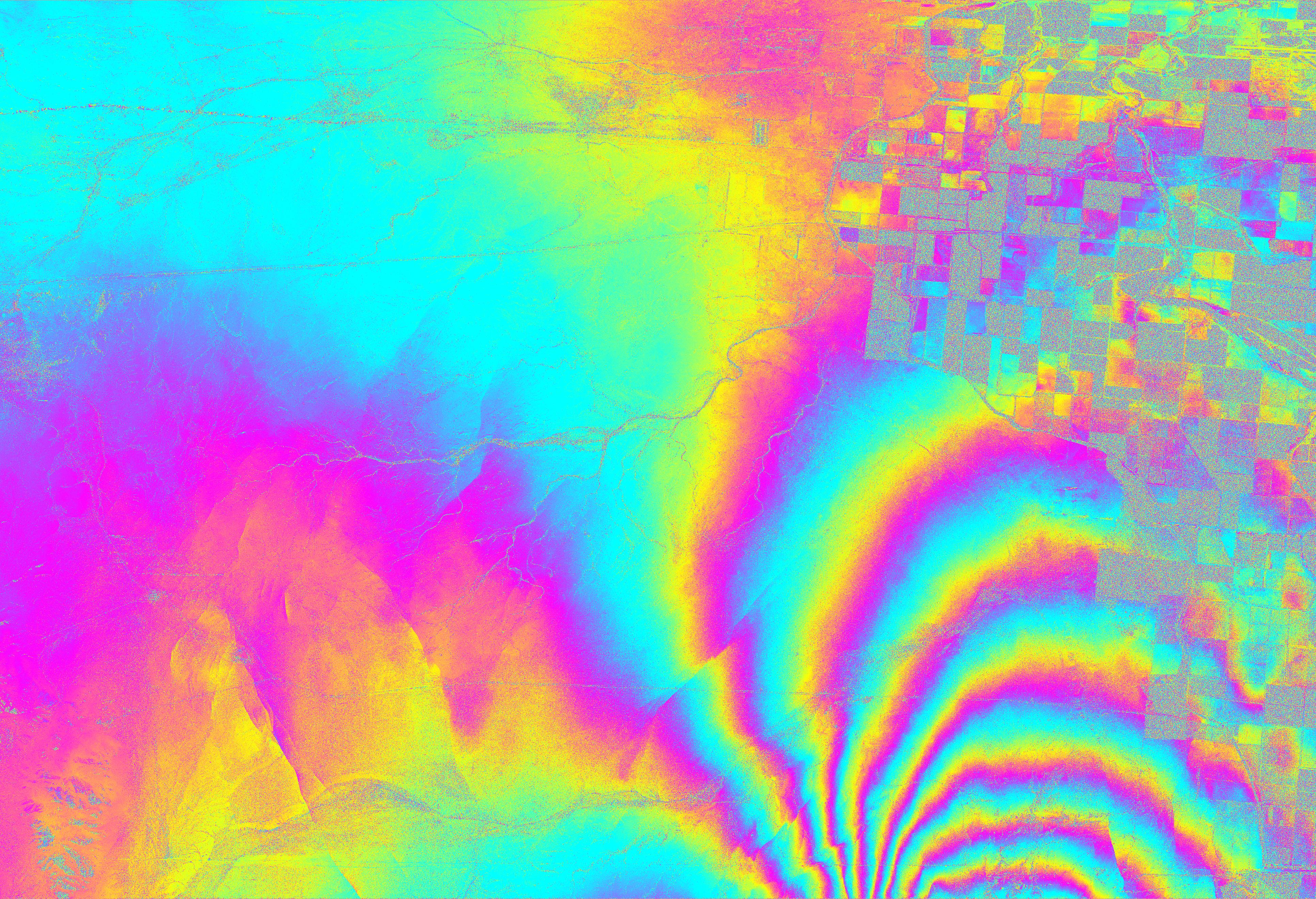
This image shows an enlargement of a UAVSAR interferogram swath, focusing on the area where the largest deformation was measured. The enlargement, which covers an area measuring about 20 by 20 kilometers (12.5 by 12.5 miles), reveals many small “cuts,” or discontinuities, in the fringes. These are caused by ground motions ranging from a centimeter to tens of centimeters (a few inches) on small faults. Each colored contour, or fringe, of the interferogram represents 11.9 centimeters (4.7 inches) of surface displacement.
The full interferogram swath is shown in Figure 1, overlaid atop a Google Earth image. It measures 110 by 20 kilometers (69 by 12.5 miles). Major fault lines are marked in red, and recent aftershocks are denoted by yellow, orange and red dots. Figure 2 shows a close-up of the region where the magnitude 5.7 aftershock struck.
The data reveal that in the area studied, the quake moved the Calexico, Calif., region in a downward and southerly direction up to 80 centimeters (31 inches). The maps can be seen at: http://www.nasa.gov/topics/earth/features/UAVSARimage20100623.html .
The April 4, 2010, El Mayor-Cucapah quake was centered 52 kilometers (32 miles) south-southeast of Calexico, Calif., in northern Baja California. It occurred along a geologically complex segment of the boundary between the North American and Pacific tectonic plates. The quake, the region's largest in nearly 120 years, was also felt in southern California and parts of Nevada and Arizona. It killed two, injured hundreds and caused substantial damage. There have been thousands of aftershocks, extending from near the northern tip of the Gulf of California to a few miles northwest of the U.S. border. The area northwest of the main rupture, along the trend of California's Elsinore fault, has been especially active, and was the site of a large, magnitude 5.7 aftershock on June 14.
Each UAVSAR flight serves as a baseline for subsequent quake activity. The team estimates displacement for each region, with the goal of determining how strain is partitioned between faults. When quakes do occur during the project, the team will observe their associated ground motions and assess how they may redistribute strain to other nearby faults, potentially priming them to break. Data from the Baja quake are being integrated into JPL's QuakeSim advanced computer models to better understand the fault systems that ruptured and potential impacts to nearby faults, such as the San Andreas, Elsinore and San Jacinto faults.
UAVSAR is also serving as a flying test bed to evaluate the tools and technologies for future space-based radars, such as those planned for a NASA mission currently in formulation called the Deformation, Ecosystem Structure and Dynamics of Ice, or DESDynI. That mission will study hazards such as earthquakes, volcanoes and landslides, as well as global environmental change.
UAVSAR is a reconfigurable polarimetric L-band synthetic aperture radar (SAR) specifically designed to acquire airborne repeat track SAR data for differential interferometric measurements. For more information about radar polarimetry, see http://www.ccrs.nrcan.gc.ca/resource/tutor/polarim/index_e.php. The radar will eventually be flown aboard an uninhabited, remote-piloted aircraft such as the Northrop Grumman Global Hawk. The radar was built at JPL with funding by NASA's Earth Science Technology Office. UAVSAR is managed and operated by JPL under contract with NASA's Science Mission Directorate, Washington, D.C.
For more information on UAVSAR, visit http://uavsar.jpl.nasa.gov/ .

