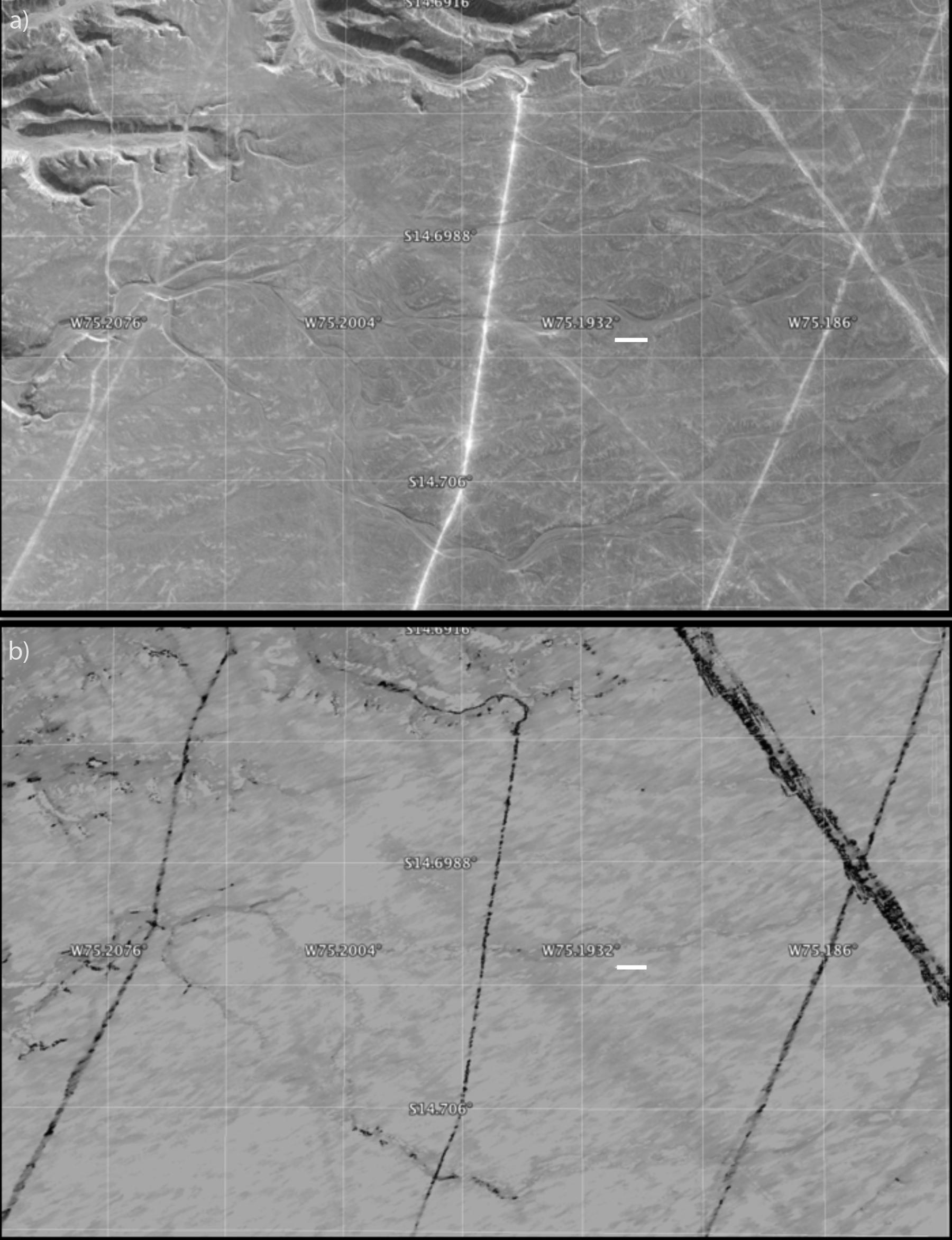
A protected area within the Nasca World Heritage Site in Peru that has experienced apparent disturbance between two different observations by NASA's Uninhabited Aerial Vehicle Synthetic Aperture Radar (UAVSAR). a) Google Earth image © 2015 Digital Globe image showing an area within the site traversed by dirt roads, power lines and geoglyphs. b) Calibrated correlation image from NASA's UAVSAR overlaid in Google Earth. Black corresponds to decorrelation, typically due to disturbance between the two observations (March 2013 and March 2015), while grey and light grey correspond to areas with minimal decorrelation. This image shows three unpaved roads within the protected portion of the Nasca World Heritage Site that have been disturbed, probably due to vehicular traffic, plus evidence of erosion along what is usually a dry creek bed in the center middle of the image. The power lines are in the upper right hand portion of the image, where the decorrelation stands out due to the movement of the power lines between observations. The white line indicates 100 meters. North is up.
NASA's Uninhabited Aerial Vehicle Synthetic Aperture Radar (UAVSAR), developed and managed by the Jet Propulsion Laboratory, Pasadena, California, can record changes on the ground beneath the aircraft that occur between multiple flights, which take exactly the same flight path. The instrument is used to monitor how volcanoes, earthquakes, and other natural hazards are changing Earth. Principal investigator Bruce Chapman of JPL noted that UAVSAR is ideally suited for observing the Nasca site because the region has virtually no vegetation and receives no rainfall whatsoever in most years, meaning that natural disturbances are minimal.
