My
List |
Addition Date
|
Target
|
Mission
|
Instrument
|
Size
|

|
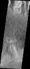
2004-10-07 |
Mars
|
Mars Exploration Rover (MER)
|
Panoramic Camera
|
22348x4487x3 |
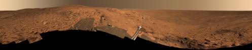
|
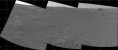
-
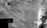
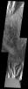
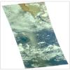
PIA06917:
'Cahokia' Panorama
Full Resolution:
TIFF
(183.7 MB)
JPEG
(8.79 MB)
QTVR
(9.678 MB)
|
|
|
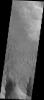
2004-10-07 |
Mars
|
2001 Mars Odyssey
|
THEMIS
|
1391x3237x1 |
|
-
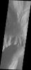
PIA06924:
-
Candor Chasma
Full Resolution:
TIFF
(3.135 MB)
JPEG
(339 kB)
|
|
|
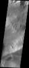
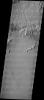
2004-10-06 |
Mars
|
2001 Mars Odyssey
|
|
1382x3226x1 |
|
-
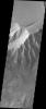
PIA06911:
-
Candor Chasma
Full Resolution:
TIFF
(3.164 MB)
JPEG
(381.4 kB)
|
|
|
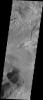
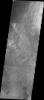
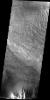
2004-10-05 |
Mars
|
2001 Mars Odyssey
|
THEMIS
|
1361x3061x1 |
|
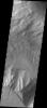
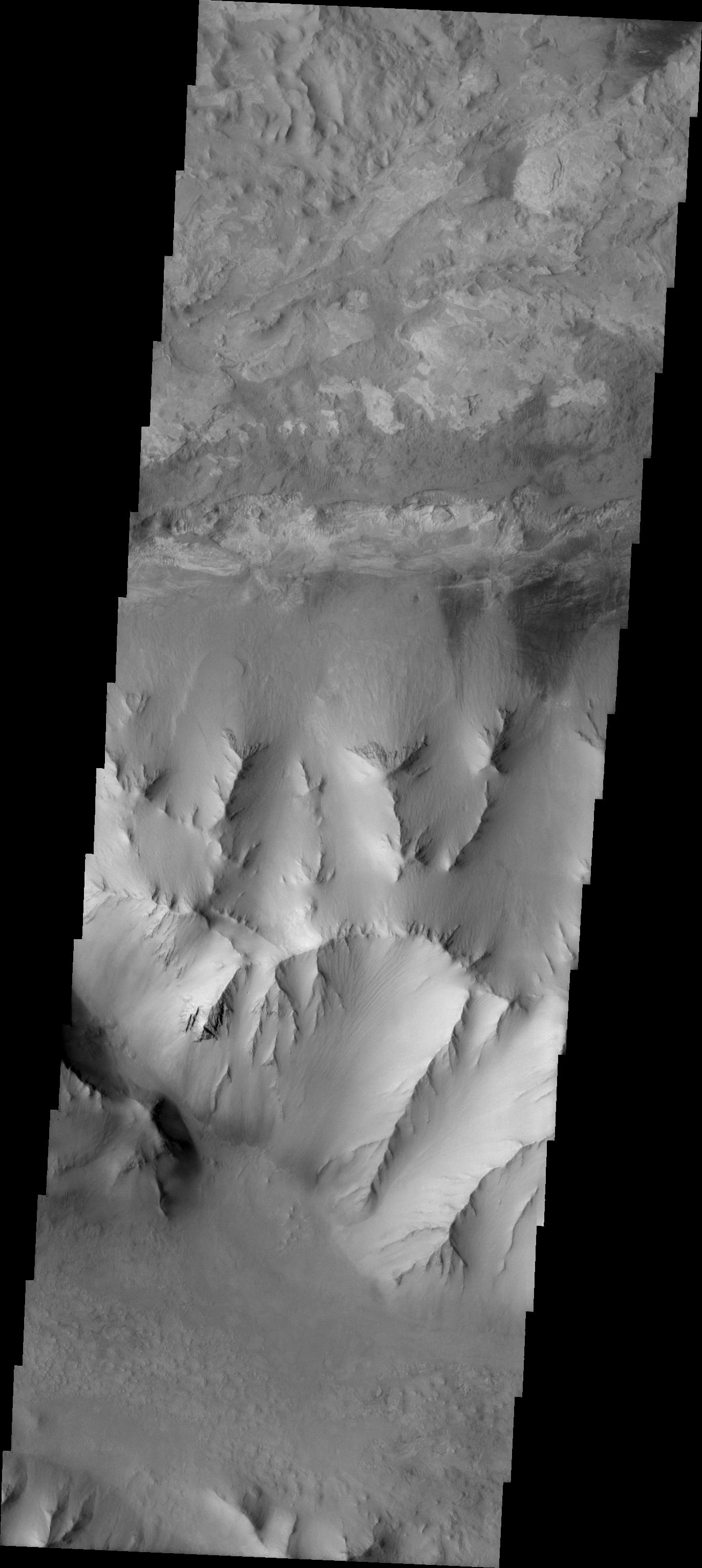
-
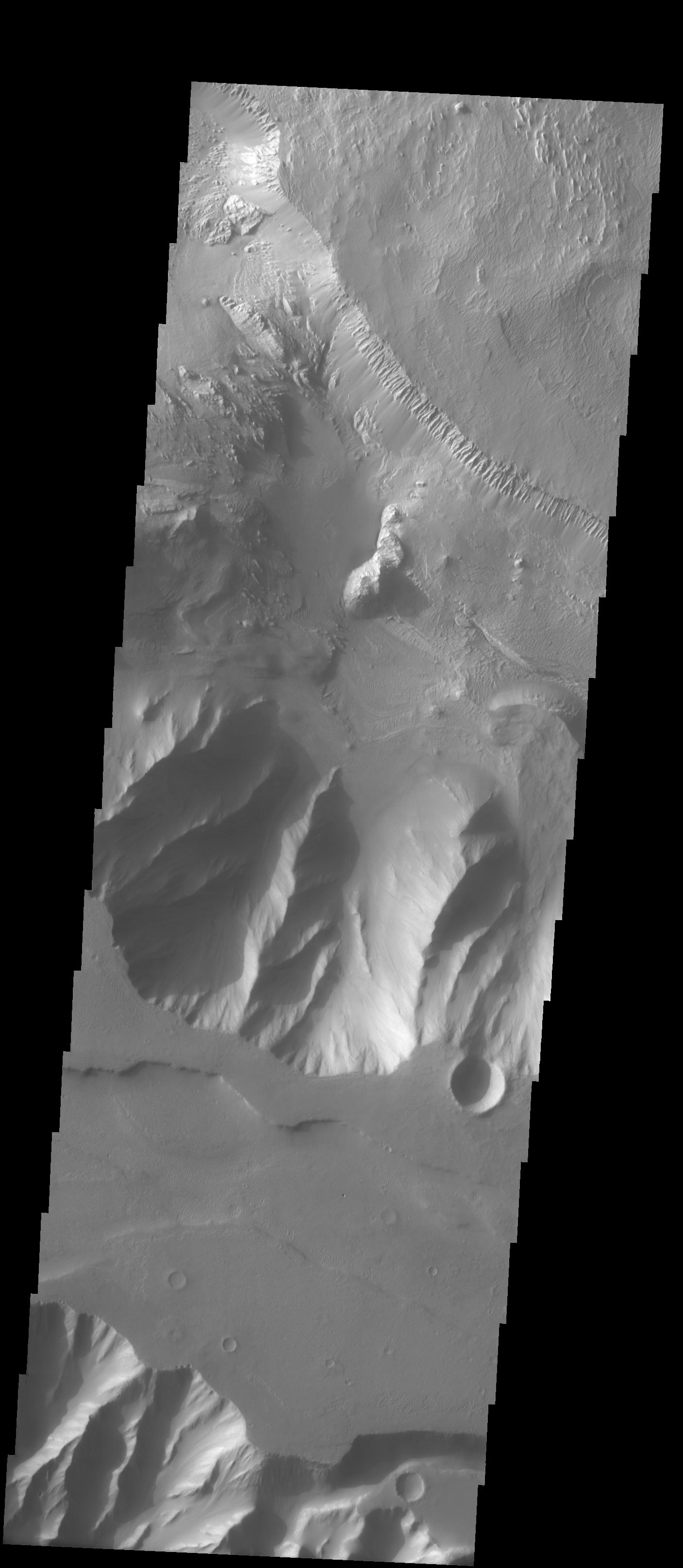
PIA06906:
-
Layered Candor Chasma
Full Resolution:
TIFF
(2.791 MB)
JPEG
(283 kB)
|
|
|
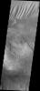
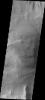
2004-10-04 |
Mars
|
2001 Mars Odyssey
|
THEMIS
|
1349x3067x1 |
|
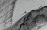
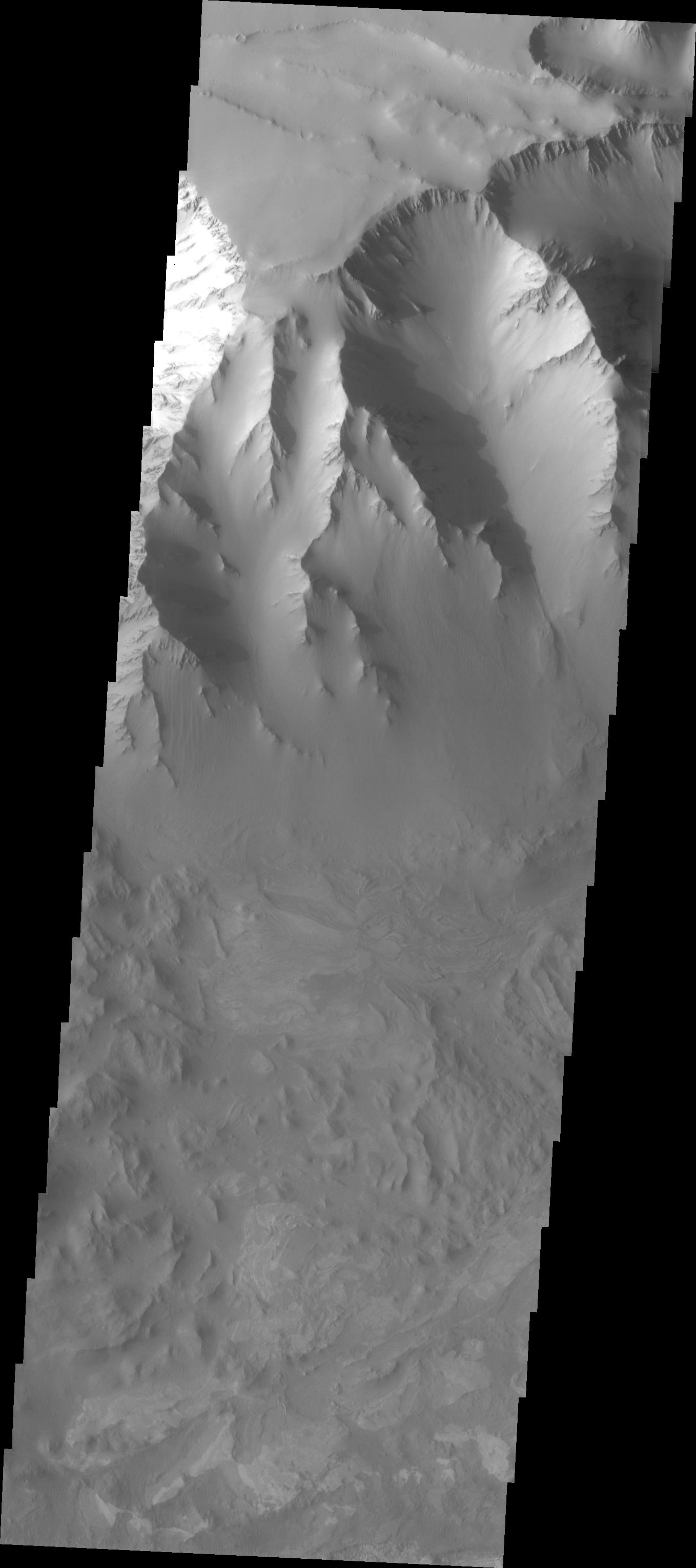
-
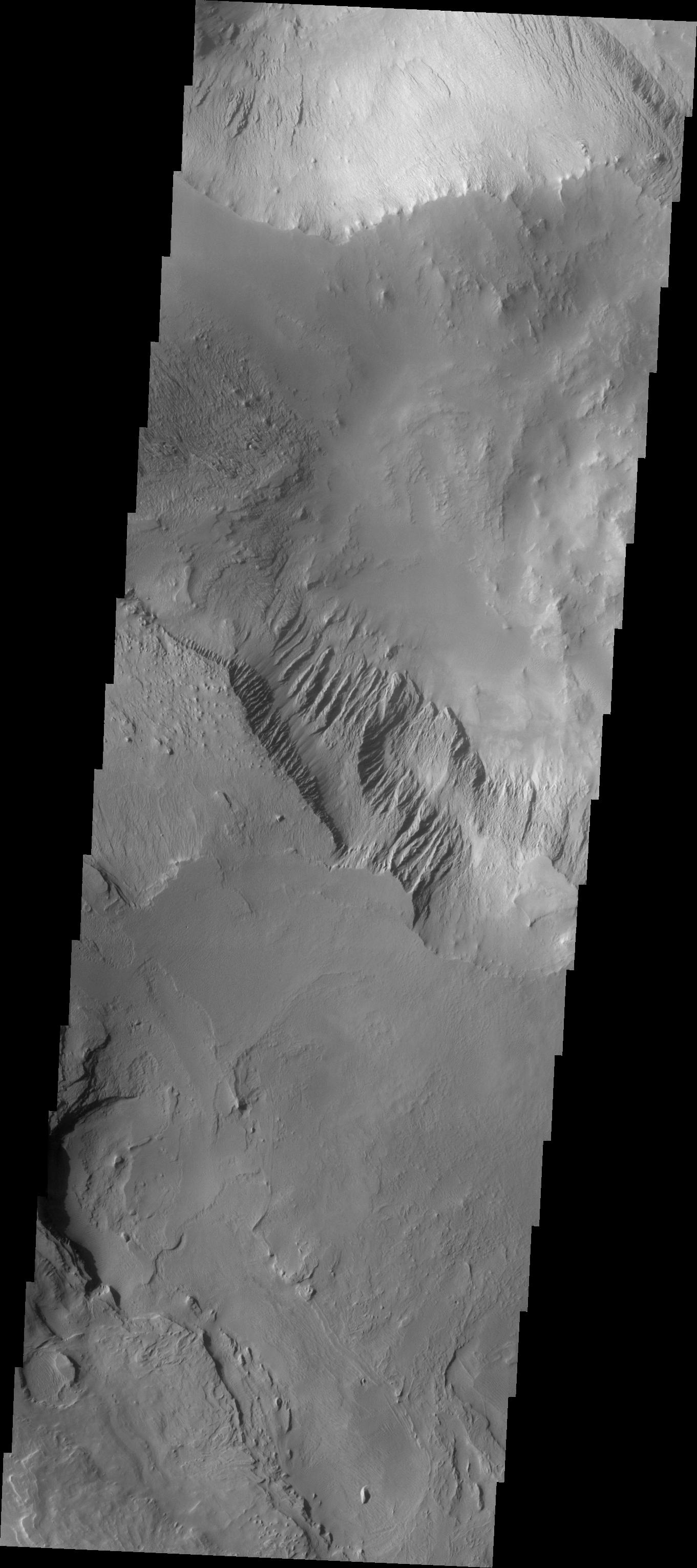
PIA06904:
-
Chaotic Candor Chasma
Full Resolution:
TIFF
(2.784 MB)
JPEG
(264.1 kB)
|
|
|
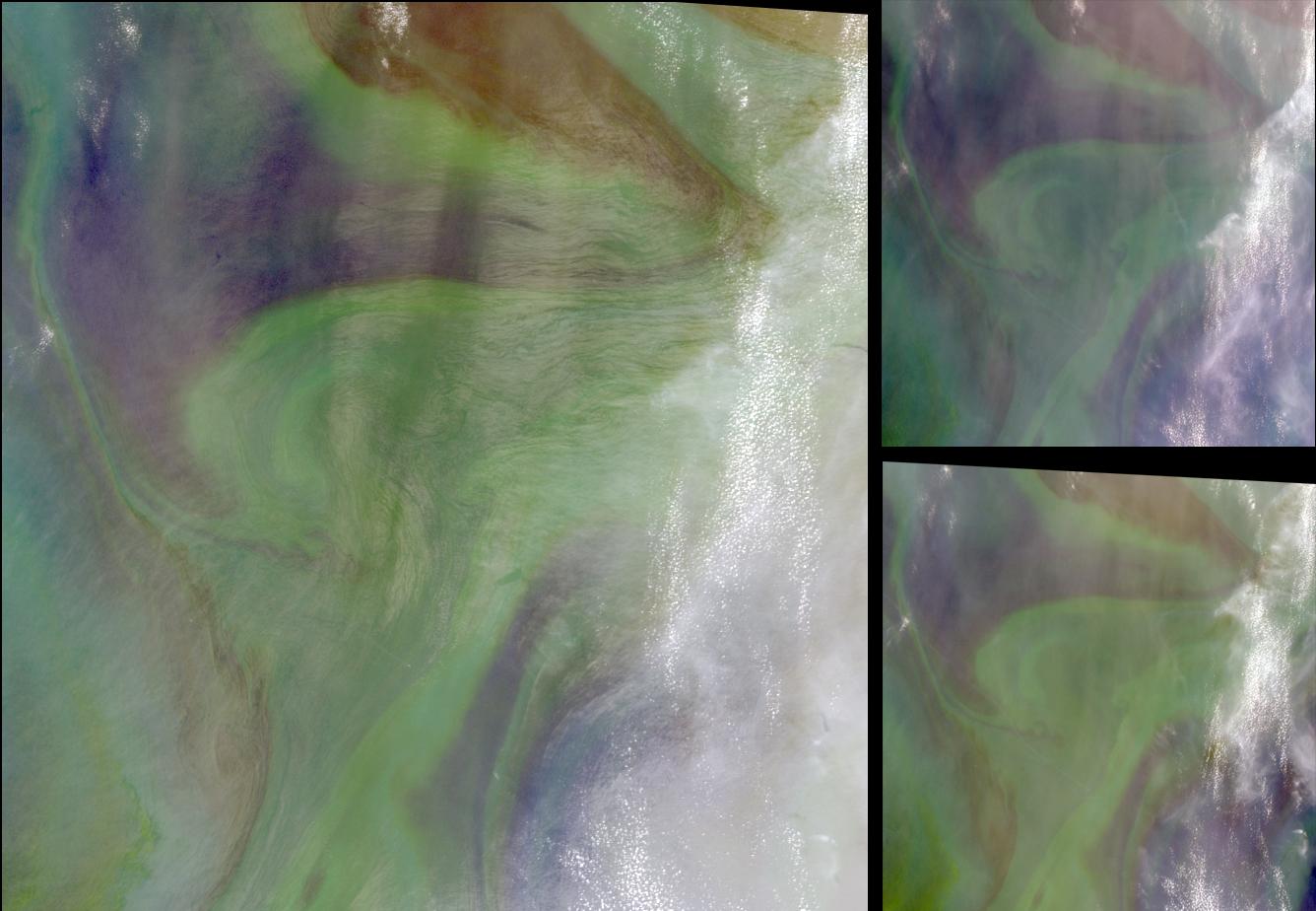
2004-10-02 |
Earth
|
Terra
|
MISR
|
1336x924x3 |

|
-
PIA04369:
-
Red Plankton in the Arabian Sea
Full Resolution:
TIFF
(3.416 MB)
JPEG
(118.9 kB)
|
|
|
2004-10-01 |
Earth
|
Shuttle Radar Topography Mission (SRTM)
|
C-Band Imaging Radar
X-Band Radar
|
2300x1730x3 |
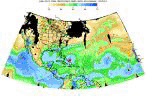
|
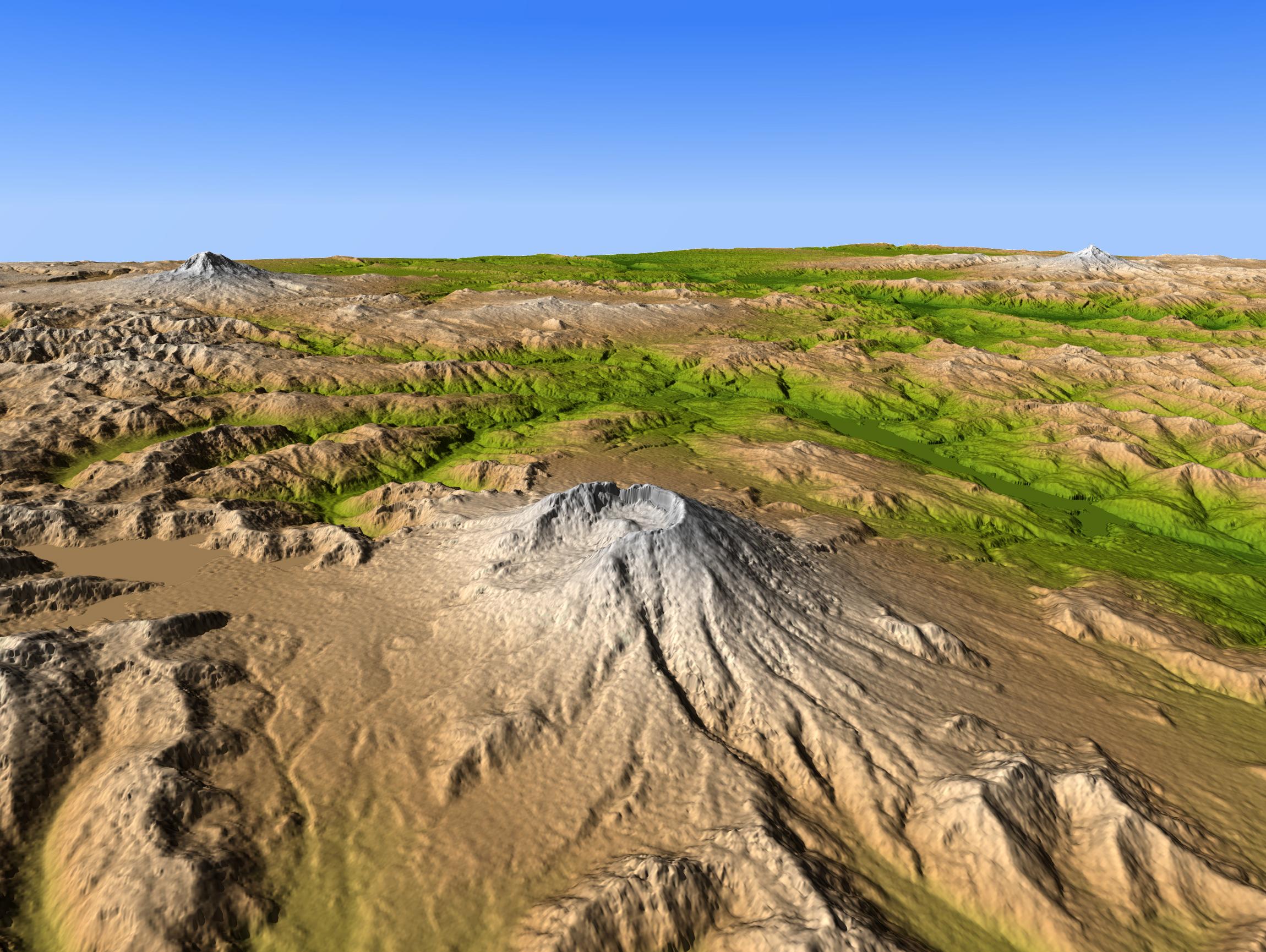
-
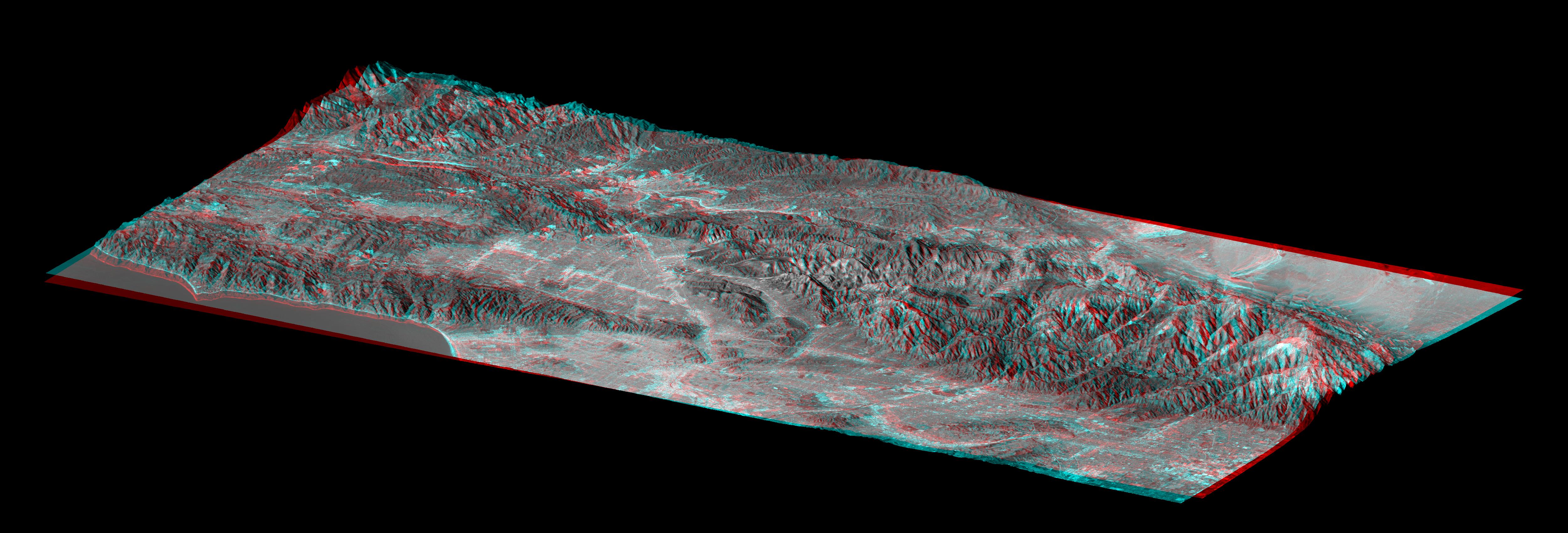
PIA06668:
-
Mount Saint Helens, Washington, USA, SRTM Perspective: Shaded Relief and Colored
Height
Full Resolution:
TIFF
(10.69 MB)
JPEG
(580.4 kB)
|
|
|
2004-10-01 |
Mars
|
2001 Mars Odyssey
|
THEMIS
|
1353x3060x1 |
|
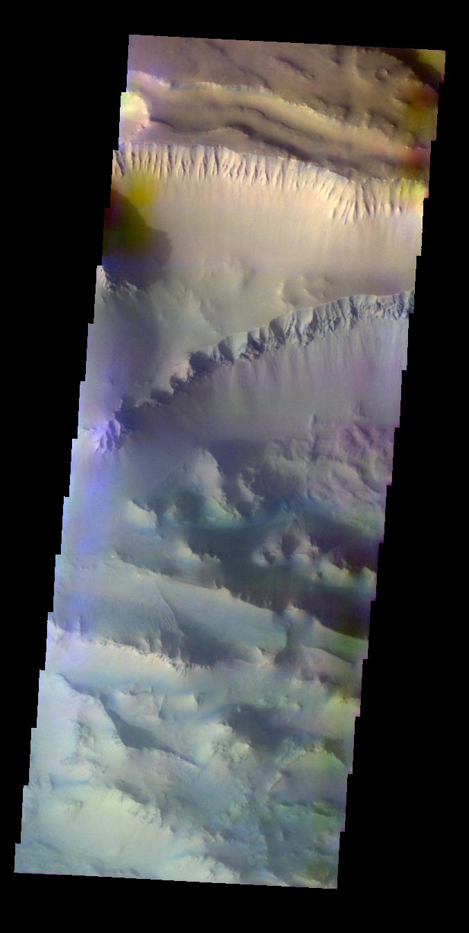
-
PIA06903:
-
Candor Chasma Landslides
Full Resolution:
TIFF
(2.75 MB)
JPEG
(253.8 kB)
|
|
|
2004-09-30 |
Mars
|
Mars Exploration Rover (MER)
|
Navigation Camera
|
1024x1024x1 |
|
-
PIA06894:
-
Layered Rock Ahead
Full Resolution:
TIFF
(962.5 kB)
JPEG
(142.5 kB)
|
|
|
2004-09-30 |
Mars
|
2001 Mars Odyssey
|
THEMIS
|
1351x3065x1 |
|
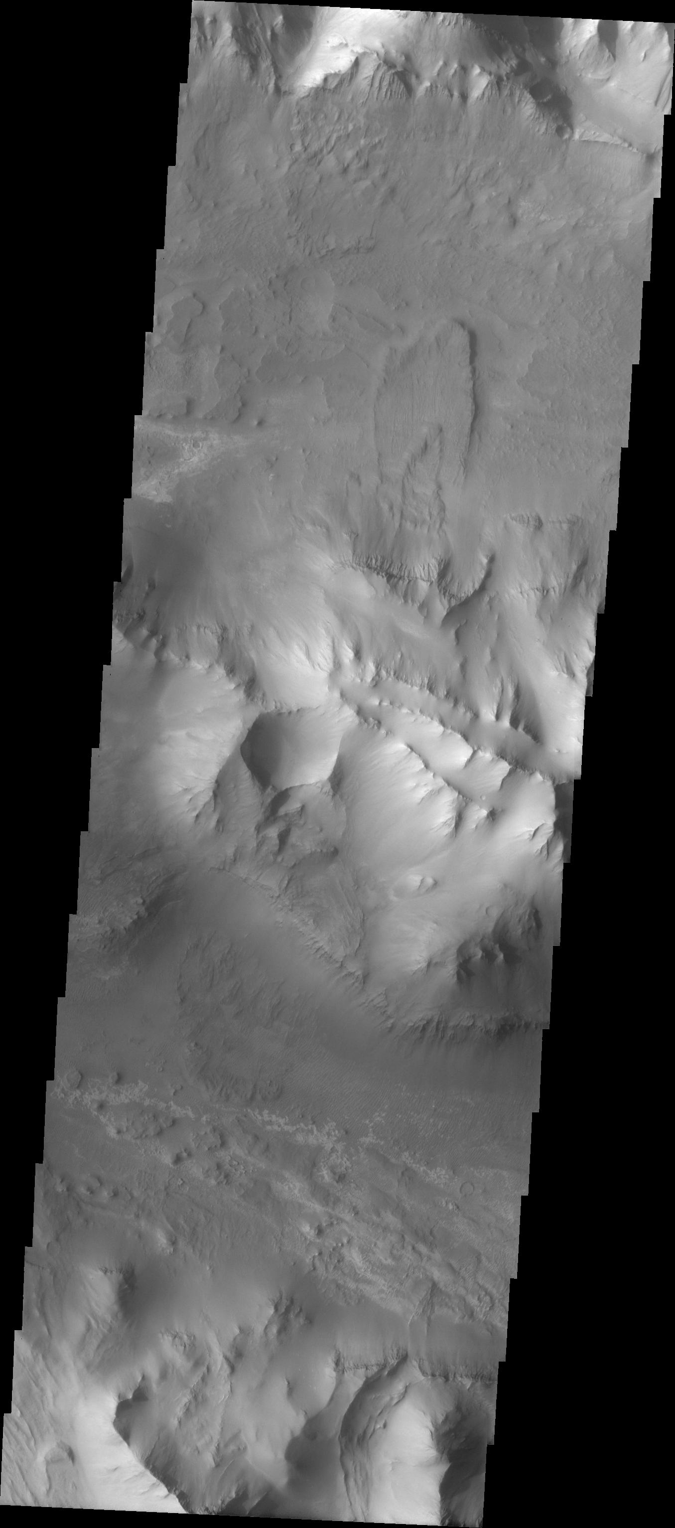
-
PIA06902:
-
Candor Chasma Landslide
Full Resolution:
TIFF
(2.88 MB)
JPEG
(300.1 kB)
|
|
|
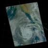
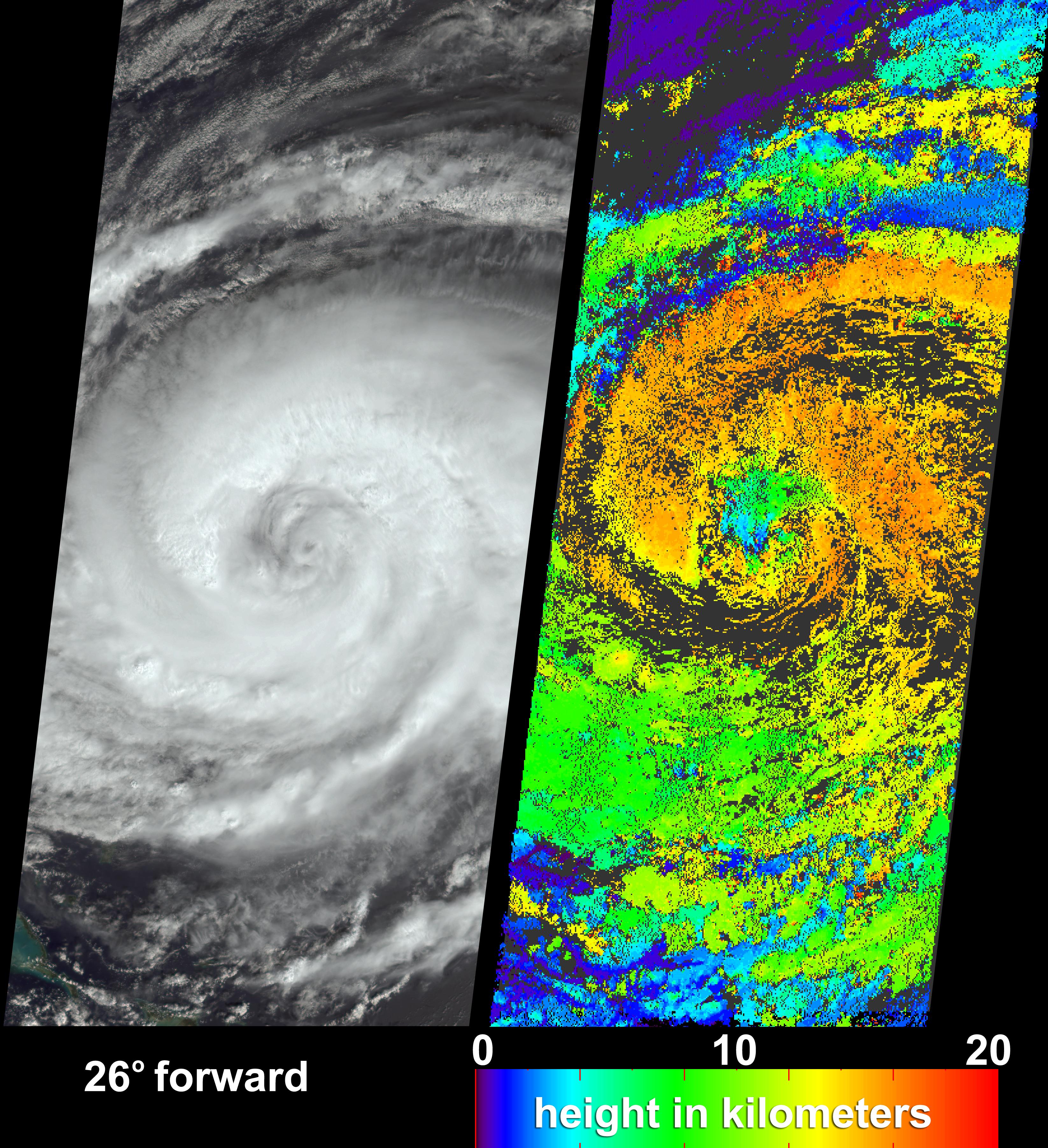
2004-09-29 |
Earth
|
Terra
|
MISR
|
3292x3608x3 |
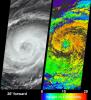
|
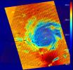
-
PIA04368:
-
Hurricane Jeanne Cloud Height and Motion
Full Resolution:
TIFF
(16.71 MB)
JPEG
(2.156 MB)
|
|
|
2004-09-29 |
Mars
|
2001 Mars Odyssey
|
THEMIS
|
1353x3063x1 |
|
-
PIA06901:
-
Wind Etching in Candor Chasma
Full Resolution:
TIFF
(3.055 MB)
JPEG
(389.5 kB)
|
|
|
2004-09-28 |
Mars
|
Mars Global Surveyor (MGS)
|
Mars Orbiter Camera (MOC)
|
512x2304x1 |

|
-
PIA06886:
-
Solar Conjunction Ends: Nirgal Vallis
Full Resolution:
TIFF
(1.181 MB)
JPEG
(201.4 kB)
|
|
|
2004-09-28 |
Mars
|
2001 Mars Odyssey
|
THEMIS
|
1370x3066x1 |
|
-
PIA06889:
-
Layered Rock in Candor Chasma
Full Resolution:
TIFF
(2.936 MB)
JPEG
(311.5 kB)
|
|
|
2004-09-27 |
Mars
|
Mars Global Surveyor (MGS)
|
Mars Orbiter Camera (MOC)
|
6849x6280x1 |
|
-
PIA06878:
-
Megaripples in Athabasca Vallis
Full Resolution:
TIFF
(37.82 MB)
JPEG
(8.193 MB)
|
|
|
2004-09-27 |
Mars
|
2001 Mars Odyssey
|
THEMIS
|
1369x3230x1 |
|
-
PIA06888:
-
Candor Chasma Plateau
Full Resolution:
TIFF
(2.95 MB)
JPEG
(331.6 kB)
|
|
|
2004-09-24 |
Mars
|
2001 Mars Odyssey
|
THEMIS
|
1361x3061x1 |

|
-
PIA06887:
-
Candor Chasma
Full Resolution:
TIFF
(2.976 MB)
JPEG
(340.7 kB)
|
|
|
2004-09-23 |
Mars
|
2001 Mars Odyssey
|
THEMIS
|
1383x3041x1 |
|
-
PIA06876:
-
Ophir Chasma Etched Rock
Full Resolution:
TIFF
(2.584 MB)
JPEG
(237.8 kB)
|
|
|
2004-09-22 |
Earth
|
Terra
|
ASTER
|
870x390x3 |
|
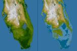
-
PIA06873:
-
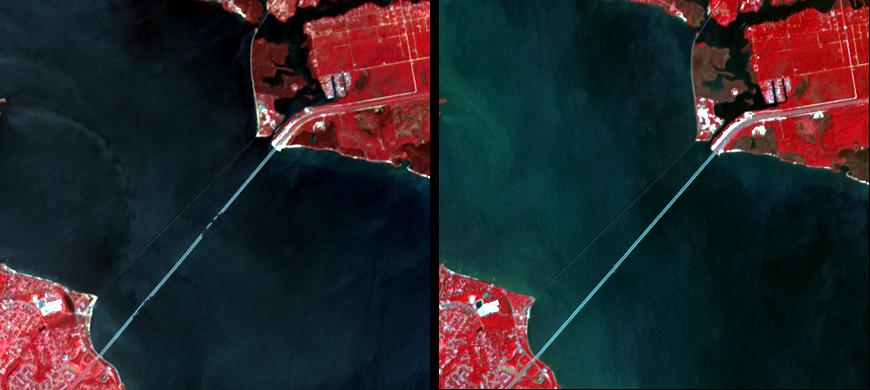
Damage by Hurricane Ivan over Pensacola Bay, Florida
Full Resolution:
TIFF
(723.5 kB)
JPEG
(42.85 kB)
|
|
|
2004-09-22 |
Mars
|
2001 Mars Odyssey
|
THEMIS
|
1407x3231x1 |

|
-
PIA06875:
-
Where Ophir Meets Candor
Full Resolution:
TIFF
(2.745 MB)
JPEG
(266.8 kB)
|
|
|
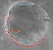
2004-09-21 |
Mars
|
Mars Global Surveyor (MGS)
Mars Exploration Rover (MER)
|
Mars Orbiter Camera (MOC)
Navigation Camera
|
1163x704x3 |
|
-
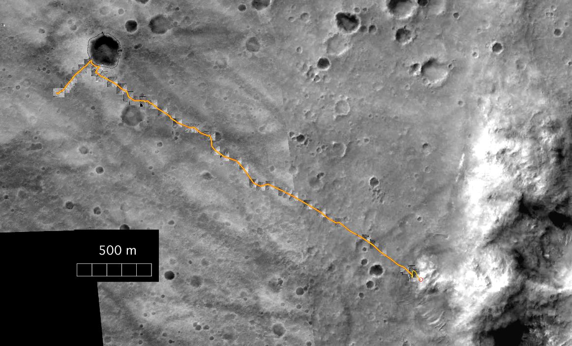
PIA06872:
-
Spirit's Travels During its First 238 Martian Days
Full Resolution:
TIFF
(1.16 MB)
JPEG
(123.9 kB)
|
|
|
2004-09-21 |
Mars
|
Mars Global Surveyor (MGS)
|
Mars Orbiter Camera (MOC)
|
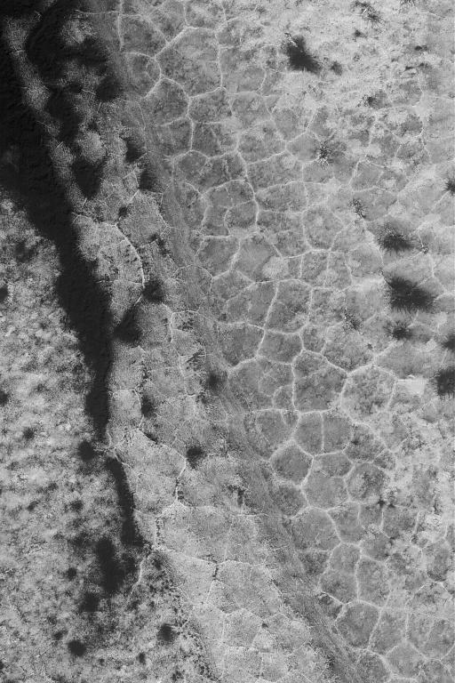
512x768x1 |

|
-
PIA05951:
-
High Latitude Polygons
Full Resolution:
TIFF
(393.8 kB)
JPEG
(100 kB)
|
|
|
2004-09-21 |
Mars
|
2001 Mars Odyssey
|
THEMIS
|
1368x3230x1 |

|
-
PIA06874:
-
Candor Chasma's Rim
Full Resolution:
TIFF
(2.792 MB)
JPEG
(290.7 kB)
|
|
|
2004-09-20 |
Mars
|
2001 Mars Odyssey
|
THEMIS
|
1355x3065x1 |
|
-
PIA05959:
-
Inter-Chasma Hills
Full Resolution:
TIFF
(2.532 MB)
JPEG
(208.5 kB)
|
|
|
2004-09-17 |
Mars
|
2001 Mars Odyssey
|
THEMIS
|
1368x3230x1 |
|
-
PIA05958:
-
Candor Chasma Rim
Full Resolution:
TIFF
(2.571 MB)
JPEG
(216.2 kB)
|
|
|
2004-09-16 |
Saturn
|
Cassini-Huygens
|
ISS - Narrow Angle
|
1020x1016x3 |
|
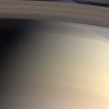
-
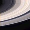
PIA06114:
-
Colorful Threads and Shadows
Full Resolution:
TIFF
(2.854 MB)
JPEG
(43.68 kB)
|
|
|
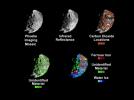
2004-09-16 |
Mars
|
2001 Mars Odyssey
|
THEMIS
|
1674x5232x1 |
|
-
PIA05957:
-
Hebes Chasma Mosaic
Full Resolution:
TIFF
(5.154 MB)
JPEG
(501.1 kB)
|
|
|
2004-09-15 |
Earth
|
Shuttle Radar Topography Mission (SRTM)
|
C-Band Radar
X-Band Radar
|
9100x11220x3 |
|
-
PIA06667:
-
Gulf Coast, Shaded Relief and Colored Height
Full Resolution:
TIFF
(236.5 MB)
JPEG
(26.54 MB)
|
|
|
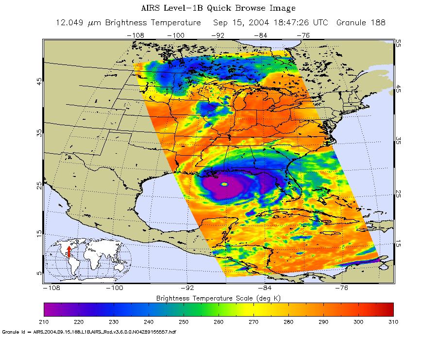
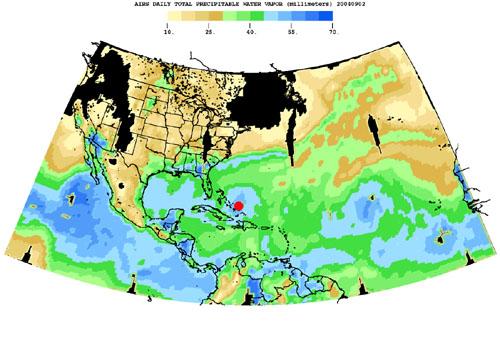
2004-09-15 |
Earth
|
Aqua
|
AIRS
|
900x695x3 |
|
-
PIA00431:
-
Hurricane Ivan as Observed by NASA's Spaceborne Atmospheric Infrared
Sounder (AIRS)
Full Resolution:
TIFF
(708.9 kB)
JPEG
(149.8 kB)
|
|
|
2004-09-15 |
Mars
|
2001 Mars Odyssey
|
THEMIS
|
1368x3059x1 |

|
-
PIA05956:
-
Ophir Chasma Dunes
Full Resolution:
TIFF
(3.196 MB)
JPEG
(437 kB)
|
|
|
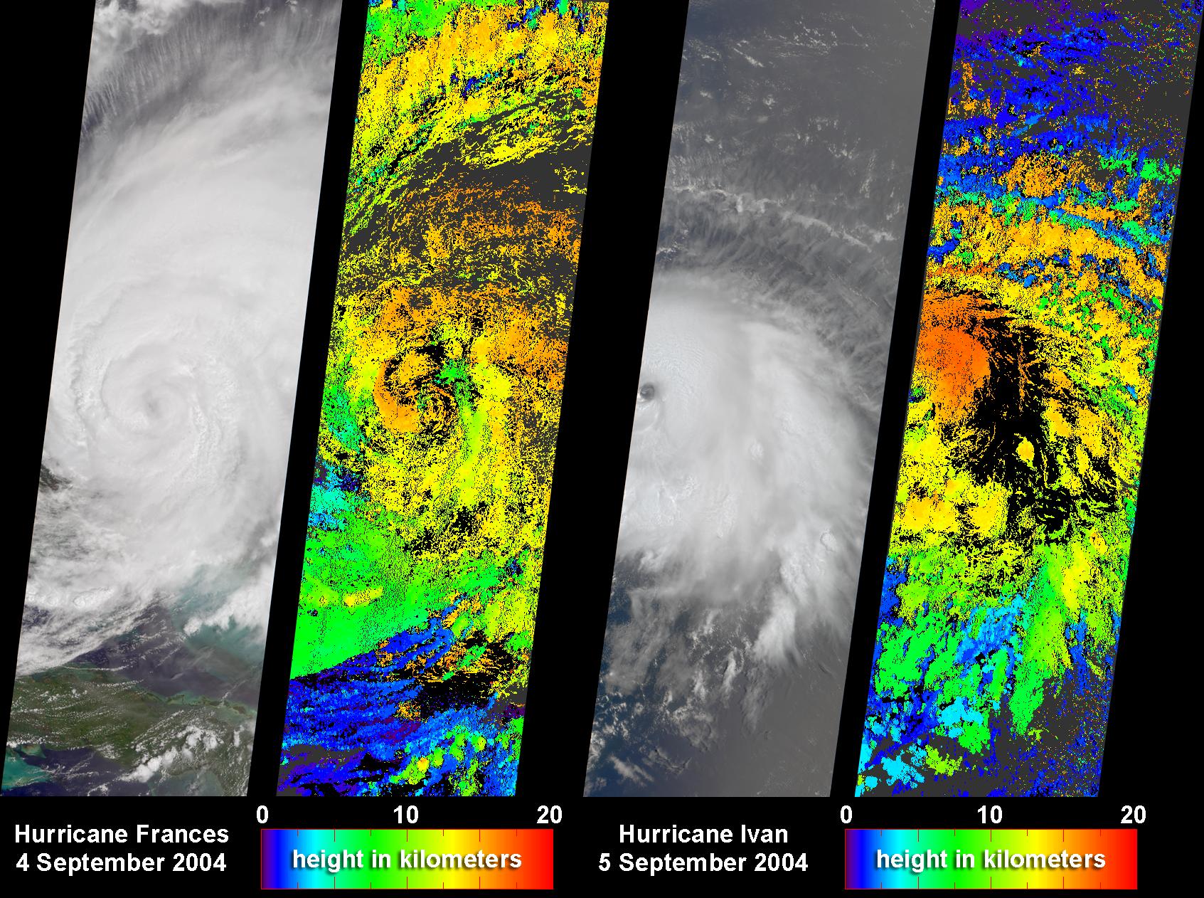
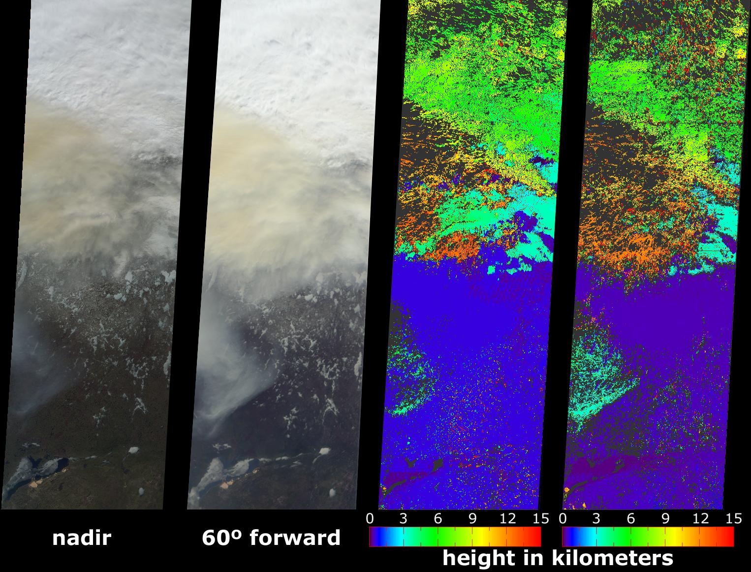
2004-09-14 |
Earth
|
Terra
|
MISR
|
1693x1262x3 |

|
-
PIA04367:
-
Cloud Height Maps for Hurricanes Frances and Ivan
Full Resolution:
TIFF
(2.952 MB)
JPEG
(578.8 kB)
|
|
|
2004-09-14 |
Mars
|
2001 Mars Odyssey
|
THEMIS
|
1362x3058x1 |
|
-
PIA05955:
-
Hebes Chasma
Full Resolution:
TIFF
(2.691 MB)
JPEG
(276.7 kB)
|
|
|
2004-09-13 |
Mars
|
2001 Mars Odyssey
|
THEMIS
|
1371x3062x1 |

|
-
PIA05954:
-
Ius Chasma Ridge
Full Resolution:
TIFF
(2.958 MB)
JPEG
(303.8 kB)
|
|
|
2004-09-12 |
Mars
|
Mars Global Surveyor (MGS)
|
Mars Orbiter Camera (MOC)
|
240x240x181 |
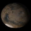
|
-
PIA05942:
-
Mars Global Surveyor: 7 Years in Orbit!

Full Resolution:
|
|
|
2004-09-11 |
Mars
|
Mars Exploration Rover (MER)
Mars Global Surveyor (MGS)
|
Mars Orbiter Camera (MOC)
Panorama Camera
|
872x814x3 |
|
-
PIA06865:
-
'Endurance Crater' Overview
Full Resolution:
TIFF
(870.7 kB)
JPEG
(66.8 kB)
|
|
|
2004-09-10 |
Mars
|
2001 Mars Odyssey
|
THEMIS
|
1358x3061x1 |
|
-
PIA05953:
-
Old Landslide In Ius Chasma
Full Resolution:
TIFF
(2.537 MB)
JPEG
(208.5 kB)
|
|
|
2004-09-09 |
Mars
|
2001 Mars Odyssey
|
THEMIS
|
677x1346x3 |
|
-
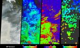
PIA06864:
-
Ius Chasma In False Color
Full Resolution:
TIFF
(1.964 MB)
JPEG
(66.85 kB)
|
|
|
2004-09-08 |
Mars
|
2001 Mars Odyssey
|
THEMIS
|
1355x3066x1 |

|
-
PIA06863:
-
Ius Chasma Ridge
Full Resolution:
TIFF
(2.767 MB)
JPEG
(249.8 kB)
|
|
|
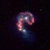
2004-09-07 |
|
Spitzer Space Telescope
|
IRAC
|
1125x1125x3 |

|
-
PIA06854:
-
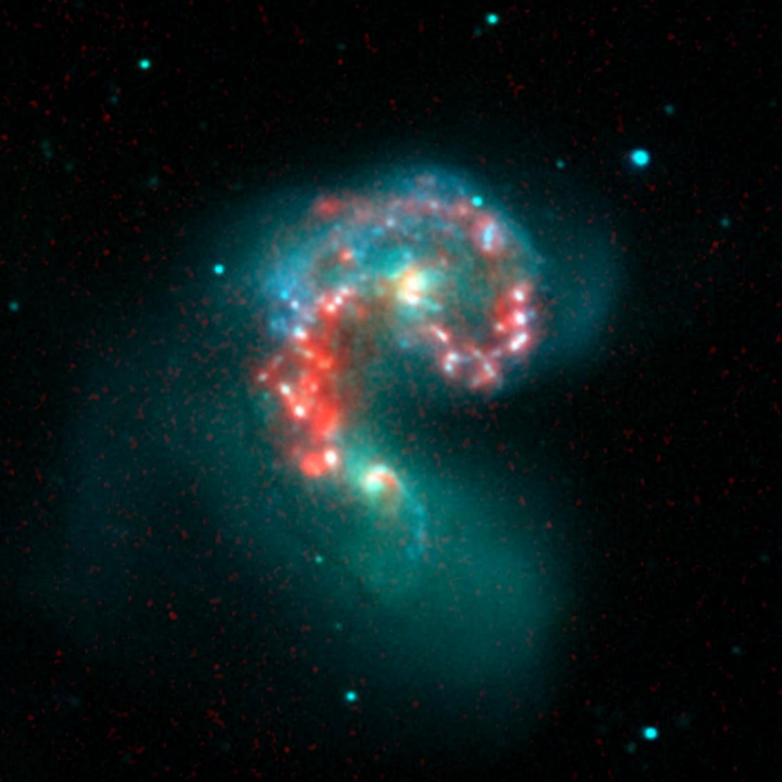
Fire within the Antennae Galaxies
Full Resolution:
TIFF
(2.308 MB)
JPEG
(76.5 kB)
|
|
|
2004-09-07 |
|
Spitzer Space Telescope
|
IRAC
|
1125x1125x3 |
|
-
PIA06853:
-
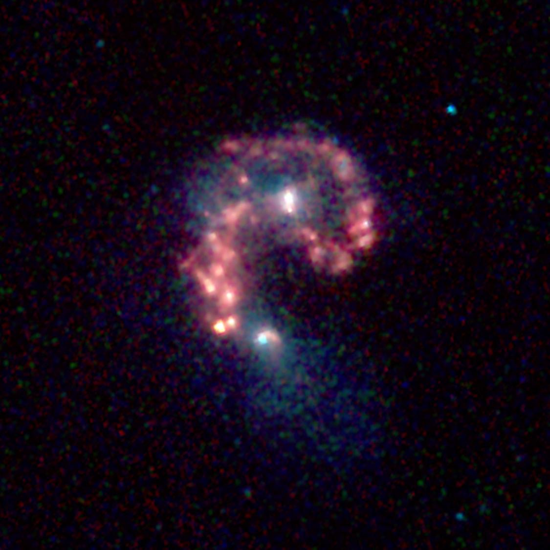
Life at the Intersection of Colliding Galaxies
Full Resolution:
TIFF
(2.824 MB)
JPEG
(96.35 kB)
|
|
|
2004-09-07 |
Mars
|
2001 Mars Odyssey
|
THEMIS
|
647x1282x1 |
|
-
PIA06862:
-
Ius Chasma Debris
Full Resolution:
TIFF
(672.1 kB)
JPEG
(102.2 kB)
|
|
|
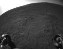
2004-09-03 |
Mars
|
Mars Exploration Rover (MER)
|
Navigation Camera
|
7704x4853x3 |
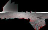
|
-
PIA06851:
-
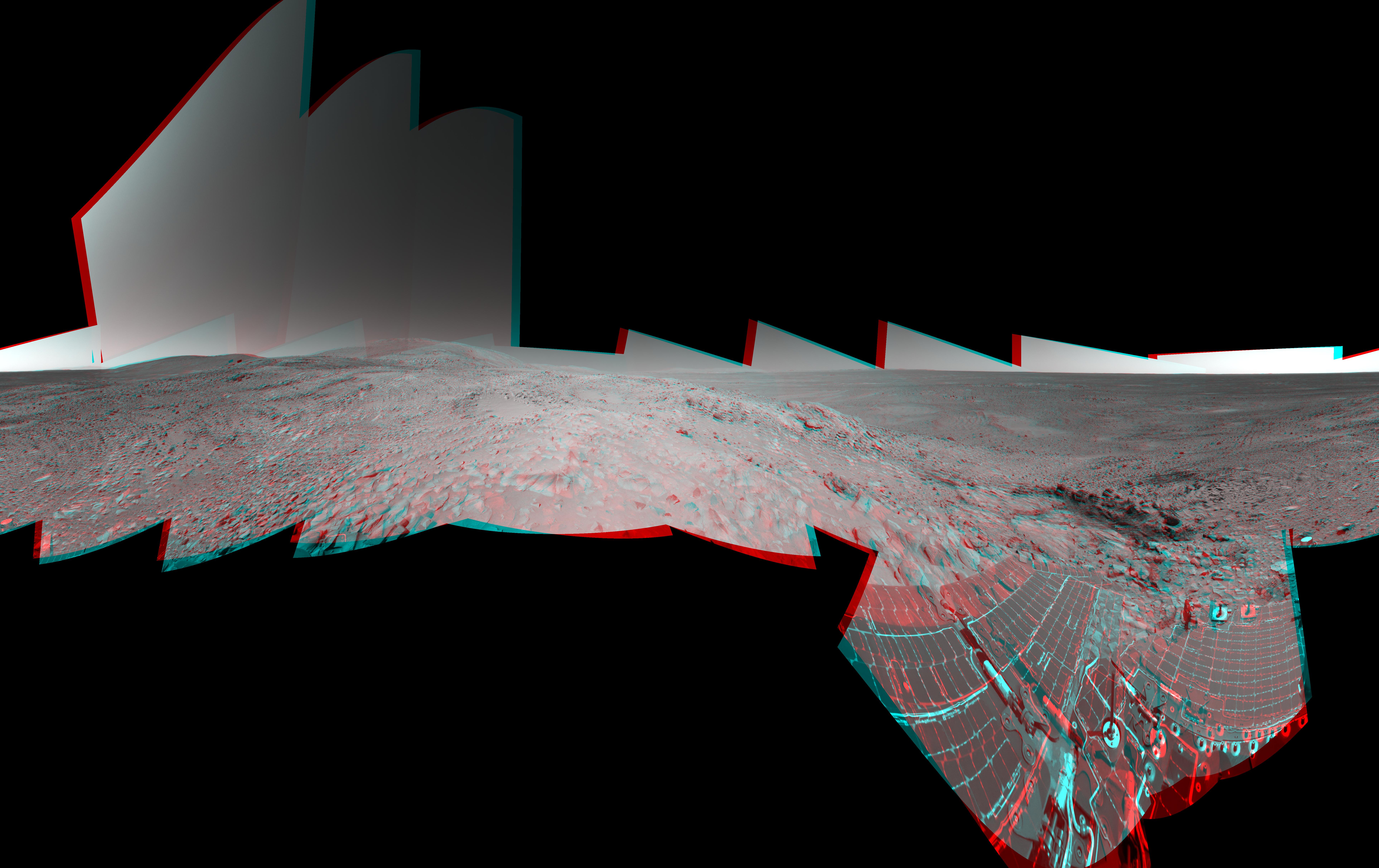
Preparing for 'Lights Out' on Mars (3-D)
Full Resolution:
TIFF
(38.69 MB)
JPEG
(2.209 MB)
|
|
|
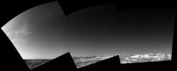
2004-09-03 |
Mars
|
Mars Exploration Rover (MER)
|
Navigation Camera
|
7466x2568x1 |
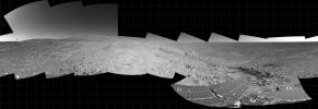
|
-
PIA06850:
-
Preparing for 'Lights Out' on Mars
Full Resolution:
TIFF
(10.01 MB)
JPEG
(1.578 MB)
|
|
|
2004-09-03 |
Earth
|
Shuttle Radar Topography Mission (SRTM)
|
C-Band Radar
X-Band Radar
|
8200x5389x3 |
|
-
PIA06666:
-
Southern Florida, Shaded Relief and Colored Height
Full Resolution:
TIFF
(65.04 MB)
JPEG
(5.819 MB)
|
|
|
2004-09-03 |
Mars
|
2001 Mars Odyssey
|
THEMIS
|
647x1282x1 |

|
-
PIA06861:
-
Ius Chasma Landslide
Full Resolution:
TIFF
(604 kB)
JPEG
(75.86 kB)
|
|
|
2004-09-01 |
Earth
|
Terra
|
MISR
|
2544x1527x3 |
|
-
PIA04366:
-
A Summer View of Russia's Lena Delta and Olenek
Full Resolution:
TIFF
(10.55 MB)
JPEG
(608.1 kB)
|
|
|
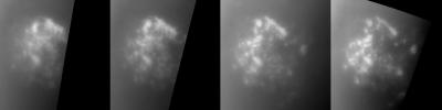
2004-08-30 |
Earth
|
Aqua
|
AIRS
|
490x471x3 |
|
-
PIA00435:
-
Hurricane Frances as Observed by NASA's Spaceborne Atmospheric Infrared Sounder (AIRS) and SeaWinds Scatterometer
Full Resolution:
TIFF
(693.4 kB)
JPEG
(88.32 kB)
|
|
|
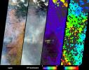
2004-08-30 |
Earth
|
Aqua
|
AIRS
|
500x342x3 |
|
-
PIA00433:
-
Hurricane Frances as Observed by NASA's Spaceborne Atmospheric Infrared
Sounder (AIRS) - Total Water Vapor Time Series
Full Resolution:
TIFF
(344.8 kB)
JPEG
(36.3 kB)
|
|
|
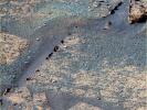
2004-08-24 |
Mars
|
2001 Mars Odyssey
|
THEMIS
|
1419x3053x3 |

|
-
PIA06829:
-
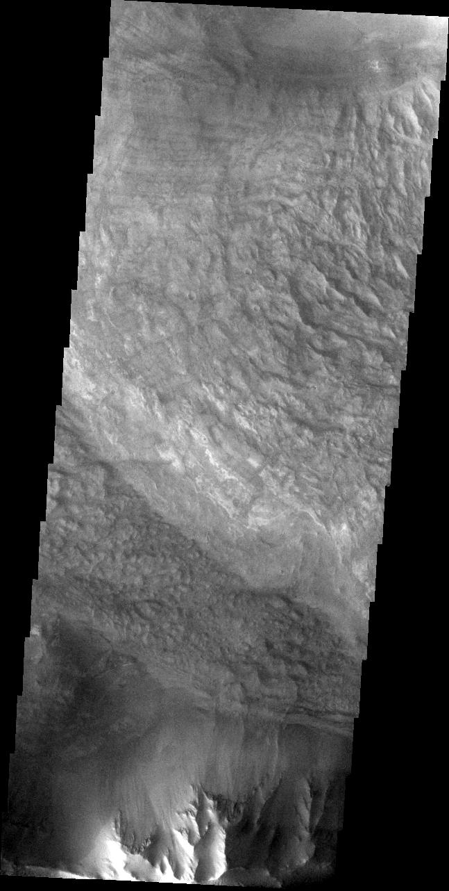
Acheron Catena
Full Resolution:
TIFF
(5.031 MB)
JPEG
(494 kB)
|
|
|
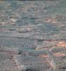
2004-08-18 |
Mars
|
Mars Global Surveyor (MGS)
|
Mars Orbiter Camera (MOC)
|
836x1254x1 |
|
-
PIA06805:
-
Ancient Bedforms
Full Resolution:
TIFF
(1.003 MB)
JPEG
(134.2 kB)
|
|
|
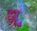
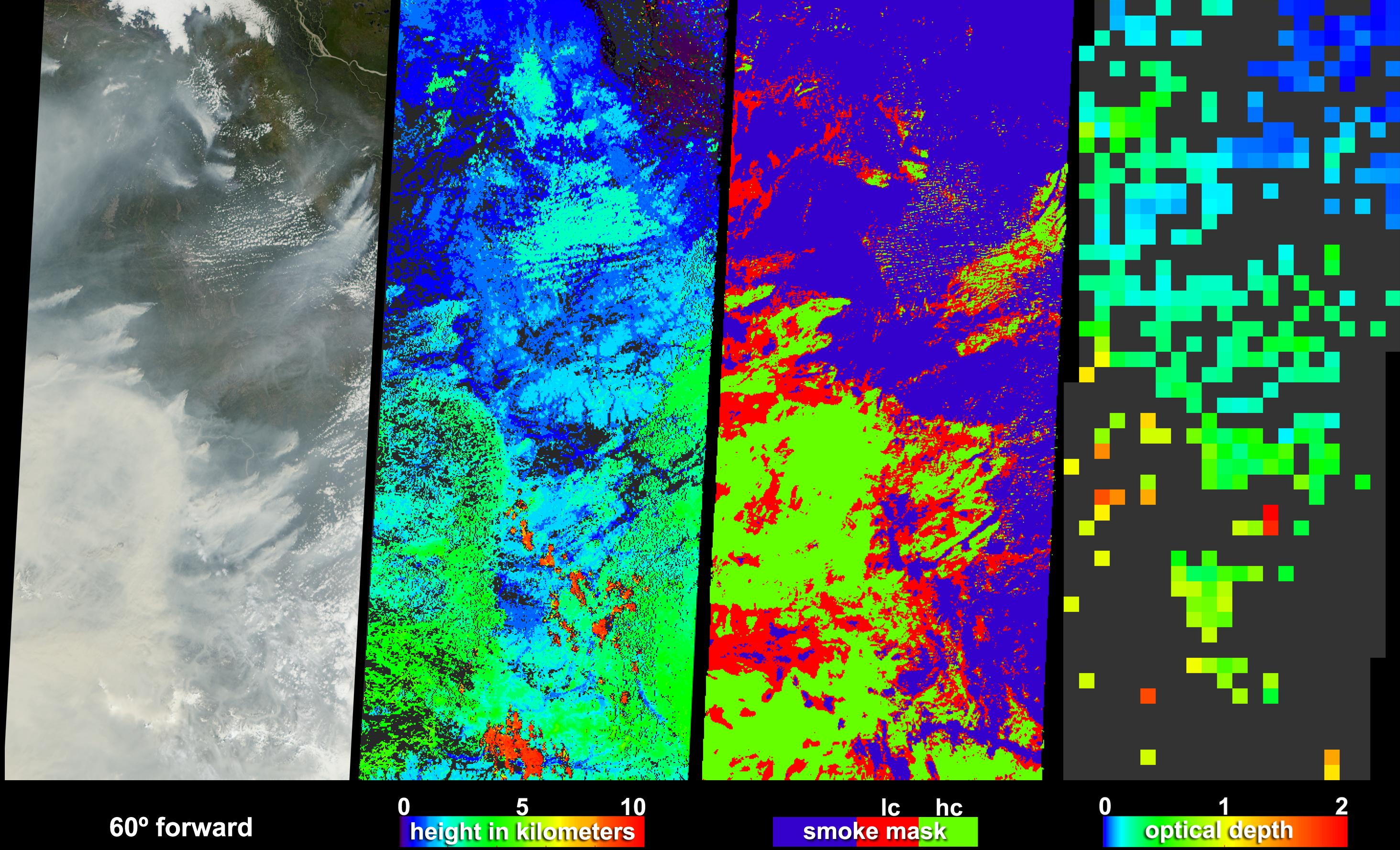
2004-08-18 |
Earth
|
Terra
|
MISR
|
1526x1162x3 |
|
-
PIA04365:
-
Smoke Soars to Stratospheric Heights
Full Resolution:
TIFF
(2.566 MB)
JPEG
(395.6 kB)
|
|
|
2004-08-12 |
Mars
|
2001 Mars Odyssey
|
THEMIS
|
1397x3052x1 |
|
-
PIA06821:
-
The Naming of Things: Tartarus Montes
Full Resolution:
TIFF
(3.215 MB)
JPEG
(375.7 kB)
|
|
|
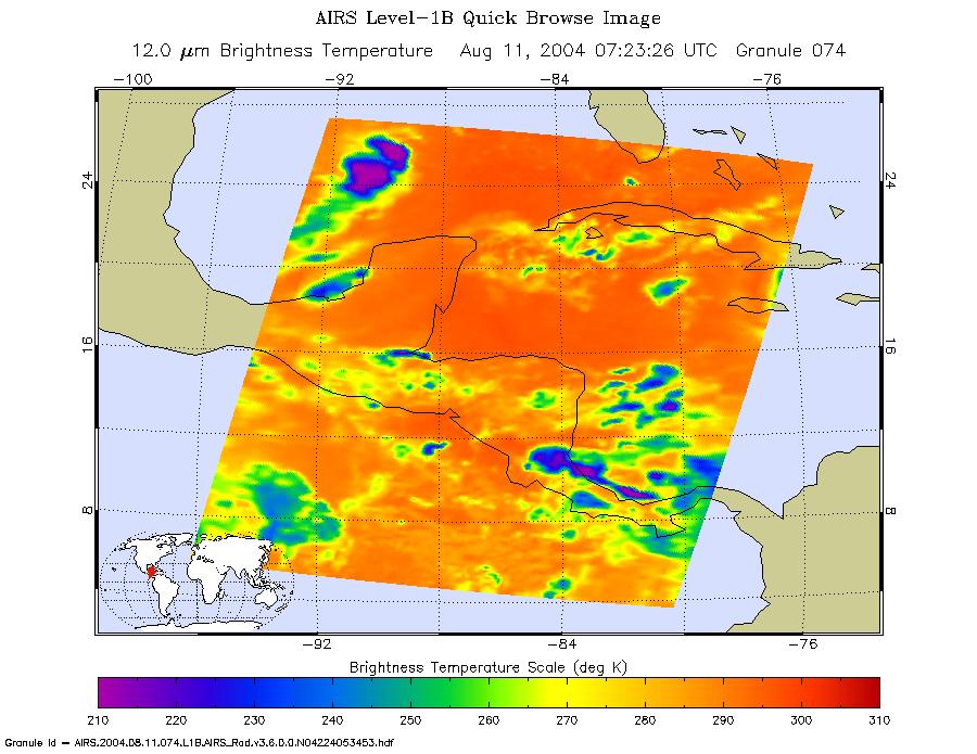
2004-08-12 |
Earth
|
Aqua
|
AIRS
|
900x695x3 |
|
-
PIA00441:
-
Tropical Storm Bonnie as Observed by NASA's Spaceborne Atmospheric
Infrared Sounder (AIRS)
Full Resolution:
TIFF
(1.879 MB)
JPEG
(110 kB)
|
|
|
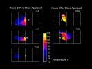
2004-08-11 |
Mars
|
Mars Exploration Rover (MER)
|
Navigation Camera
|
2709x1146x1 |
|
-
PIA06758:
-
New Look at "Endurance" via Mars Express
Full Resolution:
TIFF
(1.708 MB)
JPEG
(244.7 kB)
|
|
|
2004-08-11 |
Mars
|
Mars Exploration Rover (MER)
|
Hazcam
|
1024x1024x1 |
|
-
PIA06759:
-
Side View of "Endurance Crater"
Full Resolution:
TIFF
(839.2 kB)
JPEG
(85.15 kB)
|
|
|
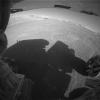
2004-08-11 |
Mars
|
Mars Exploration Rover (MER)
|
Panoramic Camera
|
953x1019x3 |
|
-
PIA06761:
-
"Endurance" Courtesy of Mars Express
Full Resolution:
TIFF
(2.918 MB)
JPEG
(248.1 kB)
|
|
|
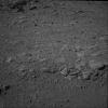
2004-08-11 |
Mars
|
Mars Exploration Rover (MER)
|
Hazcam
|
1018x796x1 |
|
-
PIA06757:
-
Tracks Inside 'Endurance'
Full Resolution:
TIFF
(696.5 kB)
JPEG
(96.11 kB)
|
|
|
2004-08-05 |
Saturn
|
Cassini-Huygens
|
Radio and Plasma Wave Science Instrument
|
403x327x3 |

|
-
PIA06417:
-
Lightning, Crackles and Pops
Full Resolution:
TIFF
(206.8 kB)
JPEG
(19.9 kB)
|
|
|
2004-08-04 |
Earth
|
Terra
|
MISR
|
1365x1480x3 |

|
-
PIA04364:
-
Where on Earth...? MISR Mystery Image Quiz #19: The Black Sea
Full Resolution:
TIFF
(5.417 MB)
JPEG
(215 kB)
|
|
|
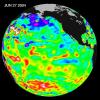
2004-08-04 |
Earth
|
Jason-1
|
Altimeter
|
900x900x3 |
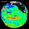
|
-
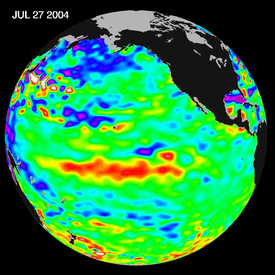
PIA06751:
-
Warm Pacific Water Wave Heads East, But No El Niño Yet
Full Resolution:
TIFF
(2.438 MB)
JPEG
(110.9 kB)
|
|
|
2004-08-03 |
Mercury
|
MESSENGER
|
|
1800x1626x3 |

|
-
PIA18148:
-
MESSENGER Departing Earth (Artist's Concept)
Full Resolution:
TIFF
(8.784 MB)
JPEG
(289.5 kB)
|
|
|
2004-08-03 |
Earth
|
Aqua
|
AIRS
|
792x998x3 |
|
-
PIA00440:
-
Hurricane Alex, located about 80 miles south-southeast of Charleston, South Carolina, as observed by NASA's Spaceborne Atmospheric Infrared
Sounder (AIRS).
Full Resolution:
TIFF
(2.374 MB)
JPEG
(102.7 kB)
|
|
|
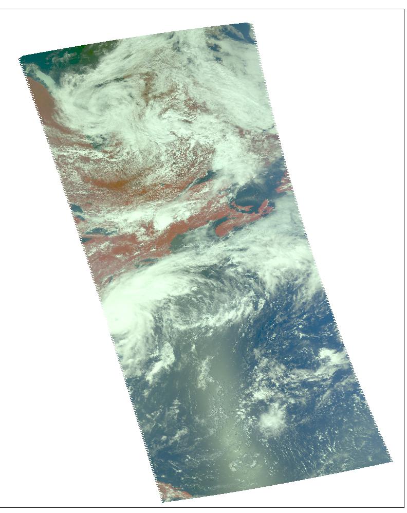
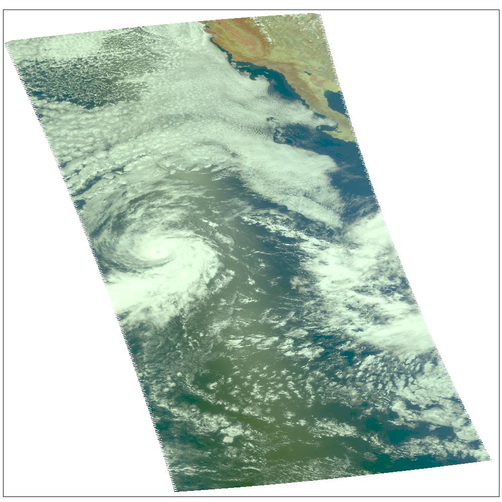
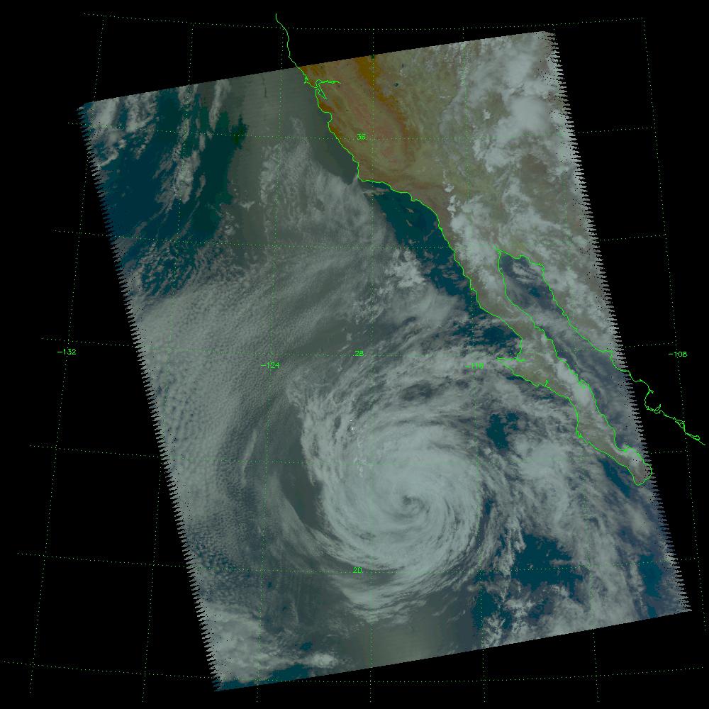
2004-07-26 |
Earth
|
Aqua
|
AIRS
|
1000x1000x3 |
|
-
PIA00439:
-
Hurricane Darby off the Pacific Coast of Mexico
Full Resolution:
TIFF
(3.004 MB)
JPEG
(139 kB)
|
|
|
2004-07-25 |
Mars
|
Mars Global Surveyor (MGS)
|
Mars Orbiter Camera (MOC)
|
672x1322x1 |
|
-
PIA06722:
-
South Polar Terrain
Full Resolution:
TIFF
(617.3 kB)
JPEG
(143.9 kB)
|
|
|
2004-07-23 |
Earth
|
Aqua
|
AIRS
|
1000x1000x3 |
|
-
PIA00438:
-
Hurricane Celia off the Pacific Coast of Mexico
Full Resolution:
TIFF
(3.004 MB)
JPEG
(140.8 kB)
|
|
|
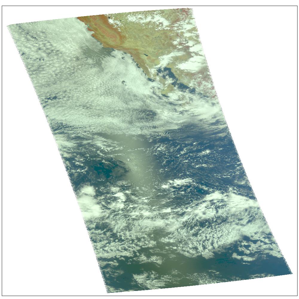
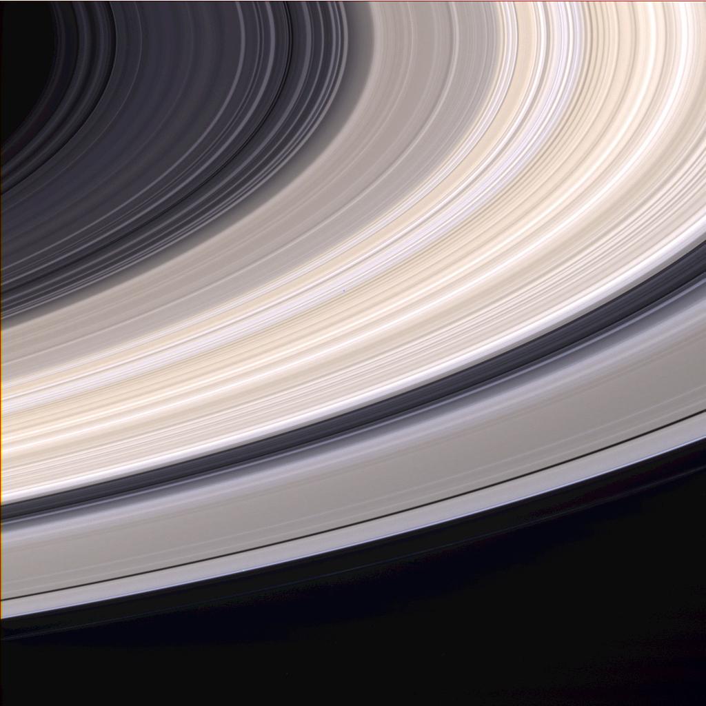
2004-07-22 |
Saturn
|
Cassini-Huygens
|
ISS - Narrow Angle
|
1024x1024x3 |
|
-
PIA05421:
-
Ringscape In Color
Full Resolution:
TIFF
(2 MB)
JPEG
(99.41 kB)
|
|
|
2004-07-21 |
Earth
|
Terra
|
MISR
|
2927x1778x3 |
|
-
PIA04363:
-
Smoke Signals from the Alaska and Yukon Fires
Full Resolution:
TIFF
(7.759 MB)
JPEG
(912.9 kB)
|
|
|
2004-07-19 |
Dione
|
Cassini-Huygens
|
ISS - Narrow Angle
|
1178x618x3 |
|
-
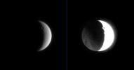
PIA05418:
-
Dark Side of Dione
Full Resolution:
TIFF
(264.2 kB)
JPEG
(27.18 kB)
|
|
|
2004-07-17 |
Mars
|
Mars Exploration Rover (MER)
|
Panoramic Camera
|
1024x768x3 |
|
-
PIA06692:
-
The 'Razorback' Mystery
Full Resolution:
TIFF
(2.363 MB)
JPEG
(215.6 kB)
|
|
|
2004-07-14 |
Earth
|
Aqua
|
AIRS
|
1000x1000x3 |
|
-
PIA00436:
-
Tropical Storm Blas off the Pacific Coast of Mexico
Full Resolution:
TIFF
(3.004 MB)
JPEG
(121.3 kB)
|
|
|
2004-07-14 |
Mars
|
2001 Mars Odyssey
|
THEMIS
|
1356x3064x1 |
|
-
PIA06459:
-
Windstreaks in Daedalia
Full Resolution:
TIFF
(3.325 MB)
JPEG
(589.7 kB)
|
|
|
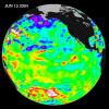
2004-07-13 |
Earth
|
Jason-1
|
Altimeter
|
900x900x3 |
|
-
PIA06381:
-
Pacific Decadal Oscillation Influences Drought (June 27, 2004)
Full Resolution:
TIFF
(2.433 MB)
JPEG
(115.5 kB)
|
|
|
2004-07-13 |
Earth
|
Jason-1
|
Altimeter
|
900x900x3 |
|
-
PIA06380:
-
Pacific Decadal Oscillation Influences Drought (June 15, 2004)
Full Resolution:
TIFF
(2.433 MB)
JPEG
(114.2 kB)
|
|
|
2004-07-13 |
Earth
|
Shuttle Radar Topography Mission (SRTM)
|
C-Band Radar
X-Band Radar
|
3987x10607x3 |
|
-
PIA04969:
-
Western Tibet, Shaded Relief with Color as Height
Full Resolution:
TIFF
(104.1 MB)
JPEG
(8.565 MB)
|
|
|
2004-07-13 |
Mars
|
Mars Exploration Rover (MER)
|
Navigation Camera
|
1580x635x1 |
|
-
PIA06384:
-
Clouds Roll in for Martian Winter
Full Resolution:
TIFF
(369.1 kB)
JPEG
(45.27 kB)
|
|
|
2004-07-10 |
|
Aura
|
|
2048x1627x3 |

|
-
PIA18178:
-
NASA's Aura Spacecraft (Artist's Concept)
Full Resolution:
TIFF
(10 MB)
JPEG
(299.8 kB)
|
|
|
2004-07-09 |
Earth
|
Terra
|
ASTER
|
2713x2262x3 |
|
-
PIA06375:
-
Willow Fire Near Payson, Arizona
Full Resolution:
TIFF
(17.49 MB)
JPEG
(1.148 MB)
|
|
|
2004-07-07 |
Earth
|
Terra
|
MISR
|
3141x2477x3 |
|
-
PIA04362:
-
Fire and Deforestation near the Xingu River
Full Resolution:
TIFF
(13.92 MB)
JPEG
(1.079 MB)
|
|
|
2004-07-03 |
Titan
|
Cassini-Huygens
|
ISS - Narrow Angle
|
3212x803x1 |
|
-
PIA06110:
Titan's South Polar Clouds
Full Resolution:
TIFF
(1.362 MB)
JPEG
(87.1 kB)
|
|
|
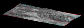
2004-07-03 |
Earth
|
Landsat
Shuttle Radar Topography Mission (SRTM)
|
C-Band Radar
X-Band Radar
|
5000x1700x3 |
|
-
PIA04968:
-
Library of Congress Model, Anaglyph
Full Resolution:
TIFF
(9.503 MB)
JPEG
(858.8 kB)
|
|
|
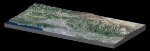
2004-07-03 |
Earth
|
Landsat
Shuttle Radar Topography Mission (SRTM)
|
C-Band Radar
X-Band Radar
|
5000x1700x3 |
|
-
PIA04967:
-
Library of Congress Model, Perspective View
Full Resolution:
TIFF
(11.27 MB)
JPEG
(895.3 kB)
|
|
|
2004-07-02 |
Saturn
|
Cassini-Huygens
|
Visual and Infrared Mapping Spectrometer
|
720x540x3 |
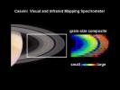
|
-
PIA06349:
-
The Stuff of Rings
Full Resolution:
TIFF
(352.8 kB)
JPEG
(28.26 kB)
|
|
|
2004-07-01 |
Saturn
|
Cassini-Huygens
|
Dual Technique Magnetometer
Plasma Spectrometer
|
720x540x3 |
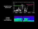
|
-
PIA06348:
-
Entering the Magnetic Bubble
Full Resolution:
TIFF
(244.3 kB)
JPEG
(36.88 kB)
|
|
|
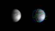
2004-07-01 |
Saturn
|
Cassini-Huygens
|
MIMI
|
720x486x3 |
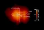
|
-
PIA06345:
-
Behold Saturn's Magnetosphere!
Full Resolution:
TIFF
(343.8 kB)
JPEG
(20.3 kB)
|
|
|
2004-06-25 |
Mars
|
Mars Exploration Rover (MER)
|
Moessbauer Spectrometer
|
2076x1603x3 |
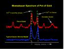
|
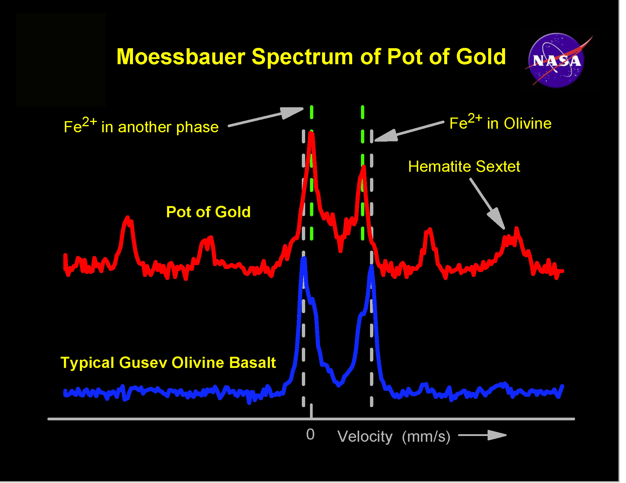
-
PIA06314:
-
Spirit, Too, Finds Hematite
Full Resolution:
TIFF
(9.991 MB)
JPEG
(363.1 kB)
|
|
|
2004-06-25 |
Titan
|
Cassini-Huygens
|
ISS - Narrow Angle
|
704x398x3 |
|
-
PIA06071:
-
Through the Haze
Full Resolution:
TIFF
(61.88 kB)
JPEG
(27.88 kB)
|
|
|
2004-06-25 |
Earth
|
Envisat
|
Advanced Synthetic Aperture Radar (ASAR)
|
710x609x3 |
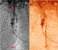
|
-
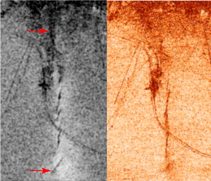
PIA06311:
-
Bam, Iran, Radar Interferometry -- Earthquake
Full Resolution:
TIFF
(1.109 MB)
JPEG
(77.72 kB)
|
|
|
2004-06-25 |
Earth
|
European Remote Sensing Satellite Mission (ERS)
Landsat
|
Synthetic Aperture Radar (SAR)
Thematic Mapper (TM)
|
1473x1200x3 |

|
-
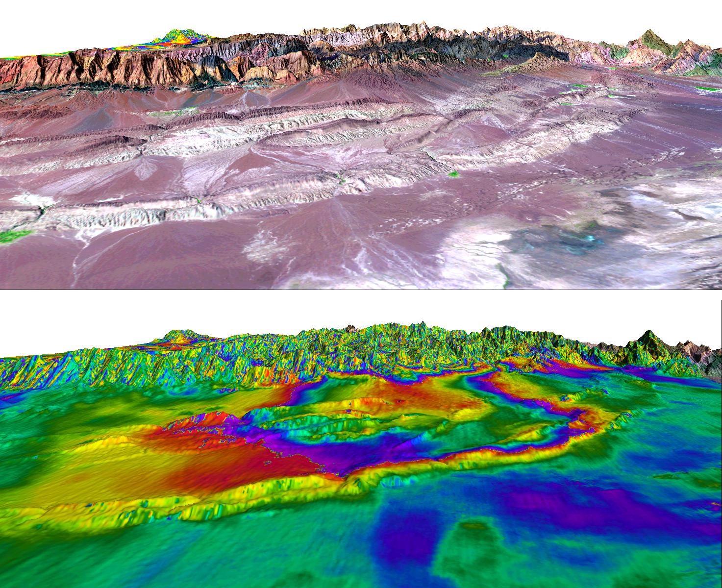
PIA06310:
-
Shahdad, Southeast Iran, Radar Interferometry -- Silent Earthquake, Perspective View
Full Resolution:
TIFF
(4.672 MB)
JPEG
(367.1 kB)
|
|
|
2004-06-23 |
Earth
|
Shuttle Radar Topography Mission (SRTM)
Terra
|
C-Band Interferometric Radar
Multi-angle Imaging SpectroRadiometer (MISR)
|
4149x2299x3 |
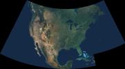
|
-
PIA04361:
-
Natural Color Mosaic of North America
Full Resolution:
TIFF
(10.95 MB)
JPEG
(597.3 kB)
|
|
|
2004-06-23 |
Phoebe
|
Cassini-Huygens
|
Composite Infrared Spectrometer
|
720x540x3 |
|
-
PIA06403:
-
Phoebe Temperature Maps
Full Resolution:
TIFF
(122.2 kB)
JPEG
(38.86 kB)
|
|
|
2004-06-23 |
Phoebe
|
Cassini-Huygens
|
ISS - Narrow Angle
|
720x539x3 |
|
-
PIA06400:
-
Phoebe's Mineral Distribution
Full Resolution:
TIFF
(193.7 kB)
JPEG
(34.47 kB)
|
|
|
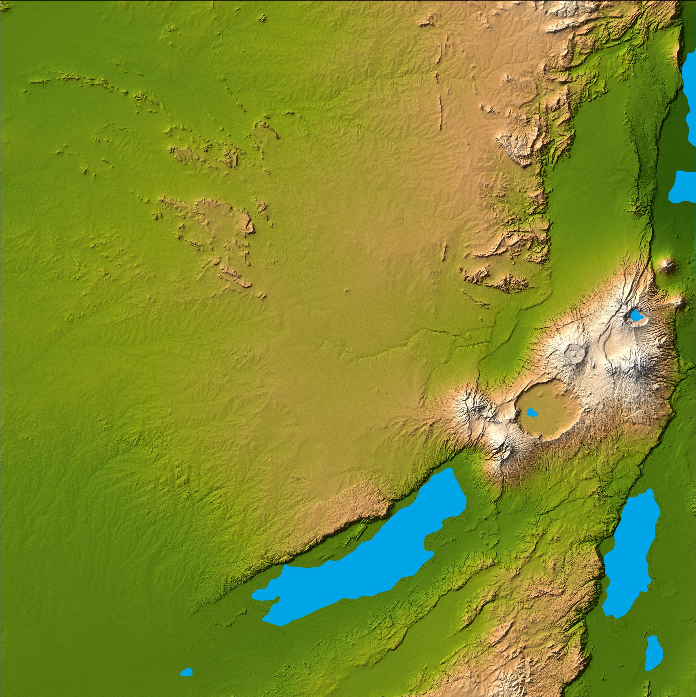
2004-06-17 |
Earth
|
Shuttle Radar Topography Mission (SRTM)
|
C-Band Interferometric Radar
X-Band Radar
|
9600x10500x3 |
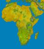
|
-
PIA04965:
-
SRTM Data Release for Africa, Colored Height
Full Resolution:
TIFF
(146.2 MB)
JPEG
(19.74 MB)
|
|
|
2004-06-17 |
Earth
|
Shuttle Radar Topography Mission (SRTM)
|
C-Band Interferometric Radar
X-Band Radar
|
9600x10500x3 |
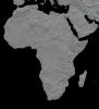
|
-
PIA04964:
-
Africa in SRTM 3-D, Anaglyph of Shaded Relief
Full Resolution:
TIFF
(123.1 MB)
JPEG
(13.79 MB)
|
|
|
2004-06-17 |
Earth
|
Landsat
Shuttle Radar Topography Mission (SRTM)
|
C-Band Interferometric Radar
X-Band Radar
|
2259x1244x3 |
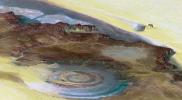
|
-
PIA04963:
-
Richat Structure, Mauritania
Full Resolution:
TIFF
(8.441 MB)
JPEG
(507 kB)
|
|
|
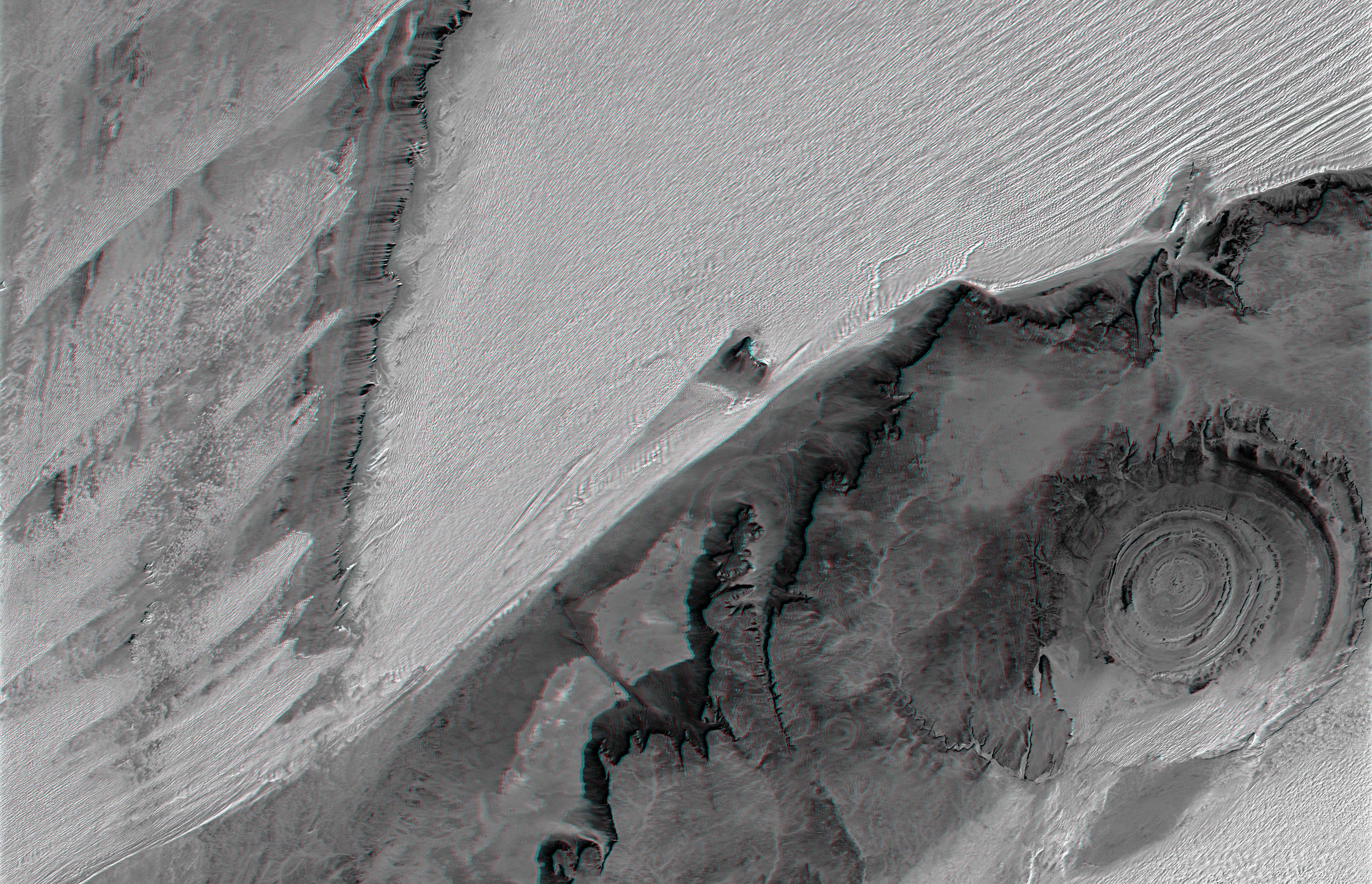
2004-06-17 |
Earth
|
Landsat
Shuttle Radar Topography Mission (SRTM)
|
C-Band Interferometric Radar
X-Band Radar
|
5657x3645x3 |
|
-
PIA04962:
-
Richat Structure, Mauritania, Anaglyph, Landsat Image over SRTM Elevation
Full Resolution:
TIFF
(54.43 MB)
JPEG
(3.974 MB)
|
|
|
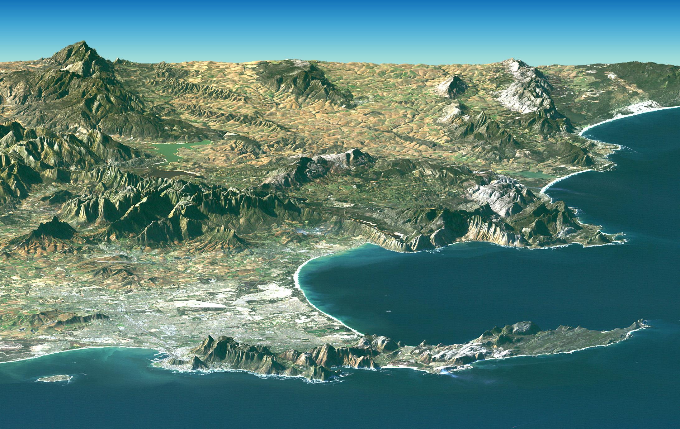
2004-06-17 |
Earth
|
Landsat
Shuttle Radar Topography Mission (SRTM)
|
C-Band Interferometric Radar
X-Band Radar
|
2184x1377x3 |
|
-
PIA04961:
-
Cape Town, South Africa, Perspective View, Landsat Image over SRTM
Elevation
Full Resolution:
TIFF
(8.727 MB)
JPEG
(581.8 kB)
|
|
|
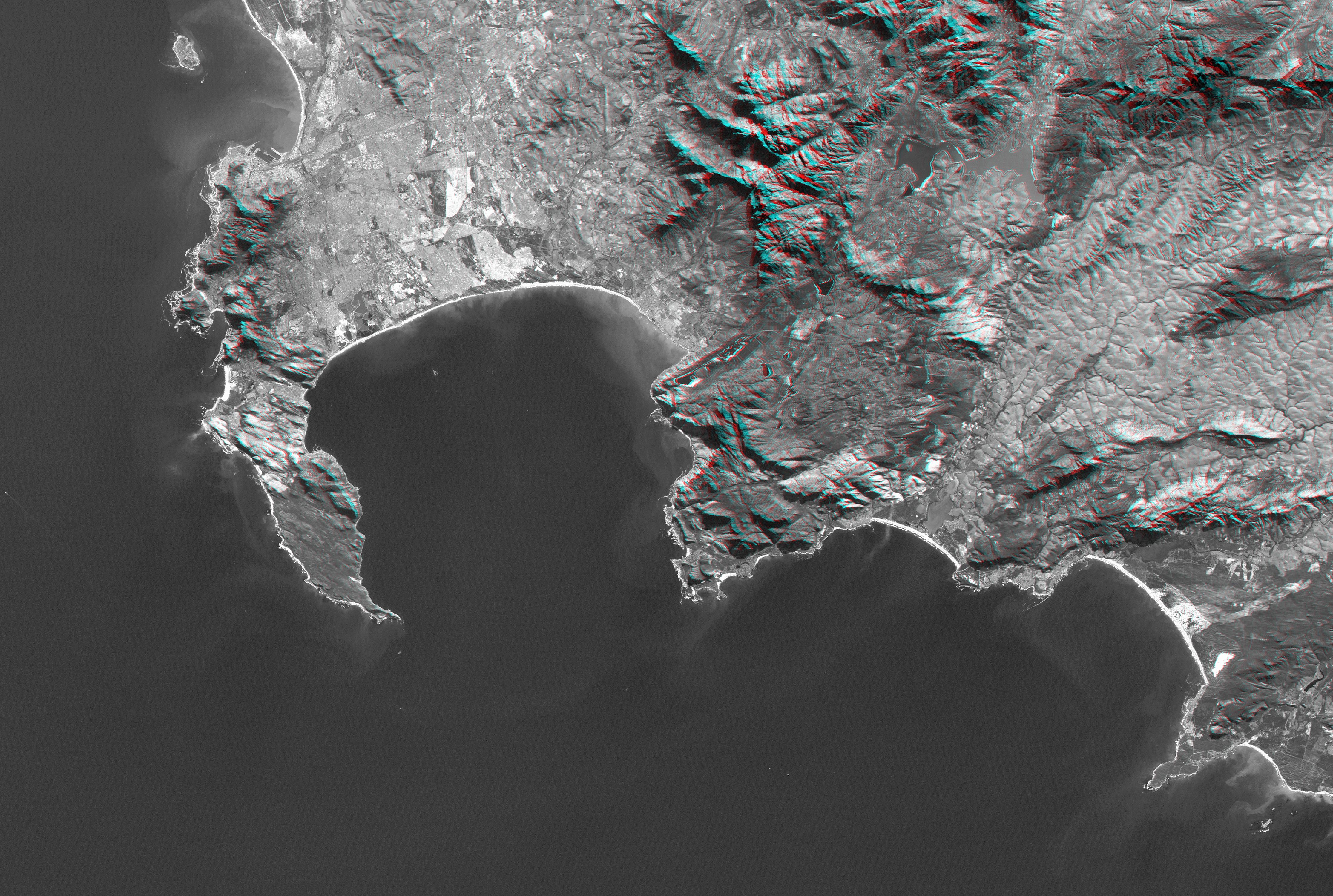
2004-06-17 |
Earth
|
Landsat
Shuttle Radar Topography Mission (SRTM)
|
C-Band Interferometric Radar
X-Band Radar
|
4463x3000x3 |
|
-
PIA04960:
-
Cape Town, South Africa, Anaglyph, Landsat Image over SRTM Elevation
Full Resolution:
TIFF
(26.41 MB)
JPEG
(2.219 MB)
|
|
|
2004-06-17 |
Earth
|
Shuttle Radar Topography Mission (SRTM)
|
C-Band Interferometric Radar
X-Band Radar
|
2401x2403x3 |

|
-
PIA04959:
-
Olduvai Gorge, Shaded Relief and Colored Height
Full Resolution:
TIFF
(17.33 MB)
JPEG
(1.018 MB)
|
|
|
2004-06-17 |
Earth
|
Shuttle Radar Topography Mission (SRTM)
|
C-Band Interferometric Radar
X-Band Radar
|
2401x2401x3 |

|
-
PIA04958:
-
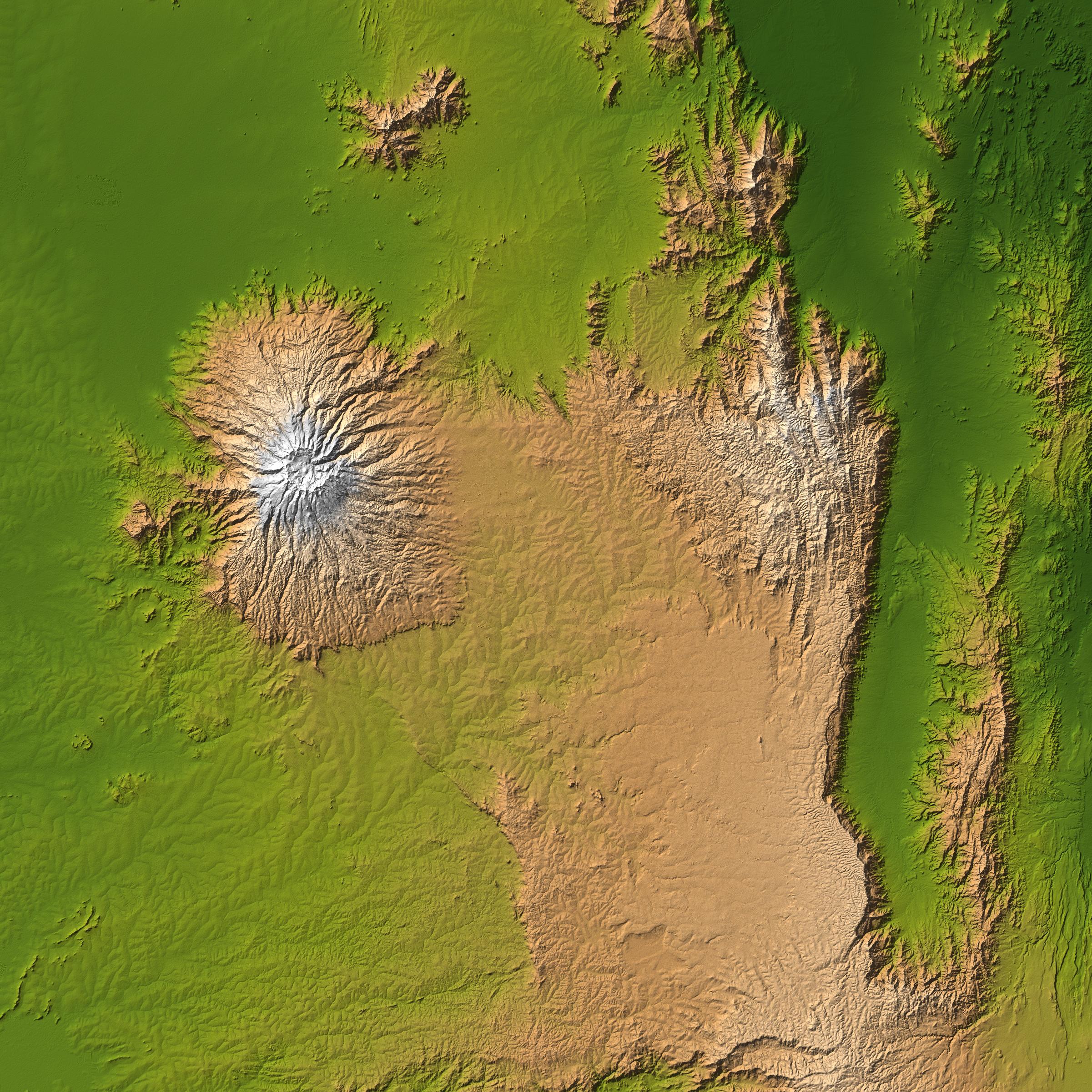
Mt. Elgon, Africa, Shaded Relief and Colored Height
Full Resolution:
TIFF
(17.31 MB)
JPEG
(1.24 MB)
|
|
|
2004-06-17 |
Earth
|
Shuttle Radar Topography Mission (SRTM)
|
C-Band Interferometric Radar
X-Band Radar
|
3601x6897x3 |

|
-
PIA04957:
-
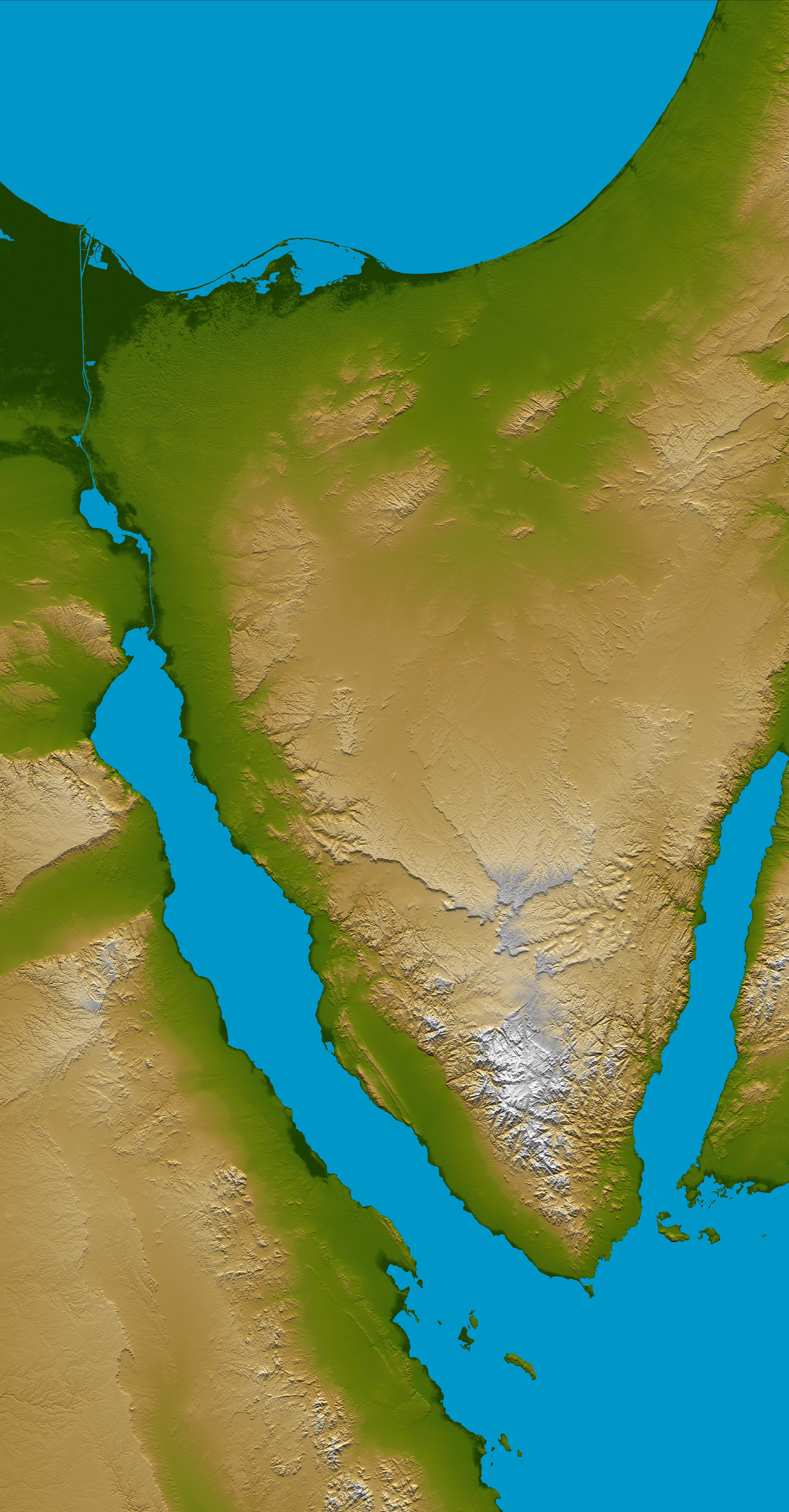
Sinai Peninsula, Shaded Relief and Colored Height
Full Resolution:
TIFF
(56.53 MB)
JPEG
(3.751 MB)
|
 Planetary Data System


