- Original Caption Released with Image:
-
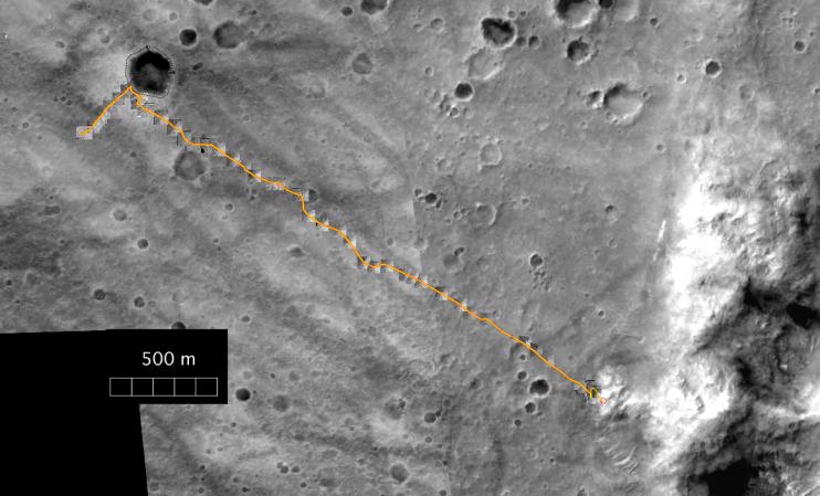
This map shows the complete traverse of NASA's Mars Exploration Rover Spirit through the rover's 238th martian day, or sol (Sept. 3, 2004). This was shortly before the rover stopped driving for about two weeks while Mars was nearly behind the Sun from Earth's perspective. The background image consists of frames from the Mars Orbiter Camera on NASA's Mars Global Surveyor orbiter. Inset images along the route are from Spirit's navigation camera. From its landing site, Spirit drove up to the rim of "Bonneville" crater on the far left and to the north rim of "Missoula" crater. Then it commenced a long drive across the plains, deviating to avoid large hollows. Upon arrival at the base of the "Columbia Hills," Spirit drove north for a short distance before beginning its ascent onto the "West Spur," where it is currently located. The scale bar at lower left is 500 meters (1,640 feet). North is up.
- Image Credit:
-
NASA/JPL/New Mexico Museum of Natural History
Image Addition Date: -
2004-09-21
|