The Odyssey spacecraft has taken some great pictures of Valles Marineris, the largest canyon in the solar system. If this canyon were on Earth, it would stretch from New York to Los Angeles. For the next several weeks, the Image of the Day will tour some of the canyons that make up this vast system. We will start with Ius Chasma in the west, and end with Coprates Chasma to the east. For more information on Vallis Marineris, please see http://mars.jpl.nasa.gov/mep/science/vm.html.
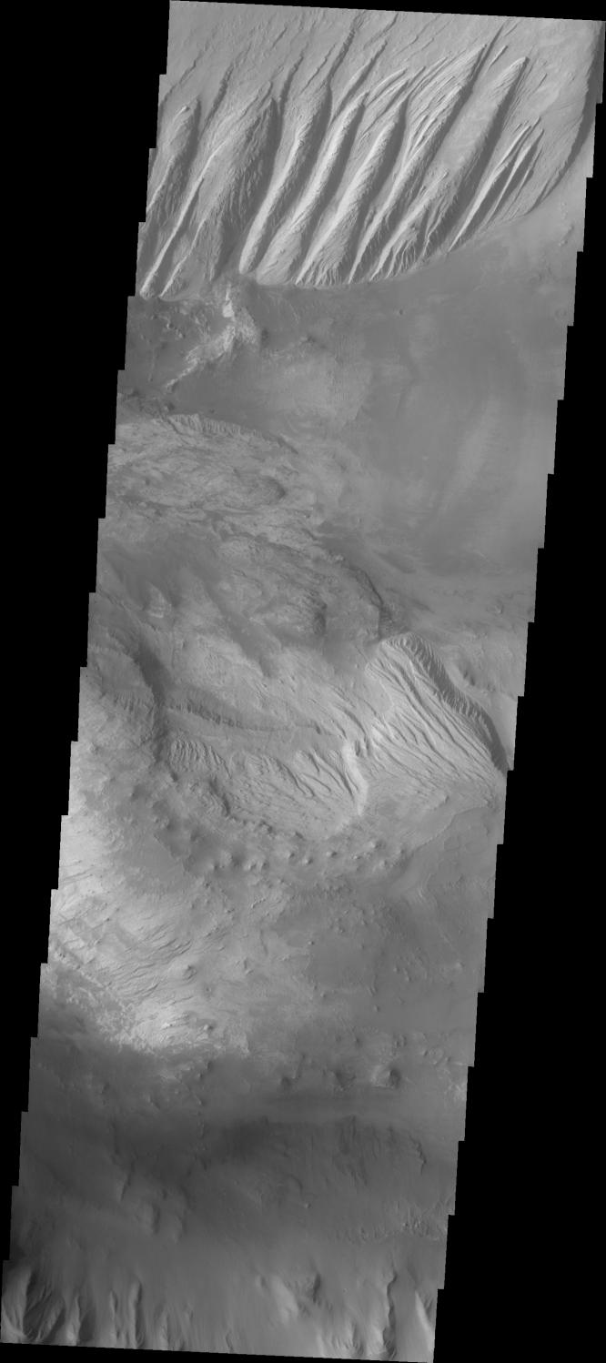
This image shows an area in Candor Chasma. The imaged area is close to the depression that connects Candor and Melas Chasmas together. The image's top part shows parts of one of the large deposits that lie in the middle of Candor Chasma. Wind etched lines and gullies can be seen on this downward sloping area. The image's middle part show another layered deposited area with dunes on the Chasma floor around it.
Image information: VIS instrument. Latitude -7.1, Longitude 288.8 East (71.2 West). 19 meter/pixel resolution.Note: this THEMIS visual image has not been radiometrically nor geometrically calibrated for this preliminary release. An empirical correction has been performed to remove instrumental effects. A linear shift has been applied in the cross-track and down-track direction to approximate spacecraft and planetary motion. Fully calibrated and geometrically projected images will be released through the Planetary Data System in accordance with Project policies at a later time.
NASA's Jet Propulsion Laboratory manages the 2001 Mars Odyssey mission for NASA's Office of Space Science, Washington, D.C. The Thermal Emission Imaging System (THEMIS) was developed by Arizona State University, Tempe, in collaboration with Raytheon Santa Barbara Remote Sensing. The THEMIS investigation is led by Dr. Philip Christensen at Arizona State University. Lockheed Martin Astronautics, Denver, is the prime contractor for the Odyssey project, and developed and built the orbiter. Mission operations are conducted jointly from Lockheed Martin and from JPL, a division of the California Institute of Technology in Pasadena.
 Planetary Data System


