My
List |
Addition Date
|
Target
|
Mission
|
Instrument
|
Size
|

|
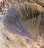
2005-04-08 |
Mars
|
2001 Mars Odyssey
|
THEMIS
|
523x6523x1 |

|
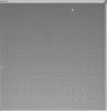
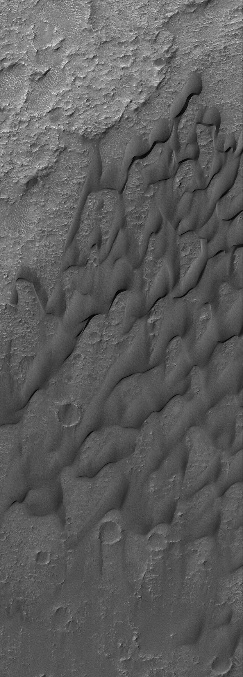
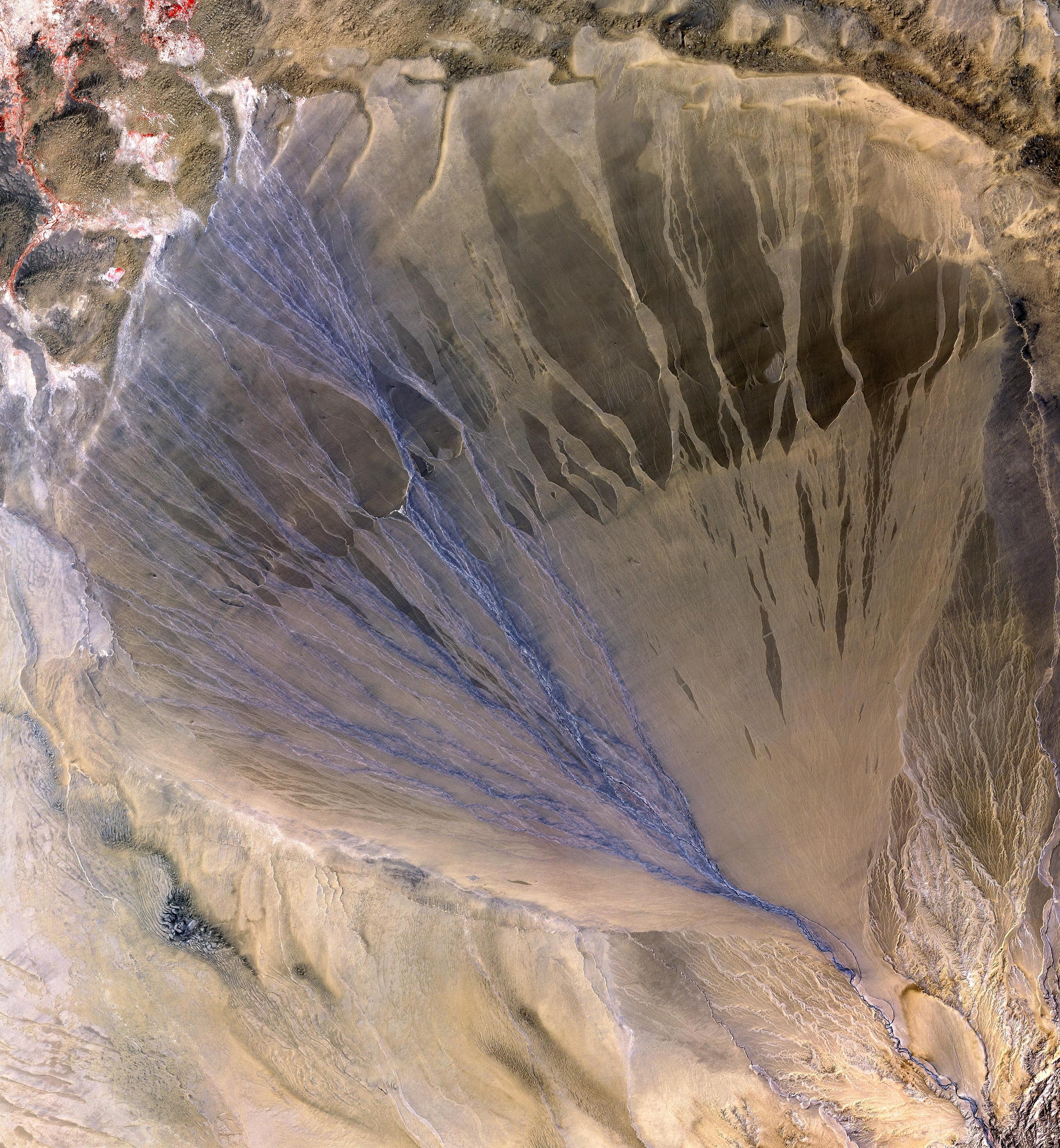
-
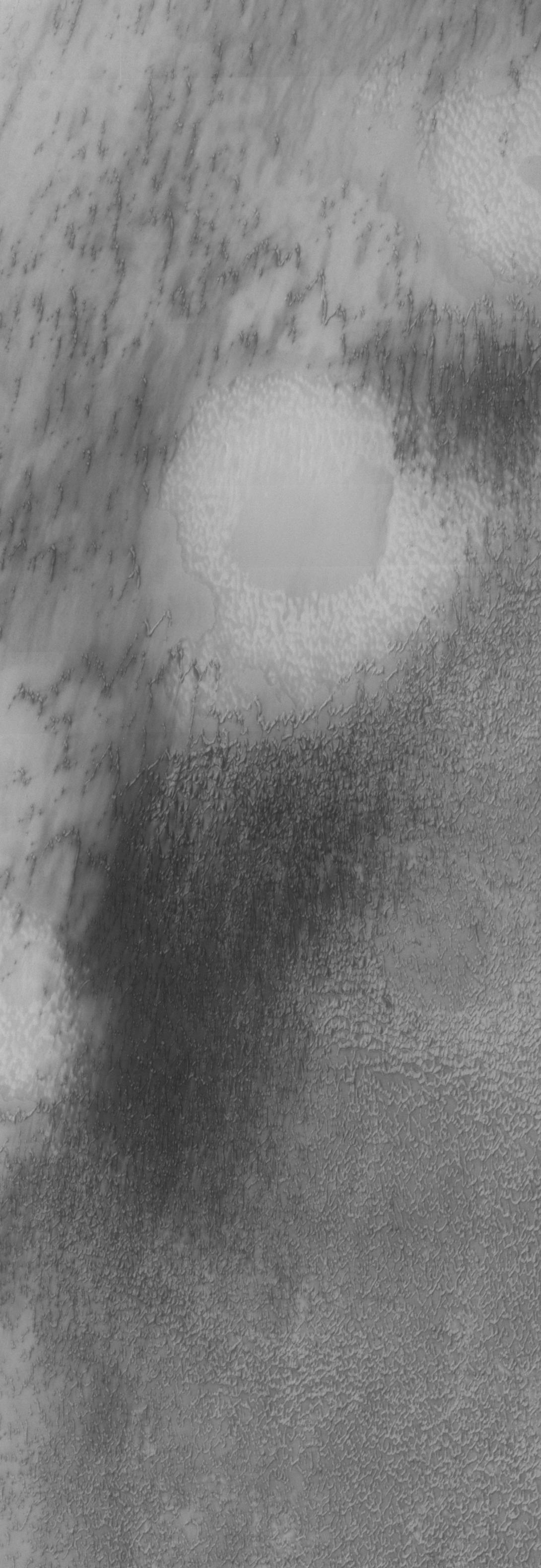
PIA07825:
-
Dune Variety
Full Resolution:
TIFF
(3.405 MB)
JPEG
(430.2 kB)
|
|
|
2005-04-07 |
Mars
|
2001 Mars Odyssey
|
THEMIS
|
1090x3155x1 |
|
-
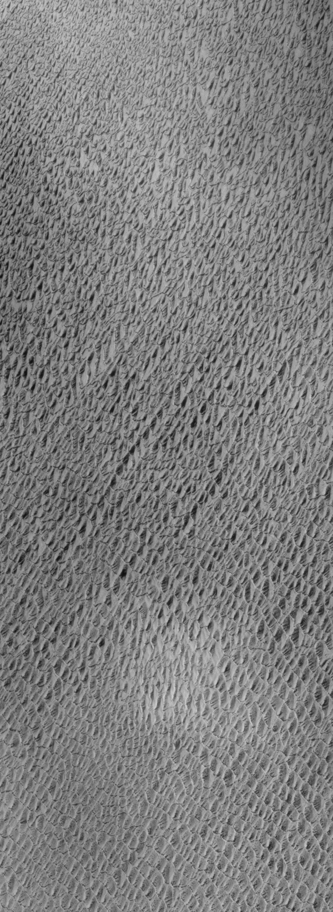
PIA07824:
-
North Polar Erg
Full Resolution:
TIFF
(3.319 MB)
JPEG
(364.5 kB)
|
|
|
2005-04-06 |
Mars
|
2001 Mars Odyssey
|
THEMIS
|
1091x2988x1 |
|
-
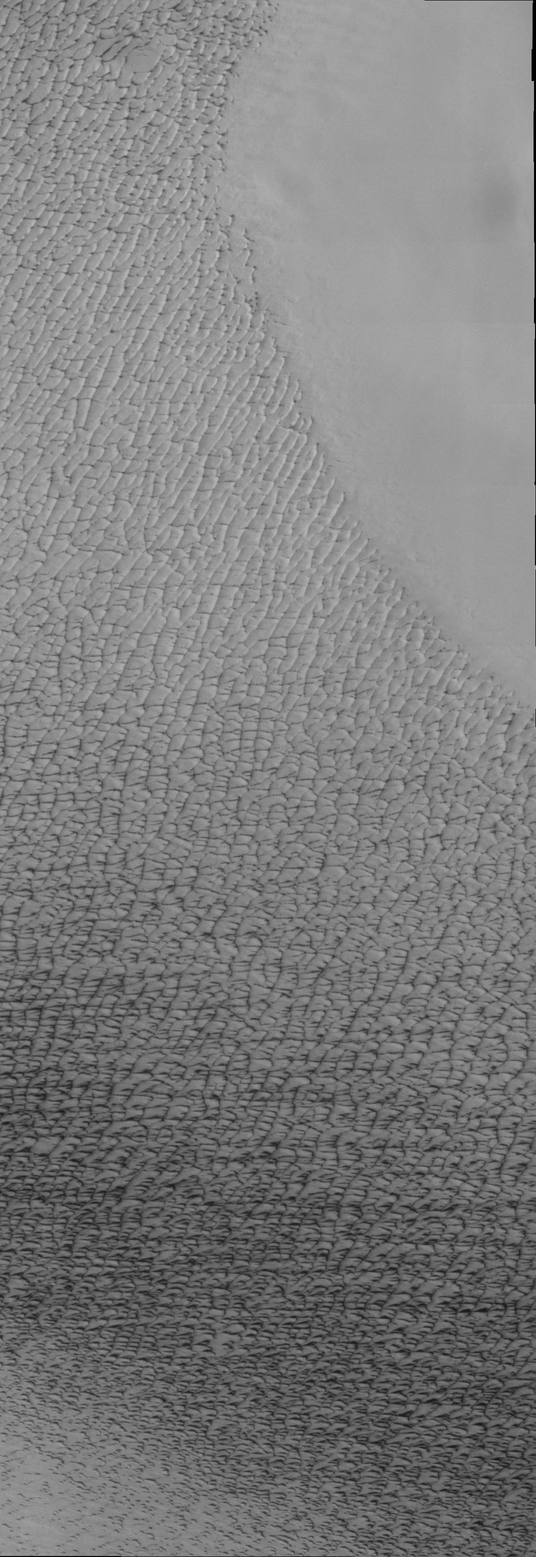
PIA07822:
-
Northern Sand Sea
Full Resolution:
TIFF
(3.264 MB)
JPEG
(603.9 kB)
|
|
|
2005-04-05 |
Mars
|
2001 Mars Odyssey
|
THEMIS
|
1084x2995x1 |
|
-
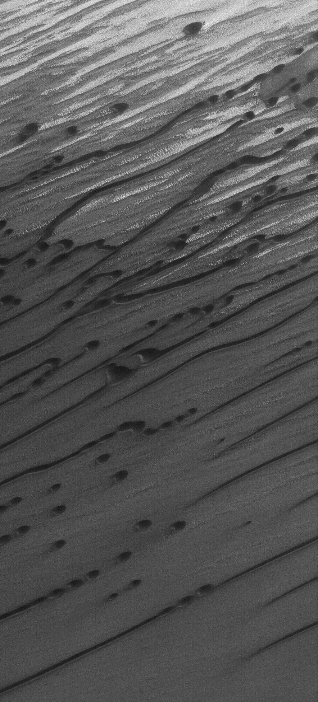
PIA07820:
-
North Polar Erg
Full Resolution:
TIFF
(3.25 MB)
JPEG
(369.1 kB)
|
|
|
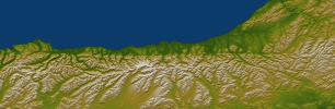
2005-04-04 |
Mars
|
2001 Mars Odyssey
|
THEMIS
|
1092x3172x1 |
|
-
PIA07819:
-
Isolated Northern Dunes
Full Resolution:
TIFF
(3.087 MB)
JPEG
(407.8 kB)
|
|
|
2005-03-30 |
Mars
|
Mars Global Surveyor (MGS)
|
Mars Orbiter Camera (MOC)
|
1024x2256x1 |

|
-
PIA07507:
-
Dunes of the North
Full Resolution:
TIFF
(2.313 MB)
JPEG
(441.5 kB)
|
|
|
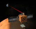
2005-03-29 |
|
Mars Telecommunications Orbiter (MTO)
|
|
5500x4000x3 |

|
-
PIA07500:
-
Mars Telecommunications Orbiter, Artist's Concept
Full Resolution:
TIFF
(43.19 MB)
JPEG
(2.354 MB)
|
|
|
2005-03-29 |
|
Mars Telecommunications Orbiter (MTO)
|
|
4600x3670x3 |
|
-
PIA07499:
-
Mars Laser Communication Demonstration, Artist's Concept
Full Resolution:
TIFF
(25.32 MB)
JPEG
(1.602 MB)
|
|
|
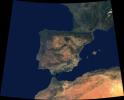
2005-03-23 |
Earth
|
Terra
|
MISR
|
2076x1670x3 |
|
-
PIA04376:
-
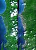
Where Europe meets Africa
Full Resolution:
TIFF
(5.048 MB)
JPEG
(286.9 kB)
|
|
|
2005-03-18 |
Mars
|
Mars Exploration Rover (MER)
|
Microscopic Imager
|
2094x1767x1 |
|
-
PIA07480:
-
Looking Closely at 'Yuri'
Full Resolution:
TIFF
(3.536 MB)
JPEG
(597.2 kB)
|
|
|
2005-03-18 |
Earth
|
Terra
|
ASTER
|
1595x1458x3 |

|
-
PIA07478:
-
Mount St. Helens
Full Resolution:
TIFF
(6.988 MB)
JPEG
(598.9 kB)
|
|
|
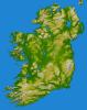
2005-03-16 |
Earth
|
Shuttle Radar Topography Mission (SRTM)
|
C-Band Imaging Radar
X-Band Radar
|
6587x8336x3 |
|
-
PIA06672:
-
Ireland, Shaded Relief and Colored Height
Full Resolution:
TIFF
(96.97 MB)
JPEG
(6.802 MB)
|
|
|
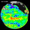
2005-03-14 |
Earth
|
Jason-1
|
Altimeter
|
900x900x3 |
|
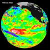
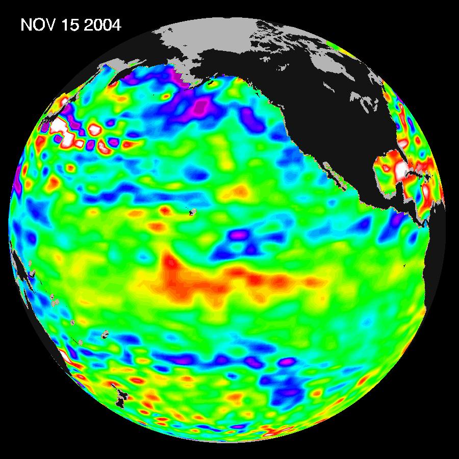
-
PIA07456:
-
El Niño: The Weak, Getting Weaker
Full Resolution:
TIFF
(1.554 MB)
JPEG
(116.5 kB)
|
|
|
2005-03-09 |
Earth
|
Terra
|
MISR
|
1371x1181x3 |
|
-
PIA04375:
-
Where on Earth...? MISR Mystery Image Quiz #21:
ACTINAE
Full Resolution:
TIFF
(4.61 MB)
JPEG
(257.9 kB)
|
|
|
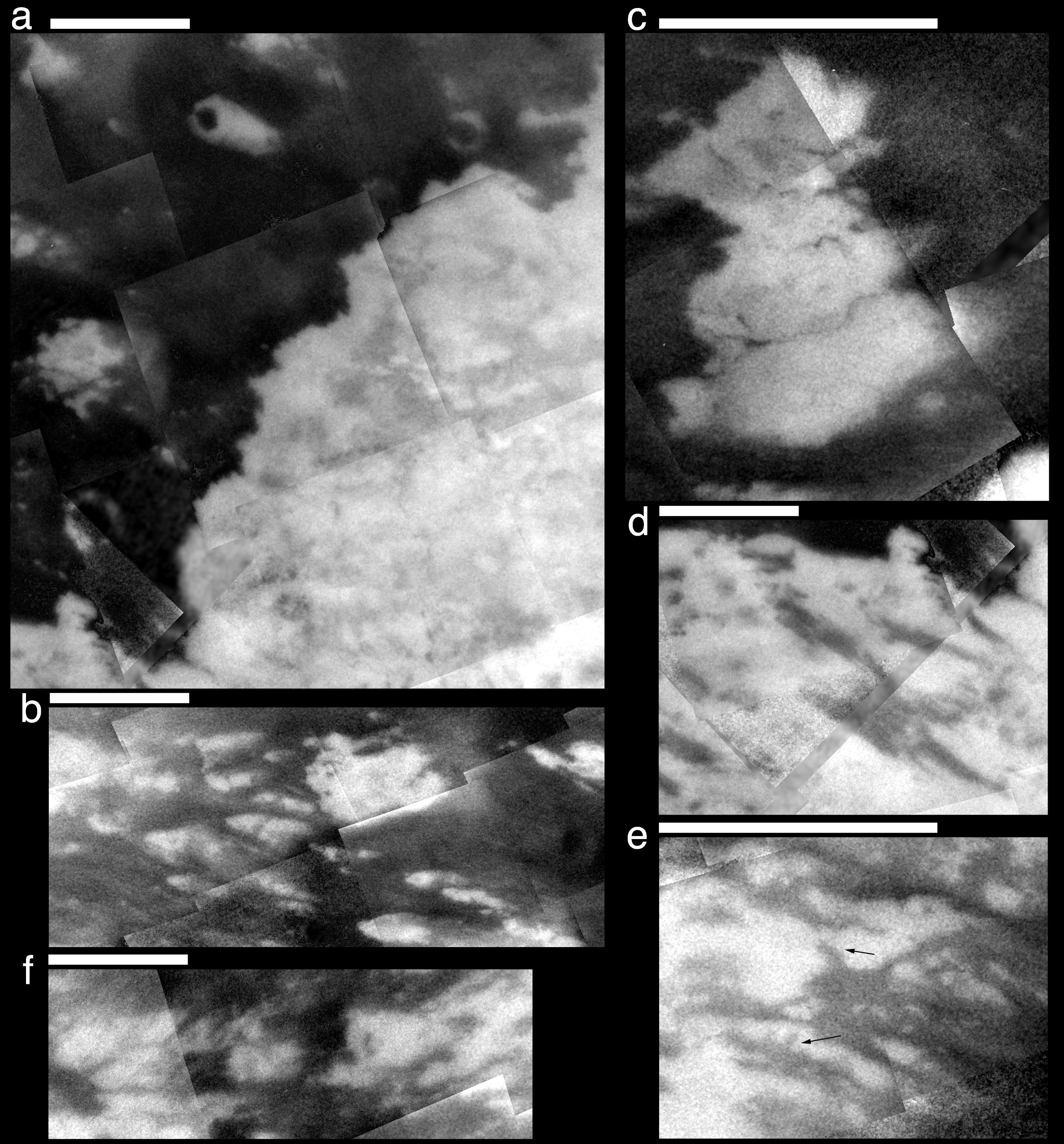
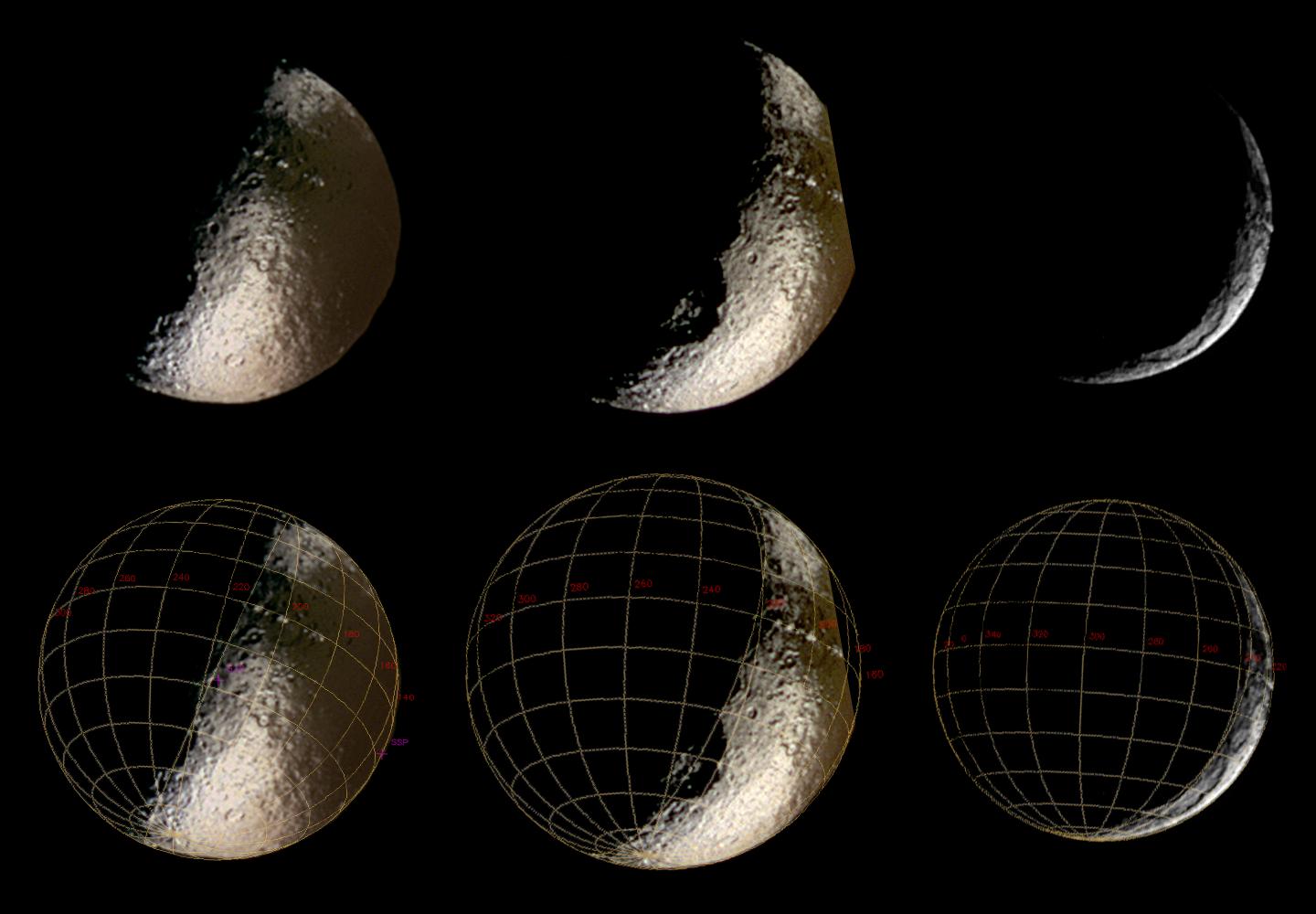
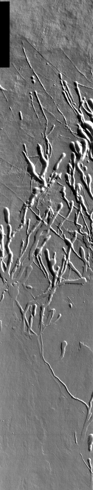
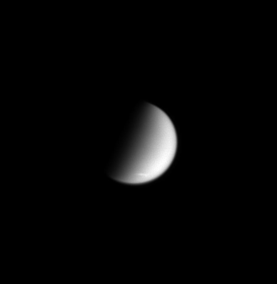
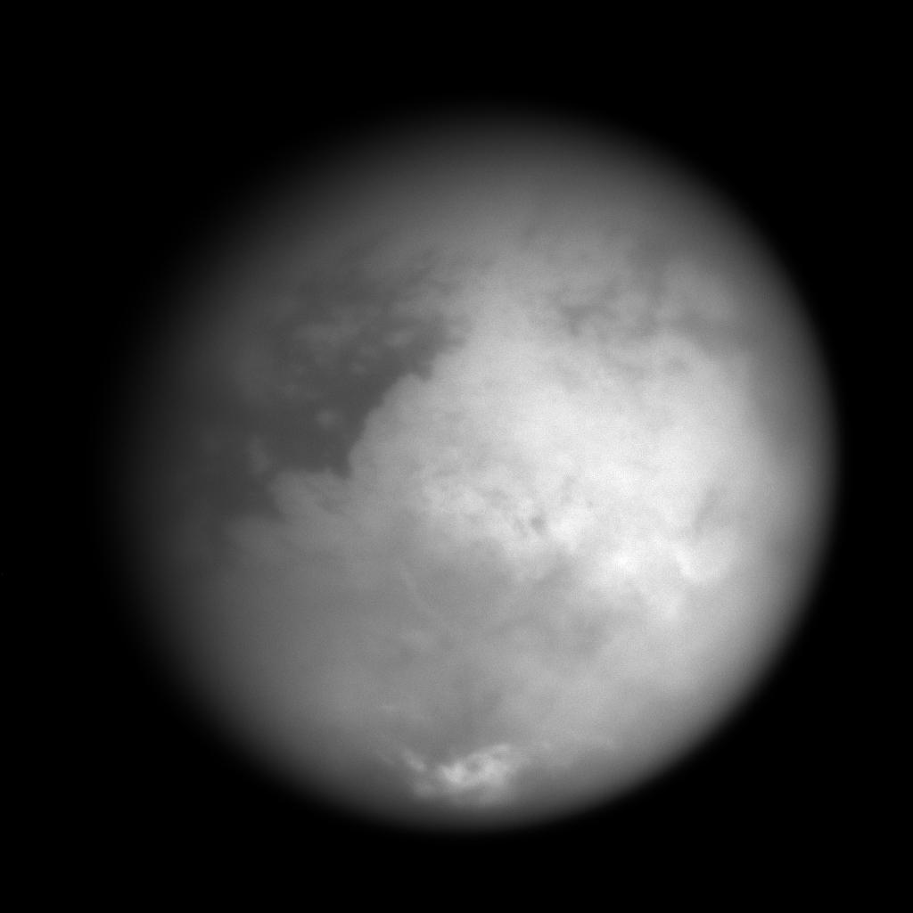
2005-03-09 |
Titan
|
Cassini-Huygens
|
Imaging Science Subsystem
|
2660x2859x1 |

|
-
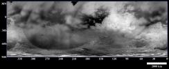
PIA06204:
-
Scrutinizing Titan's Surface
Full Resolution:
TIFF
(6.929 MB)
JPEG
(907.9 kB)
|
|
|
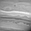
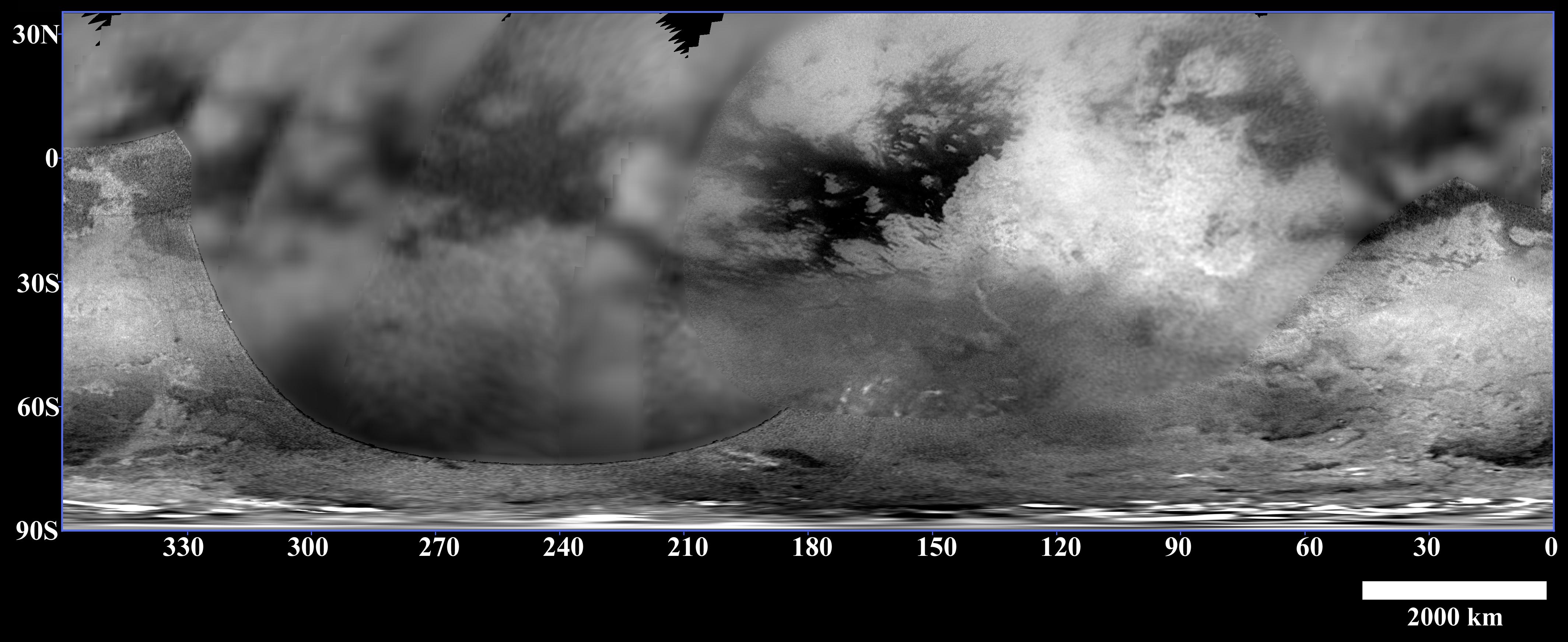
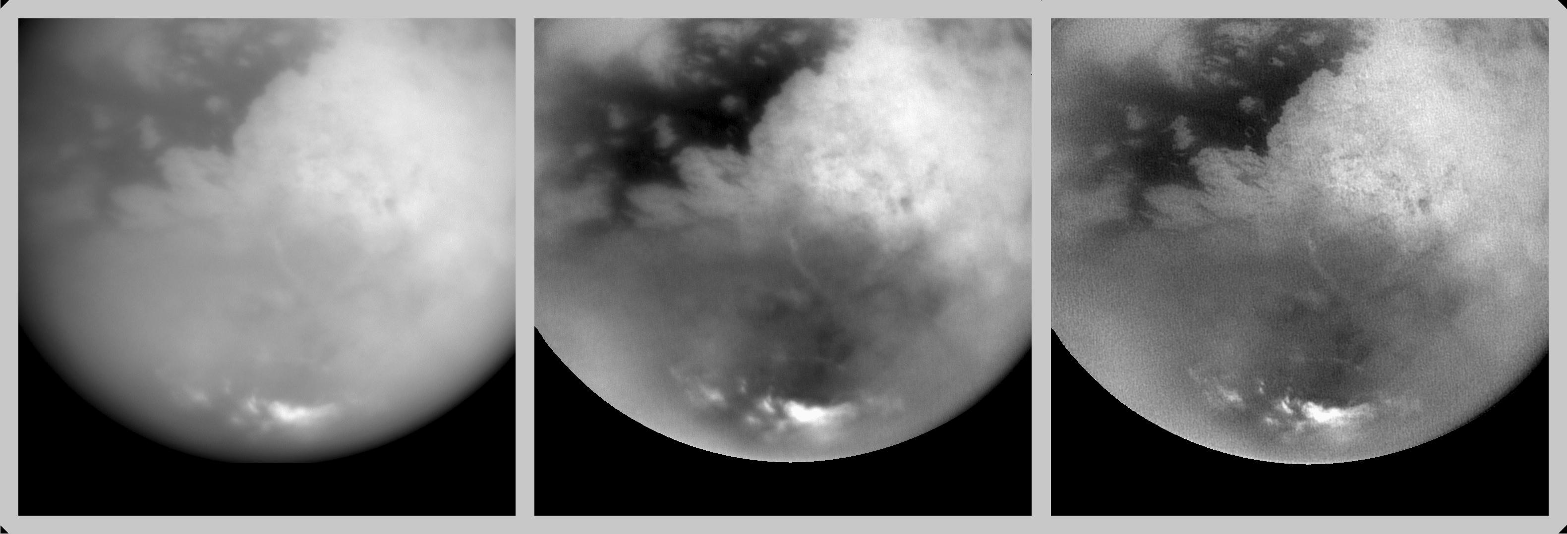
2005-03-09 |
Titan
|
Cassini-Huygens
|
Imaging Science Subsystem
|
4256x1744x3 |
|
-
PIA06201:
-
Titan's Variety
Full Resolution:
TIFF
(7.402 MB)
JPEG
(612.9 kB)
|
|
|
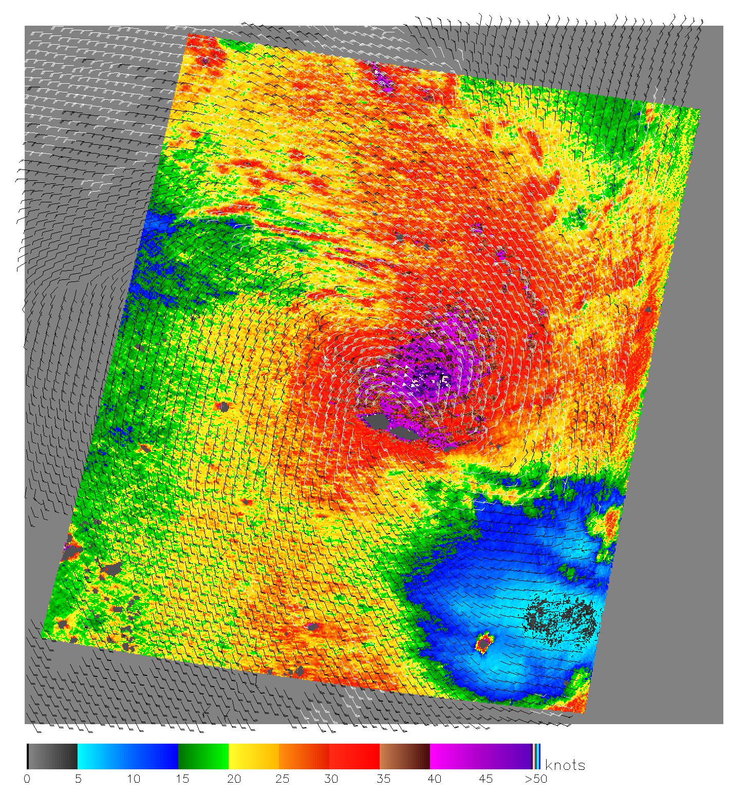
2005-03-03 |
Earth
|
QuikScat
|
SeaWinds Scatterometer
|
1456x1548x3 |
|
-
PIA07415:
-
Cyclones in the Pacific
Full Resolution:
TIFF
(4.757 MB)
JPEG
(792.9 kB)
|
|
|
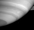
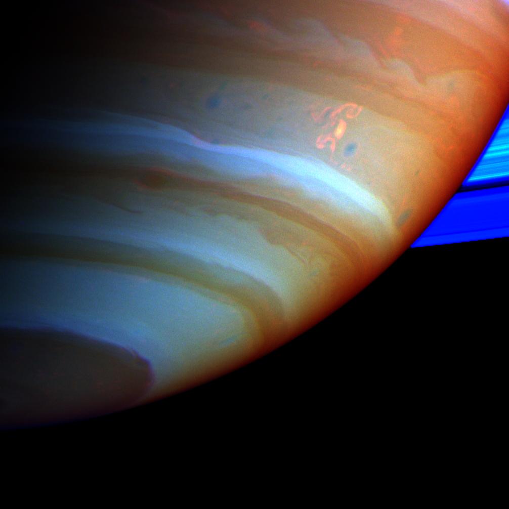
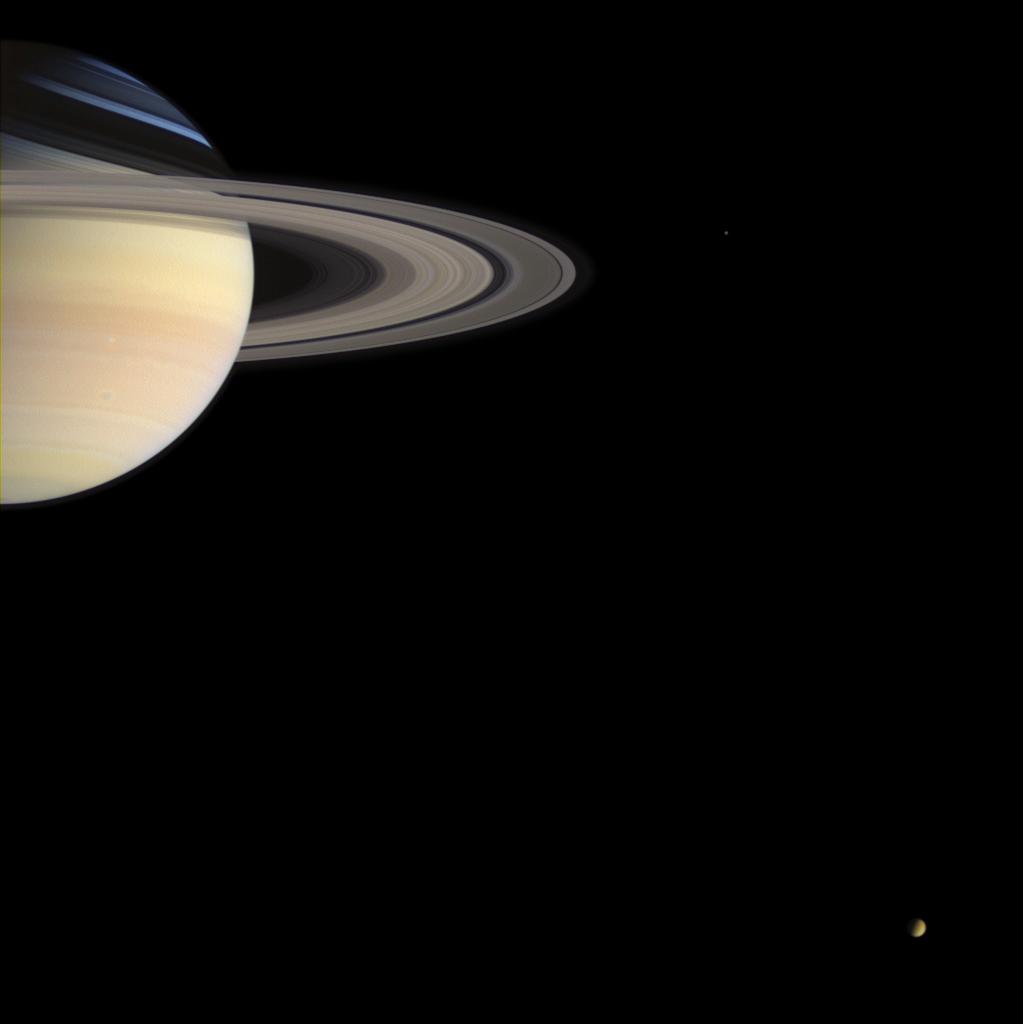
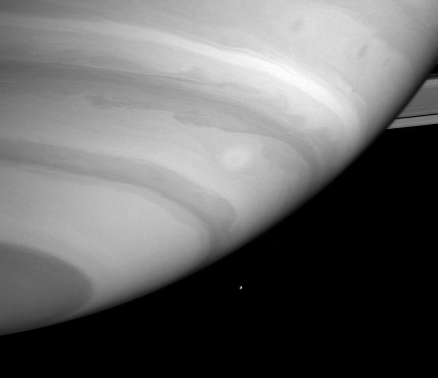
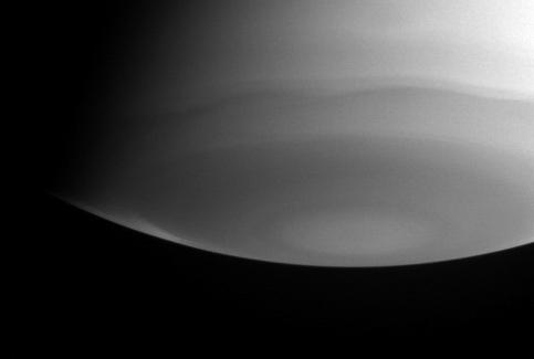
2005-02-24 |
Saturn
|
Cassini-Huygens
|
Imaging Science Subsystem
|
1006x1006x3 |

|
-
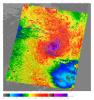
PIA06197:
-
The Dragon Storm
Full Resolution:
TIFF
(2.294 MB)
JPEG
(53.89 kB)
|
|
|
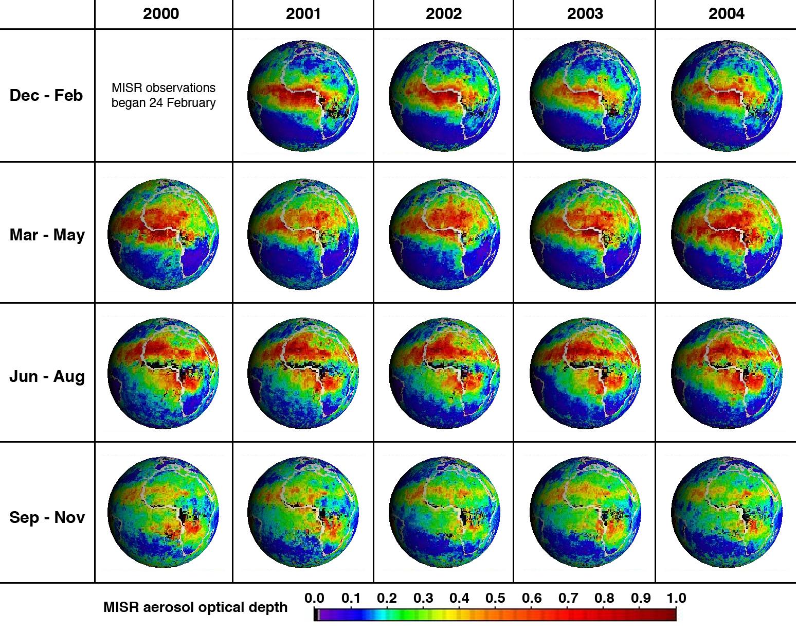
2005-02-23 |
Earth
|
Terra
|
MISR
|
1548x1224x3 |
|
-
PIA04374:
-
Five Years of MISR Global Aerosol Observations
Full Resolution:
TIFF
(2.641 MB)
JPEG
(369.7 kB)
|
|
|
2005-02-11 |
Ring Nebula
|
Spitzer Space Telescope
|
IRAC
|
2104x1726x3 |
|
-
PIA07343:
-
Ring Beholds a Delicate Flower

Full Resolution:
TIFF
(7.244 MB)
JPEG
(304.1 kB)
|
|
|
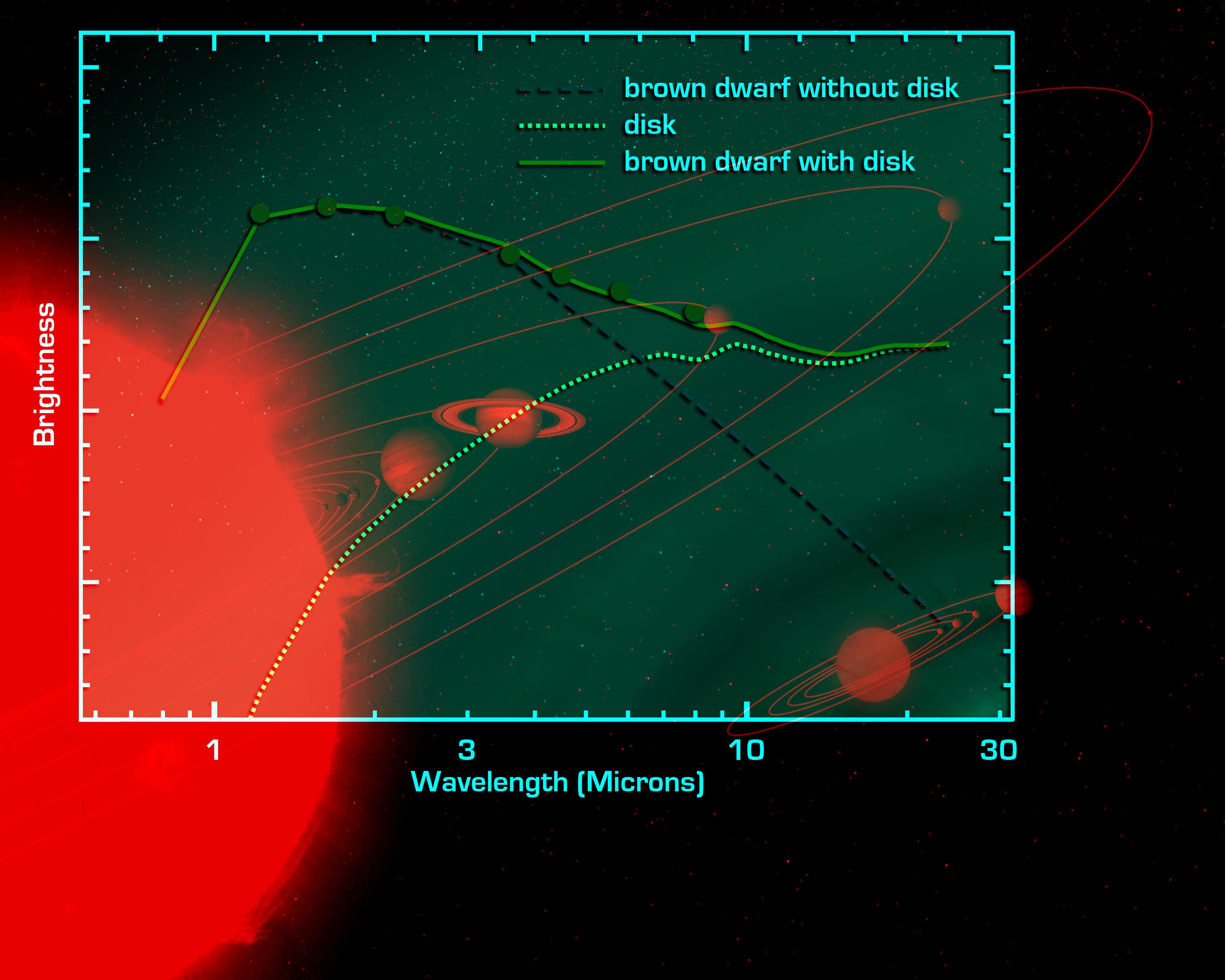
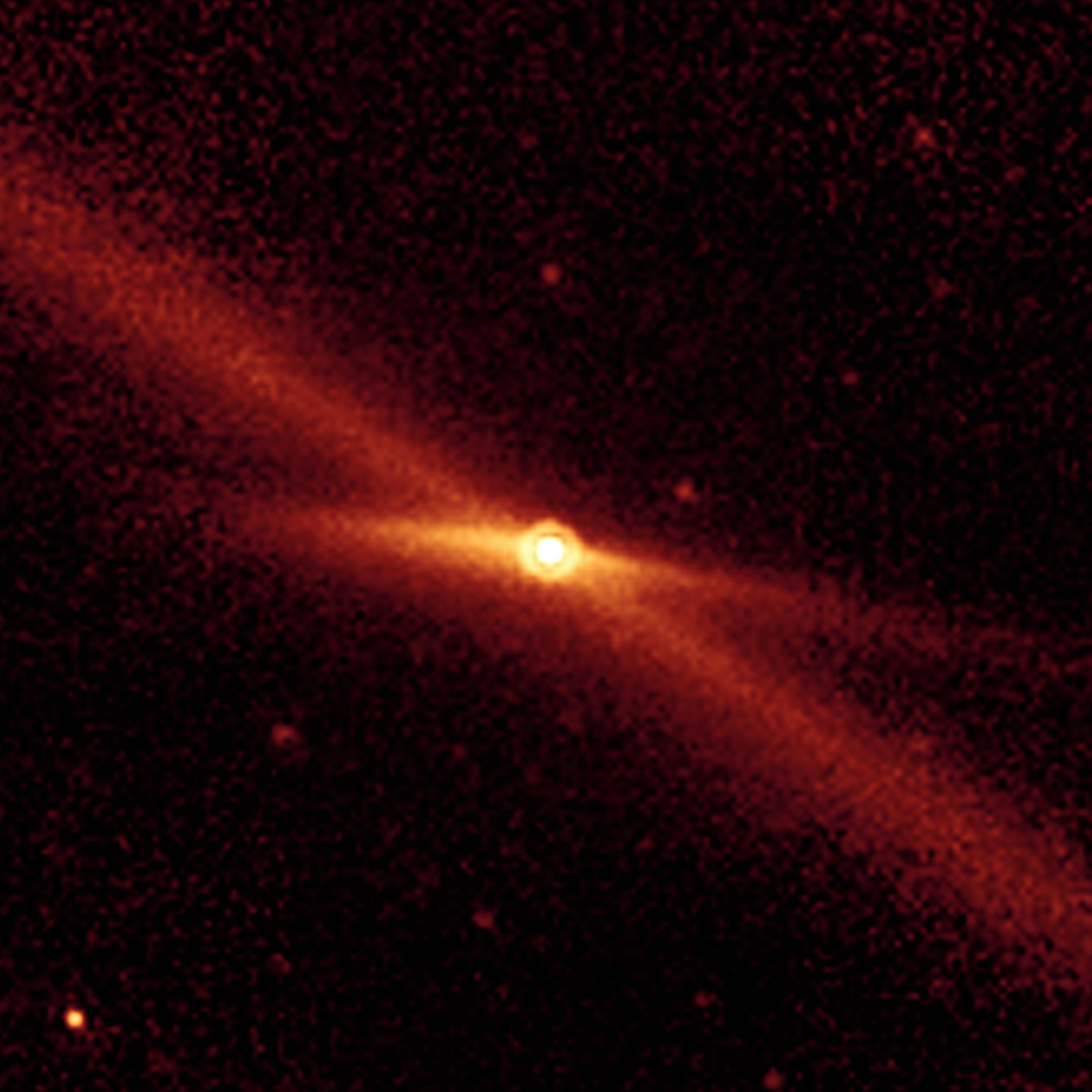
2005-02-08 |
OTS 44
|
Spitzer Space Telescope
|
|
2580x2010x3 |
|
-
PIA07336:
-
'Mini-Me' Solar System (Artist Concept)
Full Resolution:
TIFF
(6.098 MB)
JPEG
(386.3 kB)
|
|
|
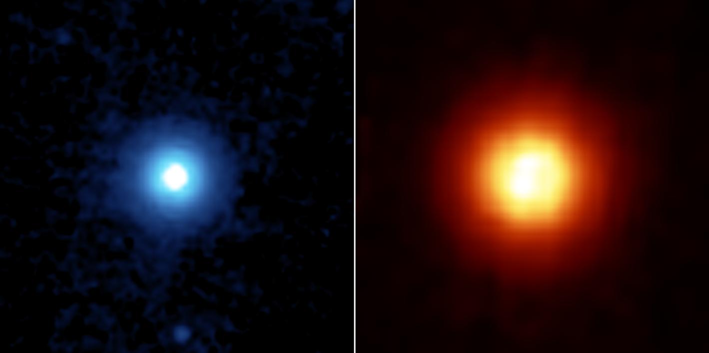
2005-02-08 |
OTS 44
|
Spitzer Space Telescope
|
|
3000x2400x3 |
|
-
PIA07335:
-
Birth of an Unusual Planetary System (Artist Concept)
Full Resolution:
TIFF
(11.05 MB)
JPEG
(371.7 kB)
|
|
|
2005-01-26 |
Earth
|
Terra
|
MISR
|
1516x1504x3 |

|
-
PIA04373:
-
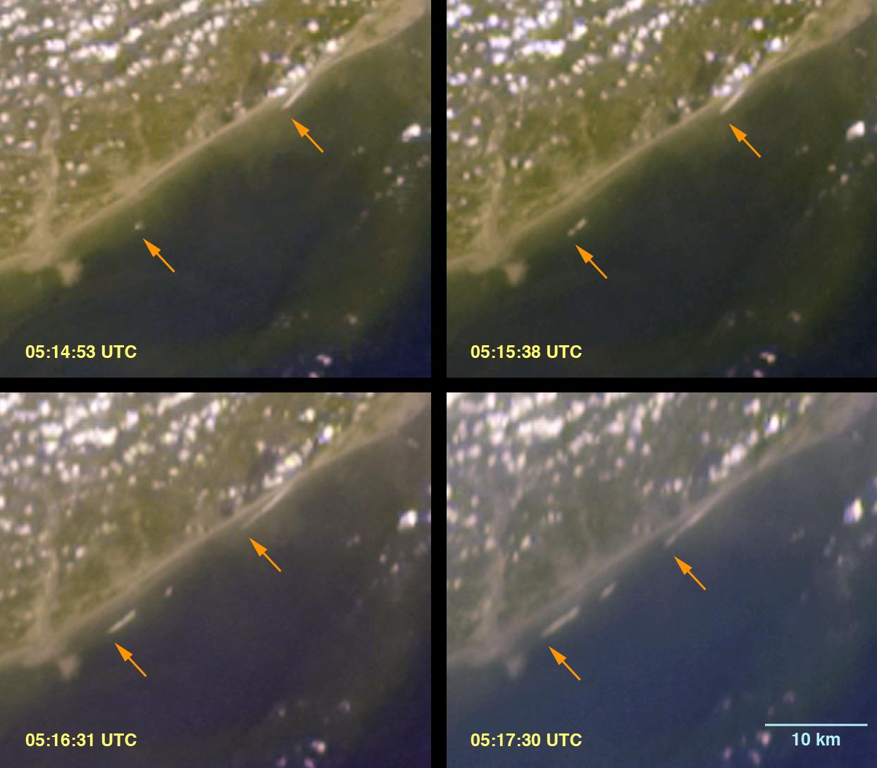
Deep Ocean Tsunami Waves off the Sri Lankan Coast
Full Resolution:
TIFF
(6.162 MB)
JPEG
(260.6 kB)
|
|
|
2005-01-25 |
Mars
|
Mars Exploration Rover (MER)
|
Microscopic Imager
|
1024x1024x1 |
|
-
PIA07301:
-
Dust Accumulation on Mars
Full Resolution:
TIFF
(949.4 kB)
JPEG
(116.7 kB)
|
|
|
2005-01-20 |
Mars
|
Mars Exploration Rover (MER)
|
Navigation Camera
|
1024x1024x1 |
|
-
PIA07268:
-
A Year's Worth of Tracks in the Dust
Full Resolution:
TIFF
(916.3 kB)
JPEG
(122.5 kB)
|
|
|
2005-01-18 |
Tempel 1
|
Deep Impact
|
Hale Telescope 200-inch
|
224x319x3 |
|
-
PIA07266:
-
Deep Impact on Its Way
Full Resolution:
TIFF
(214.8 kB)
JPEG
(36.38 kB)
|
|
|
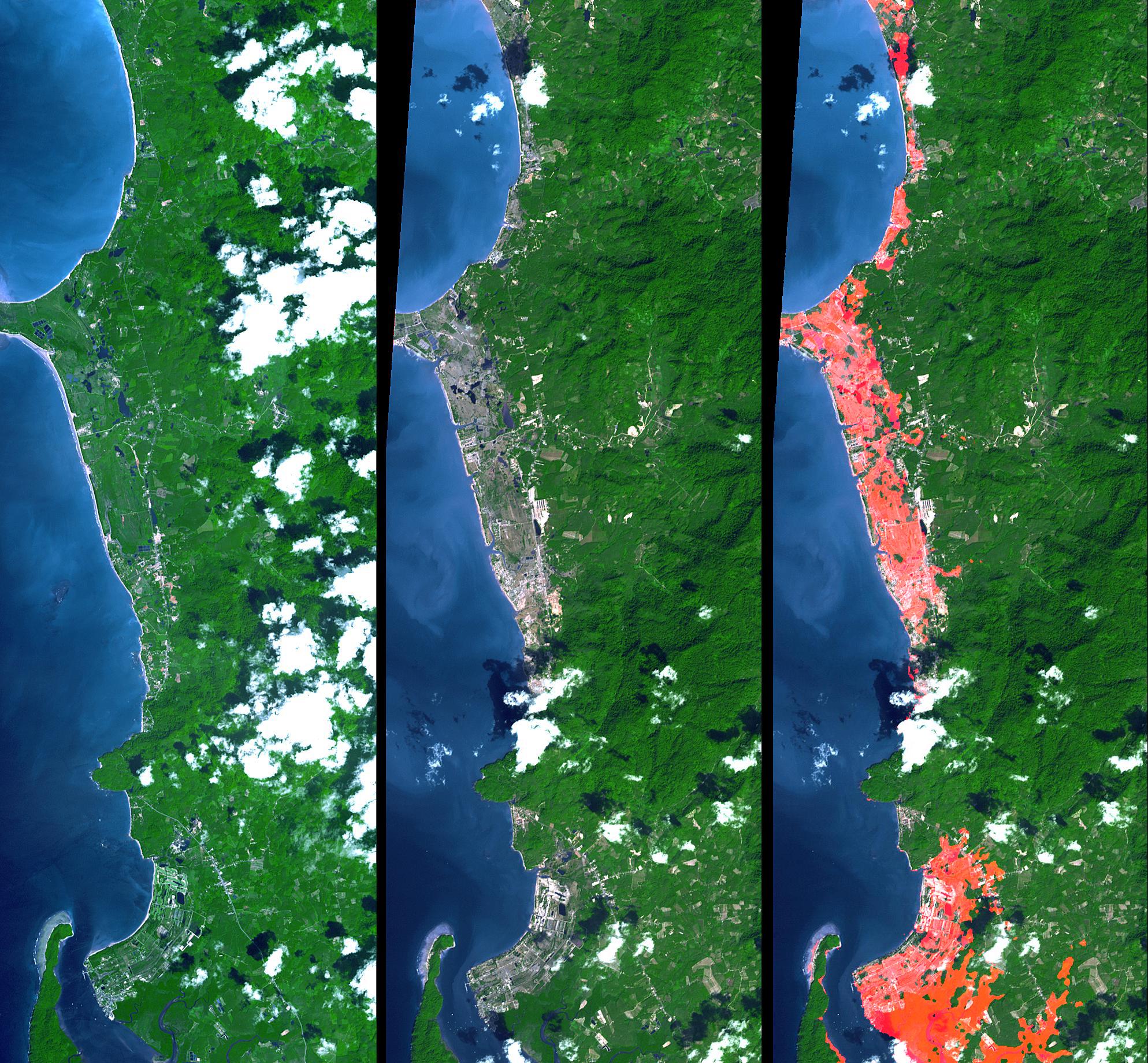
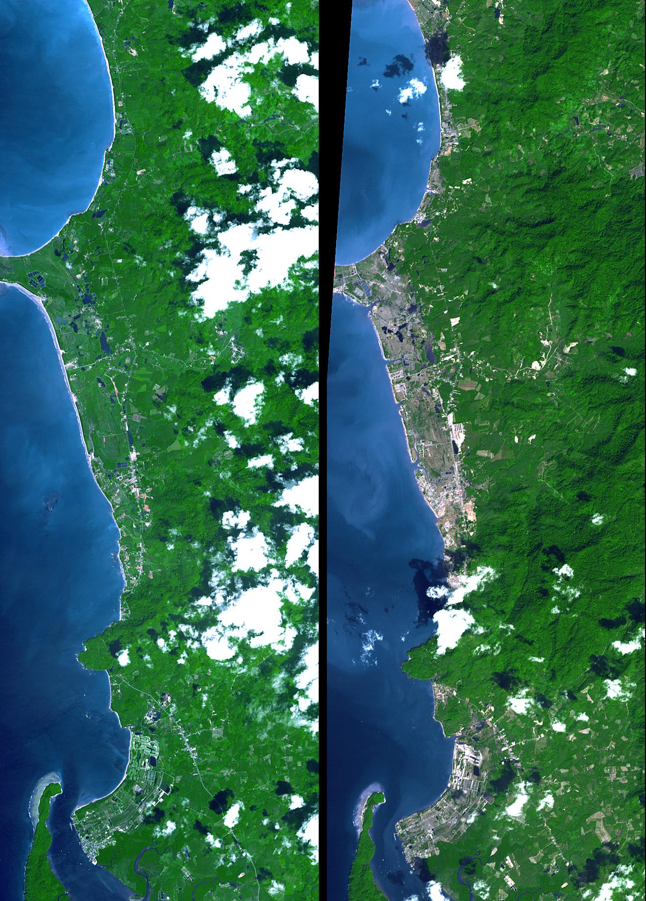
2005-01-14 |
Earth
|
Shuttle Radar Topography Mission (SRTM)
Terra
|
ASTER
SIR-C/X-SAR
|
1987x1840x3 |
|
-
PIA06671:
-
Tsunami Inundation, North of Phuket, Thailand
ASTER Images and SRTM Elevation Model
Full Resolution:
TIFF
(10.98 MB)
JPEG
(737.4 kB)
|
|
|
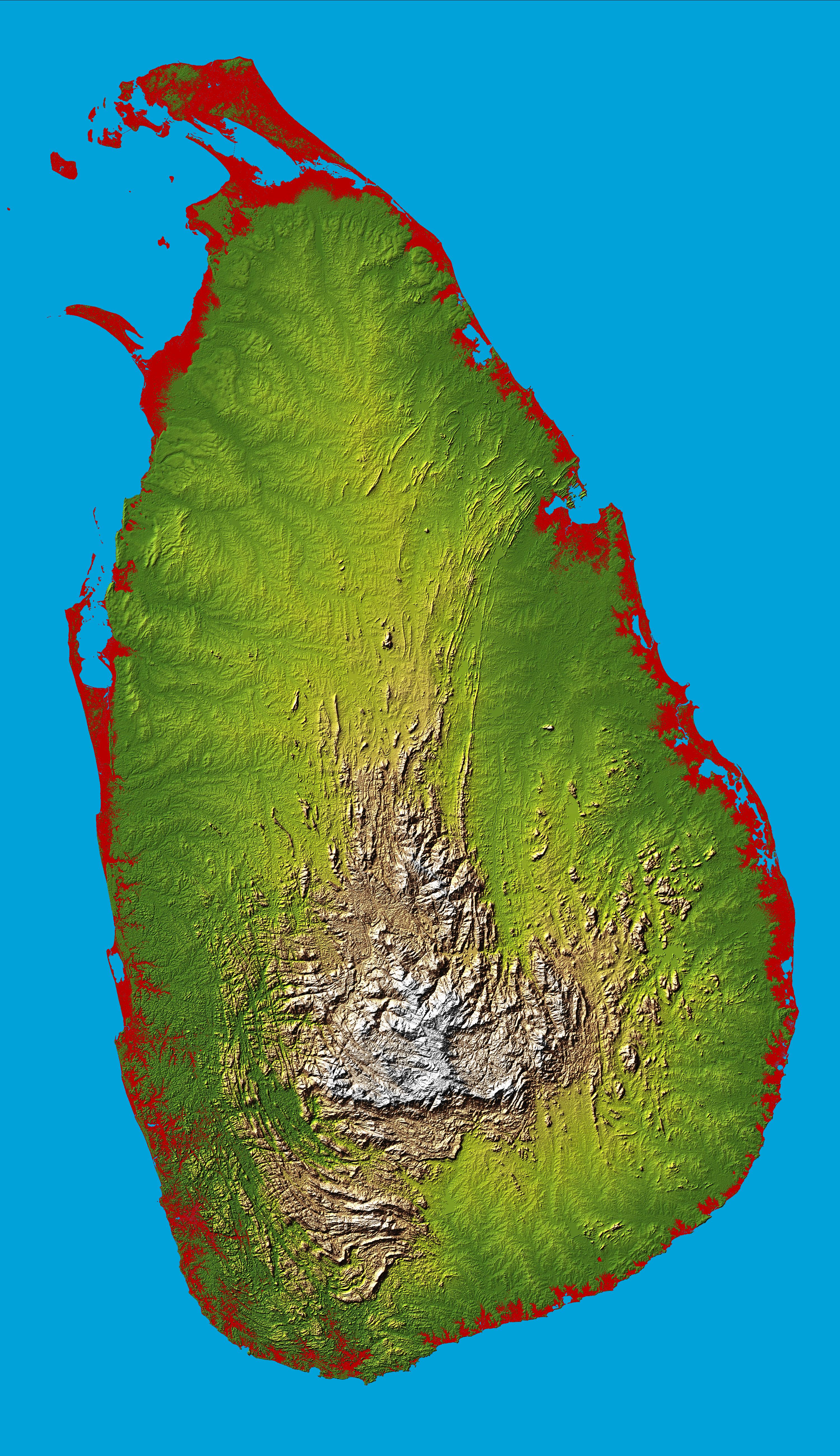
2005-01-14 |
Earth
|
Shuttle Radar Topography Mission (SRTM)
|
C-Band Interferometric Radar
|
3000x5200x3 |

|
-
PIA06670:
-
Sri Lanka, Colored Height
Full Resolution:
TIFF
(28.95 MB)
JPEG
(3.425 MB)
|
|
|
2005-01-12 |
Earth
|
Terra
|
ASTER
|
1320x1840x3 |
|
-
PIA07227:
-
New NASA Imagery Sheds Additional Perspectives on Tsunami
Full Resolution:
TIFF
(7.294 MB)
JPEG
(481.9 kB)
|
|
|
2005-01-12 |
Earth
|
Terra
|
MISR
|
1245x1090x3 |
|
-
PIA04372:
-
Breaking Tsunami Waves along India's Eastern Coast
Full Resolution:
TIFF
(3.174 MB)
JPEG
(100.1 kB)
|
|
|
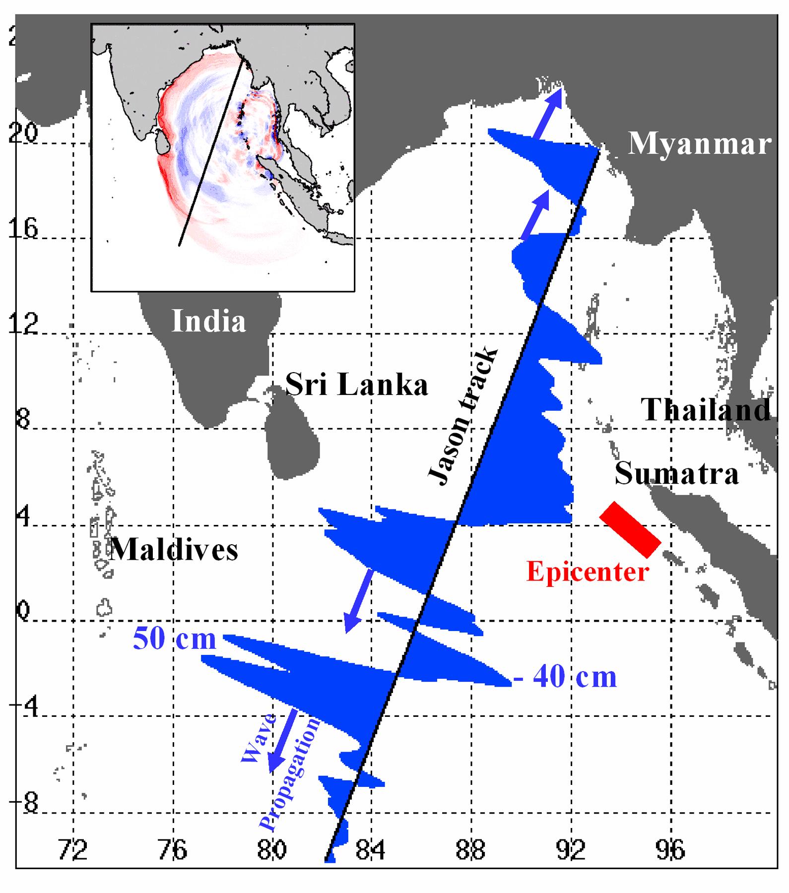
2005-01-12 |
Earth
|
Jason-1
|
Altimeter
|
1590x1800x3 |
|
-
PIA07219:
-
NASA/French Satellite Data Reveal New Details of Tsunami
Full Resolution:
TIFF
(1.269 MB)
JPEG
(280 kB)
|
|
|
2005-01-11 |
Titan
|
Cassini-Huygens
|
ISS - Narrow Angle
|
1135x908x3 |
|
-
PIA06172:
-
Go Huygens!
Full Resolution:
TIFF
(1.391 MB)
JPEG
(82.95 kB)
|
|
|
2005-01-11 |
Titan
|
Cassini-Huygens
|
ISS - Narrow Angle
|
1135x907x3 |
|
-
PIA06173:
-
Go Huygens!
Full Resolution:
TIFF
(1.358 MB)
JPEG
(73.77 kB)
|
|
|
2005-01-11 |
Encke
|
Spitzer Space Telescope
|
MIPS
|
2154x2154x3 |
|
-
PIA07222:
-
Riding a Trail of Debris
Full Resolution:
TIFF
(6.884 MB)
JPEG
(215.1 kB)
|
|
|
2005-01-10 |
Vega
|
Spitzer Space Telescope
|
MIPS
|
1419x707x3 |
|
-
PIA07218:
-
Tiny Particles, So Far Away
Full Resolution:
TIFF
(1.332 MB)
JPEG
(36.35 kB)
|
|
|
2005-01-07 |
Iapetus
|
Cassini-Huygens
|
ISS - Narrow Angle
|
1000x750x1 |
|
-
PIA06171:
-
Giant Landslide on Iapetus
Full Resolution:
TIFF
(751 kB)
JPEG
(125 kB)
|
|
|
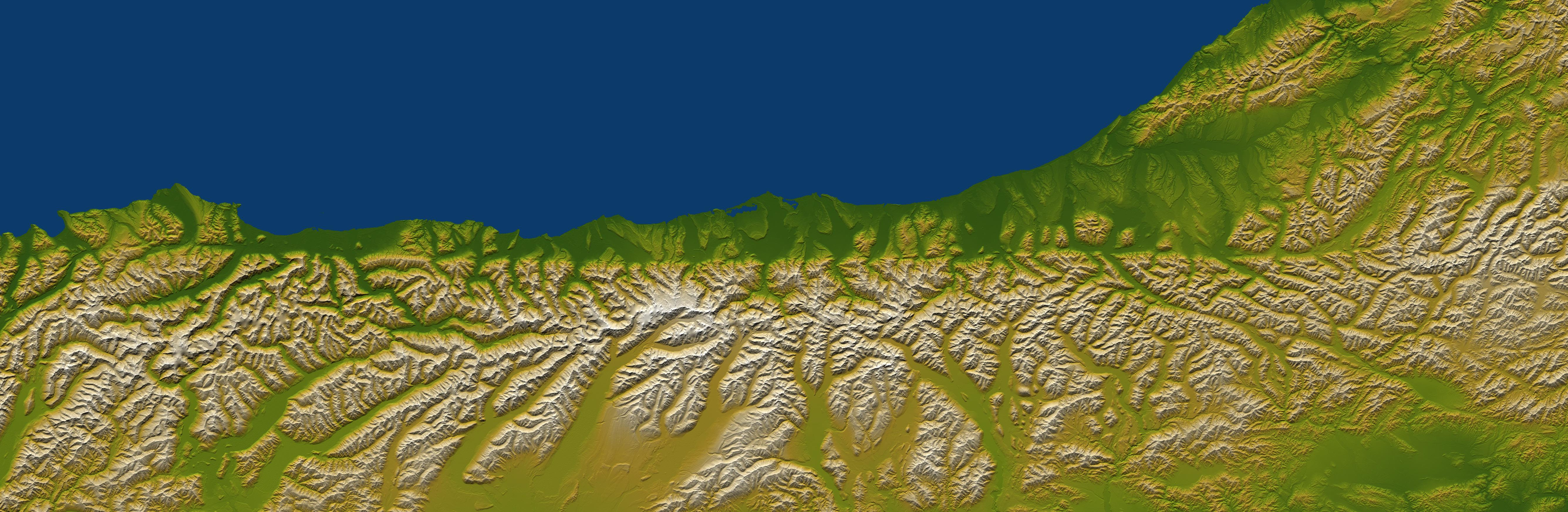
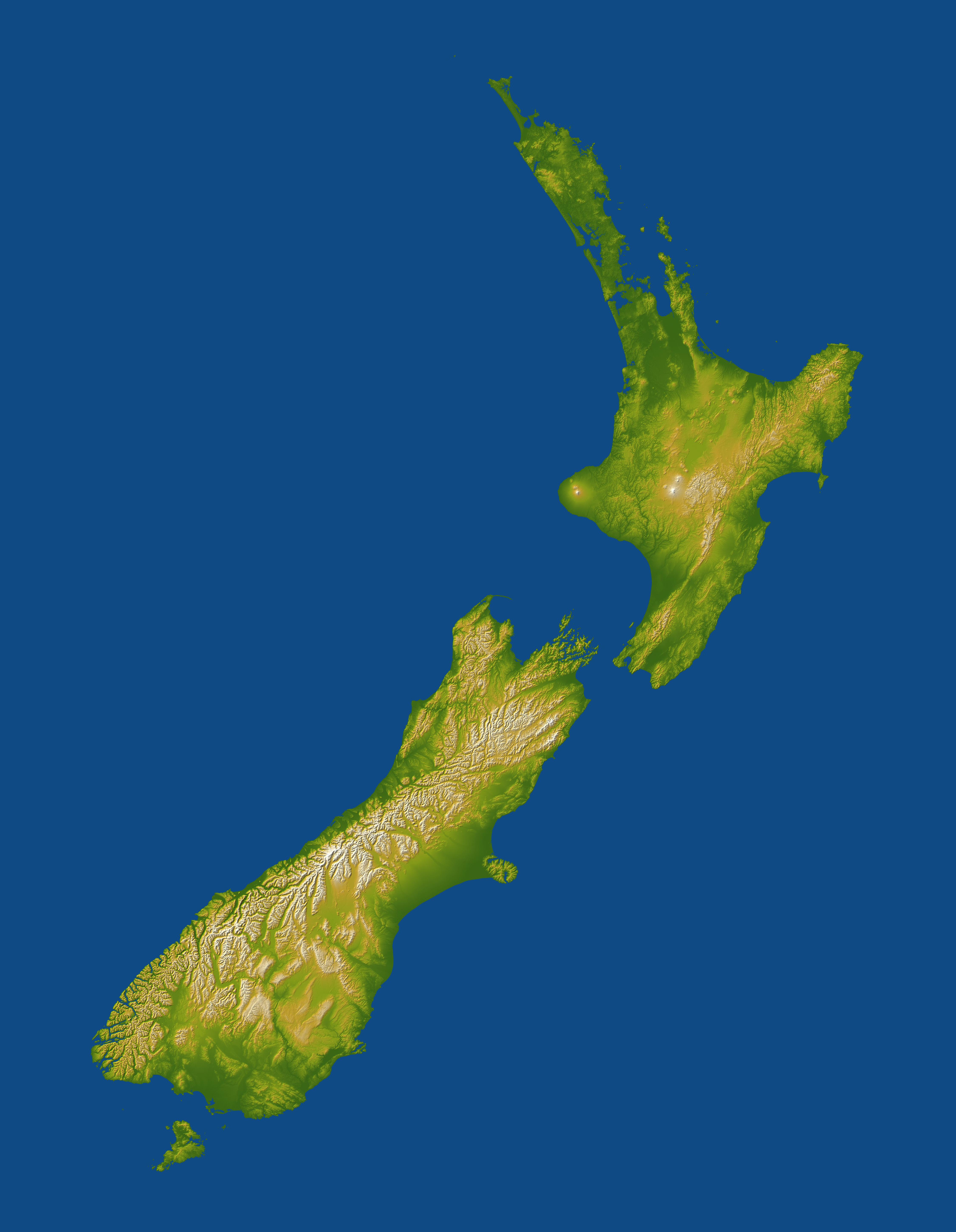
2005-01-06 |
Earth
|
Shuttle Radar Topography Mission (SRTM)
|
Spaceborne Imaging Radar
C/X-Band Synthetic Aperture Radar
|
5342x1746x3 |
|
-
PIA06661:
-
Alpine Fault, New Zealand, SRTM Shaded Relief and Colored Height
Full Resolution:
TIFF
(22.84 MB)
JPEG
(1.473 MB)
|
|
|
2005-01-06 |
Earth
|
Shuttle Radar Topography Mission (SRTM)
|
Spaceborne Imaging Radar
C/X-Band Synthetic Aperture Radar
|
2919x1565x3 |

|
-
PIA06663:
-
Davenport Ranges, Northern Territory, Australia, SRTM Shaded Relief and
Colored Height
Full Resolution:
TIFF
(10.79 MB)
JPEG
(608.1 kB)
|
|
|
2005-01-06 |
Earth
|
Shuttle Radar Topography Mission (SRTM)
|
Spaceborne Imaging Radar
C/X-Band Synthetic Aperture Radar
|
1610x1100x3 |
|
-
PIA06664:
-
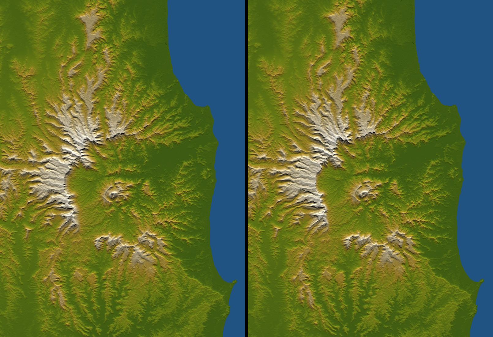
Tweed Extinct Volcano, Australia, Stereo Pair of SRTM Shaded Relief and
Colored Height
Full Resolution:
TIFF
(4.368 MB)
JPEG
(254.5 kB)
|
|
|
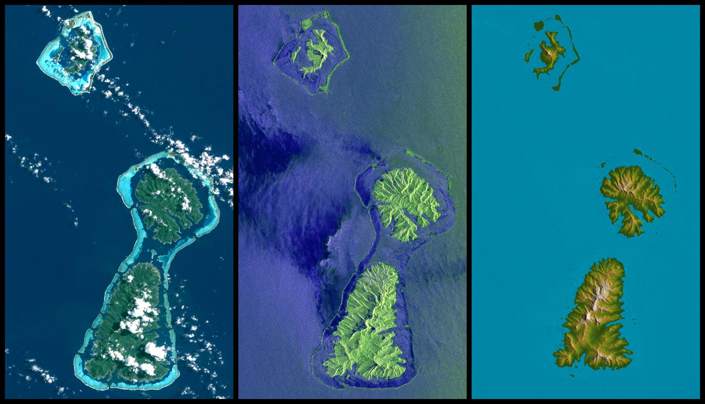
2005-01-06 |
Earth
|
Landsat
Shuttle Radar Topography Mission (SRTM)
|
Spaceborne Imaging Radar
C/X-Band Synthetic Aperture Radar
|
1414x810x3 |
|
-
PIA06660:
-
Bora Bora, Tahaa, and Raiatea, French Polynesia, Landsat and SIR-C Images
Compared to SRTM Shaded Relief and Colored Height
Full Resolution:
TIFF
(2.921 MB)
JPEG
(158.8 kB)
|
|
|
2005-01-03 |
|
|
|
4538x4391x3 |
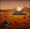
|
-
PIA07187:
-
Illustration of Launching Samples Home from Mars
Full Resolution:
TIFF
(57.89 MB)
JPEG
(1.698 MB)
|
|
|
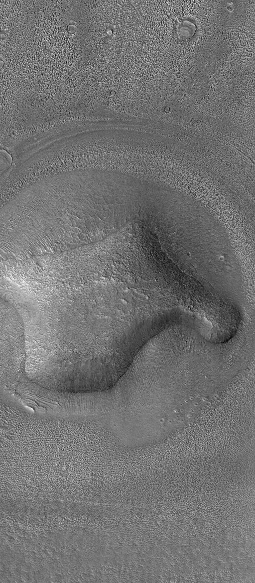
2004-12-28 |
Mars
|
Mars Global Surveyor (MGS)
|
Mars Orbiter Camera (MOC)
|
512x1170x1 |
|
-
PIA07153:
-
Hill In Deuteronilus
Full Resolution:
TIFF
(599.9 kB)
JPEG
(181.7 kB)
|
|
|
2004-12-27 |
Titan
|
Cassini-Huygens
|
ISS - Narrow Angle
|
554x554x1 |
|
-
PIA07001:
-
Close-Up of Huygens Probe
Full Resolution:
TIFF
(88.27 kB)
JPEG
(5.896 kB)
|
|
|
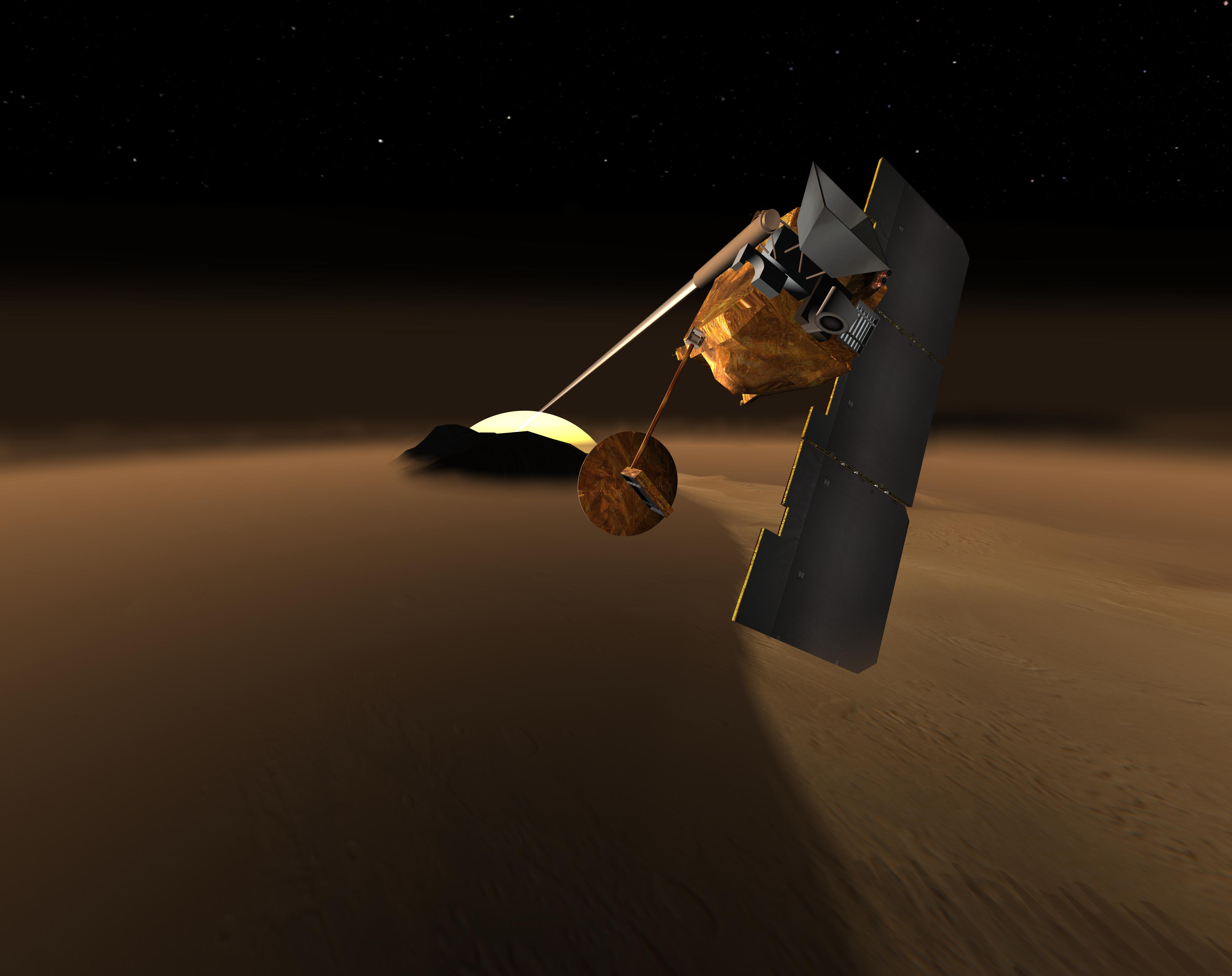
2004-12-27 |
Titan
|
Cassini-Huygens
|
ISS - Narrow Angle
|
1024x1024x1 |
|
-
PIA06999:
-
Huygens Probe Shines for Cassini's Cameras #1
Full Resolution:
TIFF
(703.8 kB)
JPEG
(97.91 kB)
|
|
|
2004-12-27 |
Mars
|
Mars Global Surveyor (MGS)
|
Mars Orbiter Camera (MOC)
|
836x2322x1 |
|
-
PIA07152:
-
Dunes of Herschel
Full Resolution:
TIFF
(1.943 MB)
JPEG
(326.5 kB)
|
|
|
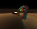
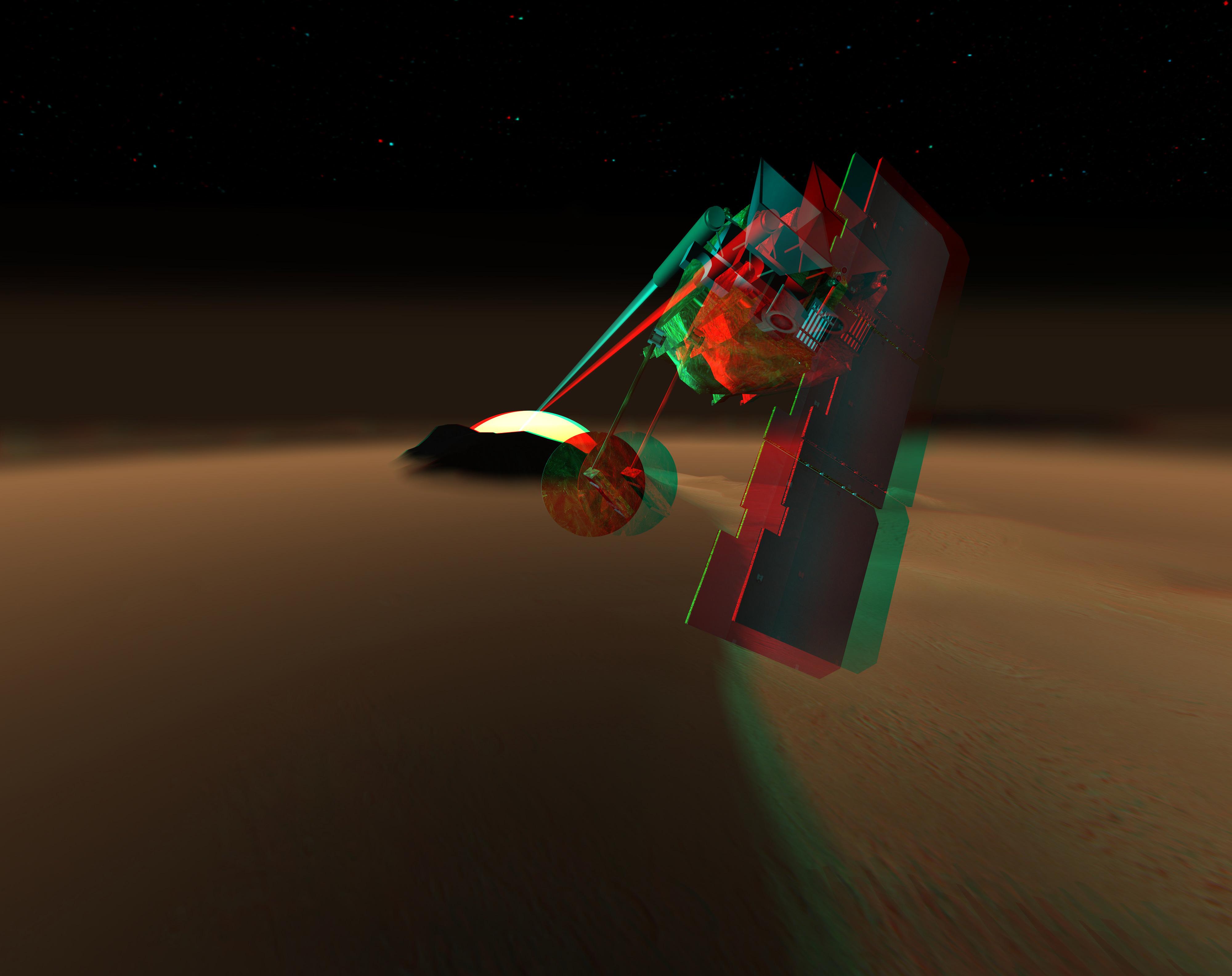
2004-12-25 |
Titan
|
Cassini-Huygens
|
ISS - Wide Angle
|
1039x1068x1 |
|
-
PIA06998:
-
Cassini Snaps Image of ESA's Huygens Probe
Full Resolution:
TIFF
(1.111 MB)
JPEG
(244 kB)
|
|
|
2004-12-24 |
Saturn
|
Cassini-Huygens
|
ISS - Wide Angle
|
1024x1024x3 |

|
-
PIA06164:
-
Cassini's Holiday Greetings
Full Resolution:
TIFF
(550 kB)
JPEG
(30.37 kB)
|
|
|
2004-12-24 |
Saturn
|
Cassini-Huygens
|
ISS - Narrow Angle
|
499x496x1 |
|
-
PIA06546:
-
Nope, Not Jupiter!
Full Resolution:
TIFF
(248 kB)
JPEG
(47.33 kB)
|
|
|
2004-12-21 |
|
Mars Volcanic Emission Life Scout (MARVEL)
|
Mars Volcanic Emission Life Scout (MARVEL)
|
4000x3170x3 |
|
-
PIA07086:
-
Concept for Mars Volcanic Emission Life Scout (3-D) (Artist Concept)
Full Resolution:
TIFF
(13.81 MB)
JPEG
(404.4 kB)
|
|
|
2004-12-21 |
|
Mars Volcanic Emission Life Scout (MARVEL)
|
Mars Volcanic Emission Life Scout (MARVEL)
|
4000x3170x3 |

|
-
PIA07085:
-
Concept for Mars Volcanic Emission Life Scout
Full Resolution:
TIFF
(12.52 MB)
JPEG
(374.5 kB)
|
|
|
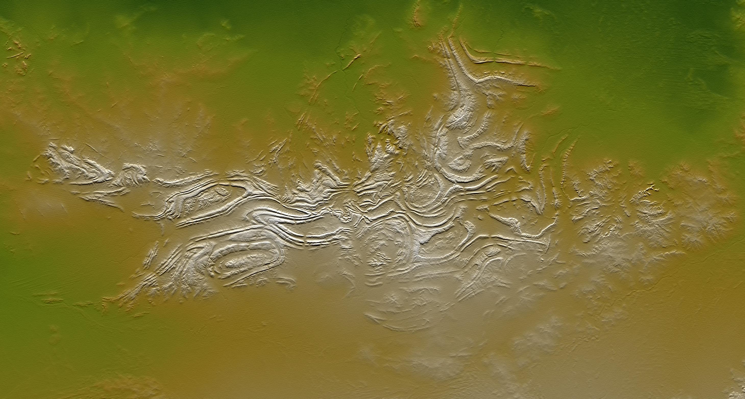
2004-12-14 |
Earth
|
Shuttle Radar Topography Mission (SRTM)
|
C-Band Radar
X-Band Radar
|
4500x5800x3 |

|
-
PIA06662:
-
New Zealand, SRTM Shaded Relief and Colored Height
Full Resolution:
TIFF
(13.15 MB)
JPEG
(1.272 MB)
|
|
|
2004-12-13 |
Mars
|
Mars Exploration Rover (MER)
|
Navigation Camera
|
1907x607x1 |

|
-
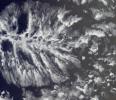
PIA07106:
-
Clouds over 'Endurance' on Sol 291
Full Resolution:
TIFF
(346 kB)
JPEG
(125.5 kB)
|
|
|
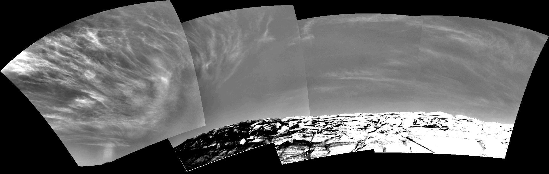
2004-12-13 |
Mars
|
Mars Exploration Rover (MER)
|
Navigation Camera
|
1907x607x1 |
|
-
PIA07105:
-
Clouds over 'Endurance' on Sol 290
Full Resolution:
TIFF
(304.5 kB)
JPEG
(121.1 kB)
|
|
|
2004-12-13 |
Mars
|
Mars Global Surveyor (MGS)
Mars Exploration Rover (MER)
|
Thermal Emission Spectrometer
|
794x274x3 |
|
-
PIA07102:
-
Seasonal Trend in Water Vapor Seen from Orbit
Full Resolution:
TIFF
(262.8 kB)
JPEG
(35.92 kB)
|
|
|
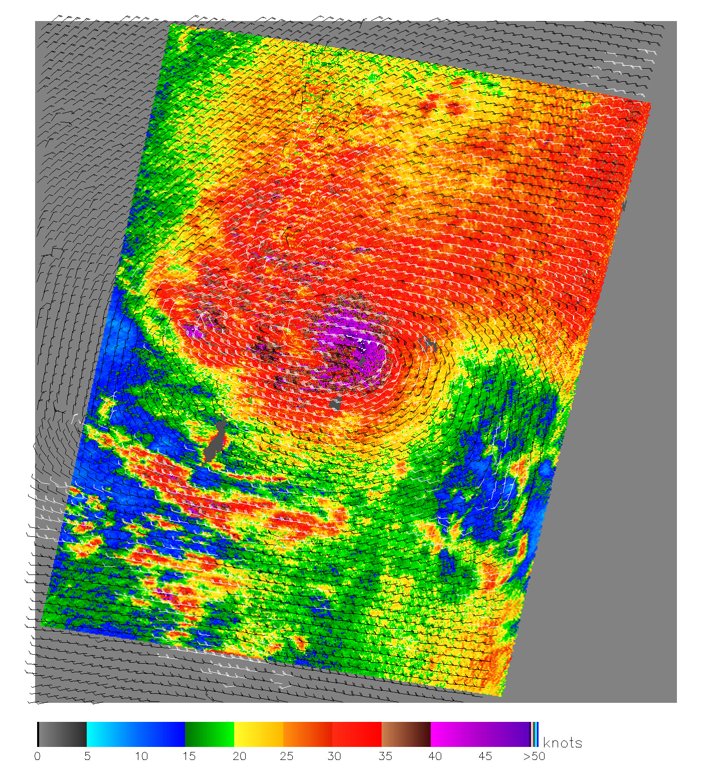
2004-12-09 |
Earth
|
QuikScat
|
SeaWinds Scatterometer
|
1414x1540x3 |
|
-
PIA07100:
-
Typhoon Nanmadol
Full Resolution:
TIFF
(6.539 MB)
JPEG
(1.741 MB)
|
|
|
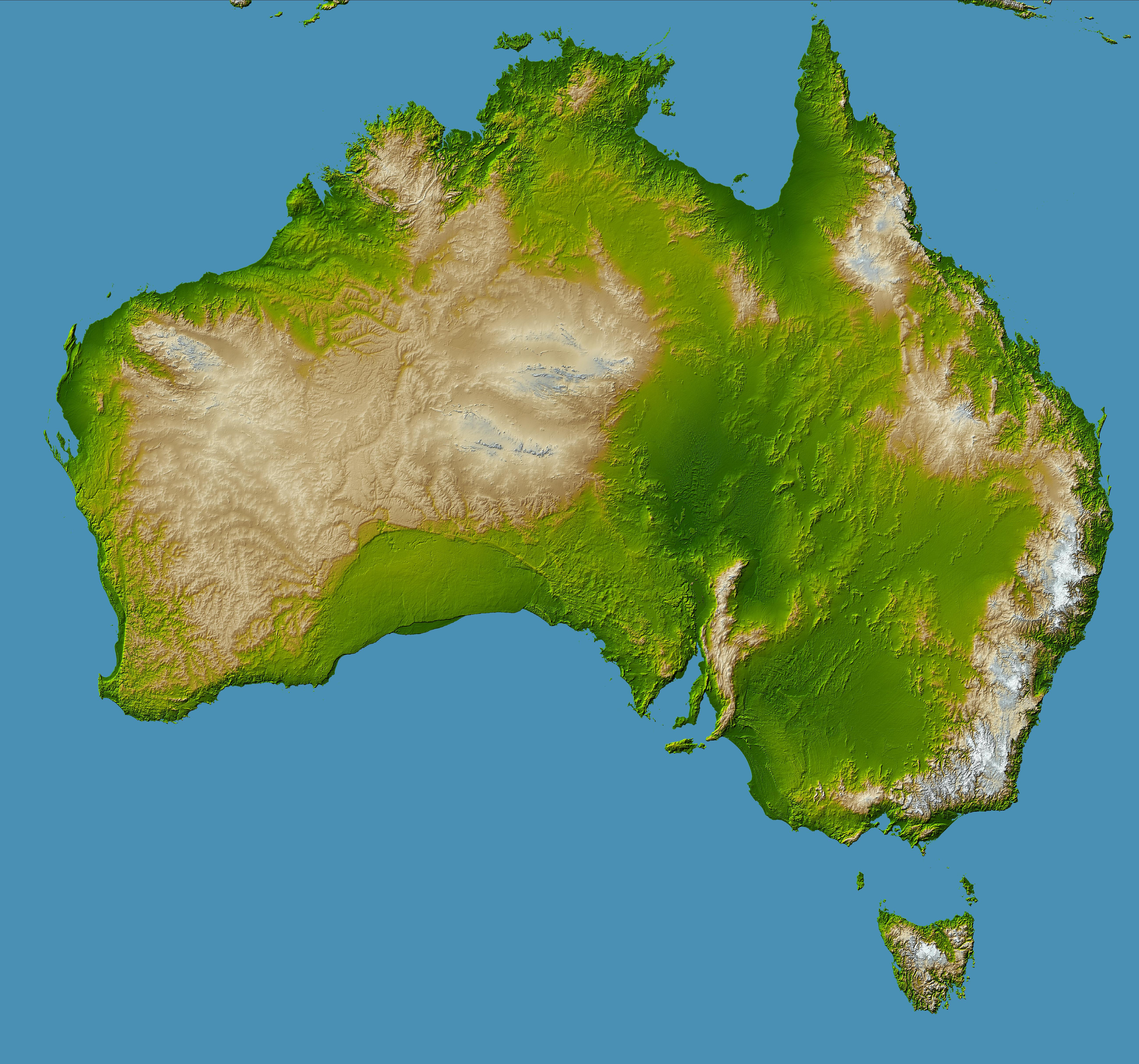
2004-12-09 |
Earth
|
Shuttle Radar Topography Mission (SRTM)
|
C-Band Radar
X-Band Radar
|
5200x4858x3 |

|
-
PIA06665:
-
Australia, Shaded Relief and Colored Height
Full Resolution:
TIFF
(38.46 MB)
JPEG
(3.481 MB)
|
|
|
2004-12-09 |
|
Spitzer Space Telescope
|
|
1386x956x3 |
|
-
PIA07098:
-
Is There Anybody Home?
Full Resolution:
TIFF
(1.3 MB)
JPEG
(126 kB)
|
|
|
2004-12-08 |
Iapetus
|
Cassini-Huygens
|
ISS - Narrow Angle
|
1440x1000x3 |
|
-
PIA06145:
-
Waning Iapetus
Full Resolution:
TIFF
(1.156 MB)
JPEG
(110.6 kB)
|
|
|
2004-11-29 |
Mars
|
Mars Global Surveyor (MGS)
|
Mars Orbiter Camera (MOC)
|
609x913x1 |
|
-
PIA07094:
-
Bouldery Impact Ejecta
Full Resolution:
TIFF
(542.6 kB)
JPEG
(88.69 kB)
|
|
|
2004-11-22 |
Rhea
|
Cassini-Huygens
|
ISS - Narrow Angle
|
909x907x1 |
|
-
PIA06525:
-
A Real Shiner
Full Resolution:
TIFF
(124.9 kB)
JPEG
(17.19 kB)
|
|
|
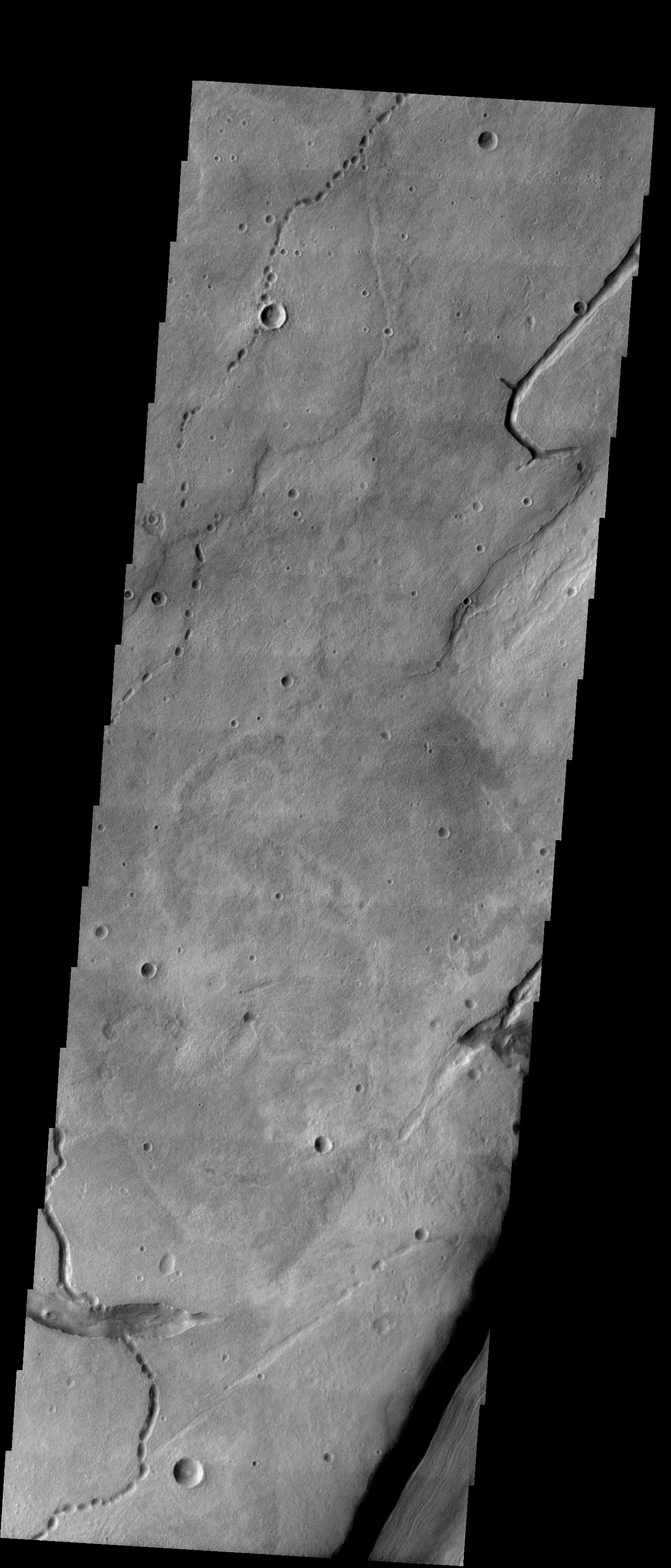
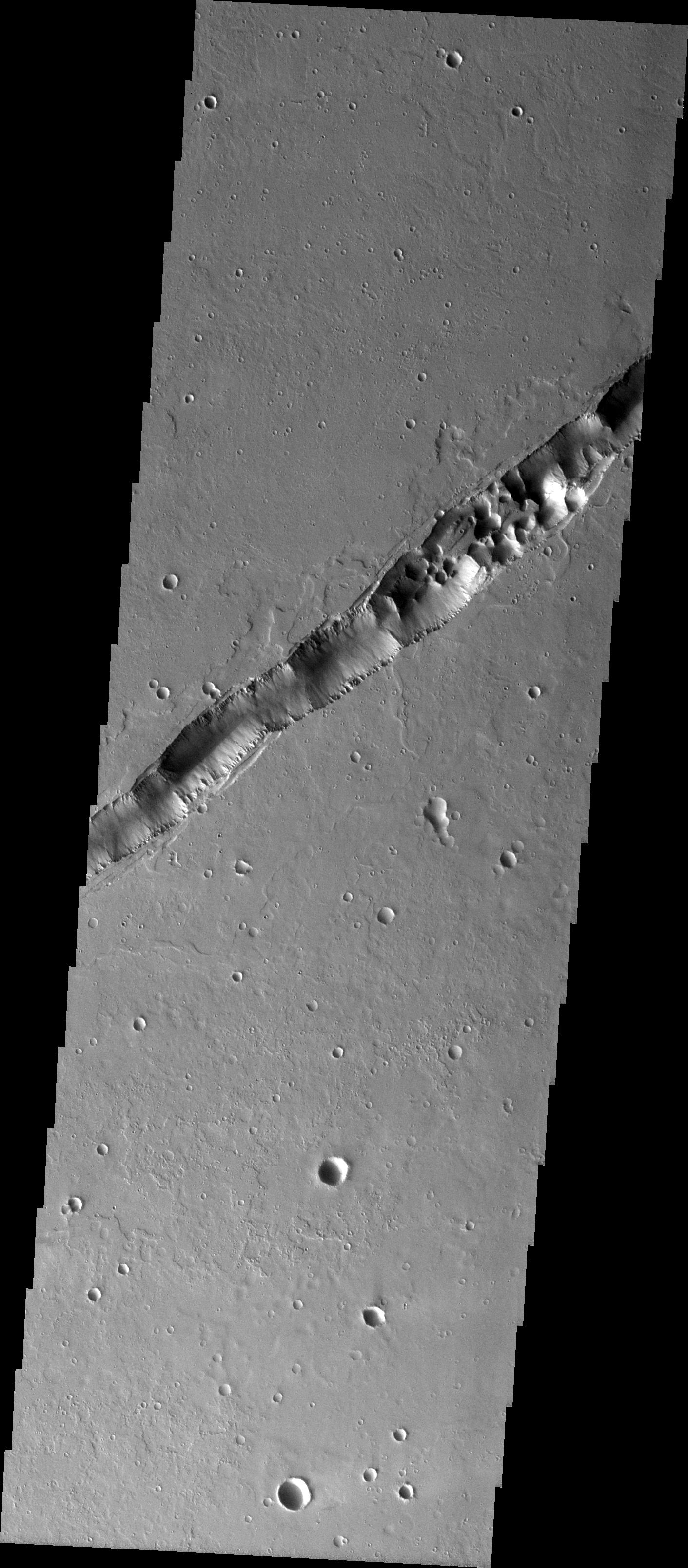
2004-11-19 |
Mars
|
2001 Mars Odyssey
|
THEMIS
|
1489x2909x1 |
|
-
PIA07070:
-
Tractus Catena Collapse Pits
Full Resolution:
TIFF
(2.608 MB)
JPEG
(246.9 kB)
|
|
|
2004-11-19 |
Mimas
|
Cassini-Huygens
|
ISS - Narrow Angle
|
889x768x1 |
|
-
PIA06524:
-
Dwarfed by Storms
Full Resolution:
TIFF
(452.8 kB)
JPEG
(26.85 kB)
|
|
|
2004-11-18 |
Mars
|
2001 Mars Odyssey
|
THEMIS
|
320x1088x1 |

|
-
PIA07069:
-
Alba Patera Collapse Pits
Full Resolution:
TIFF
(327.7 kB)
JPEG
(37.59 kB)
|
|
|
2004-11-17 |
Mars
|
Mars Exploration Rover (MER)
|
Navigation Camera
|
1024x1024x1 |
|
-
PIA07059:
-
Clouds Over 'Endurance'
Full Resolution:
TIFF
(457.6 kB)
JPEG
(20.44 kB)
|
|
|
2004-11-17 |
Mars
|
Mars Exploration Rover (MER)
|
Navigation Camera
|
1024x1024x1 |
|
-
PIA07058:
-
Clouds Over Crater Rim
Full Resolution:
TIFF
(759.4 kB)
JPEG
(43.99 kB)
|
|
|
2004-11-17 |
Mars
|
2001 Mars Odyssey
|
THEMIS
|
320x1202x1 |

|
-
PIA07068:
-
Arsia Mons Collapse Pits in IR
Full Resolution:
TIFF
(385.3 kB)
JPEG
(59.07 kB)
|
|
|
2004-11-16 |
Earth
|
Jason-1
|
Altimeter
|
900x900x3 |
|
-
PIA05078:
-
El Nino: Pumping Up or Fizzling Out?
Full Resolution:
TIFF
(1.575 MB)
JPEG
(116.1 kB)
|
|
|
2004-11-16 |
Mars
|
2001 Mars Odyssey
|
THEMIS
|
320x1681x1 |

|
-
PIA07056:
-
Ascraeus Mons Collapse Pits
Full Resolution:
TIFF
(538.7 kB)
JPEG
(93.84 kB)
|
|
|
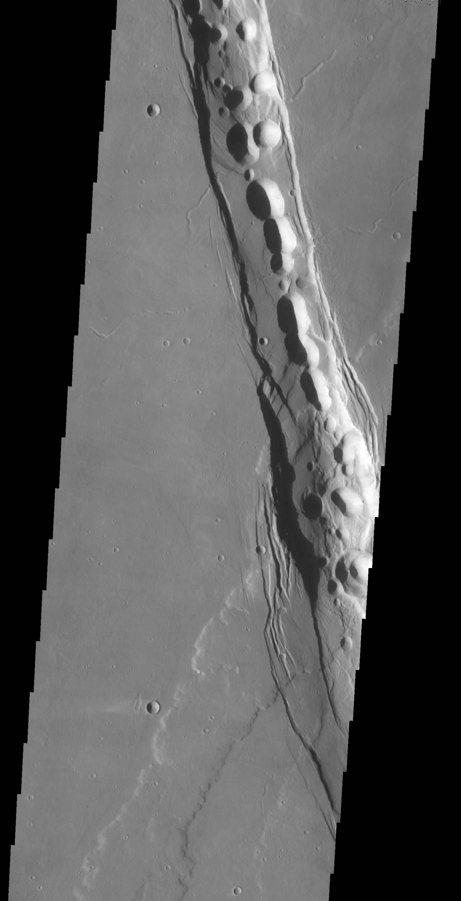
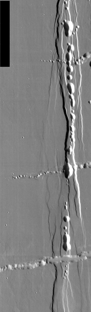
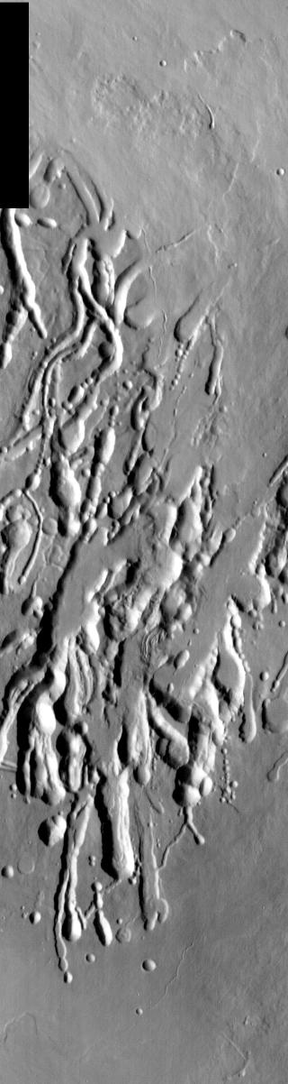
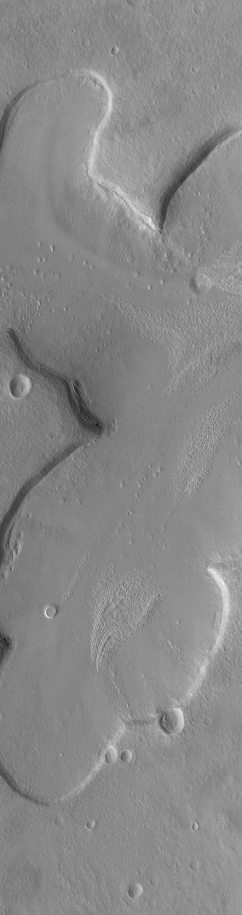
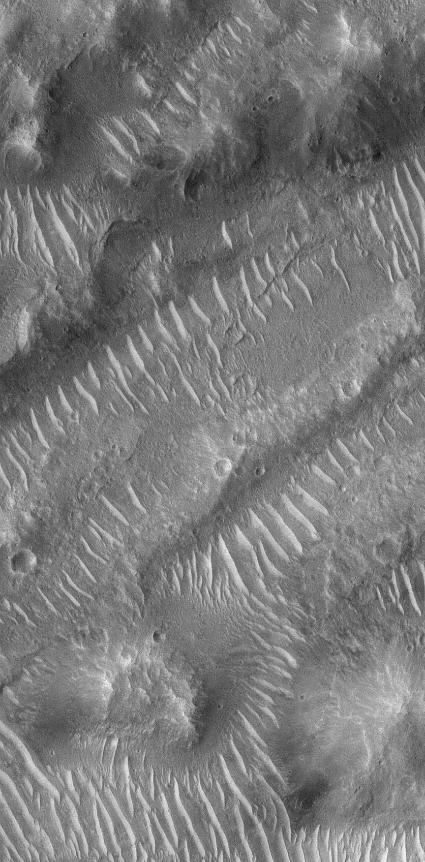
2004-11-15 |
Mars
|
2001 Mars Odyssey
|
THEMIS
|
1396x3264x1 |

|
-
PIA07055:
-
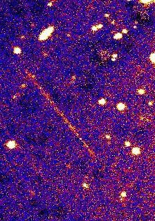
Lava Tube Collapse Pits
Full Resolution:
TIFF
(3.163 MB)
JPEG
(473.4 kB)
|
|
|
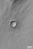
2004-11-12 |
Mars
|
2001 Mars Odyssey
|
THEMIS
|
395x713x1 |
|
-
PIA07054:
-
Alba Patera Collapse Pits
Full Resolution:
TIFF
(205.7 kB)
JPEG
(31.02 kB)
|
|
|
2004-11-11 |
Mars
|
2001 Mars Odyssey
|
THEMIS
|
1411x3218x1 |
|
-
PIA07053:
-
Tharsis Collapse Pits
Full Resolution:
TIFF
(3.27 MB)
JPEG
(482.2 kB)
|
|
|
2004-11-11 |
Mars
|
2001 Mars Odyssey
|
THEMIS
|
1403x3239x1 |
|
-
PIA07042:
-
Sulci Collapse Pits
Full Resolution:
TIFF
(2.49 MB)
JPEG
(173.6 kB)
|
|
|
2004-11-10 |
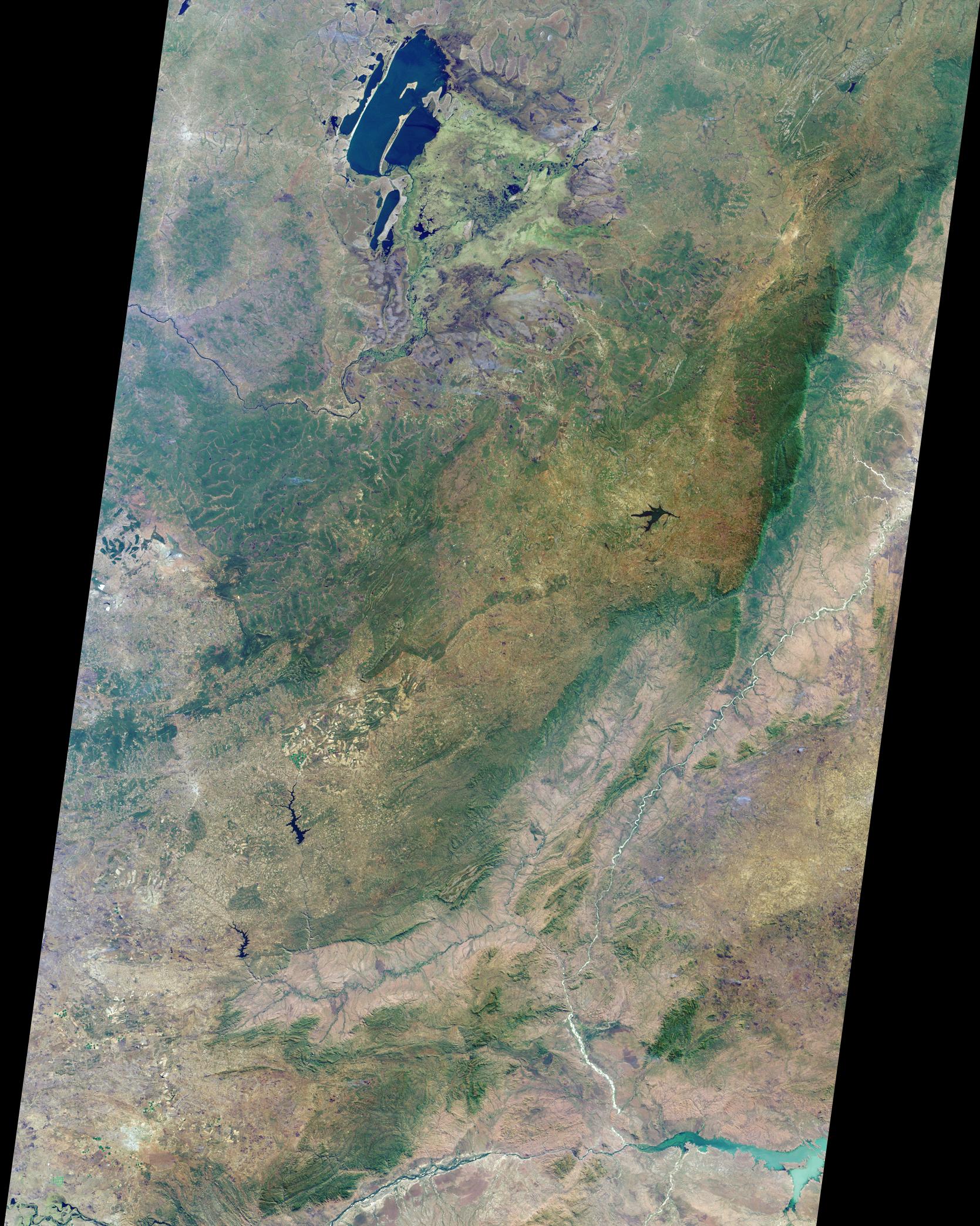
Earth
|
Terra
|
MISR
|
1723x1838x3 |
|
-
PIA04371:
-
Floodwaters Renew Zambia's Kafue Wetland
Full Resolution:
TIFF
(8.518 MB)
JPEG
(716.8 kB)
|
|
|
2004-11-09 |
Mars
|
2001 Mars Odyssey
|
THEMIS
|
1402x3221x1 |
|
-
PIA07038:
-
Sulci Collapse Pits
Full Resolution:
TIFF
(3.332 MB)
JPEG
(341.1 kB)
|
|
|
2004-11-08 |
Mars
|
2001 Mars Odyssey
|
THEMIS
|
1394x3251x1 |
|
-
PIA07037:
-
Collapse Pits in Bernard Crater
Full Resolution:
TIFF
(3.15 MB)
JPEG
(410.7 kB)
|
|
|
2004-11-05 |
Saturn
|
Cassini-Huygens
|
ISS - Narrow Angle
|
548x511x1 |
|
-
PIA06514:
-
Shredding a Cloud
Full Resolution:
TIFF
(214.5 kB)
JPEG
(11.32 kB)
|
|
|
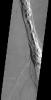
2004-11-01 |
Titan
|
Cassini-Huygens
|
ISS - Narrow Angle
|
884x904x1 |

|
-
PIA06510:
-
Titan's Polar Streak
Full Resolution:
TIFF
(102.3 kB)
JPEG
(12.48 kB)
|
|
|
2004-10-30 |
Mars
|
Mars Global Surveyor (MGS)
|
Mars Orbiter Camera (MOC)
|
836x3161x1 |
|
-
PIA06976:
-
Fretted Terrain Valleys
Full Resolution:
TIFF
(2.646 MB)
JPEG
(450.1 kB)
|
|
|
2004-10-29 |
Mars
|
2001 Mars Odyssey
|
THEMIS
|
535x1242x1 |

|
-
PIA07013:
-
North Polar Cap
Full Resolution:
TIFF
(580.3 kB)
JPEG
(43.12 kB)
|
|
|
2004-10-29 |
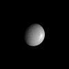
Mimas
|
Cassini-Huygens
|
ISS - Narrow Angle
|
838x628x1 |

|
-
PIA06509:
-
Influence of Mimas
Full Resolution:
TIFF
(107.4 kB)
JPEG
(15.28 kB)
|
|
|
2004-10-28 |
Titan
|
Cassini-Huygens
|
Radar Mapper
|
720x540x1 |
|
-
PIA06989:
-
Topography on Titan
Full Resolution:
TIFF
(154.4 kB)
JPEG
(39.7 kB)
|
|
|
2004-10-28 |
Mars
|
2001 Mars Odyssey
|
THEMIS
|
535x1309x1 |
|
-
PIA07012:
-
North Polar Cap
Full Resolution:
TIFF
(628.8 kB)
JPEG
(49.58 kB)
|
|
|
2004-10-27 |
Earth
|
Terra
|
MISR
|
1669x2088x3 |
|
-
PIA04370:
-
Where on Earth...? MISR Mystery Image Quiz # 20:
Zambia, the Democratic Republic of the Congo, Mozambique, and Zimbabwe
Full Resolution:
TIFF
(7.715 MB)
JPEG
(668.9 kB)
|
|
|
2004-10-27 |
Mars
|
2001 Mars Odyssey
|
THEMIS
|
553x1310x1 |
|
-
PIA07011:
-
North Polar Cap
Full Resolution:
TIFF
(679.9 kB)
JPEG
(48.02 kB)
|
|
|
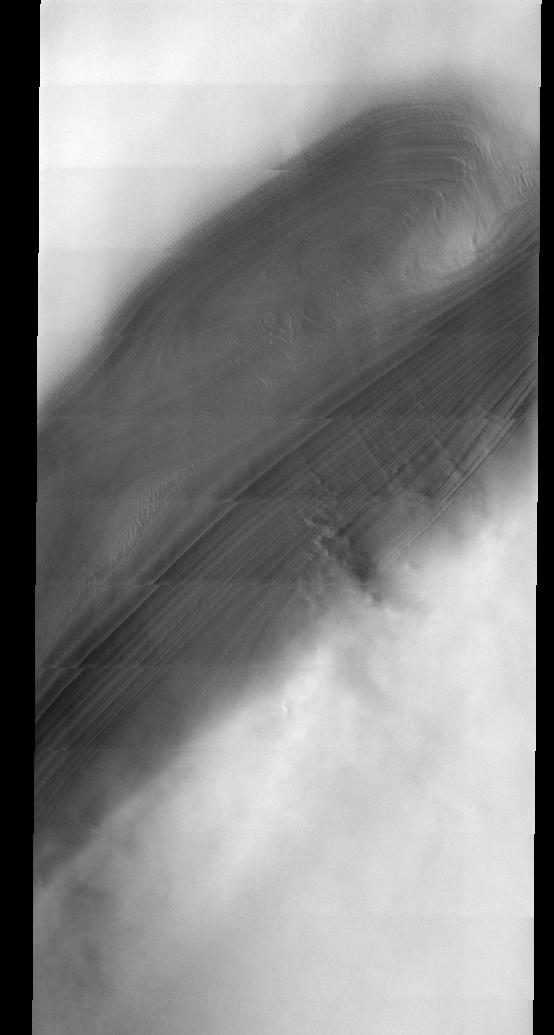
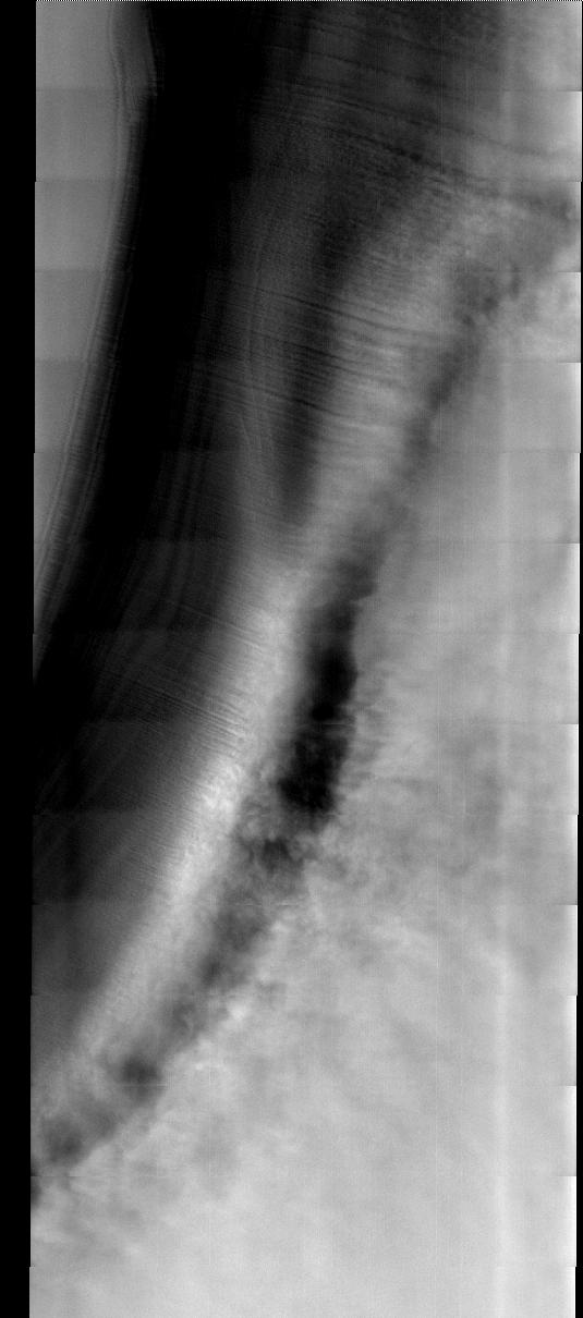
2004-10-27 |
Titan
|
Cassini-Huygens
|
Composite Infrared Spectrometer
Imaging Science Subsystem
Ultraviolet Imaging Spectrograph
Visual and Infrared Spectrometer
|
485x320x837 |
|
-
PIA06119:
-
Titan Flyby Animation
Full Resolution:
|
|
|
2004-10-27 |
Titan
|
Cassini-Huygens
|
Imaging Science Subsystem
|
3161x1078x1 |

|
-
PIA06125:
-
Revealing Titan's Surface
Full Resolution:
TIFF
(2.466 MB)
JPEG
(225.3 kB)
|
|
|
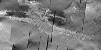
2004-10-26 |
Titan
|
Cassini-Huygens
|
ISS - Narrow Angle
|
1024x1024x1 |

|
-
PIA06107:
-
Eyes on Xanadu
Full Resolution:
TIFF
(618.2 kB)
JPEG
(36.32 kB)
|
|
|
2004-10-26 |
Mars
|
2001 Mars Odyssey
|
THEMIS
|
554x1035x1 |

|
-
PIA07010:
-
North Polar Cap
Full Resolution:
TIFF
(531.9 kB)
JPEG
(37.72 kB)
|
|
|
2004-10-25 |
Mars
|
2001 Mars Odyssey
|
THEMIS
|
535x1210x1 |

|
-
PIA06969:
-
North Polar Cap
Full Resolution:
TIFF
(619.5 kB)
JPEG
(58.43 kB)
|
|
|
2004-10-21 |
Saturn
|
Cassini-Huygens
|
ISS - Narrow Angle
|
483x325x1 |

|
-
PIA06503:
-
South Pole in Ultraviolet
Full Resolution:
TIFF
(99.4 kB)
JPEG
(5.868 kB)
|
|
|
2004-10-12 |
|
Spitzer Space Telescope
|
IRAC
|
602x602x3 |
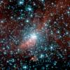
|
-
PIA06928:
-
Spitzer Digs Up Galactic Fossil
Full Resolution:
TIFF
(1.089 MB)
JPEG
(63.25 kB)
|
|
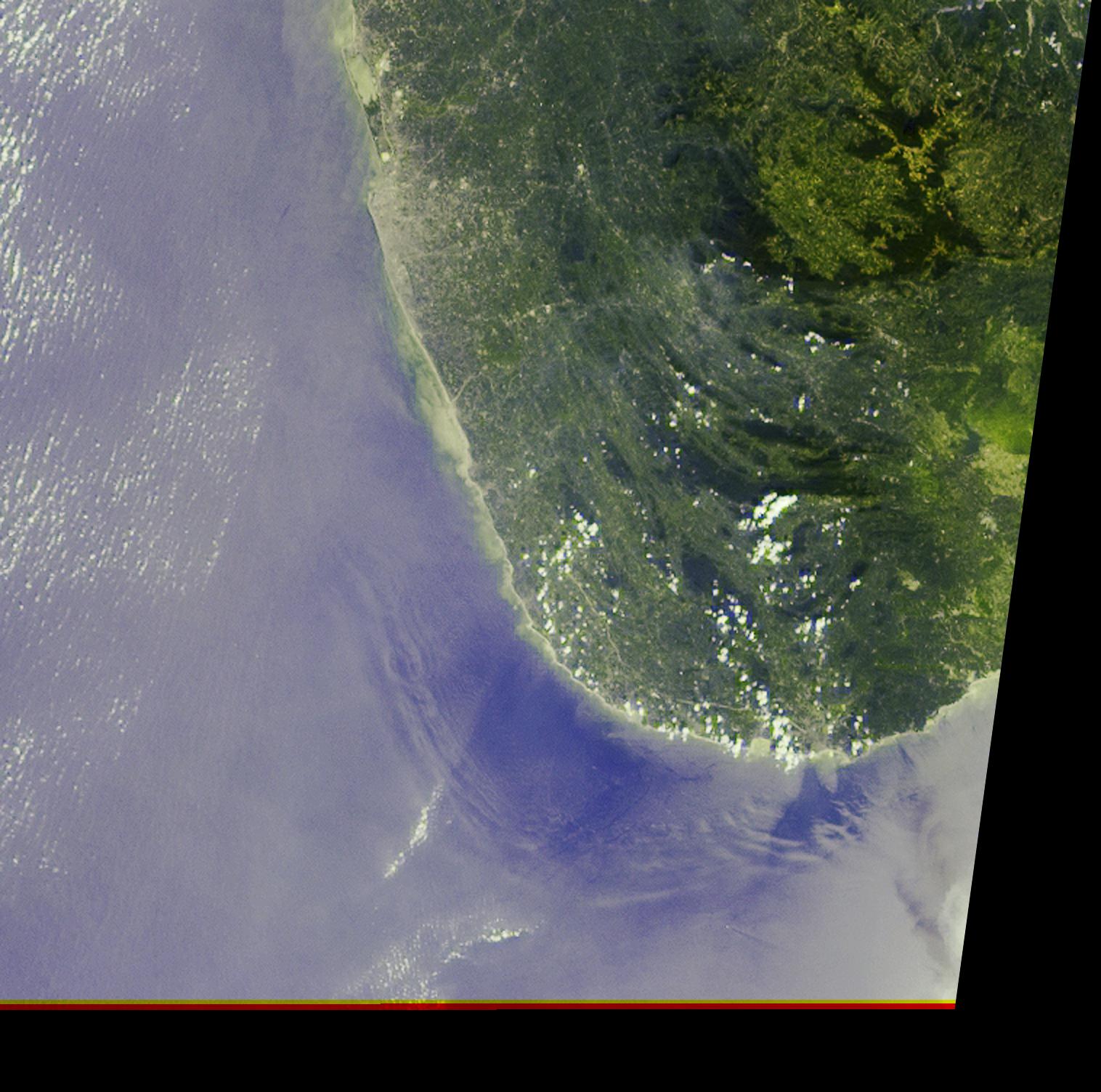
|
2004-10-11 |
Earth
|
Terra
|
ASTER
|
2771x3000x3 |
|
-
PIA12070:
-
Alluvial Fan, China
Full Resolution:
TIFF
(24.94 MB)
JPEG
(1.935 MB)
|
|
|
2004-10-08 |
Mars
|
2001 Mars Odyssey
|
THEMIS
|
7905x3953x1 |
|
-
PIA06926:
-
Valles Marineris Mosaic
Full Resolution:
TIFF
(31.28 MB)
JPEG
(6.256 MB)
|
|
|
2004-10-08 |
Mars
|
Mars Global Surveyor (MGS)
|
Mars Orbiter Camera (MOC)
|
836x1696x1 |

|
-
PIA06925:
-
Bedforms in Maja Valles
Full Resolution:
TIFF
(1.42 MB)
JPEG
(287.8 kB)
|
|
|
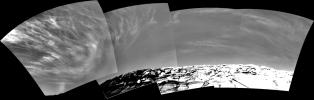
2004-10-07 |
Mars
|
Mars Exploration Rover (MER)
|
Panoramic Camera
|
22348x4487x3 |
|
-
PIA06917:
'Cahokia' Panorama
Full Resolution:
TIFF
(183.7 MB)
JPEG
(8.79 MB)
QTVR
(9.678 MB)
|
|
|
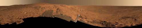
2004-10-07 |
Mars
|
2001 Mars Odyssey
|
THEMIS
|
1391x3237x1 |
|
-
PIA06924:
-
Candor Chasma
Full Resolution:
TIFF
(3.135 MB)
JPEG
(339 kB)
|
|
|
2004-10-06 |
Mars
|
2001 Mars Odyssey
|
|
1382x3226x1 |
|
-
PIA06911:
-
Candor Chasma
Full Resolution:
TIFF
(3.164 MB)
JPEG
(381.4 kB)
|
|
|
2004-10-05 |
Mars
|
2001 Mars Odyssey
|
THEMIS
|
1361x3061x1 |
|
-
PIA06906:
-
Layered Candor Chasma
Full Resolution:
TIFF
(2.791 MB)
JPEG
(283 kB)
|
|
|
2004-10-04 |
Mars
|
2001 Mars Odyssey
|
THEMIS
|
1349x3067x1 |
|
-
PIA06904:
-
Chaotic Candor Chasma
Full Resolution:
TIFF
(2.784 MB)
JPEG
(264.1 kB)
|
|
|
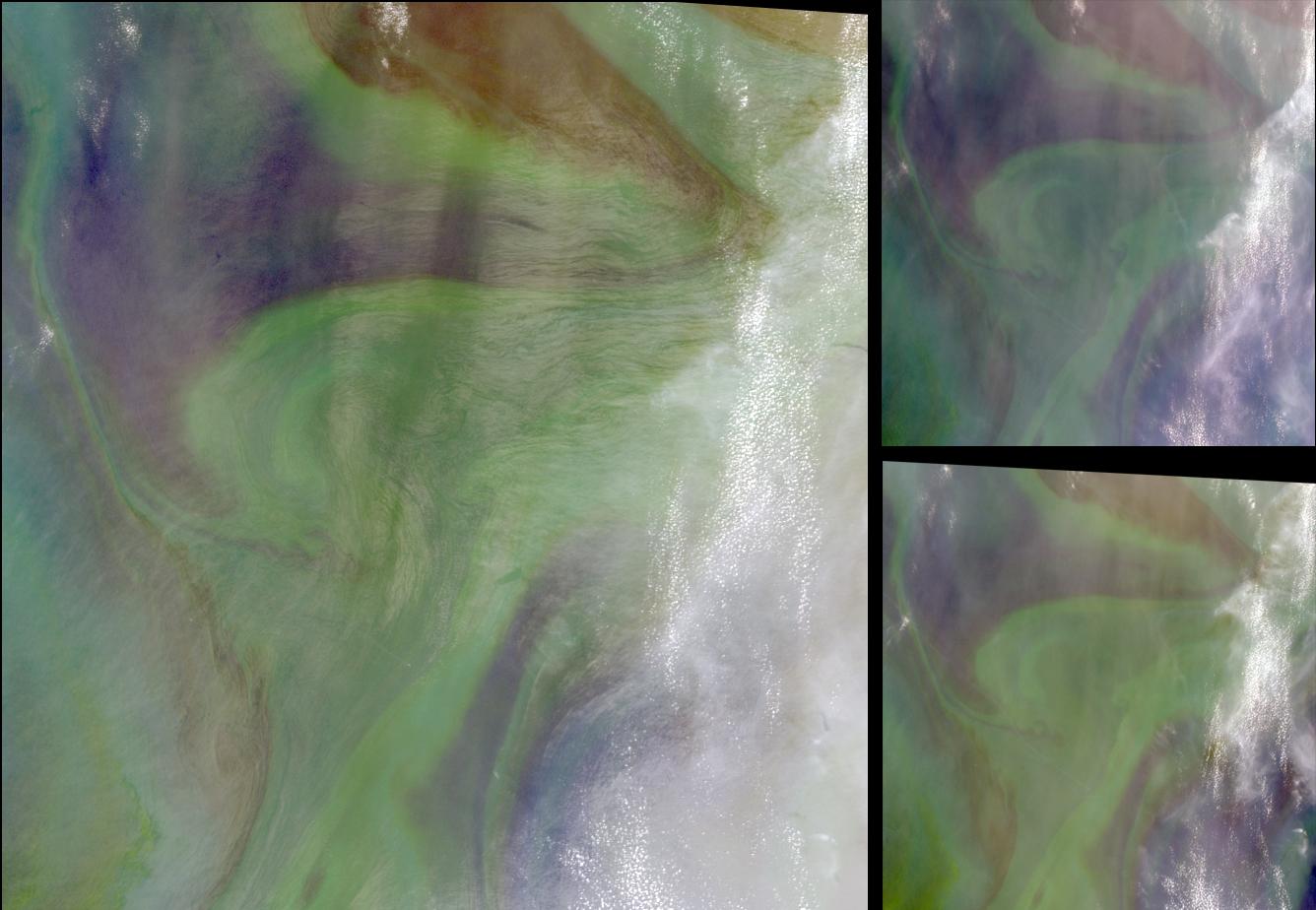
2004-10-02 |
Earth
|
Terra
|
MISR
|
1336x924x3 |

|
-
PIA04369:
-
Red Plankton in the Arabian Sea
Full Resolution:
TIFF
(3.416 MB)
JPEG
(118.9 kB)
|
 Planetary Data System


