My
List |
Addition Date
|
Target
|
Mission
|
Instrument
|
Size
|

|
2002-05-08 |
Earth
|
Terra
|
MISR
|
1532x1408x3 |
|
-
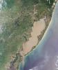
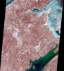
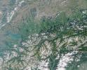
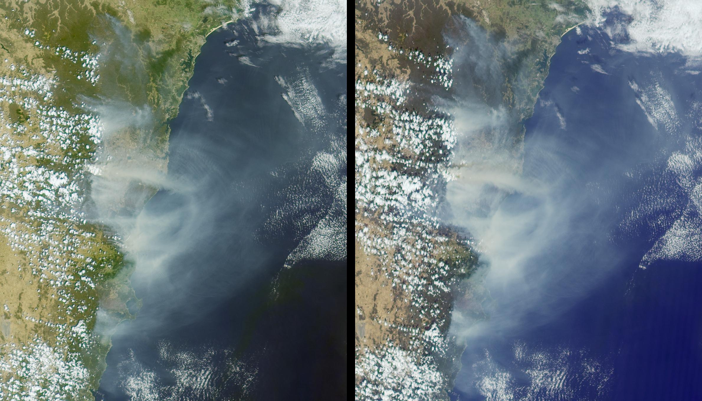
PIA03706:
-
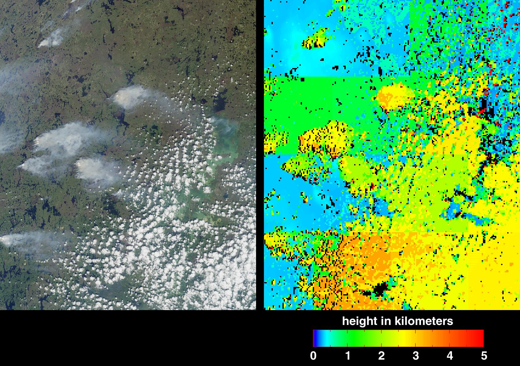
Smoke from Fires in Southern Mexico
Full Resolution:
TIFF
(3.367 MB)
JPEG
(189.6 kB)
|
|
|
2002-05-07 |
Earth
|
Terra
|
ASTER
|
1200x600x3 |
|
-
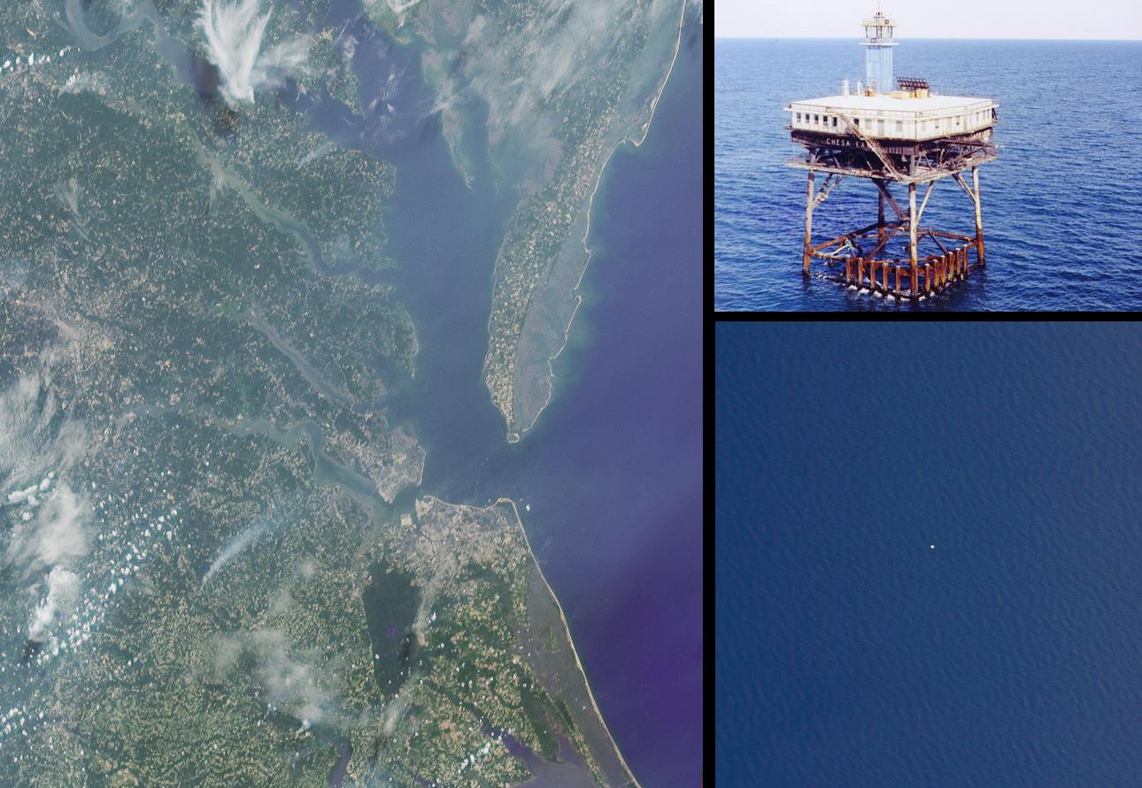
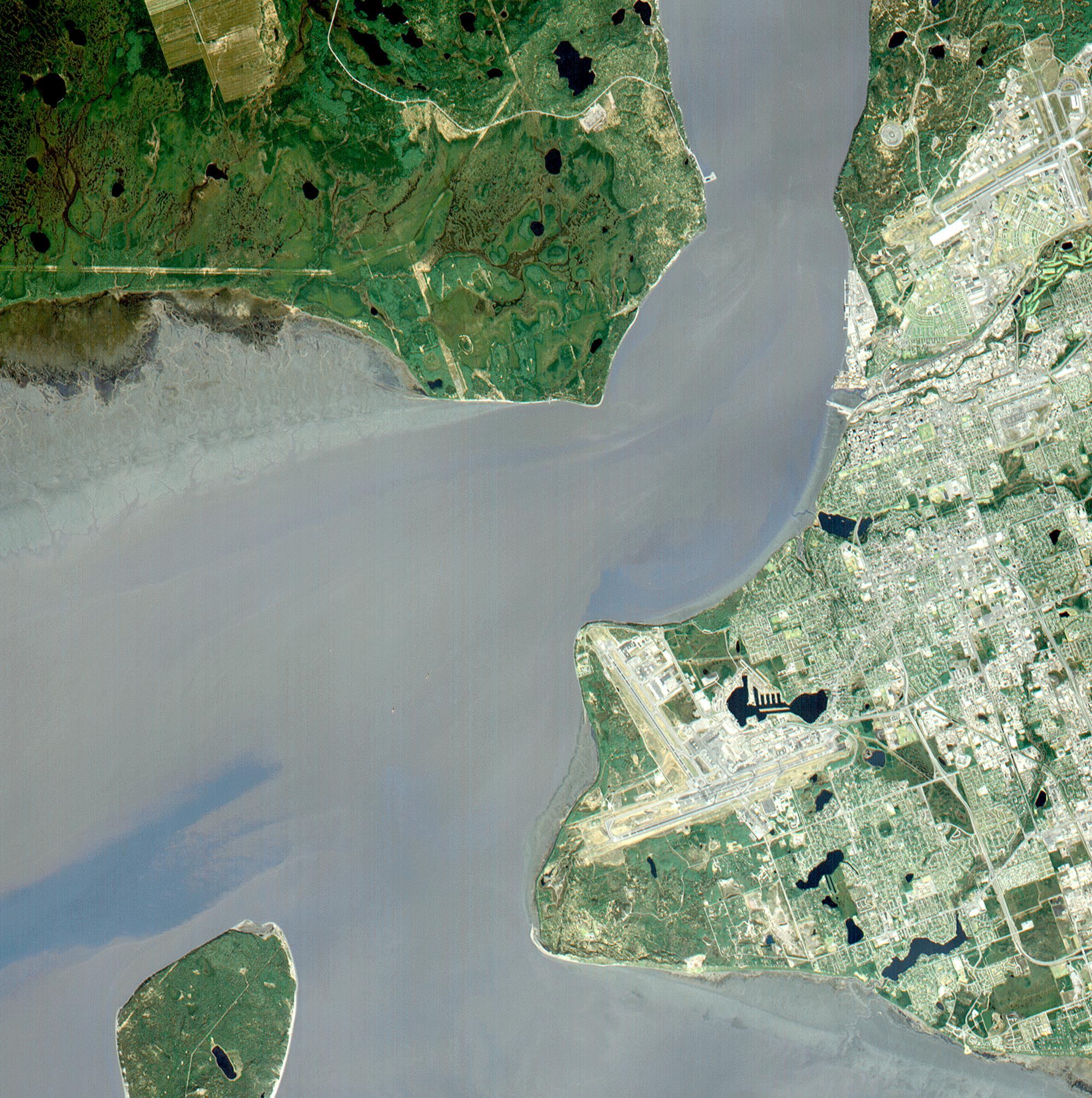
PIA03494:
-
La Plata, Maryland
Full Resolution:
TIFF
(3.1 MB)
JPEG
(253.9 kB)
|
|
|
2002-05-01 |
Earth
|
Terra
|
MISR
|
2060x1242x3 |

|
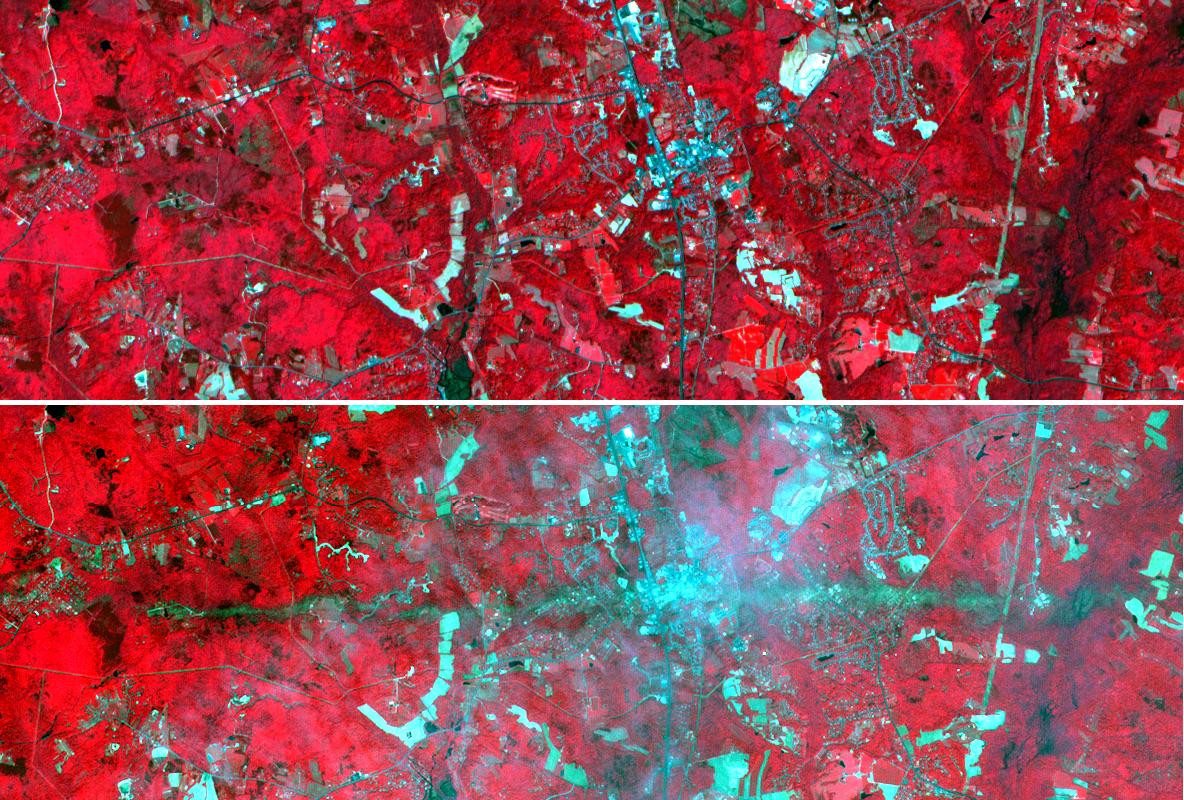
-
PIA03705:
-
Dust Obscures Liaoning Province, China
Full Resolution:
TIFF
(6.024 MB)
JPEG
(205.1 kB)
|
|
|
2002-04-24 |
Earth
|
Terra
|
MISR
|
1020x651x3 |

|
-
PIA03704:
-
Closed Small Cell Clouds in the South Pacific
Full Resolution:
TIFF
(694.7 kB)
JPEG
(123.1 kB)
|
|
|
2002-04-19 |
Earth
|
Terra
|
ASTER
|
1200x600x3 |
|
-
PIA03493:
-
Chiliques Volcano, Chile
Full Resolution:
TIFF
(1.548 MB)
JPEG
(103.7 kB)
|
|
|
2002-04-19 |
Earth
|
Terra
|
ASTER
|
1597x1082x3 |
|
-
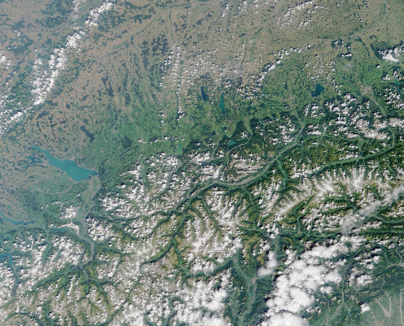
PIA03492:
-
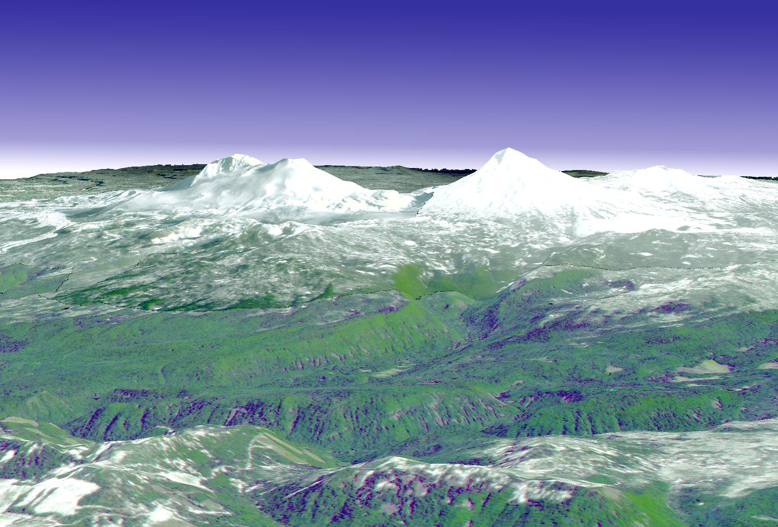
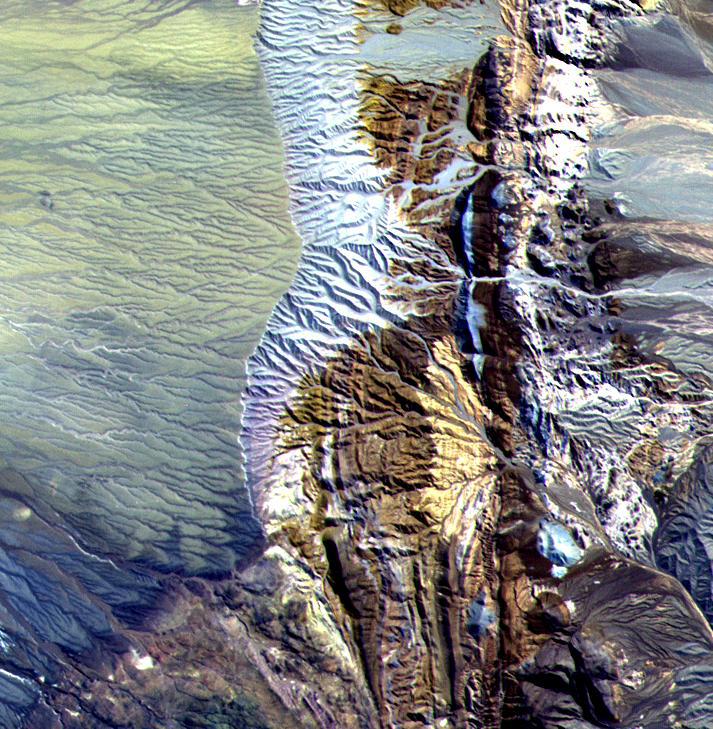
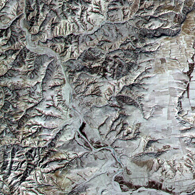
Cascade Mtns. Oregon
Full Resolution:
TIFF
(3.096 MB)
JPEG
(292.4 kB)
|
|
|
2002-04-17 |
Earth
|
Terra
|
MISR
|
1280x680x3 |
|
-
PIA03703:
-
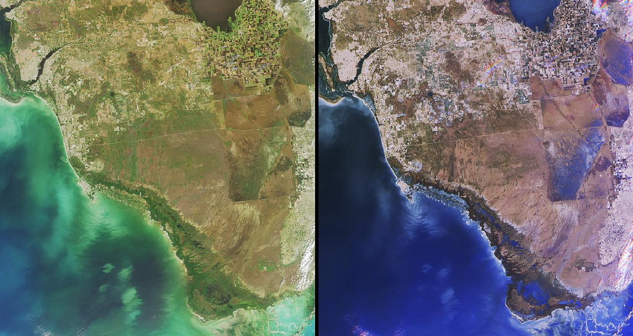
Southern Florida's River of Grass
Full Resolution:
TIFF
(3.176 MB)
JPEG
(208.8 kB)
|
|
|
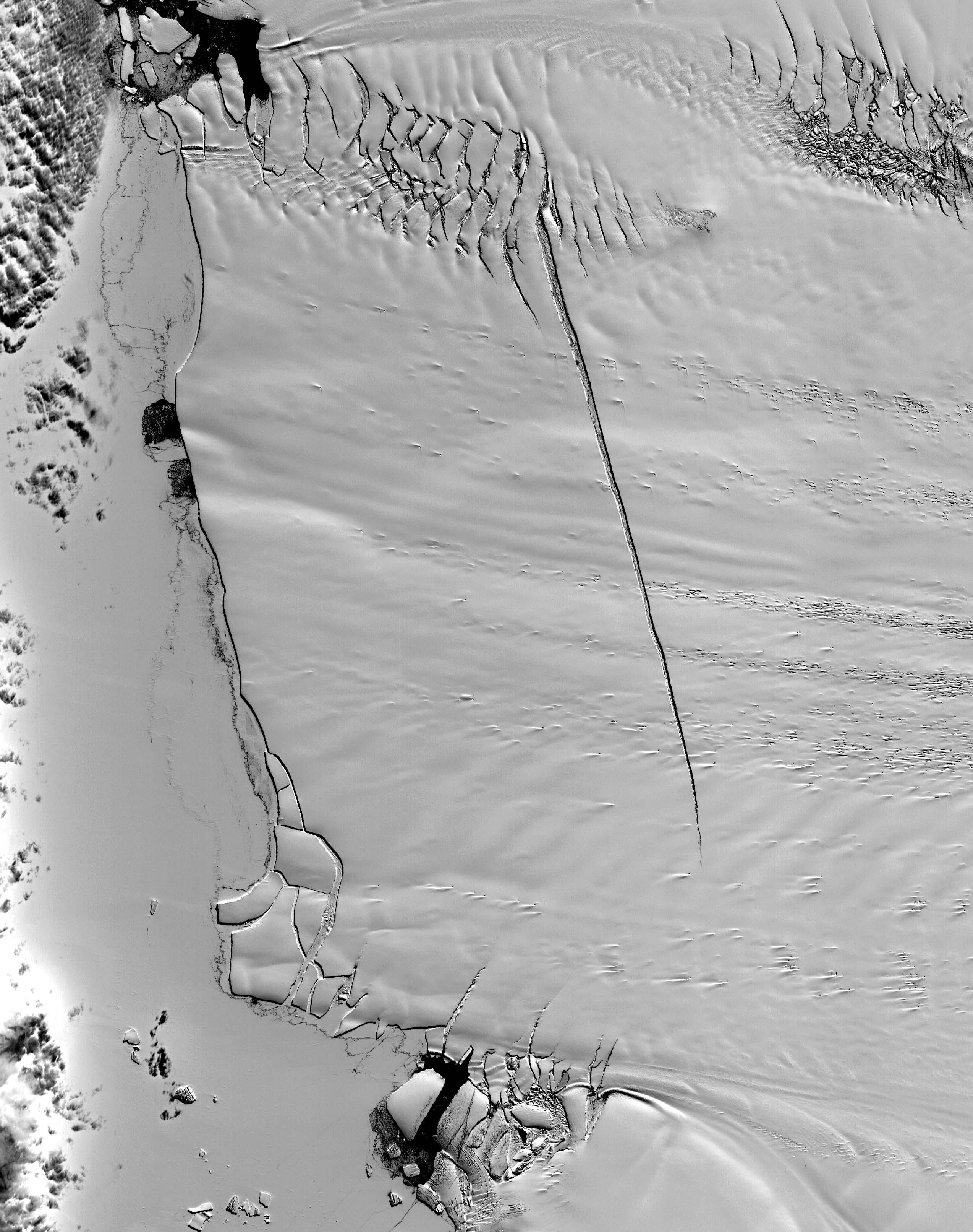
2002-04-10 |
Earth
|
Terra
|
MISR
|
1106x675x3 |
|
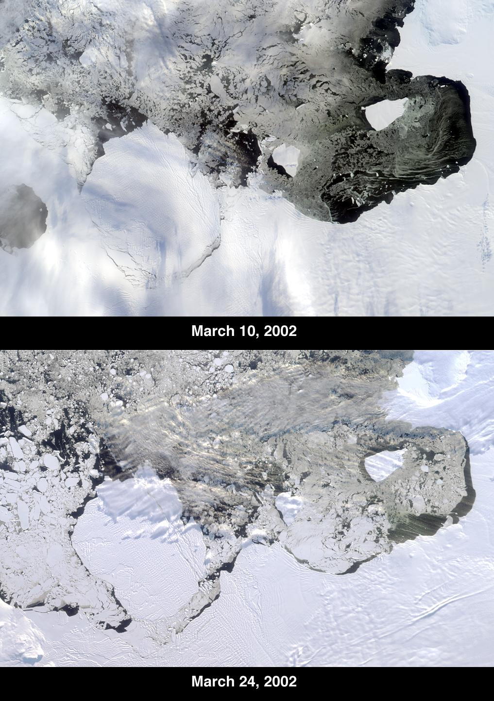
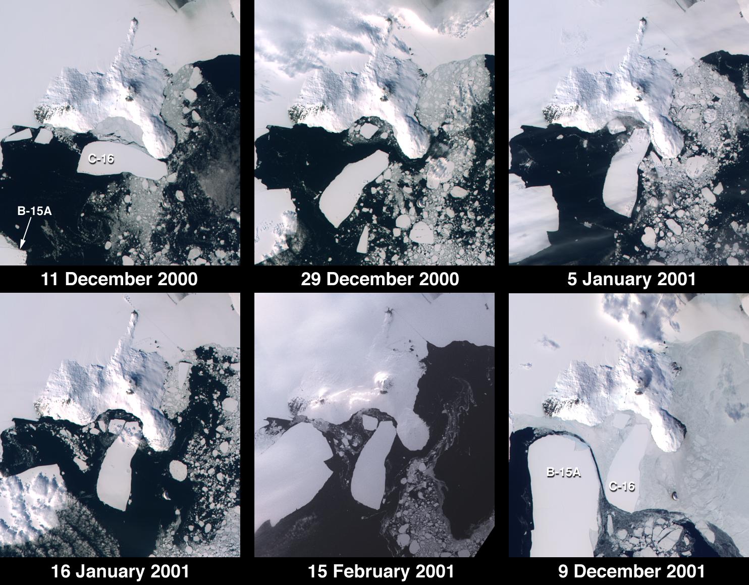
-
PIA03702:
-
Unique Views of a Shattered Ice Shelf
Full Resolution:
TIFF
(2.264 MB)
JPEG
(173.3 kB)
|
|
|
2002-04-03 |
Earth
|
Terra
|
ASTER
|
1100x1750x3 |
|
-
PIA03491:
-
New York State
Full Resolution:
TIFF
(3.654 MB)
JPEG
(519.1 kB)
|
|
|
2002-04-03 |
Earth
|
Terra
|
MISR
|
1152x1500x3 |
|
-
PIA03701:
-
Where on Earth...? MISR Mystery Image Quiz #7:
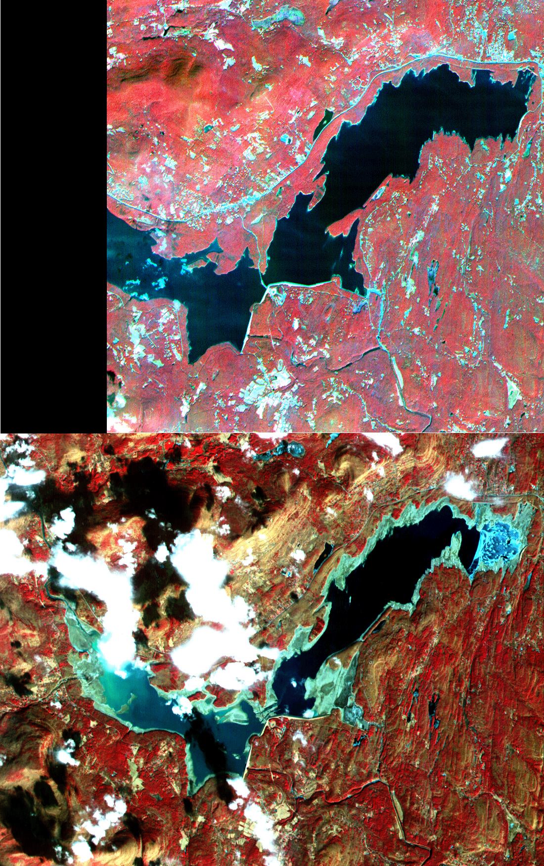
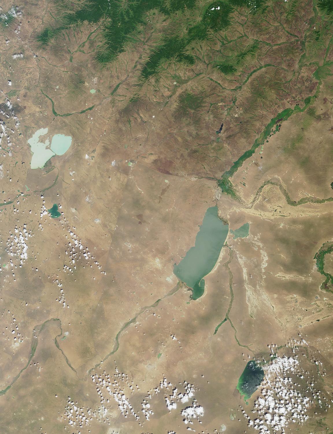
Torey Lakes, Central Asia
Full Resolution:
TIFF
(5.454 MB)
JPEG
(303.4 kB)
|
|
|
2002-03-27 |
Earth
|
Terra
|
MISR
|
1017x1444x3 |
|
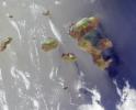
-
PIA03700:
-
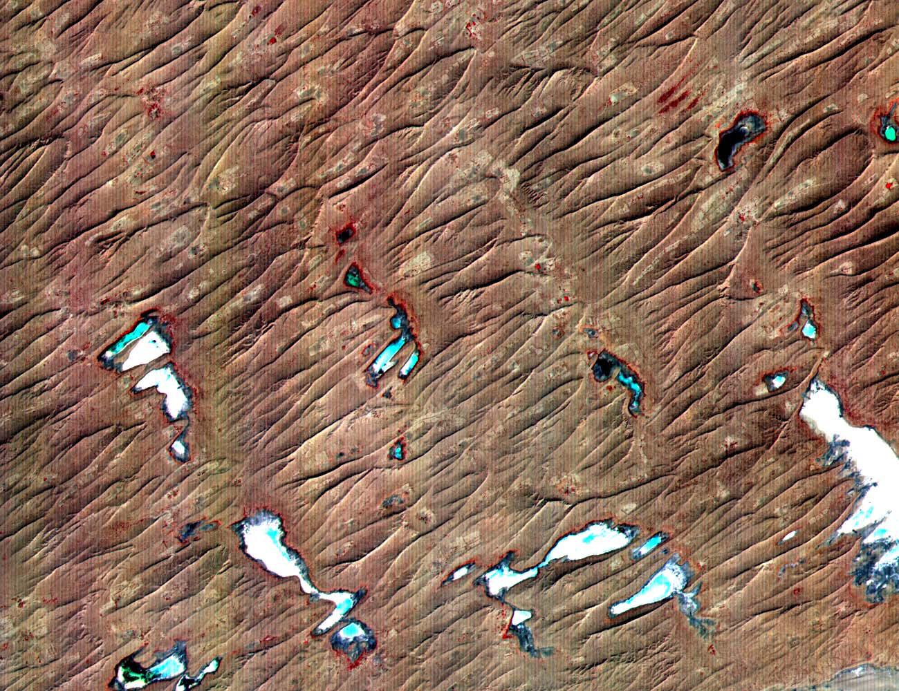
Icebergs Adrift in the Amundsen Sea
Full Resolution:
TIFF
(3.61 MB)
JPEG
(263.8 kB)
|
|
|
2002-03-20 |
Earth
|
Terra
|
MISR
|
1026x688x3 |
|
-
PIA03449:
-
Smoke over Sumatra, Indonesia
Full Resolution:
TIFF
(933.4 kB)
JPEG
(71.97 kB)
|
|
|
2002-03-13 |
Earth
|
Terra
|
MISR
|
1328x1229x3 |
|
-
PIA03448:
-
A Vortex Street in the Arctic
Full Resolution:
TIFF
(4.249 MB)
JPEG
(272 kB)
|
|
|
2002-03-12 |
Earth
|
Terra
|
ASTER
|
1208x797x3 |
|
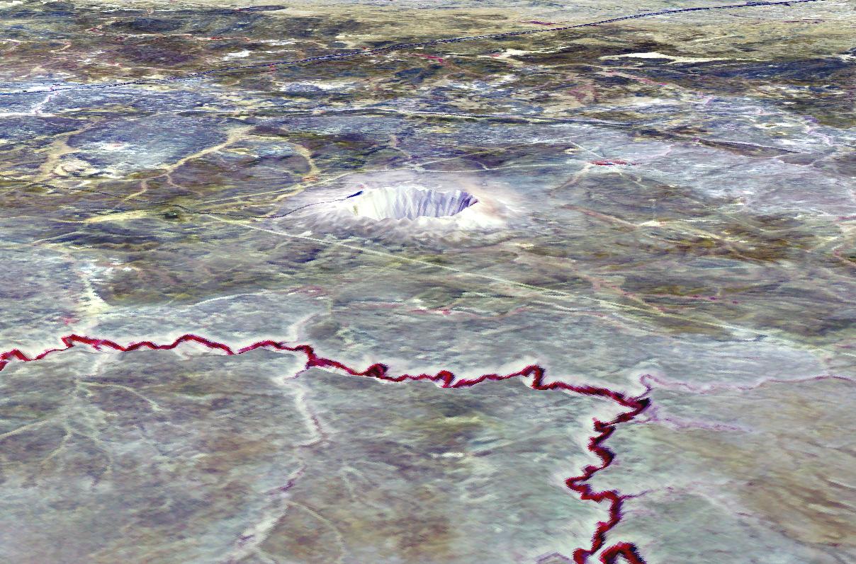
-
PIA03490:
-
Meteor Crater, AZ
Full Resolution:
TIFF
(2.53 MB)
JPEG
(218 kB)
|
|
|
2002-03-06 |
Earth
|
Terra
|
MISR
|
1500x1282x3 |
|
-
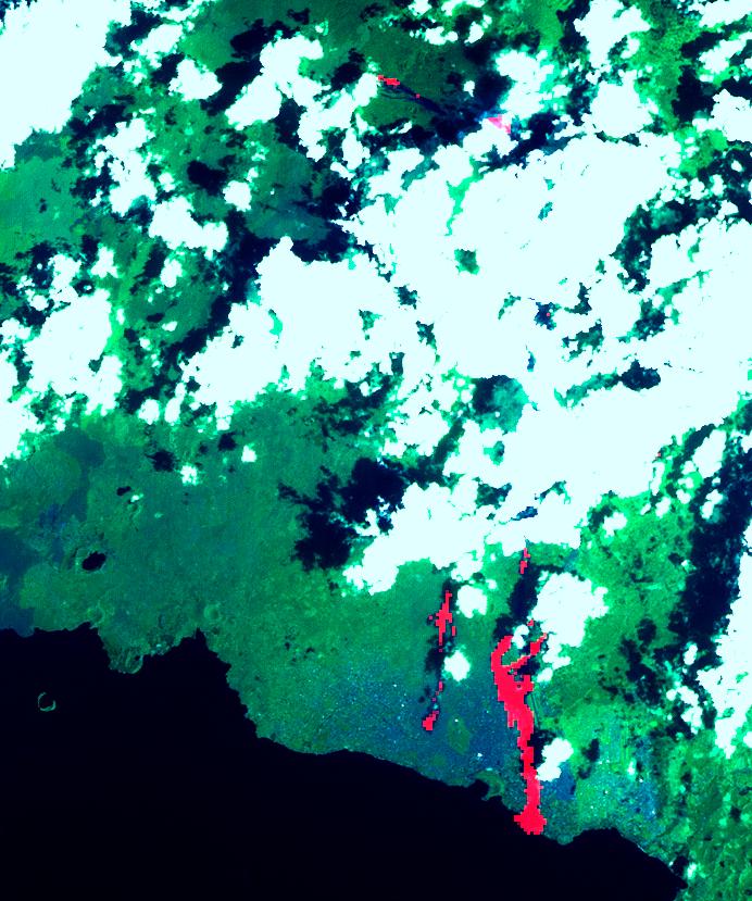
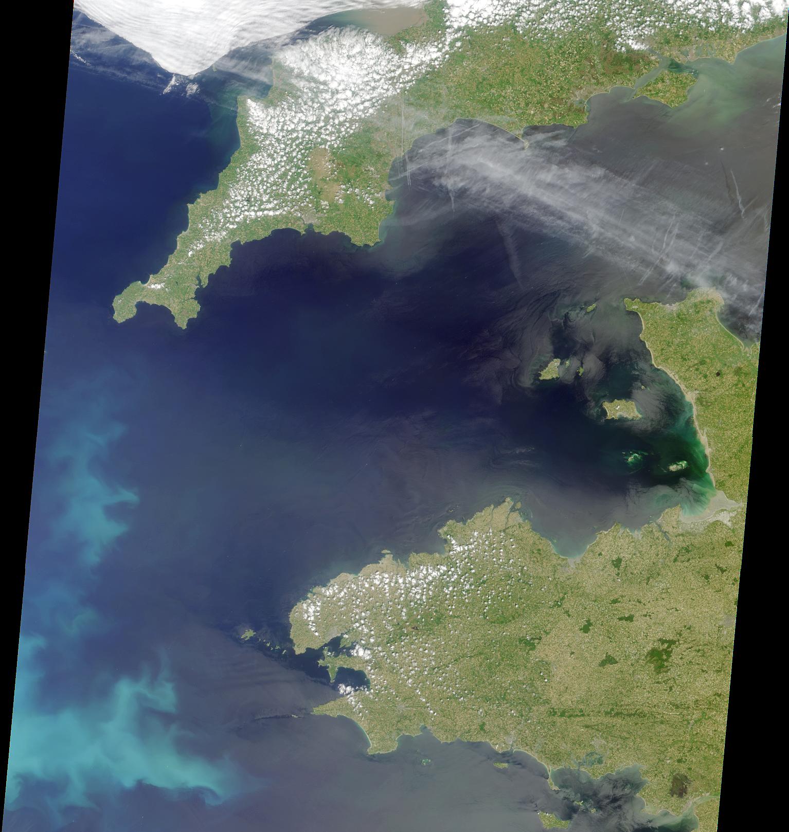
PIA03447:
-
Red Tide Strands South African Rock Lobsters
Full Resolution:
TIFF
(5.909 MB)
JPEG
(242.3 kB)
|
|
|
2002-02-27 |
Earth
|
Terra
|
MISR
|
2034x1128x3 |
|
-
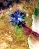
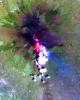
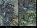
PIA03446:
-
Southern Québec in Late Winter
Full Resolution:
TIFF
(8.161 MB)
JPEG
(741.2 kB)
|
|
|
2002-02-26 |
Earth
|
Terra
|
ASTER
|
1650x1800x3 |
|
-
PIA03475:
-
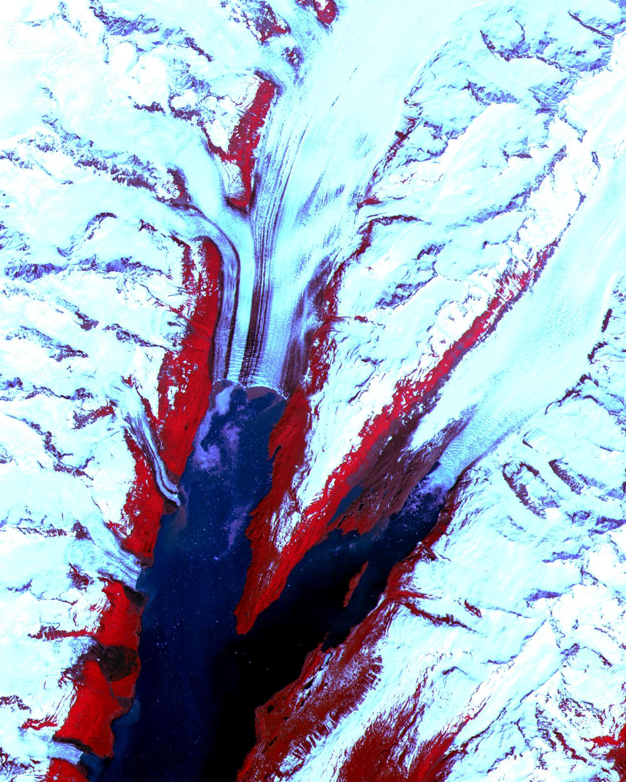
Malaspina Glacier, Alaska
Full Resolution:
TIFF
(7.824 MB)
JPEG
(547.8 kB)
|
|
|
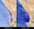
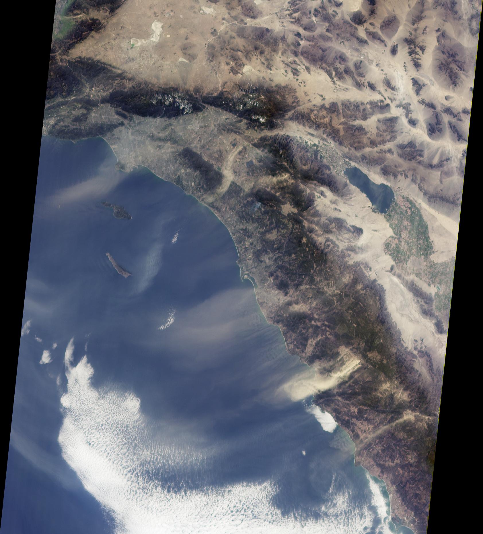
2002-02-20 |
Earth
|
Terra
|
MISR
|
1684x1860x3 |
|
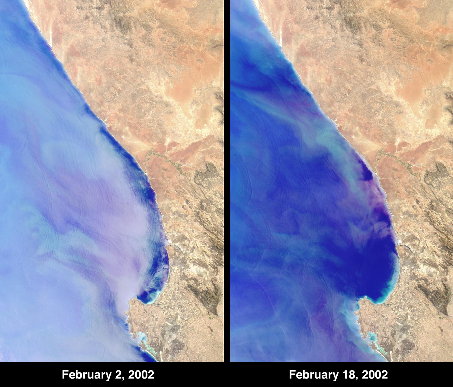
-
PIA03445:
-
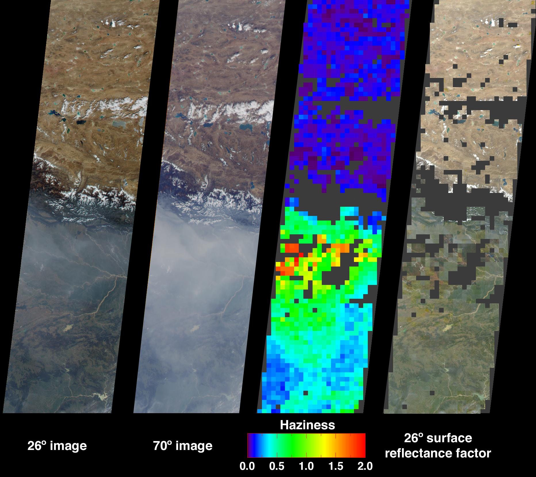
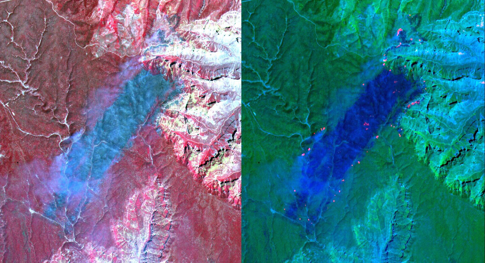
Dusty Skies over Southern California
Full Resolution:
TIFF
(8.033 MB)
JPEG
(328.7 kB)
|
|
|
2002-02-13 |
Earth
|
Terra
|
MISR
|
1084x1300x3 |
|
-
PIA03444:
-
Where on Earth...? MISR Mystery Image Quiz #6:
Lagoa dos Patos
Full Resolution:
TIFF
(3.34 MB)
JPEG
(280.3 kB)
|
|
|
2002-02-07 |
Earth
|
Terra
|
ASTER
|
1500x1137x3 |
|
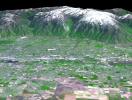
-
PIA03466:
-
Salt Lake City, Utah, Perspective View
Full Resolution:
TIFF
(5.424 MB)
JPEG
(418.7 kB)
|
|
|
2002-02-07 |
Earth
|
Terra
|
ASTER
|
4100x8221x3 |
|
-
PIA03465:
-
Salt Lake City, Utah, Winter 2001
Full Resolution:
TIFF
(97.99 MB)
JPEG
(8.545 MB)
|
|
|
2002-02-07 |
Earth
|
Terra
|
ASTER
|
4100x8220x3 |
|
-
PIA03464:
-
Salt Lake City, Utah
Full Resolution:
TIFF
(103.2 MB)
JPEG
(6.455 MB)
|
|
|
2002-02-06 |
Earth
|
Terra
|
MISR
|
1500x1778x3 |
|
-
PIA03443:
-
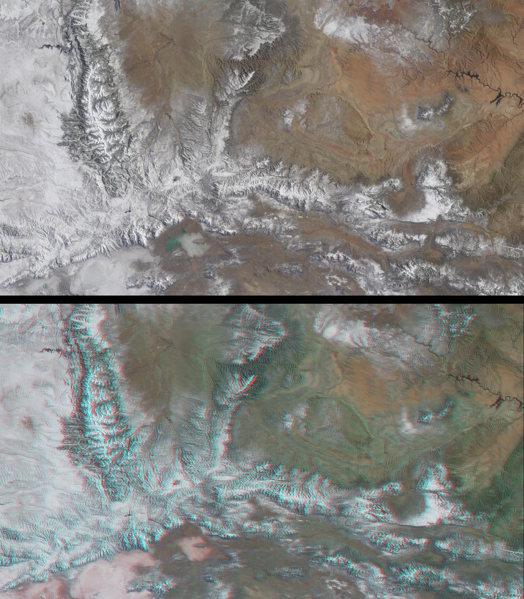
Western United States beyond the Four Corners
Full Resolution:
TIFF
(7.33 MB)
JPEG
(424.7 kB)
|
|
|
2002-02-06 |
Earth
|
Terra
|
MISR
|
1635x1038x3 |
|
-
PIA03442:
-
Winter and Summer Views of the Salt Lake Region
Full Resolution:
TIFF
(5.755 MB)
JPEG
(349.3 kB)
|
|
|
2002-02-01 |
Earth
|
Terra
|
ASTER
|
600x1250x3 |
|
-
PIA03463:
-
Railroad Valley, Nevada
Full Resolution:
TIFF
(940.3 kB)
JPEG
(98.08 kB)
|
|
|
2002-02-01 |
Earth
|
Terra
|
ASTER
|
692x829x3 |
|
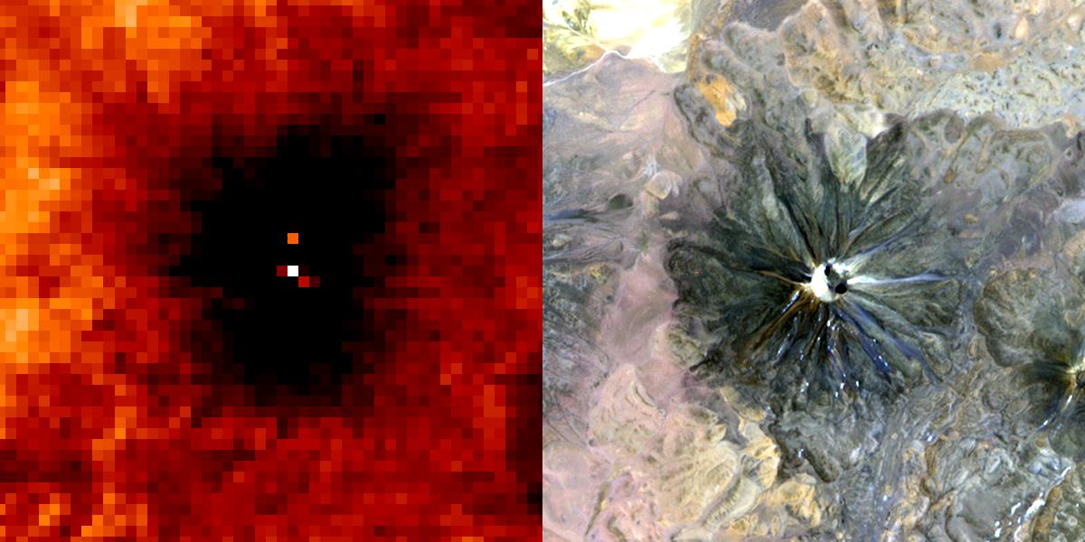
-
PIA03462:
-
Nyiragonga Volcano
Full Resolution:
TIFF
(997.9 kB)
JPEG
(119.6 kB)
|
|
|
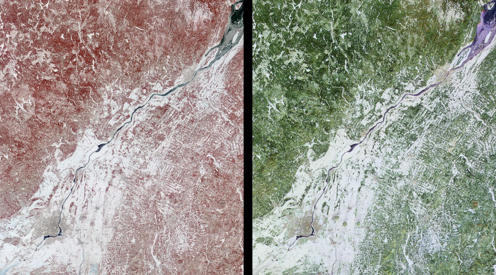
2002-01-30 |
Earth
|
Terra
|
MISR
|
1534x1618x3 |
|
-
PIA03441:
-
Coccoliths in the Celtic Sea
Full Resolution:
TIFF
(6.931 MB)
JPEG
(285.5 kB)
|
|
|
2002-01-23 |
Earth
|
Terra
|
MISR
|
2026x1366x3 |
|
-
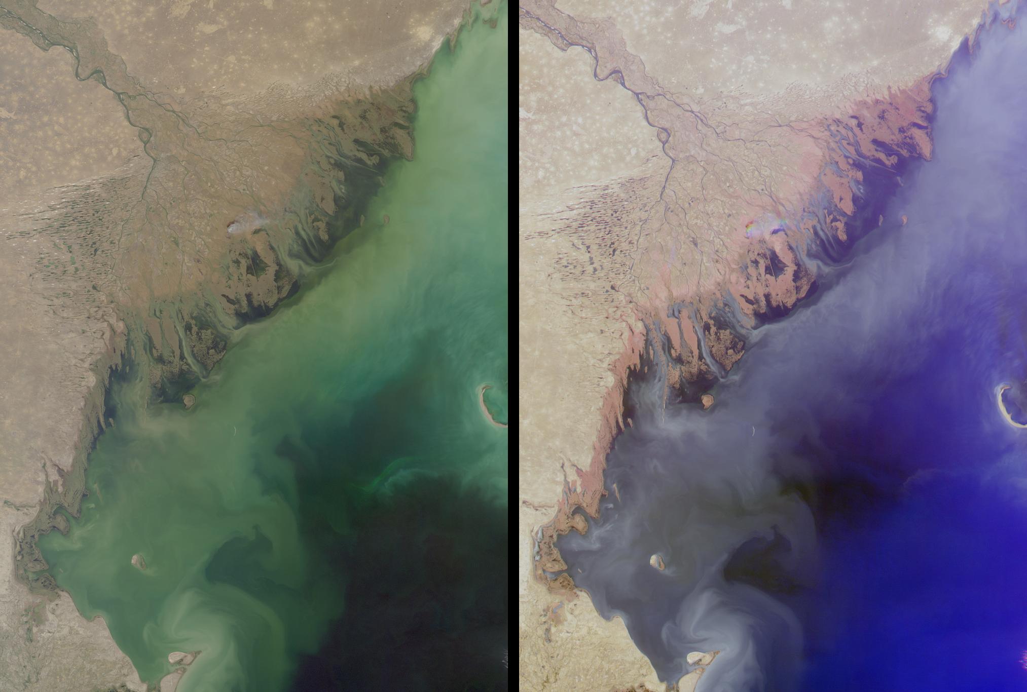
PIA03440:
-
Volga Delta and the Caspian Sea
Full Resolution:
TIFF
(7.898 MB)
JPEG
(230.4 kB)
|
|
|
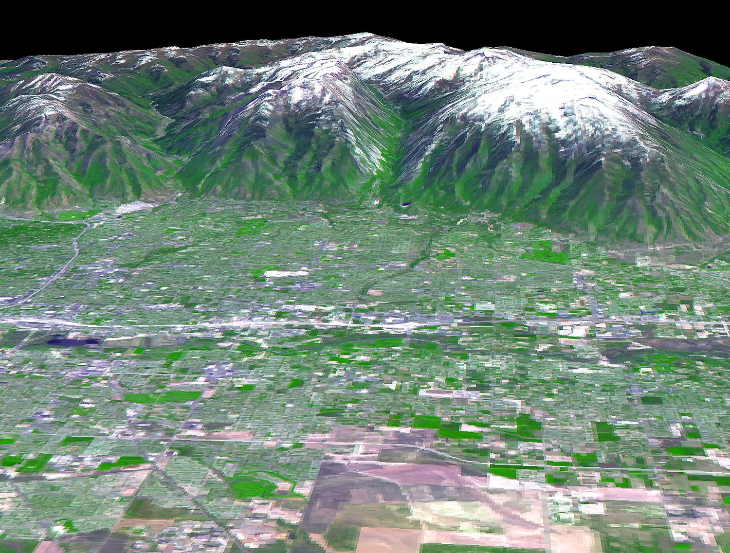
2002-01-16 |
Earth
|
Terra
|
MISR
|
1728x1974x3 |
|
-
PIA03439:
-
Snow-Covered Peaks of the Wasatch and Uinta Mountains
Full Resolution:
TIFF
(10.85 MB)
JPEG
(649.6 kB)
|
|
|
2002-01-09 |
Earth
|
Terra
|
MISR
|
2380x1360x3 |

|
-
PIA03438:
-
Smoke Blankets New South Wales, Australia
Full Resolution:
TIFF
(10.37 MB)
JPEG
(482.8 kB)
|
|
|
2002-01-03 |
Earth
|
Terra
|
ASTER
|
516x946x3 |

|
-
PIA03514:
-
Shiveluch Volcano, Kamchatka Peninsula, Russia
Full Resolution:
TIFF
(375.8 kB)
JPEG
(98.03 kB)
|
|
|
2002-01-02 |
Earth
|
Terra
|
MISR
|
1484x1159x3 |
|
-
PIA03437:
-
Penguins in Peril
Full Resolution:
TIFF
(4.34 MB)
JPEG
(249.5 kB)
|
|
|
2001-12-19 |
Earth
|
Terra
|
MISR
|
1548x1713x3 |
|
-
PIA03436:
-
Christmas Mountains Wrapped in Holiday Colors
Full Resolution:
TIFF
(8.938 MB)
JPEG
(806 kB)
|
|
|
2001-12-12 |
Earth
|
Terra
|
MISR
|
1161x940x3 |
|
-
PIA03435:
-
Where on Earth...? MISR Mystery Image Quiz #5:
Galapagos Islands
Full Resolution:
TIFF
(2.928 MB)
JPEG
(140.6 kB)
|
|
|
2001-12-05 |
Earth
|
Terra
|
MISR
|
1156x886x3 |
|
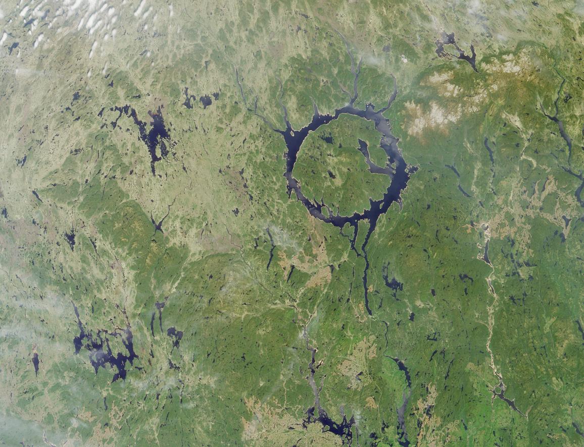
-
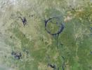
PIA03434:
-
Manicouagan Impact Structure, Quebec
Full Resolution:
TIFF
(3.305 MB)
JPEG
(210.9 kB)
|
|
|
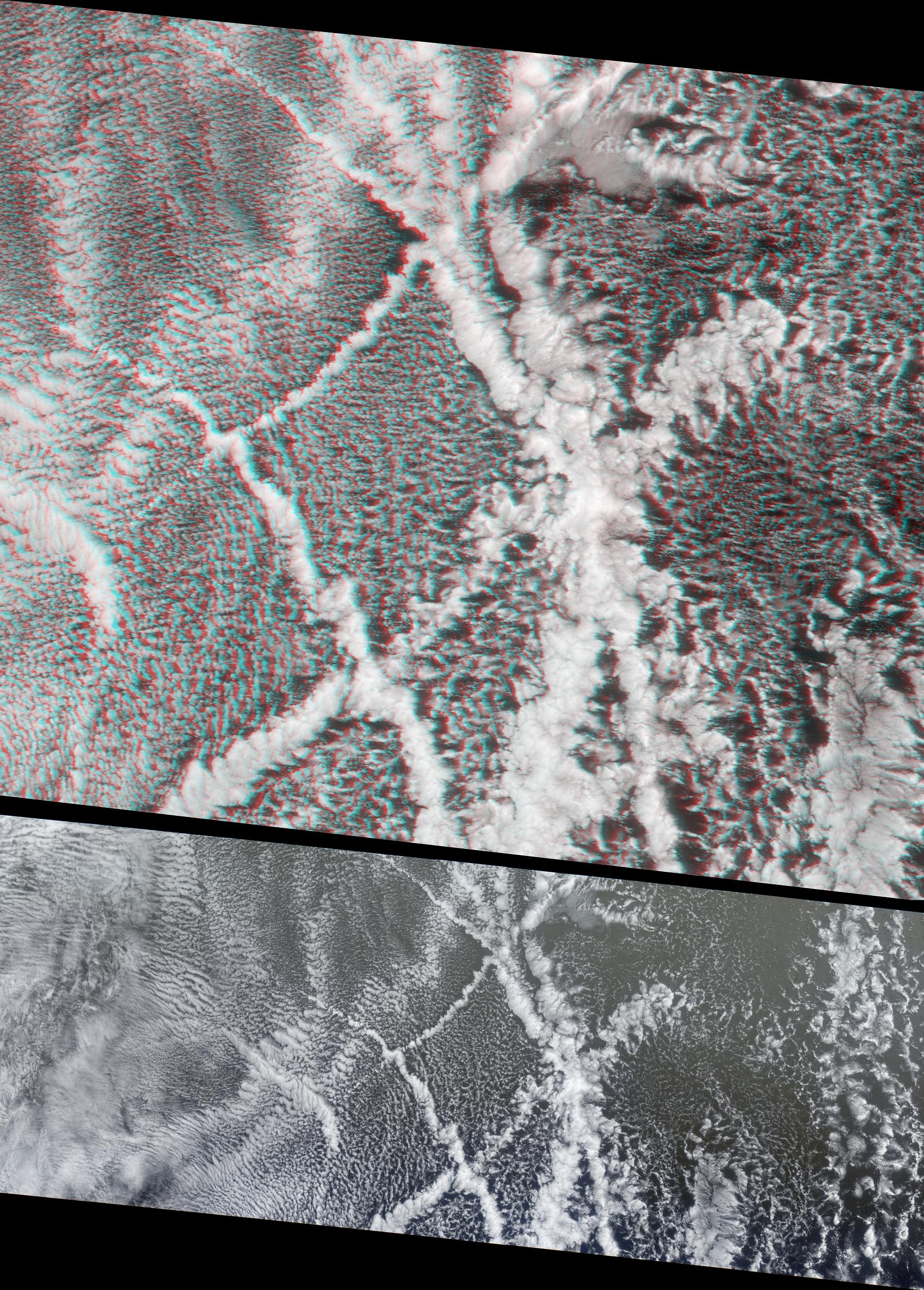
2001-11-28 |
Earth
|
Terra
|
MISR
|
1698x2372x3 |
|
-
PIA03433:
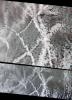
-
Ship Tracks in a Stratiform Cloud Layer
Full Resolution:
TIFF
(10.73 MB)
JPEG
(839.9 kB)
|
|
|
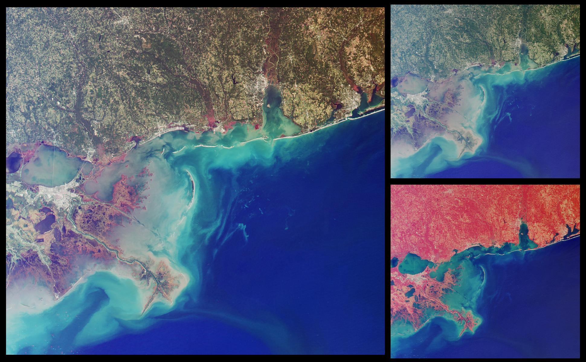
2001-11-21 |
Earth
|
Terra
|
MISR
|
1940x1200x3 |
|
-
PIA03432:
-
Wetlands of the Gulf Coast
Full Resolution:
TIFF
(6.322 MB)
JPEG
(383.9 kB)
|
|
|
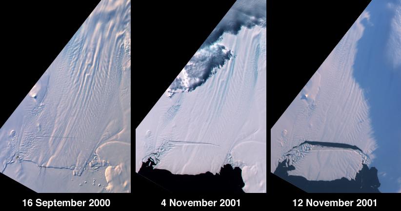
2001-11-14 |
Earth
|
Terra
|
MISR
|
822x432x3 |
|
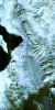
-
PIA03431:
-
Birth of a Large Iceberg in Pine Island Bay, Antarctica
Full Resolution:
TIFF
(674.3 kB)
JPEG
(43.08 kB)
|
|
|
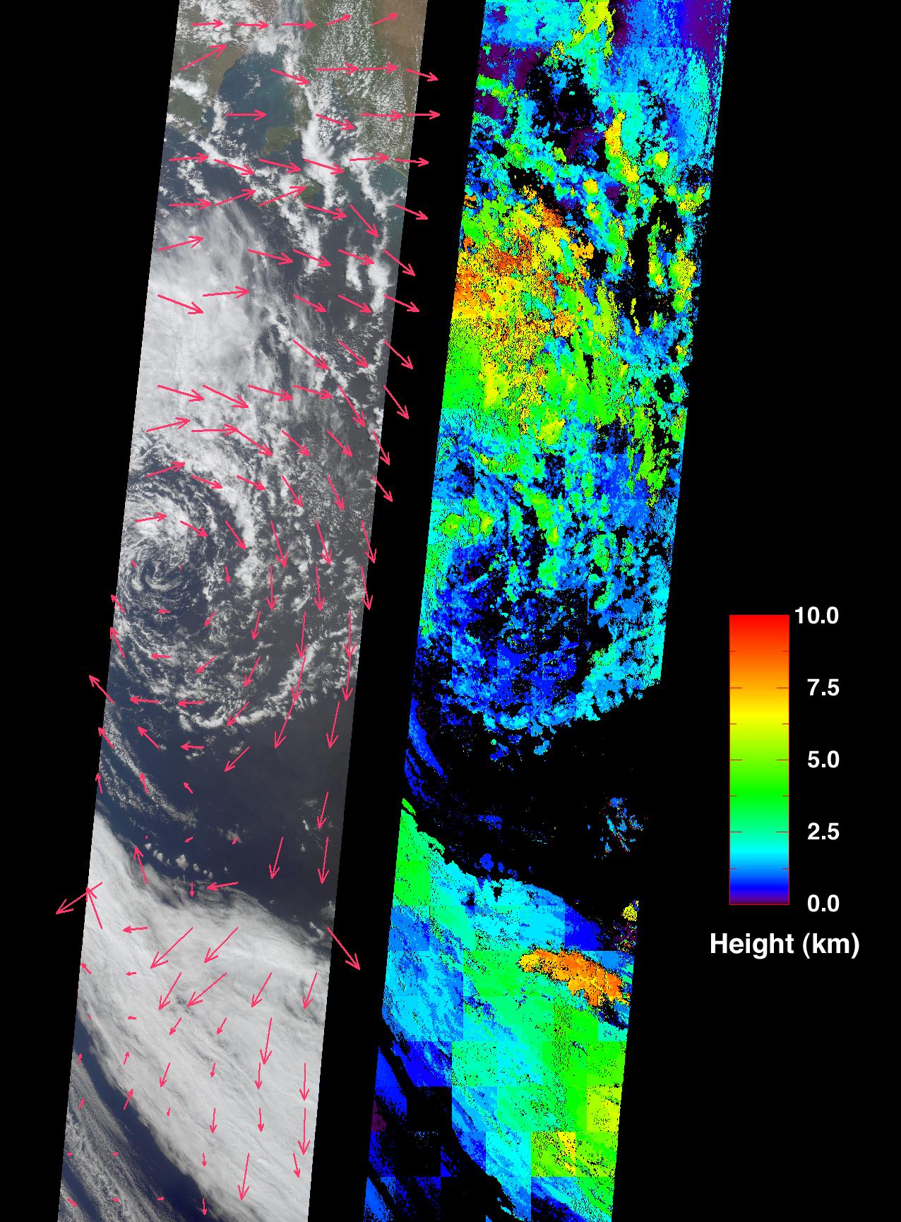
2001-11-07 |
Earth
|
Terra
|
MISR
|
1276x1731x3 |
|
-
PIA03430:
-
Extratropical Cyclone in the Southern Ocean
Full Resolution:
TIFF
(2.402 MB)
JPEG
(450.5 kB)
|
|
|
2001-10-31 |
Earth
|
Terra
|
MISR
|
1605x1650x3 |
|
-
PIA03429:
-
Where on Earth...? MISR Mystery Image Quiz #4:
Mali, Africa
Full Resolution:
TIFF
(7.02 MB)
JPEG
(305.6 kB)
|
|
|
2001-10-24 |
Earth
|
Terra
|
MISR
|
1864x1659x3 |
|
-
PIA03428:
-
Aerosols over India
Full Resolution:
TIFF
(5.072 MB)
JPEG
(329 kB)
|
|
|
2001-10-22 |
Earth
|
Terra
|
ASTER
|
1528x1322x3 |
|
-
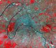
PIA11168:
-
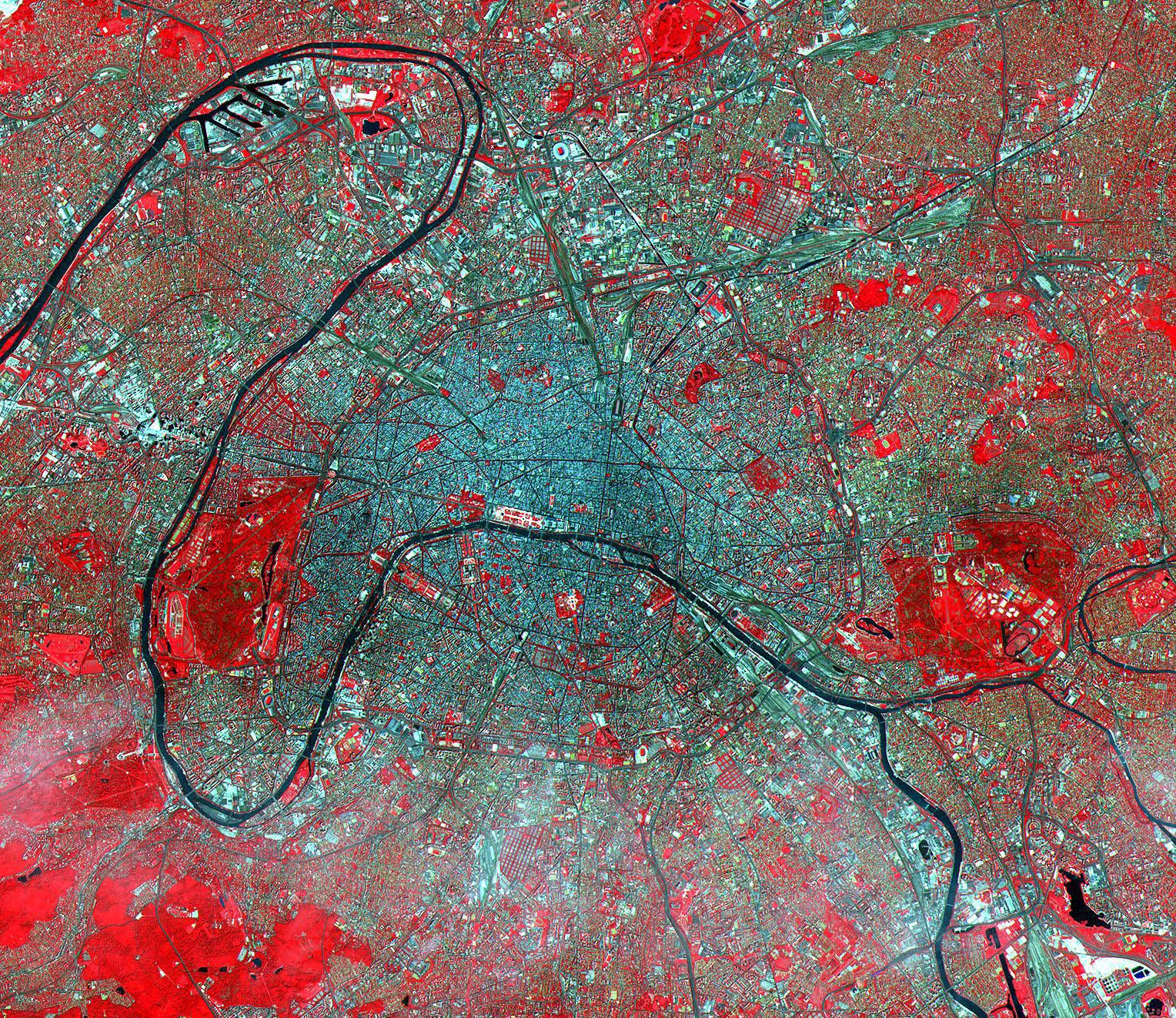
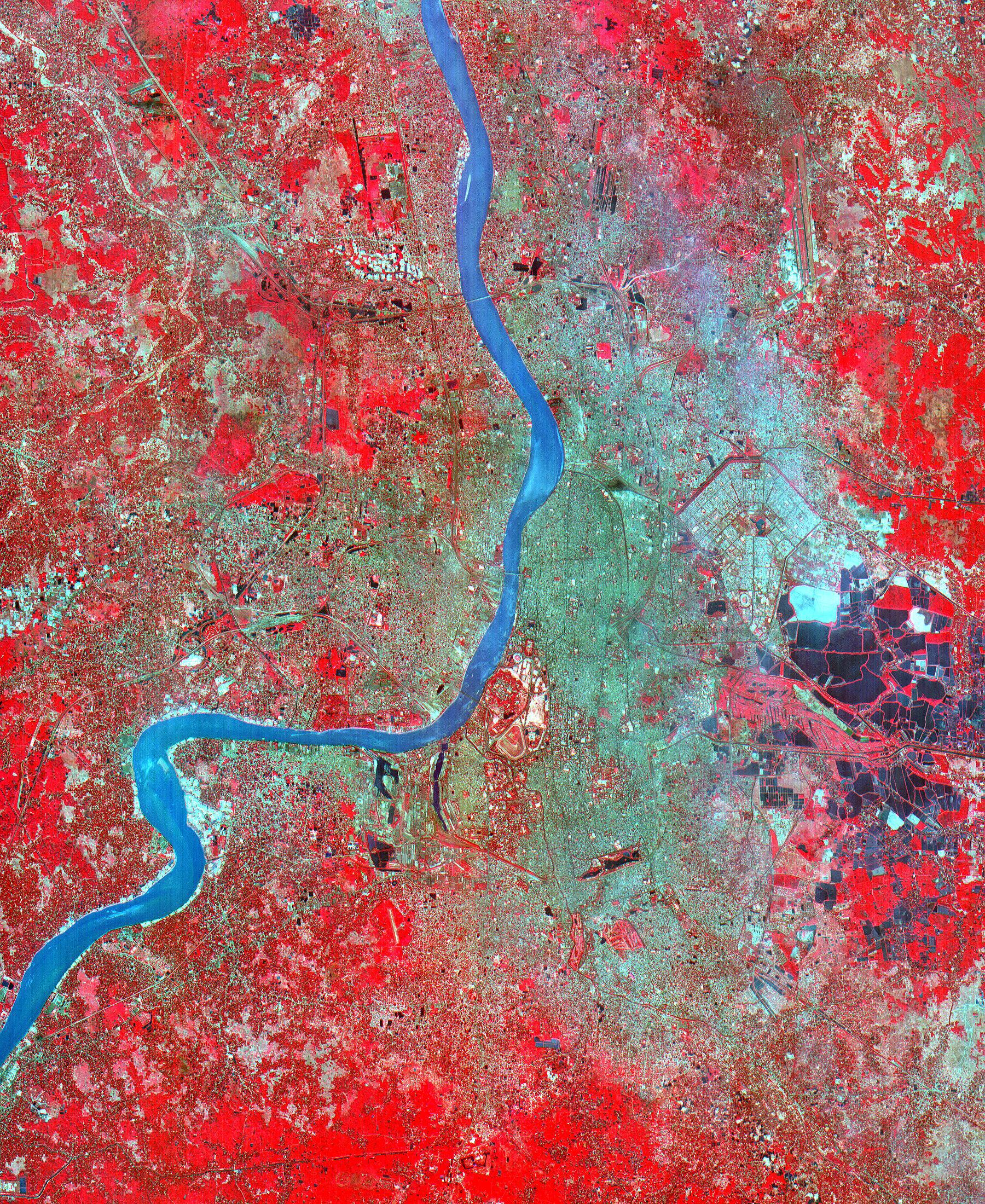
Paris
Full Resolution:
TIFF
(6.071 MB)
JPEG
(1.008 MB)
|
|
|
2001-10-22 |
Earth
|
Terra
|
ASTER
|
2280x3887x3 |
|
-
PIA11167:
-
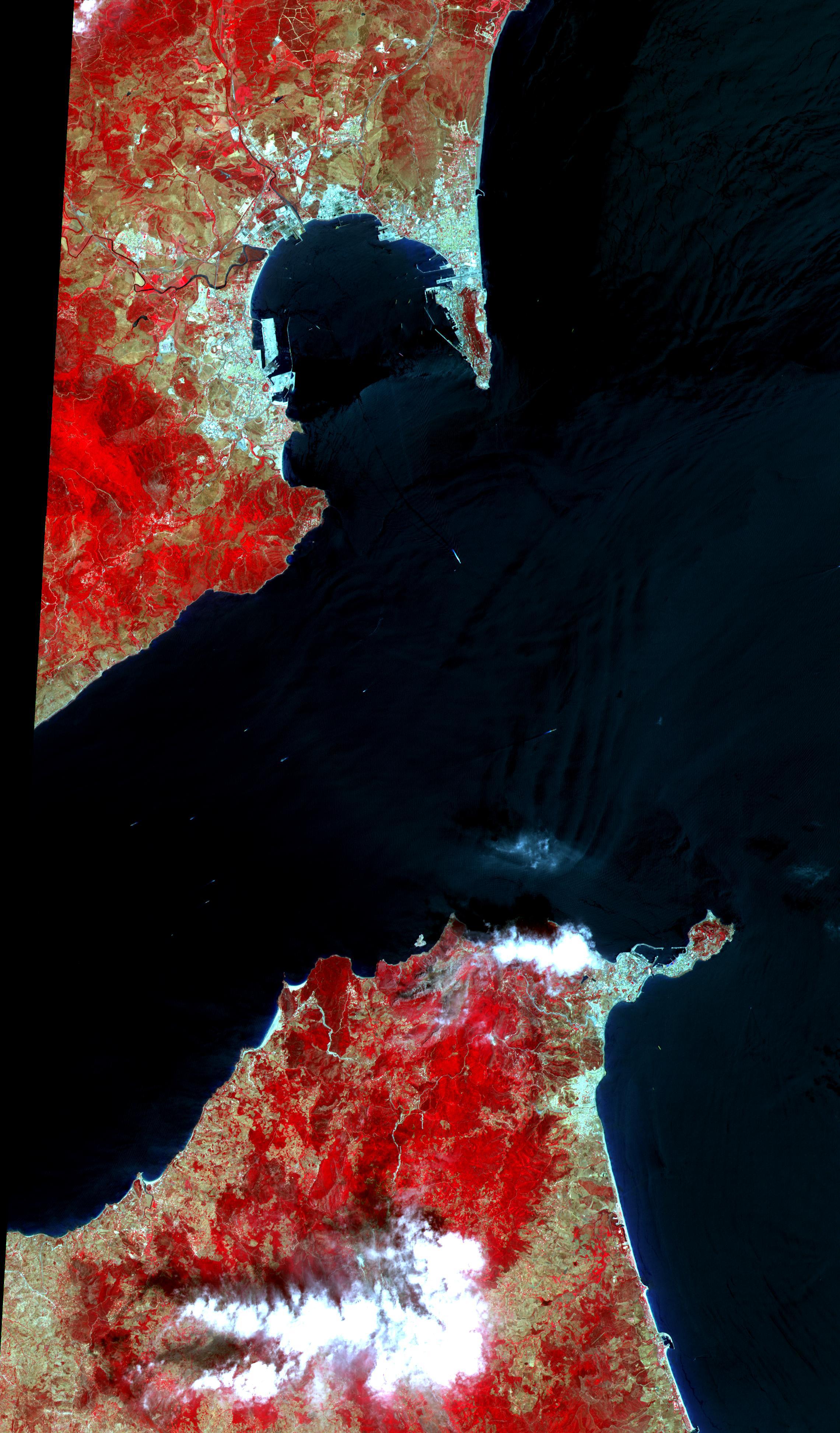
Strait of Gibraltar
Full Resolution:
TIFF
(26.62 MB)
JPEG
(1.024 MB)
|
|
|
2001-10-22 |
Earth
|
Terra
|
ASTER
|
340x256x3 |

|
-
PIA11166:
-
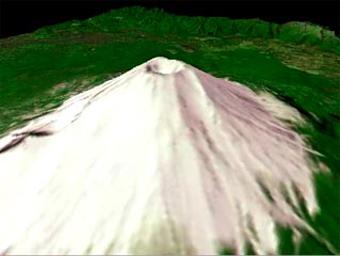
Mt. Fuji, Japan

Full Resolution:
TIFF
(261.6 kB)
JPEG
(12.14 kB)
|
|
|
2001-10-22 |
Earth
|
Terra
|
ASTER
|
3138x2611x3 |
|
-
PIA11165:
-
Oregon Forests
Full Resolution:
TIFF
(24.58 MB)
JPEG
(2.054 MB)
|
|
|
2001-10-22 |
Earth
|
Terra
|
ASTER
|
1960x2100x3 |
|
-
PIA11164:
-
Saline Valley
Full Resolution:
TIFF
(12.37 MB)
JPEG
(1.34 MB)
|
|
|
2001-10-22 |
Earth
|
Terra
|
ASTER
|
1711x1575x3 |
|
-
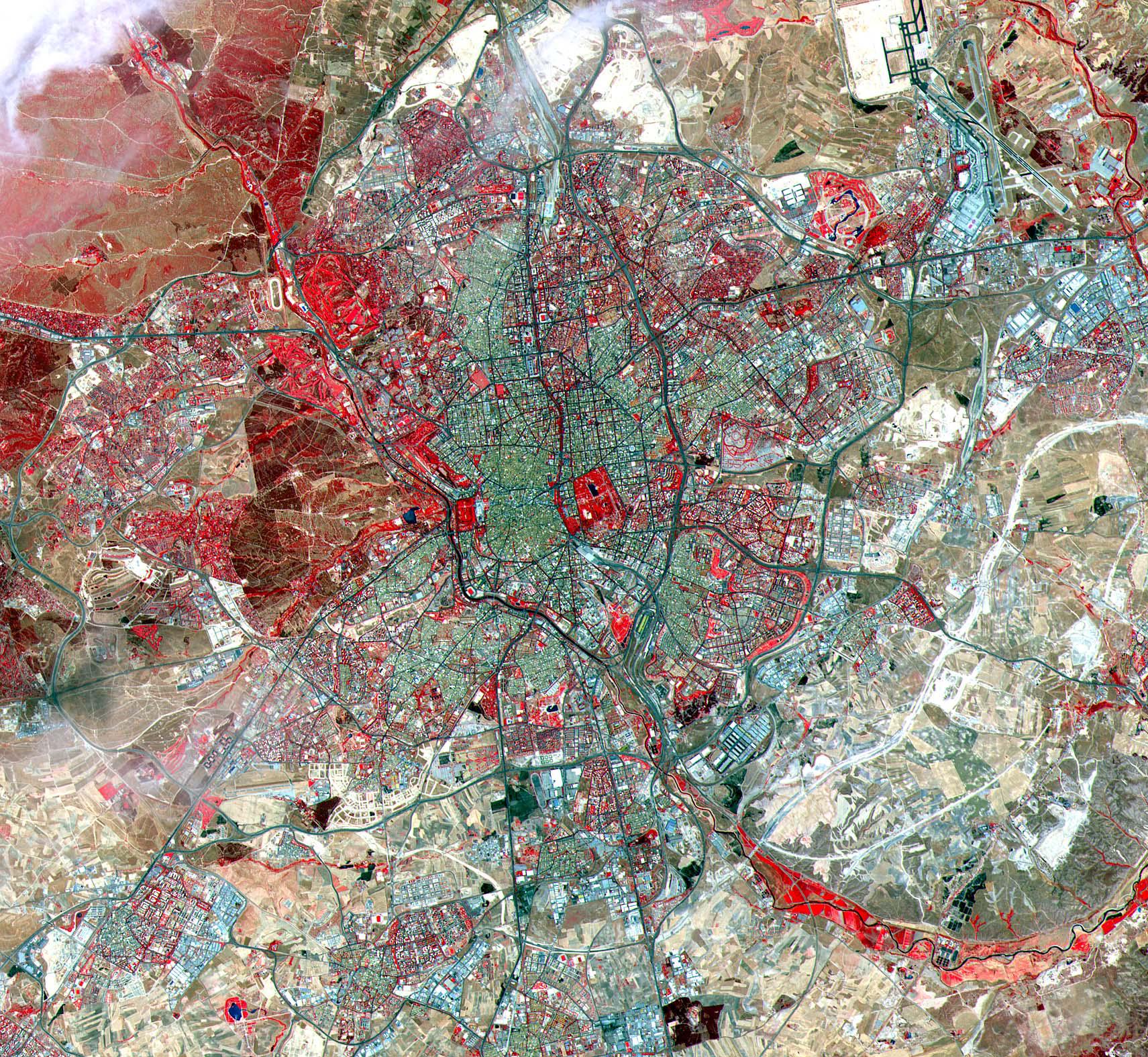
PIA11163:
-
Madrid
Full Resolution:
TIFF
(8.097 MB)
JPEG
(889.5 kB)
|
|
|
2001-10-22 |
Earth
|
Terra
|
ASTER
|
3851x2645x3 |

|
-
PIA11162:
-
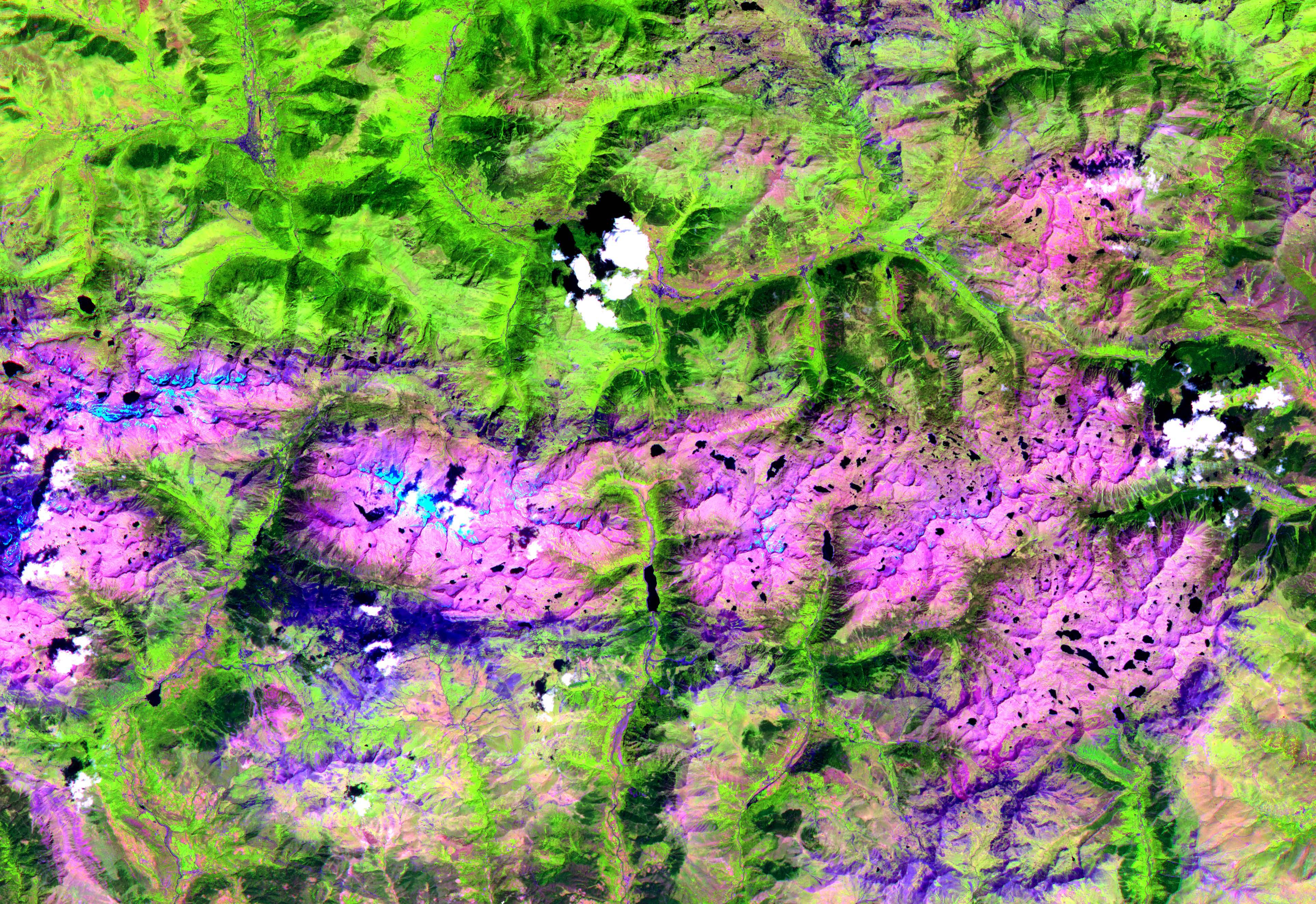
Pyrenees Mtns., Spain
Full Resolution:
TIFF
(30.56 MB)
JPEG
(2.239 MB)
|
|
|
2001-10-22 |
Earth
|
Terra
|
ASTER
|
1567x1811x3 |
|
-
PIA11161:
-
Coachella Valley, CA
Full Resolution:
TIFF
(8.528 MB)
JPEG
(676 kB)
|
|
|
2001-10-22 |
Earth
|
Terra
|
ASTER
|
1200x1354x3 |
|
-
PIA11160:
-
Mt. St. Helens
Full Resolution:
TIFF
(4.88 MB)
JPEG
(460.2 kB)
|
|
|
2001-10-22 |
Earth
|
Terra
|
ASTER
|
713x729x3 |
|
-
PIA11159:
-
Chile Altiplano Unconformity
Full Resolution:
TIFF
(1.562 MB)
JPEG
(147.2 kB)
|
|
|
2001-10-22 |
Earth
|
Terra
|
ASTER
|
3636x4008x3 |
|
-
PIA11158:
-
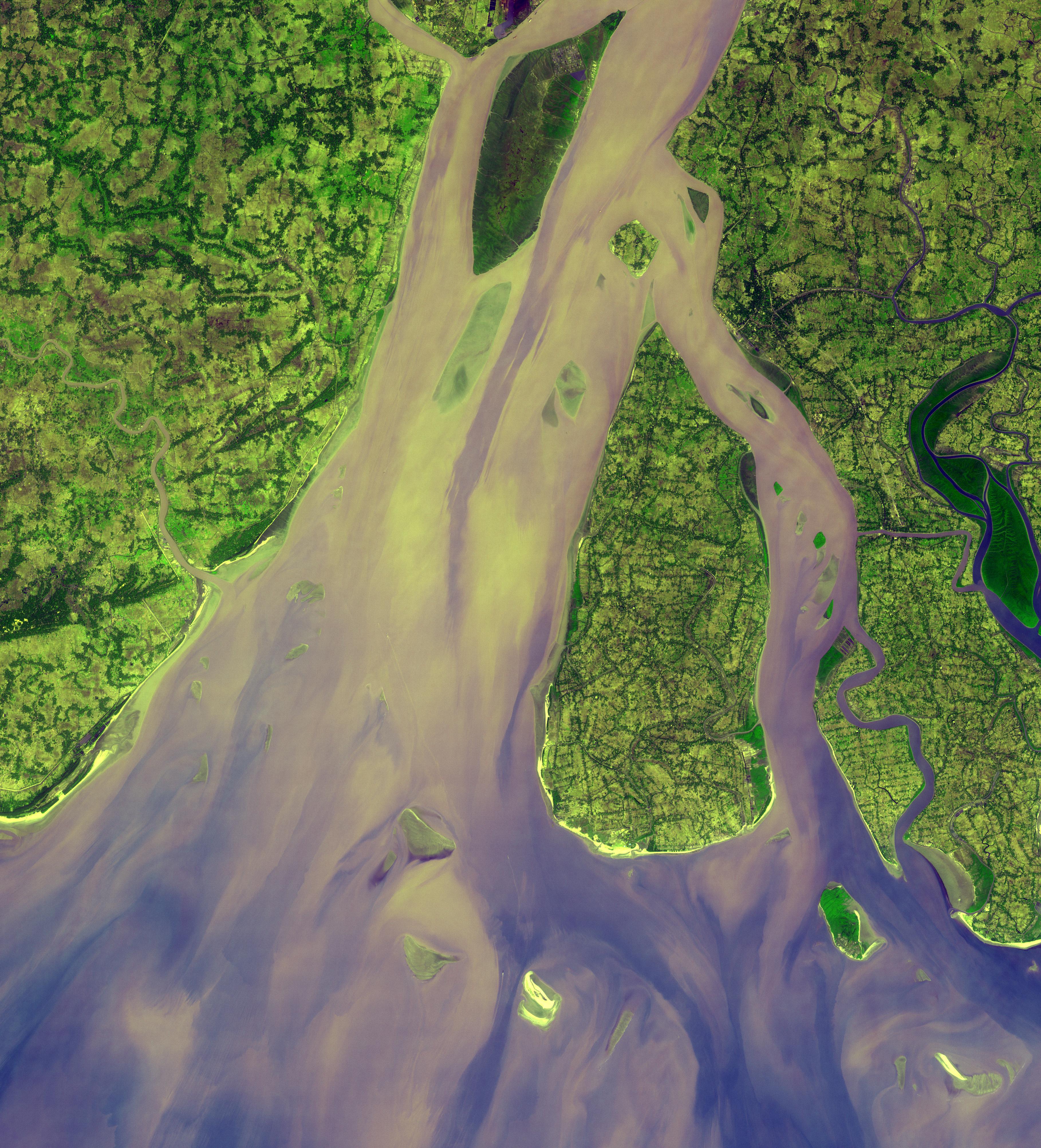
Hugli River Delta, India
Full Resolution:
TIFF
(43.72 MB)
JPEG
(2.484 MB)
|
|
|
2001-10-22 |
Earth
|
Terra
|
ASTER
|
1800x2200x3 |
|
-
PIA11157:
-
Calcutta
Full Resolution:
TIFF
(11.9 MB)
JPEG
(1.91 MB)
|
|
|
2001-10-22 |
Earth
|
Terra
|
ASTER
|
1000x700x3 |
|
-
PIA11099:
-
Sand Dunes, Afghanistan
Full Resolution:
TIFF
(2.103 MB)
JPEG
(229.1 kB)
|
|
|
2001-10-22 |
Earth
|
Terra
|
ASTER
|
700x800x3 |
|
-
PIA11098:
-
Jerusalem
Full Resolution:
TIFF
(1.682 MB)
JPEG
(193.9 kB)
|
|
|
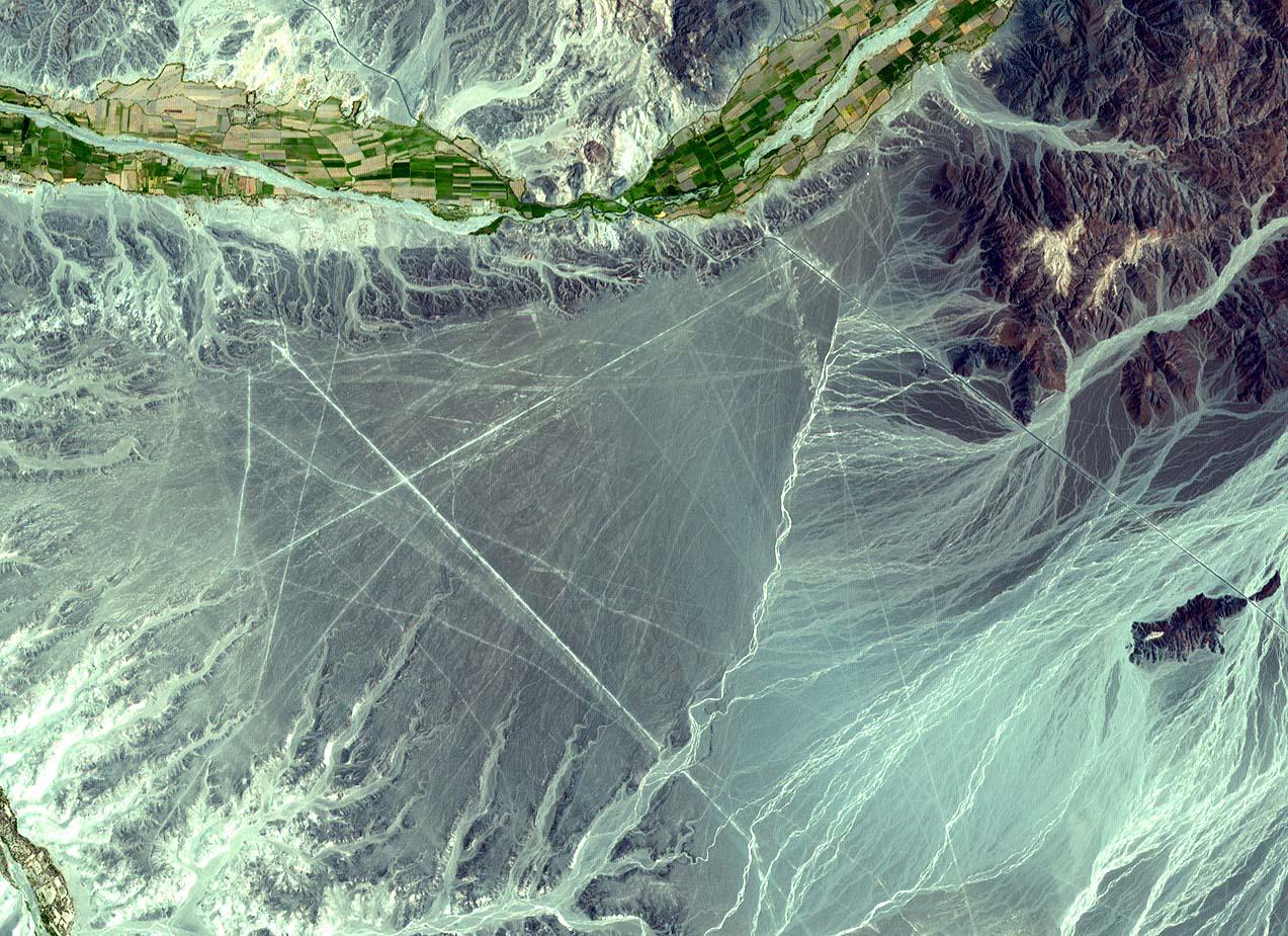
2001-10-22 |
Earth
|
Terra
|
ASTER
|
1273x925x3 |
|
-
PIA11097:
-
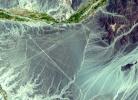
Nasca Lines, Peru
Full Resolution:
TIFF
(3.537 MB)
JPEG
(301.1 kB)
|
|
|
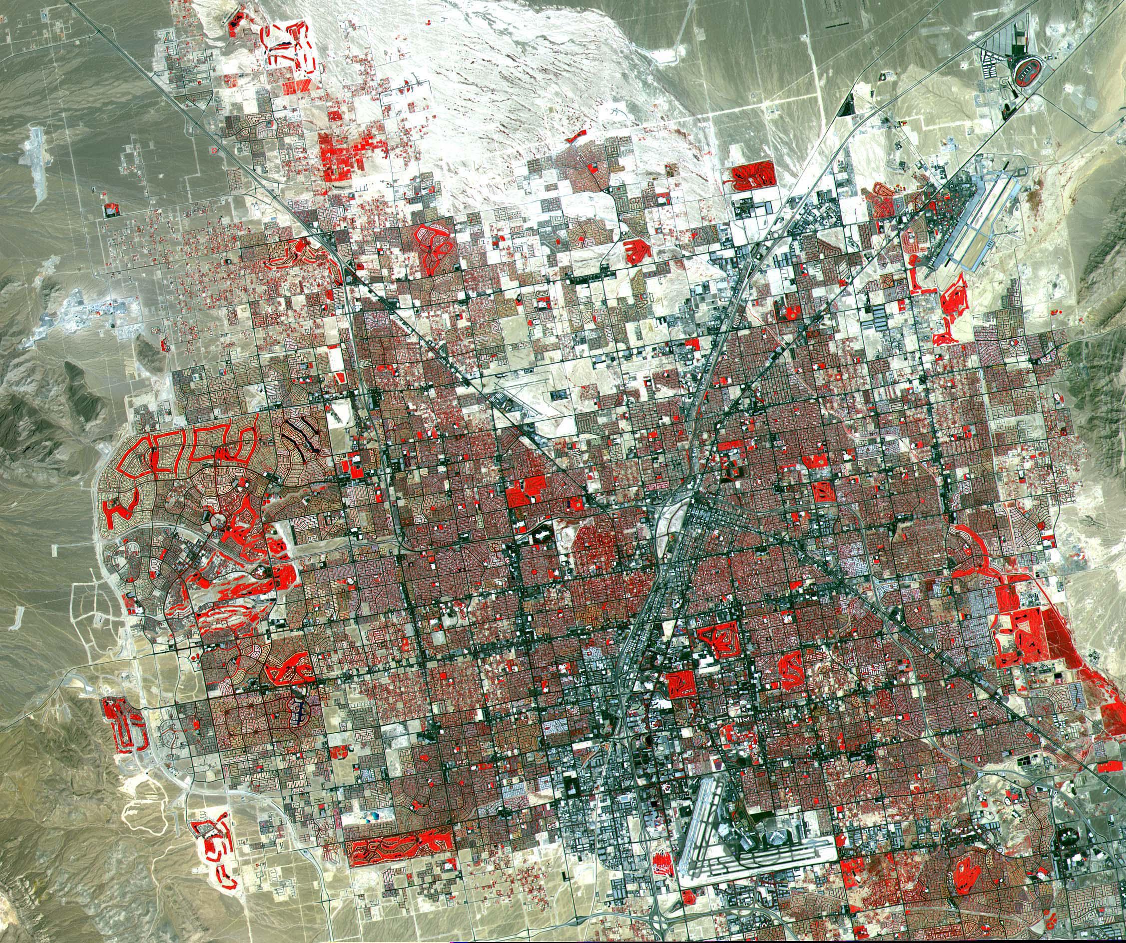
2001-10-22 |
Earth
|
Terra
|
ASTER
|
2254x1887x3 |
|
-
PIA11096:
-
Las Vegas
Full Resolution:
TIFF
(12.78 MB)
JPEG
(1.252 MB)
|
|
|
2001-10-22 |
Earth
|
Terra
|
ASTER
|
2547x3222x1 |
|
-
PIA11095:
-
Pine Island Glacier, Antarctica
Full Resolution:
TIFF
(8.215 MB)
JPEG
(785.4 kB)
|
|
|
2001-10-22 |
Earth
|
Terra
|
ASTER
|
1300x1000x3 |
|
-
PIA11094:
-
Thar Desert
Full Resolution:
TIFF
(3.904 MB)
JPEG
(351.1 kB)
|
|
|
2001-10-22 |
Earth
|
Terra
|
ASTER
|
1694x921x3 |
|
-
PIA11092:
-
Arizona Forest Fire
Full Resolution:
TIFF
(4.688 MB)
JPEG
(343.9 kB)
|
|
|
2001-10-22 |
Earth
|
Terra
|
ASTER
|
600x540x3 |

|
-
PIA11093:
-
Hawaii Lava Flows
Full Resolution:
TIFF
(973.3 kB)
JPEG
(26.82 kB)
|
|
|
2001-10-22 |
Earth
|
Terra
|
ASTER
|
3002x2477x3 |
|
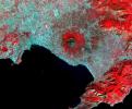
-
PIA11091:
-
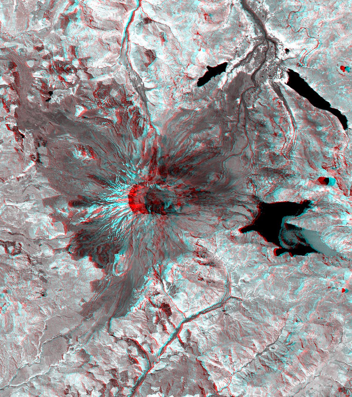
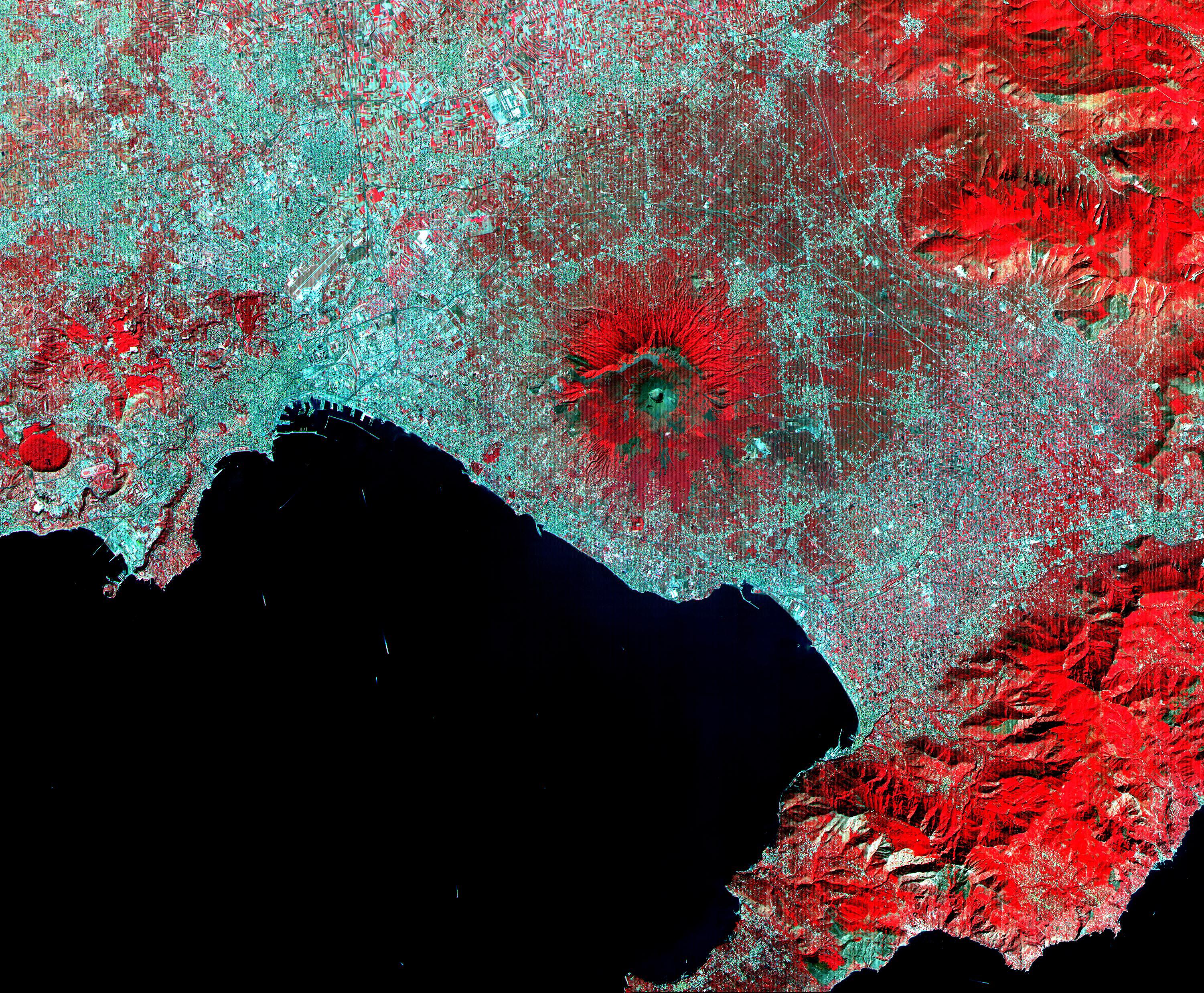
Mt. Vesuvius, Italy
Full Resolution:
TIFF
(22.31 MB)
JPEG
(2.267 MB)
|
|
|
2001-10-22 |
Earth
|
Terra
|
ASTER
|
2000x2500x3 |
|
-
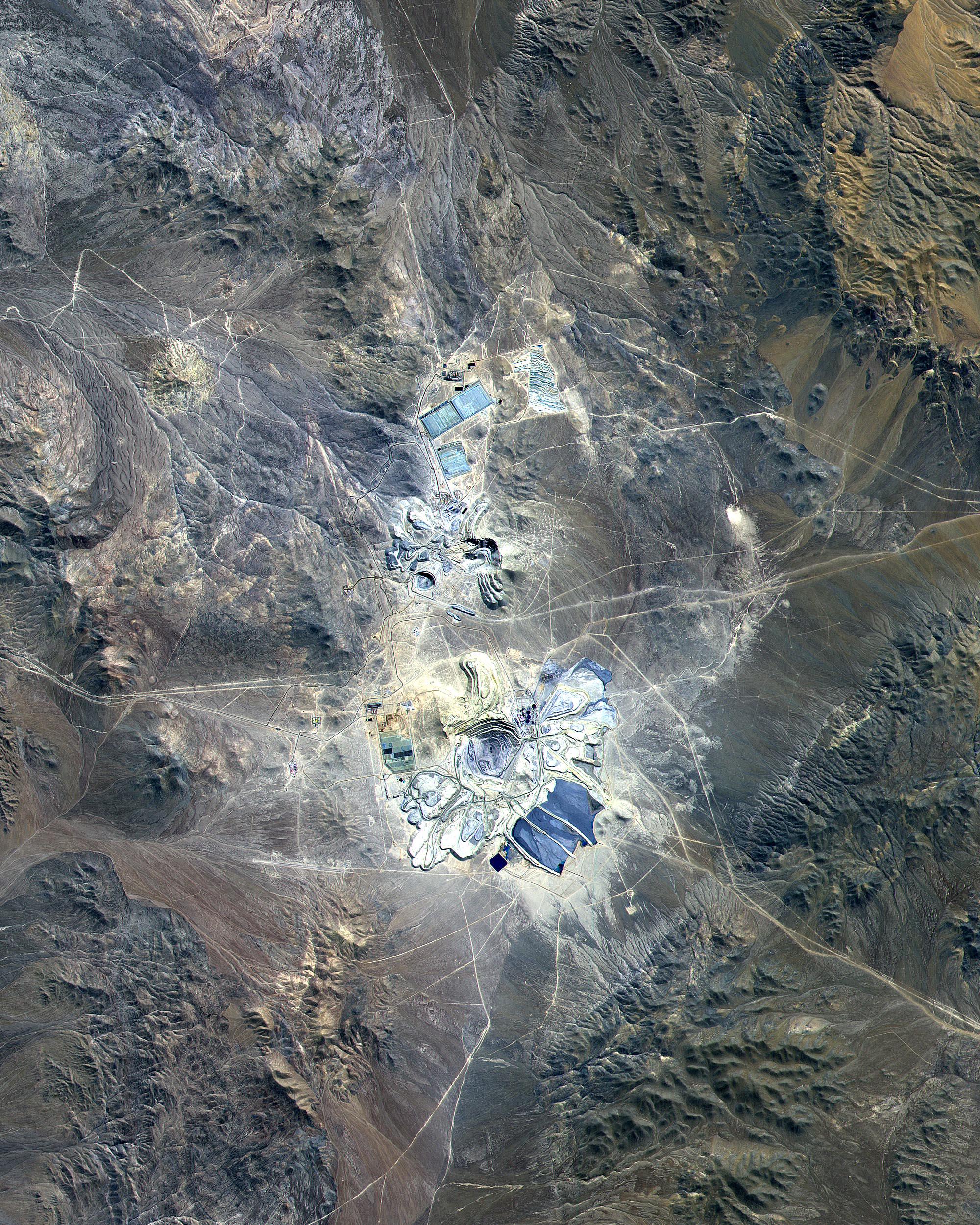
PIA11090:
-
Escondida Mine, Chile
Full Resolution:
TIFF
(15.02 MB)
JPEG
(1.402 MB)
|
|
|
2001-10-22 |
Earth
|
Terra
|
ASTER
|
1388x1167x3 |
|
-
PIA11089:
-
Baltimore, MD
Full Resolution:
TIFF
(4.869 MB)
JPEG
(565.4 kB)
|
|
|
2001-10-22 |
Earth
|
Terra
|
ASTER
|
4100x4200x3 |
|
-
PIA11088:
-
Idaho Fires
Full Resolution:
TIFF
(51.66 MB)
JPEG
(2.704 MB)
|
|
|
2001-10-22 |
Earth
|
Terra
|
ASTER
|
837x690x3 |

|
-
PIA11087:
-
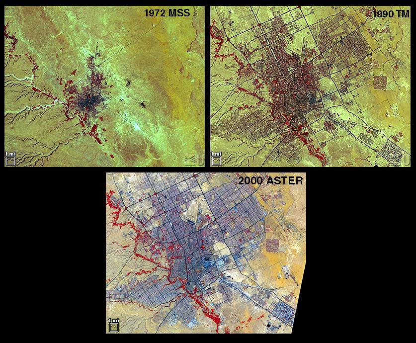
Urbanization: Riyadh, Saudi Arabia
Full Resolution:
TIFF
(1.735 MB)
JPEG
(157.5 kB)
|
|
|
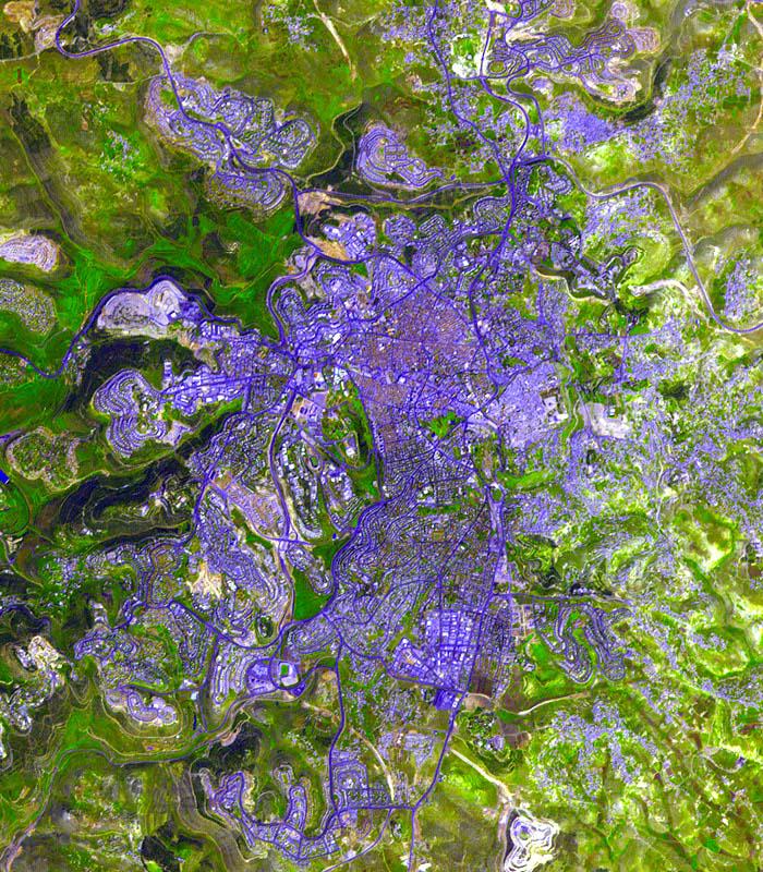
2001-10-22 |
Earth
|
Terra
|
ASTER
|
2000x1500x3 |

|
-
PIA01908:
-
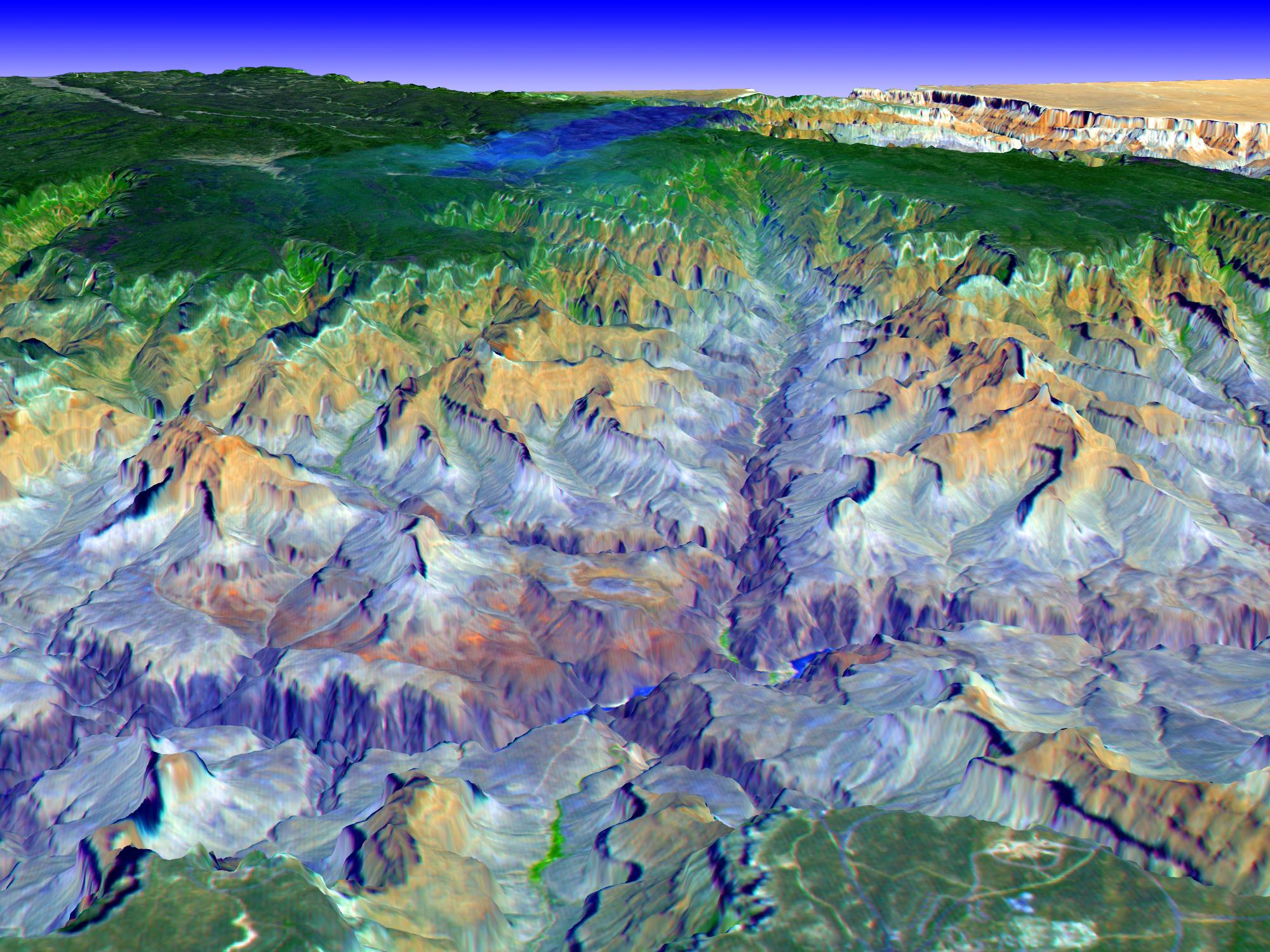
Perspective view over the Grand Canyon, Arizona
Full Resolution:
TIFF
(9.012 MB)
JPEG
(477.4 kB)
|
|
|
2001-10-17 |
Earth
|
Terra
|
MISR
|
846x606x3 |

|
-
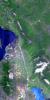
PIA03427:
-
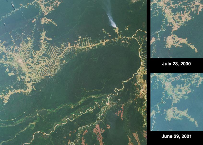
Deforestation near Rio Branco, Brazil
Full Resolution:
TIFF
(1.479 MB)
JPEG
(85.05 kB)
|
|
|
2001-10-10 |
Earth
|
Terra
|
MISR
|
730x900x3 |
|
-
PIA03426:
-
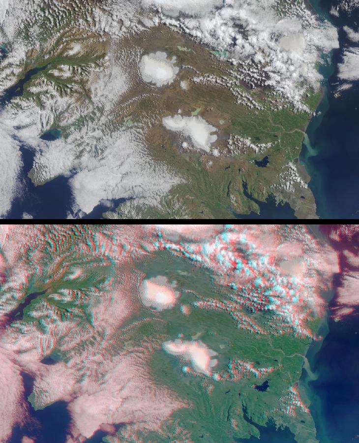
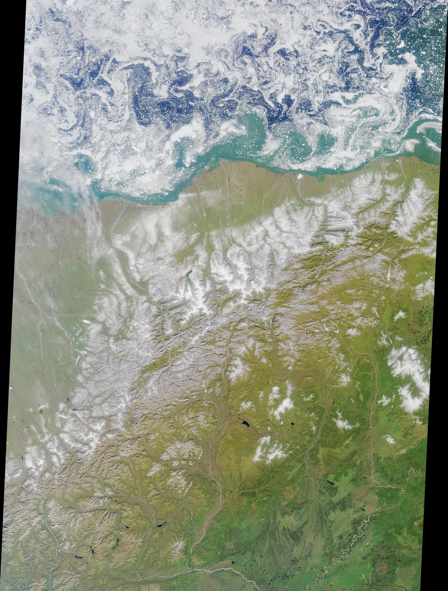
The Land of Ice and Fire
Full Resolution:
TIFF
(2.148 MB)
JPEG
(141.7 kB)
|
|
|
2001-10-04 |
Earth
|
Terra
|
MISR
|
1700x1456x3 |
|
-
PIA03425:
-
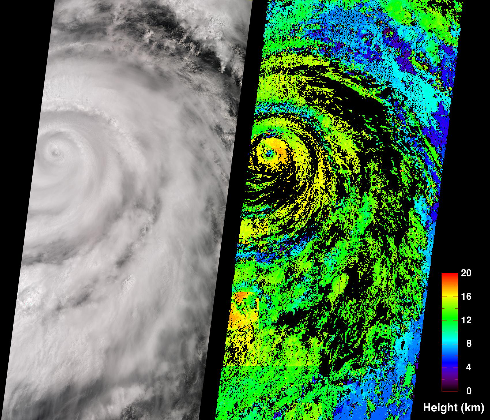
Hurricane Juliette
Full Resolution:
TIFF
(3.694 MB)
JPEG
(651.3 kB)
|
|
|
2001-09-26 |
Earth
|
Terra
|
MISR
|
1290x1510x3 |
|
-
PIA03424:
-
Where on Earth...? MISR Mystery Image Quiz #3:
Lofoten Islands, Norway
Full Resolution:
TIFF
(6.46 MB)
JPEG
(392.5 kB)
|
|
|
2001-09-19 |
Earth
|
Terra
|
MISR
|
1737x981x3 |
|
-
PIA03423:
-
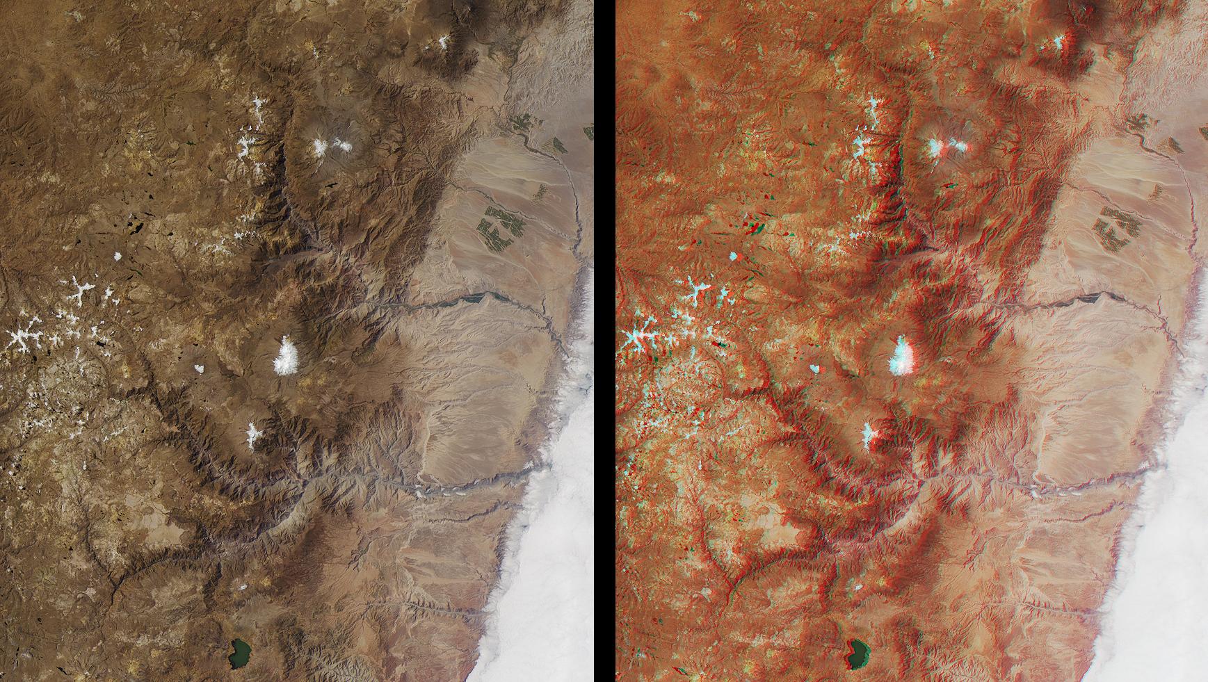
Deepest Canyons of the Andes
Full Resolution:
TIFF
(6.045 MB)
JPEG
(413.2 kB)
|
|
|
2001-09-13 |
Earth
|
Terra
|
MISR
|
1268x1908x3 |
|
-
PIA03422:
-
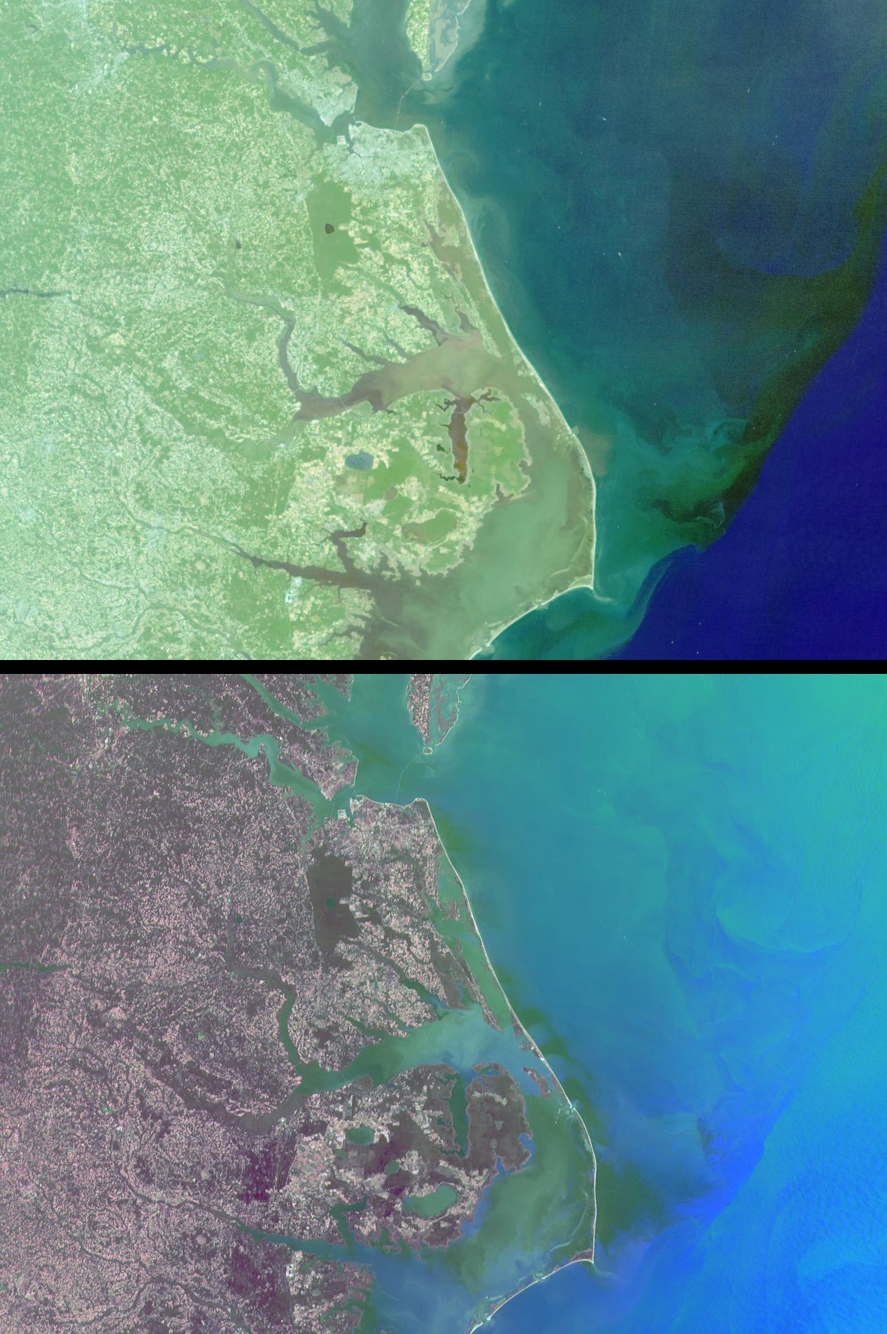
Mixing Waters and Moving Ships off the North Carolina Coast
Full Resolution:
TIFF
(7.865 MB)
JPEG
(341.6 kB)
|
|
|
2001-09-05 |
Earth
|
Terra
|
MISR
|
1223x1208x3 |
|
-
PIA03421:
-
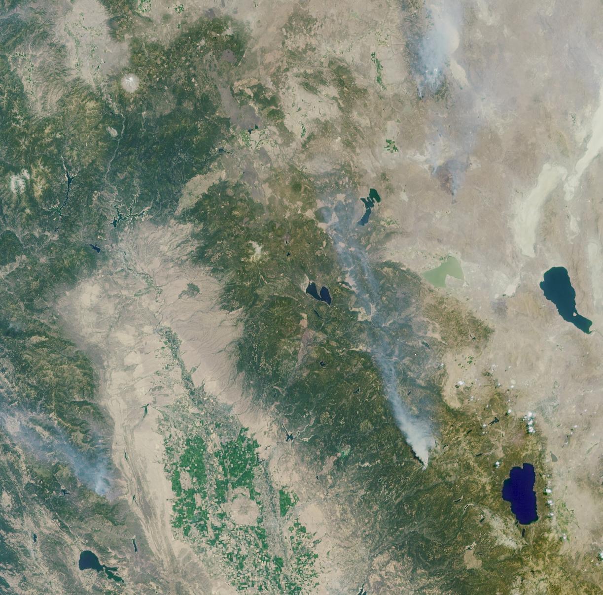
A Panoramic View of the Emigrant Gap Fire, California
Full Resolution:
TIFF
(5.087 MB)
JPEG
(270.8 kB)
|
|
|
2001-08-29 |
Earth
|
Terra
|
MISR
|
983x1250x3 |
|
-
PIA03420:
-
Nile River Fluctuations Near Khartoum, Sudan
Full Resolution:
TIFF
(3.15 MB)
JPEG
(165.1 kB)
|
|
|
2001-08-27 |
Earth
|
Terra
|
ASTER
|
4376x4820x3 |
|
-
PIA02679:
-
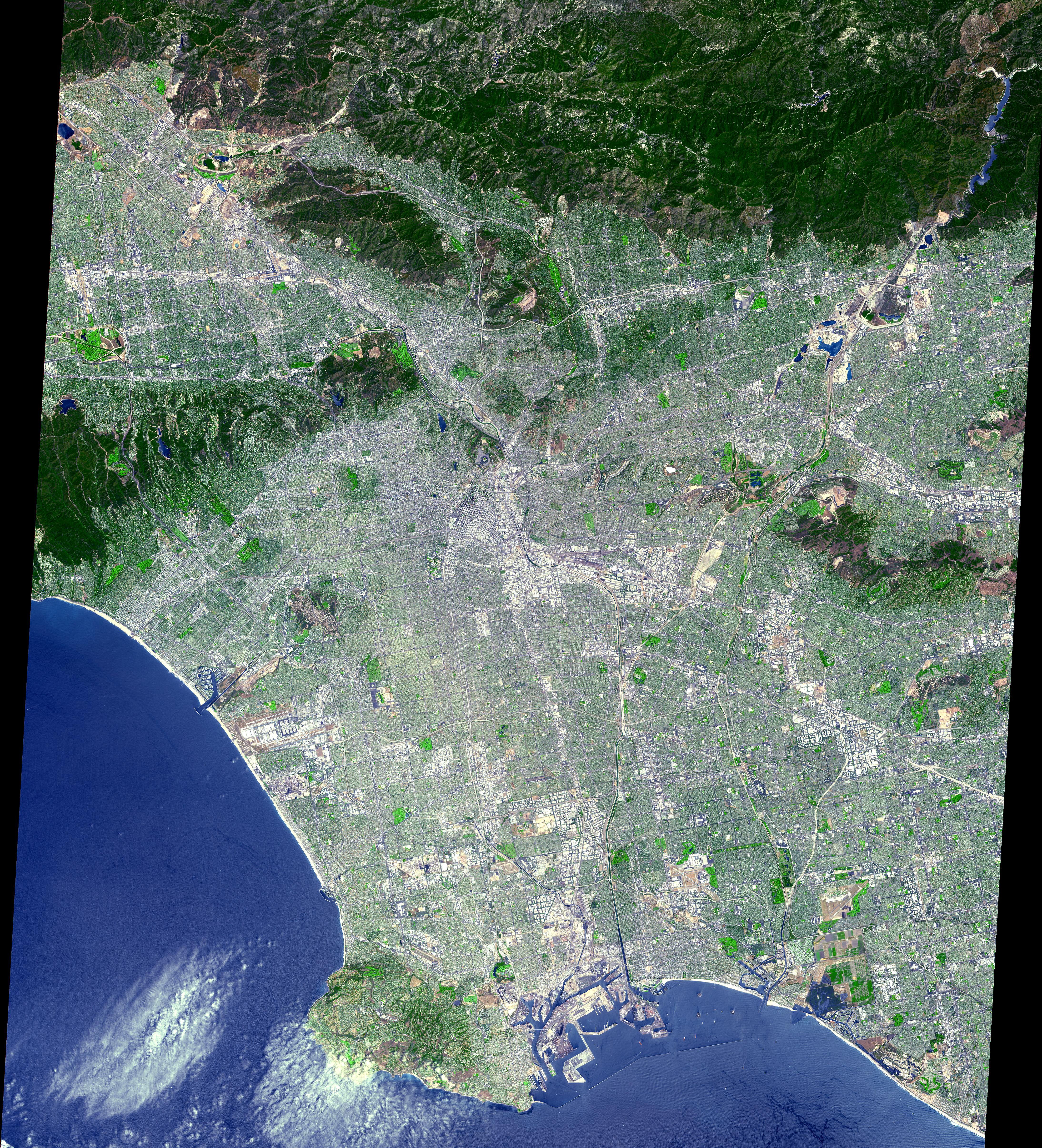
Los Angeles from Space
Full Resolution:
TIFF
(67.34 MB)
JPEG
(7.226 MB)
|
|
|
2001-08-22 |
Earth
|
Terra
|
MISR
|
1480x1952x3 |
|
-
PIA03419:
-
Summer in the Arctic National Wildlife Refuge
Full Resolution:
TIFF
(9.157 MB)
JPEG
(601.5 kB)
|
|
|
2001-08-15 |
Earth
|
Terra
|
MISR
|
1290x890x3 |
|
-
PIA03418:
-
A CLAMS-Eye View of Earth
Full Resolution:
TIFF
(3.185 MB)
JPEG
(183.3 kB)
|
|
|
2001-08-08 |
Earth
|
Terra
|
MISR
|
1292x1044x3 |
|
-
PIA03417:
-
Where on Earth...? MISR Mystery Image Quiz #2:
Lake Constance, Europe
Full Resolution:
TIFF
(4.453 MB)
JPEG
(405.9 kB)
|
|
|
2001-08-03 |
Earth
|
Terra
|
ASTER
|
576x720x3 |
|
-
PIA02678:
-
Sulfur Dioxide Plume During the Continuing Eruption of Mt. Etna, Italy
Full Resolution:
TIFF
(1.463 MB)
JPEG
(140 kB)
|
|
|
2001-08-03 |
Earth
|
Terra
|
ASTER
|
1600x2000x3 |
|
-
PIA02677:
-
Lava Flows During the Continuing Eruption of Mt. Etna, Italy
Full Resolution:
TIFF
(10.01 MB)
JPEG
(465.8 kB)
|
|
|
2001-08-01 |
Earth
|
Terra
|
MISR
|
1736x1328x3 |
|
-
PIA03416:
-
Smoke over Jackson Hole, Wyoming
Full Resolution:
TIFF
(7.261 MB)
JPEG
(467.3 kB)
|
|
|
2001-08-01 |
Earth
|
Terra
|
ASTER
|
2000x2400x3 |
|
-
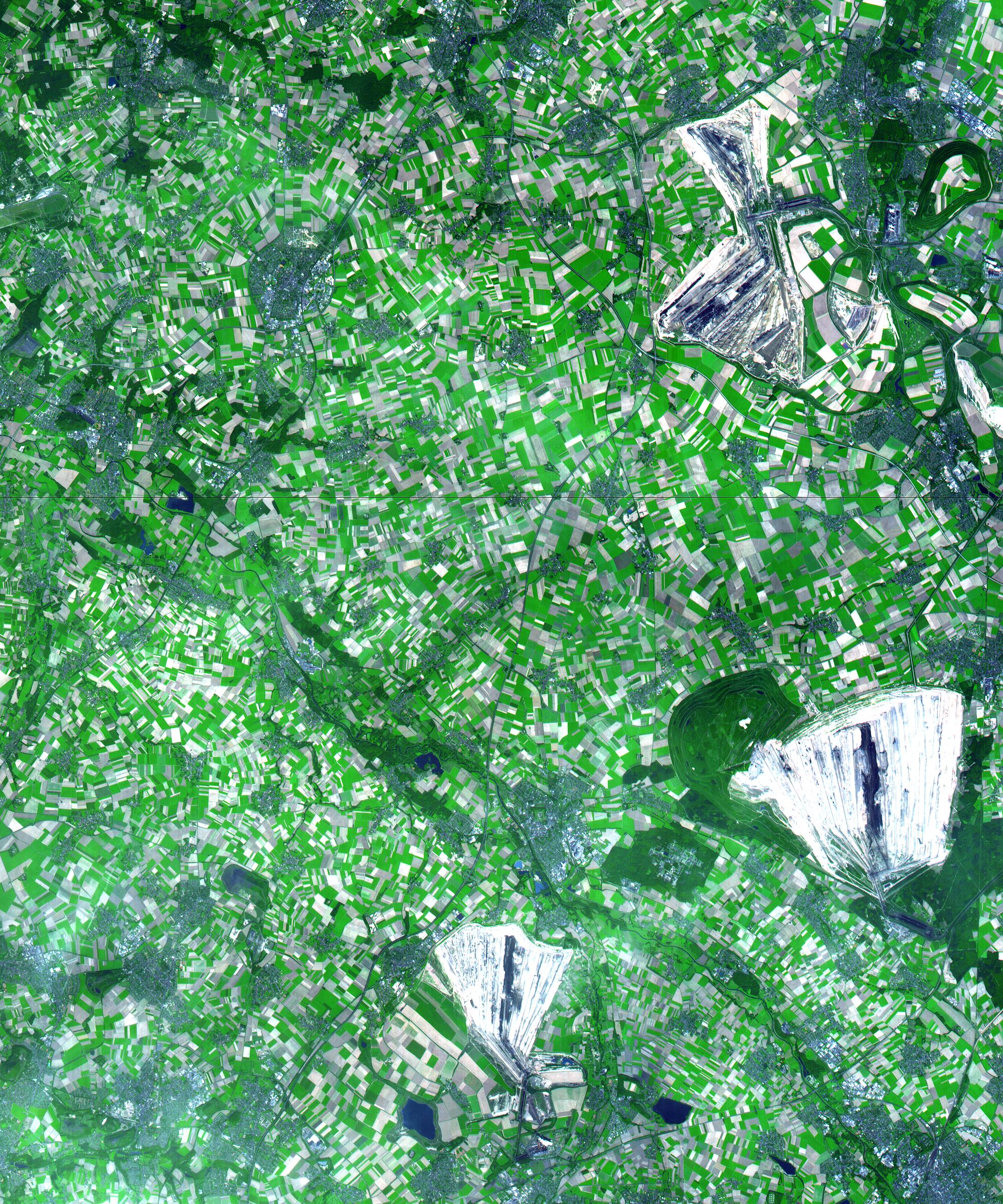
PIA02676:
-
Coal Mining, Germany
Full Resolution:
TIFF
(18.15 MB)
JPEG
(1.438 MB)
|
|
|
2001-07-26 |
Earth
|
Terra
|
ASTER
|
2000x2011x3 |
|
-
PIA02675:
-
Anchorage, AK
Full Resolution:
TIFF
(13.23 MB)
JPEG
(775.5 kB)
|
|
|
2001-07-25 |
Earth
|
Terra
|
MISR
|
1594x1444x3 |
|
-
PIA03415:
-
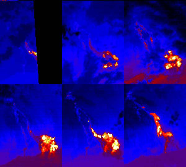
Eruption of Mt. Etna
Full Resolution:
TIFF
(5.094 MB)
JPEG
(282.1 kB)
|
|
|
2001-07-21 |
Earth
|
Terra
|
ASTER
|
516x946x3 |

|
-
PIA02674:
-
Eruption of Shiveluch Volcano, Kamchatka, Russia
Full Resolution:
TIFF
(375.8 kB)
JPEG
(98.03 kB)
|
|
|
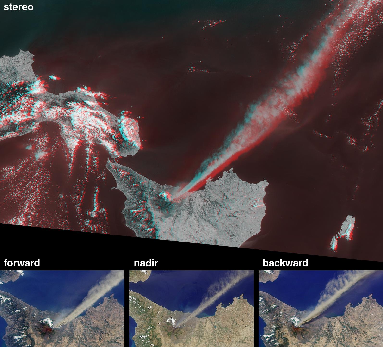
2001-07-21 |
Earth
|
Terra
|
ASTER
|
1191x1230x3 |
|
-
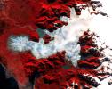
PIA02673:
-
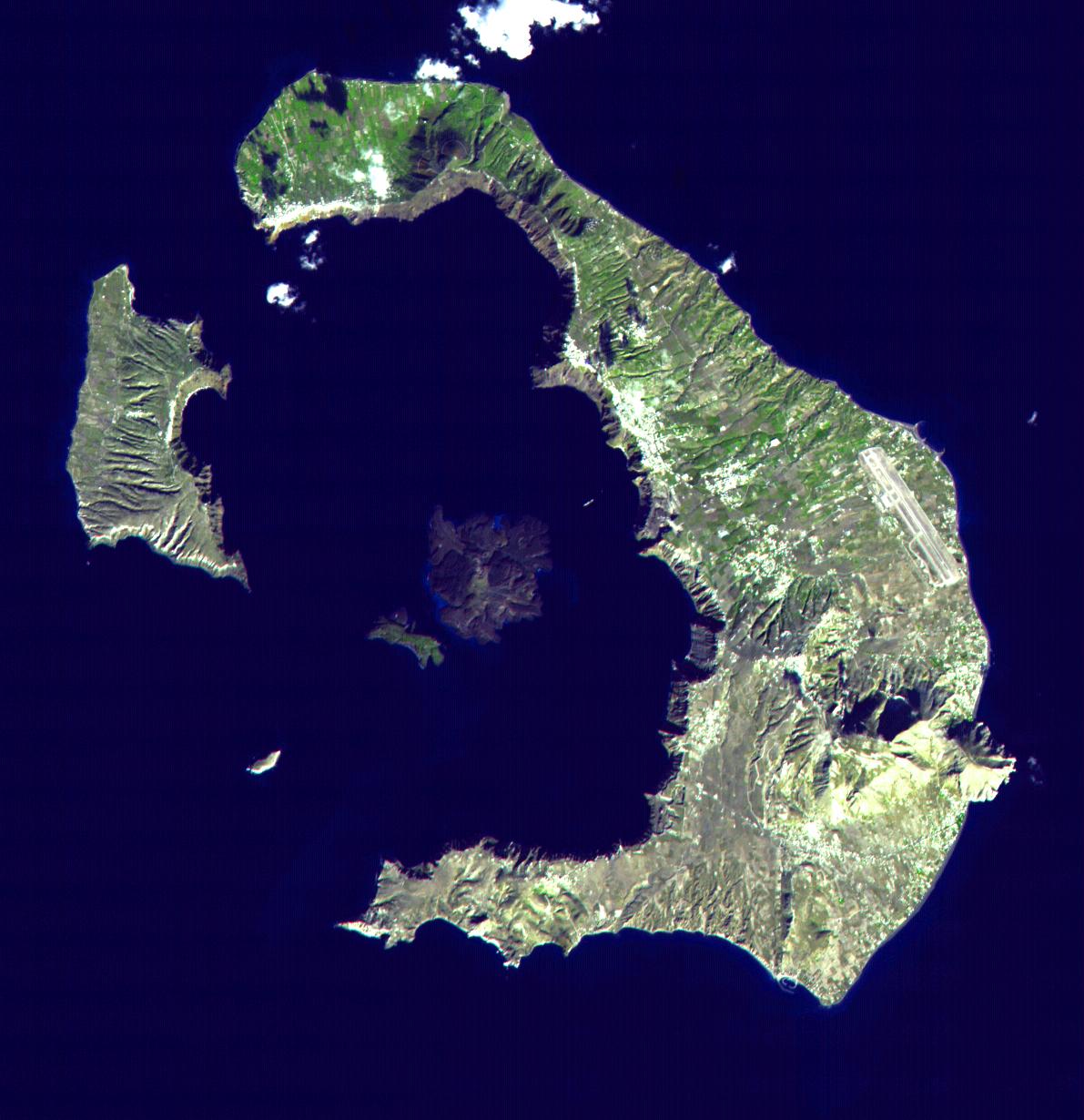
Santorini, Greece
Full Resolution:
TIFF
(2.163 MB)
JPEG
(154 kB)
|
|
|
2001-07-21 |
Earth
|
Terra
|
ASTER
|
4200x3600x3 |
|
-
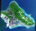
PIA02672:
-
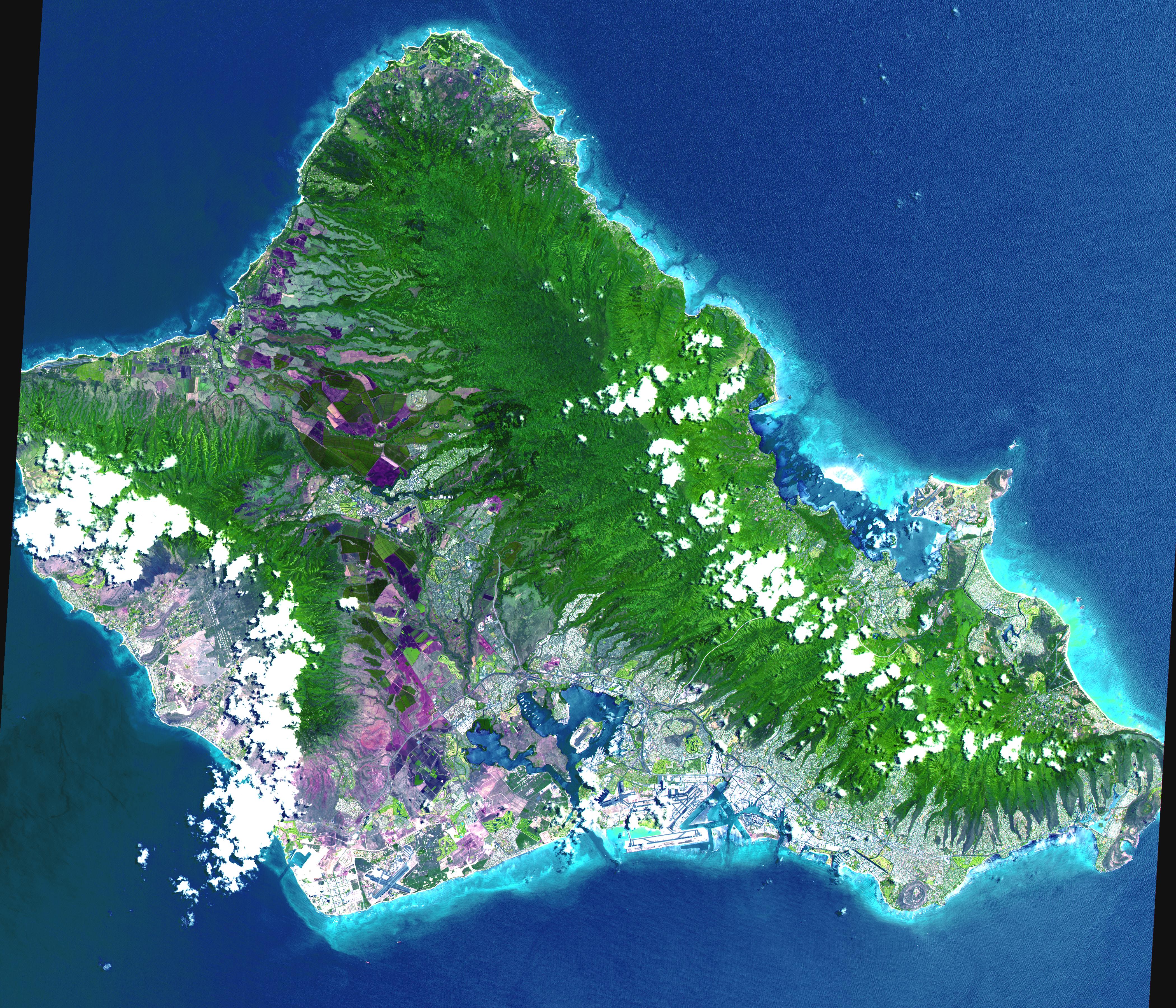
Oahu, Hawaii
Full Resolution:
TIFF
(44.7 MB)
JPEG
(3.314 MB)
|
|
|
2001-07-21 |
Earth
|
Terra
|
ASTER
|
4048x3824x3 |
|
-
PIA02671:
-
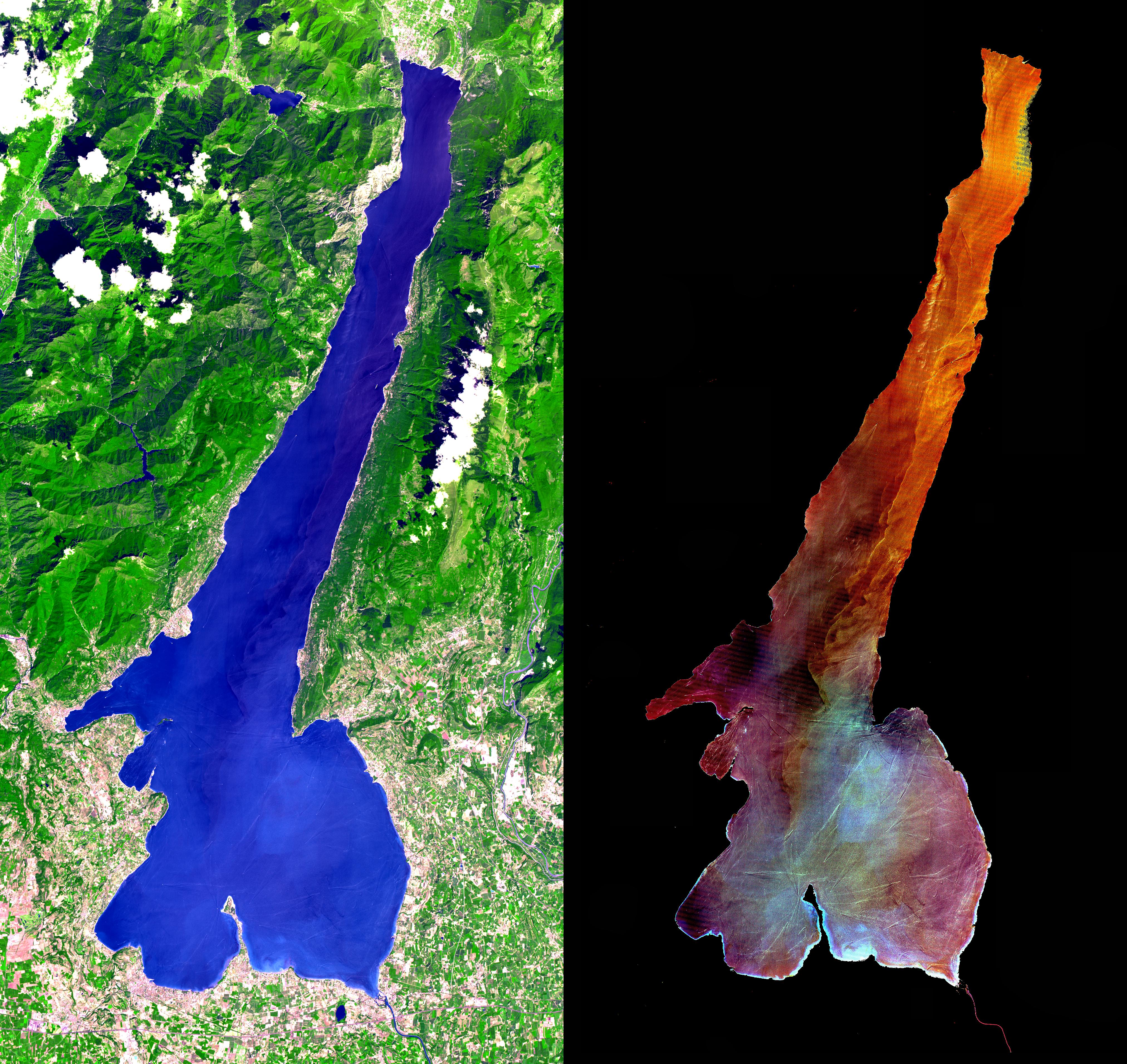
Lake Garda, Italy
Full Resolution:
TIFF
(28.47 MB)
JPEG
(2.608 MB)
|
|
|
2001-07-21 |
Earth
|
Terra
|
ASTER
|
2412x1925x3 |
|
-
PIA02670:
-
Patagonia Glacier, Chile
Full Resolution:
TIFF
(11.47 MB)
JPEG
(883.8 kB)
|
|
|
2001-07-21 |
Earth
|
Terra
|
ASTER
|
800x800x3 |
|
-
PIA02669:
-
Great Wall of China
Full Resolution:
TIFF
(2.432 MB)
JPEG
(228 kB)
|
|
|
2001-07-21 |
Earth
|
Terra
|
ASTER
|
2000x1500x3 |

|
-
PIA02668:
-
3-D View of Grand Canyon, Arizona
Full Resolution:
TIFF
(10.35 MB)
JPEG
(477.4 kB)
|
|
|
2001-07-21 |
Earth
|
Terra
|
ASTER
|
4368x4140x3 |
|
-
PIA02665:
-
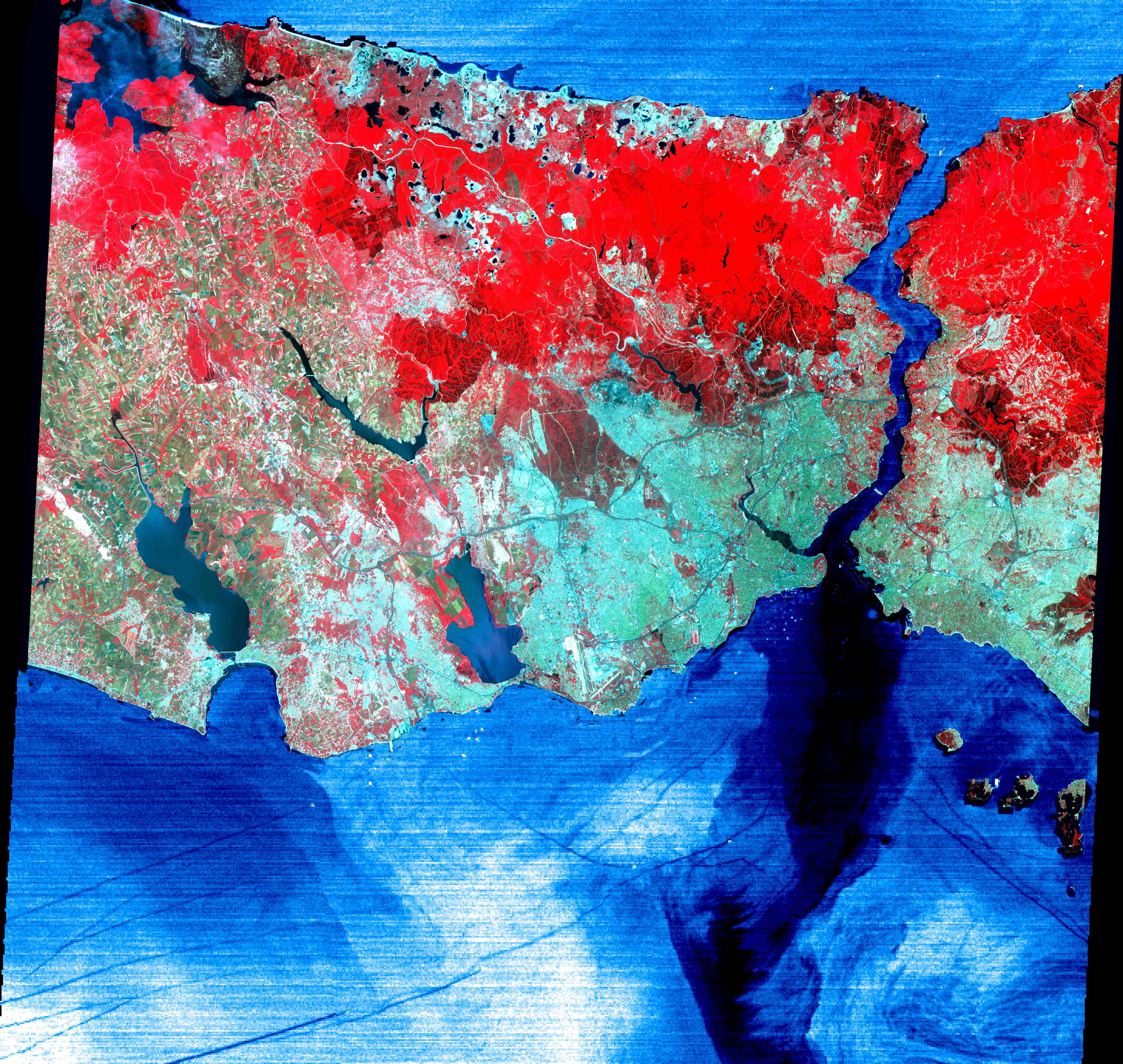
Istanbul, Turkey
Full Resolution:
TIFF
(32.35 MB)
JPEG
(3.96 MB)
|
|
|
2001-07-21 |
Earth
|
Terra
|
ASTER
|
1282x1603x3 |

|
-
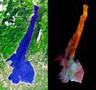
PIA02664:
-
College Fjord, Prince Williams Sound
Full Resolution:
TIFF
(4.17 MB)
JPEG
(395.8 kB)
|
|
|
2001-07-21 |
Earth
|
Terra
|
ASTER
|
1228x709x3 |
|
-
PIA02663:
-
3-D View of Death Valley, California
Full Resolution:
TIFF
(1.19 MB)
JPEG
(112 kB)
|
|
|
2001-07-18 |
Earth
|
Terra
|
MISR
|
1712x1204x3 |
|
-
PIA03414:
-
Fire in the Land of 100,000 Lakes
Full Resolution:
TIFF
(3.75 MB)
JPEG
(478.8 kB)
|
|
|
2001-07-11 |
Earth
|
Terra
|
MISR
|
1434x1232x3 |
|
-
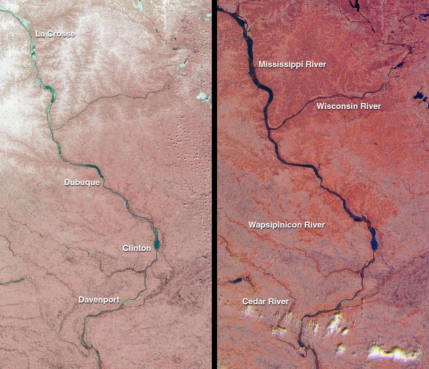
PIA03413:
-
Spring Flooding on the Mississippi
Full Resolution:
TIFF
(5.775 MB)
JPEG
(428.5 kB)
|
|
|
2001-07-02 |
Earth
|
Terra
|
MISR
|
1215x1191x3 |
|
-
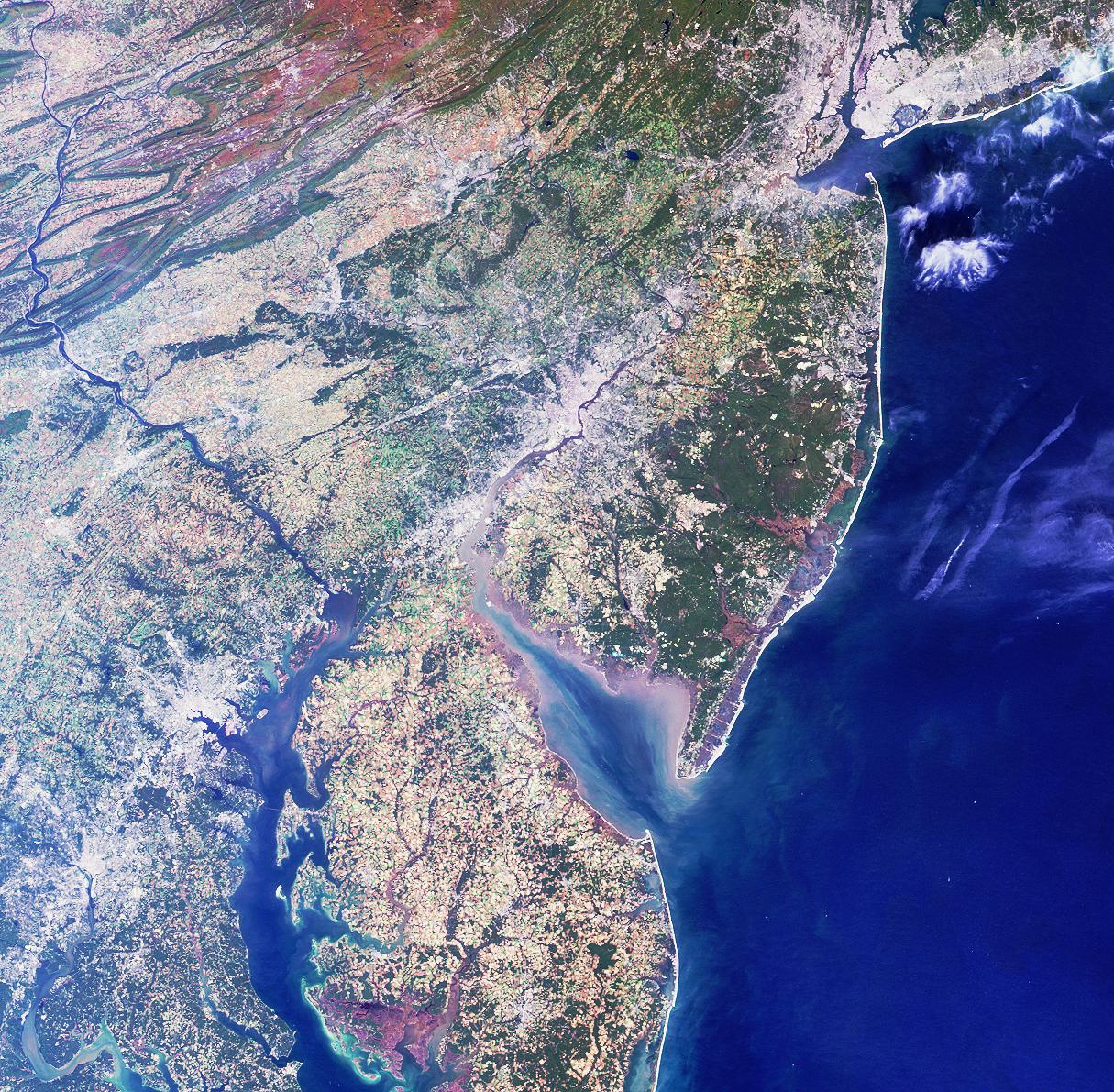
PIA03412:
-
A Spaceborne Perspective on the Red, White, and Blue
Full Resolution:
TIFF
(5.067 MB)
JPEG
(488.9 kB)
|
|
|
2001-06-27 |
Earth
|
Terra
|
MISR
|
1595x1553x3 |
|
-
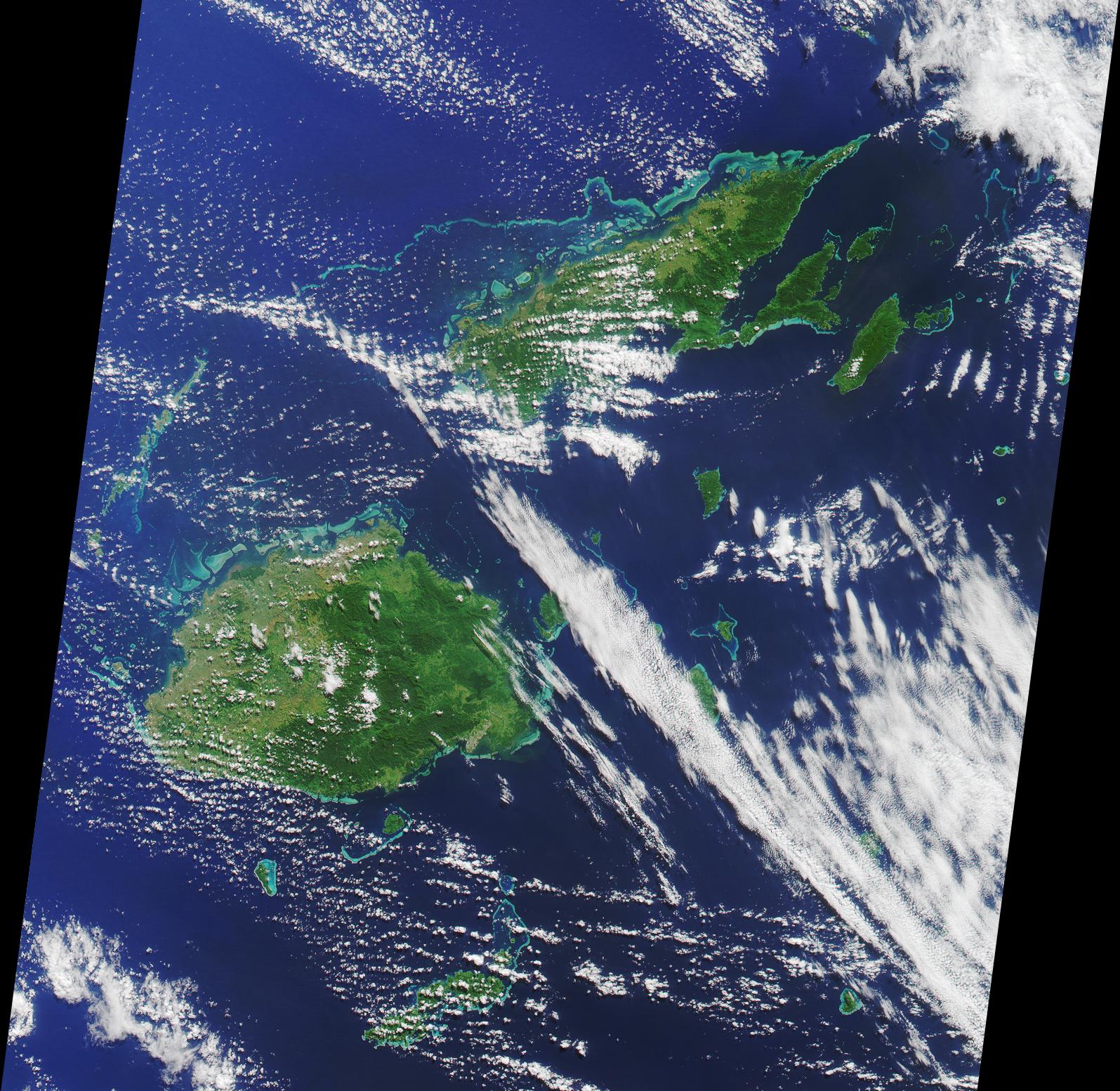
PIA03411:
-
Where on Earth...? MISR Mystery Image Quiz #1:
Republic of Fiji
Full Resolution:
TIFF
(6.351 MB)
JPEG
(509.5 kB)
|
|
|
2001-06-20 |
Earth
|
Terra
|
MISR
|
1356x1932x3 |
|
-
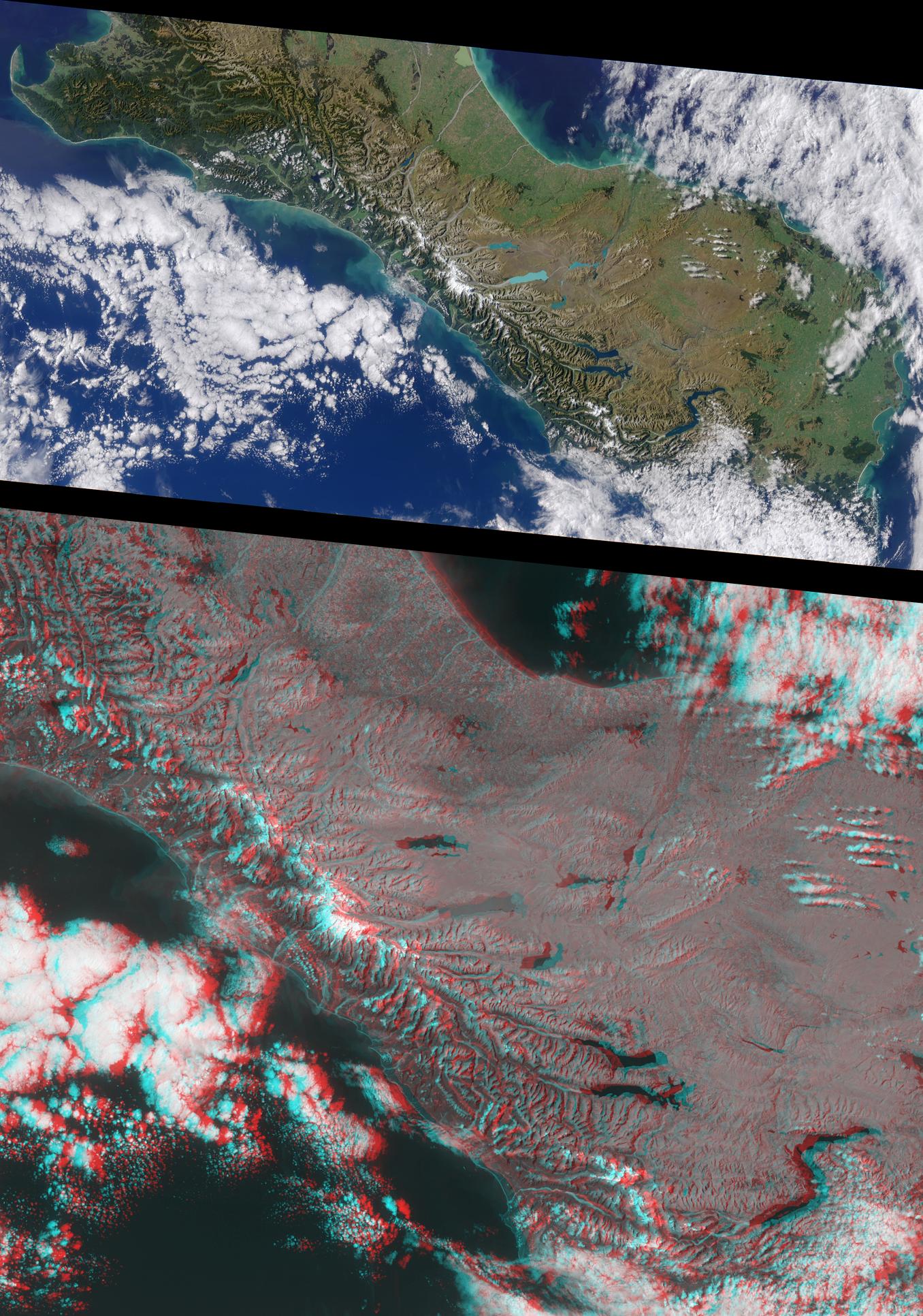
PIA03410:
-
New Zealand's Southern Alps
Full Resolution:
TIFF
(7.269 MB)
JPEG
(518.5 kB)
|
 Planetary Data System


