According to researchers funded by the National Science Foundation, several penguin colonies near the Ross Ice Shelf, Antarctica have not been able to hatch their young this year due to a combination of huge icebergs grounded near Ross Island and an unprecedented amount of sea ice in the Ross Sea. The grounded icebergs and sea ice have increased the distance between the penguins' feeding areas in the open sea and their breeding grounds. The birds affected include one of Antarctica's most populous Adelie penguin colonies, as well as a small colony of Emperor penguins.
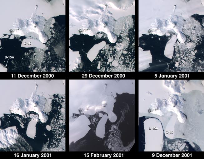
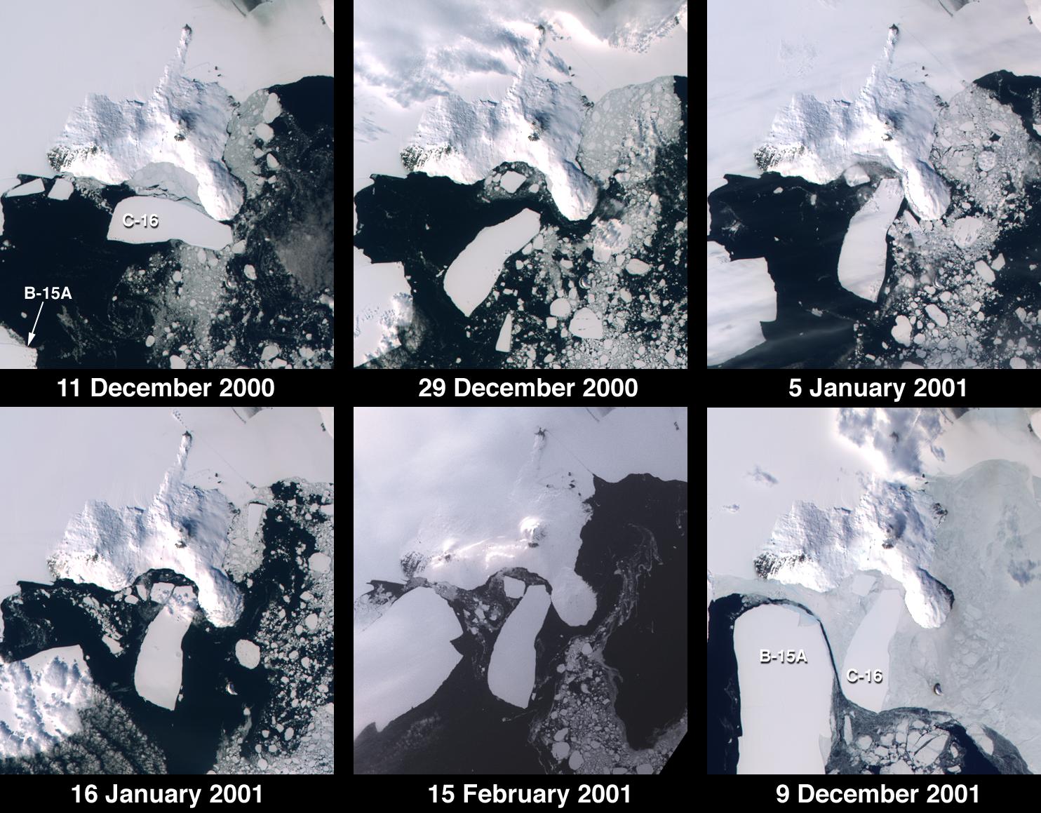
These images from the Multi-angle Imaging SpectroRadiometer document iceberg movements and changes in sea ice between December 11, 2000 and December 9, 2001. Note the changing positions of icebergs C-16 and B-15A, and the increased extent of sea ice in the December 2001 image relative to the view acquired one year earlier. The icebergs initially calved from the Ross Ice Shelf in March 2000 and gradually migrated to a point northeast of McMurdo Sound where they have created a barrier that has altered wind and current patterns. Iceberg C-16, measuring about 50 kilometers x 19 kilometers in size, was brought to a halt at Ross Island at the beginning of 2001, after rapid rotation during the latter part of 2000. The giant iceberg B-15A (of which only a portion is shown) also rotated and moved southwest until grounding at Ross Island.
The images were captured by MISR's nadir (vertical-viewing) camera during Terra orbits 5235, 5497, 5599, 5759, 6192, and 10521. Each panel covers an area of about 130 kilometers x 145 kilometers. South is toward the top. McMurdo Station, a U.S. research facility, is located near the southern tip of Ross Island's Hut Point Peninsula.
For a press release from the National Science Foundation containing additional details and MISR imagery pertaining to this story, see http://www.nsf.gov/od/lpa/news/press/01/pr01108.htm.
MISR was built and is managed by NASA's Jet Propulsion Laboratory, Pasadena, CA, for NASA's Office of Earth Science, Washington, DC. The Terra satellite is managed by NASA's Goddard Space Flight Center, Greenbelt, MD. JPL is a division of the California Institute of Technology.
 Planetary Data System


