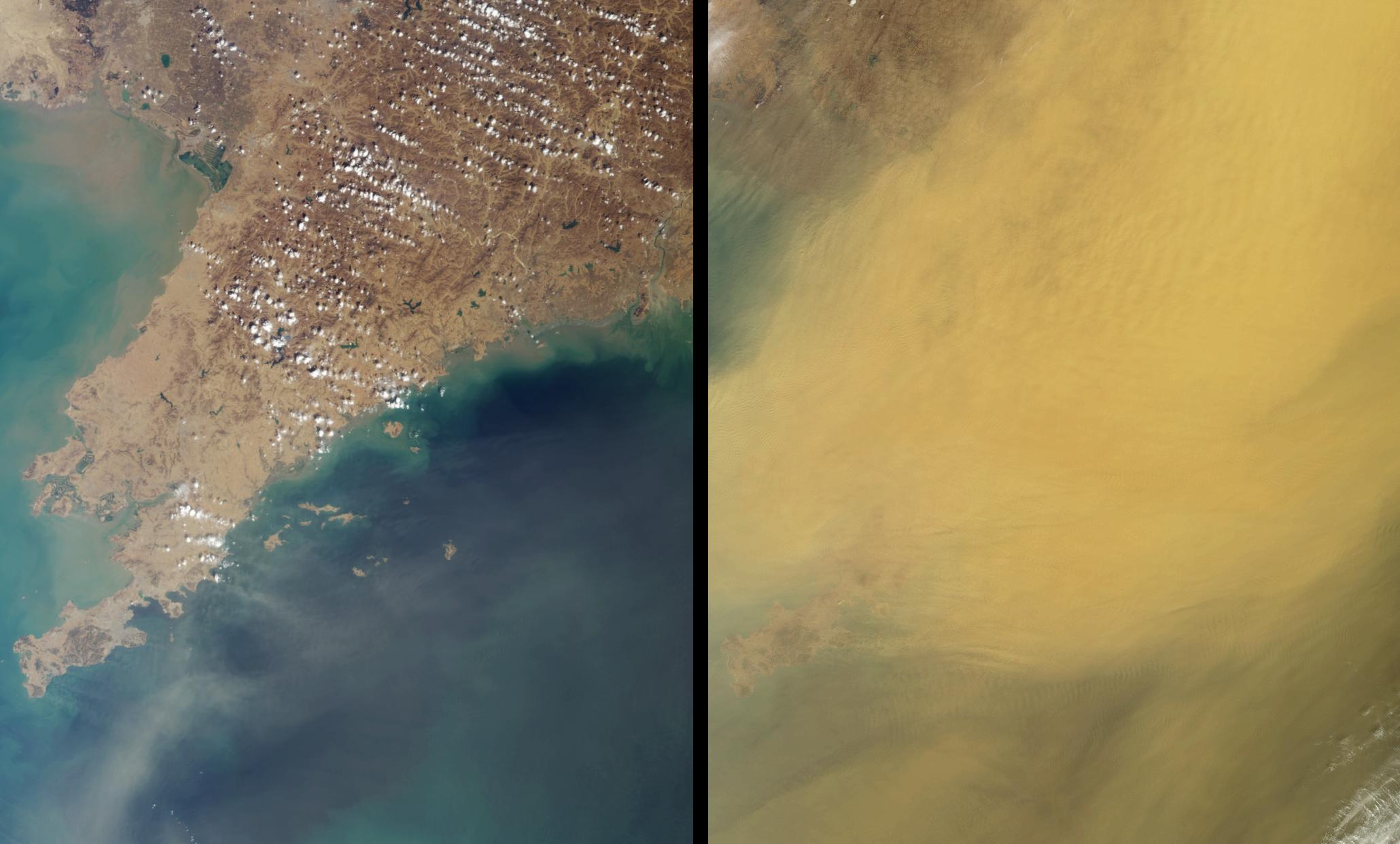
This pair of Multi-angle Imaging SpectroRadiometer images, acquired 16 days apart, covers the Liaoning region of China and parts of northern and western Korea. They contrast a relatively clear day (March 23, 2002) with one in which the skies were extremely dusty (April 8, 2002). In the later view (right-hand image), the dust obscures most of the surface, although the Liaodong peninsula extending between the Bo Hai Sea and Korea Bay is faintly visible at the lower left. Wave features are apparent within the dust layer.
Storms such as this transport mineral dust from the deserts of China and Mongolia over great distances, and pollution from agriculture, industry and power generation is also carried aloft. Thick clouds of dust block substantial amounts of incoming sunlight, which in turn can influence marine phytoplankton production and have a cooling effect on regional climates. Small dust particles can remain airborne for many thousands of kilometers, and the National Oceanic and Atmospheric Administration detected dust from the 2002 Asian storms as far away as Colorado (http://www.noaanews.noaa.gov/stories/s885.htm).
These natural color views were acquired by MISR's nadir camera, during Terra orbits 12025 and 12258. Each image represents an area of about 280 kilometers x 342 kilometers.
